Map of California's Counties
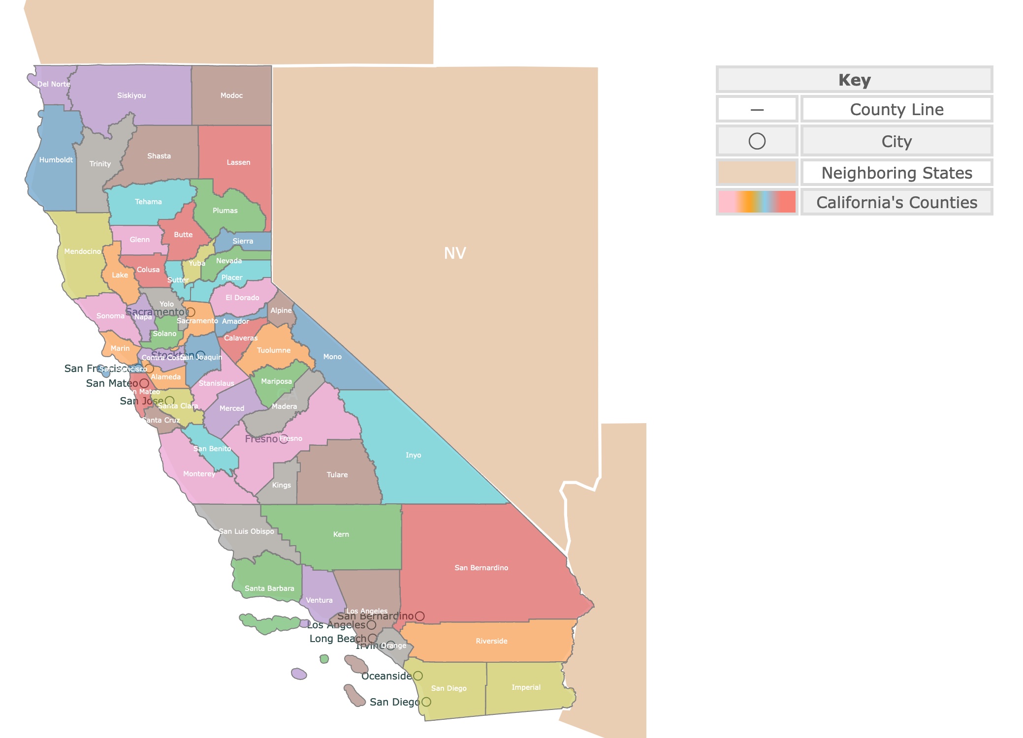
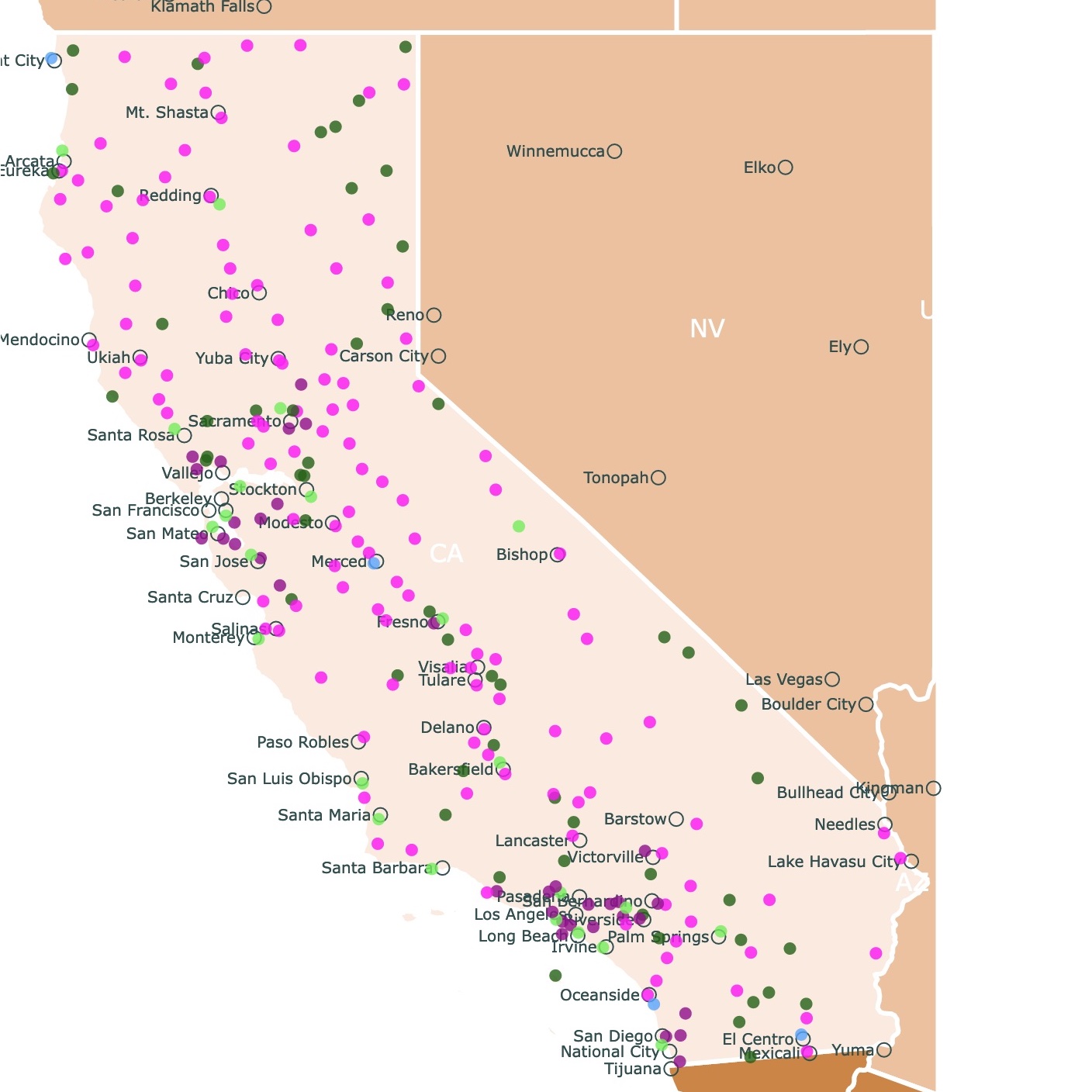
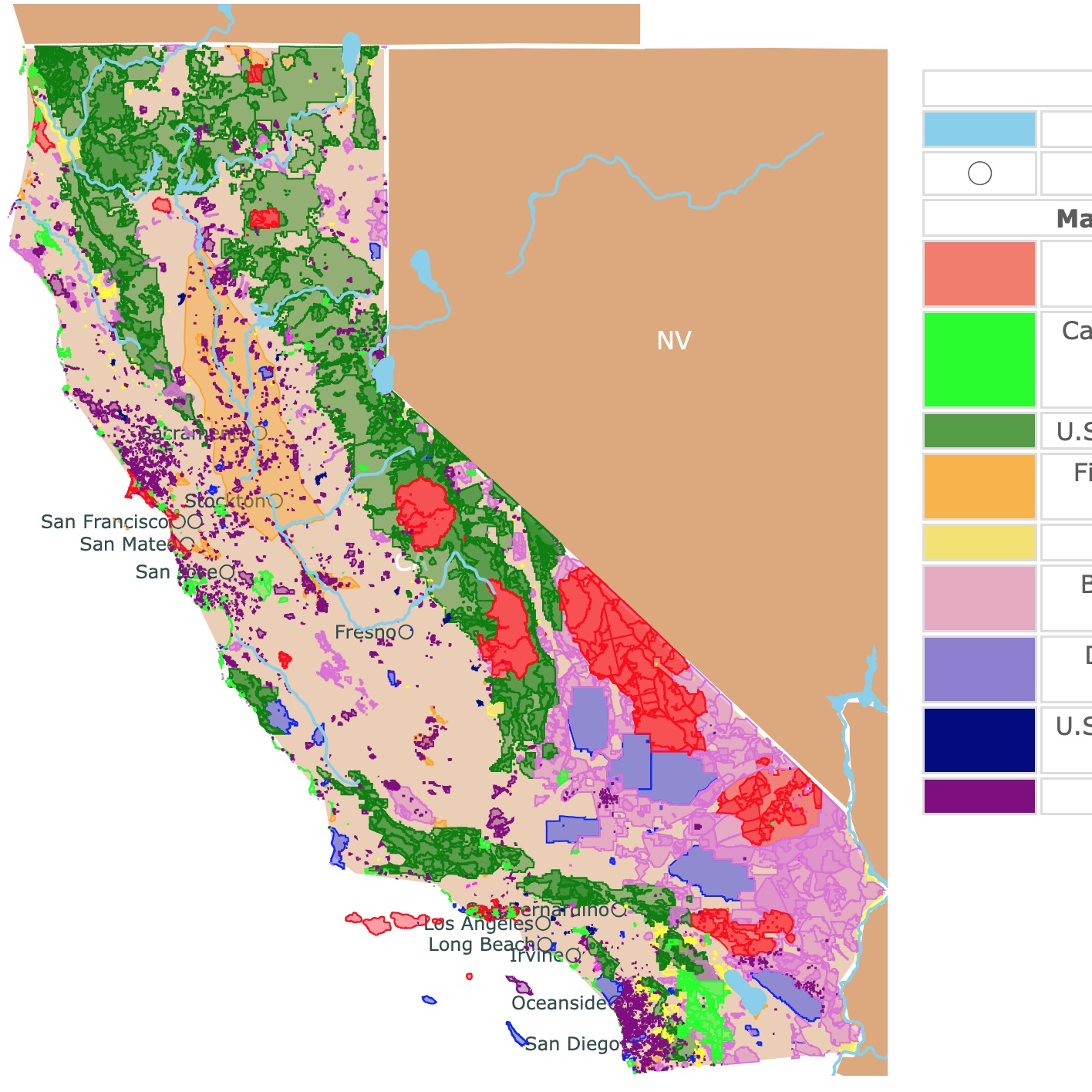
This interactive map shows the Locations and Names of Counties in California. It also shows major cities for context. For more detail, zoom in. For more information, scroll down.
| Key | |
|---|---|
| ― | County Line |
| ◯ | City |
| Neighboring States | |
| California's Counties | |
California's County Facts
California is called the Golden State. This nickname not only recalls its Gold Rush, but the seemingly limitless possibilities of California's residents.
California is divided into 58 counties.
The largest counties by area are San Bernardino, Inyo, Kern, and Riverside. San Bernardino is also the largest county in the contiguous United States.
California has a population of approximately 40 million people. The most populated counties are Los Angeles County, San Diego County, Orange County, Riverside County, and San Bernardino County.
Los Angeles County is also the most populous county in the United States.
One of the qualities of California's economy is its multiple dominant industry sectors.
California's largest industries are finance and insurance; trade, transportation, and utilities; and professional and business services. California State Assembly.
If you are looking to go to California and are unsure where to go, Expedia can help:
California's Counties and Agriculture
In 2022 California had 9 out of 10 top agricultural producing continues of the nation.
Fresno County was first in the nation, with a total production value of $7 billion, followed by Tulare ($6.4B), Monterey ($5.5B), Kern ($5B), Merced ($4B), Imperial and San Joaquin ($3B) counties. Ceres Courier.
Fresno's top products are almonds, pistachios, and poultry. Tulare produces oranges, cotton, grapes, and more. Monterey produces strawberries, lettuce, and broccoli.
California's Counties and Technology
California is famous for Silicon Valley. The term is associated with the local production of semiconductors. Silicon Valley includes Santa Clara, San Mateo, Alameda, and Santa Cruz.
These are also the wealthiest counties in California.
Major companies in the region include Apple, Alphabet's Google, Chevron, Meta, (formerly Facebook), and Visa.
Prominent California Counties
San Bernardino
Covering 20,105 square miles, San Bernardino County is America’s largest county. With over 24 cities, this county also has a diverse community of over 2.2 million residents.
San Bernardino's terrain is known for its diverse elevations, multi-faceted geography, and enviable climate.
San Bernardino is known for its wide-open spaces as well as its outdoor adventures, from skiing and snowboarding to hiking and watersports.
Santa Clara County
Located in the heart of Silicon Valley, the county has a rich history from its agricultural roots to its current position as a global hub of innovation and technology.
In the later half of the 20th century, the area became home to a number of high-tech companies, including Hewlett-Packard, Intel, and Apple.
Today, Santa Clara County is a diverse community of over 1.9 million people. The county has a large Hispanic population, making up over a quarter of local residents.
Asian Americans also make up a significant portion of the population. Source: Santa Clara
Santa Clara County is the wealthiest county in California, with a median household income of $140,00 and a median home value of almost $1.49 million.
San Mateo County
Today, more than 764,000 people call San Mateo County home and it stretches the boundary of Silicon Valley northward.
Innovation thrives here in industries like bioscience, computer software, green technology, hospitality, financial management, health care, education, and transportation.
San Mateo County is the second richest in California, with a median household income of $136,000 and an average home value of over $1.42 million.
Marin County
Marin County is located in the northwestern part of California’s San Francisco Bay Area. It is a colorful region known for its stunning natural beauty and quaint towns.
With a population of around 262,231 as of the 2020 census, Marin County is an ideal destination for those seeking to explore the outdoors.
As of 2019, Marin County had the sixth highest income per capita of all U.S. counties. It has a median income of $131,000, and a median home value of 1,428,000.
Another notable fact about Marin County is that it holds one of the highest percentage of residents in the nation with Bachelor's Degrees.
| Population | Area | Name | Seat |
|---|---|---|---|
| 1,628,997 | 739.02 | Oakland | Alameda |
| 1,190 | 738.33 | Markleeville | Alpine |
| 41,412 | 594.58 | Jackson | Amador |
| 207,303 | 1,636.46 | Oroville | Butte |
| 46,563 | 1,020.01 | San Andreas | Calaveras |
| 21,914 | 1,150.73 | Colusa City | Colusa |
| 1,156,966 | 715.94 | Martinez | Cont. Costa |
| 27,082 | 1,006.37 | Crescent City | Del Norte |
| 192,646 | 1,707.88 | Placerville | El Dorado |
| 1,015,190 | 5,957.99 | Fresno City | Fresno |
| 28,339 | 1,313.95 | Willows | Glenn |
| 135,010 | 3,567.98 | Eureka | Humboldt |
| 178,713 | 4,176.60 | El Centro | Imperial |
| 18,718 | 10,180.87 | Independence | Inyo |
| 916,108 | 8,131.91 | Bakersfield | Kern |
| 152,981 | 1,389.42 | Hanford | Kings |
| 68,191 | 1,256.46 | Lakeport | Lake |
| 29,904 | 4,541.18 | Susanville | Lassen |
| 9,721,138 | 4,057.88 | Los Angeles City | Los Angeles |
| 160,256 | 2,137.07 | Madera City | Madera |
| 256,018 | 520.31 | San Rafael | Marin |
| 17,020 | 1,448.82 | Mariposa City | Mariposa |
| 89,783 | 3,506.34 | Ukiah | Mendocino |
| 290,014 | 1,934.97 | Merced | Merced |
| 8,511 | 3,917.77 | Alturas | Modoc |
| 12,978 | 3,048.98 | Bridgeport | Mono |
| 432,858 | 3,280.59 | Salinas | Monterey |
| 134,300 | 748.36 | Napa City | Napa |
| 102,293 | 957.77 | Nevada City | Nevada |
| 3,151,184 | 790.57 | Santa Ana | Orange |
| 417,772 | 1,407.01 | Auburn | Placer |
| 19,351 | 2,553.04 | Quincy | Plumas |
| 2,473,902 | 7,206.47 | Riverside | Riverside |
| 1,584,169 | 964.64 | Sacramento | Sacramento |
| 67,579 | 1,388.71 | Hollister | San Benito |
| 2,193,656 | 20,056.92 | San Bernardino | San Bernardino |
| 3,276,208 | 4,206.63 | San Diego | San Diego |
| 808,437 | 46.87 | San Francisco | San Francisco |
| 793,229 | 1,391.32 | Stockton | San Joaquin |
| 282,013 | 3,298.56 | San Luis Obispo | San Luis Obispo |
| 729,181 | 448.41 | Redwood City | San Mateo |
| 443,837 | 2,735.08 | Santa Barbara | Santa Barbara |
| 1,870,945 | 1,290.10 | San Jose | Santa Clara |
| 264,370 | 445.17 | Santa Cruz | Santa Cruz |
| 180,930 | 3,775.40 | Redding | Shasta |
| 3,217 | 953.21 | Downieville | Sierra |
| 43,660 | 6,277.88 | Yreka | Siskiyou |
| 448,747 | 821.76 | Fairfield | Solano |
| 482,650 | 1,575.85 | Santa Rosa | Sonoma |
| 551,275 | 1,494.83 | Modesto | Stanislaus |
| 98,503 | 602.41 | Yuba City | Sutter |
| 65,245 | 2,949.71 | Red Bluff | Tehama |
| 15,781 | 3,179.25 | Weaverville | Trinity |
| 477,544 | 4,824.21 | Visalia | Tulare |
| 54,531 | 2,220.88 | Sonora | Tuolumne |
| 832,605 | 1,843.13 | Ventura City | Ventura |
| 222,115 | 1,014.69 | Woodland | Yolo |
| 84,310 | 631.84 | Marysville | Yuba |
California's County Structure and Power
In California, there is a distinction between a county and a city. Counties lack broad powers of self-government that California cities have. In addition, legislative control over counties is more complete than it is over cities.
The California Constitution recognizes two types of counties: general law counties and charter counties.
General law counties adhere to state law as to the number and duties of county elected officials.
Charter counties, have a limited degree of “home rule” authority that may provide for the election, compensation, terms, removal, and salary of the governing board.
- General Law Counties are Alpine, Amador, Calaveras, Colusa, Contra Costa, Del Norte, Glenn, Humboldt, Imperial, Inyo, Kern, Kings, Lake, Lassen, Madera, Marin, Mariposa, Mendocino, Merced, Modoc, Mono, Monterey, Napa, Nevada, Plumas, Riverside, San Benito, San Joaquin, San Luis Obispo, Santa Barbara, Santa Cruz, Shasta, Sierra, Siskiyou, Solano, Sonoma, Stanislaus, Sutter, Trinity, Tulare, Tuolumne, Ventura, Yolo, and Yuba.
- Charter Counties: Alameda, Butte, El Dorado, Fresno, Los Angeles, Orange, Placer, Sacramento, San Bernardino, San Diego, San Francisco, San Mateo, Santa Clara, Tehama. More information about this topic in California State Association of Counties.
Resources for California Counties Map
The shapefiles for cities came from Natural Earth.
The shapefiles with California counties were downloaded from California data portal.
The population of California was obtained from the U.S.Census.
This information will also improve with your suggestions. To receive updates on this and more nature maps, join my email list!!!!!!!
Made by Luz K. Molina with D3.js.


