Rivers of the United States Mapped
This interactive map shows all the Rivers of the conterminous United States. Only major River names are displayed. Each blue shade represents a different reach type. Hover over the rivers, for names and reach types. For more detail zoom in. For more information scroll down.
Rivers of the USA

Most water in rivers comes from precipitation and the runoff from the land surrounding them.
The area between ridges that collects precipitation is called a watershed or drainage basin.
Not all precipitation ends up in rivers. Some of it evaporates, some is soaked by the ground and trees, and some of it seeps into the ground and recharges groundwater aquifers.
Rivers originate from water moving from higher elevations to lower elevations, thanks to gravity. As mentioned before, water comes from rain that becomes runoff and flows downhill into rivers and lakes.
River water eventually reaches a lake or the ocean. Source: USGS.
Rivers in the U.S. are of great importance as they are used for transportation, waste treatment, water supply, power generation, fisheries, agriculture irrigation, and recreation, among other purposes. Their floodplains provide fertile soils while their ecological importance is still misunderstood.
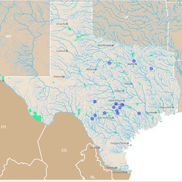
If you are more interested in enjoying rivers rather than learning about them, here is a map for tubing in Texas
U.S. Rivers Facts

- The United States of America has over 250,000 rivers, with a total of about 3,500,000 miles of rivers.
- Rivers systems account for 0.001% of all water on Earth. Nevertheless, two thirds of U.S. drinking water comes from Rivers. PEW
- The deadliest river in the U.S. is Kern River located in California, between the Sierra Nevada and the San Joaquin Valley. The river is a popular site for rafting and fishing but there is a sign at Kern Canyon reminding visitors of its dangers.
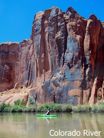
- The rivers between U.S. and Mexico are the Colorado River and the Rio Grande.
- The Colorado River does not end in a lake or the ocean. It used to reach the Gulf of California, but due to irrigation and human consumption, it just disappears in the desert sands.
- The longest undammed river in the U.S. is the Yellowstone river, with 692 miles (1,113 Km).
- There are about 8,100 dams in the United States.
- New River in West Virginia is the oldest river in the United States. It was formed an estimated 260 million years ago. The only river that is older in the world, is the Nile River. Source: NPCA
- The second longest river in the U.S. is the Mississippi River, but it is the biggest, deepest and most voluminous river in the United States.
- The Ohio River flows through an important industrial region. It is historically seen as the border between northern and southern states.
- The Columbia River is an important waterway of the Pacific. When the Grand Coulee Dam was completed in 1943, it was the largest hydroelectric plant in the world; it is still America’s largest electric power plant.
- The Snake River was a vital route for travelers headed west on the Oregon Trail. They followed the river most of the way to its mouth on the Columbia River.
- George Washington crossed the Delaware on Christmas night in 1776 to surprise the Hessians at the Battle of Trenton.
- George Washington’s plantation Mount Vernon was on the Potomac River, while Robert E. Lee’s two invasions north of the Potomac were major events of the Civil War.
- The Mississippi picks up numerous major tributaries including the Illinois, Missouri, Ohio, Arkansas, and Red Rivers, and flows past numerous major cities, including Minneapolis, St. Louis, Memphis, and New Orleans. Source: NAQT
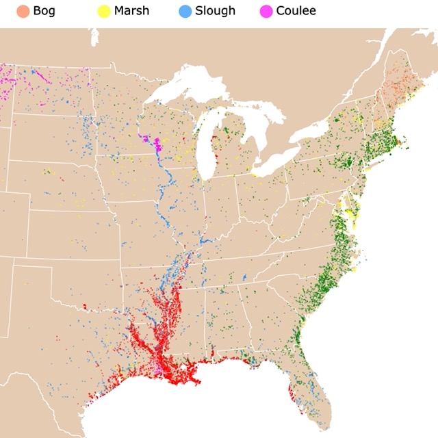
Interested in Water Bodies? Here is a map of Swamps and Bayous
10 Longest Rivers of the USA
River length is affected by natural and artificial elements as well as techniques for measurement. "The length may be considered to be the distance from the mouth to the most distant headwater source (irrespective of stream name) or from the mouth to the headwaters of the stream commonly identified as the source stream."
Some river names do not change from the source to the mouth, like the Mississippi River or the Rio Grande. Meanwhile, the Mobile River goes through 5 names before settling on Mobile river. Source: USGS
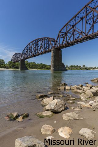
- Missouri River: 2,540mi (4,087Km)
- Mississippi River: 2,340mi (3,765Km)
- Yukon River: 1,980mi (3,186Km)
- Rio Grande River: 1,900mi (3,057Km)
- Arkansas River: 1,460mi (2,349Km)
- Colorado River:1,450mi (2,333Km)
- Atchafalaya River: 1,420mi (2,285Km)
- Ohio River: 1,310mi (2,108Km)
- Red River: 1,290mi (2,076Km)
- Brazos River: 1,280mi (2,059Km)
Yukon River is in Alaska and Canada, therefore not displayed in this map.
Some lists include St. Lawrence River. But it is mainly Canadian so it was not included in this list.
Rivers in the U.S. that Run North
Not all rivers run south, and there is no particular reason they should. But just in case you are wondering, below are some rivers in the United States that flow North. Source: World Atlas
- Bighorn, Wyoming and Montana: 336 miles
- Deschutes, Oregon: 250 miles
- Fox, Wisconsin: 200 miles
- Genesee, New York: 144 miles
- Mojave, California: 100 miles
- Oswego, New York: 24 miles
- Red, Minnesota, North Dakota (into Canada): 318 miles
- Saint Johns, Florida: 275 miles
- Shennandoah, Virginia and West Virginia: 55 miles
- Willamette, Oregon: 188 miles
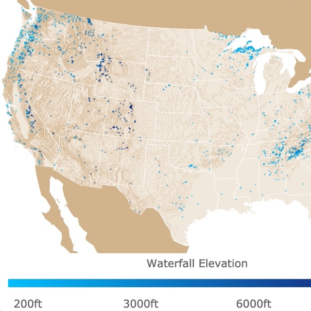
Some rivers form waterfalls. Here is a map of Waterfalls in the U.S.
Underground Rivers of the U.S.
As mentioned above, water that seeps through the ground may form underground aquifers. Some of these form underground rivers. Below are some of the well-known cases in the U.S.
- The Mojave River in southern California flows underground in most places.
- The Lost River in Indiana is probably the largest underground river in the country. It begins like a normal river and then it sinks. This river has still much more to be explored. USDA
- Not far from Lost River is Blue Springs Caverns. This is the longest navigable underground river in the U.S.
- Springs in Florida are made up of different springs and rivers that sink and surface. For more information go to Springs of Florida Map.

In case you want to learn more about other water bodies, here is a Lakes and Ponds map.
About U.S. Rivers Map
As you may have noticed when you hover over each river on this map, they don't highlight completely. This is because they have been labeled according to smaller sections or subdivisions inside them.
You may also read that each type is labeled with a letter. Each letter is a type of reach. “A reach is a section of a stream or river along which similar hydrologic conditions exist, such as discharge, depth, area, and slope. It can also be the length of a stream or river (with varying conditions) between two stream gages, or a length of river for which the characteristics are well described by readings at a single stream gage.” USGS.
These sections or reaches, are classified according to different specifications. The most common reach types are described below. Source: USGS
- N.: Non-Connected Reach (a transport reach). A reach not having codes to link it to other reaches.
- R.: Regular Reach (a transport reach). A reach that has upstream and downstream reaches connected to it and that is not classified as another type of reach.
- S.: Start Reach (a transport reach). A headwater reach that has no reaches above it and either one or two transport reaches connected to its downstream end.
- T.: Terminal Reach (a transport reach). A reach downstream of which there is no other reach (for example, a reach that terminates into an ocean, a land-locked lake, or the ground). This type of reach has either one or two reaches connected to its upstream end.
- V.: Open-Water Terminal Reach (a transport reach). A reach that is both a terminal reach and an artificial open-water reach.
- W.: Wide-River Shoreline Segment (a shoreline reach). A reach that represents a segment of the left or right bank of a stream.
- X.: Terminal Start Reach (a transport reach). A reach that is both a terminal reach and a start reach.
When you hover over the rivers you may also see a HUC code. The United States is divided and sub-divided into successively smaller hydrologic units which are classified into four levels: regions, subregions, accounting units, and cataloging units. HUC are the Hydrologic Unit Codes, consisting of two to eight digits based on the four levels of classification. Source: USGS
The shapefiles where downloaded from NWS.
This map will be updated with new data! To receive updates on this and more nature maps join my email list!!!!!!!
Made by Luz K. Molina with D3.js.
