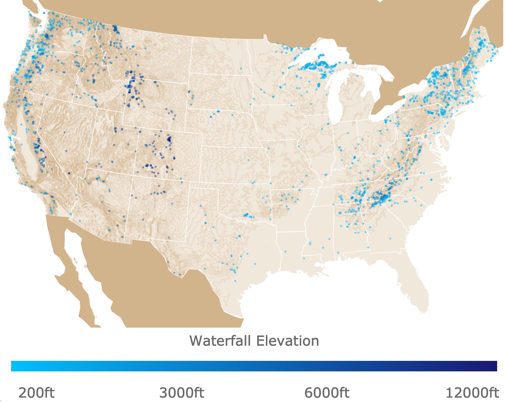
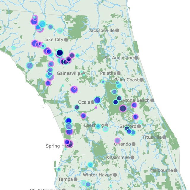
Map of Waterfalls in the U.S.
This interactive map shows the Locations, Names, and Elevations of Waterfalls in the US. The color of each circle shows the elevation of each waterfall. For more detail, zoom in. To see Alaska and Hawaii zoom out. For more data hover over the map. For more information scroll down.
| Waterfall Elevation | ||||||
| 200ft | 3000ft | 6000ft | 12000ft | |||
What are Waterfalls
A waterfall is usually a geological formation resulting from water, in the form of a stream flowing over a rock, establishing a vertical fall of some magnitude. Sometimes a plunge pool may be formed as a result of the waterfall.
Waterfalls also occur where meltwater falls over the edge of an iceberg or an ice shelf.
A Cataract also describes of Waterfall. A cascade describes a fall of only a few feet. Source: Sciendo
How are Waterfalls Formed
A waterfall is formed around the basic principle that there is a watercourse flowing over different layers of rock, with different rates of erosion. This means a river or stream flows over soft rocks, where erosion is rapid; and hard rocks, where erosion is slow.
Eventually the soft rock is eroded by the water resulting in the watercourse getting steeper beyond the hard rock layer.
The steepness of the fall also accelerates the erosion, as gravity increases the speed of water accelerates and so does the force on the soft layer.
Over time the watercourse slope increases, until there is a vertical fall, at this point the waterfall is formed!
As the watercourse keeps cutting into the softer rock, the water lands on a pool that keeps getting deeper.
After a long while it is possible for the water resistant rock to give in to the erosion and collapse into the base of the waterfall. An example of this is the Niagara Falls that continue to retreat at a rate of 3ft per year. Source: WorldofWaterfalls.com
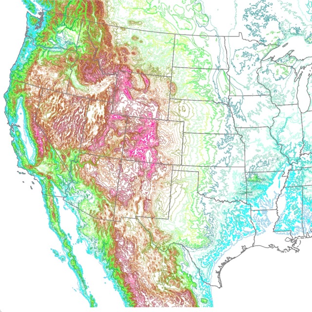
If you like US geography, you might like this map of US Topography.
Where are Waterfalls Found
The distribution of waterfalls around the world is not uniform. Many large areas around the world have no waterfalls at all.
This is expected in areas like deserts, and semiarid areas which don't have enough water to create one. Polar regions and low lying plateaus are also not favorable places for their formation.
Waterfalls form in three different kind of areas:
- Along the margins of High Plateaus, or the fractures that dissect them. These include the highest one, Angel Falls which falls from a plateau 3211 feet (979 meters).
- Along Fall Lines, which mark a zone between resistant rocks of continental interiors and the weaker sedimentary formation of coastal regions. An example is Churchill (formerly Grand) Falls, in Labrador, Canada
- In High Mountain Areas, especially those that have been under glaciation in the recent past. Is where most of the waterfalls in the west of the United States fall. Examples include Yosemite Falls, and Yellowstone Falls.
This uneven distribution of waterfalls is also visible in the map above. Furthermore, the elevation contour lines also confirm that there is a higher concentration of waterfalls in mountainous areas of the U.S,
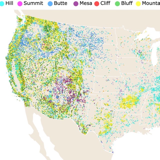
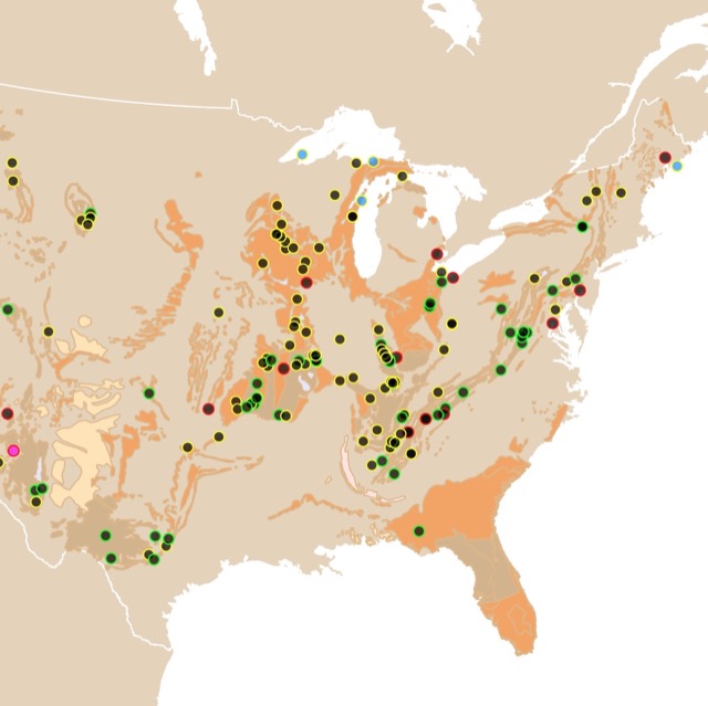
Most waterfalls are in montanous areas. To learn more check this map that shows hills, mountains, and mounts in the US.
Waterfall Classification by Form
Waterfalls come in all shapes, sizes, and forms. There is no standard way to classify waterfalls. Some are based on volume, others on width, others by height.
Nevertheless there is a classification that tries to describe them as a whole:
- Block Waterfall: This type descends from a wide stream. An example is the Niagara Falls.
- Cascade: This waterfall descends over a series of rock steps, like Minaret Falls in the Eastern Sierra of California.
- Cataract: This is a powerful and probably dangerous waterfall. An example is the Falls of Iguazu River in the Argentina, Paraguay, and Brazil border.
- Chute: This waterfall is a stream whose passage is very narrow. This forces the water through a lot of pressure. An example is the Tenaya Creek falls in Yosemite National Park, California.
- Fan Waterfalls: These are named for their shape. Water spreads horizontally as it descends. An example is Union Falls in Yellowstone National Park.
- Frozen Waterfalls: These are waterfalls that freeze at least part of the year. An example is the Fang, a pillar of ice in Vail Colorado.
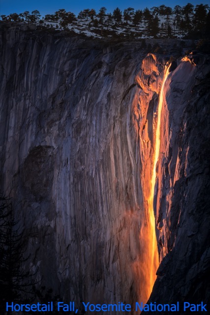
- Horsetail Waterfalls: This falls keep in contact with the hard rock that underlies them. An example is Horsetail Fall in Yosemite National Park.
- Multi-step Waterfalls: These are a series of connected waterfalls. Each one with a plunge pool. An example is Yosemite Falls in California, which includes Upper Yosemite Falls, the Middle Cascades and Lower Yosemite Falls.
- Plunge Waterfalls: These lose contact with the hard rock. An example is Rainbow Falls in Hilo, Big Island of Hawaii.
- Punchbowls: These falls have wide pools at their base. Some of this bowls are calm and great for a swim but not all of them. An example is Wailua Falls in Kauai, Hawaii.
Source: National Geographic.
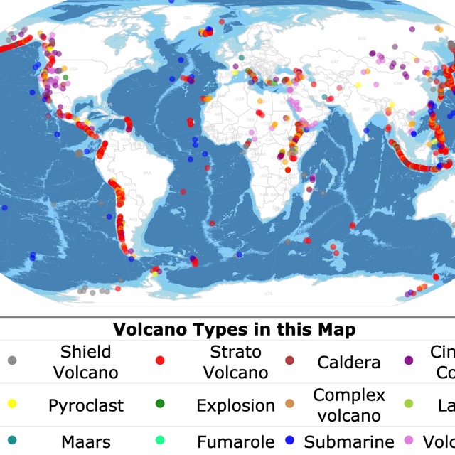
Interested in geology? Check this map of World Volcanoes
Must See Waterfalls in the U.S.
This list includes must see waterfalls because of their beauty and size, others because of their idyllic location and views. They are all unique and preference.
Niagara Falls
This is a group of three waterfalls, located on the Niagara River, between New York and South Eastern Ontario Canada. The combined falls have the highest rate of any waterfall in North America. It is well known by its beauty, power, and size.
The falls are of glacial origin and at their highest point they have a higtht of 167 feet (51 m).
The water flow is halved during the night and low tourist seasons, in part to control the hydroelectric power. The peak tourist season is summer. During this time of year, the falls are illuminated from sunset until midnight!
One of the magnets of this location is the possibility of watching the falls from different angles, even up close from a boat! But besides the falls there other attractions that will make your visit worthwhile.
Want to learn about other geologic features in the US? Check this map about Caves!
Yosemite Falls
Located in Yosemite National park in California. These falls are of glacial origin and its rocks are mainly made of Granite.
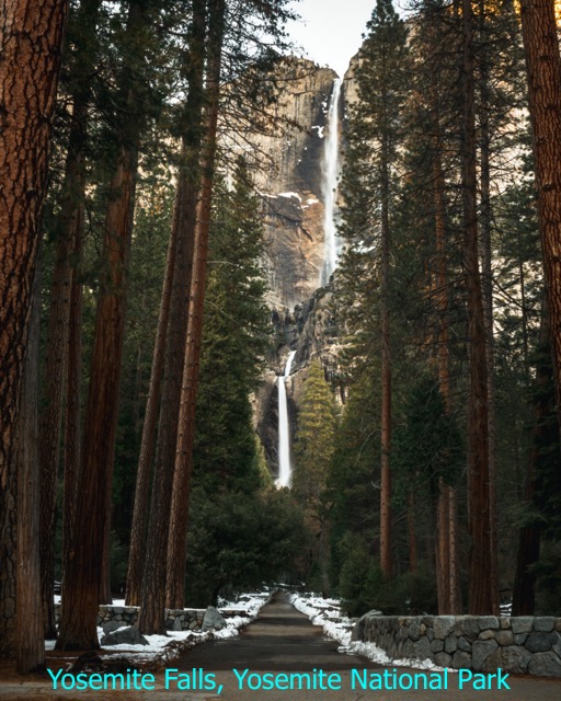
The peak flow is in early summer, as snowmelt cascades down to the Valley floor. During late summer to early fall the falls dry completely.
The fall is divided into three sections. The upper section is 1430 feet (436m) tall, one of the tallest in the world. The middle section is 675 feet (206 m) and has 4 plunges. The bottom tier is 320-foot (98 m).
The falls have different trails and road access to view them from different angles and appreciate their beauty.
Bridalveil Fall
Bridalveil is also located in Yosemite National Park California. This waterfall is in one of the most beautiful valleys, Yosemite Valley. Bridalveil is in front of El Capitan, an imposing 3,000 feet (914m) granite wall.
Bridalveil with a height of 620 feet (189m), was made famous by Ansel Adams in one of his many photographs of the Park.
The best time to visit is in early spring, but a small rainfall brings the flows back to the waterfall in other seasons.
With a strong wind, the falling water is often blown sideways, and when the flow is light, it may not reach the ground directly below. Source: WorldofWaterfalls.com
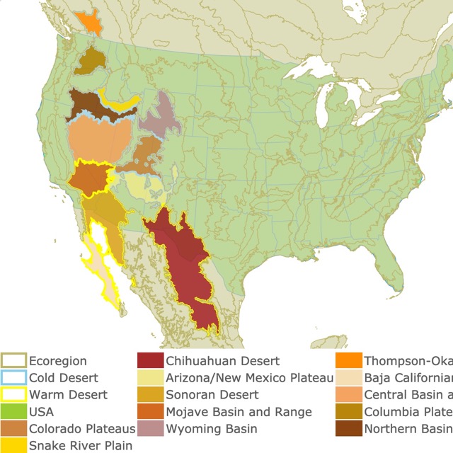
Many of these hot springs are located in Deserts. To learn more about them check this map of US Deserts.
Union Falls
This beautiful fall is 265 feet tall and is in Wyoming, at Yellowstone National Park.
The first thing that strikes you is its particular shape. It looks like a circus big top.
To see this waterfalls you need to walk 16 miles round trip and cross a river. Nevertheless, it is a popular trail because it provides access to abundant berry patches, fishing opportunities, and colorful fall foliage.
Multnomah Falls
Located in Oregon's Columbia Gorge Natural Scenic Area. The gorge itself has multiple falls worth visiting, but Multnomah is the most popular water fall.
In fact, Multnomah Falls is the most visited natural recreation site in the Pacific Northwest with more than 2 million visitors each year! Source:fs.usda.gov
The fall is 620 feet high, but for a closer view, it is possible to walk several hundred feet up the paved trail to reach Benson Bridge, which spans the falls. From the bridge you have perfect views of the top tier and the bottom one.
The fall is fed by underground springs and does not dry up in late summer like other falls.
Ruby Falls
Ruby Falls is close to Chattanooga Tennessee. Located in the Lookout mountains, this waterfall is inside a cave!
This is the highest cave waterfall in the United States. It has a 145 foot (44 m) height over the plunge. To see it, you can descend 26 stories by elevator and explore the scenic cavern path.
Ruby Falls Cave has many of the well-known types of cave formations like stalactites and stalagmites, columns, drapery, and flowstone.
Akaka Falls
Akaka Falls State Park is in Hilo, Hawaii. The falls are 420 feet high and flow year round.
To access the falls you can walk half a mile on a paved road. Unlike most waterfalls in the U.S., these falls are surrounded by the lush tropical forests of Hawaii.
The path to the falls has multiple platforms to view them at different points.
If you join a tour it is possible to see more than one waterfall in a day.
Interested in water but just the slow flowing kind? Click on this map of Florida's Springs
Whitewater Falls
Situated in Sapphire, North Carolina, these falls are 811 feet tall. The upper section or tier falls 411 ft. This is the tallest waterfall in the Eastern United States.
You can access the upper section through a paved path of a 1/4 mile. To see it from the bottom you have to walk over wooden steps. The bottom access is through South Carolina.
The falls have a high volume of visitors in the afternoon, so to avoid crowds is better to visit in the morning. Source: fs.usda.gov
Best Waterfalls to Swim in the U.S.
Fortunately there are falls that are not just for viewing but for swimming. Here are the best to go and take plunge.
Havasu and Mooney Falls
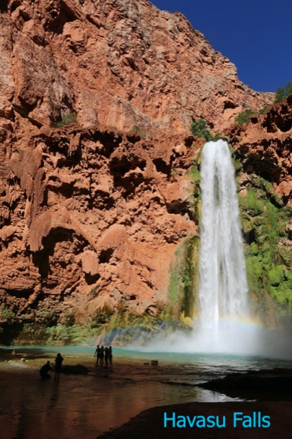
Both falls are in Havasupai Private owned land in Arizona. Not far from each other, the access to the falls is a 10 mile route on foot or horseback. No paved roads in the arid trails.
The natural beauty of the desert, and the contrast of the reddish rocks surrounding it, with the incredible blues of the water make it a feast for the eyes.
The attraction is not just the beautiful sight but the cool, blue swimming hole for visitors to plunge in. Campsites are available for those who wish to spend more than one day in the area.
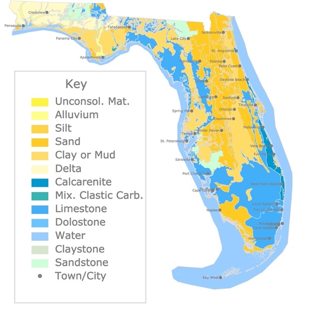
Interested in Geology but the Karst type? Check this map of Florida's Geological Features.
Cummins Falls
Cummins Falls State Park is a picturesque, 282 acre park located nine miles north of Cookeville on the Blackburn Fork State Scenic River, Tennessee.
The gorge and waterfall are not easily accessed and can only be reached by foot. It is about 1.5 miles of hiking on steep and rugged terrain. Nevertheless, part of the fun is the beautiful hike.
These falls are not just about the swim, but getting water springling all over your body! It is possible to climb different tiers of the waterfalls!
Pe'epe'e Falls and Boiling Pots
Located in the Big Island of Hawaii, these falls are close to another beautiful waterfall, Rainbow Falls.
Pe'epe'e falls are visible from the road. The waterfall reaches a height of 100ft and the plunge pools are surrounded by lava rocks from the eruptions of the Mauna Loa.
This is an idyllic location where the water from the falls continues into Boling Pots. They are called this way because when there is enough water they look like they are boiling.
Reaching both locations and swimming is allowed but when there is heavy rainfall it is better not swim. There are flash floodings that have resulted in loss of life.
Alamere Falls
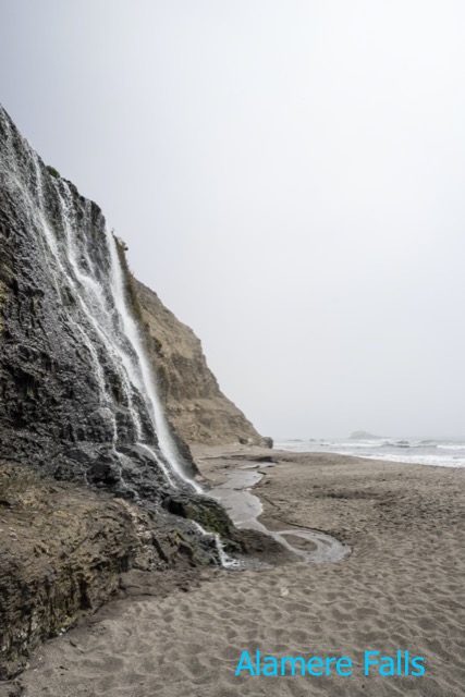
Alamere Falls is in Phillip Burton Wilderness. Reaching the falls is at least a 13 mile (20km) walk. However, the path is accessible year round and is a popular trail for bird watchers, and nature lovers.
The falls are a spectacular sight as water cascades over a 40 foot tall (12 m) cliff onto the south end of Wildcat Beach. This means the falls flow directly into the ocean!
The falls are an incredible sight as you can see the waterfall, the cliffs, and the Pacific Ocean.
Jump Creek Falls
Jump Creek Falls is in Owyhee County, Idaho. The trail that leads to the falls is only 1/4 mile long.
The falls are 60 feet tall, but the greatest part is not the views of the fall at the canyon, it is swimming in the pool below the falls.
Because this area is not just about the falls, take your time to admire the cliffs in the canyon that can reach up to a 600 feet. Source: Rootsrated.com
Hooker Falls
Hooker falls are located in Ashville North Carolina. This is the fourth waterfall on the Little River in DuPont State Forest, and you can hike to the other three.
The falls are only a 12ft high, but its wide drop into the pool creates a beautiful view, and a great place for splashing around on hot summer days.
The trails are about 1/4 mile and one is paved for wheelchair access. This is a perfect pool for families with children, as the falls generate very little current.
Affiliate Disclosure
Databayou.com is a participant in the Amazon Services LLC Associates Program, an affiliate advertising program designed to provide a means for sites to earn advertising fees by advertising and linking to Amazon.com. Databayou.com also participates in affiliate programs with Clickbank, CJ, and other sites.
These are my favorite products found on Amazon when hiking of visiting Amrerica's Waterfalls.
- Merrell Women's Moab 2 Mid Waterproof Hiking Boot. Some waterfalls have easy access, while others require a long hike in uneven terrain. These boots will take you to your next destination.
- DJI Osmo Action - 4K Action Cam 12MP Digital Camera with 2 Displays 36ft Underwater Waterproof: It is not just about the next stop is how you get there. This camera will help you record your ourney and get the best views even if it means you will get wet in the process.
- Marmot Essential Women's Lightweight Waterproof Rain Jacket, GORE-TEX with PACLITE Technology. Not all waterfalls are for a swim. Some are in cold areas, where you might get close and enjoy the mist. With this jacket you can get close and stay dry.
- Columbia Storm Surge Waterproof Rain Pant: For rainy trips and wet waterfalls, these pants will keep you dry.
- Osprey Rook 65 Men's Backpack: This backpack is light and will keep your personal belongings dry.
Water Fall Map Resources
The shapefiles for the states were downloaded from Natural Earth.
The data was downloaded from the Geographic Names Information System (GNIS), maintained by USGS. Data cleaning was done with R Project for Statistical Computing.
This map will be updated with new data! To receive updates on this and more nature maps join my email newsletter!!!!!!!
Made by Luz K. Molina with D3.js.