Lakes and Ponds: Where are they commonly found?
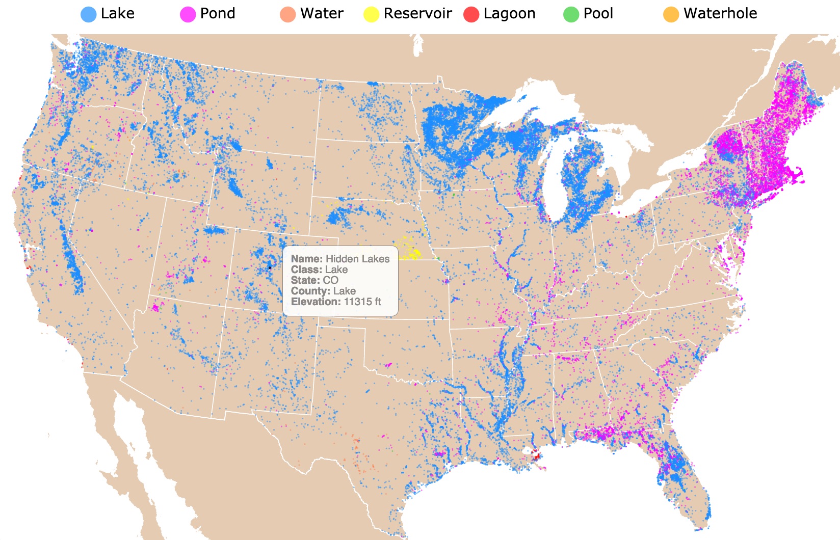
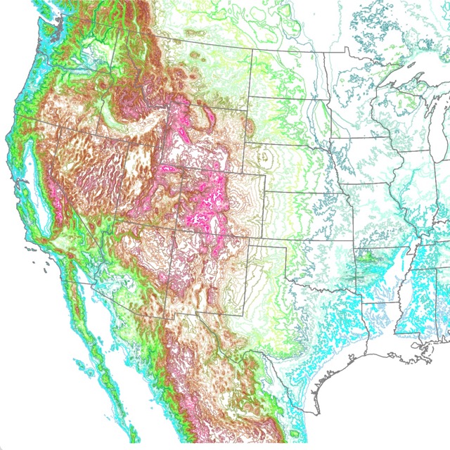
This is an interactive map of lakes from the continental United States. It shows the locations of water bodies named Lake, Pond, Water, Reservoir, Lagoon, Pool, and Waterhole. For names and types, hover over the map. Zoom out to see Alaska and Hawaii. Zoom in to see all water bodies in detail.
Lentic Features
Lentic ecosystems are bodies of standing water. They range from seeps, ditches, ponds, basins, and lakes.
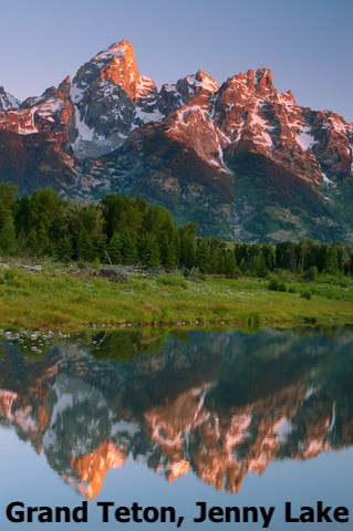
Lakes
A lake is a site where surface-water, runoff, or groundwater seepage accumulates in a low spot relative to its surroundings.
The water in lakes is not trapped, but the water entering a lake comes in faster than it escapes. The water from lakes can outflow into a river, seepage into the ground, or by evaporation.
Human presence affects water levels as people withdraw water for their needs; USGS.
The water in lakes comes from rain, snow, melting ice, streams, and groundwater seepage.
Lakes are large enough to have deep waters. Deep lakes have layers of water that have different characteristics due to light penetration and oxygenation.
Lakes are either open or closed. If water leaves a lake by a river or other outlet, it is said to be open. All freshwater lakes are open and most lakes are freshwater.
If water only leaves a lake by evaporation, the lake is closed. Closed lakes usually become saline or salty. This is because as the water evaporates, it leaves behind salts National Geographic.
The Great Salt Lake in Utah, is the largest saline lake in North America. Its water is saltier than the ocean.
Surrounding the Great Salt Lake are salt flats, areas where the lake has evaporated, leaving only stretches of white salt.
This map shows you where Swamps and Bayous are found throughout the U.S.
Origin of Lakes
Lakes can be classified according to their origin. Here we summarize just a few.
Glacial Lakes
Most lakes can be found in the Northern Hemisphere, where large areas once were covered by huge ice formations. In the past gigantic sheets of ice and snow accumulated on the ground and water, creating Glaciers.
During the last ice age, 115,000 – 11,700 years ago, glaciers covered an area that extended from the Atlantic Ocean to the Rocky Mountains.
At some point, the ice sheet was more than a mile high. As the glaciers moved back and forth across the land, they scraped off the tops of hills and bluffs and took rocks with them. Most of this glacial movement occurred 10,000 to 12,0000 years ago, NALMS.
Glacial Lakes formed when glaciers eroded the land, melted, and filled the depressions they created.
An example of glacial lakes is the Great Lakes.
Solution Lakes
Lakes may form when underground soluble rocks are dissolved by water. As the water dissolves the rock, an underground depression is created.
Rock formations made of sodium chloride (salt), or calcium carbonate (limestone), are most likely to be dissolved by acidic waters.
When the groundwater has dissolved the rocks below the surface, the top of the land caves in, forming a round-shaped lake called a solution lake.
Typically, the depressions are deep enough to extend below the groundwater table and permanently fill with water. Solution lakes are common in Michigan, Indiana, Kentucky and particularly in Florida. Source North American Lake Management Society.
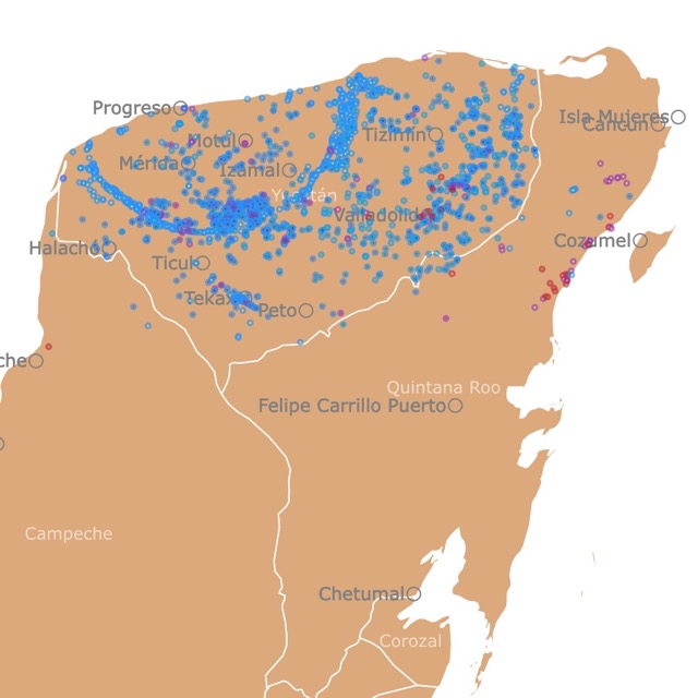
Cenotes are formed like solution lakes. To learn more about them, visit this map of Yucatan Cenotes
Volcanic Lakes
Lakes may also be created by the explosive activity and collapse of a volcano.
After a volcanic explosion, the caldera and crater left are filled with rainwater or snowmelt.
Examples of crater lakes include Mount Katmai in Hawaii and Aniakchak Crater in Alaska.
Tectonic Lakes
Tectonic Lakes are formed by the tectonic activity of the Earth.
The deformation of the Earth's crust due to lateral and vertical movement results in rift valleys and lakes.
Examples of these lakes are Lake Baikal in Russia and the Caspian Sea in central Asia.
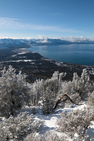
The basin of Lake Tahoe in California and Nevada is believed to be formed by the rise and fall of the landscape due to faulting.
Fluvial Lakes
Fluvial lakes may be the result of running water.
When meandering rivers change course, they may leave behind crescent-shaped lakes, called oxbow lakes.
Lakes may also be formed by landslides, wind, or the action of plants and animals!
Ponds
There is a slight difference between a Lake and a Pond. This is not a regulatory difference, but generally, lakes are larger and deeper than ponds.
A lake is a body of water that is deep enough to thermally stratify into two or three layers during the summer in temperate regions such as New Hampshire; ASLO.
As mentioned before, deeper bottoms receive less sunlight. Meanwhile, the stratification or layering affects the concentration of oxygen, therefore, the presence of fish.
"A pond is shallow enough that sunlight can penetrate to the bottom and support rooted plant growth across its entire width". Source: New Hampshire Dept. of Environmental Services.
Because Ponds have more light penetration, they can to support a diverse range of water plants.
Reservoirs
A reservoir is a manmade lake created when a dam is built on a river. River water backs up behind the dam creating a reservoir USGS.
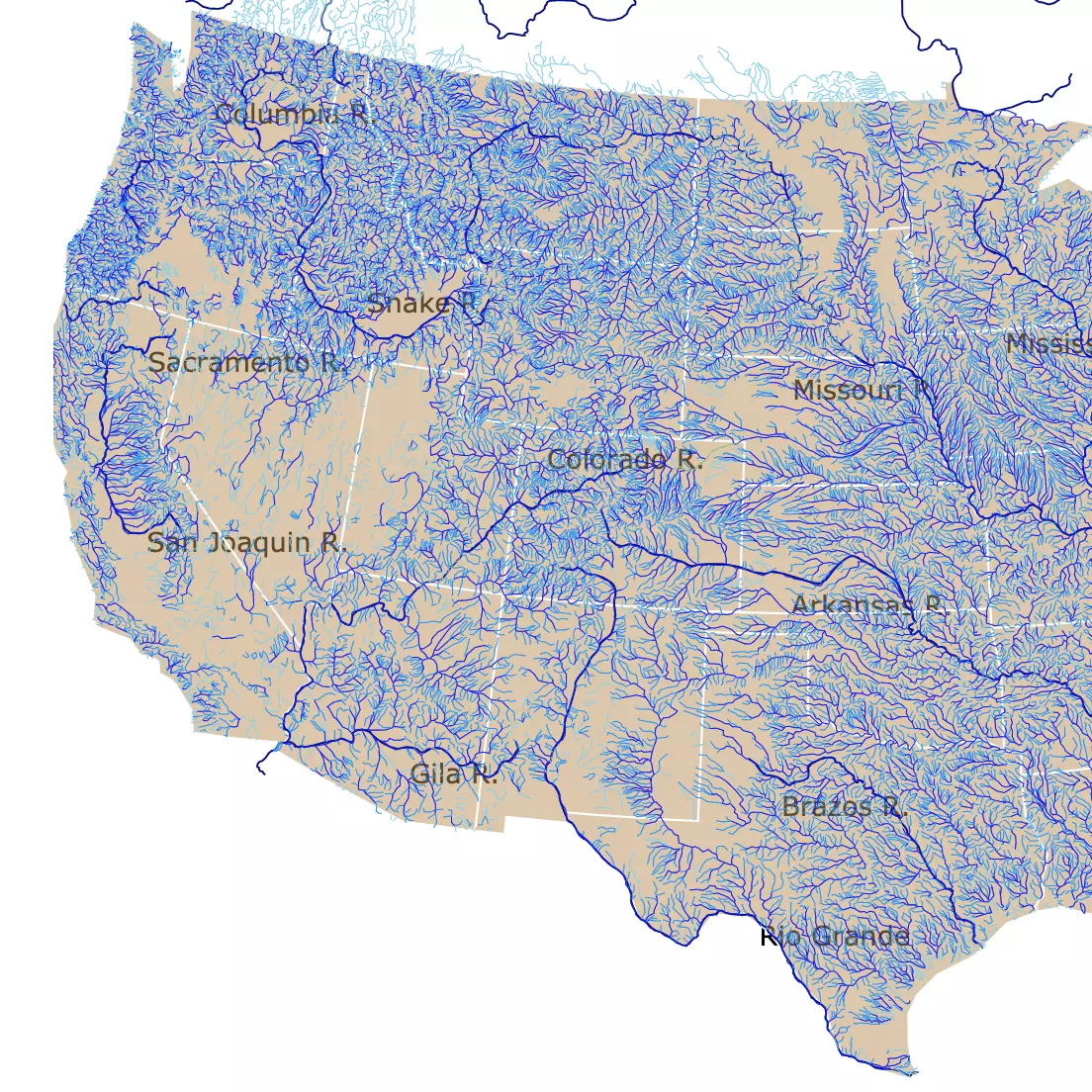
To learn more about bodies of water, check this interactive map of U.S. Rivers and streams.
Lagoons
A lagoon is a shallow body of water protected from a larger body of water (usually the ocean) by sandbars, barrier islands, or coral reefs.
Lagoons are often called estuaries, sounds, bays, or even lakes. Lagoons sheltered by sandbars or barrier islands are called coastal lagoons.
Coastal lagoons form along coastal plains—flat or gently sloping landscapes. They form in areas with small tidal ranges; Britannica.
Pool
According to the Cary institute, "Pools are typically created by the vertical force of water falling down over logs or boulders. The movement of the water carves a deeper indentation in the stream bed."
Waterhole
Finally, and to my surprise, the definition of a waterhole by the Cambridge dictionary is: "a small pool of water in a dry area where animals go to drink".
Features are not only punctual. Some form beautiful shapes worth exploring
.This map, like other name maps, shows that similar geographic features are the result of the people living in those areas.
The names of this map, in particular, seem to be the result of differentiating water features according to their characteristics. After all, these names are not random but reflect the area where they are located.
Facts About Lakes
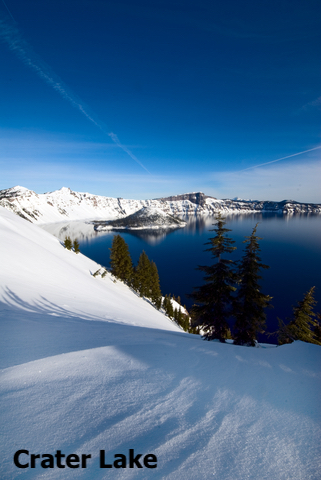
- The deepest lake in the United States is Crater Lake in Oregon. This lake is 1,949ft (594m) deep and resulted from a volcanic explosion.
- The deepest, largest, and oldest freshwater lake globally, is Lake Baikal, situated in the Russian Siberia. This lake is 5,387ft (1,642m) deep, 12,248sqmi (31,722 km2) wide, and about 25 million years old.
- Lake Superior is the largest lake in the United States. It covers an area of 31,700 sq mi (82,103 km2)
- The U.S. has 14 saltwater lakes.
- The highest lake in the United States is Pacific Tarn. It is situated in Colorado, and it is 13,420 feet (4,090m) above sea level.
- The world's highest lake is Ojos del Salado in Chile and Argentina. It is 20,965 feet (6,390 meters) above sea level.
- The clearest lake in the world is Blue Lake. This lake, located in New Zealand, has a visibility of 249.3 feet (76m). This visibility is equivalent to the clearness of distilled water.
- The most transparent lakes in the United States are Crater Lake and Lake Tahoe. Lake Tahoe has a visibility of 80 feet (24m) UCDavis. Crater lake has an average visibility of 100ft (30.5m) Crater Lake Institute.
- Alaska is the state with the most lakes. It has over 3 million lakes.
- Minnesota, the “Land of 10,000 Lakes,” does not have the most lakes, but it has the most named lakes, with about 15,291 natural lakes, 11,824 of which are greater than 10 acres, Review.
Affiliate Disclosure
Databayou.com is a participant in the Amazon Services LLC Associates Program, an affiliate advertising program designed to provide a means for sites to earn advertising fees by advertising and linking to Amazon.com. Databayou.com also participates in affiliate programs with Clickbank, CJ, and other sites.
- For more information on freshwater and water supplies, Amazon has a visual guide to the state of this resource. With vivid graphics and charts, The Atlas of Water: Mapping the World's Most Critical Resource has on-point illustrations of the present and future of water.
- Also on Amazon is this handbook with terminology and concepts in geography. I recommend that if you want to find out more about a location's history and how geographic features came to be named, you read the Encyclopedia of Geography Terms, Themes, and Concepts.
- If you cannot have enough of place names and would like to read about the origin of location names, this book found on Amazon called Encyclopedia of Place Names in the United States is a perfect fit for your quest.
Follow Me
This map will be updated with improved and recent information! To receive updates on this and more nature maps, join my email list!!!!!!!
Inspiration for Lakes and Ponds Map
This map was created after creating the map Wetlands of the US. The data provided the names of different water bodies.
I decided lakes was an appropriate follow up. It shows the locations of all features classified as a Lake but differentiated by their name. The names included were those classified as synonyms of "lake".
Resources for Map of Lakes and Ponds
The data was downloaded from the Geographic Names Information System (GNIS), maintained by USGS.
Data cleaning was done with R Project for Statistical Computing. I used only the names classified as Lakes.
The Shapefiles for this map were downloaded from Natural Earth. The code was obtained and altered from Chris Williams’s Block.
Made by Luz K. Molina with D3.js.