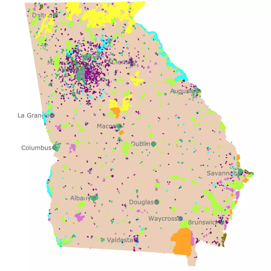
Georgia County Map
This interactive Georgia county map with cities for context. Hover over the map to see the name, population, and area. For more detail, zoom in. For more information, scroll down.
County Map of Georgia
The Peach State has 159 counties, second only to Texas.
The states population is $11.18 million. Fulton County has the largest population with over 1,066,710 residents followed by Gwinnett County with 957,062.
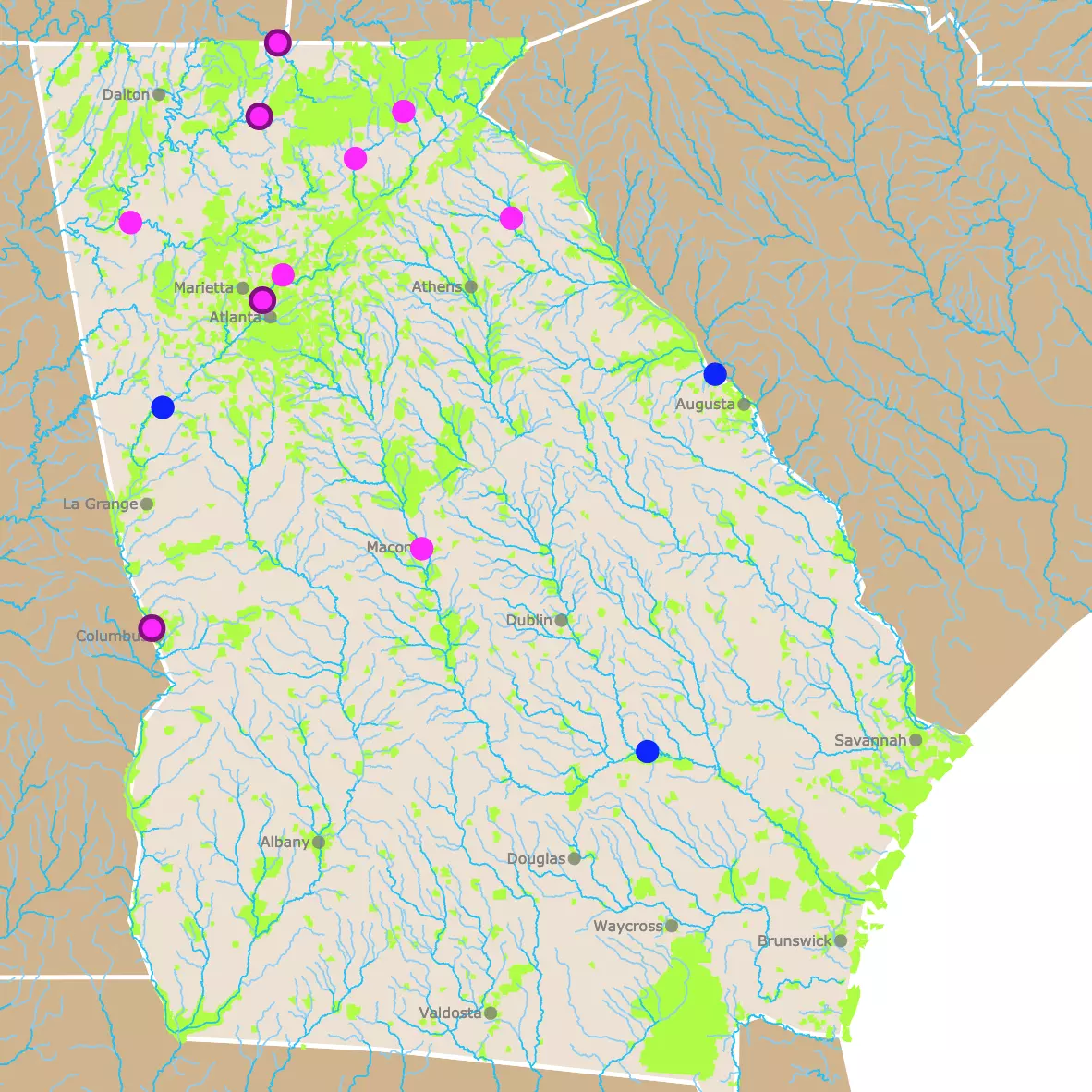
Map of Georgia's Parks and Protected Areas
Prominent Counties in Georgia
- Fulton County is the most populous county in Georgia. Fulton is home to much of Atlanta, the state’s capital and largest city. It is a hub for business, media, and transportation, housing corporate giants like Coca-Cola and CNN, and the world’s busiest airport, Hartsfield-Jackson Atlanta International.
- DeKalb CountyJust east of Fulton, DeKalb includes a portion of Atlanta and is known for its diverse population and cultural institutions. It is home to Emory University and the Centers for Disease Control and Prevention (CDC), making it a national center for education and public health.
- Cobb County Located northwest of Atlanta, Cobb is a fast-growing suburban area known for its strong school systems and economic development. It is also the site of Truist Park, home of the Atlanta Braves, contributing to its rising profile.
- Gwinnett County One of the fastest-growing counties in Georgia, Gwinnett is recognized for its ethnic diversity and vibrant immigrant communities. Its thriving economy and well-regarded public schools make it a desirable place for families and businesses.
- Chatham County On Georgia’s southeastern coast, Chatham is anchored by Savannah, a historic city known for its charming architecture, tourism, and port—the fourth busiest container port in the U.S. Its blend of history and modern industry makes it a coastal powerhouse.
Georgia, a southeastern U.S. state, is home to several prominent counties, each playing a significant role in the state's cultural, economic, and political landscape.
Here are a few of the most notable:

Printable Map of Georgia Counties
These are the PDF files for the Georgia counties map in color and black and white.
 |
 |
List of Counties in Georgia
This table includes Georgia counties, and seats.
| County | Seat | County | Seat |
|---|---|---|---|
| Appling | Baxley | Jefferson | Louisville |
| Atkinson | Pearson | Jenkins | Millen |
| Bacon | Alma | Johnson | Wrightsville |
| Baker | Newton | Jones | Gray |
| Baldwin | Milledgeville | Lamar | Barnesville |
| Banks | Homer | Lanier | Lakeland |
| Barrow | Winder | Laurens | Dublin |
| Bartow | Cartersville | Lee | Leesburg |
| Ben Hill | Fitzgerald | Liberty | Hinesville |
| Berrien | Nashville | Lincoln | Lincolnton |
| Bibb | Macon | Long | Ludowici |
| Bleckley | Cochran | Lowndes | Valdosta |
| Brantley | Nahunta | Lumpkin | Dahlonega |
| Brooks | Quitman | Macon | Oglethorpe |
| Bryan | Pembroke | Madison | Danielsville |
| Bulloch | Statesboro | Marion | Buena Vista |
| Burke | Waynesboro | McDuffie | Thomson |
| Butts | Jackson | McIntosh | Darien |
| Calhoun | Morgan | Meriwether | Greenviille |
| Camden | Woodbine | Miller | Colquitt |
| Campbell | Fairburn | Milton | Alpharetta |
| Candler | Metter | Mitchell | Camilla |
| Carroll | Carrollton | Monroe | Forsyth |
| Catoosa | Ringgold | Montgomery | Mount Vernon |
| Charlton | Folkston | Morgan | Madison |
| Chatham | Savannah | Murray | Chatsworth |
| Chattahoochee | Cusseta | Muscogee | Columbus |
| Chattooga | Summerville | Newton | Covington |
| Cherokee | Canton | Oconee | Watkinsville |
| Clarke | Athens | Oglethorpe | Lexington |
| Clay | Fort Gaines | Paulding | Dallas |
| Clayton | Jonesboro | Peach | Fort Valley |
| Clinch | Homerville | Pickens | Jasper |
| Cobb | Marietta | Pierce | Blackshear |
| Coffee | Douglas | Pike | Zebulon |
| Colquitt | Moultrie | Polk | Cedartown |
| Columbia | Evans | Pulaski | Hawkinsville |
| Cook | Adel | Putnam | Eatonton |
| Coweta | Newnan | Quitman | Georgetown |
| Crawford | Knoxville | Rabun | Clayton |
| Crisp | Cordele | Randolph | Cuthbert |
| Dade | Trenton | Richmond | Augusta |
| Dawson | Dawsonville | Rockdale | Conyers |
| Decatur | Bainbridge | Schley | Ellaville |
| DeKalb | Decatur | Screven | Sylvania |
| Dodge | Eastman | Seminole | Donalsonville |
| Dooly | Vienna | Spalding | Griffin |
| Dougherty | Albany | Stephens | Toccoa |
| Douglas | Douglasville | Stewart | Lumpkin |
| Early | Blakely | Sumter | Americus |
| Echols | Statenville | Talbot | Talbotton |
| Effingham | Springfield | Taliaferro | Crawfordville |
| Elbert | Elberton | Tattnall | Reidsville |
| Emanuel Swainsboro | Taylor | Butler | |
| Evans | Claxton | Telfair | McRae-Helena |
| Fannin | Blue Ridge | Terrell | Dawson |
| Fayette | Fayetteville | Thomas | Thomasville |
| Floyd | Rome | Tift | Tifton |
| Forsyth | Cumming | Toombs | Lyons |
| Franklin | Carnesville | Towns | Hiawassee |
| Fulton | Atlanta | Treutlen | Soperton |
| Gilmer | Ellijay | Troup | LaGrange |
| Glascock | Gibson | Turner | Ashburn |
| Glynn | Brunswick | Twiggs | Jeffersonville |
| Gordon | Calhoun | Union | Blairsville |
| Grady | Cairo | Upson | Thomaston |
| Greene | Greensboro | Walker | LaFayette |
| Gwinnett | Lawrenceville | Walton | Monroe |
| Habersham | Clarkesville | Ware | Waycross |
| Hall | Gainesville | Warren | Warrenton |
| Hancock | Sparta | Washington | Sandersville |
| Haralson | Buchanan | Wayne | Jesup |
| Harris | Hamilton | Webster | Preston |
| Hart | Hartwell | Wheeler | Alamo |
| Heard | Franklin | White | Cleveland |
| Henry | McDonough | Whitfield | Dalton |
| Houston | Perry | Wilcox | Abbeville |
| Irwin | Ocilla | Wilkes | Washington |
| Jackson | Jefferson | Wilkinson | Irwinton |
| Jasper | Monticello | Worth | Sylvester |
| Jeff Davis | Hazlehurst |
Map of Georgia Tubing
FOLLOW ME
Resources for Georgia Counties Map
The shapefiles for cities, counties, and states from Georgia were downloaded from Natural Earth.
The population of Georgia was obtained from U.S.Census.
This information will also improve with your suggestions. To receive updates on this and more nature maps, join my email list!!!!!!!
Made by Luz K. Molina with D3.js.
