Illinois County Map
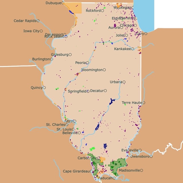
This is an interactive Illinois county map with cities for context. Hover over the map to see the names. For more detail, zoom in. For more information, scroll down.
County Map of Illinois

The Land of Lincoln or the Pririe State has 102 counties and its capital is Springfield.
Illinois is a state in the Midwestern United States, also part of the Great Lakes region. Illinois is located in the heart of the country, bordered by several states and Lake Michigan.
The Land of Lincoln is the birthplace of Walt Disney, the skyscraper, and the home of America's tallest building, the Willis Tower (Formerly the Sears Tower.
Right infront of the Art Institute of Chicago is where Route 66 begins and also in Chicago is the World's Largest Public Library the Chicago Public Library.
Springfield was Lincoln's hometown for 20 years and Illinois was the firts state to ratify the 13 Amendment and abolish slavery.
Map of Illinois's Parks and Protected Areas
Prominent Counties in Illinois
Illinois counties, contribute to its diverse economic, cultural, and geographic identity.
Among these, several counties stand out due to their population size, economic influence, and cultural significance.
- Cook County is the most populous in Illinois and the second most populous in the United States, is anchored by Chicago, a cosmopolitan city known for its finance, healthcare, transportation, and museums. With over 5 million residents, Cook County is the state's epicenter for commerce, politics, and innovation.
- DuPage County, west of Cook, is a thriving suburban hub. Known for its affluence and strong educational institutions, DuPage boasts a highly skilled workforce and a robust economy driven by technology, healthcare, and manufacturing.
- Lake County, bordering Lake Michigan, blends suburban living with natural beauty, including forest preserves and lakefront access. Its county seat, Waukegan, is part of the Chicago metro area and supports a mix of residential, commercial, and industrial development.
- Will County, one of the fastest-growing in the state, plays a vital role in logistics and transportation, thanks to its location at the intersection of several major interstates and rail lines. Joliet, the county seat, has evolved from an industrial city to a diversified urban center.
- Kane County, anchored by Geneva, balances agriculture with suburban expansion. The Fox River Valley runs through its core, providing scenic views and economic activity linked to recreation and tourism.

Printable Map of Illinois Counties
These are the PDF files for the Illinois counties map in color and black and white.
 |
 |
List of Counties in Illinois
This table includes Illinois counties, and seats.
| County | County Seat | Population | Area (sq mi) |
|---|---|---|---|
| Cook | Chicago | 5,087,072 | 944 |
| DuPage | Wheaton | 921,213 | 327 |
| Lake | Waukegan | 708,760 | 443 |
| Will | Joliet | 700,728 | 837 |
| Kane | Geneva | 514,982 | 519 |
| McHenry | Woodstock | 312,800 | 603 |
| Winnebago | Rockford | 280,922 | 519 |
| Madison | Edwardsville | 262,752 | 716 |
| St. Clair | Belleville | 251,018 | 657 |
| Champaign | Urbana | 205,644 | 996 |
| Sangamon | Springfield | 193,491 | 868 |
| Peoria | Peoria | 177,513 | 618 |
| McLean | Bloomington | 170,441 | 1,183 |
| Rock Island | Rock Island | 141,236 | 427 |
| Kendall | Yorkville | 139,976 | 320 |
| Tazewell | Pekin | 129,541 | 646 |
| LaSalle | Ottawa | 108,309 | 1,135 |
| Kankakee | Kankakee | 105,940 | 676 |
| DeKalb | Sycamore | 100,288 | 631 |
| Macon | Decatur | 100,591 | 580 |
| Vermilion | Danville | 74,188 | 898 |
| Adams | Quincy | 64,109 | 855 |
| Whiteside | Morrison | 55,000 | 697 |
| Jackson | Murphysboro | 52,141 | 584 |
| Boone | Belvidere | 53,313 | 280 |
| Grundy | Morris | 53,578 | 418 |
| Knox | Galesburg | 48,411 | 716 |
| Henry | Cambridge | 48,448 | 822 |
| Coles | Charleston | 46,863 | 508 |
| Macoupin | Carlinville | 44,967 | 862 |
| Stephenson | Freeport | 44,000 | 565 |
| Woodford | Eureka | 38,664 | 543 |
| Franklin | Benton | 37,138 | 408 |
| Marion | Salem | 37,205 | 572 |
| Jefferson | Mount Vernon | 37,000 | 571 |
| Clinton | Carlyle | 36,000 | 474 |
| Monroe | Waterloo | 34,000 | 385 |
| Livingston | Pontiac | 35,320 | 1,043 |
| Effingham | Effingham | 34,331 | 478 |
| Lee | Dixon | 33,654 | 724 |
| Christian | Taylorville | 32,000 | 709 |
| Fulton | Lewistown | 32,541 | 865 |
| Bureau | Princeton | 32,486 | 869 |
| Morgan | Jacksonville | 31,000 | 568 |
| Randolph | Chester | 30,000 | 575 |
| Montgomery | Hillsboro | 29,000 | 703 |
| Logan | Lincoln | 27,590 | 618 |
| McDonough | Macomb | 27,000 | 589 |
| Iroquois | Watseka | 26,136 | 1,117 |
| Saline | Harrisburg | 24,000 | 379 |
| Jo Daviess | Galena | 22,000 | 600 |
| Jersey | Jerseyville | 21,000 | 369 |
| Fayette | Vandalia | 21,164 | 716 |
| Shelby | Shelbyville | 20,000 | 758 |
| Perry | Pinckneyville | 20,000 | 441 |
| Douglas | Tuscola | 19,629 | 416 |
| Crawford | Robinson | 18,300 | 443 |
| Hancock | Carthage | 17,186 | 793 |
| Union | Jonesboro | 17,000 | 413 |
| Edgar | Paris | 16,334 | 623 |
| Warren | Monmouth | 16,000 | 542 |
| Bond | Greenville | 16,576 | 380 |
| Piatt | Monticello | 16,000 | 439 |
| Wayne | Fairfield | 15,000 | 715 |
| Richland | Olney | 14,000 | 360 |
| Mercer | Aledo | 15,000 | 561 |
| DeWitt | Clinton | 15,365 | 397 |
| Clark | Marshall | 15,000 | 501 |
| Carroll | Mount Carroll | 15,000 | 445 |
| Lawrence | Lawrenceville | 14,813 | 372 |
| Pike | Pittsfield | 14,000 | 831 |
| Moultrie | Sullivan | 14,000 | 335 |
| Massac | Metropolis | 14,000 | 237 |
| White | Carmi | 14,000 | 495 |
| Washington | Nashville | 14,000 | 562 |
| Ford | Paxton | 13,250 | 485 |
| Clay | Louisville | 13,000 | 468 |
| Johnson | Vienna | 13,000 | 343 |
| Mason | Havana | 13,000 | 539 |
| Cass | Virginia | 13,000 | 375 |
| Menard | Petersburg | 13,000 | 314 |
| Greene | Carrollton | 11,543 | 543 |
| Marshall | Lacon | 12,000 | 386 |
| Wabash | Mount Carmel | 12,000 | 223 |
| Cumberland | Toledo | 10,261 | 345 |
| Jasper | Newton | 10,000 | 494 |
| Hamilton | McLeansboro | 7,911 | 434 |
| Schuyler | Rushville | 7,000 | 437 |
| Henderson | Oquawka | 6,088 | 378 |
| Brown | Mount Sterling | 6,307 | 305 |
| Edwards | Albion | 5,968 | 222 |
| Putnam | Hennepin | 5,561 | 160 |
| Alexander | Cairo | 4,594 | 236 |
| Gallatin | Shawneetown | 4,670 | 322 |
| Calhoun | Hardin | 4,224 | 253 |
| Pope | Golconda | 4,000 | 368 |
| Hardin | Elizabethtown | 3,569 | 177 |

Industry that Employs Most People in Every U.S. County Mapped
FOLLOW ME
Resources for Illinois Counties Map
The shapefiles for cities, and states from Illinois were downloaded from Natural Earth.
The county shapefiles are from the Census Bureau.
The population of Illinois was obtained from U.S.Census.
This information will also improve with your suggestions. To receive updates on this and more nature maps, join my email list!!!!!!!
Made by Luz K. Molina with D3.js.
