Map of the Great Lakes
This interactive map shows the Great Lakes and its bathymetry. It also shows major cities for context. For more detail, zoom in. For more information, hover over the map, or scroll down.
| Depth | ||||||
| 3ft | 272ft | 544ft | 820ft | |||
| 1m | 83m | 166m | 250m | |||
The Great Lakes
The Great Lakes are located on the northeastern side of the United States. They are a chain of lakes partly shared by the USA and Canada.
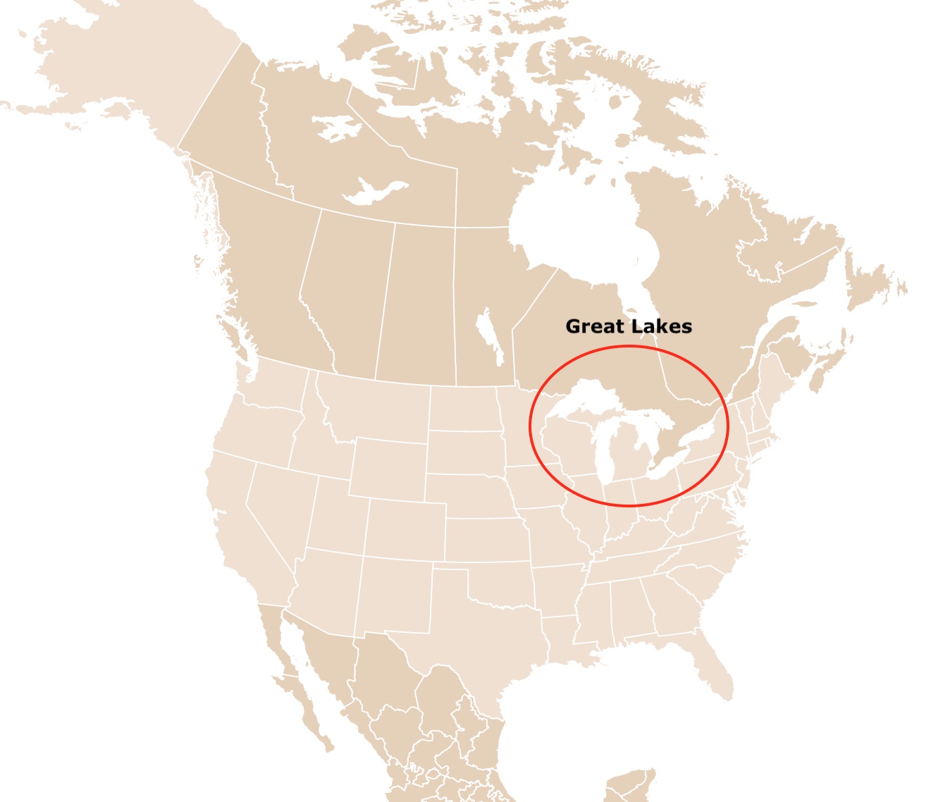
The Great Lakes are Lake Superior, Michigan, Huron, Erie, and Ontario.
The Great Lakes comprise an area of 94,250 square miles (244,106 square kilometers), the largest freshwater surface in the world.
When it comes to volume, the Great Lakes is only surpassed by Lake Baikal in Russia. The Great Lakes contain more than 6 quadrillion gallons (23 quadrillion liters) of freshwater. They hold 20% of the world's fresh water.
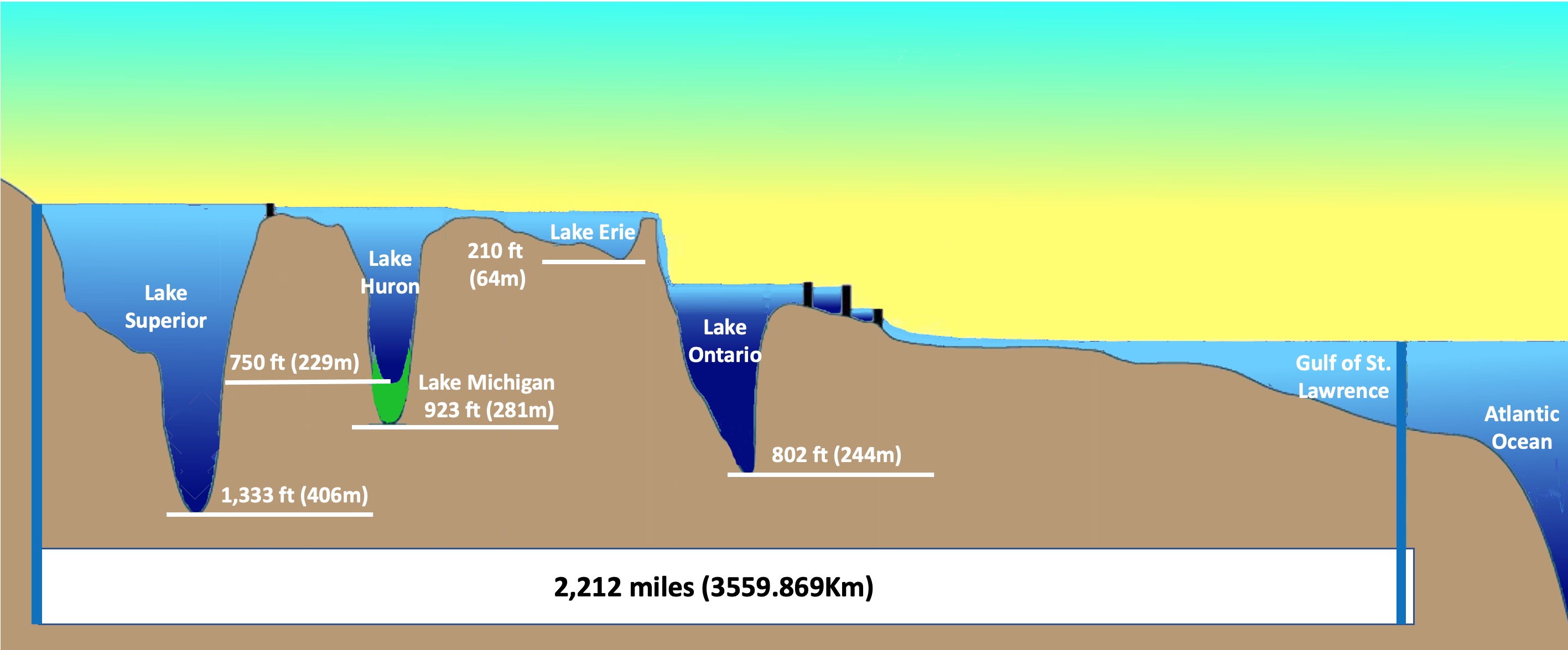
The Great Lakes are part of the St. Lawrence river system. This waterway system connects the St. Louis River with the Lakes and the St. Lawrence River. The St. Lawrence River then empties into the Atlantic Ocean through the Gulf of St. Lawrence.
The Great Lakes are freshwater ecosystems. Their salinity is under 0.5ppt.

For more lakes around the U.S. visit this map of Lakes and Ponds
Economic Importance of the Great Lakes
The Lakes played a vital role in the European colonization and North America's development.
Today, they provide drinking water, fisheries, shipping, recreational opportunities, and more.
Major cities by the lakes include Chicago, Toronto, Cleveland, and Milwaukee. About 12 million people live on its shores.
Lake shores are highly productive, thanks to the lake waters. They maintain various crops.
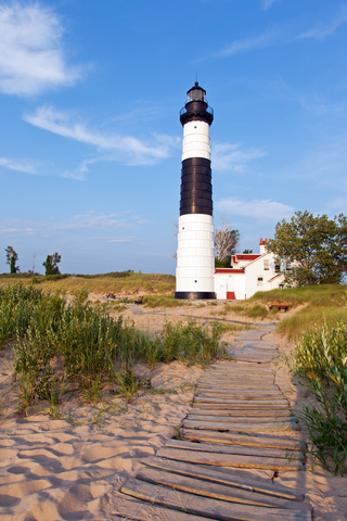
One of the coolest features of the lakes links its shipping history with today's tourism industry. The lakes have an abundance of lighthouses. Lake Michigan is known for having over 100 lighthouses!
If you admire the lakes and appreciate machinery, Amazon has Lake Boats: The Enduring Vessels of the Great Lakes. This book has visually stunning pictures of old and new ships from the Great Lakes!
The Great Lakes and Climate
The surface temperature of the lakes varies significantly throughout the year. From 35°F to 70°F. Besides the seasonal variation, these temperatures are different depending on the lake.
Lake effect snow is common close to the Great Lakes during the late fall and winter seasons. It happens when cold air from the north moves over the lakes.
As the cool air moves over the relatively "warm" lakes. This warmth and moisture rise to the atmosphere. As the air rises more, the clouds grow and form a band that produces 2 to 3 inches of snow per hour.
Depending on wind direction, there might be snow, while not far away, there might be bright blue skies. Weather.gov
Map of Glaciers Worldwide
Great Lakes Origins
The bedrock of the lakes is Precambrian metamorphosized igneous and sedimentary rocks formed 3600 to 1000 million years ago.
During the Phanerozoic, the sea covered the area, leaving behind sedimentary rocks. These are mainly shale, sandstone, and limestone.
During the last million years, glaciers removed the Phanerozoic bedrock and exposed the Precambrian bedrock; Mineral Museum.
Most of the sedimentary rock is still present south of the lakes. The northern side of the lakes was heavily glaciated, and most of the sedimentary rock was carved, leaving behind igneous rock.
The heavy glaciers from the last Ice Age carved but eroded the rock, leaving glacial moraines (ridges or mounds of debris).
Over the last 20,000 years, the ice sheet melted, leaving behind meltwater that filled the depressions carved by the glaciers. Nevertheless, the area's geology determined the lakes' shape before the glaciers appeared. This meltwater formed the Great Lakes.
Great Lakes Ecosystems
The Great Lakes used to be dominated by forests, grasslands, and wetlands.
The original wildlife is still present in the remaining habitats. These include moose, beaver, gray wolf, little brown bat, river otter, coyote, and lynx.
The area is also of great importance for waterfowl and migratory birds. Some common birds in the area include the common loon, cormorant, bald eagle, common tern, northern harrier, and Kirtland's warbler.
The fish found in the lakes include yellow perch, lake sturgeon, walleye, brook trout, muskellunge, and lake whitefish.
Because the lakes have different characteristics, the wildlife in each, varies considerably; NWF.
If you wish to read more about the ecological portrait of the lakes, Amazon has The Death and Life of the Great Lakes. This fantastic book also ensembles history, science, and personal experiences about the present and future of the lakes.
World Bathymetry Map
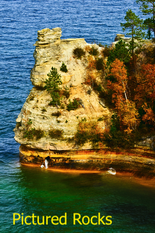
Lake Superior
Its name comes from the French word lac supérieur, which means "upper lake."
Lake Superior is surrounded by the states of Minnesota, Wisconsin, Michigan, and the province of Ontario.
Lake Superior is the largest, deepest, coldest, and clearest of the lakes, containing as much water as the other four lakes combined.
Lake Superior is the world's largest lake by surface area, with 31,700 square miles (82,170 square kilometers). It holds 10% of the world's fresh water.
Its deepest point, just north of the state of Michigan, is 1,300 feet (400 meters) below the surface. Eventhough, there are measurements of its depth, the lake's bathymetry was not available. Therefore, it is missing from the map above.
The lake has a visibility of 27 feet. In some places, it is 100 feet; hence it is classified as oligotrophic. This means it has very little nutrient input.
Over 300 rivers and streams flow into the lake, and there are over 400 islands. The largest island is Isle Royale, also a beautiful National Park in Michigan.
Lake Superior is 350 miles (563 km) in length and 160 miles (257 km) in width. It has waves of more than 40 feet in height. Source: https://law.umkc.edu/.
The area surrounding the lake has over 58 native orchid species. Near the lake, there are also some of the oldest rocks in North America. In fact, the oldest fossil in North America is found close to its shores.
Lake Michigan
The word Michigan comes from the Ojibwa word Michi Gami, meaning "large lake."
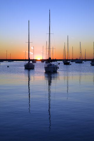
Lake Michigan is the only one of the Great Lakes that is completely located in the United States. It is surrounded by the states of Michigan, Indiana, Illinois, and Wisconsin.
Lake Michigan is the third largest of the Great Lakes. It is approximately 118 miles (189.9Km) wide and 307 miles (494Km)long.
You can check the depths of the lake on the map above. It is, on average, 279feet (85m) deep. The lake reaches 925 feet (281m) at its deepest point.
Lake Michigan is joined by Lake Huron by the Straits of Mackinac. Its waters flow to Lake Huron.
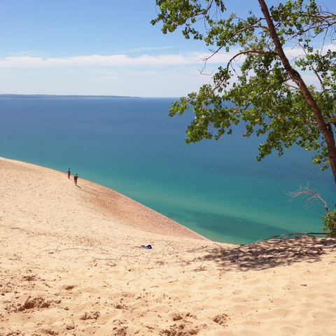
Because of its long stretch from north to south, there is a great variety in the lake's climate, which also influence the immense diversity of plant and animal species. Besides prairies and wetlands, the lake has the largest freshwater sand dune.
Lake Michigan has over 140 bird species and 6 rare plant and animal species. These include the Dwarf Lake Iris and the Piping Plover. Source: GLC.
Map of U.S. Waterfalls
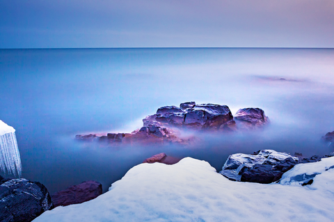
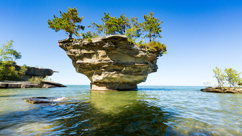
Lake Huron
Lake Huron got its name from the Huron people that lived by its shores.
It is bordered by the state of Michigan and the province of Ontario.
Lake Huron has the longest shoreline of the Great Lakes and the second largest surface area, with 23,007 square miles (59,590 square Kms.) It is also the fourth largest by surface area worldwide.
Lake Huron has an average depth of 193ft (59m). Its waters flow from Lakes Superior and Michigan through the Straits of Mackinac. Lake Huron waters flow out to Lake Ontario.
This lake has over 30,000 islands. More than any other of the Great Lakes. One of its islands is Manitoulin. This is the long island that looks like it almost divides the lake in two.
Manitoulin is the largest freshwater island in the world, with over 100 freshwater lakes of its own.
Lake Huron is well known for its beaches, sand dunes, wetlands, and river system. Its broadleaf forests are known fot their beautiful yellow and red colors during fall.
Lake Huron even has a petrified forest of over 7,000 trees below its waters.
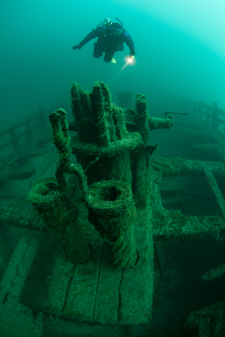
This lake is known for its cyan waters, bays, channels, and many shipwrecks. It provides water for drinking, food, and recreation to 3 million people in the USA and Canada.
Lumber and fisheries are critical industries in the region's economy. Furthermore, the world’s largest limestone mine is on the shore of Lake Huron (Calcite Quarry in Michigan). The world’s largest salt mine is also located on its shores, in Goderich, Ontario; GL guide.
Lake Erie
Lake Erie was named after the people who lived by its beaches.
Lake Erie is bounded by the states of Michigan, Ohio, Pennsylvania, New York, and the province of Ontario.
It is the shallowest and the smallest of the Great Lakes. Its average depth is only about 62 ft. (19m). It has a surface area of 9,990 square miles (25,874 square kilometers).
Because of the smaller volume, it frequently freezes in the winter and warms quickly in spring and summer.
Lake Eerie is the most populated of the Great Lakes, with 12 million people living in its watershed. Their communities use the lake waters for their livelihood and recreation. Most of the land around Lake Erie is urban or agricultural.
In the 1960s, the lake was "dying". This was because of the excessive algal growth in the lake. A joint effort by U.S. and Canadian agencies was established to limit the phosphorus input to the lake. This significant input was due to urban and agricultural runoff.
Unfortunately, excessive algal growth persists, creating dead zones (areas in the water column with little or no oxygen) in the summer; EPA.
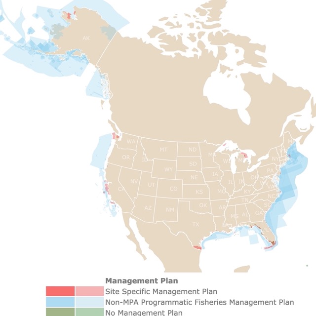
The lakes have a long coastline and many marine ecosystems to protect. To learn more, check this map of U.S. Marine Protected Areas
Lake Ontario
Lake Ontario’s name comes from the Iroquoian language and means “lake of shining waters.”
It is bordered by the state of New York and the Province of Ontario.
Lake Ontario is the smallest of the Great Lakes.
All the water from the Great Lakes flows through this lake to the Atlantic Ocean! Because of this, Lake Ontario is considered an ecologic wonder.
Here, fish travel back and forth from the lake to the ocean.
Its shores can be sand dunes, wetlands, or rocky cliffs. Source: Waterkeeper.ca
The lakes have similar water levels, except Lake Ontario. It drops down from Lake Erie by Niagara Falls!
This lake is home and a source of water for 9 million people!
FOLLOW ME
Resources for Great Lakes Map
The shapefiles with state boundary lines, major rivers, and cities were downloaded from Natural Earth Data.
The Great Lakes bathymetry shapefiles were downloaded from NOAA.
This map will be updated with new data! To receive updates on this and more nature maps, join my email list!!!!!!!
Made by Luz K. Molina with D3.js.
