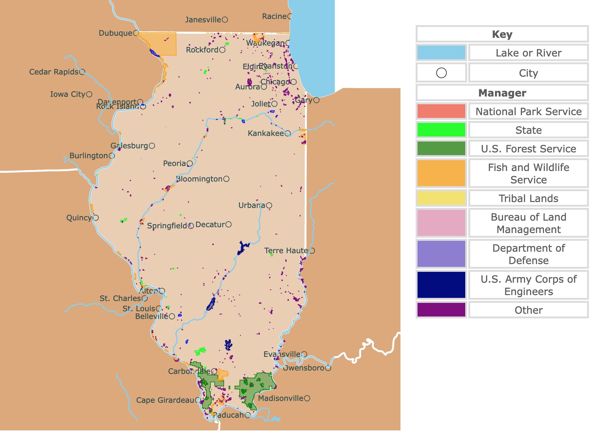
Map of Illinois's Protected Areas
This interactive map shows the Locations, Names, Areas, and Details of National Parks, State Parks, National Forests, Tribal, and other Public Lands of Illinois. It also shows major cities and rivers for context. For more detail, zoom in. For more information, hover over the map, or scroll down.
| Key | |
|---|---|
| Lake or River | |
| ◯ | City |
| Manager | |
| National Park Service | |
| State | |
| U.S. Forest Service | |
| Fish and Wildlife Service | |
| Tribal Lands | |
| Bureau of Land Management | |
| Department of Defense | |
| U.S. Army Corps of Engineers | |
| Other | |
Illinois's Geography
Illinois is located midway between the Atlantic Ocean and the Continental Divide. The state's southernmost tip is 500 miles north of the Gulf of Mexico.
Illinois is bordered by Lake Michigan, Kentucky, and Indiana in the east; Wisconsin to the north; Missouri and Kentucky to the south; and Iowa and Missouri to the west.
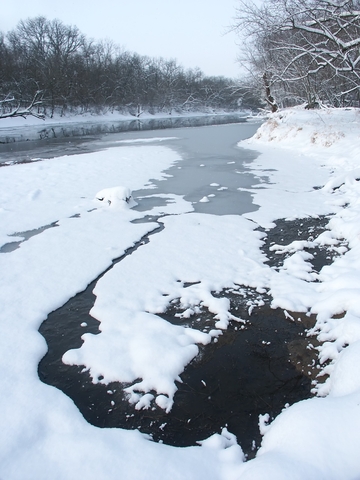
The climate in Illinois is generally continental, with cold winters and beautiful, warm summers.
The state experiences frequent, short fluctuations in temperature, cloudiness, humidity, and wind directions. Visitors and locals consider the moderate temperatures during the spring and fall to be the most pleasing, so if you're planning a vacation, you know when to go.
Illinois is divided into three regions:
- The Central Plains region covers most of the state, containing low hills and fertile land.
- The Central Plains include the Great Lakes Plain that runs along Lake Michigan, the elevated Driftless Plains in the northwest, and the Till Plains in the northern region.
- In southern Illinois, the Shawnee Hills region is a narrow strip of land containing higher elevations, forests, and rivers. While the Gulf Coastal Plain is a hilly area at Illinois' southern tip. This plain region is sometimes called Egypt because of its similarities to its fertile delta.
The highest natural point in Illinois is Charles Mound, 1,235 feet (376.42 meters) above sea level.
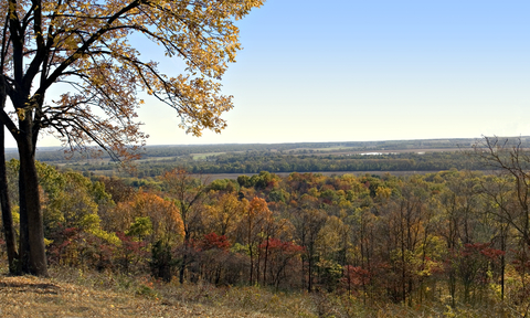
Charles Mound is located 11 miles north of Galena. You will find a stunning view from the top that deserves much appreciation.The unique rolling hills, country roads, and nature all around make the Mound a peaceful place to relax.
The natural springs in Illinois are beautiful. The Bell Smith Springs Scenic Area is a popular tourist attraction. The Bell Smith Spring is located in Ozark, Illinois, in the Shawnee National Forest in Pope County.
If you want to learn more about Illinois geography Amazon has Place Names of Illinois. This extensive guide shows how the history and culture of Illinois are embedded in the names of its towns, cities, and other geographical features.
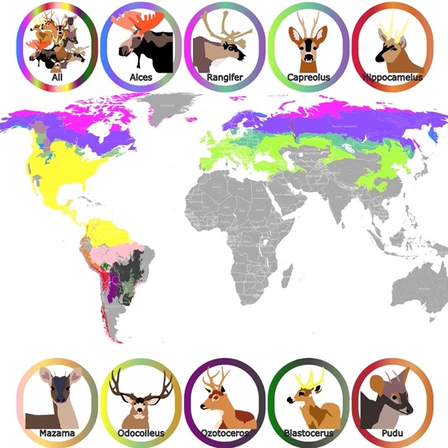
To learn where deer live, check this map of the Deer habitat range
Illinois Vegetation and Wildlife
Among some of the common mammals in the state of Illinois, you'll find bobcats, white-tailed deer, and black bears.
Birdwatchers love spotting the orioles, bluebirds, quail, northern cardinals, and meadowlarks.
Scarlet snakes, five-line skins, and snapping turtles are a few of the common reptiles. The amphibians list includes tiger salamanders, American toads, and western chorus frogs.
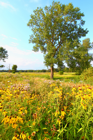
Pawpaw, box elder, sweetgum, and red maple trees grow throughout the entire state. Leopard lilies, Illinois rose, and Illinois bundle flower add colorful beauty across the landscape.
Best Parks and Forests in Illinois
While Illinois is a highly urbanized area, there are several incredible parks to enjoy recreational activities. The lakes are stunning and the caverns make exceptional places to explore, Illinois.gov
To learn more about Illinois parks Amazon has Illinois State Parks. Illinois State Parks brings together more than 130 gorgeous full-color photographs highlighting some of the most beautiful and popular state parks in Illinois.
Starved Rock State Park
Starved Rock State Park is the purple polygon on the Illinois River, west of Chicago. This park is managed by the State Department of Land.
13 miles of beautiful trails and 18 canyons await park visitors. Starved Rock State Park is voted number one on the attractions list of Illinois.
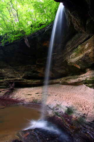
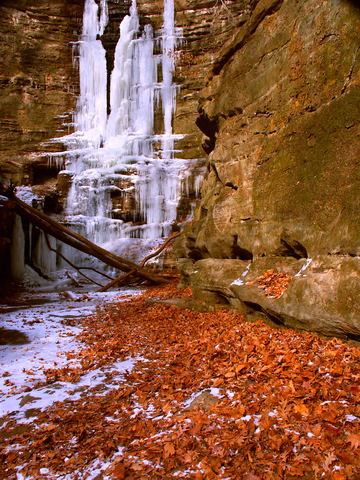
The amazing seasonal waterfalls are active during the spring and after heavy rains. It's a spectacular area for photography.
The Illinois River is a beautiful place for boating, fishing, and incredible views. There are trolley tours available throughout the year, including a Winter Wildlife Tour and a waterfall and canyon tour. Enjoy sightseeing without the need to drive.
Starved Rock Park is a day park with visiting hours. However, there are several restaurants and lodging, and cabin accommodations. The visitor center even has a Trailhead Snacks shop for hungry hikers on the weekends.
Some of the activities are guided hikes and tours, live music, and many outdoor events. You can even book weddings and meetings at Starved Rock State Park. Remember, the park closes at sunset.
You can stay in a comfortable hotel nearby with EXPEDIA. For dates and prices GO HERE!
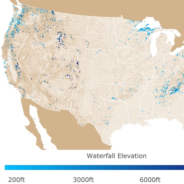
There are waterfalls all over the U.S. To see where they are, check this map!
Matthiessen State Park
Matthiessen State Park is the lime green area south of Starved Rock State Park, 4 miles south of Utica.
The Matthiessen State Park looks like scenery you'd find in Thomas Kinkade's paintings. Visitors enjoy hiking, picnics, fishing, cross-country skiing, and hunting with the proper permits.
Matthiessen also offers geocaching, which has become incredibly popular in the last several years.
The equestrian or horse trails provide horseback riders with an opportunity to enjoy the view on horseback. There are trails for mountain bike riding as well.
The rolling streams, canyons, forest, and prairie lands are inviting. It's been called a paradise for people interested in geology and recreation.
The beautiful rock formations add to the scenic beauty. There is a lengthy list of camping sites that include which area of the park the sites are located, Illinois Parks.
Shawnee National Forest
The Shawnee National Forest is represented as the two green units at the southern tip of Illinois.
Shawnee National Forest, is a broadleaf forest with Scenic drives, camping, hiking, and countless outdoor recreational activities. There's an adventure around every bend.
The Trail of Tears National Historic Trail gives visitors insight into the sad history the Indigenous people faced. The Trail of Tears in Illinois is located just south of Jonesboro. Shawnee Forest
The wilderness areas at Shawnee make up about ten percent of the entire forest. The Millstone Bluff Archeological Site is another great stop for history and geology fans.
Bell Smith Springs is surrounded by scenic canyons, and bordered by high sandstone cliffs.
Stop down at Lush Creek with your kayak or canoe, and spend the day floating the beautiful river. Lush Creek is a Zoological area due to the ecological significance of the site.
Jackson Falls in the Hidden Springs Ranger District is the site for rock climbers and rappellers. There might be other areas for this extreme activity throughout the state. Still, Jackson Falls is the only permitted area within the Shawnee National Forest.
For an unforgettable stay near Shawnee National Forest, VRBO has cabins and retreats. For details and amenities Click Here!
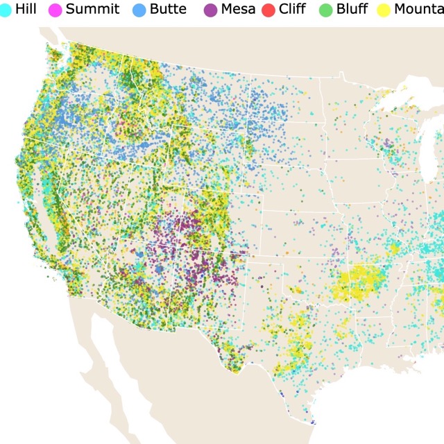
Summits, Bluffs, and Hills are scattered around Illinois. To see where they are, check this map!
Pere Marquette State Park
Pere Marquette State Park is the small lime green polygon west of Alton, on the border of Missouri.
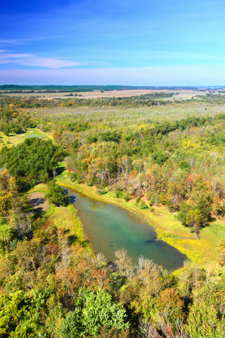
Pere Marquette is a nature lover's dream. Aside from the incredible views of the Illinois River and backwaters, visitors can enjoy numerous year-round recreational activities, including camping, boating, fishing, hunting, and horseback riding.
The Visitor Center includes a 3-D map of the park, as well as displays and exhibits about the Illinois River, local history, geology, and the wildlife habitat. Stop in before you go adventuring to learn more, Pere Marquette.
The fall colors make a trip around the park precious with the wooded ravines and riverside roadways. During January and February, the Pere Marquette State Park is a hot spot to watch bald eagles.
Hosted tours give onlookers an up-close and personal view of the wintering bald eagles along the Mississippi River and lower Illinois River, close to the park.
Camp out at one of the campsites or book a spot at the Pere Marquette Lodge and Conference Center. The mammoth stone fireplace in the lobby is enough to cause some visitors to book a room.
Kankakee River Nature Preserve
Kankakee River Nature Preserve is a small preserve depicted in purple, south of Chicago next to Kankakee.
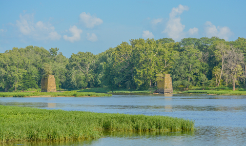
The Kankakee River Nature Preserve consists of 135 acres in two separate tracts. There is an island in the Kankakee River known as Altorf or Langham Island, and both sides of the river are located at the westernmost edge of the state park.
The forested areas represent the Kankakee Sand Area and the Grand Prarie of the Grand Prairie Natural Division
White and black oak trees ripple across the upland forest to the south. The north-facing slopes offer a majestic, almost magical forest.
Red oak, sugar maples, and basswood can be seen in this forest area. Rich wildflowers and ferns blanket the forest floors, and it's beautiful.
Park activities include an archery range, camping, boating, canoeing, bike trails, horseback riding, and cross-country skiing. There is something fun for the whole family, including a chance to go metal detecting.
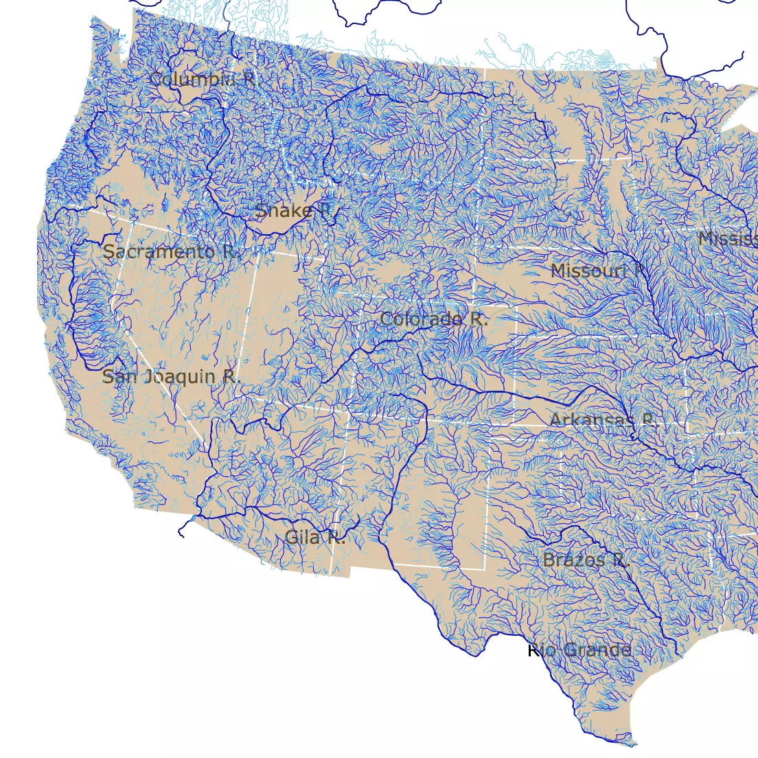
To learn more about the Mighty Mississippi, visit this map on U.S. Rivers
Upper Mississippi River National Wildlife and Fish Refuge
The Upper Mississippi River National Wildlife and Fish Refuge is the orange stripe in northwest Illinois, by the Mississippi River.
This refuge covers a little over 240-thousand acres, and it extends for 261 river miles from north to south.
The Upper Mississippi River National Wildlife Refuge was established in the early 1900s and spans four states: Illinois, Wisconsin, Iowa, and Minnesota.
The Upper Mississippi River Refuge was established in the early 1900s as a refuge for wildlife.
The refuge encompasses one of the largest areas of floodplain habitat in the lower 48. The floodplain habitat is bordered by steep wooded buffs rising between 100 to 600 feet (30.48 to 182.88 meters) above the river valley.
The Mississippi River is a marvel all on its own but adds to that the scenic beauty of the refuge, and you've got a beautiful day ahead of you. Stop into the visitors center to find out more about the events and activities that go on throughout the year, Refuge Upper Mississippi.
Castle Rock State Park
Castle Rock State Park is the lime green area west of the city of Chicago.
Castle Rock is an area designated for protecting the natural resources unique to Illinois.

There is a thin layer of glacial ice still covering the region. Several distinctive plant species and remnants of the native prairie and forest still exist.
In one valley alone, there are 27 different fern species. The park is one of the largest significant wildlife regions in the northern part of the state.
The incredible natural features at the Nature Preserve are protected by state law. The use of the 710-acre preservation area is restricted to scientific study and limited interpretation activities.
Castle Rock is a massive sandstone butte situated between the Rock River and Illinois Route 2. The rock is made from St. Peter sandstone; it's one of the only places in Illinois where this type of sandstone comes to the surface, St. Peter Sandstone
Outdoor enthusiasts love the beauty and activity that takes place. Enjoy hiking, backpacking, boating, geocaching, and more.
If you're interested in camping at Castle Rock, you'll have to stick to the primitive style. The primitive camping area is only accessible by boat or canoe. Some hunting is allowed with the necessary paperwork.
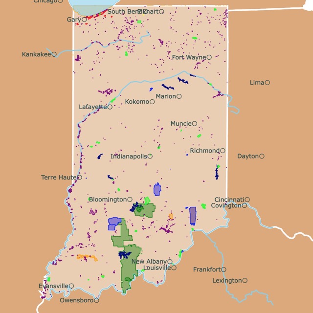
Want to find places to explore in nearby Indiana? Check this map of Indiana Parks
Crab Orchard National Wildlife Refuge
The Crab Orchard National Wildlife Refuge is the orange region located in southern Illinois, primarily in Williamson County.
This wildlife conservation exists to protect, manage, and enhance the natural resources and landscape.
This is achieved through sustaining optimum populations of the migratory waterfowl, wildlife species, and native fish. The intention is to also protect any endangered wildlife.
There are close to 44-thousand acres of land to explore and three lakes: Crab Orchard, Devils Kitchen, and Little Grassy.
The refuge provides plenty of opportunities for observing wildlife, nature trail hikes, photography, fishing, swimming, camping, and hunting.
Four seasonally operational campgrounds are available through the months of April to October. The sites offer full hook-ups, water, electric, and non-electric as well.
Enjoy a guided hike or bald eagle tour. There are monthly F.U.N. programs that help bring families closer to the diversity of the wildlife and outdoor recreational activities.
There is a wide diversity of flora and fauna at Crab Orchard National Wildlife Refuge. The major habitat types include agricultural land, hardwood forests, bushland, wetlands, and lakes.
Wintering numbers of Canadian Geese can peak 200-thousand. There are over 700 different plants, more than 240 bird species, 33 mammals, and 63 fish. Forty-four reptiles and amphibians also call the refuge home.
Resources for Illinois's Protected Areas Map
The shapefiles with Illinois's state boundary lines, major rivers, and cities were downloaded from Natural Earth Data.
The Parks and Public Lands shapefiles for Illinois were downloaded from USGS.
This map will be updated with new data! To receive updates on this and more nature maps join my email list!!!!!!!
Made by Luz K. Molina with D3.js.