National Park of American Samoa Park
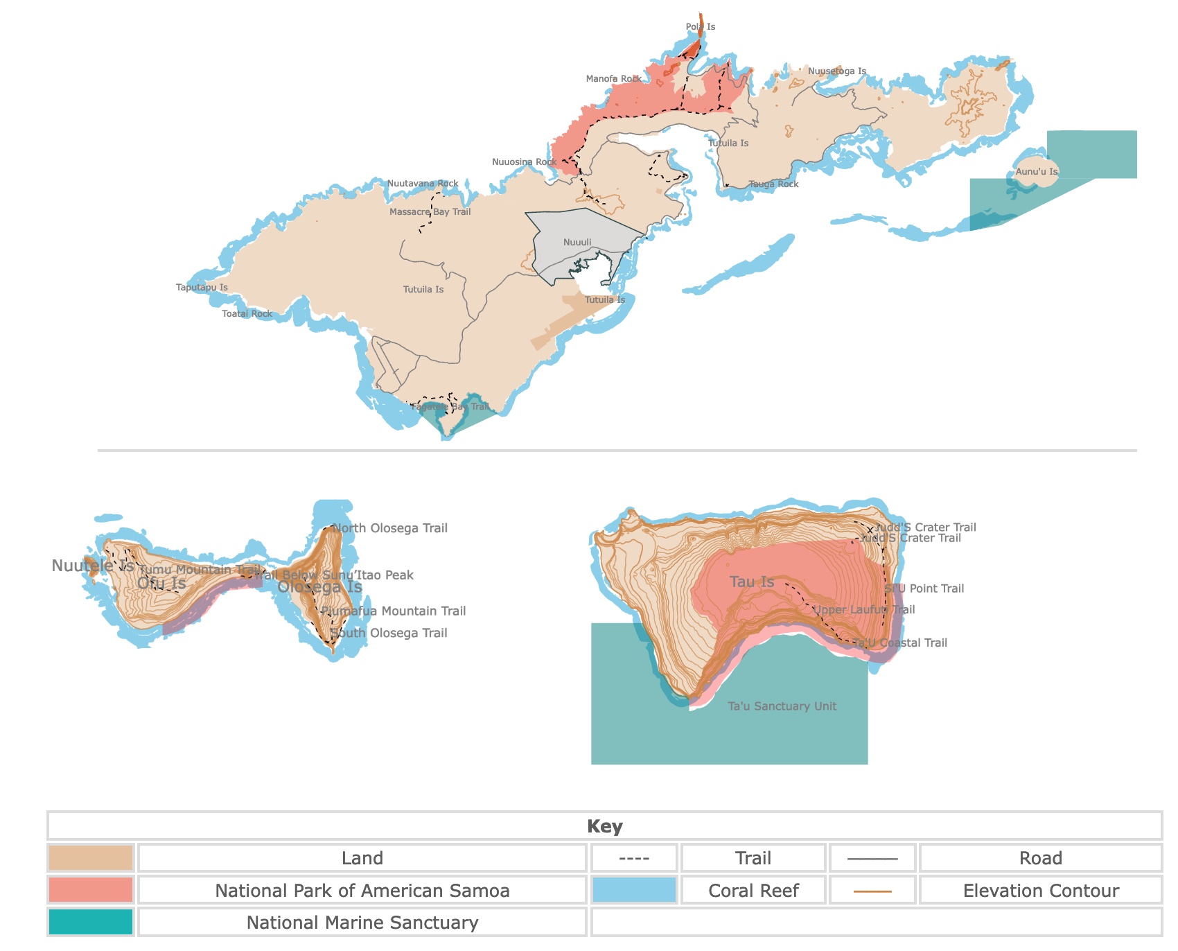
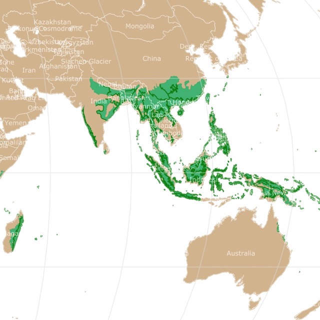
This interactive map shows the Locations and Areas, of the National Park of American Samoa. Ofu, Olosega, and Tau Islands are smaller and east of Tutuila Island, but are depicted underneath. It also shows trails, elevation contours, and major roads for context. For more detail, zoom in. For more information, hover over the map, or scroll down.
| Key | |||||
|---|---|---|---|---|---|
| Land | ---- | Trail | ──── | Road | |
| National Park of American Samoa | Coral Reef | ─── | Elevation Contour | ||
| National Marine Sanctuary | |||||
Geography of American Samoa
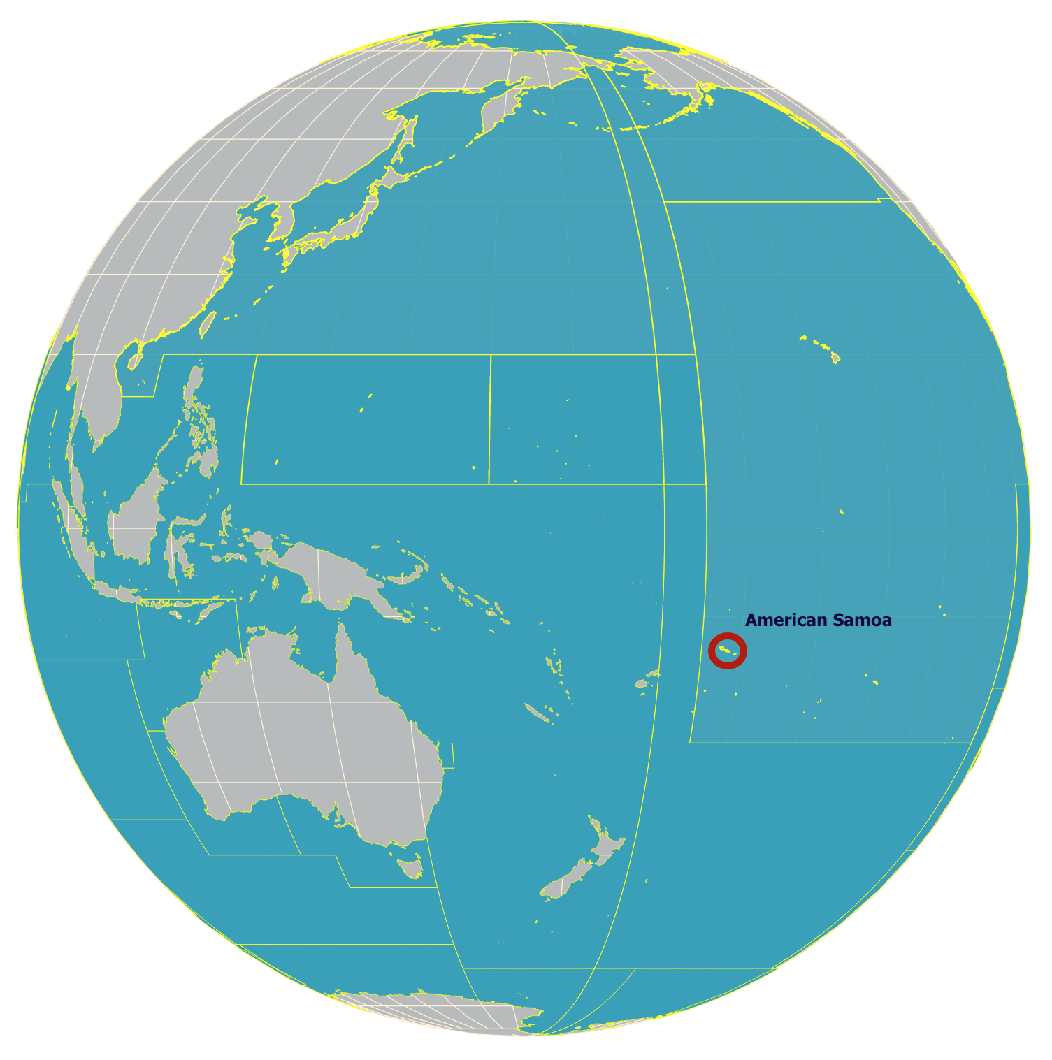
American Samoa, or the "Islands of Sacred Earth", is an unincorporated territory of the U.S., which consists of the eastern portion of the Samoan archipelago, located in the southcentral Pacific Ocean. American Samoa is about 1,600 miles (2,600 km) northeast of New Zealand and 2,600 miles (4,184 km) southwest of Hawaii.
American Samoa is the southernmost territory of the United States and one of two U.S. territories south of the Equator, along with the uninhabited Jarvis Island.
Part of the territory of Polynesia includes the six Samoan Islands. Samoa (formerly Western Samoa) is a self-governing country. American Samoa consists of the inhabited islands of Tutuila, Olosega, Ofu, Tau, and Aunuu.
It also includes an uninhabited coral atoll named Rose Atoll. Swains Island is an uninhabited coral atoll, around 280 miles (450 km) northwest of Tutuila, and it's physiographically separate from the archipelago.
The islands of American Samoa have been formed by volcanic activity within the last seven million years.
Tutuila, the main island of the American Samoan, has an area of 52 square miles (135 square km) and rises steeply above the deep inlets. This is where most of the population resides.
The most notable of the inlets is Pago Pago Harbor, which naturally divides the island in two. Matafao Peak (2,142 feet [653 meters]) is Tutuila's highest point.
Manua island group contains Tau, Ofu, and Olosega islands and is about 60 miles (100km) east of the island of Tutuila.
American Samoa's terrain includes five volcanic islands with narrow coastal plains and rugged peaks. Rose Island and Swains Island contain two coral atolls. An atoll is a circular-shaped coral reef island or series of islets. The atoll surrounds a body of water called a lagoon.
Swains Island is north of Tutuila. Rose Island is east of Tutuila. None of these islands are visible on the map above.
Want to find more places to explore in the Pacific? Visit this map of Hawaii
Things to See and Do
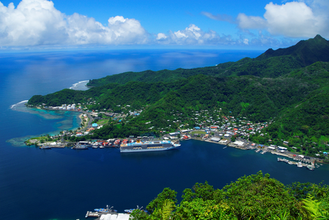
Pago Pago is the territorial capital of American Samoa. It features one of the best natural deepwater harbors in the South Pacific Ocean. The harbor is naturally sheltered from the rough seas, and protected from high winds by peripheral mountains.
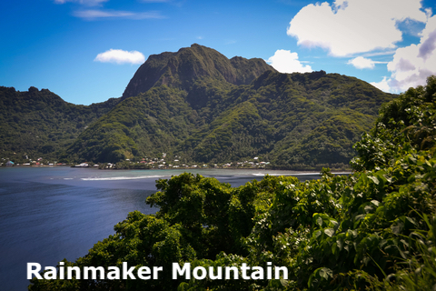
From Pago Pago, it is possible to see Rainmaker Mountain. This is a volcanic plug mountain with tropical forests on its sides. It is an integral part of local legends and lore.
At Pago Pago, visitors can learn about Samoa's rich history and tradition or enjoy tropical fruits by the pound.
The food is incredible, and visitors can find traditional favorites like palusami and oka, at various restaurants.
A local boat transports visitors to Aunu'u Island, where visitors can hike to the famous quick sand lake. Whether you drive, boat, or explore on foot, something beautiful is waiting to be explored around every corner.
Anglers might enjoy a day or two on a fishing charter or boat.
Pago Pago offers an incredible charter for fishing, snorkeling, scuba diving, etc. The islands also have several beautiful hiking trails.
If you are planning to visit, make sure you wear coral-safe sunscreen. Natural SPF 30 Mineral Sunscreen Spray is non-allergenic, 30 SPF, and kid-safe. Because it is mineral and biodegradable. It does not pose a threat to corals.
If you're looking for adventure, you're in for a lot of it in American Samoa; look into the North Shores Tour, South Pacific Watersports, and the Pago Pago Marine Charters.
American Samoa's Climate
The climate of the American Samoan Islands is tropical marine, with an ample amount of precipitation annually. Pago Pago receives about 200 inches (16 feet) of rain annually.
Remember, the islands are south of the Equator, so the coolest months are July and August. The hottest months are December and January!
Temperatures in American Samoa are unusually consistent, with average temperatures ranging from the high 60s to the mid to low 90s ℉ (21 to 32℃). November to March is the wet season when severe storms are more likely to occur.
According to Audley, the best time to visit American Samoa is between April and October, when the humidity is lower and the air is drier.
American Samoa experiences its rainy season from November to April, with the dry season starting in May and lasting through October.
December through March, American Samoa experiences the typhoon season. So, it's best to avoid making a trip to the Samoan Islands during this time.
American Samoa is covered in lush tropical forests. Interested? Visit this link.
American Samoa's Wildlife
Rainforests with tall trees and ferns cover the mountainous interiors of the tropical islands. Taro coconut and various food crops are grown throughout the island's coasts.
While the islands aren't rich with a diverse amount of animals, there are various birds, including rare and unique species like the tooth-billed pigeon.
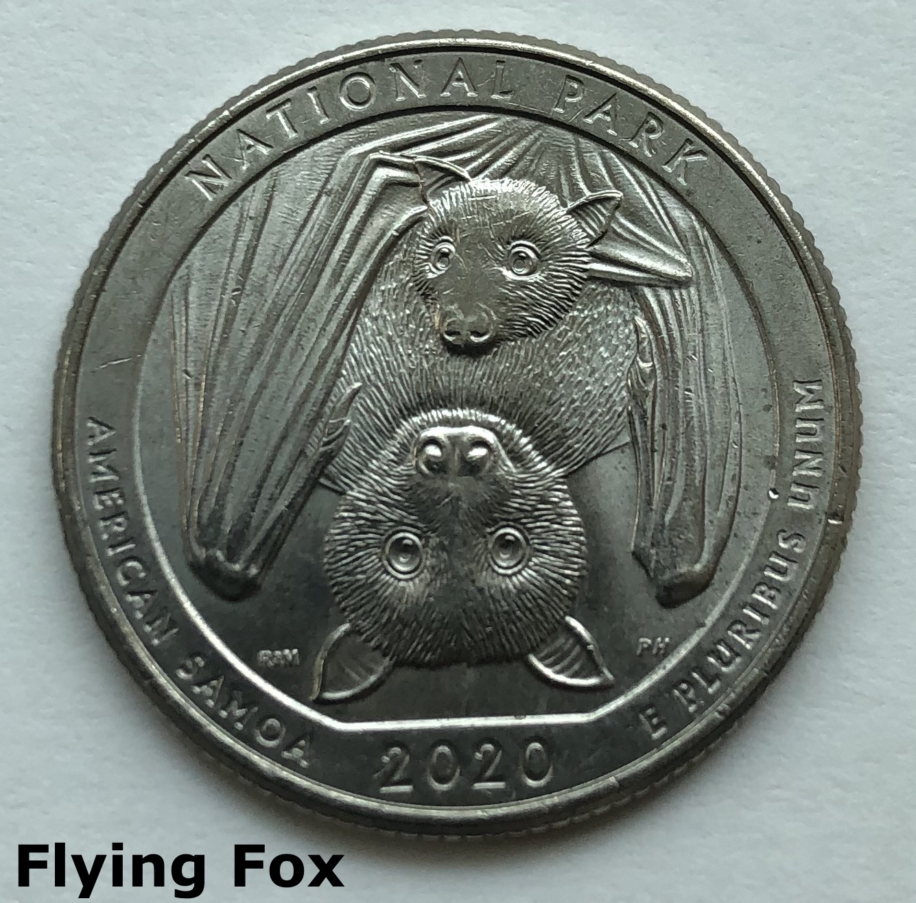
Flying foxes, rats, lizards, snakes, and wild pigs are some of the island's animals. A myriad and ubiquitous crawling and flying insects call the islands home.
National Park of American Samoa
The park is divided between Tutuila Island, Ofu Island, and Tau Island. Around 4,000 acres of the park are underwater.
The National Park of American Samoa has an excellent visitor center on the island of Pago Pago. If you're visiting, you should try and stop in there first; it's filled with great information.
Tutuila Island
Tutuila is the main island of American Samoa.
The majority of Tutuila's island comprises steep, deeply eroded mountains, and it's rich in tropical vegetation.
The island's center boasts American Samoa's highest mountain, Matafao Peak, 2,142 feet (653 meters).
Mount Rainmaker, 1,745 feet (523 meters), is another famous mountain that dominates the bay of Pago Pago. Travel to the end of the deep bay to find one of the best ports in the South Pacific, Pago Pago.
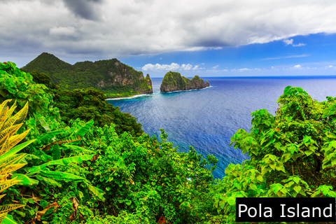
Pola Island is a long island on the northern shores of Tutuila Island. This island is known for its incredible high cliffs.
The island is separate from the land by Vai'ava Strait. The Vai'ava Strait National Natural Landmark comprises about 250 acres, and it's the only US National Natural Landmark in American Samoa.
You can pass east through Vatia, where the road ends at the Pola Island trailhead. The view of the two sea arches is incredible.
Erosion from the sea sculpted the stunning cliffs and sea arches in the rocks of the huge volcanic plug known as Pola Island. The rock formations resemble a dinosaur tail that juts 3,500 feet (1,066 meters) out into the sea.
Visitors may take boat tours to Pola Island. This is the most photographed site on Tutuila Island.
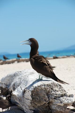
Pola Island and Pola'uta Ridge are two of the most important nesting and roosting areas for various species of seabirds. The only breeding colony of Red-footed boobies in American Samoa are Pola Island and Rose Atoll, including the nearby Pola'uta Ridge. Other species include:
- Brown Booby
- Greater Frigatebird
- Black Noddy
- Brown Noddy
- Blue-Gray Noddy
- Gray-Backed Tern
- Lesser Frigatebird
Bridled Terns rarely visit American Samoa, but they've been recorded at Pola Island, making it a prime space for avid birdwatchers.
You cannot visit American Samoa without binoculars. Wheater on land or on water, the islands are filled with beautiful wildlife. These Free Soldier Binoculars are made of rubber, waterproof, and light. They are easy to operate, come with a smartphone adapter, and have a field view of 1000 yards.
There are various tours around American Samoa.They offer private boat and ship trips with educational guides. The guides are equipped with knowledge of the islands, ocean, wildlife, history, and geography.
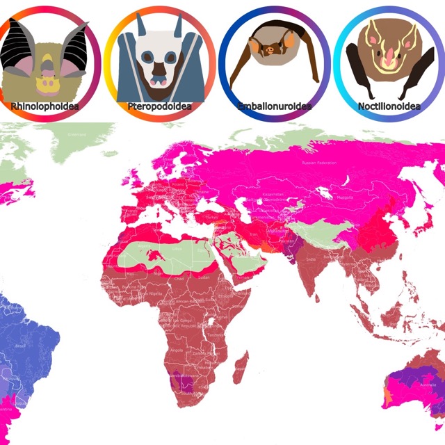
Curious about the flying fox? This map of bats will tell you more about them.
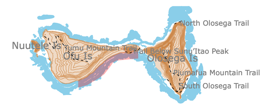
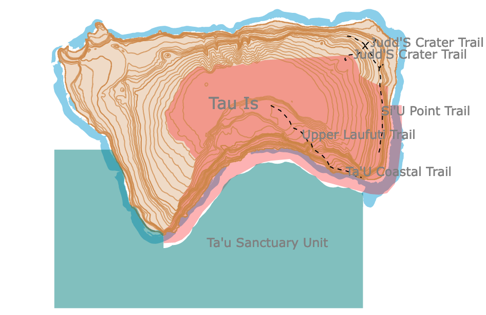
Ofu and Tau Islands
Three islands form the volcanic archipelago of the Manu'a islands: Olosega, 1.93 square miles (5 sq km), Ofu, 2.70 square miles (7 sq km), and Tau, 17.76 square miles (46 sq km).
The Manu'a group of islands is only 62 miles (100 km) east of Tutuila. Visitors can reach the islands by plane or boat from Tutuila Island.
The islands can be a challenge to reach. Still, there are various tours and fishing charters that will help visitors reach their destination. Once they are there, they'll have experienced paradise.
The highest mountain in Ofu is Mount Tumutumu, with 1,610 feet(491 meters).
On the nearby island of Olosega, Piumafua stands 2,063 feet (629 meters), making it the tallest mountain on Olosega. The volcanic islands Olosega and Ofu are connected by a bridge and are surrounded by the same coral reef.
The islands of Olosega and Ofu are the more traditional areas of the American Samoa islands. The two islands are about 62 miles (100 km) east of Tutuila, the main island of American Samoa, and they're included in the National Park of American Samoa.
These incredible islands are characterized by their rugged mountains and remnants of ancient volcanoes. Mount Piumafua overlooks the island of Olosega, while Ofu reaches lower heights.
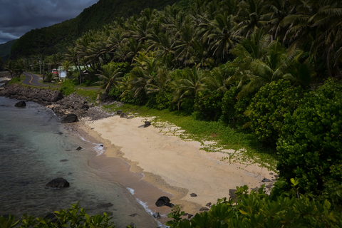
The island of Ofu offers a beautiful white sand beach with a scenic backdrop of the mountains of jagged Sunu'itao Peak and Mount Piumafua. The entire beach and reef in front are a part of the National Park of American Samoa.
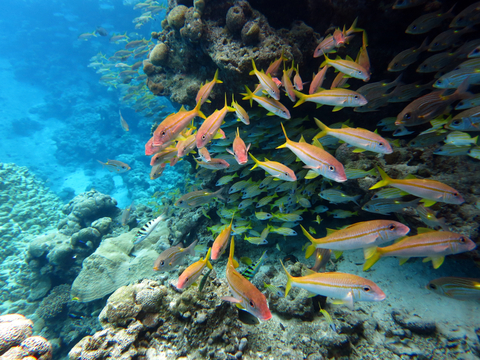
The reefs on these islands offer some excellent snorkeling opportunities.
Tau is the chief island of the Man'ua islands. Its attractive conical shape rises to Lata Mountain 3,179 feet (969 meters).
The main village is Luma, on the western coast. Tau or Ta'u Island is located 93 miles (150 kilometers) northeast of Tutuila Island.
Ofu beach offers visitors a pristine beach where the water is clear, and fish can be seen swimming around visitors.
It can be challenging to visit only one of the American Samoa islands, as they are all equally beautiful.
American Samoa has a lot to offer, water sports, water activities, sailing, swimming, fishing, snorkeling, spending the day at the beaches, bird watching, and hiking.
National Marine Sanctuaries of American Samoa
"National marine sanctuaries are protected waters that include habitats such as rocky reefs, kelp forests, deep-sea canyons, and underwater archaeological sites" Source: NOAA. These sanctuaries are managed by NOAA, and they are multiple-use areas.
These are considered the most diverse of the National Marine Sanctuary System. They also protect crucial marine fishing grounds in the Pacific.
Fortunately for visitors, it is possible to snorkel in all American Samoa Sanctuary units.
If you are planning to visit, make sure you take the appropriate gear and not cheap masks that will leak water. Amazon can ship to your house this Zeeporte set. It comes with an anti-fog, anti-leak, and a panoramic view mask. It also includes a dry top snorkel, flippers, and a bag.
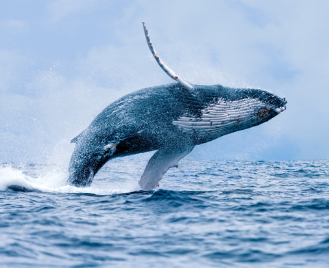
American Samoa is a humpback whale sanctuary, as they visit islands between September and October. This is also a turtle sanctuary. There are several turtle species present, and they are all considered endangered.
There are 6 Sanctuary units in American Samoa.
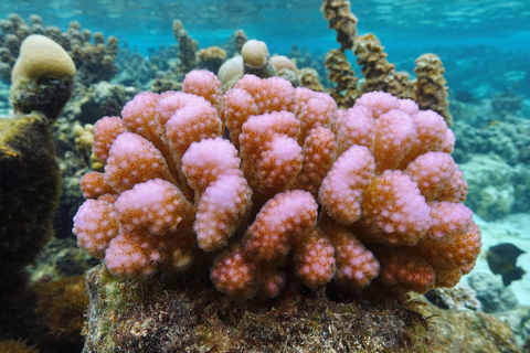
American Samoa has impressive reefs. To learn more about corals, visit this map.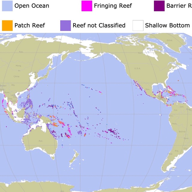
Swains Island Sanctuary and Muliāva Sanctuary (Rose Atoll)
Swains Island Sanctuary and Muliāva Sanctuary (Rose Atoll) are not visible on the map above.
Vailulu`u Seamount is the only hydrothermally active seamount within the American Samoa Exclusive Economic Zone. Seamounts are formed by volcanic processes that create a mountain on the ocean floor. Seamounts offer unique habitats for nektonic and benthic life, including both microbes and animals.
There are over 1400 different invertebrates dwelling in Samoan waters. There are also over 250 coral species in American Samoa. These communities support the fisheries economy of the island.
Fagatele Bay
Take a drive west and discover the National Marine Sanctuary of American Samoa at Fagatele Bay. Fagatele Bay is one of the sanctuaries south of Tutuila Island. This bay was formed from a collapsed crater volcano.
The bay is 0.25 square miles (0.65 square km) and is surrounded by steep forested cliffs.
Maintainance and access are managed by the Fuimaono Family.
Fogama`a / Fagalua
This sanctuary is just east of Fagatale on Tutuila Island. Fagalua was also created by a volcanic crater, and it is surrounded by steep cliffs. The area is also known as Larson's Cove.
Aunu`u Island
The Aunu`u island is over 1 mile (2Km) southeast of Tutuila Island. The sanctuary area occupies an area of 5.8 square miles (15 square kilometers); Samoa Sanctuaries.
Besides snorkeling, visitors can surf, dive, and watch marine mammals at this sanctuary.
Ta'u Island
Ta'u Island also originated as the crater of a volcano. This resulted in steep seafloor slopes near the island.
This sanctuary is also known for the presence of "Big Momma". This is a massive Porites coral colony that lives on the west side of Ta’u, in an area called the Valley of Giants. "Big Momma" is the largest of several massive Porites in that area Samoa News.
FOLLOW ME
Resources for American Samoa's Protected Areas Map
The shapefiles with American Samoa's boundary lines and park boundaries were downloaded from Data.gov
The shapefiles with elevation contours were downloaded from GeoServer.
The shapefiles of roads and trails were downloaded from USGS.
The shapefiles of Marine Sanctuaries were downloaded from NOAA
This map will be updated with new data! To receive updates on this and more nature maps, join my email list!!!!!!!
Made by Luz K. Molina with D3.js.