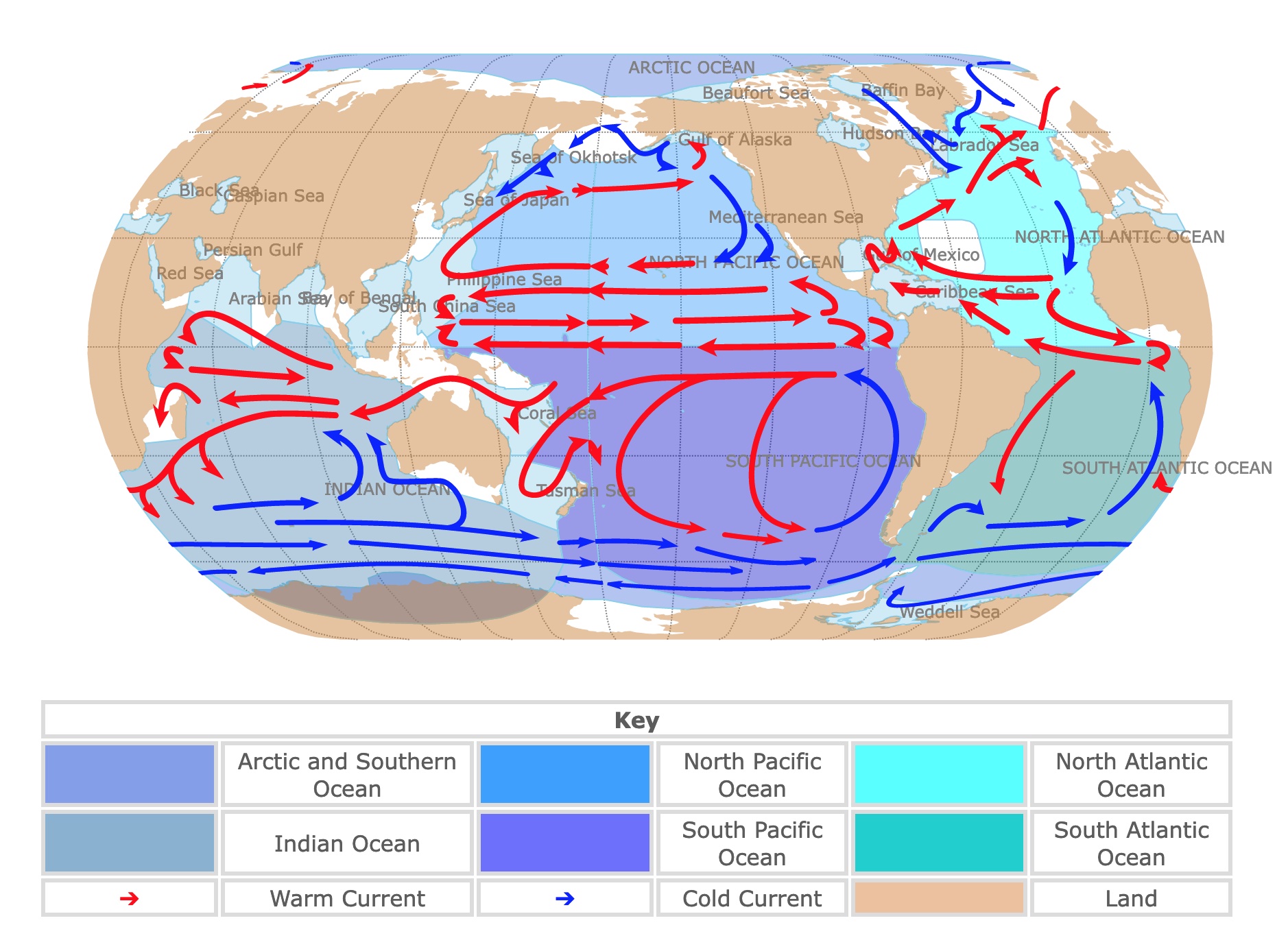
World Map of Oceans and Currents
This map shows world oceans in different shades of blue and continents in light brown. Blue arrows represent cold currents, and red arrows represent warm currents. To see the name of each ocean or current, hover over the map. For more detail, zoom in. Scroll down if you want to read more information.
| Key | |||||
|---|---|---|---|---|---|
| Arctic and Southern Ocean | North Pacific Ocean | North Atlantic Ocean | |||
| Indian Ocean | South Pacific Ocean | South Atlantic Ocean | |||
| ➔ | Warm Current | ➔ | Cold Current | Land | |
World Oceans
There are 5 Oceans: the Pacific Ocean, the Atlantic Ocean, the Indian Ocean, the Arctic Ocean, and the Southern Ocean. The map above splits the Atlantic and Pacific oceans into north and south. Overall, oceans are delimited by the continents.
There are also many demarcated seas you can find on the map. These are usually delimited by smaller geographic forms like islands and peninsulas.
The surface covered by the oceans is 139,730,371mi2 (361,900,000Km2) and a total volume of 1,335,000,000Km3. The world's oceans cover about 70.9% of the world, and the largest ocean is the Pacific Ocean, NOAA.
If you find ocean maps fascinating, you might be interested in taking a course in GIS. Coursera has a course about Geographic Information Systems. For more information CLICK HERE!
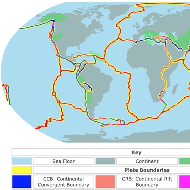
To find out more about how the oceans got their shape, visit this map of Tectonic Plates and Boundaries
Seawater
Ocean water is saline. This means it has significant amounts of dissolved salts. Salinity can be expressed as a ratio of salt in grams to liters of water.
Seawater is typically close to 35 grams of dissolved salts per liter of water. The values depend on each ocean, but it usually ranges between 33-37 grams per liter.
These values are also expressed in gr/Kg. Since 1Kg of pure water is approximately 1 liter of water, the values are very close. Other common ways to express water salinity include ppm and ppt:
ppm↔g/kg 1g/kg = 1000 ppm = 1ppt
So the average salinity of seawater is 35ppt.
Due to rain and evaporation, the lowest salinity is found near the poles. THe highest salinity is found near deserts and close to the equator.
For example, the saltiest ocean water is found in the Red Sea and the Persian Gulf. Their salinity is on average 40ppt. Weather.gov"
Some salts dissolved in seawater include calcium carbonate (CaCO3), gypsum CaSO4·H2O, salt NaCl, potassium KCl, and magnesium MgCl2 salts.
Water salinity is not just crucial for life in the ocean. Salinity affects water density and its properties, which in turn affects currents. Salinity can also be used to trace the origin of water currents.
Ocean Science requires different skills and the analysis of big data. Coursera offers a specialization on Deep Learning that you can use on different fields of sicence and technology. For more information go to THIS LINK!

Seas and currents affect coastal areas. This map shows the different marine ecoregions of Northamerica
Pacific Ocean
The Pacific Ocean received its name from the Portuguese explorer Ferdinand Magellan, who found its waters very Pacific.
The Pacific Ocean is the largest, and it covers an area of 62,455,885mi2 (161,760,000Km2).
The Pacific Ocean has the most islands and it is the deepest ocean, with an average depth of 13,000 feet (4,000 meters). It also has the deepest point on Earth, located in the Mariana Trench, with a depth of 36,201ft (11,034m).
The Pacific ocean is affected by catastrophic events due to weather, like Typhoons. It is also affected by volcano activity and tectonics resulting in deadly Tsunamis.
Due to the geographic pattern of mountains worldwide, the total drainage that enters the Pacific is relatively small.
Rivers that flow into the Pacific include the Columbia River, the Colorado River, the Yukon, the Mekong River, the Yellow River, and the Yangtze River.
Adjacent seas include the Japan Sea, the Philippine Sea, the Tasman Sea, and the Coral Sea.
Atlantic Ocean
The Atlantic Ocean is the second-largest ocean, with 32,870,035mi2 (85,133,000Km2) of surface area, including neighboring seas.
The Atlantic Ocean is the saltiest ocean.
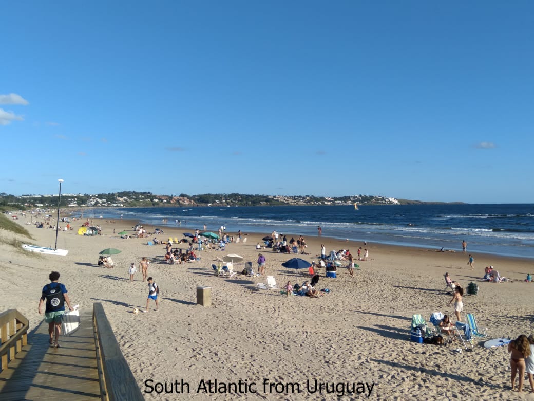
Scientists commonly divide the Atlantic into two basins: the North Atlantic and the South Atlantic.
The North Atlantic is where waters are cooled with Arctic temperatures and sink to form the Global Ocean Conveyor. This is a circulation pattern that includes deep waters and affects global weather.
Tropical cyclones or hurricanes are not rare in the Atlantic Ocean. They form near the African coast and move towards the Caribbean or towards North America. Hurricanes are most frequent between July and September.
Large rivers flowing into the Atlantic include the Amazon River, the Orinoco River, the Congo River, the Parana River, the Senegal River, and the Niger River, among many others.
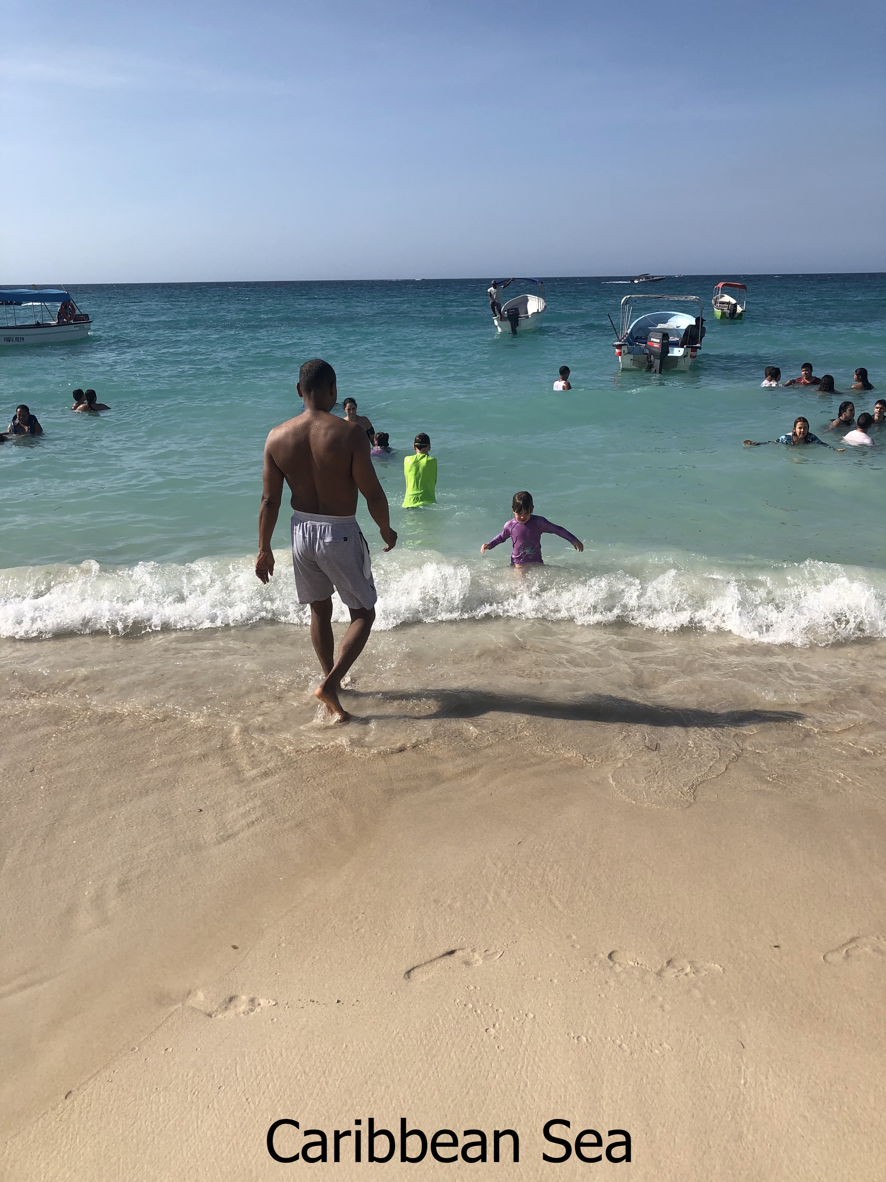
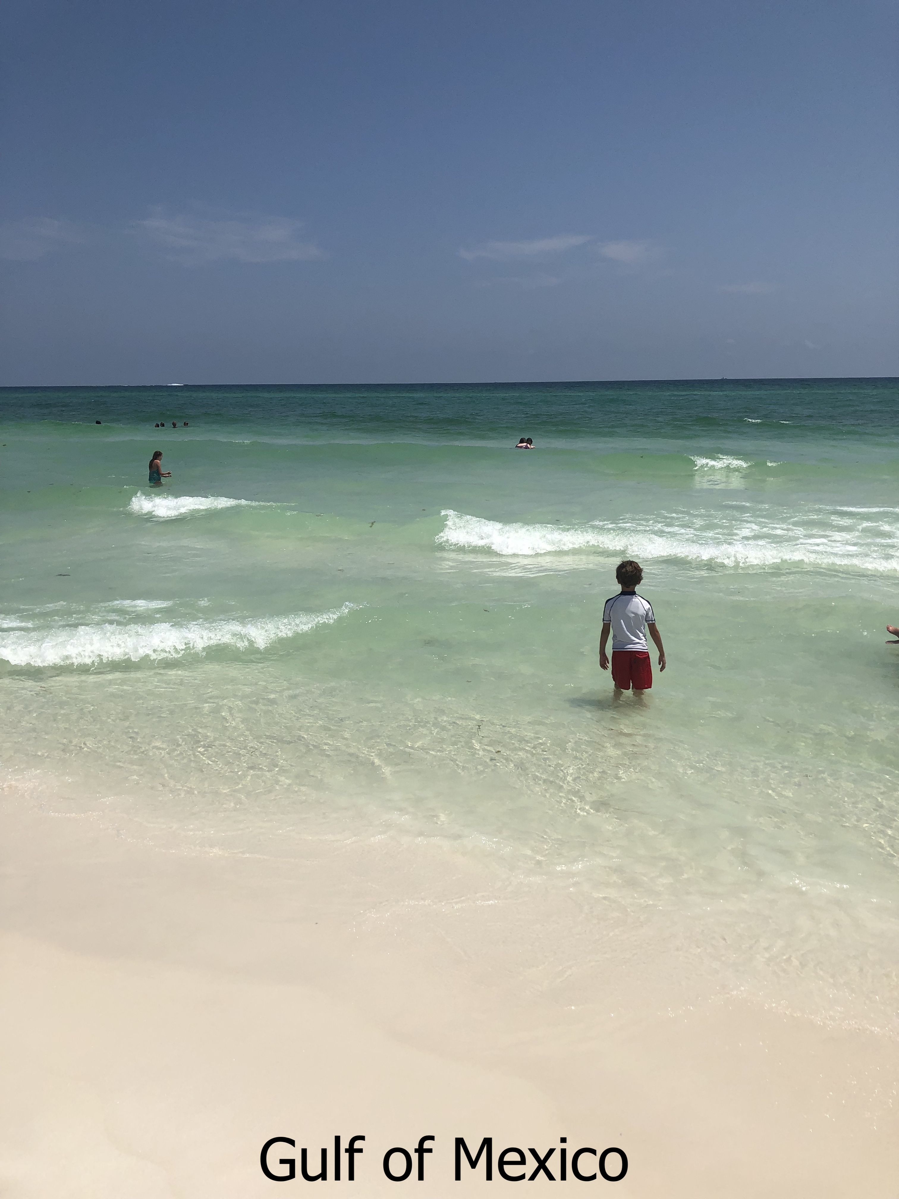
Adjoining seas include the Gulf of Mexico, the Caribbean Sea, and the Mediterranean.
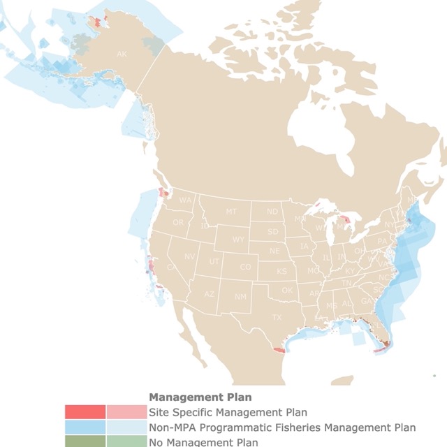
The sea harbors fragile ecosystems that need our attention. To find out about them, click on this map of U.S. Marine Protected Areas
Indian Ocean
The Indian Ocean is the third largest ocean located south of the Asian continent.
The climate of the Indian Ocean is mainly affected by a monsoon wind system. Strong northeast winds blow from October until April. From May until October, south and west winds prevail.
Rivers flowing into the Indian Ocean include the Zambezi, Arvandrud/Shatt-al-Arab, Indus, Ganges, Brahmaputra, and the Irrawaddy.
Adjoining seas include the Arabian Sea and the Bay of Bengal.
Arctic Ocean
The Arctic Ocean is Earth's northernmost body of water, the smallest and shallowest. The Arctic Ocean is delimited by the Asian, European, and American continents.
Most of its waters flow in from the Atlantic Ocean.
Ice used to cover most of the Arctic Ocean year-round. This is now less common due to Climate Change.
Southern Ocean
This is a deep and narrow ocean that surrounds the Antarctic. Its size increases when the winter ice melts between September and March.
In 2000, the International Hydrographic Organization accepted the Southern Ocean as an ocean.
This ocean has the most extensive ocean current, the Antarctic Circumpolar Current, which flows perpetually, Marinebio.
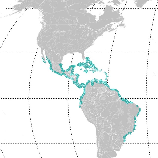
Oceans and currents determine where these tropical forests grow. To find out more, check this map of Mangroves!
Ocean Currents
Oceans are in constant movement. This movement is the product of different forces.
Vertical movements of water are called upwellings and downwellings. Horizontal movements are referred to as currents.
Oceanic currents describe the movement of water from one location to another. These are continuous movements of water that follow a set path, like rivers in the ocean.
Thanks to the Coriolis force, ocean currents in the northern hemisphere deflect towards their right. In the southern hemisphere, they deflect towards their left Jagran Josh.
The speed of a current may depend on the shoreline and the ocean floor.
Currents are measured in meters per second or in knots (1 knot = 1.85 kilometers per hour or 1.15 miles per hour).
Currents vary in size. They can be tiny or large enough to span an ocean basin.
Ocean currents transport significant amounts of heat around the globe. This makes them one of the most important driving forces of climate World Ocean Review.
One of the many tools scientists use to map and study the ocean include software programs. Coursera has a certificate in Python to examine large data sets. For more information visit this LINK!
Factors Behind Currents
There are different factors behind currents. These factors may be related to water characteristics, Earth's rotation, atmospheric factors, or topography of the area.
These factors include Earth's Rotation, Coriolis Force, Atmospheric Pressure, Temperature, Salinity, Winds, Evaporation, Precipitation, and Tides.
Current Types
Currents may be classified in more than one way:
Based on velocity, dimension, and direction, currents can be divided into Drifts, Currents, and Streams.
- Drift: The movement of surface water under the influence of prevailing winds.
- Current: The movement of large masses of oceanic water in a direction.
- Stream: Th movement of a larger mass of marine water in a definite direction at a greater velocity.
Currents can also be divided depending on their temperature. This is the most common classification, and it is the one on the map above.
It is essential to highlight that there are fewer cold currents than warm currents.
- Warm Currents: Flow from the equator towards the poles. They are warmer than surrounding waters. They are present in low and mid latitudes of both hemispheres. These currents are usually observed on the east coast of continents.
- Cold Currents: Flow from the poles and are cooler than surrounding waters. Cold currents are usually found on the west coast of continents, in the low and middle latitudes in both the hemispheres.
Ocean currents may also be divided into Surface Currents and Deep Currents.
- Surface Currents affect water currents above the pycnocline. The pycnocline is a layer of the ocean where the density changes rapidly. This is usually the top 10% of the water column or the top 400m of the ocean. These currents are driven by winds. Surface currents may reach 5 knots.
- Deep Currents are below the pycnocline. These currents are driven by density differences. Deep currents are slower and larger than surface currents. Deep currents are about 0.5 knots GKToday
Major Ocean Currents
The Gulf Stream
The Gulf Stream originates in the Gulf of Mexico and follows the eastern coastline of the U.S.
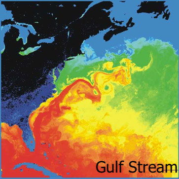
The Gulf Stream brings warm salty water from the tropics to higher latitudes. Therefore, it is represented as a red arrow on the map.
Places like the British Isles have milder weather compared to other places in similar latitudes, thanks to the Gulf Stream.
It travels at speeds of 25 to 75 miles per day (1.15-3.45 miles per hour or 1.85-5.55 kilometers per hour) NOAA.
North equatorial Current (NEC)
This is a warm current that forms between the equator and 10°N latitude.
This current is formed thanks to the upwelling of cold water on the west coast of Africa.
This current flows from east to west.
South Equatorial Current
This current flows from Western Africa towards South America between the equator and 20°S latitude.
This current is stronger and more constant than the North equatorial Current.
This warm current is an extension of the Benguela current.
The South equatorial Current is bifurcated by the Southamerican landmass. One branch heads north, while the other heads south and continues as the Brazil current.
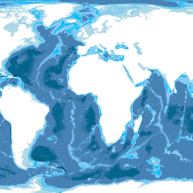
For more information on Ocean Floor and DepthC visit this world bathymetry map.
Equatorial Counter Current (ECC)
This warm current flows in the Pacific, Atlantic, and Indian Oceans. It flows about 3 - 10°N. It is also known as the North equatorial Counter Current (NECC).
This current is less developed in the west due to the stress of trade winds.
Canary Current
The Canary current is a cold current that flows by the northern coast of Africa.
This current is the continuation of the North Atlantic Drift. This cold current ameliorates the hot temperatures in the Western Coast of Africa. Source: Geography Notes
Kuroshio Current
The Kuroshio Current begins east of the Philippines and flows towards Japan. It forms the western side of the North Pacific Ocean Gyre.
This is a warm and salty current that influences the climate of Japan, bringing heat and increased chances of rain. EOS
Oyashio Current
The Oyashio current is a western boundary current in the subpolar gyre of the N. Pacific. It originates in the Bering Sea and flows to meet the Kuroshio current.
The Oyashio flows at less than 0.5 m/s; it is cold and has low salinity.
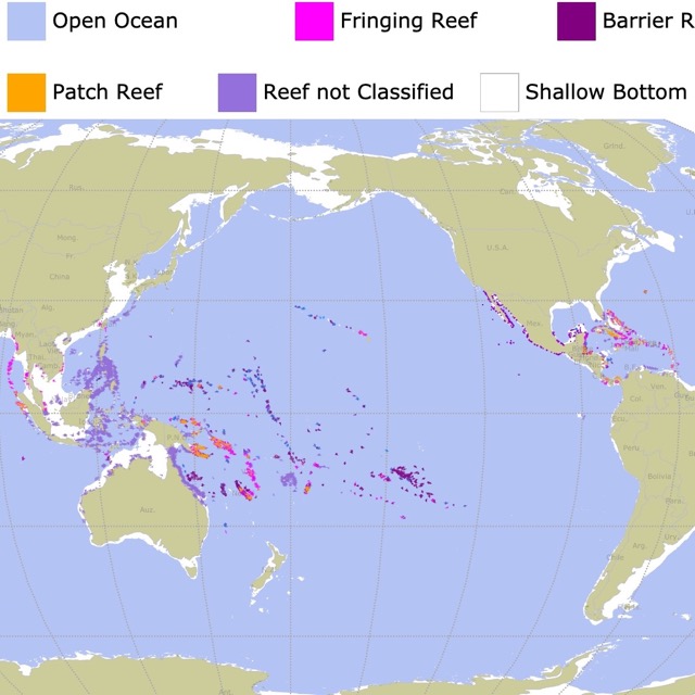
Currents and their temperatures affect the growth of corals. To find out about Coral Reefs, click this map
Gyres
Large circular mounds of flowing water are called Gyres. USC
Gyres are large systems of rotating ocean currents. These are not named on the map above, but they are the visible circles made up of arrows (currents).
The five major gyres are the Indian Ocean Gyre, the North Pacific O. Gyre, the South Pacific O. Gyre, the North Atlantic O. Gyre, and the South Atlantic O. Gyre.
Follow Me
Resources for Oceans and Currents Map
The shapefiles with the currents was downloaded from Dataverse Harvard.
The Shapefiles for the continents and oceans were downloaded from Natural Earth.
To receive updates on this and more nature maps join my email list!!!!!!!