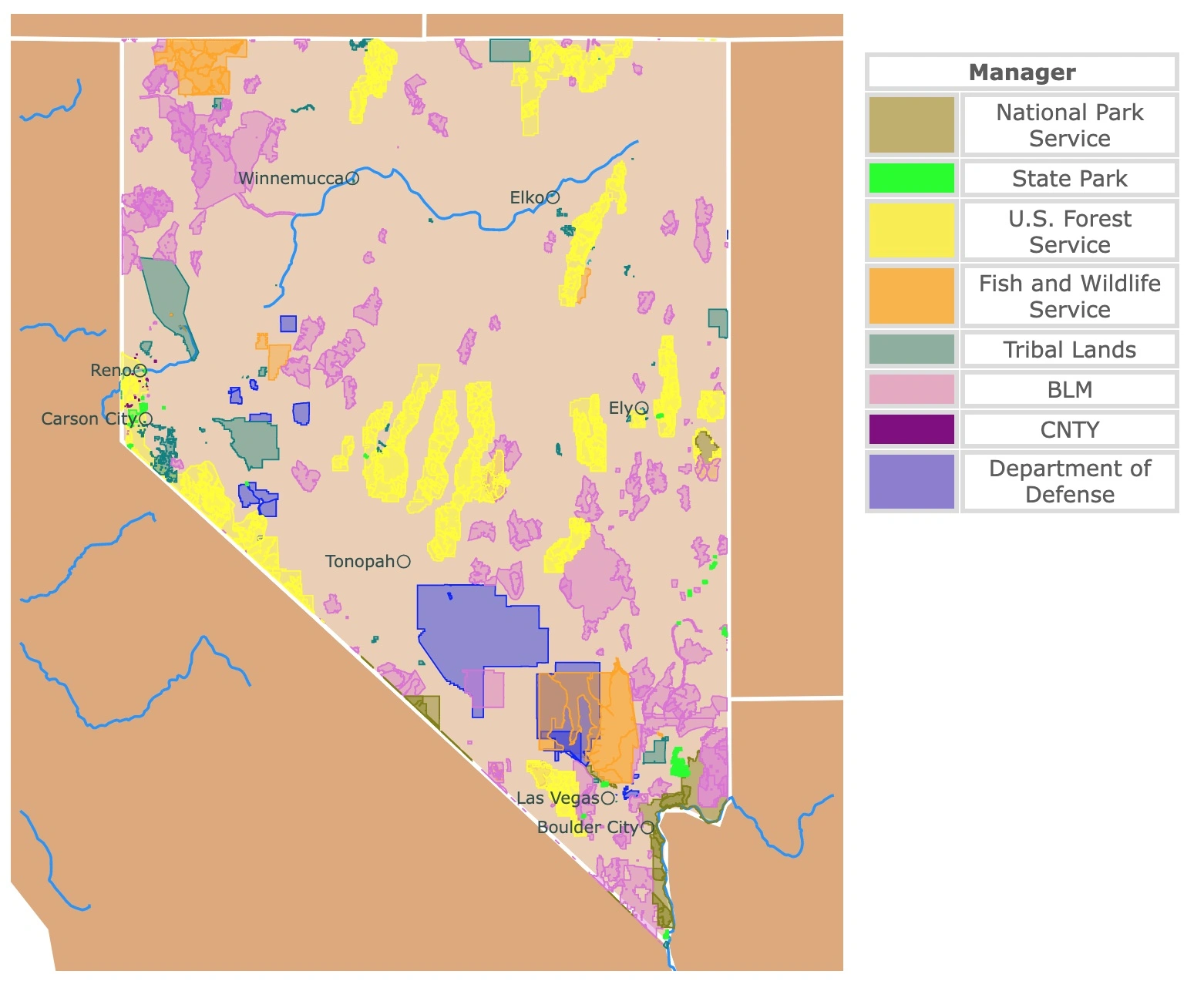
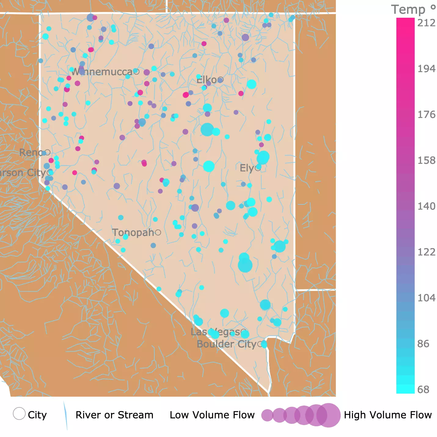
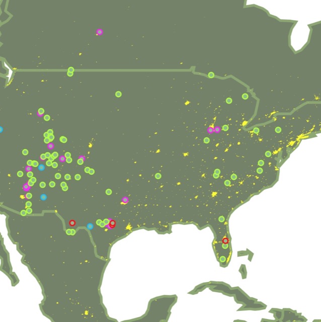
Map of Nevada Parks and Natural Areas
This interactive map shows the Locations, Names, Area, and Details of National Parks, State Parks, National Forests, Tribal and other Public Lands of the Silver State. It also shows major cities and rivers for context. For more detail, zoom in. For more information, hover over the map or scroll down.
| Key | |
|---|---|
| Lakes and Rivers | |
| ◯ | City |
| Manager | |
| National Park Service | |
| State Park | |
| U.S. Forest Service | |
| Fish and Wildlife Service | |
| Tribal Lands | |
| Bureau of Land Management | |
| Department of Defense | |
Nevada's Geography
Nevada is an arid state that seems to have endless plains, but it is flanked by the Sierra Nevada and crossed by the Toiyabe, Toquima, and Schell Creek Range. No matter where you are in Nevada, you will see a mountain.
The Silver state is also blessed with Lake Tahoe, which it shares with California, and Lake Mead located east of Las Vegas. This arid state also has two major rivers: Humboldt R. and Colorado R.
The entire state is classified as a desert. Nevertheless, there are two types of deserts within the state. A Cold Desert up north in the Central Basin and Range and a Warm Desert in the Southern tip of the state, which is the Mojave desert.
The most known fact of Nevada's geography is the Great Basin and Range. In this area, rain and water bodies do not reach the ocean or the sea. They evaporate and form salt lakes.
Nevada legalized gambling in 1931, which changed the fortune of the state. Furthermore, Nevada is one of the fastest-growing states in the country.
Besides casinos, other drivers of Nevada's economy include mining. In fact, 81% of the gold extracted from the U.S. comes from Nevada. Nevada is also a large producer of Silver, therefore called the Silver State. Nevada
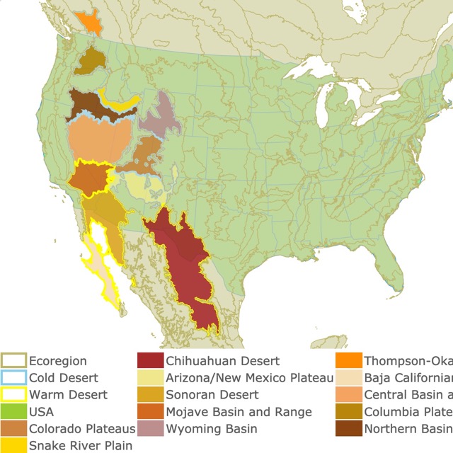
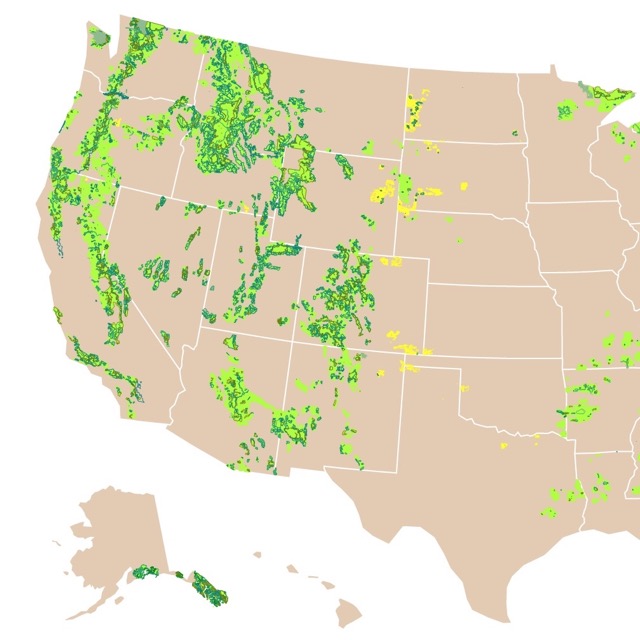
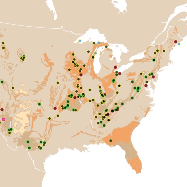
In case you want to learn more about deserts in the U.S. check this map!
Nevada's Public Lands and Other Areas
Most of the state area is public land and is managed by the Bureau of Land Management.
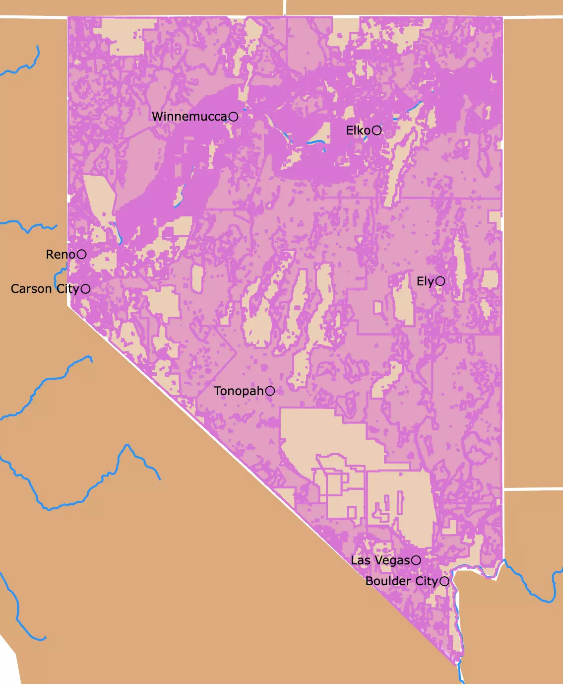
Because the area is so large and almost overwhelming when depicted, I made a separate map seen on the right. The large pink landmass is administrated by the Bureau of Land Management.
To highlight the smaller State Parks and National Parks, I created the interactive map above. This map still includes some key Bureau of Land Management Areas that are National Monuments or Wilderness Study Areas, colored in pink.
Another important economic driver in Nevada and large land owner in the state, is the Department of Defense.
Military bases include Nellis Airforce Base, North of Las Vegas, and the Nevada National Security Site or Nevada Test Site depicted in blue.
The Nevada Test Site is where the most nuclear testing was carried out in the U.S. At least 100 above-ground nuclear devices were detonated in the 1950s. Also somewhere in the Base is Area 51!
The main indigenous group isthe Northern Paiute. Their first contact with Europeans was in the 1830s. The government tried to force them into large reservations but instead, they were moved into smaller reservations throughout the state, as seen on the map.
The US Forest Service partners with 26 Tribal Nations in the area to protect the cultural and spiritual ties to this land. They also collaborate in projects that promote resilient ecosystems. Source: Bristlecone Pines
Many of the areas in the state of Nevada overlap. If you hover over the map, you will find the different designations some areas have.
No matter who manages these incredible landscapes, the best way to enjoy the state's beauty is by visiting its natural parks. This is because the state is rich in desert scenery, gorges, mountains, petroglyphs, and the best sites for star gazing at night!
Interested in Public Lands? Here is a link to the Bureau of Land Management Areas Map
Nevada Parks and Natural Areas You Cannot Miss
Since Nevada's natural areas belong to different managing agencies, this list has different designations that include National Parks, National Forests, State Parks, and Bureau of Land Management Areas.
Humboldt-Toiyabe National Forest
The Humboldt-Toiyabe National Forest, groups all the forests in Nevada as one Administrative Area. They are all represented with yellow polygons on the map above.
To the Northeast is the Humboldt National Forest and to the Southwest is the Toiyabe National Forest.
Even though it is not contiguous, the Humboldt-Toiyabe forest is considered the largest forest in the conterminous United States.
The name Toiyabe is a Shoshone word meaning "mountain". The name Humboldt is in honor of the German Botanist Alexander von Humboldt.
This forest is quite diverse due to its topography. Its elevations range fro 4,000feet (1.2Km) to 12,000feet (3.6 Km).
The forest has the Toihabe Range, White Pine Range, Egan Range, and the Schell Creek Range, all of which result in incredible vistas.
You can find Alpine habitats above 10,000feet (3Km). This environment is very cold and dry. Common organisms include bighorn sheep, mountain goats, rabbits, and cougars.
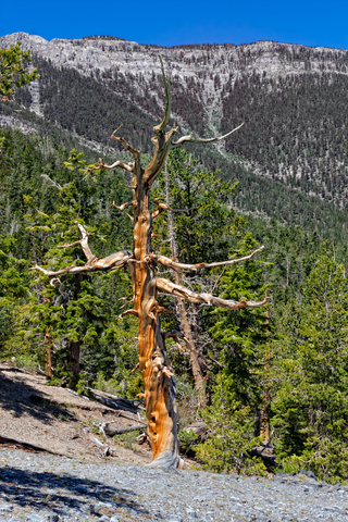
An extraordinary tree found in these forests is the Bristlecone Pine Pinus longaeva. This twisted tree can live nearly 5,000 years and is the oldest non-clonal species.
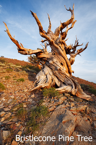
Bristlecones have very dense and resistant wood. They resist insects, fungi, rot, and even erosion. They also have a strange look, shaped by the wind, snow, and rain. Surviving these harsh environments is probably the reason for their longevity.
Bristlecones grow right below the tree-line, in isolated areas. Because of the harsh conditions, they grow slowly and some years don't even grow a tree ring.
Pinus longaeva is a very rare species found only in California, Utah, and Nevada. Bristlecone
Another plant common in these forests is the Sagebrush. Sagebrush is adapted to little rain, wind, hot summers, and cold winters. Animals like larks, owls, rabbits, wild horses, mule deer, burritos, and sparrows frequent sagebrush areas.
Aspen Woodlands and Pinyon-Juniper are also quite common, providing refuge to different species of animals. Source: USFS
Due to its size and remote location, there are very few hiking trails, and the largest Ranger District is present in this forest. In fact, the "Loneliest Road in America" crosses this forest. Peakvisor
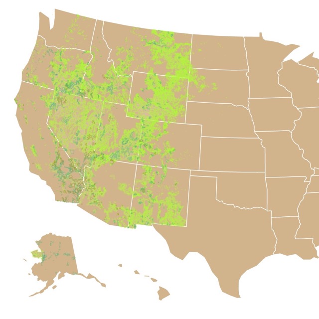
If you want to learn more about forests in the US, check this map!
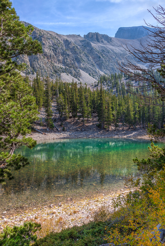
Great Basin National Park
Situated in the middle portion of the state, very close to the border with Utah and depicted in olive green on this map.
The name of the park comes from the particular drainage of the area. As mentioned before, streams and rivers from this basin find no outlet to the sea. Instead, the water collects in salt lakes, marshes, and mudflats.
Great Basin National Park has different valleys and mountain ranges, with Wheeler Peak at 13,063 feet (3.9Km).
Common vegetation includes sagebrush. At higher elevations, there is more water and there are more plants and animals that cannot survive in the lower desert.
Just like the Humboldt-Toiyabe Forest, this area has the ancient Bristlecone Pines. Furthermore, it still has the remains of the Prometheus tree. This Bristlecone pine was estimated to have lived 5000 years and been the oldest tree in the world. Its stump is still there if you want to count its rings.
Besides the views and the trees, this park has the Lehman Caves. A beautiful limestone cave with rare shield formations. (Shields are discs separated by a capillary sheet void).
Besides shields, the cave has stalactites, stalagmites, helictites, flowstone, and popcorn. Great Basin.
Because this park is far from large populations and even interstates, there are very few visitors and it is very secluded.
Want to find places to relax in Nevada? Check this map of Nevada Hot Springs
Valley of Fire State Park
Located Northeast of Las Vegas, this park has 40,000 acres of red Aztec sandstone nestled in tan limestone. As a state park, it is depicted with lime green on the map.
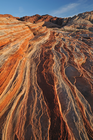
Valley of Fire also has petrified trees and petroglyphs that date more than 2,000 years.
This is the most scenic drive in Southern Nevada!
Impressive landscape with elegant archways, canyons, and an endless sea of sandstone. Before your eyes, you will see layers of reds, oranges, pinks, and yellows.
The area started as a sea, then it converted into mudflats, then dunes that dried, and turned in into sandstone. Years of erosion from wind and water continue to alter the landscape today.
Besides Rock climbing and propelling, visitors can cycle, and hike in different levels of difficulty. Source: Parks.NV.gov
Want to visit caves? Check this map of caves around the US!
Sand Harbor - Lake Tahoe Nevada State Park
Located in the West corner of the state, on the border with California, and situated atop the Sierra Nevada mountain range.
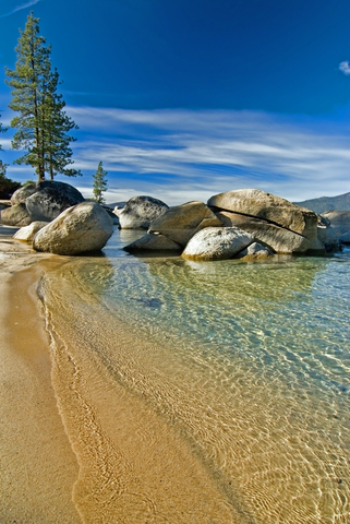
Lake Tahoe is the largest Alpine lake in North America. The lake is renowned for its crystal and Cobalt blue waters, sandy beaches, and rock formations.
The Lake is ideal for swimming, kayaking, fishing, paddle boarding, water skiing, and scuba diving. The park is also known for its Shakespeare festival.
The park has a nature trail to enjoy the views of the lake and the snowy mountains. Source: Parks.NV.gov
Lake Tahoe was formed by the rise and fall of landscape due to faulting. The lake was also carved during the last Ice age, which left behind boulders.
Lake Tahoe is the third deepest lake in North America and the tenth deepest lake in the world. Its depth can reach 1,645 feet (501m). It has about 191,6 mi2 (496Km2). Lake Tahoe
Red Rock Canyon National Conservation Area
Red Rock is 17 miles (27Km) West of Las Vegas. This is Nevada's first National Conservation Area, therefore, managed by the Bureau of Land Management and depicted in pink on the map.
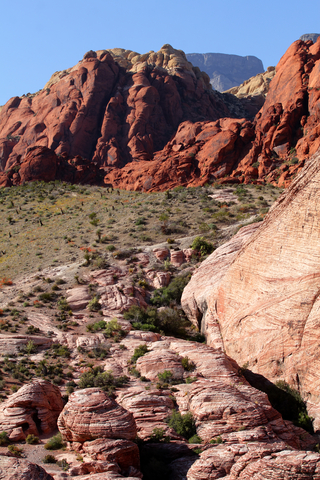
Its proximity to Las Vegas results in 2 million local and international visitors who come to enjoy the desert landscape every year!
In contrast to its neighbor Las Vegas, this is a natural retreat from gambling and lights. Red Rock offers a 13-mile (20Km) scenic drive, hiking trails, horseback riding, rock climbing, and nature observing.
The park has different hiking trails, with views of the desert and the mountains. These hikes offer views of wildlife, desert plants, and petroglyphs!
The park is on the eastern side of the Mojave Desert. Sandstone is predominant in the area, and so are springs and canyons.
Common plants in the park include Joshua tree, Mojave yucca, banana yucca, Agave creosote, blackbrush, and Ponderosa pines.
Wildlife include rabbits, squirrels, burros, bighorn sheep, and the desert tortoise. BLM
Wondering which of these parks is the best one for stargazing? Check this Dark Skies Map site!
Cathedral Gorge State Park
Cathedral Gorge is located 165 miles north northeast of Las Vegas. One of Nevada's original state parks, and depicted in lime green on this map.
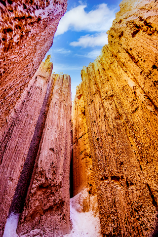
The park is well known for its dramatic carved cliffs, canyons, cave-like formations, and cathedral-like spires. These formations are the result of geologic processes that include wind and water erosion over hundreds of years.
The gorge was at some point a lake that later was filled with volcanic ash. This kind of volcanic ash is called welded tuft. As the ash was carried by rivers and streams into the lake, and then eroded over time, it formed depositional material. Now that the lake has drained, we see the cathedral-like formations.
Narrow canyons also formed as the water drained and softer sediment was eroded forming tall walls where you can now walkthrough. The walls are so close in some places, they almost block out the sun. It is almost like an alien landscape.
An advantage of these canyons is that they provide shade from the sun and cooler temperatures during the hot summer desert months.
This is an ever-changing landscape. The siltstone is so fine that it blows away.
The trails are surrounded by dramatic vistas. Lots of sites to explore, hike, and bike. Source: http://parks.nv.gov/parks/cathedral-gorge
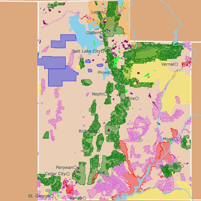
Interested in nearby Utah? Visit this map of Utah Parks!
Big Bend of the Colorado State Park
Located in the Southernmost corner of Nevada and situated on the shores of the Colorado River.
In contrast to the previous park, Big Bend offers miles of sandy beaches and shorelines on the Colorado River.
The park is ideal for swimming, hiking, boating, and fishing in cool waters year-round. Big Bend of the Colorado
The park boasts different bird species, including roadrunners, hummingbirds, hawks, quails, owls, and doves. Source: Parks.nv.gov
Affiliate Disclosure
Databayou.com is a participant in the Amazon Services LLC Associates Program, an affiliate advertising program designed to provide a means for sites to earn advertising fees by advertising and linking to Amazon.com. Databayou.com also participates in affiliate programs with Clickbank, CJ, and other sites.
If you plan on hiking in one of these arid parks and natural areas, I suggest you get some of these items found on Amazon.
- CamelBak, Hydration Pack: This comfortable vest and pack holds 2 Liter of water and is designed for quick loading and refilling.
- KEEN Sandals: Ideal for walking comfortably while keeping your feet cool.
- Victorinox Swiss Army Huntsman Pocket Knife (Red): An army knife always comes in handy. You never know what you will find or need in remote areas.
Resources for Nevada Parks Map
The shapefiles with Nevada's state boundary lines, major rivers, and cities were downloaded from Natural Earth Data.
The Parks and Public Lands shapefiles for Nevada were downloaded from USGS.
This map will be updated with new data! To receive updates on this and more nature maps join my email list!!!!!!!
Made by Luz K. Molina with D3.js.