Map of Annual Snowfall in the USA
This interactive map displays the Annual Average Snowfall in the United States. For stations, snowfall and elevation, hover over the map. Zoom out to see Alaska. Zoom in to see all stations in detail.
Annual Snowfall Average (in)
Snow Formation
Snow is the solid precipitation that occurs when temperatures drop below 32°F or 0°C.
Snow forms when small ice crystals inside clouds adhere to each other. If they become heavy enough, they will fall to the ground.
Snowflakes that fall in moist air that is just warmer than 32°F (0°C) will melt on their edges and stick to other snowflakes. These result in bigger snowflakes. Snow that descends through cold and dry air produces powdery snow that does not stick together.
Precipitation of snow occurs when the air temperature is below 35.6°F (2°C).
If the temperature is warmer than 35.6°F (2°C), the snowflake will melt and fall as sleet. If it gets evenwarmer then it will fall as rain.
When there are strong winds, snowfall can result in blizzards! Source: Metoffice.
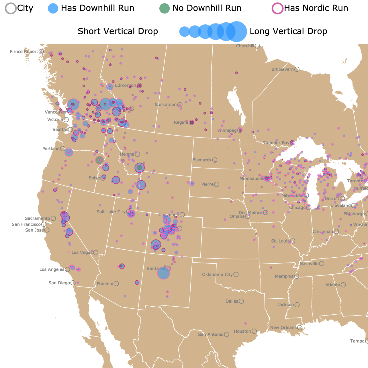
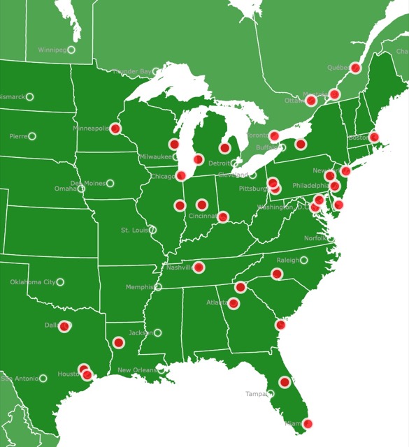
Interactive map of Ski Resorts in the U.S. and Canada
Snowfall in the U.S.A.
The snowfall shown in this map is the annual average total for each station depicted. The averages were calculated between 1981 and 2010. The data comes from 6,377 stations in the U.S.A.
The annual average is displayed in inches. The elevation of each station is in meters above sea level. To learn more about the data, check this article from NOAA.
Only 22% of the country received, on average, more than 40 inches of snowfall per year, and just 5 stations received more than 400 inches.
Because snowfall is so uneven, the color scale on the map is not linear.
The states with the least snow are those with the most stations depicted in white. These states are Hawaii, Florida, Louisiana, Alabama, and Mississippi. These states have temperature lows in the upper 60s.
If you love snow and checking the weather, why not get your own weather station? Amazon has the Sainlogic WiFi Weather Station. You can experience the convenience of accessing all kinds of weather information directly at home. It is a 10.2-inch Large Display Wireless Weather Station. It comes with a Rain Gauge and a Wind Gauge.
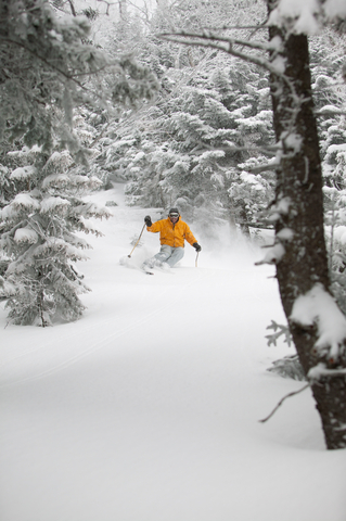
Snowiest Locations in the U.S.A.
Remote and uninhabited locations, like Mt. Rainier in Washington, are likely to have extreme snow. Snowy towns are mountain ski resorts like Alta, in Utah.
It is essential to keep in mind that climate change has changed the amounts and locations of snowfall throughout the U.S.A. and the world.
The following table has the 10 snowiest locations in the U.S.A.
| Station | State | Snowfall (in) | Elevation (m) | Elevation (ft) |
|---|---|---|---|---|
| RAINIER PARADISE RS | WA | 670.8 | 1,654 | 5,426 |
| ALTA | UT | 546.1 | 2,660 | 8,729 |
| CRATER LAKE NPS HQ | OR | 482.5 | 1,973 | 6,475 |
| SILVER LAKE BRIGHTON | UT | 411.1 | 2,664 | 8,740 |
| ECHO SUMT SIERRA AT | CA | 407.4 | 2,240 | 7,350 |
| WOLF CREEK PASS 1 E | CO | 392.1 | 3,243 | 10,640 |
| TWIN LAKES | CA | 375.0 | 2,438 | 8,000 |
| BRIAN HEAD | UT | 368.4 | 2,977 | 9,770 |
| VALDEZ WSO | AK | 326.3 | 29 | 95 |
| MT EVANS RSCH STN | CO | 300.9 | 3,240 | 10,629 |
Interested in visiting Alta? You can stay at the amazing Solitude Mountain Resort. For prices and dates visit Hotels.com
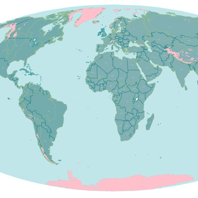
Interactive Map of Glaciers Worldwide
What Affects Snowfall in the U.S.A.?
Below are some of the factors that affect snowfall in the U.S.A. These factors are not the only ones, just the ones easy to observe on the map.
Want to explore different snowy locations and prices? No problem. Expedia is here to help!
Elevation
The higher you go, the colder it gets. For every 1,000 feet gained in elevation, the air temperature is roughly 3.5°F colder.
So nearby areas with different elevations might have drastic differences in snowfall depending on their elevation.
An interesting result is that air flowing toward a mountain cannot penetrate it. It will be forced to rise, cool, condense, and if it is cool enough, it will produce clouds. If the air is moist, it will produce precipitation in the form of rain or snow.
The side where the air pushes is called the windward side. It is common for windward sides to get snow. The opposite side, or leeward, does not get much precipitation, of any kind.
Examples of high snowfall in the mountains are visible in the Appalachians, the Cascades, and the Sierra Nevada; Washington Post.
For this reason, elevation has been included in the stations on the map.
If you live in a snowy area and like to monitor the weather, you can always get your own Gauge from Amazon. The Iron Art Snow Gauge Measuring Stick is a handmade Ruler for your yard. It is a 36-inch sturdy stake, resistant to corrosion, and ideal to use in your garden.
Lake Effect
On the map, you can see that the states surrounding the Great Lakes have more snow. This is due to the Lake Effect.
Frigid air blowing from Canada rushes over the warmer waters of the Great Lakes.
The air over the lakes is moist, promoting massive snowstorms.
Moisture is a significant factor in snow production. The coldest areas in the U.S. do not produce the most snow. This is because they are sometimes too dry to form snow.
Best Christmas Markets in the U.S. and Canada
Coastal Climate
Water masses cool and warm, slower than land masses. This applies to coastal areas. When the temperature drops inland, it will not translate immediately into the shores.
The Pacific Ocean brings a cool breeze throughout the year. But when winter weather comes, it keeps cities like San Francisco from freezing or getting snowfall.
Follow Me
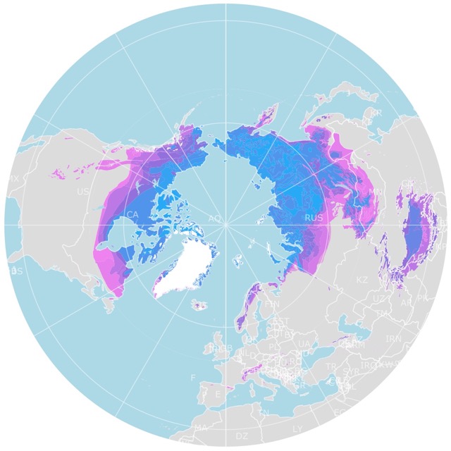
Interactive Map of Arctic Permafrost
Resources for U.S. Snowfall Map
The snowfall averages were downloaded from Anthony Arguez, Imke Durre, Scott Applequist, Mike Squires, Russell Vose, Xungang Yin, and Rocky Bilotta (2010). NOAA's U.S. Climate Normals (1981-2010). [Snow-Inventory]. NOAA National Centers for Environmental Information. DOI:10.7289/V5PN93JP [November 2022].
The Shapefiles for this map were downloaded from Natural Earth.
Made by Luz K. Molina with D3.js.
This map will be updated with improved and recent information! To receive updates on this and more nature maps, join my email list!!!!!!!
