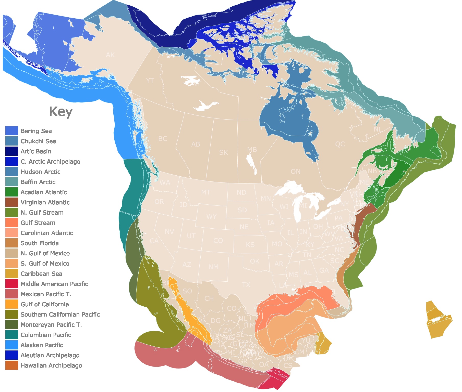
North America's Marine Ecoregions Map
This interactive map shows the Marine Ecoregions of the United States, Canada, and Mexico. The states and provinces of each country are also displayed to show context to each ecoregion. Every color represents one of the 24 Level I Ecoregions. Ecoregions Level II are also visible. To find Ecoregions Level III, names, depths, and sizes, hover over the map. To learn more, scroll down.
Marine Ecoregions of North America
The Marine Ecoregions of North America represent areas of related geographic, geologic, oceanographic, and biologic characteristics. This means that they have similar climate, currents, temperature, seafloor, and organisms.
The Ecoregions were also determined by taking into account neighboring Terrestrial Ecoregions and World Marine Ecoregions already established.
The map highlights Marine Ecoregions Level I, which are represented by one color, and represent a more continental scope. They encompass currents, larger water masses, and enclosed seas. In total there are 24 Ecoregions Level I.
Smaller ecoregions Level II are nested inside Ecoregions Level I, and represent more regional characteristics. They also represent the break between coastal waters and more oceanic ones. This means their boundaries might be features like the shelf break. There are a total of 86 Ecoregions Level II.
Ecoregions Level III are also included, and only defined on the continental shelf. This is because it is the only area with enough information to define small scale zones. Level III marine ecoregions capture differences within the near-shore area. They detail geographic features, and biological communities. There are only 86 Level III Ecoregions defined.
All these regions, were established thanks to the work of scientists from Canada, Mexico, together with the National Oceanographic and Atmospheric Administration (NOAA) and the Commission for Environmental Cooperation (CEC).
Marine Ecoregions of North America are areas within the Exclusive Economic Zones (EEZ) of USA, Canada, and Mexico. Source: CEC.org
Exclusive Economic Zones extend up to 200 Nautical miles (230 Miles) from the coast of a country. The EEZ gives sovereign rights to a country for exploring, conserving, managing, and exploiting the natural resources in such areas. NOAA
The average width of the Continental Shelf is 40 miles, therefore, marine ecoregions are likely to enclose the Continental Shelf, Continental Break, and part of the Abyssal Plain.
North America is framed by the Arctic Ocean to the North, the Atlantic Ocean to the East, the Gulf of Mexico and a bit of the Caribbean Sea to the South, and the Pacific Ocean to the West. This bodies of water will be used as a guide to describe the different Marine Ecoregions.
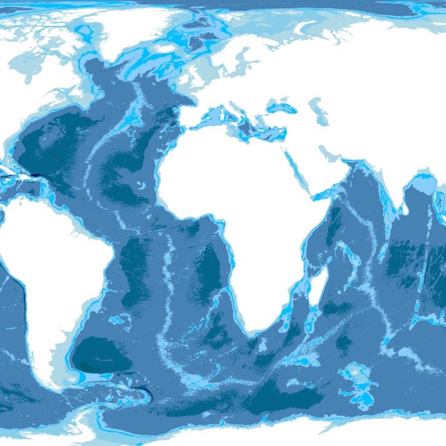
Lost with some terms? Check this map of World Ocean Depth for more information
Arctic Ocean
The Arctic Ocean is the smallest of the world's 5 oceans. It covers an area of about 5.4 million square miles, and it lies entirely in the Arctic Circle.
The Arctic Ocean is the shallowest ocean but it also contains deep basins. Its temperatures are usually less than 35°F (2°C).
The Arctic Ocean is recognized for its enduring ice cover. The ice usually covers half of its waters. Due to climate change the size of this ice is reducing. Nature
The following are marine ecoregions inside or next to the Arctic Ocean.
Affiliate Disclosure
Databayou.com is a participant in the Amazon Services LLC Associates Program, an affiliate advertising program designed to provide a means for sites to earn advertising fees by advertising and linking to Amazon.com. Databayou.com also participates in affiliate programs with Clickbank, CJ, and other sites.
Bering Sea
The Bering Sea has a deep basin to the southwest and a large continental shelf to the northeast, that supports high productivity.
The annual retreat of sea ice affects greatly the biologic regime.
The Bering sea is extraordinarily productive, and it specially supports a large population of birds, mammals, and fish. Therefore, it sustains a lucrative fisheries.
Historically fisheries has relied in Pacific cod, sea otters, fur seals crabs, whales, pollock, beluga, and walrus.
The Pollock fisheries in the Bering sea is the largest fisheries in the world. Bering Sea.
If you are planning a visit to Alaska, and admire some of these regions, I suggest you take with you this warm winter jacket from Amazon, MOERDENG Waterproof Jacket. It has different features: Waterproof, and windbreaker, perfect for skiing, snow days, and Mountain hiking.
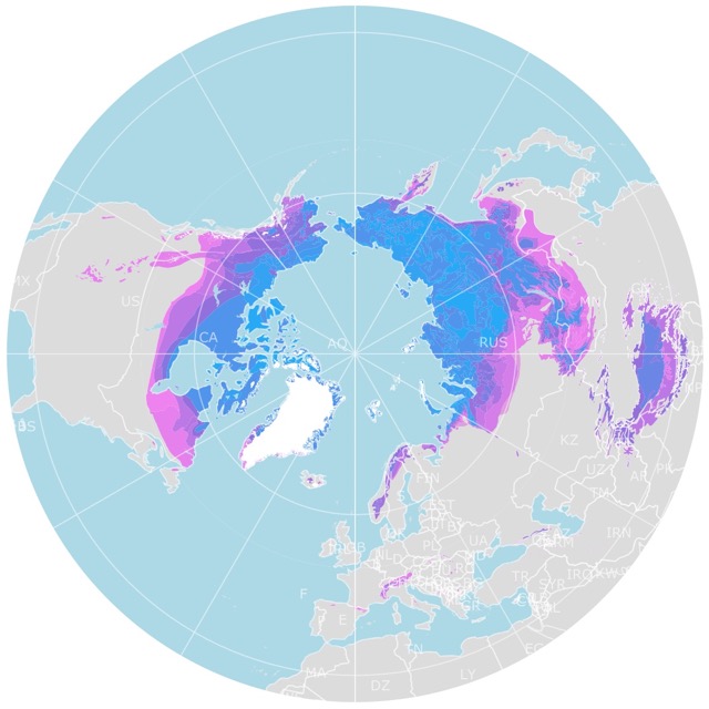
For more context on the Arctic, check this map of Arctic Permafrost
Beaufort/Chuckchi Seas
The Beaufort and Chuckchi seas have shallow waters due to the broad and shallow shelf with depths of 0 to 328feet (100 m). The width of the shelf can extend 62 miles (100 Km).
The Chuckchi seas is also one of the most biologically productive in the world. As sea ice retreats in spring, a plankton bloom follows.
The mineral rich waters that mix with melting snow, support phytoplankton blooms and result in low salinities.
Within this shelf, the 50 mile (80 km) Chukchi Corridor acts as a passageway for one of the largest marine mammal migrations in the world.
This area supports the formation of Polynyas. These are areas of unfrozen water surrounded by ice. cec.org
One of the greatest threats to the Chuckchi Seas, is the development of offshore gas and oil wells. Some of them close to feeding areas and wildlife refuges. Source: NRDC.org
Arctic Basin
The Arctic Basin is characterized by a constant ice cover. It resembles land, more than sea. The climate is extremely cold and dry.
The Ice slowly rotates counter-clockwise. It is centered in the North Pole and it is driven by the Arctic Ocean Gyre.
The region is characterized by low productivity. Most of the species live in the southern margin. They are typified by polar bears, beluga whales, walrus, narwhal, and ringed seals. Source: Ecozones.ca
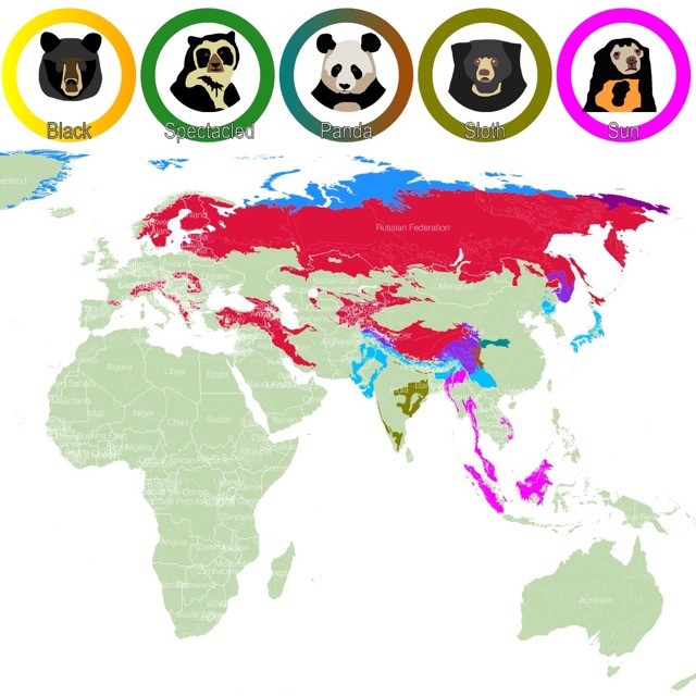
In these Arctic ecoregions it is common to find polar bears. To learn more about this mammal, check this map!
Central Arctic Archipelago
The Arctic Archipelago consists of 94 major islands. The eastern Islands are an extent of the Canadian shield and contains Paleozoic rocks (251- 542 million years old). The region also has some sedimentary rocks.
The geologic variety results in rugged mountains, fjords, and deposits of gold, diamonds, oil, and coal.
Sea Ice cover is 1.5 to 2m, distinguished by polynyas.
Life is typified by small Arctic cod, birds, and Polar bears.
Hudson/Boothian Arctic
The Hudson/Boothian Arctic has a coastline with glaciers, flat coastal plains, and fjords. The area is marked by seasonal ice.
This is one of the richest marine mammal regions of the world.
Most of the World's Narwhal population is in this area, as well as bowhead whale. There is also a large concentration of belugas.
The interconnection of land and sea is primordial and evident with the Arctic tern and the Polar bear. They both roam between land and sea.
The Hudson Bay tidal flats harbor some of the world’s largest concentrations of shorebirds and waterfowl.
If you can visit this area, I suggest you hike with this winter boots found on Amazon Columbia Snow Boots, ideal for cold environments.
Baffin/Labradoran Arctic
This ecoregion hosts some of the largest seabird colonies in North America. This is because of the large number of islands and rocky cliffs.
Some of the birds present include: millions of gulls, murres, sea ducks, dovekies, and fulmars.
This is technically subarctic because of the warm waters from West Greenland Current.
If you like to follow birds and plan to go birding in the area, I suggest you get this binoculars Celestron Binoculars from Amazon. They have a Large Aperture with 70mm Objective Lens, 25x Magnification, and carrying case.
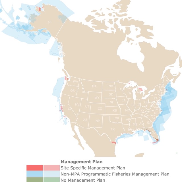
For more detailed information on some of these areas, check this map of marine protected areas.
Atlantic Ocean
The Atlantic Ocean is the second largest ocean in the world. It is bound by North and South America to the West and Europe and Africa to the East.
The Atlantic Ocean average depth is 3,338m (10,932ft). The ocean floor is mainly flat but it has seamounts and the mid ocean ridge.
Atlantic Ocean has the saltiest waters.
Its climatic zones vary widely, with higher latitudes having the coldest temperatures. Cool waters in the North Atlantic sink, forming what is known as the global ocean conveyor belt or giant conveyor belt.
Ocean currents contribute to climate control by transporting warm waters. An example of this is the Gulf Stream, which warms the British Isles and Northwestern Europe. Hurricanes tend to form close to the Equator.
The following Ecoregions are adjacent to the Atlantic Ocean.
Acadian Atlantic
The coastline is characterized by glacial moraines like Cape Cod, rocky shorelines, and cliffs like those found along Newfoundland.
The coastal watersheds bring freshwater to estuaries that support coastal fisheries.
This used to be one of the most productive marine areas in the world. But due to overfishing it has been depleted.
Commercial valuable fish include Atlantic cod, redfish, Atlantic herring, halibut, Atlantic mackerel, and silver hake.
The benthic communities are also diverse. They support kelps, seaweed, brown, red, and green algae. They are also rich with invertebrates such as barnacles, crabs, sea stars, American lobster, sponges, scallops, clams, and jellyfish.
The population increase in coastal cities, resulted in sewage, industrial pollutants, and toxic chemicals contaminating the nearby watersheds.
Can't get enough of the sea? Check this map of Warm Water Coral Reefs.
Virginian Atlantic
The Virginian Atlantic extends from Cape Cod to Cape Hatteras. It includes Chesapeake Bay, the largest estuary of the U.S.
The region is known for a historically large oyster fishery. Due to overfishing and pollution the fishery has dwindled.
The area is also known for horseshoe crab, Atlantic Mackerel, and the migration of bigeye tuna.
Unfortunately the extensive urban development has brought heavy metal contamination, pesticides, and sewage contamination that has impacted local marine species.
Northern Gulf Stream Transition
The Northern Gulf Stream transition is affected by the Gulf Stream to the East and the Labrador Current to the north.
The transition between cold and warmer waters results in many migratory species. It is a highly productive region with over 250 fish species including Atlantic white marlin and bluefin tuna.
This region is not in direct contact with the coast, and it used to be remote fishing area. Nevertheless, the adoption of new technologies have resulted in over fishing.
Gulf Stream Ecoregion
This ecoregion gets its name from the current with the same name. The Gulf Stream is also known as the Atlantic Meridional Overturning Circulation, or AMOC, and it is part of the "giant conveyor belt".
The current begins in the Eastern Coast of Florida, and carries warm water to Newfoundland. It keeps moving towards the North Atlantic where it cools and sinks. This deep sea water, then cycles around the globe to rise back to the surface in the Pacific. Livescience.
The Gulf Stream Ecoregion is dominated by the Gulf Stream current. It is offshore and starts in Florida and ends close to Cape Hatteras.
Due to the warm waters and bathymetric features there is upwelling in this area, which results in surface waters.
It is common to find bluefin tuna, humpback whale, and wreckfish.
Want to visit Natural Areas of Florida? Check this map of Florida's Natural Places
Carolinian Atlantic
The region is defined by broad continental shelf, and severe hurricanes.
The Carolinian Atlantic includes estuaries, bays, coastal marshes, deep reefs, and sand plains. The bays and estuaries of the region have examples of temperate seagrasses, salt and brackish marshes, plus native shellfish and reefs.
The area serves as a nursery a for many marine fishes, and is an important region for shellfish. Unfortunately coastal habitat degradation has resulted in oyster populations reduced or extinct. Conservation Getaway
If you want to visit the area and enjoy some its bays and watersheds, I suggest you get this Kayak found on Amazon Inflatable Kayak, it includes aluminum oars and air pump.
South Florida/Bahamian Atlantic
This ecoregion is well recognized by its sandy beaches, mangrove forests, coral reefs, and seagrass.
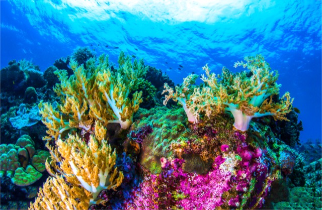
The water is clear and due to its tropical and subtropical climate, it has coral reef formations.
This area is surrounded by some of the most densely populated areas of Florida. Because of this, it is suffering of anthropogenic stress due to development, septic system contamination, runoff, ship, and anchor damage, and unsustainable fishing practices.
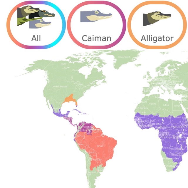
If you would like to read more about some of the residents in this area, check this map of Crocodile and Alligator Distribution
Gulf of Mexico
The Gulf of Mexico is the Largest Gulf in the World and the tenth largest body of water.
The Gulf of Mexico is surrounded by the U.S., Mexico, and Cuba.
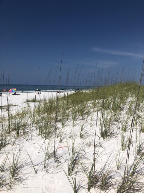
Northern Gulf of Mexico
The Northern Gulf of Mexico extends from Gullivan Bay in Florida to the Rio Panuco in Mexico.
The dominant land ecosystems are estuaries, wetlands, salt marshes, and swamps. Submerged ecosystems include seagrass meadows and oyster reefs.
This is one of the U.S. Most important fishing areas. It is coined the "Fertile Fisheries Crescent".
It has three of the top six commercial U.S. fishing ports (by poundage landed). The ports are: Empire-Venice, LA, Intracoastal City, LA, and Pascagoula-Moss Point, MS. Source: Oceaneconomics.org
Commercially it is a very important area as it has top transportation ports including Houston and New Orleans.
The economic power is not limited to commerce and fisheries. The Northern Gulf of Mexico also produces 54% and 52% respectively of crude oil and natural gas in the U.S. There are over 3,700 active oil and gas platforms in the Gulf.
The Gulf of Mexico receives the output of major river systems in North America, including the Mississippi River. The discharge of these rivers, filled with fertilizers, result in a high nutrient content that creates the Dead Zone during the summer months.
A Dead Zone, is the consequence of nutrient excess that result in a phytoplankton bloom. These blooms die, decompose, and sink before they are consumed by other critters. Their decomposition depletes the oxygen in the water column. The low oxygen levels near the bottom does not support most of marine life. Fish and shrimp swim away while others are killed. Source: http://acer.disl.org/news/2016/07/14/the-northern-gulf-of-mexico/.
To learn more about marine ecosystems, check this book full of information, and details on the identification, biology, and conservation of marine life, plus incredible images. The book found on Amazon is called The Marine World: A Natural History of Ocean Life.
Southern Gulf of Mexico
It is located between the Yucatan Peninsula and the Gulf of Mexico.
It is characterized by estuaries, coastal lagoons and mangroves, seagrass, and coral reefs.
The area supports over 100 species of fish. It also supports oil production, gas production, tourism, and fisheries.
Caribbean Sea
A small portion of the Caribbean sea is adjacent to the East coast of the Yucatan Peninsula.
This tropical sea has coral reefs, seagrass meadows, and mangrove trees that provide breeding and feeding habitat to more than 1,300 fish species. It is also home to sea mammals and turtles.
Unfortunately the grouper, and conch fisheries collapsed. Currently the spiny lobster is also under concern.
Some of the major stressors for this marine ecoregion are tourism, coastal development, hurricanes, and coastal runoff.
Coral reefs are specially affected by climate change, water pollution, and water turbidity.
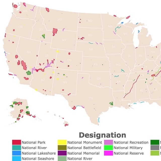
Want to check other natural features and parks of these countries? Check this map of National Parks of North America
Pacific Ocean
The Pacific Ocean is the largest ocean on earth. It covers 30 percent of Earth's surface.
The Pacific Ocean is also world's deepest body of water with an average depth of 4000m (13,000feet). The greatest depth on Earth is within the Pacific, in the Mariana Trench. It is known as the Challenger Deep and it is about 11,000 m (36,000 feet) deep. NOAA
Middle American Pacific
This part of the Pacific is far from the cooler Pacific up North and is considered tropical.
The area has a wide continental shelf and a continental slope that result in the Mesoamerican Trench.
The main fish are yellowfin tuna, skipjack tuna, and shrimp. Other species include the leatherback turtle, the purpura conch, and several shark species.
The region is characterized by mangrove communities and reefs.
The main concern in this marine ecoregion is the high bycatch ratio.
Mexican Pacific Transition
This Ecoregion has a narrow shelf, followed by great ocean depths close to the coast. There are canyons that may reach 5,000m (16404feet) deep.
The area also has submarine mountains, rifts and volcanic cones.
The Mexican Pacific Transition has diverse coastal systems such as estuaries, coastal lagoons, coral communities, mangroves, rocky and sandy shores, which in turn have resulted in a diverse species community.
There are over 215 fish species that include speckled guitarfish, Chilean round ray, Pacific flagfin mojarra, burrito grunt, oval flounder, and bullseye puffer.
There are also rocky reefs, with endemic species.
This used to be the largest nesting place in the world for the leatherback sea turtle.
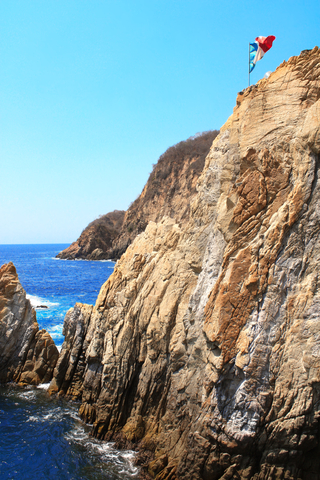
Some of the main economic activities is tourism. This area is well known for destinations like Acapulco and Puerto Vallarta.
Gulf of California
The Gulf of California stretches over 1,000 Km, is also known as the Sea of Cortez or Mar de Cortes. It has high levels of diversity and productivity thanks to upwelling systems.
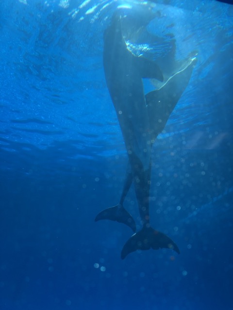
The extraordinary diversity of sea life includes turtles, sharks, whales, reef fish species, and the world's smallest porpoise, the Vaquita.
This is Mexico's most important fisheries region. Commercial fisheries include shrimp, giant squid, billfishes, sardines, and tuna.
This area is also an important tourist area, as visitors flock to see the reefs and beaches. WWF
Southern California Pacific
This region stretches from the tip of Cabo San Lucas in Mexico to Point Conception in California USA.
Here, the cold waters from the California current and warm waters from the south. This confluence makes this area a transition zone with high species diversity.
The Southern California Pacific holds the southern-most extension of kelp and the northern-most extension of mangroves in the Eastern Pacific.
Some of the fisheries in this area include anchovies, sardines, Pacific chub mackerel, Pacific bonito, jack mackerel, Pacific hake and over 60 species of rockfishes.
Montereyan Pacific Transition
This area has seasonal upwelling. There is also significant presence of canyons and seamounts.
Due to the coastal proximity to deep water bathymetry, it is possible to find deep water species close to the coast; like whales, dolphins, and seabirds.
Some of the species found in this region include kelp, krill, dungeness crab, bonito, California skate, Pacific salmon, market squid, albatross, shearwaters, brown pelican, gulls, sea lions, Dall’s porpoise, harbor seal, as well as gray, blue, and humpback whales!
The area also has important estuaries, the biggest is San Francisco Bay. This area is a magnet for birds, unfortunately the area has been heavily modified for urban development.
Columbian Pacific
This ecoregion receives the runoff of the Columbia and Fraser Rivers. Their nutrient load promotes the growth of phytoplankton (micro algae).
This ecoregion is home to the greatest production of oyster and clam in North America.
The Columbian Pacific has the largest concentration of killer whales. There are also otters, gray, blue, minke, and humpback whales. Plus harbor seals, scoters, rockfish, Pacific herring and all species of northeast Pacific salmon.
The economy of the region has significantly been sustained by fisheries. Nevertheless, population growth accompanied by coastal degradation, and overfishing have decreased local fish populations.
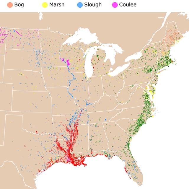
Many of these coastal regions receive waters from Marshes, Bayous, and Swamps. For more information, check this map.
Alaskan/Fjordland Pacific
This area, as its name describes, has deep fjords, islands, straits and seamounts. Nearby rivers, bring nutrients that increase primary productivity.
The region has gray, minke, hump-back and killer whales, as well as harbor and Dall’s porpoise; Pacific white-sided dolphin, and sea otters.
This region is home to 3,800 species of invertebrates, about 3.5% of world marine invertebrates. Some of these include commercially valuable ones like clam, crab, scallop, shrimp, and squid.
Fisheries species include Pacific herring (the most abundant), Pacific cod, walleye pollock, Pacific halibut, Arrowtooth flounder, and five species of salmon—coho, chinook, chum, pink and sockeye salmon. Most of these species have been overfished and local authorities are working to get them in more sustainable numbers.
Common birds include Cassin's auklet, ducks, geese, swans, loons, and tufted puffins.
A major source of economic activity is tourism, which brings shipping and cruises. The pollution from ship traffic, plus urban runoff, result in shoreline and bottom degradation.
Aleutian Archipelago
This is the World's largest Archipelago, and is close to the Aleutian Trench. This is a transition zone between the Pacific Ocean and the Arctic.
This area is home to sea otters, red tree coral, bull kelp forests, whiskered auklets, goose, albatross, and humpback whales.
Fisheries species are the same as in the Alaskan Fjordland. Commercial fishing has caused a dramatic drop in available food for local birds. Bottom trawling and longlining have also destroyed the bottom, where deep sea coral used to be found.
To learn more about volcanoes and where are they found, check this map
Hawaiian Archipelago
The islands where formed thanks to a geologic "hotspot". A hotspot is an area of the mantle where hot plume rises. These result in the formation of volcanoes. As the hotspot moves, new volcanoes are formed, this is why we see chain of islands. Another characteristic of these hotspots is that they do not have violent volcanic explosions. They have something that looks more like lava flows.
This is the most isolated archipelago, composed of 8 main islands, and 124 smaller islands. This condition, has resulted in great endemism.
Biologically speaking the area is important among other reasons for its humpback whales, Hawaiian monk seal, and seabird colonies, plus nesting ground for green sea turtles.
It is also important because more than 60% of U.S. coral reefs are found in the Hawaiian Archipelago.
It is believed that nearshore fisheries have declined 80% in the last century. Fortunately water quality in most areas is good. Hawaii Fish
Resources for Marine Ecoregions
The Shapefiles for the states and provinces of USA, Mexico, and Canada where downloaded from Natural Earth. The shapefiles for the marine ecoregions where downloaded from http://www.cec.org/north-american-environmental-atlas/marine-ecoregions-level-iii/ .
A great deal of information for the ecoregions is found in http://www3.cec.org/islandora/en/item/3256-marine-ecoregions-north-america-en.pdf
This map will be updated with improved and recent information! To receive updates on this and more nature maps join my email list!!!!!!!
Made by Luz K. Molina with D3.js.