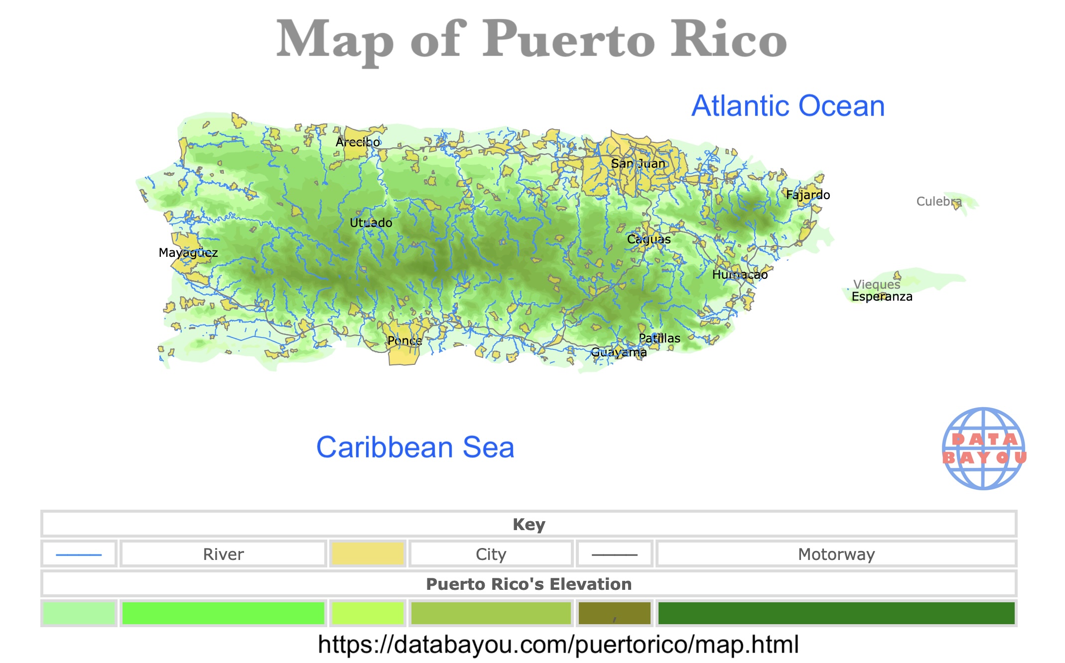
Map of Puerto Rico
This interactive map shows the Cities, Towns, Rivers, and Roads of Puerto Rico. For more detail, zoom in. For more information, hover over the map, or scroll down.
| Key | |||||
|---|---|---|---|---|---|
| ──── | River | City | ──── | Motorway | |
| Puerto Rico's Elevation | |||||
| , | |||||
Puerto Rico
Puerto Rico is a self-governing island, and a territory of the United States. Puerto Rico is known as "Isla del Encanto" which translates as Enchantment Island or Enchanting Island.
Puerto Rico is known for its Caribbean culture and beautiful beaches.
Cities of Puerto Rico
Puerto Rico's major cities, based on population and economic impoartance, are San Juan, Bayamon, Carolina, Ponce, Caguas, Guaynabo, Arecibo, Toa Baja, and Mayaguez.
- San Juan: Is the capital of Puerto Rico, the political, financial, and touristic center of the country. Also known for its architecture and colonial castle San Felipe.
- Bayamon: Is as suburban area west of San Juan. Known as "Ciudad Chicharron" or Crackling City.
- Carolina: Has "Luis Munoz Marin International Airport".
- Ponce: Is the main city of the southern coast. It is also known as "Perla del Sur" or Southern Pearl.
- Caguas: Located in the center of the island. Is an important industrial and commercial complex.
- Mayaguez: Main city in the western coast known as "Aguas Puras" or Pure Waters.
To learn more about Puerto Rico, amazon has PUERTO RICO TRAVEL GUIDE 2026–2027: Caribbean Spirit, Rich History & Smart Travel Secrets for a Safe, Easy, and Unforgettable Island Experience (World Careful Explorer Essential Series).
PUERTO RICO TRAVEL GUIDE 2026–2027 is a complete, easy-to-follow roadmap designed to help you experience Puerto Rico safely, smoothly, and deeply.

Puerto Rico has many tropical forests and parks for visitors to explore. To learn more about them, visit this map.
The People of Puerto Rico
Puerto Rico was settled by a succession of indigenous peoples of the Americas beginning 2,000 to 4,000 years ago.
Furthermore, the people from Puerto Rico call themselves "Boricua". It comes from Borikén (or Borinquen), the native Taino name for the island.
Puerto Rico was claimed by Spain following the arrival of Christopher Columbus in 1493 and subsequently colonized by Juan Ponce de León in 1508.
The decline of the indigenous population was followed by an influx of Spanish settlers and African slaves which radically changed the cultural and demographic landscape.
As of early 2026, the population of Puerto Rico is approximately 3.2 million, following a long-term decline from its peak of 3.8 million in 2004.
The population has decreased due to low fertility rates and high levels of emigration to the U.S. mainland. The median age is roughly 45, which is higher than the U.S.
If you want to learn more about the people of Puerto Rico, Amazon has History of Puerto Rico: A Captivating Guide to the Taínos, Spanish Conquest, American Invasion, and Modern Times (European Exploration and Settlement).
This book takes you through Puerto Rico’s past, from the time of the Taíno to the island’s ongoing struggle to define its future. Through hardship and strength, Puerto Ricans have built a lasting identity—one that continues to inspire people today.
Roads of Puerto Rico
The main roads in Puerto Rico include the major toll expressways PR-22 (north coast), PR-52 (south-bound/Ponce), PR-53 (east coast), and PR-66, along with key, non-toll routes like PR-2 (circular coastal route) and PR-30.
These primary, frequently high-traffic roads are essential for connecting major cities, including San Juan, Ponce, and Mayagüez.
Puerto Rico has approximately 14,400 kilometers (8,900 mi) of national, forest and municipal roads.
The highways serve the more than 3 million residents, and 3-4 million tourists who visit each year.
Puerto Rico's highway system is divided into four networks called primary, urban primary, secondary (inter-municipal), and tertiary (local).
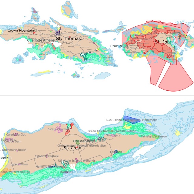
Want to find places to explore in nearby U.S. Virgin Islands? Check this map of U.S. Virgin Islands Parks
Geography of Puerto Rico
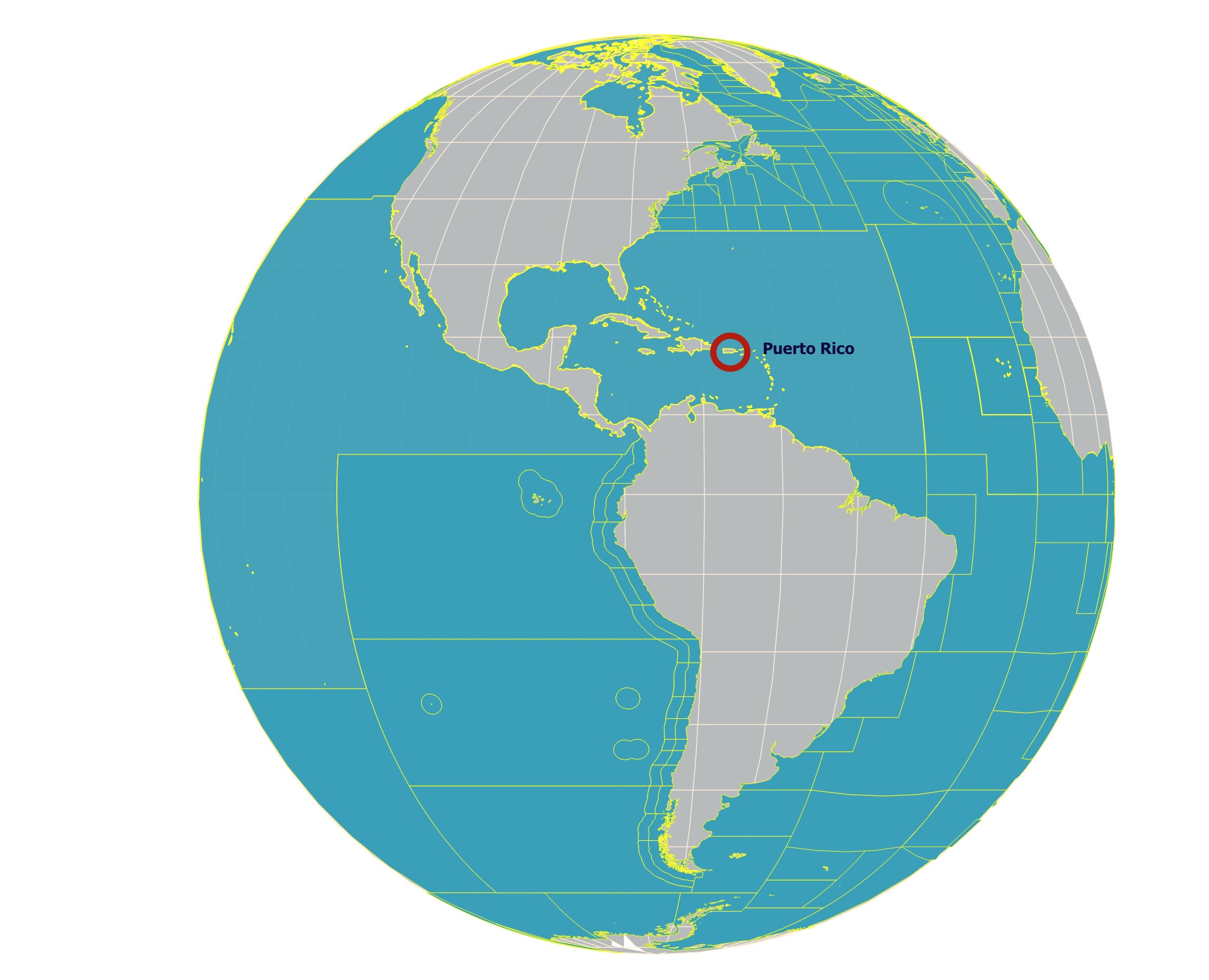
Puerto Rico is the easternmost island of the Greater Antilles. Puerto Rico is only 50 miles (80 km) east of the Dominican Republic, 40 miles (65 km) west of the U.S. Virgin Islands, and 1,000 (1,600 km) southeast of Florida, United States.
Puerto Rico is situated between the Atlantic Ocean and the Caribbean Sea.
Besides the main island, there are two small islands just off the east coast called Culebra and Vieques, both administrative parts of Puerto Rico.
None of the rivers in Puerto Rico are large enough for navigation. However, several northward-facing rivers are harnessed for irrigation, hydroelectricity, and municipal water supplies.
Puerto Rico's major rivers include the; Grande de Arecibo, Grande de Loríza, Grande de Añasco Rivers, and La Plata. Rivers coursing on the southern coast are dry for most of the year, with water only flowing after it rains.
FOLLOW ME
Resources for Puerto Rico's Map
The shapefiles with Puerto Rico's boundary lines and cities were downloaded from Natural Earth Data.
The shapefiles for Puerto Rico's cities came from the US Census Bureau.
The shapefiles of rivers in Puerto Rico came from HOTOSM.
The shapefiles with Puerto Rico's contour lines is from RCMRD Open Data.
This map will be updated with new data! To receive updates on this and more nature maps, join my email list!!!!!!!
Made by Luz K with D3.js.