Political Map of the US
This is an interactive map of the United States of America. It shows the location and postal code of each state. It also depicts rivers and cities for context. Hover over the map to see the name, region, and sub-region. Zoom in for more details. Scroll down for more information.
| Key | ||||
|---|---|---|---|---|
| ⬤ | State or Province Capital | ◯ | City | |
| Lake or River | ⭕ | Country Capital | ||
United States
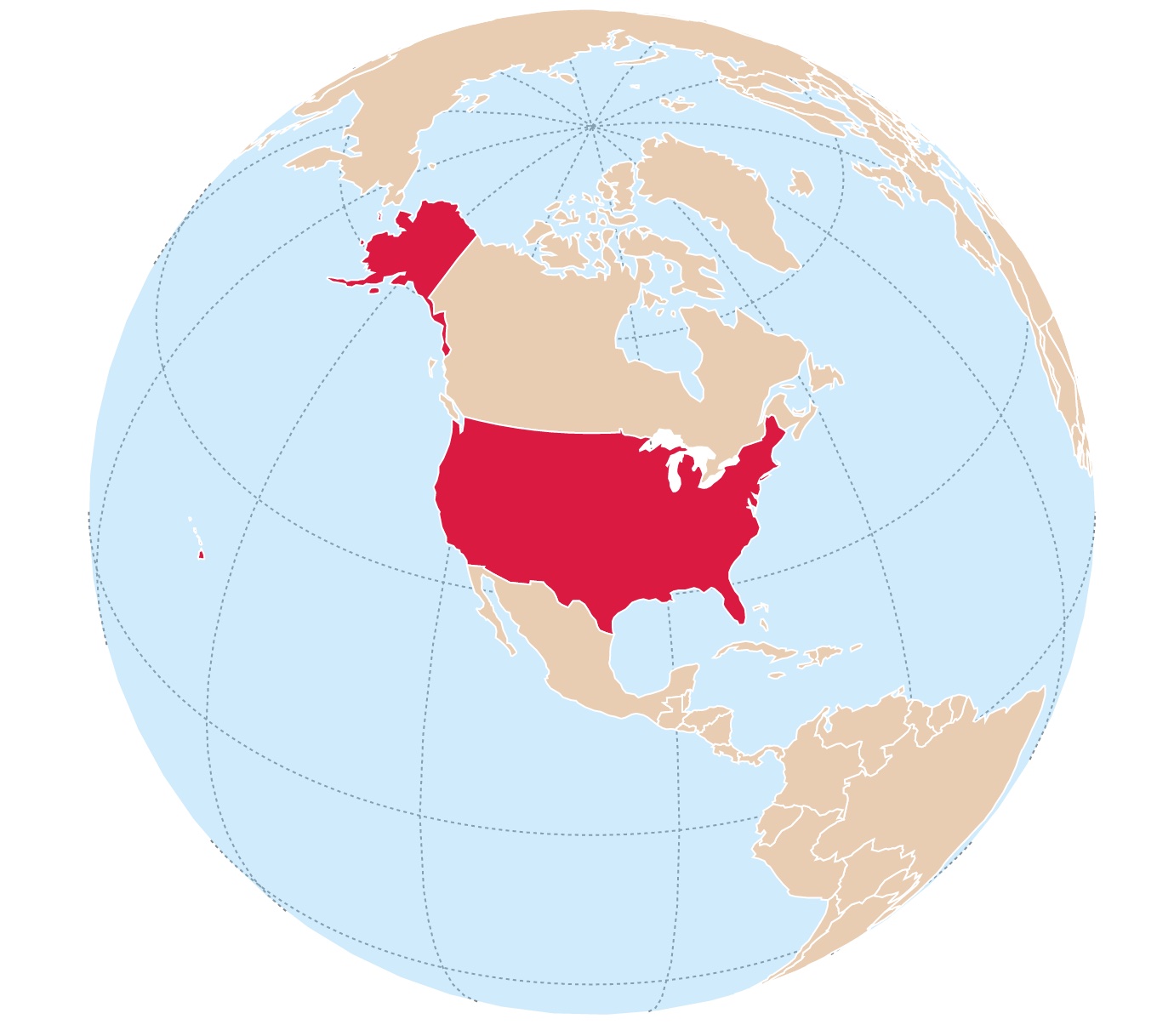
The United States of America is located on the Western Hemisphere and is a country located in North America.
The conterminous United States is bounded to the north by Canada, to the east by the Atlantic Ocean, to the south by the Gulf of Mexico and Mexico, and to the west by the Pacific Ocean.
The U.S.A. is the fourth largest country after Russia, Canada, and China.
The United States comprises 50 States and the District of Columbia (D.C.). Nevertheless, when it comes to describing and representing the U.S. There are a few distinctions.
The Continental United States includes 49 States. These are the states located on the continent of North America, including Alaska and the District of Columbia. The Continental U.S.A. excludes Hawaii.
Conterminous United States are the 48 States and the District of Columbia; that is, the United States prior to January 3, 1959, when Alaska became a state. Therefore, excluding Alaska and Hawaii.
Although the official reference applies the term "conterminous," many use the word "contiguous," which is the same and better known. Source: USGS.gov
If you are a bit confused, look at the map below.
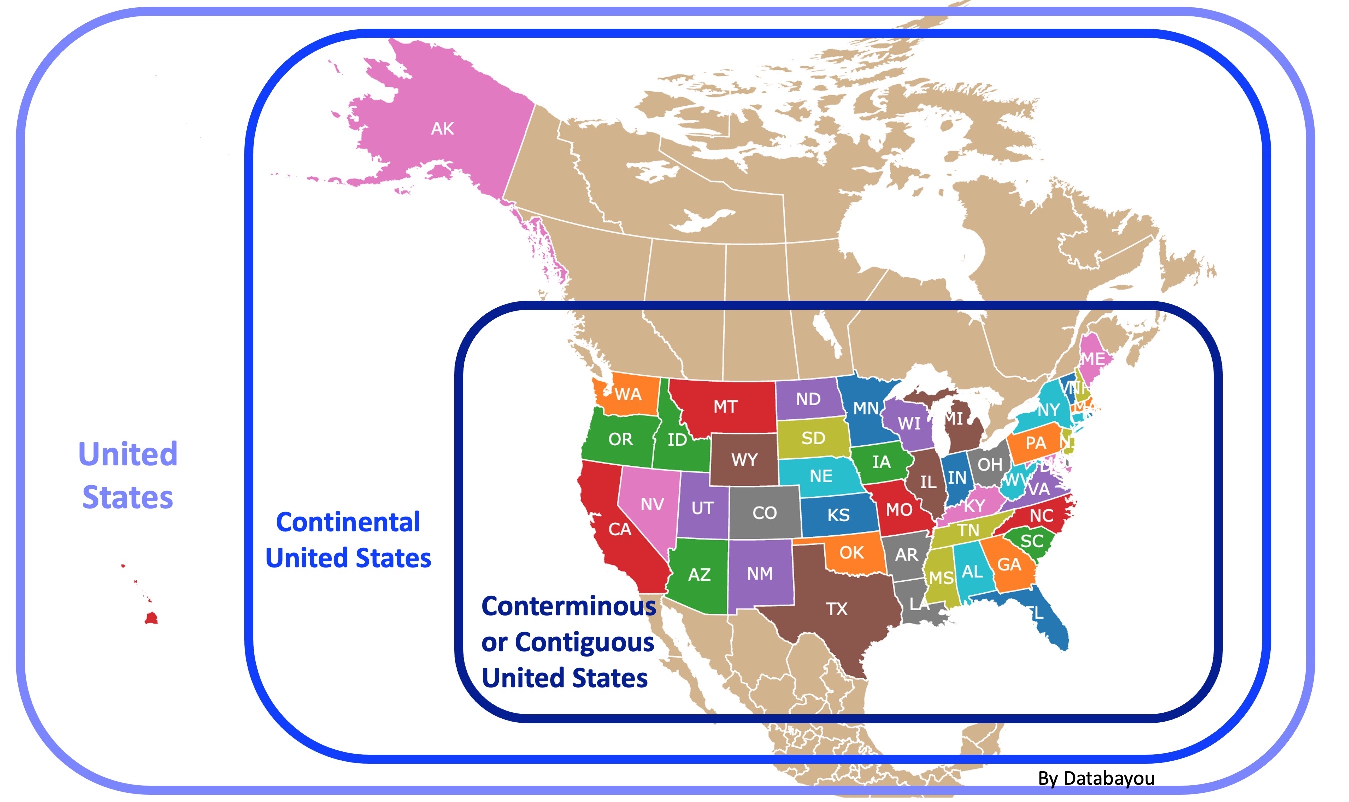
United States Outline
If you would like to save or print the United States Map and a Blank State Map view here:
 |
 |
How the States Came to Be
These maps display the states, but they also show U.S. history and US physical geography.
Fortunately, someone already chronicled this process in a book you can find on Amazon. How the States Got Their Shapes is the first book to tackle why our state lines are where they are, from ideological intrigues and religious intolerance to major territorial acquisitions.
For a short version, the shapes of the states in the United States were primarily determined by historical, political, and geographical factors.
Here are some key factors that influenced the shaping of the US states.
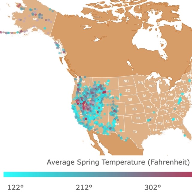
Map of Hot Springs and Thermals in the U.S.
Colonial Settlements
The original thirteen colonies were established along the eastern seaboard by European settlers. These 13 colonies were:
- New Hampshire
- Massachusetts
- Rhode Island
- Connecticut
- New York
- New Jersey
- Pennsylvania
- Delaware
- Maryland
- Virginia
- North Carolina
- South Carolina
- Georgia
The boundaries of these colonies were often based on charters, land grants, and territorial disputes between colonial powers.
Land Purchases and Treaties
As the United States expanded westward, it acquired new territories through various means.
Louisiana Purchase
The Louisiana Purchase in 1803 from France resulted in the formation or partial formation of the future states of:
- Arkansas
- Iowa
- Kansas
- Missouri
- Nebraska
- Oklahoma
- Colorado
- Louisiana
- Minnesota
- Montana
- New Mexico
- South Dakota
- Wyoming
Alaska Purchase
On March 30, 1867, the United States reached an agreement to purchase Alaska from Russia for a price of $7.2 million.
Oregon Treaty
The Oregon Treaty of 1846 with Britain, resulted in:
- Washington
- Oregon
- Idaho
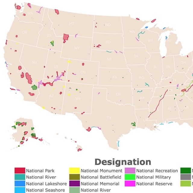
Map of National Parks of the USA
The Treaty of Guadalupe Hidalgo
By its terms, the Treaty of Guadalupe Hidalgo in 1848, Mexico ceded 55 percent of its territory.
This treaty ended the Mexican-American War and gave territory that eventually became:
- California
- Nevada
- Utah
- New Mexico
- Arizona
Texas was annexed from Mexico, and Florida was ceded by Spain.
How the States Were Shaped
We have explained the acquisition of the land. The borders required a bit more work.
For example, the 13 colonies varied widely in shape and size. They were shaped by the first European settlers.
Nevertheless, Thomas Jefferson wanted equality and suggested Congress create states of equal size, based on latitude and longitude.
His ideas were not used at first, but longitude and latitude were eventually used to delineate the Western States.
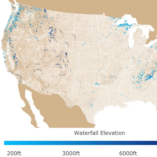
Map of Waterfalls in the USA
Geographical Features
Natural geographical features such as rivers, mountains, and coastlines played a role in defining state boundaries.
For example, the Mississippi River formed the border of Mississippi and Arkansas.
The Appalachian Mountains influenced the border of Tennessee and North Carolina.
If you would like to have a map of the United States that shows the states and major geographical features, Amazon has the International Giant Classic USA Mega-Map. This laminated poster is colorful and extra large.
Cultural and Social Factors
Cultural and social factors, including ethnic communities, migration patterns, and economic activities, also influenced state shapes.
For instance, the boundaries of some states in the Midwest were influenced by the settlement patterns of European immigrant communities.
The issue of slavery, helped shape Oklahoma.
Over time, these historical and political processes, along with other considerations, led to the unique shapes and configurations of the states in the United States as we know them today.
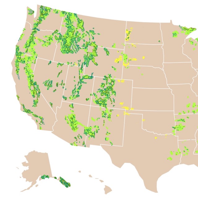
Map of National Forests
Follow Me
Resources for United States Map
The Shapefiles for this map were downloaded from Natural Earth.
Made by Luz K. Molina with D3.js.
This map will be updated with improved and recent information! To receive updates on this and more nature maps, join my email list!!!!!!!
