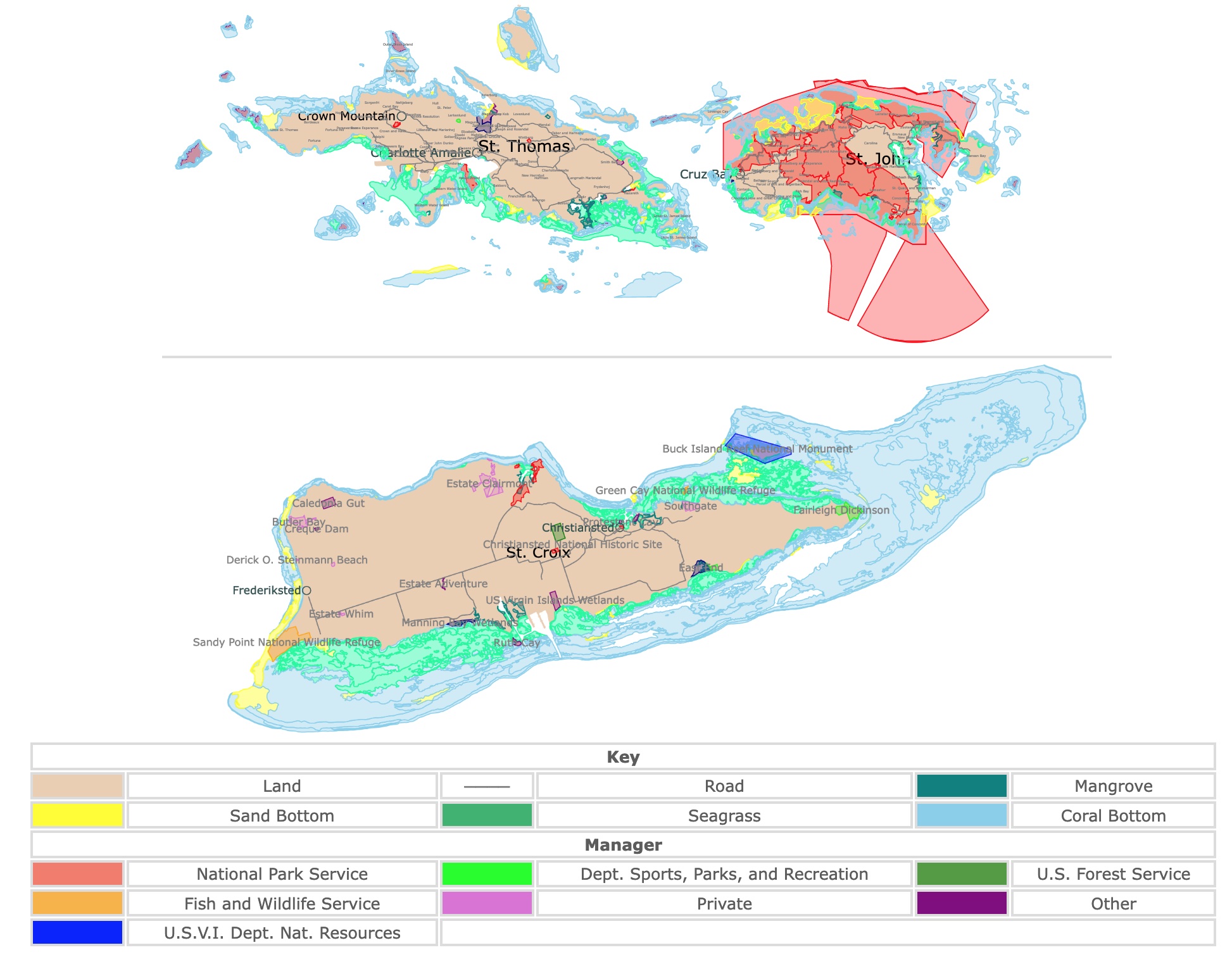
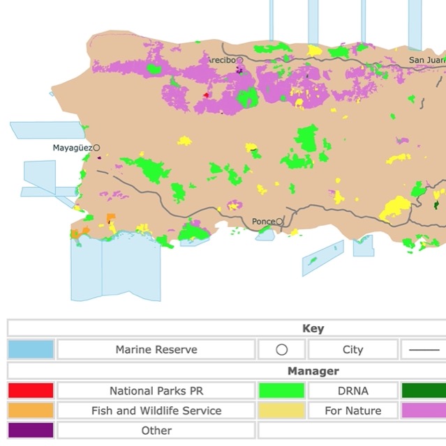
Map of Virgin Islands' Parks and Protected Areas
This interactive map shows the Locations, Names, and Details of National Parks and other Public Lands of the U.S. Virgin Islands. It also shows major roads for context. St. Croix Island is far south, but it was depicted closer to St. John for convenience. For more detail, zoom in. For more information, hover over the map, or scroll down.
| Key | |||||
|---|---|---|---|---|---|
| Land | ──── | Road | Mangrove | ||
| Sand Bottom | Seagrass | Coral Bottom | |||
| Manager | |||||
| National Park Service | Dept. Sports, Parks, and Recreation | U.S. Forest Service | |||
| Fish and Wildlife Service | Private | Other | |||
| U.S.V.I. Dept. Nat. Resources | |||||
Virgin Islands's Geography
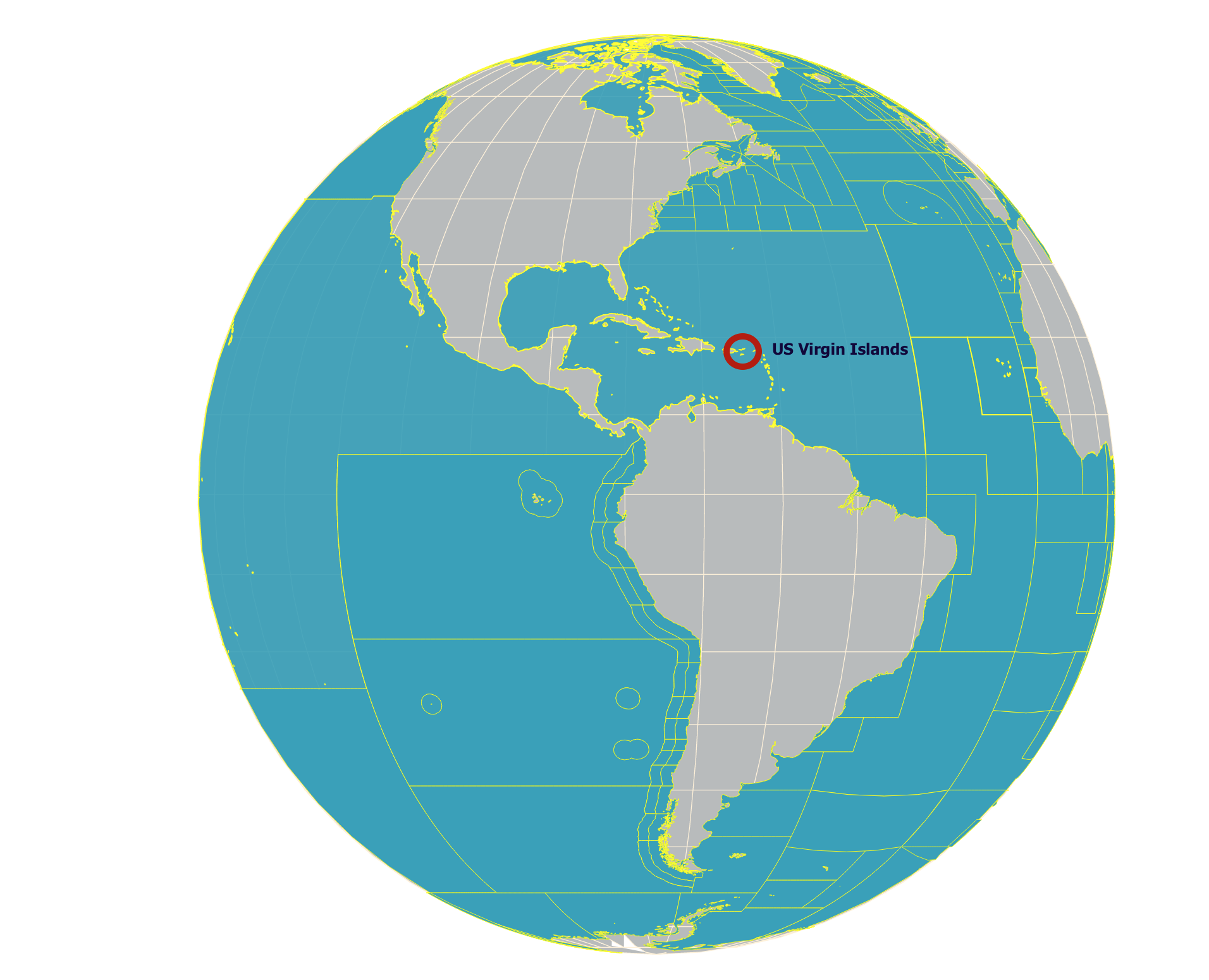
The U.S. Virgin Islands is an unincorporated island territory of the United States. They are located at the eastern end of the Greater Antilles. The Antilles are a group of islands between the Caribbean Sea and the Atlantic Ocean, comprising all of the West Indies except The Bahamas.
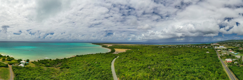
The Islands are small, with hilly to mountainous, rugged terrain. The highest point is Crown Mountain on the island of St. Thomas, at 1,555 feet (474 meters).
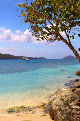
The coastline stretches for about 117 miles (188 km), with spectacular beaches for visitors looking to relax in a tropical setting.
The Virgin Islands territory consists of three large islands: St. John, St. Croix, and St. Thomas. The territory also comprises around 50 small cays and islets. Along with the British Virgin Islands, the US Virgin Islands are an extension of Puerto Rico's central fault-block mountain ranges.
St. Thomas
St. Thomas is 40 miles (64 km) east of Puerto Rico and measures a little more than 31 square miles. The island has the largest population in the U.S. Virgin Islands, with 52,000 inhabitants. Here is the capital Charlotte Amelie.
When you reach the islands, you will likely fly into St. Thomas.
St. Thomas and St. John have volcanic origins, although they are no longer active. This is because they are located on the northern edge of the Caribbean Plate.
Want to find places to explore in nearby Puerto Rico? Check this map of Puerto Rico Parks
St. John
John is only four miles from the east end of St. Thomas. The most common way to reach St. John is by ferry from St. Thomas.
The terrain features valleys and hills, with relatively few flat areas. St. John circumscribes 20 square miles of landscape scenery. The highest point is Bordeaux Mountain at 1,277 feet (389 meters).
The main town and harbor on this island are located in Cruz Bay. There is also a natural harbor in Coral Bay.
Over two-thirds of St. John Island is protected by the National Park Service. St. John's population is only 6,000 people.
The middle of the island is home to miles of beaches, low-rolling pasture land, and incredible scenic backdrops throughout.
Mount Eagle is the highest point, with an elevation of 1,088 feet (331 meters). The land varies from slopes to flat ground on the southern end of St. Croix.
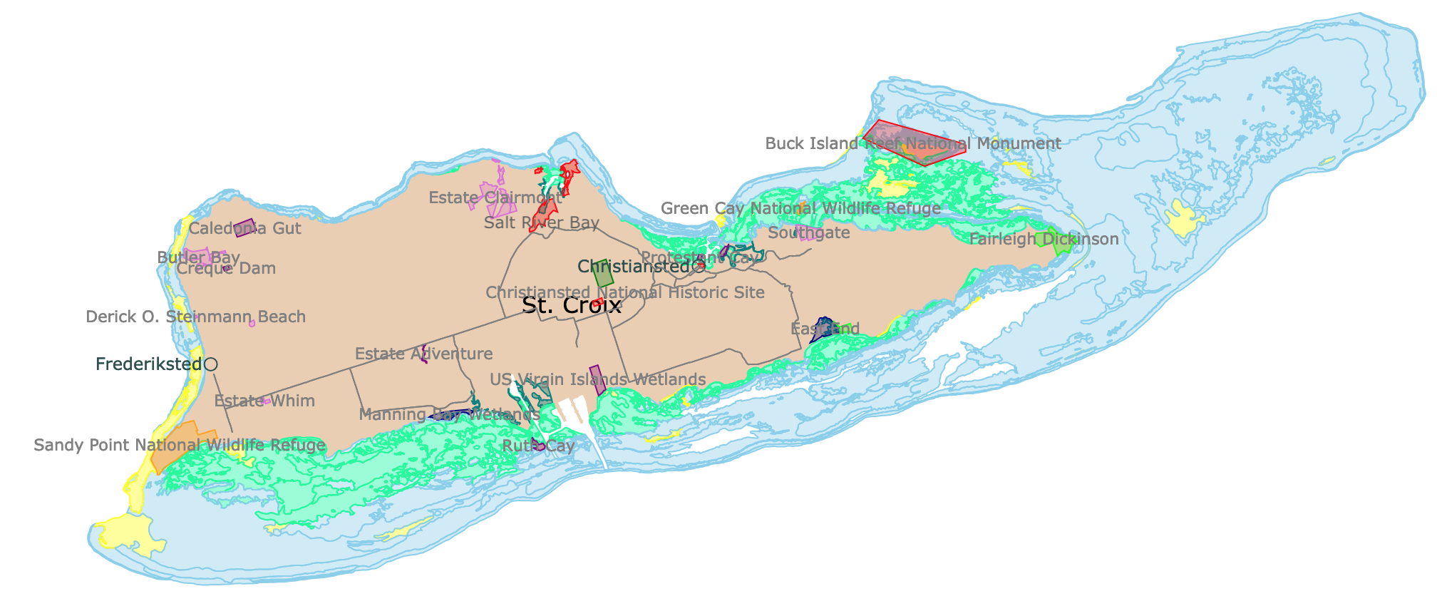
St. Croix
St. Croix is 42 miles (68Km) south of St. Thomas. It is the largest island, with 84 square miles. St. Croix is 22 miles long and a little over six miles at its widest point. The population is approximately 50,000 people.
The landscape is mainly rocky and arid in the east, with numerous cacti. The west end has beautiful and lush forests, with fruit trees and ferns growing around the hills.
St. Croix is mainly flat, thanks to its coral origin. Source: Caribbean Travel
Virgin Islands Wildlife
Iguanas, mongooses, feral donkeys, herons, bats, deer, pelicans, and hummingbirds are a handful of animals that call the Virgin Islands home.
Over a hundred species of birds, more than 20 mammals, and over 300 fish can be found throughout the Virgin Islands. That doesn't include reptiles and amphibians.
Hibiscus, poinsettias, and allamanda bloom throughout the lands. Banana, mango, and citrus trees grow in abundance.
Meanwhile, palm and caper trees are native to the islands.
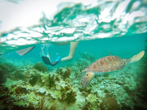
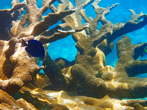
Thanks to the surrounding coral reefs, the waters around the islands are rich in all sorts of fish, including parrotfish, barracuda, snapper, and tarpon. There are also conch (large gastropod), turtles, lobsters, eels, sharks, and more! VINow
Interested in Coral Reefs? Visit this map of Coral Reefs
Virgin Islands Climate
The Virgin Islands experience a tropical climate with average daytime temperatures of about 82℉ (28℃) in January and 88℉ (31℃) in July. The nighttime temperature drops down about 11℉ (6℃), making it cooler at night while relatively humid.
According to US News Travel, the best time to visit the U.S. Virgin Islands is between April and June, when there isn't a lot of rain. July through October is the Island's hurricane season, so it's best to avoid traveling then.
U.S. Virgin Islands National Parks and Protected Areas
Virgin Islands National Park
This National Park is the large red area in St. John and small areas on St. Thomas.
The park is open daily year-round. The visitor center is in Cruz Bay.
From the peaks of St. John's mountains to the mangrove shorelines and beaches to the algal plains, and offshore seagrass beds, this tropical island is protected by the National Park Service.
Virgin Islands NP Dryland
Virgin Islands National Park offers over 7,000 acres of the terrestrial environment, covering around 60 percent of the island's area.
The Virgin Islands National Park has a rich ecosystem, providing habitats for numerous animals and over 700 species of plants.
While more than 20 mammals live on the Virgin Islands, the bat is the only native mammal to St. John. Some species of bats are crucial pollinators for the floral and edible plant life on the island. They also help disperse seeds throughout the forests.
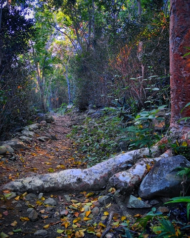
The environment is engaging in the way that you can hike from moisture-filled forests to dry cactus scrublands in a matter of minutes.
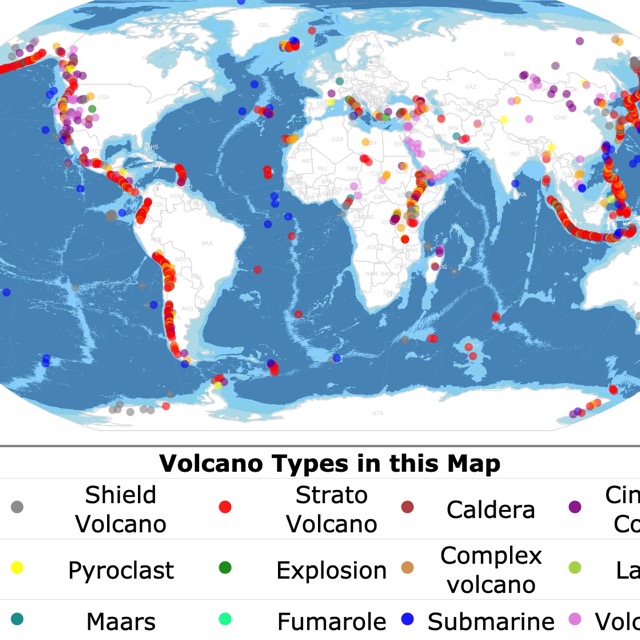
St. Thomas and St. John have a volcanic origin. To learn more about volcanoes, visit this map
Virgin Islands NP Marine Environment
The park also protects over 5,000 acres of adjacent submerged lands. It's all about protecting and preserving the area for tropical and migrating birds, fish, growing coral, and various other marine life and plants.
The coastal mangroves (represented in teal on the map) and seagrass (represented in light green on the map) support the surrounding marine ecosystem. The plants stabilize the shorelines providing crucial habitats for aquatic invertebrates and fish.
The islands are home to around 50 corals species, various gorgonians, and sea sponges. Therefore, St. Johns and the other islands provide excellent snorkeling and diving opportunities. Coral and hard bottom is the large area represented in light blue on the map.
Activities at the Virgin Islands NP
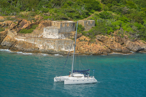
The diverse beaches, historic ruins, coral reefs, and hiking trails provide countless exploration and outdoor recreation hours.
Swimming, scuba diving, sailing, kayaking, windsurfing, camping, hiking, bird watching, and picnics are merely a part of the adventure.
Spend the day on the pristine crystal blue waters on a day-sail charter. Visitors who want to dive in can sign up for snorkeling tours. For those looking for more of a terrestrial experience, the 2-hour island safari tour is worth looking into.
Hikers and backpackers can hike throughout the mountain to the beautiful sandy beaches while exploring sugar-mill ruins and petroglyphs. The recreational opportunities are endless, the food is delicious, and the experience is unforgettable.
Visitors can make camping reservations for the Cinnamon Bay Beach & Campground. The campground features a short but beautiful nature loop and boardwalk. Take a short walk from your campsite, stroll across the warm white sand, and dip your feet in the clear blue waters.
Before you rent a car, remember you must drive on the left side of the road! Source: NPS Virgin Islands.
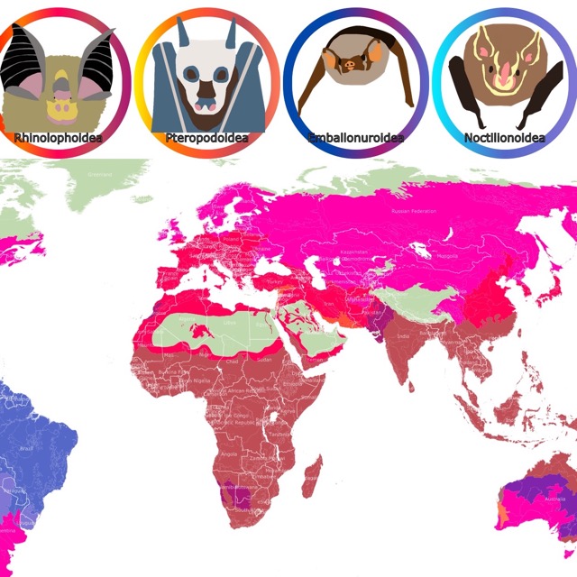
Bats are the only endemic mammals of St. John. To learn more about bats, visit this map
St. John's Best Beaches
Traveling to St. John's National Park would not be complete without the best beaches. They are all on the island's northern side and within the park's boundaries. If you can visit them at night, they might glow thanks to bioluminescent plankton!
Here is a list from west to east. To see them on the map, you just need to zoom in.
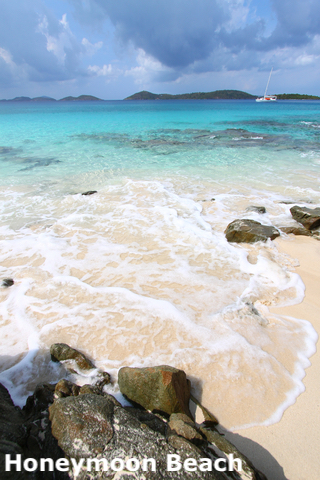
- Caneel Bay: Caneel Bay has a private resort on lease to the National Park Service. Honeymoon Beach is next to the resort, and it is one of several beaches of Caneel Bay. The beach is shaded by coconut trees, and the sand is white and soft. The water is shallow and clear. There beach has kayaks and paddle boards for rent. As seen on the map, this beach is not far from Cruz Bay.
- Hawksnest: The beach is narrow and shaded by sea grapes. Due to its location, this beach is not very calm and not very crowded.
- Denis Bay: This is a beautiful beach, but it needs a short hike to reach it. Therefore, it is not very crowded.
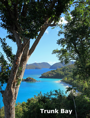
- Trunk Bay: This is St. John's most famous beach and one of the largest. Besides amenities like bathrooms and food, there are white sand, beaches, blue water, tall palm trees, and a cay off the shore. This beach has an is an entrance fee.
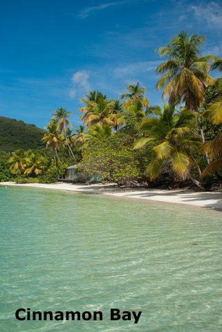
- Cinnamon Bay: This is St. John's longest beach. The beach also has a cay off the coast. As mentioned before, visitors can camp here and wake up at the sight of a beautiful beach. There are bathrooms, restaurants, and watersports rentals.
- Maho Bay: This is not just a beautiful beach. It is conveniently close to the road, perfect for people with limited mobility.
Best Snorkeling in St. John
St. John stands out for the amount and quality of shallow water for snorkeling as it is easy to access from its beaches. Just be mindful and go to areas within your swimming abilities.
- Caneel Bay: Honeymoon Beach in Caneel Bay is great for families that wish to snorkel. There are rays, conch, tropical fish, and different types of coral like elkhorn, brain, lettuce leaf, and mustard hill.
- Trunk Bay: This bay is a great site for kids to snorkel. Trunk Bay is home to an underwater snorkeling trail! The trail is 8 to 15 feet deep and it even has a lifegard on duty. The reef goes beyond the cay, but the further visitors go, the stronger the currents will get. There are different corals, Yellowtail Snapper, Atlantic Blue Tangs, Damsel Fish, and Wrasses.
- Cinnamon Bay: The bay has rock crevices covered with gorgonians, sea fans, anemones, and more. There are also crabs and lobster.
- Maho Bay: Great for Kids as there are lots of seagrass, rays, and turtles to see. The depths range between 4 to 12 inches, and there aren't many waves.
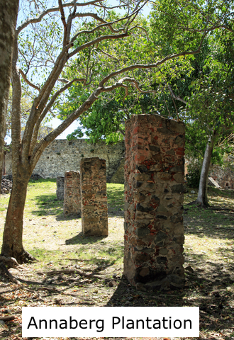
- Leinster Bay: Near the east end of Leinster Bay is Waterlemon Cay. You will find some of the most extensive plantation ruins in the U.S. Virgin Islands close the beach. Once you get in the water, you will see rays, turtles, cushion starfish, gorgonians, long spine urchins, and nurse sharks. Watch out for the strong currents!
- Haulover Bay: There is a Haulover North that is great for advanced snorkelers because the currents are strong. Haulover South has sandy beaches, pebble beaches, and underwater boulders with submerged caves! Snorkelers can see conch, hard corals, and large Jacks.
- Hansen Bay: The bay is on the eastern end of St. John Island. The beach is just off the road, there are seagrass beds, and not too far from the beach, there is a patch of a reef with soft and hard corals and tropical fish; St. John.
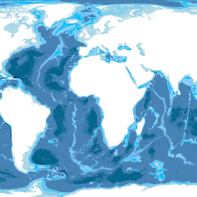
Curious about the ocean bottom in the Virgin Islands? Visit this map of Ocean Depth
Hassel Island
Hassel Island is the long red island surrounded by St. Thomas. This is a historical park rich in history and culture.
The Danish once used the island to protect Charlotte Amelie harbor from attacks. Now it has ruins of fortifications, shipping, and coal stations.
The railway is one of the few steam-powered railways still preserved. The U.S. purchased what was once the St. Thomas Marine Railway from Denmark since it was needed for military operations.
The island had a U.S. Navy station operating during WWI and WWII.
The park walks you back in time to learn more about British, Danish, and American history; Hassel Island.
Virgin Islands Coral Reef National Monument
The Coral Reef National Monument is the large red area surrounding St. John.
The Virgin Islands Coral Reef Monument was explicitly designated to preserve and protect over 12,000 acres of submerged marine habitat adjacent to the Virgin Islands National Park.
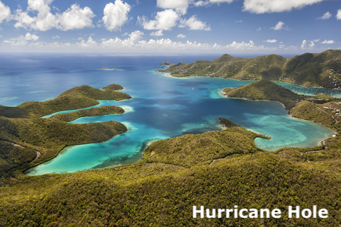
In the monument, visitors can explore the pristine mangrove habitat between Haulover and Mount Pleasant. This area is commonly known as Hurricane Hole. The mangroves within Hurricane Hole protect and support the habitats of various terrestrial and marine organisms. It was also a refuge for boaters during hurricane season, hence the name.
It was recently discovered that there were corals between the mangroves, and the trees protected them from bleaching. These are the first corals and sponges known to be living inside a mangrove ecosystem.
The monument has a high diversity of coral species. It is known the area is home to about 40 coral species.
Visitors have the opportunity to observe tropical wildlife, snorkel, boat, swim, and relax with nature;
If you wish to visit, make sure you wear coral-safe sunscreen. Natural SPF 30 Mineral Sunscreen Spray is non-allergenic, 30 SPF, and kid-safe. Because it is mineral and biodegradable. It does not pose a threat to corals.
Mangrove forests play an essential role in maintaining Coral Reefs alive. For more information on Mangroves, visit this map
Buck Island Reef National Monument
Reef National Monument is the red area surrounding Buck Island, north of St. Croix Island. The monument covers over 170 acres on the ground and below the sea.
You can follow the underwater trail through the coral reef if you decide to dive. It has signs to the most interesting structures and microhabitats.
Whether you are interested in hiking to the well-known crest of the island, marveling at the incredible coral reef underwater trail, or watching the waves roll in and fade back out, Buck Island Reef National Monument is the place for you.
The hardest parts will be deciding what to eat and what outdoor activities you will do first. Visitors enjoy snorkeling, private boating, and scenic trails; Buck Island.
Sandy Point National Wildlife Refuge
Sandy Point is the orange area in western St. Croix Island. The beach is about 2 miles. One of the longest in the Caribbean.
The Sandy Point National Wildlife Refuge provides vital nesting habitat for endangered hawksbill sea turtles, leatherback sea turtles, and the threatened green sea turtle.
According to the Sea Turtle Conservancy, the green sea turtle is likely to become endangered if things don't improve. Hopefully, the refuge and its volunteers will positively impact its status. The sanctuary has hundreds of volunteers assisting with the turtle recovery program; Conserve Turtles Sandy Beach.
The long sandy white beach and crystal blue waters are inviting. Unfortunately, the beach offers little to no shade or facilities. That in itself means the beach is less crowded.
Sandy Beac is only open on the weekends and if there's a cruise ship in port. From April to August, the beach is closed for turtle nesting season.
Magen's Bay
Magen's Bay is the purple area in northern St. Thomas.
Visitors love hanging out in the bay. The white sandy beaches and inviting water make the area excellent for swimming, paddleboarding, and kayaking.
This one-mile white sand beach is the most popular in St. Thomas.
The nature trail is perfect for hiking and wildlife watching.
Magen's Bay is the epitome of the perfect vacation spot for everyone. Visitors come alone, with their lovers, friends, and the whole family; Magen's Bay
Some of the Virgin Islands Regions are desertic. To learn more about arid areas, visit this map
Salt River Bay National Historical Park
This historical park is represented by the red polygons in northern St. Croix Island.
Salt River Bay Historical Park is only five miles from Christiansted National Historical Park; why not make an extended day of it and visit both?
The Visitor Contact Station is located on the hilltop overlooking the Columbs' Landing Site, where visitors can watch a presentation about the history and natural environment of the Salt River Watershed. The museum exhibit is the next stop, where the story of the island's ancient people is told.
After filling your mind, visitors like to sunbathe, snorkel, swim and have a lunch picnic in the shade.
If you plan to visit the Virgin Islands and swim on its shores, I suggest you get some of these items found on Amazon.
- Mask and Flippers: This snorkeling combo comes with a fog-free mask, flippers, and snorkel. The headband is made of silicone resistant to seawater and corrosion. The flippers reduce drag and fatigue.
- Action Camera: This HD action camera is perfect for the beach, snorkeling, and diving. It will help you record the incredible reefs of the islands and save special moments with your family while on holiday.
- Water Shoes: In the Virgin Islands, there is always an opportunity to get wet after a hike. These shoes make will make your walks dry and comfortable.
FOLLOW ME
Resources for Virgin Islands's Protected Areas Map
The shapefiles with Virgin Islands' boundary lines were downloaded from HDX.
The shapefiles with Virgin Islands' roads were downloaded from Hotosm.
The shapefiles with Virgin Islands' names were downloaded from Data.gov
The Parks and Public Lands shapefiles for the Virgin Islands were downloaded from USGS.
The coral reef and bottom type shapefiles for the Virgin Islands were downloaded from NCCOS.
The locations of the highest points were downloaded from Natural Earth.
The locations of major cities were downloaded from Berkeley.
This map will be updated with new data! To receive updates on this and more nature maps, join my email list!!!!!!!
Made by Luz K. Molina with D3.js.