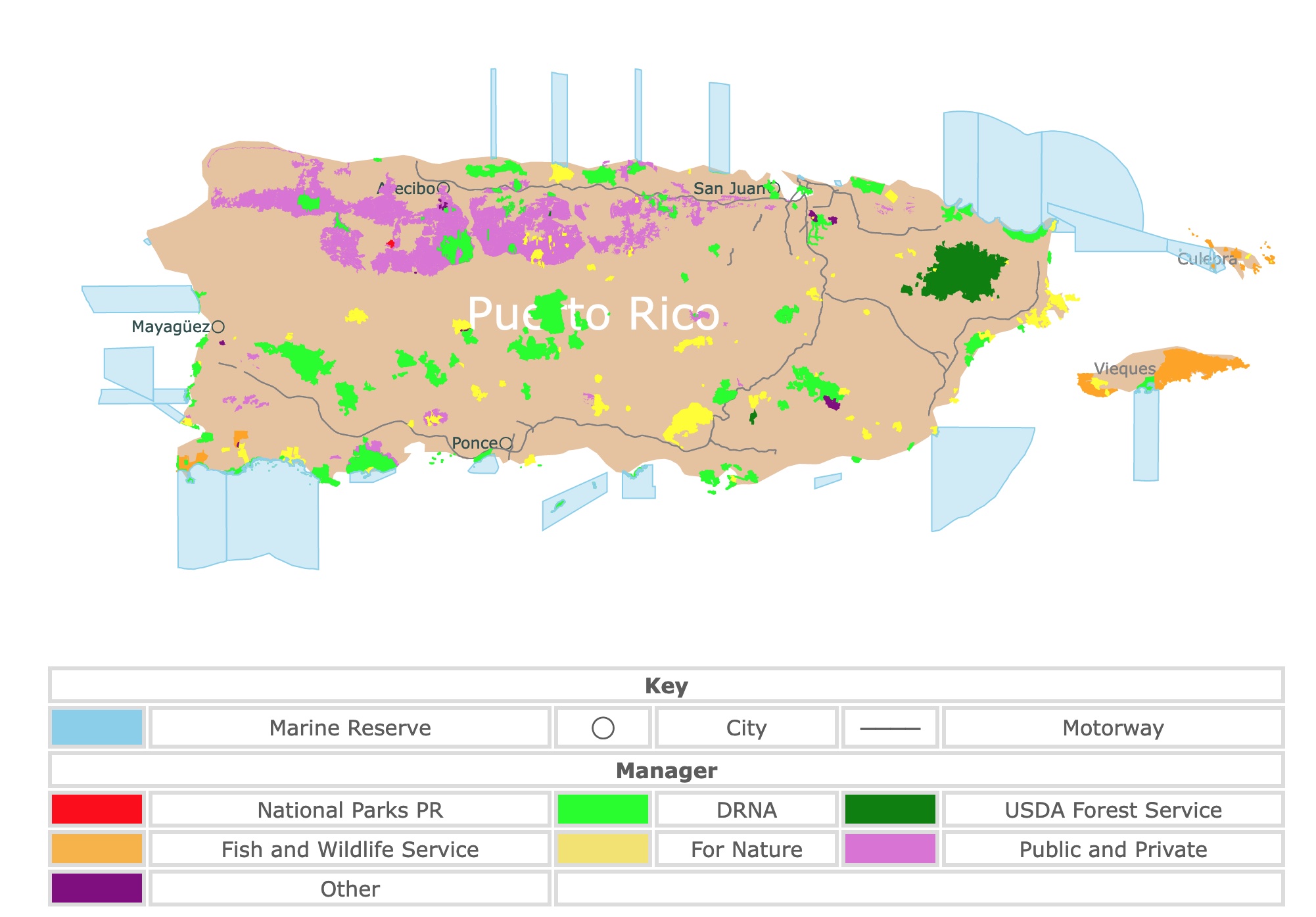
Map of Puerto Rico's Parks and Protected Areas
This interactive map shows the Locations, Names, Areas, and Details of National Parks, State Parks, National Forests, Tribal, and other Public Lands of Puerto Rico. It also shows major cities and rivers for context. For more detail, zoom in. For more information, hover over the map, or scroll down.
| Key | |||||
|---|---|---|---|---|---|
| Marine Reserve | ◯ | City | ──── | Motorway | |
| Manager | |||||
| National Parks PR | DRNA | USDA Forest Service | |||
| Fish and Wildlife Service | For Nature | Public and Private | |||
| Other | |||||
Geography of Puerto Rico
Puerto Rico is a self-governing commonwealth island in the Caribbean and a territory of the United States. Puerto Rico is also known as "Isla del Encanto" which translates as Enchantment Island or Enchanting Island. Furthermore, the people from Puerto Rico call themselves "Boricua".
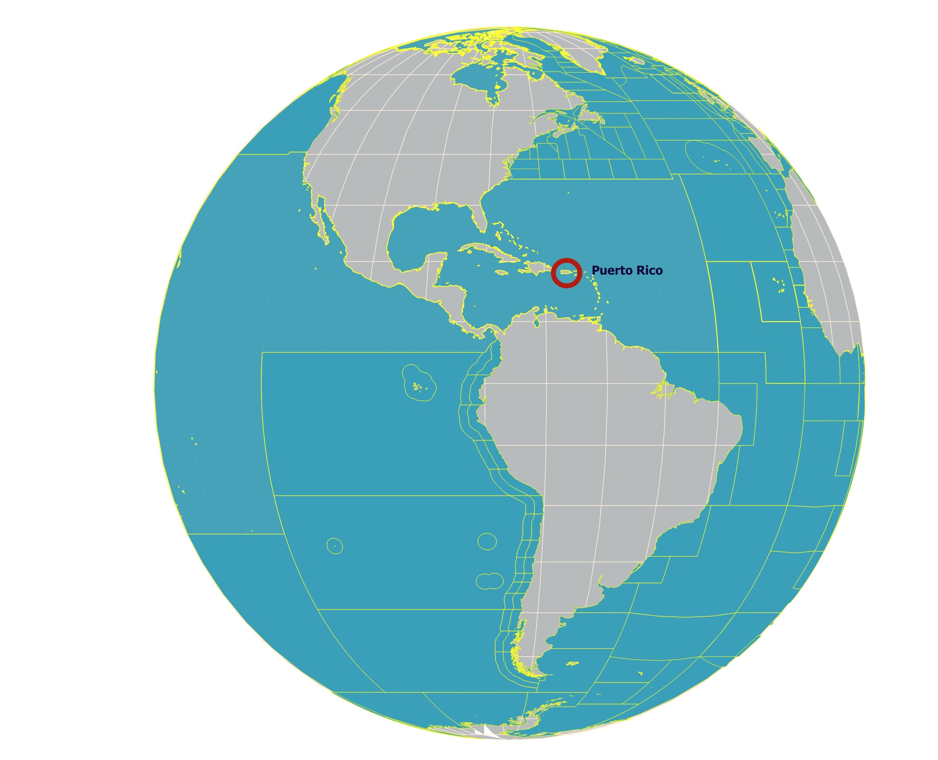
Puerto Rico is the easternmost island of the Greater Antilles. Puerto Rico is only 50 miles (80 km) east of the Dominican Republic, 40 miles (65 km) west of the U.S. Virgin Islands, and 1,000 (1,600 km) southeast of Florida, United States.
Puerto Rico is situated between the Atlantic Ocean and the Caribbean Sea.
Besides the main island, there are two small islands just off the east coast called Culebra and Vieques, both administrative parts of Puerto Rico.
Puerto Rico's landscape is composed mainly of hilly and mountainous terrain. About one-fourth of the island is covered with steep slopes.
The "Isla Del Encanto's" highest mountain range is the Cordillera Central. It spans east to west and surpasses 3,000 feet (900 meters) in many areas. The mountain's slopes are somewhat gentle in the north but rise sharply along the southern coast.
The highest point on the beautiful island is Cerro de Punta reaching over 4,390 feet (1,338 meters).
The northwestern lowlands and foothills can be characterized by karst features. These are usually limestone landscapes, characterized by barren, rocky ground, caves, sinkholes, underground rivers, and the absence of surface streams and lakes.
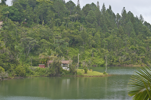
The Caguas Basin is located in the Grande de Loríza River Valley, south of San Juan. It's the largest of several mountain basins providing land for agriculture and settlements.
None of the rivers in Puerto Rico are large enough for navigation. However, several northward-facing rivers are harnessed for irrigation, hydroelectricity, and municipal water supplies.
Along the island's southern coast, irrigation is crucial because the Island's rain mainly falls on the northern-facing mountain slopes. This means that most permanent rivers flow from the middle of the island to the north and west coasts.
Puerto Rico's major rivers include the; Grande de Arecibo, Grande de Loríza, Grande de Añasco Rivers, and La Plata. Rivers coursing on the southern coast are dry for most of the year, with water only flowing after it rains.
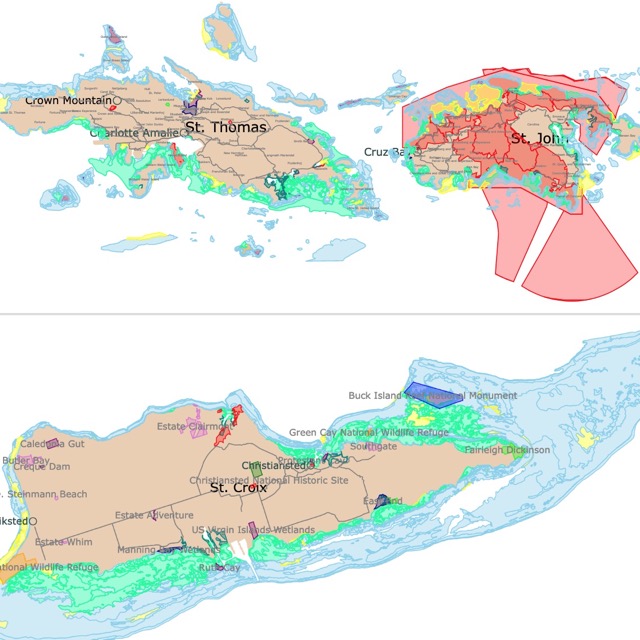
Want to find places to explore in nearby U.S. Virgin Islands? Check this map of U.S. Virgin Islands Parks
Puerto Rico's Climate
Puerto Rico is a tropical island with a tropical climate. The island experiences very few seasonal variations. However, local conditions will vary according to rain-bearing winds and elevation exposure.
The average daily temperature in Puerto Rico's lowlands is about 78℉ (26℃). However, the relatively high humidity makes the daytime temperatures feel warmer. The island's highland temperatures average a few degrees lower than the lowlands.
Rain falls every month in Puerto Rico, but the heaviest rainfall occurs from May to December. The island experiences hurricanes between June and November, so consider hurricanes before you plan your visit.
Puerto Rico's Wildlife
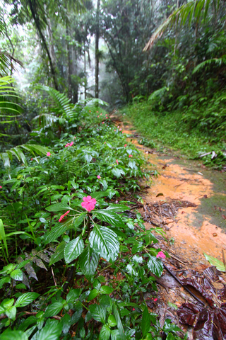
Plantlife is abundant and thriving. Tropical rainforests cover areas on the island's north side, while scrub vegetation and scrub dominate the drier southern side.
Edible trees and plants grow throughout the island, including pineapple, bananas, lemons, coconut, and citrus fruits. The scarlet and orange-flowered, royal poinciana or flamboyant, and African tulip trees are among the colorful flowering trees dotting the green backdrop.
Caribbean National Forest, southeast of San Juan, preserves the endangered small green Puerto Rican parrots and rare species of orchids. The island is home to over 200 species of birds.
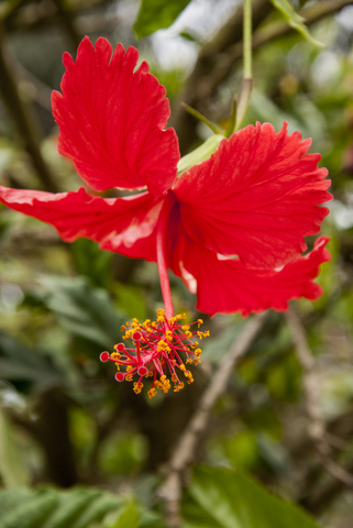
Flor de Maga is Puerto Rico's national flower. This is a common flower in most forests.
Land animals are mainly confined to lizards, nonpoisonous snakes, bats, mongooses, and the coquí frog. The coqui frogs begin singing their song “ko-kee”, at dusk, continuing throughout the night until dawn.
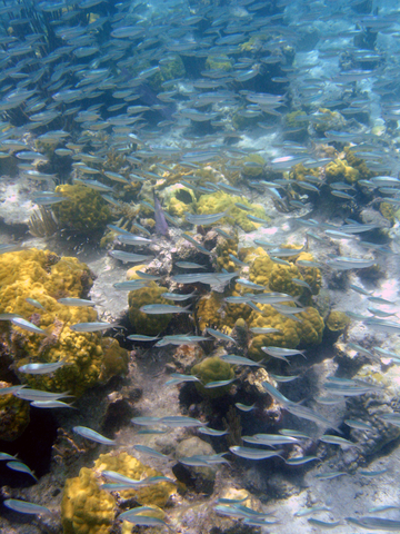
Numerous species of fish swim in the surrounding waters, both edible and inedible. Source: Animals.
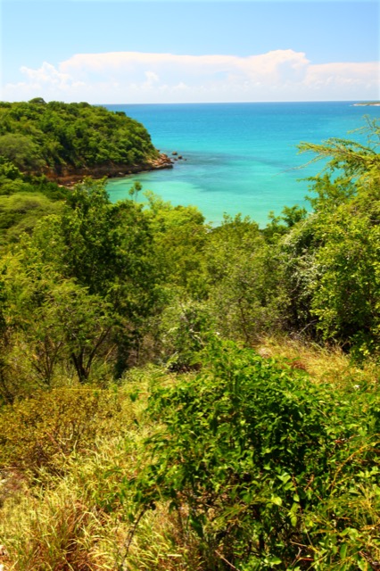
Puerto Rico has many tropical forests for visitors to explore. To learn more about them, visit this map.
Amazing Parks and Forests of Puerto Rico
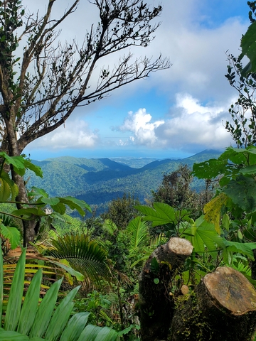
El Yunque National Forest
The large green area in eastern Puerto Rico is El Yunque National Forest. This forest receives about 600,000 visitors a year.
El Yunque National Forest is the only tropical rainforest in the U.S. National Forest Service system.
Initially set aside by the Spanish Crown, El Yunque is also one of the oldest forest reserves in the Western Hemisphere!
The park's name references Yuke, the island's indigenous Taíno people's word for "white lands" or "cloud lands".
The average rainfall in El Yunque is 120 inches, which provides a diverse ecosystem that hosts hundreds of unique animal and plant species, including the coquí frog, its famous inhabitant.
El Yunque is an excellent place to learn about over 200 plant species. This variety is thanks to the park's climate, which ranges from semi-desert to rainforest.
The park has over 50 bird species. Bring your binoculars and try to spot green mangos, woodpeckers, and the incredible Puerto Rican Parrot. The Puerto Rican Parrot is bright green with a red head. It is one of the most endangered species in the area.
The Yokahu Observation Tower is a popular site in the park. At an elevation of 1,575 feet, the view is worth the hike.
Several trail options are available, ranging in difficulty. Hike to one of the natural pools and enjoy a cool swim. La Coca Trail is an excellent hike that leads to a pond. Take the El Angelito trail for fun on a rope swing and dive into the lagoon.
There are also opportunities for horseback riding and picnics.
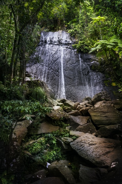
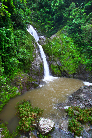
Visitors absolutely enjoy visiting La Coca Falls. It is a striking waterfall with a drop of 85 feet (26 meters)! These falls are even more spectacular during the rainy season, El Yunque.
If you are looking for birdwatching binoculars, here is the link to Adorrgon binoculars found on Amazon. These are large, lightweight (1.1 pounds), waterproof, perfect for a hike in the El Yunque rainforest. These powerful binoculars are 12x42mm and deliver 367ft/1000yds large field of view. They also include a tripod and a phone adapter!
Guanica State Forest (Bosque Estatal de Guanica)
Bosque Estatal de Guanica is the lime area west of Ponce, in southestern Puerto Rico.
Guanica State Forest is a United Nations International Biosphere Reserve that comprises about 9,000 acres of land.
This coastal forest has several mangrove cays. Nevertheless, what makes it exceptional is that it is one of the most extensive tropical dry forests and the best of its kind in the Caribbean.
The average temperature is 77.5 °F (25.3 °C), and the average annual rainfall is 31in (791 mm).
The park has 9 local bird species, 700 plant species, and 16 plant varieties found only in the area; Lacgeo.
El Bosque Estatal de Guanica features 12 trails, varying in length and difficulty. The park is a birdwatcher's paradise with various beautiful exotic birds. Guanica's forest contains over 600 species of fauna and flora, including 48 endangered animals.
Obviously, the park offers an abundance of natural beauty and exciting wildlife. Still, Guanica State Forest is an excellent place for recreational activities like biking, hiking, climbing, swimming, and various water activities.
Cayo Aurora, also known as Gilligan's Island, is a tiny island part of the Biosphere. Cayo Aurora is an incredible spot for swimming, snorkeling, sunbathing, and countless beach/ocean activities.
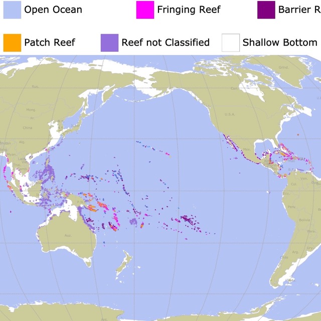
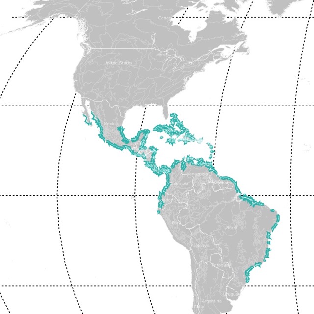
The Caribbean has many reefs worth visiting. This map shows you where they are.
Vieques National Wildlife Refuge
Vieques National Wildlife Refuge is the orange area on the long island 6 miles east of Puerto Rico.
The refuge comprises 17,771 acres of land. It is one of the most ecologically diverse wildlife refuges in the Caribbean.
Vieques is home to Mosquito Bay. According to Discover Puerto Rico, Mosquito Bay is recognized by the Guinness World Records as the brightest bioluminescent bays in the world!
Vieques Refuge is comprised of habitats including coastal lagoons, beaches, mangrove wetlands, and upland forests.
The land is home to endangered animals and plants like the brown pelican, Antillean manatee, and four species of sea turtles.
No trip to this island is complete without exploring Fortín Conde de Mirasol. The small fort is the last one built by the Spaniards.
Visitors can visit the art and history museum full of Caribbean artifacts, historical records, info on the sugarcane industry, and more. An exhibition displays how the people of Vieques fought the United States Navy. Admission to the Fort Museum is free; however, donations are appreciated.
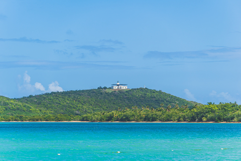
Reserva Natural Cabezas de San Juan
Cabezas is the yellow tip in the northeastern peninsula of Puerto Rico, Puerto Rico.
Cabezas de San Juan is comprised of mangroves, dry forests, coral reefs, sandy and rocky beaches, and a bioluminescent lagoon. It isn't often you can visit these ecosystems in such a small area.
The park features night and thematic tours by trolley, bike, and kayak.
The historic lighthouse "El Faro de las Cabezas de San Juan" is Puerto Rico's oldest lighthouse. El Faro was recently restored, which is the highlight of many tours.
All tours are led by an environmental interpreter who will teach you all about the landscapes, ecosystems, and wildlife reserve. The park offers special events and workshops and volunteer and Citizen Science educational opportunities all year; Cabezas de SJ.
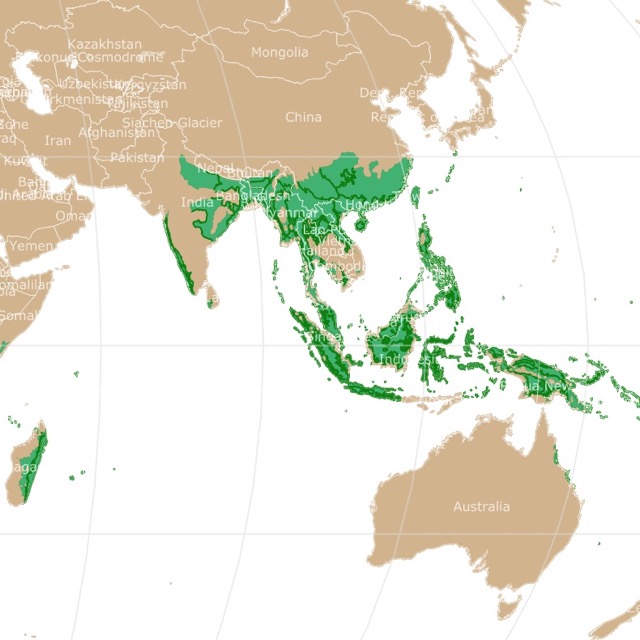
Puerto Rico has a few Mangrove Forests. This map shows where else they are found worldwide.
Cavernas del Rio Camuy (Camuy River Cave Park)
Rio Camuy Cave Park is situated in the northwestern region of Puerto Rico. The park is the red speck southwest of Arecibo.
Reaching the park takes about 1 hour and 20 minutes. The main entrance to the park can be found in the Quebrada area of Camuy.
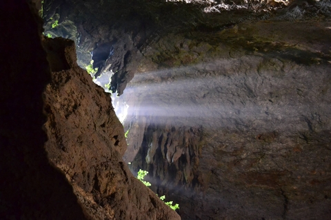
According to an article published by the New York Times, Río Camuy's underground river is the third-largest underground river in the world.
This is a limestone cave system. To date, over 10 miles of caverns, 17 entrances, and more than 200 caves have been mapped.
There may be other 800 caves in this underground cavern system. Only a small portion is open to the public, but that small amount is worth the trip.
The main chamber is massive. Some tunnels are as high as 170 feet (51m) and as wide as 200 feet (60m). While you walk through, you may hear water running and bats flying!
Depending on the time of day and the weather, sun rays come through Sumidero Empalme (Emapalme Sinkhole), flooding part of the caverns with light.
The park RÍo Camuy Cave Park is open Wednesday through Sunday, 8 a.m. to 3 p.m. Camuy Caverns.
Culebra National Wildlife Refuge
Culebra Beach National Wildlife Refuge is the orange area on Culebra island, east of Puerto Rico.
Portions of the Culebra Archipielago were designated for naval and lighthouse purposes. Several of the small islands in the area were used for bombing and gunnery practice by the Marine Corps and U.S. Navy until the late 1970s.
In 1983, approximately one-quarter of the Culebra archipelagos encompassed the Culebra National Wildlife Refuge.
Culebrita and Cayo Luis Pena welcome visitors for excellent snorkeling, diving, birdwatching, and photography opportunities. The island has some of the healthiest coral reefs in the Caribbean.
Isla Culberita is a smaller uninhabited island featuring six small beaches, including Playa Tortuga. The old lighthouse is the only structure on Playa Tortuga.
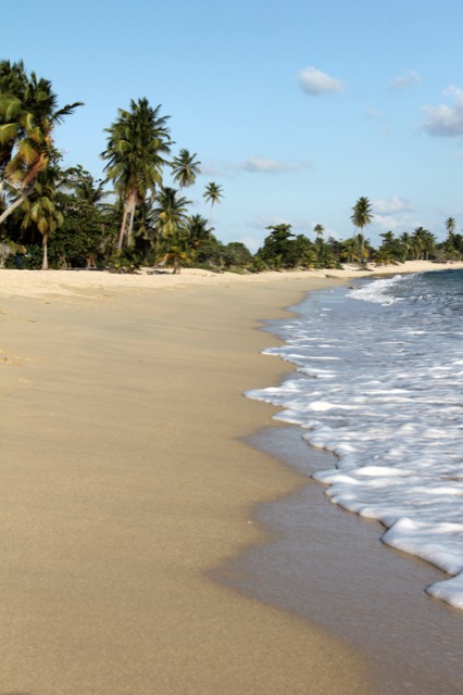
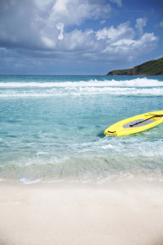
Right next to the refuge is Flamenco Beach. This is regarded as one of the most beautiful beaches in the world. It has white sands and turquoise waters.
The park is only accessible by private boat or water taxi; Culebra.
Coral Safe is an option for you if you want a coral-safe mineral sunscreen. This sunscreen is available on Amazon. It is fragrance-free, non-allergenic, and comes with a spray. You can check it out here!
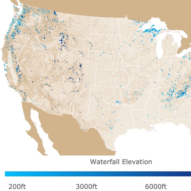
Puerto Rico has numerous waterfalls. To find more, visit this map.
Bosque Estatal de Tres Picachos
Los Tres Picachos State Forest is the large lime area in the middle of Puerto Rico. The name comes from the 3 peaks that stand out from the mountains.
Tres Picachos is one of 20 forests comprising Puerto Rico's public forest system. The park is located in the Cordillera Central or Central Mountain Range. This is one of the island's highest mountains reaching 3,953 feet (1,204m).
Visitors will find nothing but a beautiful and enchanting forest with a single trail leading to two out of the three peaks of Los Tres Picachos Mountain. This strenuous hike can be risky due to the crumbling slopes. These slumps are a consequence of heavy rains in the area.
You won't find a single structure, parking, and sanitary services. The closest town to Bosque Estatal is Coabey in Jayuya.
If you plan on visiting the park, make sure to visit the main waterfall, Las Delicias, accessible through PR-149. Parking spots are limited to four, and the trip is a short scramble through rocks, but it's worth the trip; Tres Picachos.
Bosque Estatal Toro Negro
The lime specks south of Tres Picachos in the middle of Puerto Rico, is Bosque Estatal Toro Negro.
This forest rivals El Yunque in beauty, but it is lesser-known.
The vast and lush forest includes about 11 miles (18 km) of trails leading to a beautiful path. The journey is worth the hike as it leads to a vast forest and cold ponds.
Points of interest include the Doña Juana Waterfall and the highest point on the island, Cerro Punta, at 4,390ft (1,338m) above sea level. There are also swimming holes, rivers, orchids, and camping facilities.
The observation tower sits atop the Cerro Doña Juana. The climb leads visitors to some excellent views Puerto Rico has to offer; Toro Negro.

Puerto Rico is surrounded by sea. To learn more about its waters, visit this map of Marine Ecoregions.
Bosque Estatal de Carite
Bosque Estatal de Carite is the lime area in southestern Puerto Rico. This Puerto Rico forest extends through five municipalities of the enchanted island.
The forest was created to protect the watersheds of local rivers affected by erosion. Its creation also resulted in a refuge for wildlife. The forest is home to 49 bird species, 15 amphibian species, 7 mammals, and 204 tree species Carite.
One of the more popular locations is the Charco Azul swimming hole. A 20-minute hike through the pristine forest leads to the beautiful blue swimming hole, that's the perfect temperature to dive in.
The miniature waterfalls provide a peaceful and serene setting for many outdoor activities. When hunger strikes, take a drive to the mountain town of Cayey for an incredible Puerto Rican meal at the lechoneras of Guavate.
Reserva Natural Corredor Ecologico del Noreste
The reserve is the lime belt in Purto Rico's northeastern corner.
The reserve consists of 3,000 acres of land including La Selva, San Miguel, Las Paulinas, Colorá, and El Convento beaches.
Needless to say, there is a wealth of outdoor recreational opportunities available on the sandy beaches, in the water, and throughout the forest.
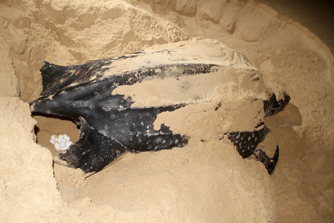
This safe haven is home to diverse natural ecosystems, including wetlands, mangroves, coastal forests, seagrass meadows, coral reefs, and a bioluminescent lagoon. Not to mention miles of beaches serving as habitats for over 50 rare, endangered, threatened, and critical species.
Its beaches are some of the most important in the U.S. They are where leatherback turtles lay their eggs. Leatherbacks are the largest turtles in the world!. Source: www.corredorecologicodelnoreste.org
Visitors enjoy kayaking, snorkeling, scuba diving, guided trail tours, surfing, camping, bird watching, and environmental interpretation guides. Step outside the park and visit the urban areas of Luquillo and Fajardo to find various shops and services.
For more information about the forest service, visit this map of forests and grasslands of the U.S.
Reserva Natural Isla Caja de Muertos
Caja de Muertos is the small lime island southeast of Ponce. Caja de Muertos, is also known as Coffin Island.
The name is attributed to the French writer Jean Baptist Labat, who said that the island looked like a corpse from afar.
Cayo Morrillito Cay and Cayo Berberia Cay Keys are included in this natural reserve.
While Coffin Island sounds intimidating, it's an enchanting, secluded, and uninhabited nature reserve with incredibly picturesque backdrops.
Visitors come from around the United States and Puerto Rico to reconnect with nature and escape the crowded, noisy cities.
Interest points include the pier and the lighthouse. The island offers opportunities to go diving, hiking around the island, kayaking the island's northern coast, and enjoying all the beach activities provided.
The island was designated a natural reserve in 1980 to protect its natural habitats.
Caja de Muertos is a sanctuary and safe haven for endangered birds, turtles, and marine life. The unique flora and fauna make the nature reserve an exceptional place.
Visitors can enjoy beach activities, hiking trails, exploring a lighthouse, and traversing a cave.
Historically the island was a shelter for pirates and is home to petroglyphs inside the caves. Some even say the island inspired Treasure Island; Caja de Muertos.
No matter which park, forest, or beach you visit, you are likely to look for a spot to sleep or rest. Wise Owl camping hammock found on Amazon is perfect for your next adventure in Puerto Rico. It comes in different colors, is light and fits 2 people. For more details, visit this link!
FOLLOW ME
Resources for Puerto Rico's Protected Areas Map
The shapefiles with Puerto Rico's boundary lines and cities were downloaded from Natural Earth Data.
The shapefiles for protected Natural Areas are from Protected Areas Conservation Action Team. 2018. Puerto Rico Protected Areas Database [version of December, 2018]. GIS data. San Juan, PR. and were downloaded from USDA.
The shapefiles of motorways in Puerto Rico were downloaded from HOTOSM.
This map will be updated with new data! To receive updates on this and more nature maps, join my email list!!!!!!!
Made by Luz K. Molina with D3.js.