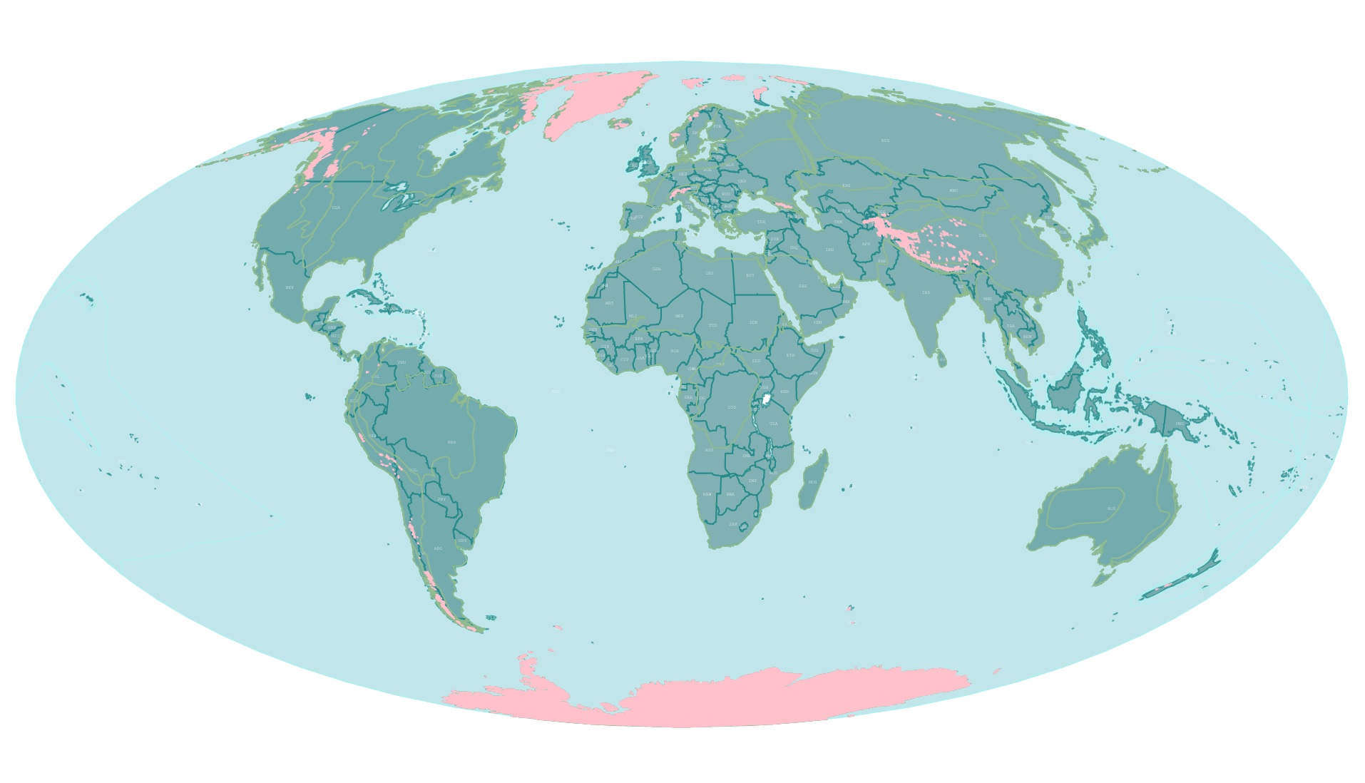
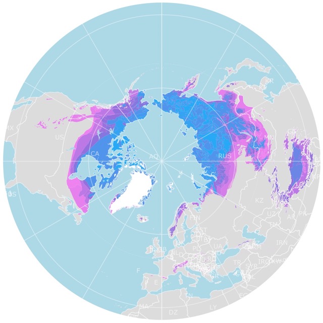
Map of Glaciers Worldwide
This interactive map shows the location of glaciers worldwide. The glaciers are displayed in pink. Country and Region borders are included for reference. Hover over the map for Glacier name or Region. Zoom in for more detail. Scroll down for more information.
Glaciers
Glaciers are layers of fallen snow compressed into large ice masses over many years. These layers can only accumulate when snow stays long enough to turn into ice.
Glaciers form where mean annual temperatures are close to the freezing point. Winter precipitation results in significant amounts of snow, and summer temperatures do not melt all the snow accumulated in the previous year; NSIDC.
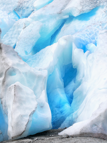
Glaciers may have crystalline ice, rock, sediment, and even liquid water! Glaciers form on land and move down a slope due to gravity and their own weight. Because of this, glaciers could be viewed as frozen rivers.
A glacier's content may change its color. A lacier appears white because the snow in it still has a lot of air bubbles. It seems blue once it becomes dense and all the air pockets are squeezed out.
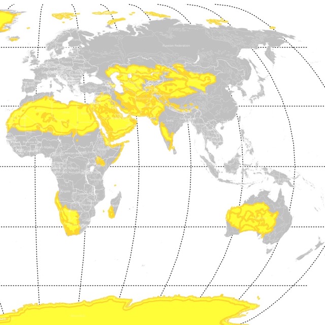
The Antarctic is not just covered in glaciers, but it is also considered the largest desert. To learn more, visit this map of deserts
Glaciers and Geography
Glaciers occupy about 10% of the world's land area. Some glaciers are small, like football fields. Others are hundreds of miles long.
Glaciers can reshape a terrain. Their size and movement have had an acute effect on the world's topography.
Tons of ice can change a landscape as it grinds the terrain. U-shaped valleys are an example of how glaciers carved land during the Ice Age.
Fjords are long narrow coastal valleys common in Norway and also carved by glaciers.
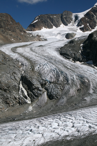
Glaciers not only sculpt the land beneath them. They also transport material as they move. They carry rocks and soil to different places. For example, this debris forms moraines along their sides.
Where are Glaciers Found?
Glaciers are found worldwide except in Australia.
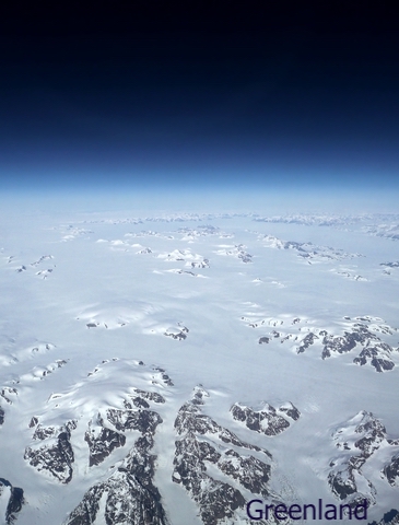
Most glaciers are located in Antarctica, Greenland, and the Canadian Arctic. They are also found on high mountains and in Alaska.
These are the percentages per continent:
- 91% in Antarctica
- 8% in Greenland
- Less than 0.5% in North America (about 0.1% in Alaska)
- 0.2% in Asia
- Less than 0.1% are in South America, Europe, Africa, New Zealand, and Indonesia

Erosion and melting of glaciers also form lakes. To learn more about lakes, visit this map of Lakes and Ponds in the U.S.
The Ice Age and Glaciers
The Earth has had warm periods and cold periods throughout its history. The last glacial period began around 100,000 years ago and lasted until 25,000 years ago.
The epoch when the last glaciation occurred is called the Pleistocene. This geologic epoch started 2,580,000 years ago, ending 11,700 years ago. The Late Pleistocene is when the Ice Age began.
During the last Ice Age, most of the northern hemisphere was covered in ice and glaciers. The sea was shallower, about 400 feet (122m) lower than today.
Many glaciers are remnants of the last Ice Age. During the Ice Age, 32 percent of the world's land area and 30 percent of the oceans were covered by ice.
Some Canadian Arctic ice caps are over 100,000 years old! While some glaciers in Alaska are 700 years young, I mean old.
Glacier Types
According to NSIDC, these are the different types of glaciers:
- Mountain Glaciers are found in high mountains.
- Valley Glaciers originate from mountain glaciers or icefields that spill down valleys. They look like tongues and flow down, sometimes reaching sea level.
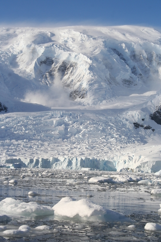
- Tidewater Glaciers flow out to reach the sea. These glaciers are responsible for calving (splitting or shedding a smaller mass of ice) icebergs.
- Piedmont Glaciers are steep valley glaciers that spill into flat plains. There, they spread out into bulb-like lobes.
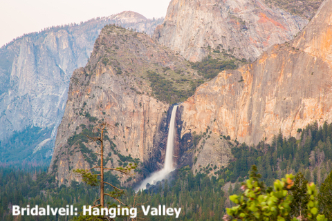
- Hanging Glaciers are the result of retreating glaciers that leave behind tributary glaciers in smaller valleys above. When melted, they leave behind hanging valleys.
- Cirque Glaciers reside in a basin and tend to be wide rather than long.
- Ice Aprons are small glaciers that cling to mountainsides. They are wider than long, and often cause avalanches.
- Rock Glaciers are a mixture of ice and rock.
- Ice Caps are small ice sheets shaped like domes, covering less than 19,305 square miles (50,000 square kilometers). They form in polar and sub-polar regions and flow in all directions.
- Ice Fields are smaller than ice caps. They flow according to the topography.
- Ice Streams are like belts of ice that flow faster than the ice on their sides.
- Ice Sheets are only found in Antarctica and Greenland. These are enormous masses of glacial ice. During the Ice Age, vast ice sheets covered Canada and Scandinavia.
- Ice Shelves happen when ice sheets extend over the sea. Ice shelves surround most of the Antarctic continent.
Permafrost is ice underground, and it is also melting. To learn more, visit this map
Amazing Glacier Facts
These glacier facts were gathered from USGS:
- In 2011 there were 27,000 glaciers in Alaska.
- The largest glacier in North America is the Bering Glacier in Alaska. It is 127mi (204Km) long.
- Antarctic ice shelves may split into icebergs 50 miles (80km) long.
- The largest glacier is Lambert Glacier in Antarctica. It is 62mi (100Km) wide, 248mi (400Km) long, and 1.5mi (2.5Km) deep.
- Greenland ice sheet can reach 2 miles (3.2Km) in thickness.It is so heavy that the land has been compressed to the point that it is below sea level in some areas.
- Parts of the Antarctic have been covered by glaciers for over 20 million years. The oldest glacier in Antarctica is about 1,000,000 years old.
- Not all of Alaska was covered by glaciers during the Ice Age. South of the Brooks Range, there was a corridor used by humans to move into North America.
- A glacier is a type of rock!
- The Kutiah Glacier in Pakistan moved about 7.4mi (12Km) in 3 months in 1953.
Glaciers' Importance
Glaciers are water reservoirs. When they melt in the summer, they contribute freshwater to ecosystems in dry months. This melt results in water available for plants and animals.
Because they are reservoirs of water, they provide drinking water to people. They can be used to irrigate crops and may help generate hydroelectric power.
Glaciers are indicators of a changing climate. Due to climate change and warming temperatures, glaciers are getting smaller every year.
Glaciers store 69% of the world's freshwater. If this ice melted, the sea would rise around 230 feet (70m).
Affiliate Disclosure
Databayou.com is a participant in the Amazon Services LLC Associates Program, an affiliate advertising program designed to provide a means for sites to earn advertising fees by advertising and linking to Amazon.com. Databayou.com also participates in affiliate programs with Clickbank, CJ, and other sites.
If you are interested in learning more about glaciers, you will like this book found on Amazon.
- Glaciers and Glaciation: It has an overview of glaciers' nature, origin, and behavior and the geological and geomorphological evidence for their past history on Earth.
FOLLOW ME
![]()
![]()
![]()
![]()
Resources for Glaciers Map
The Shapefiles for countries and glaciers were downloaded from Natural Earth.
Made by Luz K. Molina with D3.js.