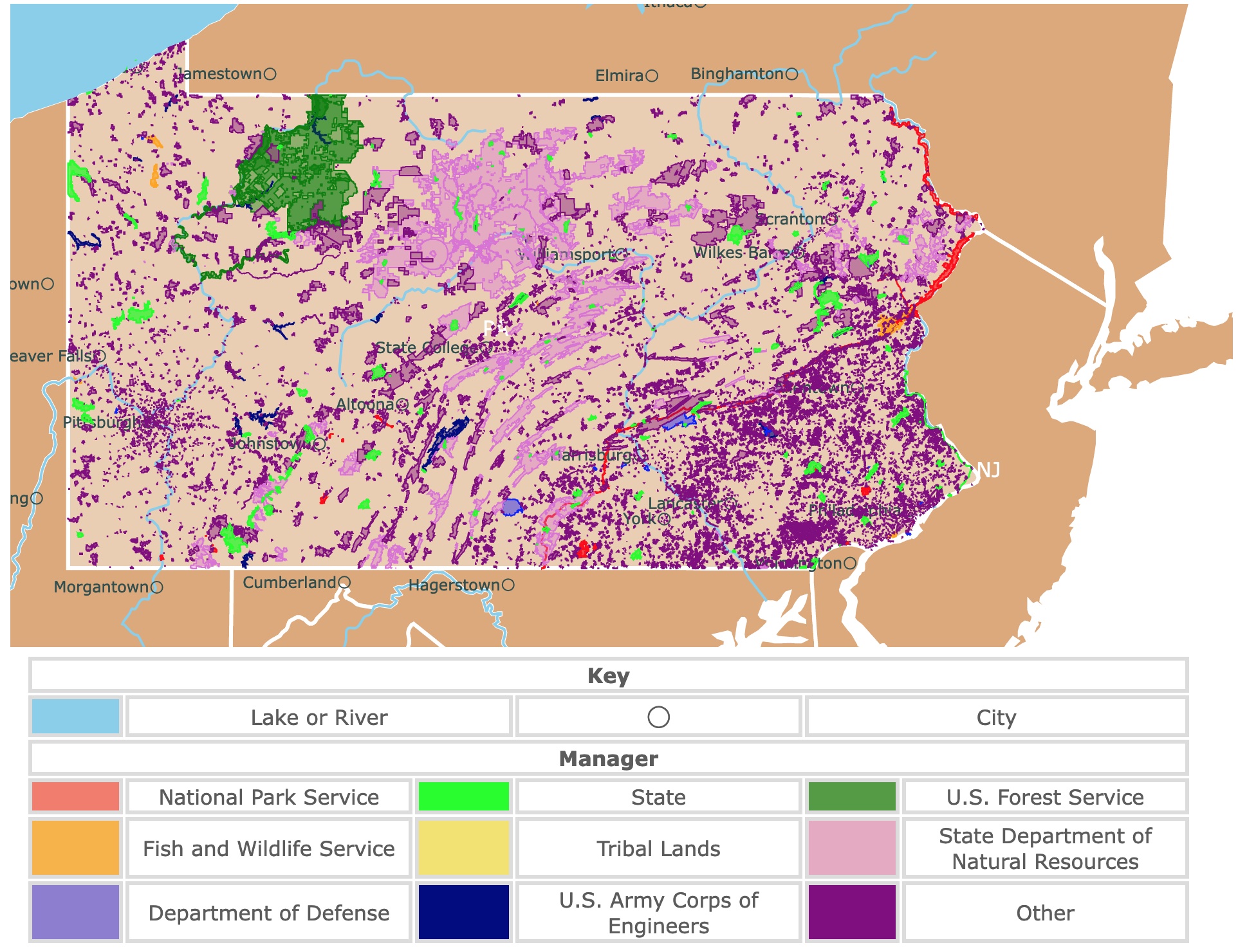
Map of Pennsylvania's Parks and Protected Areas
This interactive map shows the Locations, Names, Areas, and Details of National Parks, State Parks, National Forests, Tribal, and other Public Lands of Pennsylvania. It also shows major cities and rivers for context. For more detail, zoom in. For more information, hover over the map, or scroll down.
| Key | |||||
|---|---|---|---|---|---|
| Lake or River | ◯ | City | |||
| Manager | |||||
| National Park Service | State | U.S. Forest Service | |||
| Fish and Wildlife Service | Tribal Lands | State Department of Natural Resources | |||
| Department of Defense | U.S. Army Corps of Engineers | Other | |||
Pennsylvania's Geography
Pennsylvania is one of the original 13 colonies. The rectangular-shaped state stretches around 300 miles (480 km) from east to west and 150 miles (240 km) running north to south.
The state is bordered by Lake Erie and the state of New York along the north. New York and New Jersey to the east; Maryland, Delaware, and West Virginia in the south; and bordering the west is Ohio and the panhandle of West Virginia.
Pennsylvania comprises six physiographic provinces, from the sandy flatlands to the dissected plateaus and mountains.
- Appalachian Plateaus: This area is a dense forest. It covers the Allegheny National Forest, Pocono, and the Catskill Mountains.
- New England: It has steep hills and ridges.
- Piedmont: Characterized by caves, sinkholes, tower-shaped rocks, and rolling hills.
- Central Lowlands: This province is to the northeast, and it was formed by glaciers.
- Ridge and Valley: It has part of the Appalachian Mountains, and it is quite forested.
- Atlantic Coastal Plain: This is a low region with narrow valleys; NatGeo.
The Appalachian Plateaus, Piedmont, Ridge & Valley comprise over 98 percent of Pennsylvania.
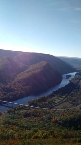
There are three major river systems in the state. In eastern Pennsylvania lies the Delaware River. The Susquehanna River is located in the central part of the state, and in the west is the Ohio River.
Minor systems lead into Lake Erie in the northwest part of the state and the Potomac River in the southwest.
The Delaware River is fed mainly by the Schuylkill and Lehigh rivers. The confluence of the Allegheny River (in the north) and the Monongahela River (in the south) helped form the Ohio River.
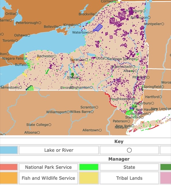
Want to find places to explore in nearby New York? Check this map of New York Parks
Pennsylvania's Climate
Pennsylvania typically experiences a humid continental climate characterized by wide fluctuations in seasonal temperatures. The average temperature in July is around 70℉ (21℃), and January's average is about 28℉ (-2℃).
According to Current Results, the average yearly precipitation in Pennsylvania ranges between 36.7 inches (931 mm) and 53.6 inches (1,360 mm), depending on the area of the state.
Pennsylvania's Nature & Wildlife
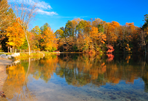
The land in Pennsylvania was once covered entirely by trees. By the 1900s, around three-quarters of the land was cleared away for farmland. However, much of the farmland has been abandoned since then, allowing forests to regrow. Half of Pennsylvania is now wooded again.

Pine, hemlock, beech, maple, and birch trees grow tall in the state's northern region. While in southern Pennsylvania, you'll find hickory, oaks, walnut, yellow poplar, and elm dominate the terrain.
Pennsylvania's abundant wildlife makes it a prime area for hunting. Rabbits, squirrels, and pheasants are some of the small game native to Pennsylvania. Deer and black bears are two large mammals that call the state home.
Pennsylvania's streams, lakes, and rivers are stocked with fish, including walleye and trout.
According to USA Today, there are 71 mammal species native to Pennsylvania. Unfortunately, 11 are no longer found in the area, including the gray wolf, lynx, mountain lion, wolverine, bison, moose, and marten.
Close to 400 species of birds are native to Pennsylvania, but almost 200 live there year-round.
Various species of amphibians and reptiles call the state home, including mud turtles, salamanders, rattlesnakes, non-venomous snakes, and mudpuppies.

Pennsylvania has many hardwood forests to explore. To learn more, visit this map
Best Parks and Natural Areas in Pennsylvania
Allegheny National Forest
This National Forest is the large green area in northwestern Pennsylvania, on the Allegheny Plateau. The forest comprises over 514,000 acres.
Allegheny National Forest is the Land of Many Uses, where the land is beautiful and protected, has a diversity of wildlife habitats, and excellent outdoor recreational opportunities.
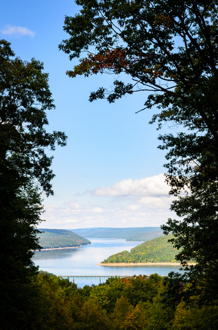
Allegheny National Forest comprises over 514,000 acres in northwestern Pennsylvania.
The park features more than 100-miles of OHV and ATV trails. Visitors will also find 76-miles of an interconnecting trail on the Marienville, Penoke, and Timberline Trails which provide a longer ride. Rocky Gap and Willow Creek are shorter trails for quick trips.
Waterfalls, rivers, creeks, and streams allow all sorts of water activities, including boating (motorized and non-motorized), swimming, tubing, scuba diving, windsurfing, and waterskiing.
Visitors will find various overnight accommodations at Allegheny National Forest. RV sites are available throughout the park at various campgrounds. Most of the sites for RVs have electric hook-ups aside from Kelly Pines.
Dispersed foot traffic and primitive camping are permitted almost anywhere in the park unless signs signify otherwise.
There is a wide array of campground sites for overnight stays. The Farnsworth Cabin is available to rent, and it includes two bedrooms. Allegheny has four group campsites designed to accommodate up to 50 people.
Boating, hiking, biking, birdwatching, wildlife observation, outdoor sports, water activities, and more await visitors at Allegheny National Forest.
Gettysburg National Military Park
The park is the red speck in southern Pennsylvania.
Tour the Gettysburg Battlefield and visit legendary landmarks along the way. Visitors can take a tour with a licensed guide by bus or car.
Gettysburg National Military Park Museum and Visitor Center should be every visitor's first stop at the park.
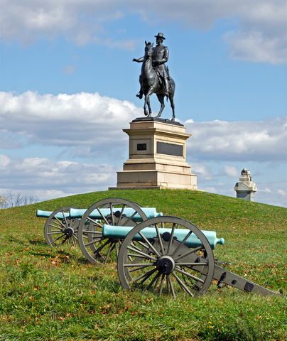
The museum and visitor center feature a park film, the iconic Gettysburg Cyclorama, and tons of educational information about the American Civil War and the Battle of Gettysburg.
According to Study.com, cycloramas are huge paintings made to be hung on a curved, concave wall within a larger structure.
Cycloramas create an illusion of surrounding space. During the mid-19th century, they were a popular form of entertainment. Cycloramas focused on famous military scenes, dramatic landscapes, and great battles. These paintings provided a 360° view of an event.
The park hosts special events providing unique opportunities and experiences. The Gettysburg Museum Bookstore features an extensive collection of books, memorabilia, gifts, and the Gettysburg t-shirt.
The Refreshment Saloon was modeled after a Civil War-era saloon. Visitors can enjoy leisurely dining. Stop into the Battlegrounds Cafe for a hot cup of coffee, snacks, and hot or cold meals.
While the park doesn't have any campgrounds or sites, visitors can find lodging at the historic Bushman House. The house is located in the park and was standing during the Battle of Gettysburg; Gettysburg.
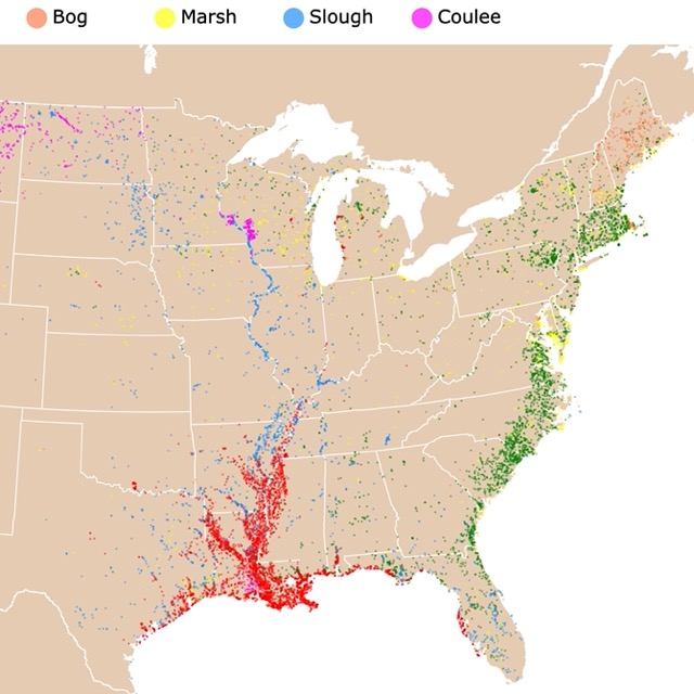
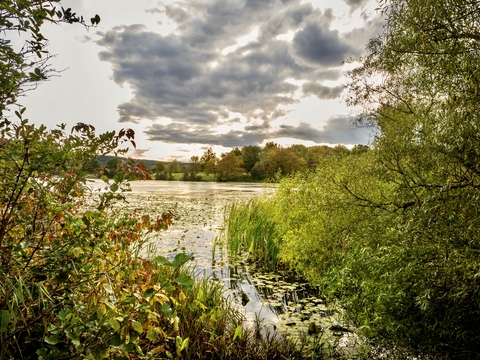
There are some wetlands and marshes in Pennsylvania worth exploring. For more information, visit this map
Ohiopyle State Park

Ohiopyle is the lime area in southwestern Pennsylvania. It is close to major metropolitan areas and offers various outdoor recreational opportunities.
The park encompasses 20,500 acres of natural beauty that serve as a gateway to the Laurel Highlands.
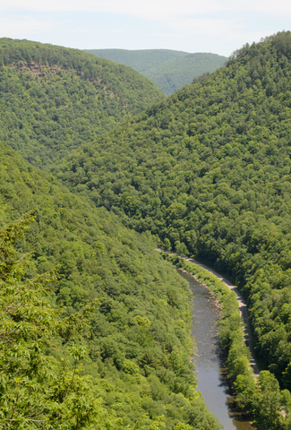
The Youghiogheny River Gorge is the centerpiece of the park. The Yough River offers incredible scenery, excellent whitewater rafting, and boating.
The park is close to major metropolitan areas and offers various outdoor and recreational opportunities. Summer activities include hiking, biking, canoeing, kayaking, swimming, fishing, rock climbing, and horseback riding.
When winter hits, visitors come out to go snowmobiling, sledding, and cross-country skiing; Ohiopyle.
Presque Isle State Park
This park is the lime speck on Lake Eerie.
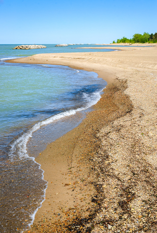
Presque Isle State Park comprises 3,200 acres of the sandy peninsula that arch into the lake.
Presque Isle is Pennsylvania's prime seashore park. Visitors can bask in the sun on the beautiful coastline. There are various recreational activities to get involved in, including boating, fishing, swimming, hiking, biking, and even in-line skating.
Presque has a vital harbor and a magnet for migratory birds.
Since Presque Isle is a day-use park, there aren't any overnight accommodations. However, visitors can find lodging and camping areas nearby.
The park has a lot to offer, including environmental education, public programs, boat tours of the Isle, three beaches for surfing, and scuba diving; Presque Isle.
Glaciers helped shape Pennsylvania. To learn more about glaciers, visit this map
Cherry Springs State Park
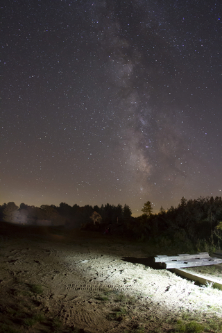
Cherry Springs State Park is the tiny speck northwest of Williamsport, just outside of Coudersport.
The area is so remote that if you visit the park on a clear night, close to 30,000 stars shine up above, making it a top location for stargazing.
Lucky visitors might glimpse the Aurora Borealis, asteroids, Venus, the Omega Nebula, meteor showers, and the Milky Way.
Park visitors can experience a private guided star tour or the Nightscapes Photography Workshop.
The park has an area of 82 acres and several trails. Campgrounds are open between April and October; Cherry Springs.
Kinzua Bridge State Park
This state park is the lime speck east of Allegheny Forest.
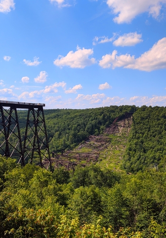
Kinzua Bridge State Park comprises 339 acres of land in McKean County and is home to the reinvented Kinzua Viaduct or bridge.
The original bridge stood firm for over 100 years before it was partially destroyed by the heavy winds of a tornado in 2003.
The viaduct was once the tallest and longest railroad structure measuring over 2,000 feet and 301 feet in height.
The bridge or viaduct was reinvented as a walkway for pedestrians in 2011. Now, visitors can venture 600 feet out to the support towers to get an excellent view of the Gorge.
The Visitor Center and Park Office have incredible views. They feature self-guided exhibits and a wealth of information about the park's area.
Picnics, exploring trails, fishing for brook trout in Kinzua Creek, and the Kinzua Bridge make the park an excellent place to kick back and enjoy the scenery, Kinzua.
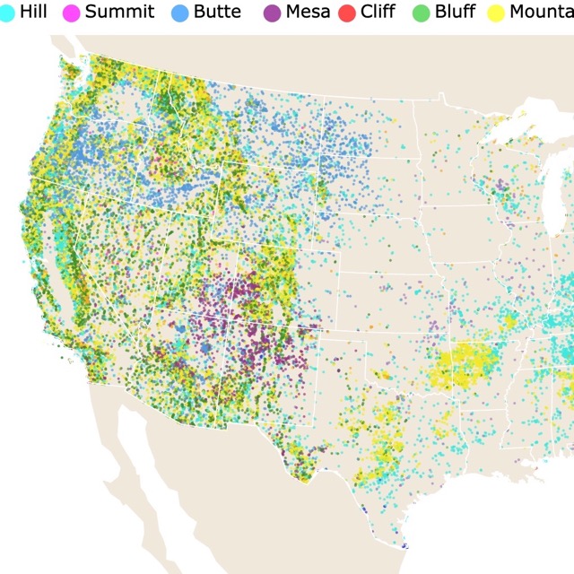
Hills and Mountains are found all over Pennsylvania. To see where they are, visit this map
Ricketts Glen State Park
The lime area southwest of Scranton is Ricketts Glen.
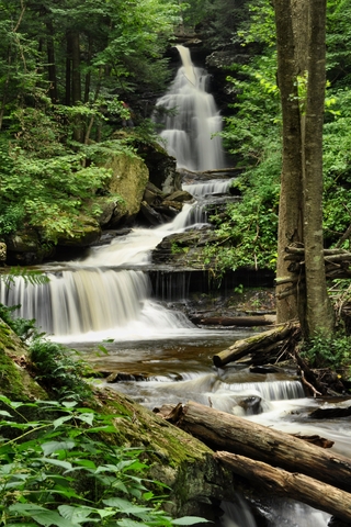
Rickets Glen State Park comprises 13,193 acres of land. You'll find the Glens Natural Area within the State Park, which is a National Natural Landmark.
The Falls Trail System provides an excellent opportunity for an incredible hike. Free-flowing waterfalls cascade through the hillside. Ganoga Falls is a 94-feet high fall, the highest of the group.
The Grand View Trail offers exceptional views, especially during the middle of June when the Mountain Laurels are in bloom.
The park has many opportunities for outdoor recreation. These include swimming at the lake, camping, exploring Lake Jean by boat, fishing, enjoying an afternoon or evening picnic, and more; Ricketts Glen.
Hyner Run State Park
The lime speck northwest of Williamsport is Hyner Run.
The park is a beautiful area with a small valley and steep mountains that create a comfortable, peaceful outdoor recreation and adventure area.
Hyner Run is surrounded entirely by Sproul State Forest, the state's largest forest.
The park features picnic sites, campgrounds, a wading and swimming pool, various streams for fishing, and hunting areas during established seasons. Hyner Run is a trailhead for the Hyner Mountain Snowmobile Trail, a 64-mile trail for winter adventuring.
There are 30 campsites; each of them features a fire ring, picnic table, and a level pad. Visitors can bring their pets for an additional fee.
The campground offers toilets, warm showers, and water outlets. Near the campground entrance, visitors can bring their garbage and recyclable materials. There is also a sanitary dump station; Hyner Run.
Canoe Creek State Park
The park is the lime speck southeast of Altoona.
Canoe Creek State Park provides over 900 acres of beautiful land to explore and a 155-acre lake.
The park also has old fields, mature forests, and wetlands that provide crucial habitats for migrating birds and other wildlife.
The lake is a popular location for fishing year-round. Trails winding through the various habitats draw hikers in. Visitors can spend time at the beach, have a picnic, and get involved with educational programs or activities; Canoe Creek.
Pine Grove Furnace State Park
Pine Grove Furnace is the lime area southwest of Harrisburg.
This Pennsylvania state park is rich with natural and historical features. Pine Grove Furnace State Park comprises 696 acres of land at the northern tip of the Blue Ridge Mountains.
Some recreational areas include:
- Two lakes: Fuller Lake and Laurel Lake.
- The rail trail for biking.
- The Appalachian Trail; the park is the halfway point for the 2,186-mile scenic trail.
- The Appalachian Trail Museum.
- Pine Grove Furnace is surrounded by Michaux State Forest, providing additional opportunities to explore the public lands in the area.
There are various educational programs featured at the park, such as Orienteering For Beginners.
The Historic Walking Tour provides a glimpse of the historic buildings, including the Iron Furnace.
A favorite of many is the Fall Furnace Festival, when hundreds of jack-o-lanterns can be seen floating on Fuller Lake Pine Grove.
Want to find places to explore in nearby Maryland and Delaware? Visit this map
Marsh Creek State Park
Marsh Creek State Park is the lime area west of Philadelphia.
Welcome to the rolling hills of northcentral Chester County, Pennsylvania. This 1,784-acre park features the 535-acre Marsh Creek Lake, which is excellent for sailing, fishing, and observing migratory waterfowl.
The 19.5 miles of trails are available for hiking through the park's various habitats. Visitors can bring their horses and head for the bridle trails.
While swimming is prohibited in Marsh Creek Lake, the park features a lovely "L"; shaped pool, a splash pad, and a playground.
After cooling off on a hot day, head to one of the several picnic areas. The picnic areas have over 150 picnic tables, charcoal grills, and restrooms available year-round; Marsh Creek.
Leonard Harrison State Park
L. Harrison is a lime speck northwest of Williamsport.
Along the eastern rim of Pine Creek canyon lies Leonard Harrison State Park. Colton Point State Park is on the opposite side of the canyon.
The 585-acre park features modern facilities, scenic views of the canyon, and a visitor center.
There are several hiking trails of various lengths, including the Turkey Path Trail, Overlook Trail, and the longest trail - Pine Creek Trail. Pine Creek Trail offers a 62-mile multi-use trail for hiking, biking, and cross-country skiing.
Campgrounds include warm showers, flush toilets, fire rings, picnic tables, and a sanitary dump station. Pets are permitted at the park and campgrounds in designated areas; Leonard Harrison.
Cherry Valley National Wildlife Refuge
Cherry Valley is the orange area in eastern Pennsylvania.
Cherry Valley National Wildlife Refuge was established in 2008 as a conservation for migratory birds and federal trust species.
The park was once a golf course but is now a safe haven for butterflies, bees, birds, and other essential pollinators.
Some of the birds include turkeys, warblers, and bald eagles!
While many changes have been made, the 193-acre Wildlife Preserve kept the old cart paths to create a couple of walking loops for hiking. Visitors have miles of hiking opportunities with maps available in the kiosk area by the parking area.
Hiking, biking, wildlife viewing, and cross-country skiing are some outdoor activities guests enjoy; Cherry Valley.
Pennsylvania's Best National Parks
Affiliate Disclosure
Databayou.com is a participant in the Amazon Services LLC Associates Program, an affiliate advertising program designed to provide a means for sites to earn advertising fees by advertising and linking to Amazon.com. Databayou.com also participates in affiliate programs with Clickbank, CJ, and other sites.
If you plan on visiting one of these parks or hiking the Pennsylvania forests, I suggest you get some of these items found on Amazon.
- Camping Stove: This propane stove is perfect for camping. It is light and easy to use.
- Gskyer Telescope: This telescope is ideal for beginners and kids. It includes a phone adapter and a remote.
- Camping Cot: It consists of an air mattress and pump. This is a folding cot with side tables.
FOLLOW ME
Resources for Pennsylvania's Protected Areas Map
The shapefiles with Pennsylvania's state boundary lines, lakes, major rivers, and cities were downloaded from Natural Earth Data.
The Parks and Public Lands shapefiles for Pennsylvania were downloaded from USGS.
This map will be updated with new data! To receive updates on this and more nature maps, join my email list!!!!!!!
Made by Luz K. Molina with D3.js.