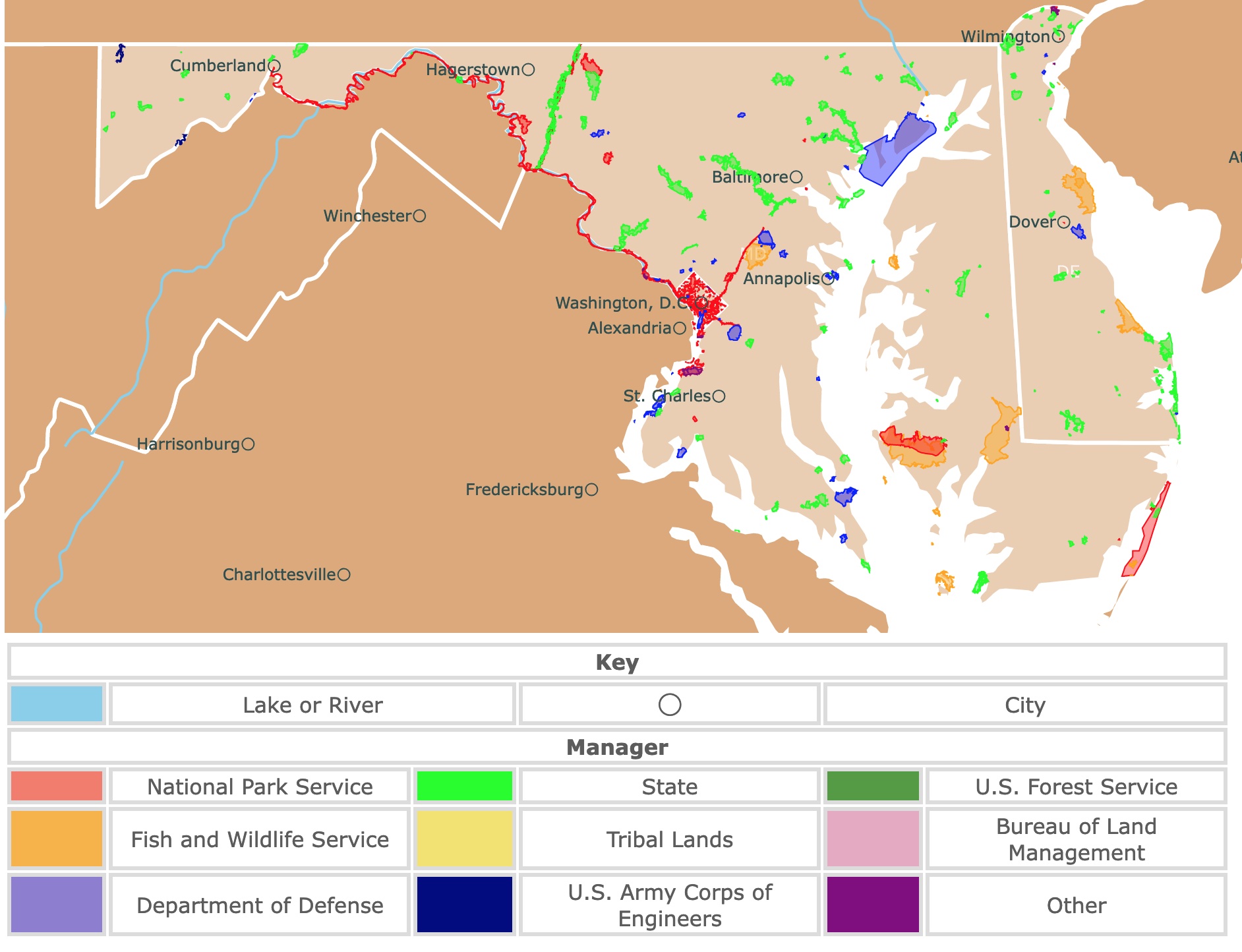
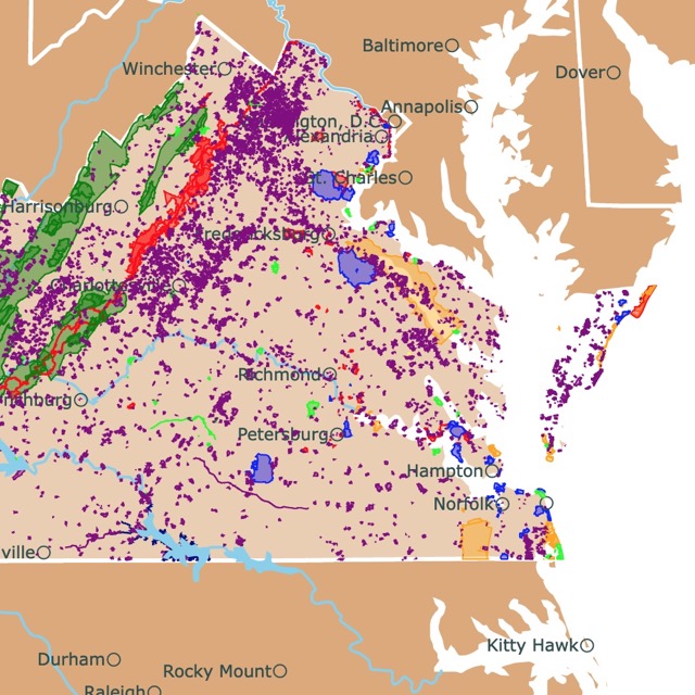
Parks of Maryland, Delaware, and D.C.
This interactive map shows the Locations, Names, Areas, and Details of National Parks, State Parks, National Forests, Tribal, and other Public Lands of Maryland, Delaware, and D.C. It also shows major cities and rivers for context. For more detail, zoom in. For more information, hover over the map, or scroll down.
| Key | |||||
|---|---|---|---|---|---|
| Lake or River | ◯ | City | |||
| Manager | |||||
| National Park Service | State | U.S. Forest Service | |||
| Fish and Wildlife Service | Tribal Lands | Bureau of Land Management | |||
| Department of Defense | U.S. Army Corps of Engineers | Other | |||
Geography of Maryland, and Delaware
Maryland is bordered by four states and the Atlantic Ocean. Pennsylvania lies to the north, Delaware and the Atlantic to the east, Virginia and the Atlantic to the south, and West Virginia to the west.
Delaware shares borders with the Atlantic Ocean, New Jersey, Pennsylvania, and Maryland.
Maryland is divided into five geographical regions.
- The Mid-Atlantic Coastal Plain: This region stretches across south and east Maryland. The Mid-Atlantic Coastal Plain is a low area with marshes along the eastern coast and fertile land on the western shoreline. The Battle Creek Cypress Swamp, a forested wetland, is located in this region.
- The Piedmont Region: The low hills, valleys, ridges, and streams of this region stretch across northeastern Maryland.
- The Blue Ridge Region: This narrow, mountainous region lies west of the Piedmont region. The area is named for the trees that seem to have a bluish haze from a distance.
- The Appalachian Plateau: The Plateau is located in the northwestern corner of Maryland. Home to the Allegheny Mountains and Maryland's highest point, Backbone Mountain (3,662 feet - 1,116 meters)
- The Appalachian Ridge & Valley Region: This slim strip of land in north Maryland is mainly forested with some farmland. It wouldn't be called the Appalachian Ridge if it didn't have steep and distinguished ridges; NatGeo.
Part of Delaware slopes downward from the Piedmont region. The rest of the state is characterized by Atlantic Coastal Plain.
Want to find places to explore in nearby New Jersey? Check this map of New Jersey Parks
Maryland and Delaware Wildlife
Bobcats, black bears, and Appalachian cottontails are a handful of mammals living in the state. The largest type of falcon, the gyrfalcon, calls Maryland home, as do ospreys and Baltimore orioles.
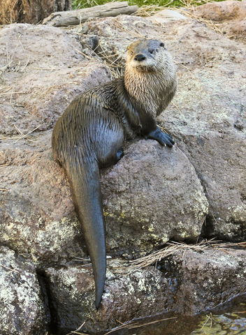
Mammals living in Delaware include gray foxes, white-tailed deer, American beavers, and river otters.
Birds found in Delaware include peregrine falcons, eastern bluebirds, bald eagles, and woodpeckers.
Bog turtles, eastern fence lizards, rainbow snakes, and Coastal Plain milk snakes are among the state's reptiles. Barking tree frogs, mudpuppies, and numerous species of salamanders (including the Allegheny Mountain dusky salamander) reside in Maryland.
Both states have Loblolly pine, bald cypress, walnut, white oak, and juniper are among the state's native trees. The Maryland golden-aster, meadow beauty, ladies' tresses, and arrowheads are some of the native wildflowers blooming throughout the landscape.
Maryland and Delaware's Climate
Maryland and Delaware experience hot, humid summers and cool winters. The upland regions in the west experience longer, colder winters and shorter, cooler summers. The average temperature in January is about 32 ℉ (0 ℃). July averages about 76 ℉ (24 ℃).
According to US News Travel Guides, the best time to visit Maryland is during the summer, from June to August. When to Visit.
However, that's peak tourist season, so high rates and large crowds should be expected. Spring and fall aren't bad options either; the weather will be cooler and sometimes damp.
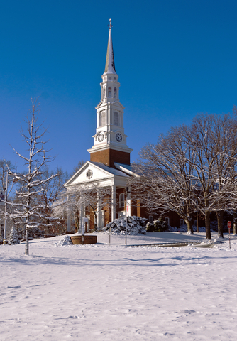
From museums, crab houses, casinos, Ocean Boardwalks, National Parks and monuments, historical sites, and an abundance of incredible nature, Maryland has a lot to offer visitors and locals alike.
Calvert Cliffs State Park, the Great Falls, and Sandy Point State Park are only a few parks offering outdoor recreational activities. Let's not forget about Holland Island, an old-fashioned town that seems like a place time had forgotten.

Maryland and Delaware have a beautiful deciduous forests. To learn more, visit this map.
Top Parks in Maryland
Chesapeake and Ohio Canal National Historical Park
Chesapeake and Ohio Canal National Historical Park (C&O Canal) is the red strip on Maryland's southern border.
The C&O Canal is a means to preserve America's early transportation history. The canal operated for almost 100 years as a lifeline for communities along the Potomac River.
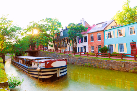
These days, the park is a place to explore and discover historical facts, natural history, geology, and recreational opportunities.
This National Historical Park offers over 180 miles of canal to float and explore. Biking, boating, canal boat programs, camping, hiking, fishing, horseback riding, picnics, ranger-led programs, and even recreational winter activities can be enjoyed.
The park has primitive campsites for bikers and hikers. Reservation sites for individuals or groups. Unfortunately, there aren't any RV hookups at the parks, so it's tent camping only.
C&O Canal Trust offers lodging in seven historic lockhouses. According to the official C&O website, each lockhouse is furnished and designed with a different time period in mind, so each stay will be different.
C&O Canal National Historical Park has various hiking trails. Several of the trails are a part of the National Trail System.
The system includes the Western Maryland Rail Trail, Appalachian National Scenic Trail, Captain John Smith Chesapeake National Historic Trail, Capital Crescent Trail, and Potomac Heritage National Scenic Trail; Chesapeake and Ohio Canal.
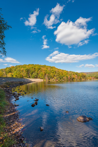
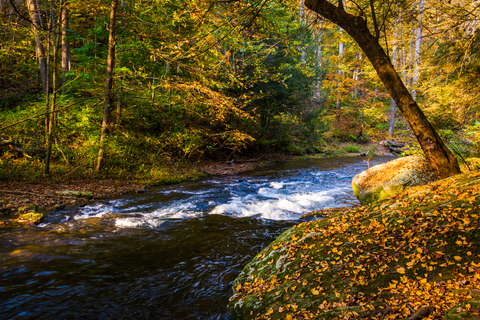
Catoctin Mountain Park
Catoctin Mountain Park is the red area in northern Maryland, situated in the Blue Ridge Province, a mountainous area.
The park comprises over 5-thousand acres of hardwood forests with flowing streams and incredibly scenic vistas. Needless to say, there is an abundance of recreational opportunities for outdoor enthusiasts.
Potomac River.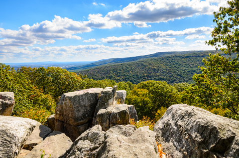
Anglers can cast a line in one of the popular trout fishing streams.
Rock climbing is allowed at Wolf Rock, but visitors need a valid permit.
Hikers and bikers have around 25 miles of trails to explore. The six miles of equestrian trails are excellent for horseback riding. The hiking trails range from easy and moderate to strenuous.
The tracks take visitors to different elevations depending on the path they choose.
A few wayside exhibits worth checking out along the park's trails are the Whiskey Still, Sawmill, and the Charcoal and iron Industries.
The overnight options are Owens Creek Campground, Adirondack shelters, Misty Mount cabin camping, and Poplar Grove (youth group site). Of course, you can stay longer if you want to. Misty Moun cabin camping, Camp Round Meadow, and Camp Greentop are your park options for visitors interested in lodging.
Catoctin Mountain Park has two picnic areas: Chestnut and Owens Creek. There are two different orienteering courses at the park, with free classes in the spring and fall.
As with any park, make sure to stop at the visitor center for all of the park's information and most current maps, Catoctin.
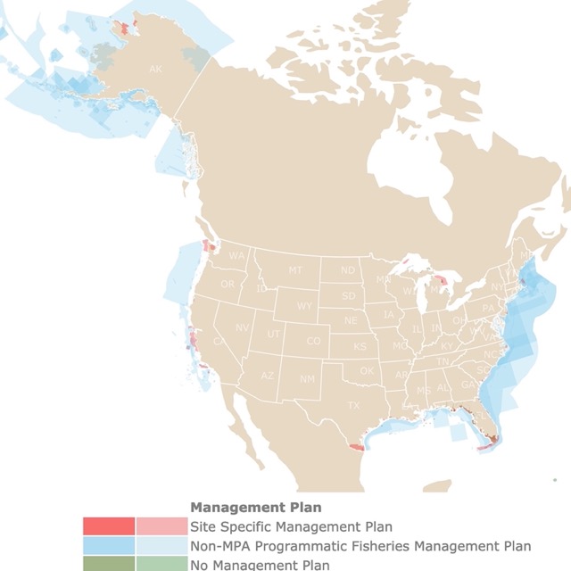
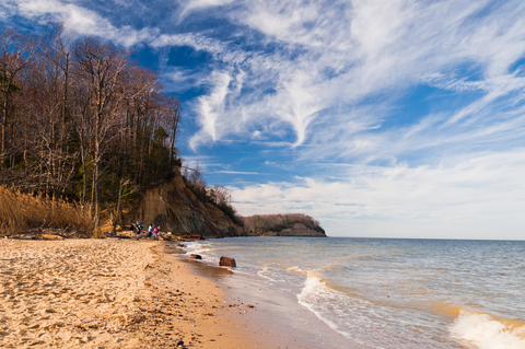
Maryland and Delaware have beautiful coastlines. To learn more, check this map of U.S. Marine Protected Areas
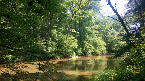
Patapsco Valley State Park
Patapsco Valley State Park is the lime area southwest of Baltimore and extends along 32 miles of the Patapsco River.
The park consists of more than 16-thousand acres with eight developed recreation areas for outdoor enthusiasts to enjoy. Outdoor recreational opportunities include; camping, hiking, horseback riding, mountain biking, fishing, canoeing, kayaking, swimming, and picnics at one of the park's many pavilions.
Patapsco has more than 200 miles of trails, 70 of them maintained. Visitors can find "hiker only" routes and multi-use trails accessible from various areas of the park.
There are various ranger-led programs and special events at Patapsco Valley.
Take a trip around the surrounding areas. You'll find museums, restaurants, casinos, entertainment, historical places of interest, historical tours, and sweet shops; Patapsco.
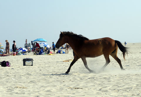
Assateague Island National Seashore
Assateague Island National Seashore is a long island depicted in red southeast of Maryland. The National Seashore stretches between Maryland and Virginia.
If you're looking for some excellent outdoor recreational opportunities by the ocean with waves rolling in the background, consider Assateague Islands. You can explore the salt marshes, sandy beaches, coastal bays, and maritime forests here.
If recreation, rest, and relaxation are not enough, remember one of the best attributes of this park are its wild horses! Some visitors just come just to admire them.
Visitors come to the park to go fishing, crabbing, boating, and swimming. Crabbing and clamming can provide you with a fresh and fantastic meal right by the water.
Assateague Island National Seashore has paved and unpaved trails and 37 miles of beach for sandy hikes. Horseback riding is allowed seasonally in the Over Sand Vehicle (OSV) Zone.
Several bike trails wind through the park on Virginia and Maryland's sides. According to the National Park Service, all vehicles used in the OSV zones must have a valid, up-to-date permit.
Come enjoy the ocean, collect seashells, head out to the water for some kayaking or canoeing, and don't forget the sunscreen.
If you were hoping to spend the night or weekend, fortunately, the Maryland portion of the park has campgrounds. However, the Virginia District does not, Assateague.
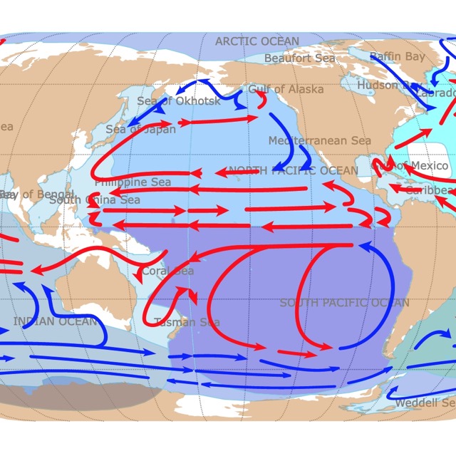
Maryland and Delaware are influenced by oceans and currents. To learn more, visit this map.
Calvert Cliffs State Park
Calvert Cliffs State Park is the lime green park southeast of St. Charles.
The enormous cliffs dominate 24 miles of Chesapeake Bay's shoreline through Calvert County.
The cliffs were formed millions of years ago when Southern Maryland was covered by the sea. The cliffs became exposed once the sea receded, eroding into what we see today.
Calvert Cliffs is a day-use park with a sandy beach, a recycled tire playground, and 13 miles of hiking trails.
The park has an abundance of fossils to be discovered. So far, these include whales, sharks, rays, and seabird fossils.
Anglers can spend some time out on the water to fish and enjoy the scenery.
The freshwater and tidal marshlands are home to various plant and animal species. Birdwatching and photography are popular in the area; who wouldn't want to capture the natural backdrop?
The surrounding area has various places of interest. It is full of things to do: Museums, nature preserves, nature parks, restaurants, historical sites, plantations, and Battlecreek Cypress Swamp are all near Calvert Cliffs State Park.
Science and geology enthusiasts can take a two-mile hike along a trail to the beach and cliffs area to hunt for fossils. Visitors can keep anything they find on the beach; Calvert Cliffs.
Gunpowder Falls State Park
Gunpowder Falls State Park is the lime area northeast of Baltimore. It is Maryland's largest state park, with more than 18,000 acres of land in Baltimore and Harford Counties.
The park has a diverse topography, from coastal wetlands to steep rocky slopes. It is so diverse that there are six areas of the park for visitors to explore.
- Hereford Area: Located east of Prettyboy Dam in northern Baltimore County, this area is excellent for fishing, canoeing, kayaking, and hiking. It features Mill Pond Cottage.
- Sweet Air Area: The land in this region is in Baltimore and Harford Counties. It's perfect for hiking and horseback riding.
- Dundee Creek Marina: This area is located in the Middle River, offering boat launching, boat rentals, fuel, a marina store, and wet and dry slips. It's close to the Dundee Creek archery range and fishing area.
- Hammerman Area: In the Middle River, this area features pavilions, playgrounds, a picnic area, and a swimming beach.
- Central Area: This is the oldest part of the park historically. It encompasses Little and Big Gunpowder Falls. It's ideal for mountain biking, horseback riding, and hiking. The Jerusalem Mill Historic Villiage is in the Central Area.
- Torrey C. Brown (TCB) Rail Trail: This multi-use, surfaced rail trail is over 19 miles and extends from Ashland, Maryland, to the Pennsylvania line, Gunpowder Falls.
Harriet Tubman Underground Railroad National Historical Park
This National Historical Park is the red area east of St. Charles.
Located in the heart of Dorchester County, Maryland, amongst the creeks, marshes, and farm fields, you'll find the Harriet Tubman Underground Railroad National Historical Park. A beautiful place dedicated to an incredible and strong woman.
The park's visitor center offers exhibits, audio-visual programs, a museum store, a research library, seasonal interpretive programs, and information. Here is where you learn about the life and legacy of Harriet Tubman and the landscapes and waterways where she once traveled.
The Harriet Tubman Historical Park is relatively new, opening in the spring of 2017. But, there's still so much to do; visit the byway, museum, and the Chesapeake Bay Gateways Network. The park has Harriet Tubmen trading cards for kids to collect while at the park.
According to the National Park Service, the Civil War to Civil Rights trading can be collected throughout the park. Just ask the staff how and where to collect them, and they'll fill you in with the necessary info.
There are various ranger-led programs excellent for children and adults, Harriet Tubman.
Best Parks in Delaware
White Clay State Park
White Clay State Park is a little over 3-thousand acres. It is the lime area located in northern Delaware, west of Wilmington.
This day-use park is the perfect way to get away from the hustle and bustle of everyday life by slipping into the peaceful wilderness.
Visitors can hike and bike over 37 miles of trails throughout the park. Visitors may also head to the water and toss out a line for an afternoon of fishing.
This park is not just important as a recreational spot. It offers a habitat for migrating birds and nesting birds like the rare cerulean warbler.
The Chambers House Nature Center is an exciting feature to explore. The designated Wild and Scenic River offers so much nature to explore. Bryan's Field Trail is perfect for mountain biking, and it leads to fishing and hunting locations.
Hunting at White Clay requires valid, up-to-date permits and licensing, White Clay.
Want to find places to explore in nearby Virginia? Check this map of Virginia
Lums Pond State Park
Lums Pond State Park is the lime area southwest of Wilmington.
The park surrounds Delaware's largest freshwater pond. Lums Pond covers approximately 200 acres of surface area and a maximum depth of 10-feet 93 meters), Premier angler.
The park offers a variety of outdoor recreational activities for outdoor enthusiasts, featuring 17-miles of trails winding through the hardwood forests.
The wetlands around the park are home to various reptiles and amphibians; it's also home to a notable dragonfly species.
The park's campground will host tent and RV camping. A primitive campsite is available for group camping. Disc golf, football, soccer, cricket, and tennis are available at the park.
Visitors can even bring their dogs to the off-leash dog park for a bit of fun and exercise.
The nature center allows visitors to check out live animal exhibits, including a 500-gallon freshwater aquarium exhibit. At the aquarium exhibit, visitors can view the fish native to the massive pond outside, Lums Pond.
Cape Henlopen State Park
Cape Henlopen State Park is depicted in lime and is located in southeastern Delaware. The park is situated at the mouth of the Delaware Bay.
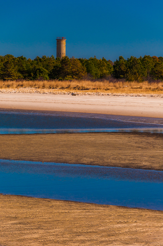
Cape Henlopen has over six miles of coastline to explore. The Point of Cape Henlopen lies where Delaware Bay meets the Atlantic Ocean.
The park features a diverse habitat collection of coastal ecosystems. Visitors can explore the barrier dunes, maritime forests, and coastal beaches.
The Seaside Nature Center is an excellent place to participate in an interpretive program to learn about the native plants and animals of the area, Cape Henlopen.
Affiliate Disclosure
Databayou.com is a participant in the Amazon Services LLC Associates Program, an affiliate advertising program designed to provide a means for sites to earn advertising fees by advertising and linking to Amazon.com. Databayou.com also participates in affiliate programs with Clickbank, CJ, and other sites.
If you plan on visiting one of these amazing parks or hiking Maryland's coastline, I suggest you get some of these items found on Amazon.
- Inflatable Couch:: Easy and comfortable inflatable couch, ideal for camping and the beach.
- Inflatable raft: This 4 person inflatable raft is an excellent way to have group fun on the water.
- Camping Shovel Axe Set: Made with carbon steel, perfect for outdoor camping, hiking, and backpacking.
FOLLOW ME
Resources for Maryland and Delaware's Protected Areas Map
The shapefiles with Maryland and Delaware's state boundary lines, lakes, major rivers, and cities were downloaded from Natural Earth Data.
The Parks and Public Lands shapefiles for Maryland and Delaware were downloaded from USGS.
This map will be updated with new data! To receive updates on this and more nature maps join my email list!!!!!!!
Made by Luz K. Molina with D3.js.