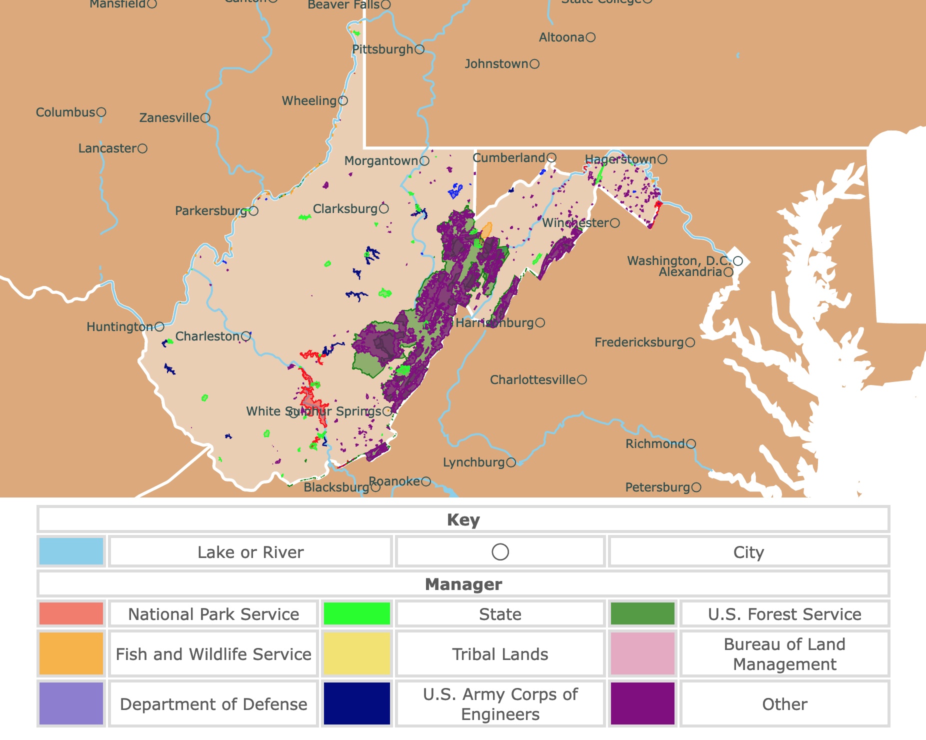
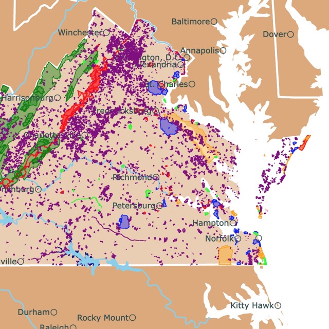
Map of West Virginia's Parks and Protected Areas
This interactive map shows the Locations, Names, Areas, and Details of National Parks, State Parks, National Forests, Tribal, and other Public Lands of West Virginia. It also shows major cities and rivers for context. For more detail, zoom in. For more information, hover over the map, or scroll down.
| Key | |||||
|---|---|---|---|---|---|
| Lake or River | ◯ | City | |||
| Manager | |||||
| National Park Service | State | U.S. Forest Service | |||
| Fish and Wildlife Service | Tribal Lands | Bureau of Land Management | |||
| Department of Defense | U.S. Army Corps of Engineers | Other | |||
Geography of West Virginia
West Virginia is the only state completely within the Appalachian Mountain range, therefore given the nickname the Mountain State.
West Virginia is bordered by Pennsylvania in the north, Virginia and Maryland in the east, Kentucky lies to the southwest, and Ohio borders the northwest part of the state.
Spruce Knob is the highest point in West Virginia, at 4,836 feet (1,482 meters). Spruce Knob is located in the Allegheny Mountains, around 25 miles (40km) southeast of Elkins.
The lowest point in West Virginia is at Harpers Ferry, with 247 feet (75 meters).
West Virginia is commonly subdivided into two major physiographic regions: The Appalachian Ridge and Valley Province and the Allegheny Plateau.
These two provinces are separated by the Allegheny Front, which divides the water that flows into the Atlantic Ocean.
The Allegheny Plateau has flat-topped hills and rounded peaks. The Allegheny Mountains include over 40 peaks of more than 4,000 feet (1,200 meters) in elevation.
The Appalachian Ridge and Valley include the Appalachian and the Blue Ridge Mountains. It is known for the streams and canyons called "water gaps".
The Appalachian Ridge and Valley is also known for its caves, forests, and peaks. These peaks include the state's tallest point, Spruce Knob.
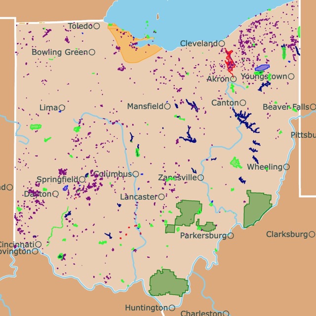
Want to find places to explore in nearby Ohio? Check this map of Ohio Parks
West Virginia's Climate
West Virginia experiences a humid continental climate with four distinct seasons that last almost equal lengths of time.
Temperatures will always vary slightly depending on the area of the state you check. We will stick with the average temperatures in the state's capital, Charleston.
According to US Climate Data, January is the coldest month, with average high temperatures of around 42℉ (5℃) and average lows of around 26℉ (-3℃).
July is the hottest month in the state, with average low temperatures of around 66℉ (18℃) and highs of 85℉ (29℃).
While July has the hottest temperatures, it is also the time of year that gets the most rainfall, with close to 5 inches of rain. The average amount of snowfall ranges from 1 inch (2.54 cm) in December to 11 inches (27.94 cm) in January.
West Virginia's Nature & Wildlife
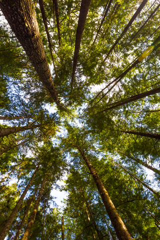
West Virginia is the third most forested state. Forests cover over three-quarters of West Virginia's area.
White oak, yellow poplar, hickory, beech, black cherry, basswood, sugar maple, and red maple are some of the native hardwoods.
Loblolly pines, spruce, hemlock, white pine, and shortleaf pine are some native softwood trees. You can also find sycamores, chestnuts, elms, locusts, and dogwoods.
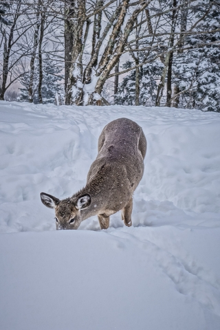
Squirrels, rabbits, skunks, raccoons, opossums, gray foxes, deer, and groundhogs are common mammals living in the state.
West Virginia's lakes and streams are home to trout, pike, bass, crappie, muskellunge, and walleye.
The rivers are full of bluegills, perch, and catfish. Various species of snakes, turtles, and lizards can be found crawling and slithering throughout the area.

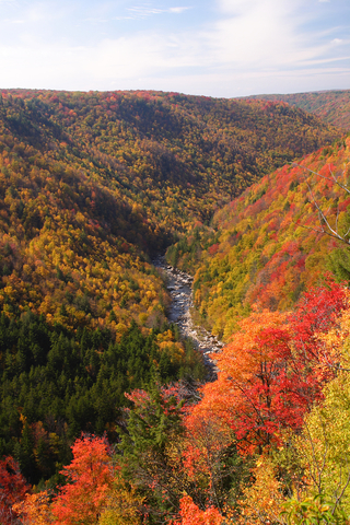
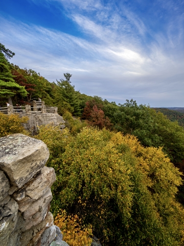
The fall colors of West Virginia broadleaf forests are unforgettable. To learn more, visit this map
The Most Beautiful Parks in West Virginia
Monongahela National Forest
Monongahela National Forest is the green belt in eastern West Virginia.
The Monongahela National Forest is a major tourist attraction in West Virginia. The national importance of the recreational resources of the park has been recognized through the designation of the Spruce Knob - Seneca Rocks National Recreation Area.
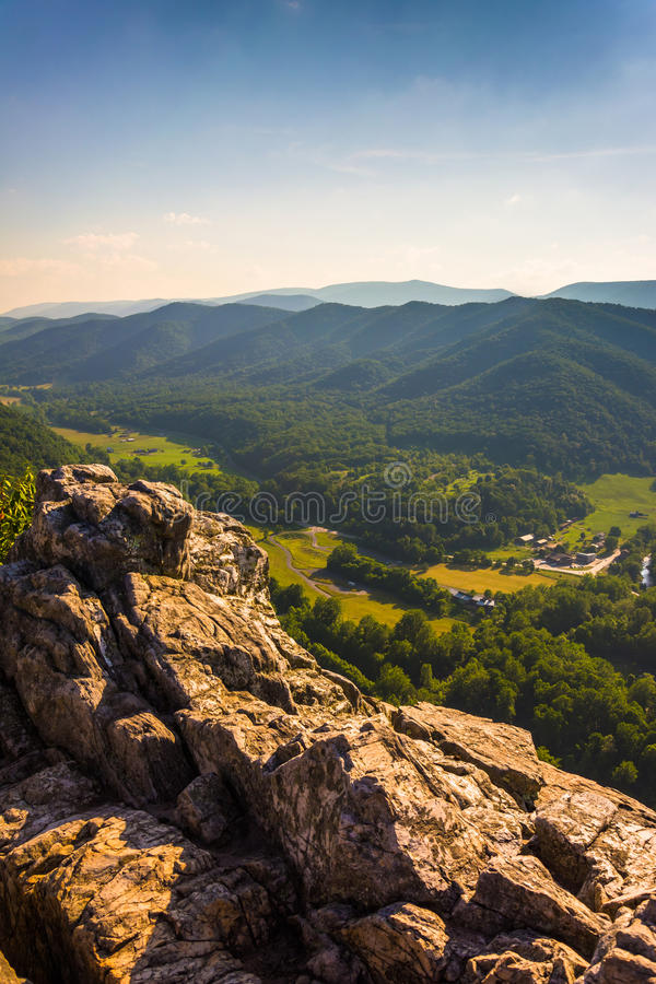
The forest is known for its rocky landscape and spectacular views. Seneca Rock is popular with climbers, and Cranberry Glades Botanical Area protects the largest bogs in West Virginia.
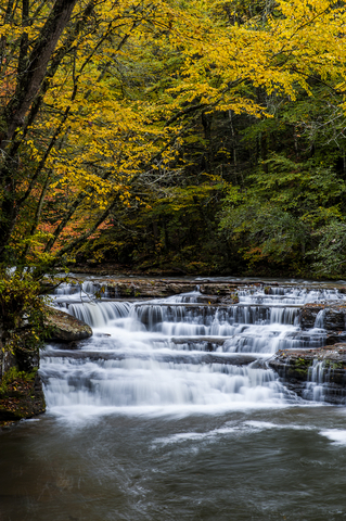
The Falls of Hills Creek Scenic Area is known for its three waterfalls.
Monongahela's ample road and trail system are excellent for hiking, horseback riding, and mountain biking. Hiking and biking through the wilderness and beautiful backcountry are only two outdoor activities one can enjoy at the park.
Add hunting, fishing, camping, and wildlife viewing, and the day gets even better.
Several observation towers are located throughout Monongahela National Forest. The Cranberry Mountain Nature Center is an excellent place to bring the kids to learn and explore the exhibits, auditorium, and join programs.
The Highland Scenic Highway extends 43 miles from Richwood to U.S. Route 219, just north of Marlinton.
There are four scenic overlooks providing visitors comfortable rest stops with incredible views of the surrounding valleys and mountains. It's a paved two-lane road that's easy to drive and even easier on the eyes.
The park features over 15 different campgrounds, each with its own amenities. There are also five picnic areas throughout the park.
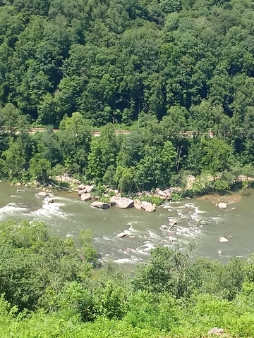
Monogahela.New River Gorge National River
This National River is the red area in southern West Virginia.
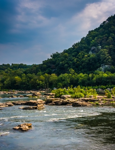
According to Oldest.org, the New River is one of the oldest rivers on the entire continent. The rugged, whitewater river flows north through deep canyons and forests.
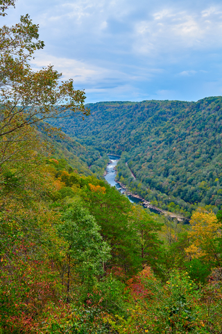
The park comprises 70,000 acres of land along the river and is rich in natural and cultural history. The scenic and recreational opportunities come in abundance.
With such a great, rushing river, it should be no surprise that the park is famous for its whitewater rafting experiences. Rock climbing, mountain biking, hiking, camping, and picnics are all possible at New River Gorge.
The park features close to 100 miles of trails ranging from 1/4 to 7 miles in length. Several of them can be connected, making it possible to have longer adventures.
New River Gorge only offers primitive camping sites with limited access to restrooms. There is no drinking water, hook-ups, or electricity available. However, there are nine sites for visitors to choose from.
With over 1,600 established climbing sites to choose from, it's a rock-climbing dream park.
The park offers various guided activities, programs, and events throughout the year, so check their event calendar before you head out; New River.
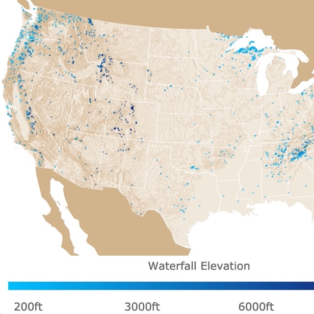
There are beautiful waterfalls in these forests. To learn more, visit this map
Gauley River National Recreation Area
This recreation area is the red curly area in central West Virginia, between Fayetteville and Summersville.
The recreation area includes 25 miles of the stunning Gauley River and five miles of the Meadow River.
Whitewater rafting and paddling are two of the most popular activities at the park. The stretch has over 100 rapids with a steep gradient! It is considered one of the best in the country.
The river has cut a gorge of up to 500 feet deep. The elevation changes from 4,600 to 600 feet (1,400 to 182m).
The extreme elevation changes result in different microclimates that cause incredible variation in plants and animals. Most of the area has beautiful hardwood forests. The park also has federally threatened species.
This peaceful park is an excellent way to spend time in West Virginia's great outdoors. Anglers, don't forget your pole, line, and gear because plenty of trout, smallmouth bass, and walleye are waiting for you.
The Gauley Tailwaters is the only campground at the park, located just below the Summersville Dam; Gauley.
Babcock State Park
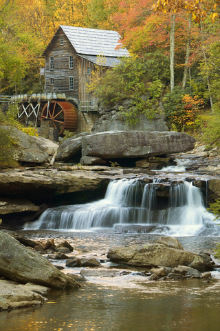
The lime speck next to New River Gorge is Babcock State Park.
Babcock offers visitors over 4,000 acres of beautiful scenery for outdoor recreation.
The park is only 20 miles southeast of the New River Gorge Bridge and is widely known for the Glade Creek Grist Mill.
The Mill is a fully functional replica of the original Cooper's Mill that was once on the grounds.
Hiking, fishing, whitewater rafting, and mountain biking are a few outdoor activities visitors enjoy. The New River Gorge is an excellent place for whitewater rafting; Babcock.
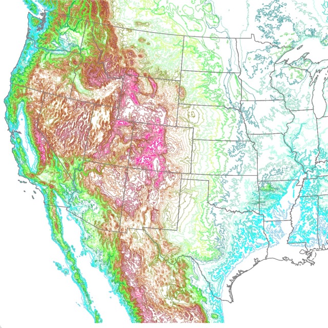
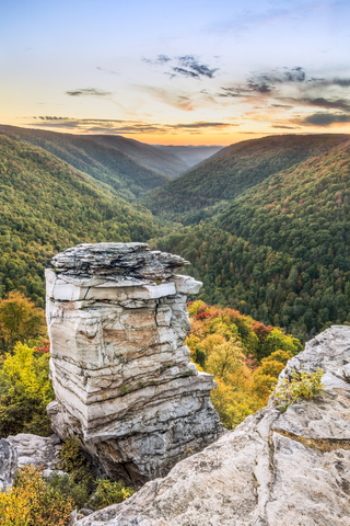
West Virginia has an incredible landscape. For a detailed map of its contours, check this map
Blackwater Falls State Park
Blackwater Falls is the lime speck southeast of Clarksburg. Located in the Allegheny Mountains of Tucker County.
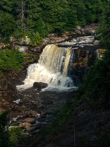
The park's name comes from the amber waters cascading 57-feet down the fall. The tea color water results from the tannic acid of fallen hemlock and red spruce needles.
Lindy Point is an observation deck that sits 3,000 feet above the Blackwater Canyon and offers stunning views. Elakala Falls are smaller falls in the park. Visitors can actually walk over them on a footbridge.
The park features 20 miles of hiking trails and an exceptional lodge. Biking, wildlife observation, geocaching, picnics, and swimming are everyday activities at Blackwater.
Blackwater Falls is also known for one of the longest sledding magic carpets on the East Coast. This activity is only available in winter; Blackwater River.
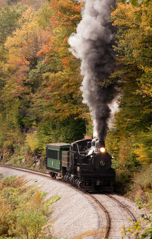
Cass Scenic Railroad State Park
The Scenic Railroad is the lime speck inside Monongahela National Forest. Cass Scenic Railroad State Park was once a lumbering town.
Whether you love history, the outdoors, trains, or locomotives, this park has something for you.
Visitors can learn about the steam-driven locomotives' rich history, and the history and culture of the land and people.
Cass's Railroad is the same one built-in 1901. The locomotives were the same used more than a century ago. The passenger cars are the old logging cars refurbished!
Cass is the largest fleet of geared Shay locomotives worldwide!
The 11-mile-long heritage railroad and company town are popular sites for locals and tourists alike. The old Company Store serves as a gift shop where you can pick up souvenirs.
The Last Run Restaurant and Fountain is open every day from 8 am to 8 pm. Visitors also enjoy the artisans' co-op, Cass Historical Theater, and the Historical Museum.
Opening times change with the season; Cass Railroad.
Audra State Park
This park is a lime speck southeast of Clarksburg.
Audra State Park consists of a heavily wooded area divided by the Middle Fork River.
Visitors like to walk along the Alum Cave Trail loop for a picturesque view of the Middle Fork River.
Every year, visitors come to the park for outdoor recreation opportunities, including hiking, camping, and picnics.
The park offers swimming, boating, and fishing if you are looking for water activities.
The park's 67 campsites are available from April through mid-October. 39 of the campsites have electricity. There are two bathhouses with modern facilities and a playground for the kids; Audra.
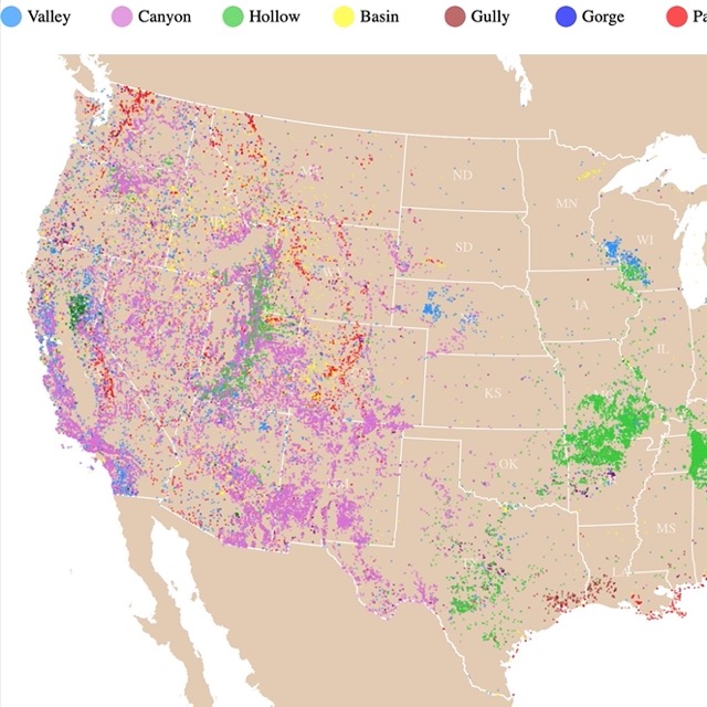
There are many gorges and canyons to explore in WV. Interested? Visit this map
Cathedral State Park
This state park is the lime speck east of Clarksburg. The park is on a mountainside with average elevations of 2500ft (762m).
Cathedral State Park features the largest old-growth forest in West Virginia. This is the only stand of mixed virgin timber left in West Virginia.
The hemlock trees reach up to 90 feet (27m) and 21 feet (6.4m) in circumference.
The park was designated as a National Natural Landmark and offers over 130 acres of sanctuary for the ancient trees, as well as 170 species of trees, 50 species of wildflowers, and 9 species of ferns.
During warm months visitors appreciate the three miles of hiking trails in an incredible outdoor setting.
Wildlife observation and photography are popular activities in the park. Geocaching and hiking are available at Cathedral State, and visitors come from surrounding areas to check the caches.
Unfortunately, the park does not offer overnight accommodations Cathedral.
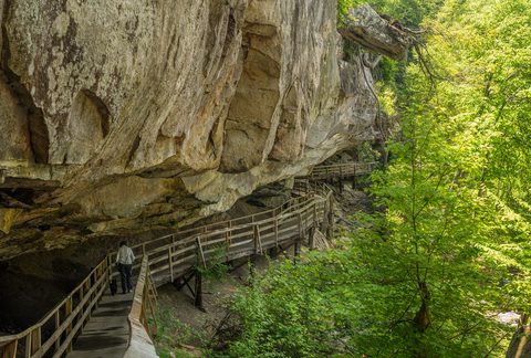
Coopers Rock State Forest
Coopers Rock is a lime speck 13 miles west of Morgantown.
Coopers Rock overlook is the best site to see the state's beauty. It is pretty gorgeous when the forest leaves change in the fall.
One of the park's features is the incredible canyon overlooks and cliffs for climbing. In fact, bouldering and rappelling are common activities.
If you take the Iron Furnace trail, you will find the Henry Clay Furnace. The first steam-powered blast furnace in Western Virginia; was built in 1836.
The park has 50 miles of trails for hiking and biking. Fishing, hiking, biking, hunting, and geocaching are other everyday activities for visitors.
The Cheat River is a great place for canoeing, swimming, kayaking, and fishing. At the Cheat River Narrows, it is possible to do whitewater rafting.
If you plan to spend the night, there are sites for camping, RV's, picnic shelters, and playgrounds for the little ones to enjoy Coopers Rock.
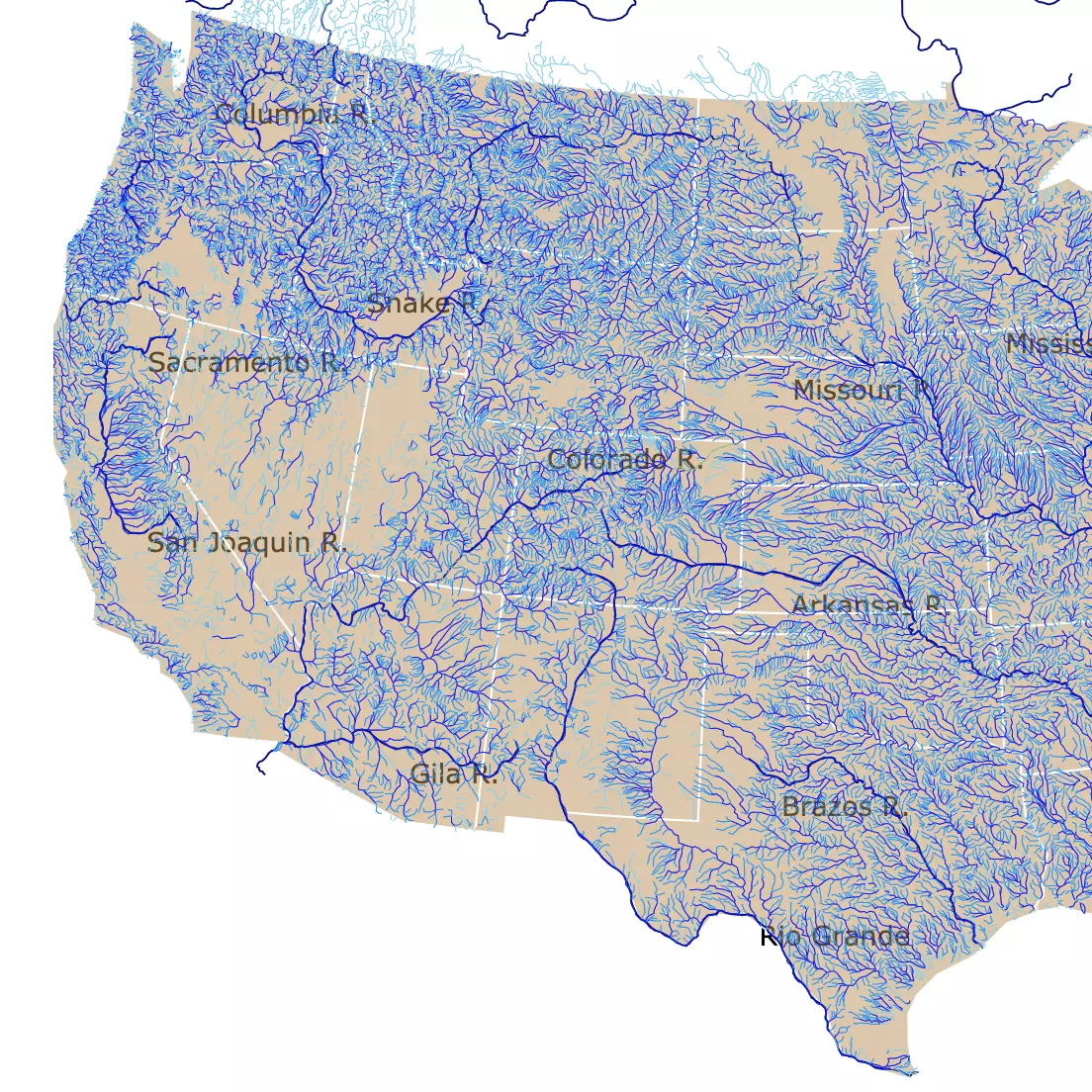
Rivers are essential recreation sites in WV. To find more, visit this map.
Hawks Nest State Park
Hawks Nest is the lime area north of New River Gorge, in the middle of whitewater rafting country.
Hawks Nest comprises 270 acres of recreational land.
The park features a nature museum, jetboat rides, hiking trails, an aerial tramway, and one of the most difficult whitewater boating waterways in the U.S.
Hawks Nest Park is well-known for the scenic overlook that provides a stunning bird's eye view of New River Gorge National Park and Preserve.
Boating, fishing, hiking, swimming, and camping are popular activities at the park.
To spend the night, visitors can sleep at the lodge or choose premade camping sites; Hawks Nest.
Pinnacle Rock State Park
Pinnacle Rock is the lime speck on the southern border of West Virginia; on U.S. Route 52 in Mercer Country.
The impressive 3,100-foot sandstone formation gives Pinnacle Rock State Park its name.
According to Geocaching, Pinnacle Rock is "a hogback formed of erosions-resistant rock known as Stoney Gap Sandstone.".
Pinnacle Rock features a scenic wooded area with picnic facilities, hiking trails, and a lake for fishing. The overlook atop Pinnacle Rock is a popular site where hundreds and hundreds of people come to get selfies and group photos.
This state park is for day-use only, so there aren't any campgrounds on the land. However, there are camping and lodging accommodations nearby; Pinnacle.
Want to find places to explore in nearby Virginia? Check this map of Virginia Parks
Camp Creek State Park and Forest
Camp Creek is a lime speck south of New River Gorge.
Camp Creek State Park is known for its incredible waterfalls and nearly 6,000 acres of forest.
35 miles of trails are available for hiking, biking, and horseback riding. Around seven miles of streams are seasonally stocked with trout!
The park offers all of the common outdoor recreations at any state park or national forest!
The park has cabins and camping for visitors to spend the night; Camp Creek.
Beartown State Park
This state park is a lime speck north of White Sulfur Springs. The park is located in northern Greenbrier County, with a small portion situated in Pocahontas County.
Beartown State Park features over 100 acres of natural area on the eastern top of Droop Mountain. Beartown is well-known for its unusual rock formations, deep crevices, overhanging cliffs, and massive boulders.
The rocks consist of Pottsville Sandstone formed during the Pennsylvanian Age, 300 million years ago. Erosion of the sandstone created the "sunken streets in this city of rocks".
The park has enormous formations, dark corners, and deep caves. The current development of the park is minimal to preserve the rough beauty of the area.
The centerpiece at Beartown is the half-mile boardwalk that displays incredible views. It's a seasonal park, open from April through October.
Aside from enjoying the incredible beauty and interesting geology, visitors enjoy hiking and geocaching.
Unfortunately, the park does not offer overnight accommodations; Beartown.
Affiliate Disclosure
Databayou.com is a participant in the Amazon Services LLC Associates Program, an affiliate advertising program designed to provide a means for sites to earn advertising fees by advertising and linking to Amazon.com. Databayou.com also participates in affiliate programs with Clickbank, CJ, and other sites.
If you plan on visiting one of these forested parks or hiking up West Virginia mountains, I suggest you get some of these items found on Amazon.
- Waterproof Duffle Bag: This MIER backpack is large with a capacity of 60L. This backpack has versatile carrying ways and is made of abrasion-resistant material. Ideal for swimming, camping, traveling, kayaking and rafting.
- Hiking Pants: These casual hiking pants are lightweight and dry quickly.
- Athletic Hiking water shoes: These are flexible shoes. Made of stretch material, breathable, light for fast draining, and cross ventilation.
FOLLOW ME
Resources for West Virginia's Protected Areas Map
The shapefiles with West Virginia's state boundary lines, lakes, major rivers, and cities were downloaded from Natural Earth Data.
The Parks and Public Lands shapefiles for West Virginia were downloaded from USGS.
This map will be updated with new data! To receive updates on this and more nature maps, join my email list!!!!!!!
Made by Luz K. Molina with D3.js.