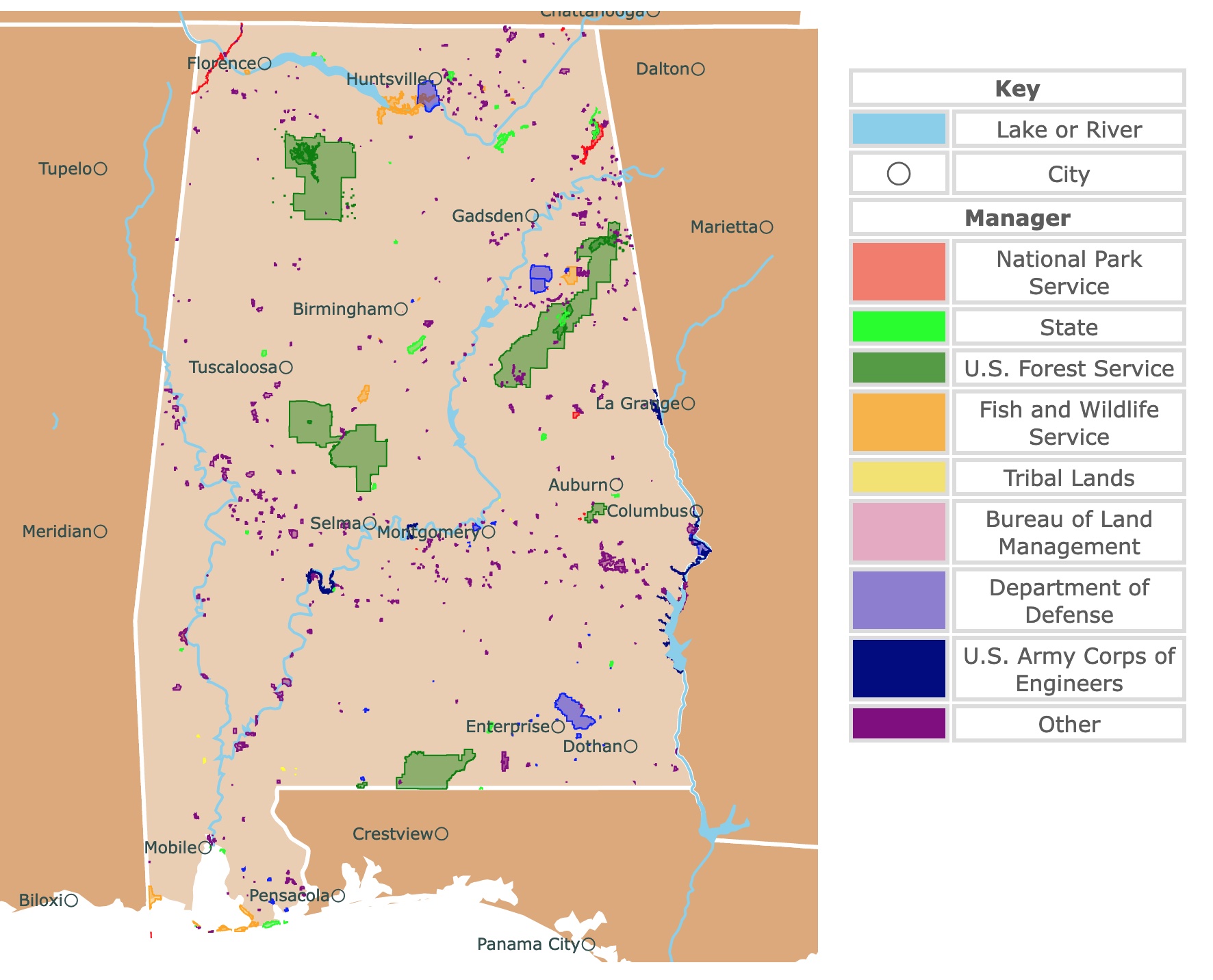
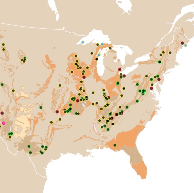
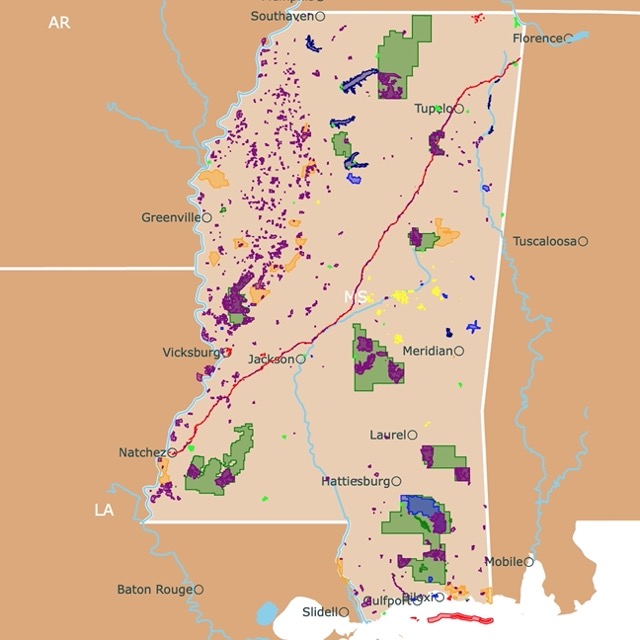
Map of Alabama's Parks and Protected Areas
This interactive map shows the Locations, Names, Areas, and Details of National Parks, State Parks, National Forests, Tribal, and other Public Lands of Alabama. It also shows major cities and rivers for context. For more detail, zoom in. For more information, hover over the map, or scroll down.
| Key | |
|---|---|
| Lake or River | |
| ◯ | City |
| Manager | |
| National Park Service | |
| State | |
| U.S. Forest Service | |
| Fish and Wildlife Service | |
| Tribal Lands | |
| Bureau of Land Management | |
| Department of Defense | |
| U.S. Army Corps of Engineers | |
| Other | |
Geography of Alabama
Alabama is a southern state bordered by Tennessee to the north, Mobile Bay and Florida to the south, Georgia to the east, and Mississippi to the west.
The Highland Rim is in northwestern Alabama, with the Tennessee River Valley and the Cumberland Plateau (the flat-topped plateaus).
The Appalachian Ridge and Valley lie in the southeast, including the Red Mountain and Coosa River.
The central-eastern part of Alabama has the Piedmont Upland. This hilly area is where Cheaha Mountain stands, with the state's highest peak at 2,407-foot (733.65 meters) above sea level.
The rest of Alabama is known as the East Gulf Coastal Plain. This area contains flatlands, hills, bayous, and the Alabama River (the 3rd longest river in the state).
Want to find places to explore in nearby Georgia? Check this map of Georgia Parks
Alabama's Wildlife
Armadillos, feral pigs, American alligators, coyotes, and deer roam Bama's land.
Birds like bald eagles, kites, and hawks can be seen flying in the state's sky.
The Perdido Key beach mouse and the Alabama beach mouse, two of North America's rarest species, call Alabama home.
The Gulf Coast waterdog and the eastern hellbender (the largest salamander species according to weight in North America) can be found in this southern state.
Alabama has over 100 types of trees, including red cedars, pines, live oaks, and magnolias. The live oaks are often draped with long, gray Spanish moss.
Bamboo and mistletoe grow wild. The carnivorous Alabama cane-breaker pitcher plant, Alabama glade cress, and Cahaba prairie-clover can only be found in the state.
Alabama's Climate
Alabama's summers are partly cloudy and warm, while winter brings freezing temperatures, snow, and wind, and the sky is mostly gray.
Throughout a year, the temperatures typically vary from about 19°F (-7.22°C) to 79°F (26°C). Temperatures rarely drop below 4°F (-15.55°C) or raise above 85°F (29.44°C).
The warm season in Alabama lasts about 3.6 months, from May to September. The hottest month in the state is typically July, with the average high being 78°F (25°C) and a low of 63°F (17.22°C).
Alabama's cold season lasts a little over three months, starting in early December and lasting until the second week in March. The coldest month in the state is January.
According to the tourism score, the best time of the year to visit Alabama is between late June to early September for warm-weather activities, Best Time.
There is a variety of places of interest in the state of Alabama. Some of the most significant landmarks from the American Civil Rights Movement. In Birmingham, you'll find 16th Street Baptist church, which is now a museum.
Alabama has interesting caves. To find more around the U.S., visit this map!
Alabama's Best Parks and Natural Areas
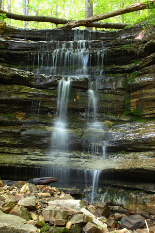
Little River Canyon National Preserve
Little River Canyon is represented as a red band in northeastern Alabama.
Little River Canyon is peculiar as it runs most of its length over Lookout Mountian.
The tree-covered uplands, canyon rims, bluffs, waterfalls, pools, sandstone cliffs, and boulders provide an exceptional setting for various outdoor activities.
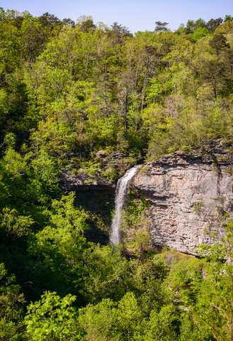
The Little River carved ridges, gorges, and the Little River Canyon, reaching 600 feet (182m) of depth in some areas.
The preserve has different microhabitats that sustain rare species of limited geographic distribution thanks to its location where the Cumberland Plateau meets the Gulf Coast and the canyon's rugged features.
These rare species include Kral's water-plantain (Sagittaria secundifolia), and the green pitcher plant (Sarracenia oreophila).
The cultural heritage combined with the state's natural resources tells the Little River Canyon Preserve story, which is an exceptional place in the Southern Appalachians.
While camping isn't allowed at the preserve, there are various outdoor activities to enjoy during the day. Hiking, bicycling, fishing, hunting (with necessary licenses and permits), bird watching, kayaking, rock climbing, and horseback riding.
Enjoy the 11-mile (17 km) scenic drive along the Little River Canyon Rim Parkway (HWY 176). There are eight overlooks where visitors can witness incredible views of the waterfalls and rock walls.
Pack a lunch and enjoy a beautiful picnic and some bird watching. There are about 142 different birds that call Little River Canyon home, including bald eagles, gold eagles, belted kingfishers, and numerous songbirds, Little River.
DeSoto State Park
DeSoto State Park is located in northeastern Alabama and is represented in lime green on the map.
DeSoto is on Lookout Mountain with beautiful views of waterfalls, wildflowers, and the surrounding landscape.
DeSoto State Park has endless outdoor activities like kayaking, swimming, fishing, biking, hiking, bicycling, bouldering, rappelling, picnics, adventure, and exploration.
The Benefield Interpretive Center features interpretive programs and live animals. Other amenities include pavilions, a picnic area with a playground, meeting rooms, a restaurant, and an Olympic-size swimming pool (this is seasonal).
The park offers over 30 miles of trails for hiking and mountain biking. DeSoto Park also has an ADA-accessible boardwalk trail dedicated to Talmadge Butler, a former park superintendent.
DeSoto is comprised of over 3,000-acres and provides lodging facilities, including log cabins, rustic cabins, mountain chalets, motel rooms, and a campground with 94 sites.
Visitors will find full-hookup RV sites and tent sites. For visitors looking for a complete off-grid camping experience, the park offers primitive camping sites for tent camping and two backcountry sites with shelters.
Some of the area attractions are the Little River Canyon Preserve, Alabama Band Fan Club, the Walls of Jericho Forever Wild Tract, and the 104-foot DeSoto Falls. The historic Fort Payne and Mentone, Alabama, are popular areas. All of this is within an hour of Chattanooga, Tennessee, DeSoto.
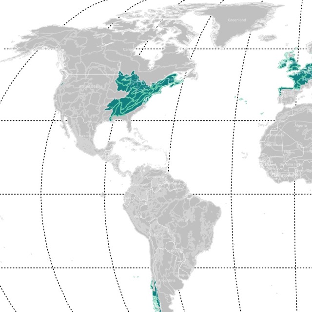
Alabama has beautiful Temperate Broadleaf forests. To learn more about them, visit this map!
Gulf State Park
Gulf State Park is situated in southern Alabama, on the shores of the Gulf of Mexico.
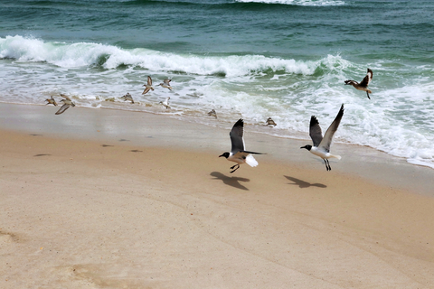
Gulf State Park has two miles of beautiful beaches, gorgeous white sands, emerald green waters, rolling waves, and sea birds that might make you believe you are in the Bahamas.
While the beaches are stunning, various activities are available for outdoor enthusiasts, including swimming, paddling, and stargazing.
Gulf State Park's Nature Center is full of incredible biodiversity. Visitors can participate in one of the center's daily educational programs led by the park's naturalists. It is an excellent experience for kids and adults.
The beach pavilion offers picnic tables for an afternoon lunch or a bit of shade. The park's pool has refreshments available, while Lake Shelby has a day-use area for canoeing and kayaking adventures, Gulf State Park.
Cathedral Caverns State Park
Cathedral Caverns is southeast of Huntsville and represented as a lime green speck.
The Cathedral Caverns was opened to the public in the 1950s by a gentleman named Jacob Gurley. The park was initially known as Bat Cave but was renamed due to its similarity with cathedrals.
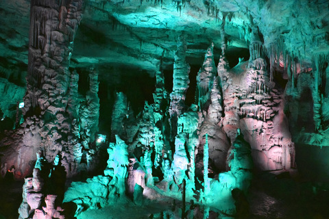
The first thing visitors notice is the massive opening that measures 126-feet (38 meters) wide and 25-feet (7.62 meters) high, which might be a world record.
While the cave's entrance is unbelievable, it gets even better inside.
Mother Nature created some magnificent formations, including "Goliath", one of the most enormous stalagmites in the world, at 45-feet (13 meters) tall and 243-feet (74 meters) in circumference.
Stalagmites are calcium deposits formed by dripping water over thousands of years!
The more you explore the cave, the more interesting it becomes. The "caveman" perched on top of a flowstone wall, the "frozen waterfall", and a large "stalagmite forest" are among the fantastic sites.
All these formations were created by nature and named by human imagination.
An added bonus is that the cave maintains a steady temperature of 60°F 15.5°C year-round, Cathedral Caverns.

Alabama has a beautiful coast. To learn more about it, visit this map of North America's Marine Ecoregions
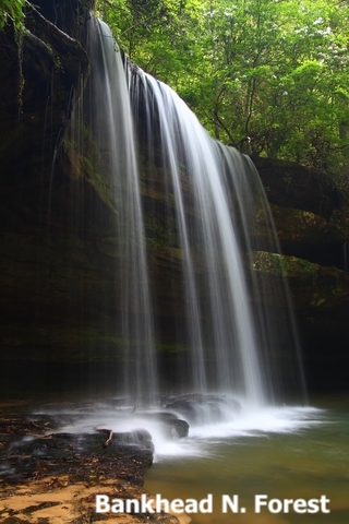
Talladega National Forest and Cheaha State Park
In lime and green, Cheaha and Talladega National Forest are east of Birmingham, respectively.
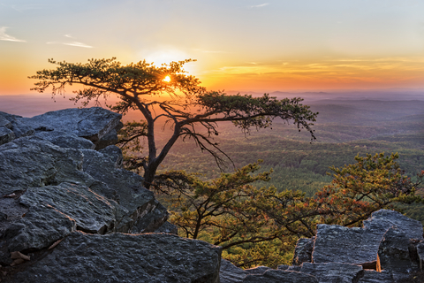
Cheaha State Park can is on the southernmost tip of the Appalachian Mountain chain, where visitors can explore the highest point in the state of Alabama. Some call it the island in the sky.
Cheaha is one of the oldest parks in Alabama, and it's considered one of the most notable parks in the entire U.S.
The park is home to 2,799 acres of granite boulders, a lake, and ancient trees at 2,407-feet (733 meters) above sea level.
The area is surrounded by the Talladega National Forest and includes over 7,000 acres of the Cheaha Wilderness.
While Cheaha seems to be far from any urban areas, it's only 30 minutes away from several historic towns, with dining, shopping, arts, and recreational activities.
There are various accommodations at the park, including lodge rooms, A-frame chalets, rock cabins, and campsites. When you're out and about, check out some of the incredible trails, Cheaha.
Rickwood Caverns State Park
Rickwood Caverns State Park is a small lime green state park north of Birmingham.
The park has a massive cave that contains formations that are 260-million years old and were created by water at a site that was once on the ocean floor.
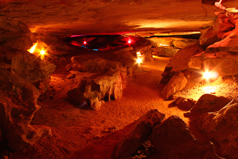
Visitors can descend up to 175 feet (53m) beneath the ground inside the cavern, which maintains a 58°F to 62°F (14°C-16°C ) temperature year-round.
Rickwood Caverns State Park offers gemstone mining, camping, picnicking, a gift shop, and a playground.
The Fossil Mountain Hiking Trail makes for an exciting hike as there are some plant and sealife fossils visible on the rocks. The park also has an Olympic-size swimming pool and a kiddie pool fed by the cave's cold waters.
The park hosts events throughout the year, including the Wonderland Under Warrior, a holiday tour of the cave.
Instead of calling it a day, make it a weekend trip and book a camping spot. You can order a site online in advance, which is a good idea because the park can fill up quickly once the weather is nice, Rickwood Caverns.
Want to find places to explore in nearby Mississippi? Check this map of Mississippi Parks
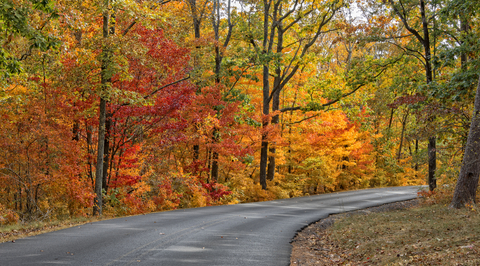
Monte Sano State Park
Monte Sano State Park is east of Huntsville and represented in lime green.
Monte Sano means "Mountain of Health" in Spanish. Back in the 1800s, visitors would come from across the U.S. to enjoy the fresh air, incredible views, and mineral springs.
The park's main attractions are the vibrant colors in the fall and the blooming azaleas during spring. Visitors can also enjoy 20mi of hiking trails and 14mi of biking trails.
At the Monte Sano Lodge, visitors can experience a laid-back mountain setting ideal for group gatherings.
On the mountainside, visitors will find rustic cabins equipped with all the essentials and more. Visitors can also stay at one of the campsites, a primitive campground, and visit the camp store for all their basic needs, Monte Sano.
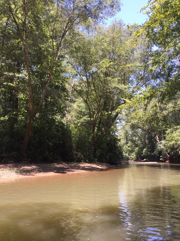
Cahaba River National Wildlife Refuge
The Cahaba River National Wildlife Refuge is situated southwest of Birmingham, depicted in orange.
The refuge is located in Bibb County and was established to protect and manage this section of the Cahaba River and its land.
The area is rich in wildlife and outdoor recreational opportunities.
Cahaba River Refuge is visited by many people every year. While some come to enjoy the tranquility or to exist in nature, others come with their family and friends.
Visitors can enjoy fishing, hunting (with proper license and permits), photography, wildlife observation, hiking, biking, non-motorized boating, and picnicking.
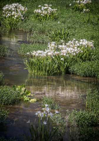
The Cahaba River spans almost 200 miles and is the state's most extended free-flowing stream. The river is home to 64 imperiled and rare species of plants and animal species, 13 of which aren't found anywhere else.
One factor that makes this area unique is the convergence of the Upper Coastal Plain, the Cumberland Plateau, and the Ridge and Valley.
Another feature that makes this area so diverse is its rocky shoals. These shoals crate pools that provide unique habitats for different species.
The refuge is home to five federally listed species: the Cahaba shiner, round rock snail, and the Goldline darter.
Other rare species include the Cahaba lily, Alabama croton, Alabama Phlox, and many more.
This area supports the most significant diverse and rare plant species of any county in the temperate Southeast!
For plant lovers, this park is a must-see. It's been called a Botanical "Lost World". There have been at least eight plants discovered at the refuge that were unknown to science previously, source: http://www.jimbotany.com/lostworld.htm.
Affiliate Disclosure
Databayou.com is a participant in the Amazon Services LLC Associates Program, an affiliate advertising program designed to provide a means for sites to earn advertising fees by advertising and linking to Amazon.com. Databayou.com also participates in affiliate programs with Clickbank, CJ, and other sites.
If you plan on visiting one of these beautiful parks and hiking one of its trails, I suggest you get some of these items found on Amazon.
- Inflatable Water FLoat: This comfortable water float for two, is perfect for a lazy day in the water.
- Merrell Waterproof Hiking Boot: Ideal for walking comfortably through Alabama trails.
- Victorinox Swiss Army Huntsman Pocket Knife (Red): An army knife always comes in handy. You never know what you will find or need in remote areas.
Resources for Alabama's Protected Areas Map
The shapefiles with Alabama's state boundary lines, major rivers, and cities were downloaded from Natural Earth Data.
The Parks and Public Lands shapefiles for Alabama were downloaded from USGS.
This map will be updated with new data! To receive updates on this and more nature maps, join my email list!!!!!!!
Made by Luz K. Molina with D3.js.