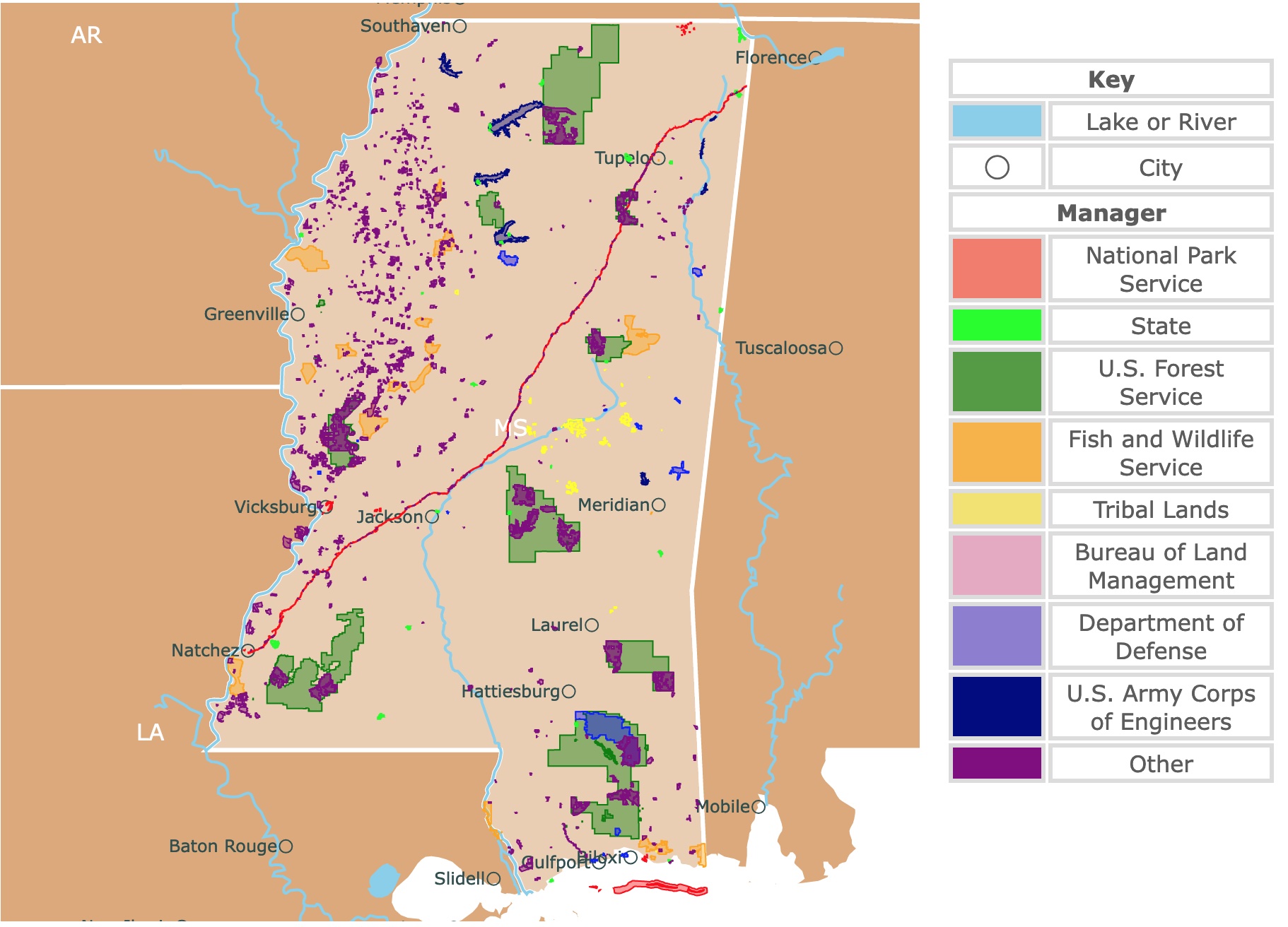
Map of Mississippi's Parks and Protected Areas
This interactive map shows the Locations, Names, Areas, and Details of National Parks, State Parks, National Forests, Tribal, and other Public Lands of Mississippi. It also shows major cities and rivers for context. For more detail, zoom in. For more information, hover over the map, or scroll down.
| Key | |
|---|---|
| Lake or River | |
| ◯ | City |
| Manager | |
| National Park Service | |
| State | |
| U.S. Forest Service | |
| Fish and Wildlife Service | |
| Tribal Lands | |
| Bureau of Land Management | |
| Department of Defense | |
| U.S. Army Corps of Engineers | |
| Other | |
Geography of Mississippi
Mississippi lies in the southern United States. It's bordered by Tennessee to the north, Alabama to the east, the Gulf of Mexico to the south, and Louisiana and Arkansas to the west. The Mississippi River is the western border.
Mississippi is divided into two geographic regions:
- The Delta, also known as the Mississippi Alluvial Plain, starts at the Mississippi River, extending to the state's eastern border. The Delta is a flood plain with very fertile soil.
- The Gulf Coastal Plain covers the majority of the state. There are the Red Clay Hills (named so for the reddish-orange soil) and the Holly Springs National Forest to the north. This coastal area includes the Gulf Islands National Seashore, containing 160 miles of bayous, sandy beaches, and maritime forests.
Mississippi has 231 named mountains, with the highest being Woodall Mountain at 804 feet (245 meters) above sea level. However, the most prominent mountain in the state is Lebanon Mountain, with 791 feet (241 meters) above sea level.

Map of North America's Marine Ecoregions
Mississippi's Wildlife
Nine-banded armadillos, white-tailed deer, and swamp rabbits are a few of the mammals in Mississippi.
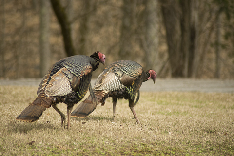
You might see bald eagles, red-bellied woodpeckers, and wild turkeys in the sky.
Slimy salamanders and cricket frogs are among the numerous amphibians residing in Mississippi. Gulf crawfish snakes, southern five-lined skinks, and Mississippi mud turtles are a few of the reptiles found in the state.
Fragrant magnolia trees are common in the area and are the state flower. There are also live oak, pecan, and hickory. Black-eyed Susans, oxeye daisies, chicory, orange daylilies, and Mississippi penstemon are a small bouquet of the state's many wildflowers; National Geographic.
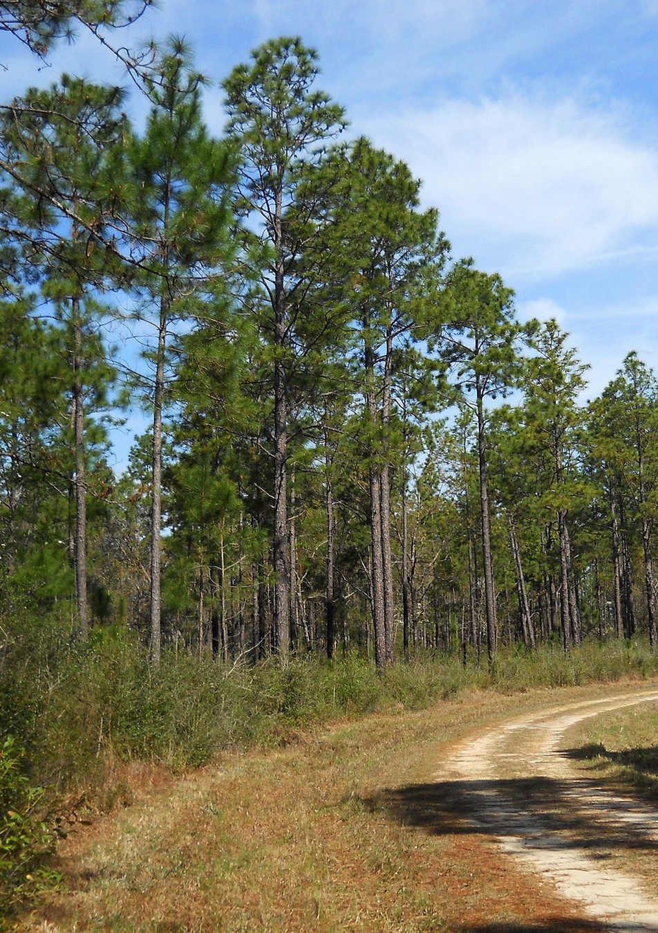
The southeast of Mississippi is covered in longleaf pine trees, known as the Pine Belt or the Piney Woods.
Mississippi's Climate
The climate in Mississippi is warm and humid year-round throughout the state. The far northern region gets cooler than the south, while the Gulf Coast experiences balmy winter weather. Most of the time, the weather is hot and humid or rainy.
Winter in Mississippi is quite pleasant, although there is more rain. The average temperature in January is 48 ℉ (8.88 ℃) in the north, while the Gulf Coast experiences lows typically in the 60s ℉.
Summer can be the least comfortable season. Between June and August, daytime highs reach the mid-90s ℉. Add to that oppressively humid conditions. September and May are a bit cooler, but the humidity level remains high.
Mississippi deals with a lot of thunderstorms striking during the summer. The state has an average of 27 tornadoes touch down every year, with most of them forming in the late spring and summer.
That being said, there are a couple of months the state has beautiful weather. Once the threat of hurricane season has passed, October and November have the most comfortable daytime temperatures, with highs in the 70s ℉.
March is another beautiful time to visit Mississippi, having similar weather as the fall.
The state of Mississippi played a vital role in the Civil War and is home to various historical sites, landmarks, monuments, and museums.
Some famous locations worth visiting around the state include the Biloxi Lighthouse, Elvis Presley's birthplace, Windsor Ruins, Old Capitol Museum, and Vicksburg National Cemetary.
Mississippi is full of adventure and activity. Cultural attractions and historic sites aren't just a fraction of the fun. The world-class gaming resorts are top-rated.
If you are interested in Mississippi's history don't hesitate to get this book form Amazon: Vicksburg National Military Park, Mississippi. This is a a guidebook produced by the National Park Service that provides the history of the civil war battles in and around Vicksburg, Mississippi, along with maps and a list with points of interest.
If you want to learn more about forests in the U.S., check this map of the U.S. Forest Service
Mississippi's Parks and Preserves
Mississippi has 23 State Parks, 2 State Wildlife Areas, 8 State Wildlife Management Areas, 7 National Forests, National Historic Site, 9 National Wildlife Refuges,4 areas managed by the National Park Service, and 6 Army Corps of Engineers areas.
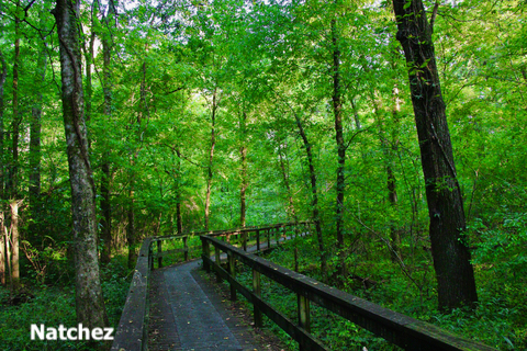
Natchez Trace Parkway
Natchez Trace Parkway is the red band that crosses Mississippi.
The Natchez Trace Parkway covers over 400-miles of recreational road that provides incredibly scenic views through three states: Alabama, Mississippi, and Tennesse.
Natchez Trace approximately follows the "Old Natchez Trace", a historic travel pathway used by the Indigenous people in the area, slave traders, soldiers, and European settlers.
Natchez Trace can be traveled by vehicle, bike, foot, or horse.
Camping is available along the Trace, making it easier for long-distance traveling.
While much of the "Old Natchez Trace" trail has been assimilated into today's landscape, there are sections that still remain to hike and explore.
The mounds at Natchez Trace are sacred places to the Indigenous tribes. The six centuries-old mound sites are protected by the Natchez Trace Parkway.
Emerald Mound is located at milepost 10.5, near Natchez, Mississippi, and it's the second-largest mound site in the United States.
There are actually hundreds of mounds throughout Mississippi, many of them being on the National Register of Historic Places.
The maximum stay at Natchez Trace Parkway campgrounds is 14 days. While the sites offer travelers a place to rest their bodies and minds, no electricity or dump stations are available; Natchez.
You can spend an unforgettable weekend in Natchez. VRBO has incredible stays depending on your needs. For riverwalks, cottages, and houses click here!
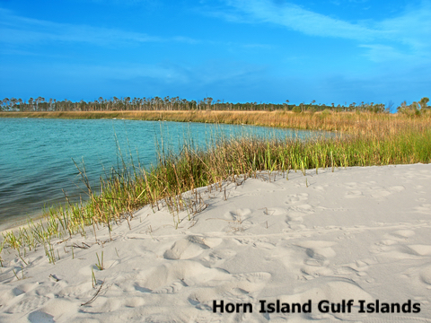
Gulf Islands National Seashore
Gulf Islands National Seashore is the red band on the Mississippi Coast. It stretches along the northern coast of the Gulf of Mexico for 160 miles.
It is located between Mississippi and Florida and includes maritime forests, historic forts, marine habitat, bayous, and barrier islands.
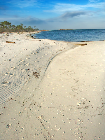
There are five islands within Mississippi's unit of the Gulf Islands National Seashore: West Petit Bois Island, Petit Bois Island, Horn Island, Ship Island, and the southern tip of Cat Island.
There is a variety of activities available year-round for visitors throughout the seashore.
You can spend a week of fun in the area's Casinos at night and visit the islands during the day. For prices and amenities at the IP Casino Resort Spa visit Expedia!
The Davis Bayou Area
This area is located close to Ocean Springs. Here you will find the William M. Colmer Visitor Center. It is an excellent starting point to explore the indoor exhibits about the islands and their history.
There is a visitor fishing pier at Gulf Islands Seashore. The boardwalk trail is located behind the visitor center, offering an incredible view of the bayou.
Several short hiking trails are marked throughout the park. The developed campground makes a weekend at the park comfortable.
There are not many guidebooks focused in the area. But Amazon has Hiking the Gulf Coast: A Guide to the Area's Greatest Hiking Adventures. This book highlights the 40 best hikes in the in the area, from easy to more moderate and difficult. The book spans Florida, Alabama, Mississippi, Louisiana, and Texas. Complete with full-color photos and maps throughout.
The Barrier Islands
These are some of the most beautiful Barrier Islands in the United States source Gulf Islands.
- Cat Island and West Petit Island: Only accessible on a private boat.
- Horn and Petit Bois Islands: Only accessible on a private boat. These islands are wilderness areas with uncommon species and hence are protected.
- Ship Island: Accessible by boat and public ferry between March and October. Great location for fishing, swimming, or having a picnic.
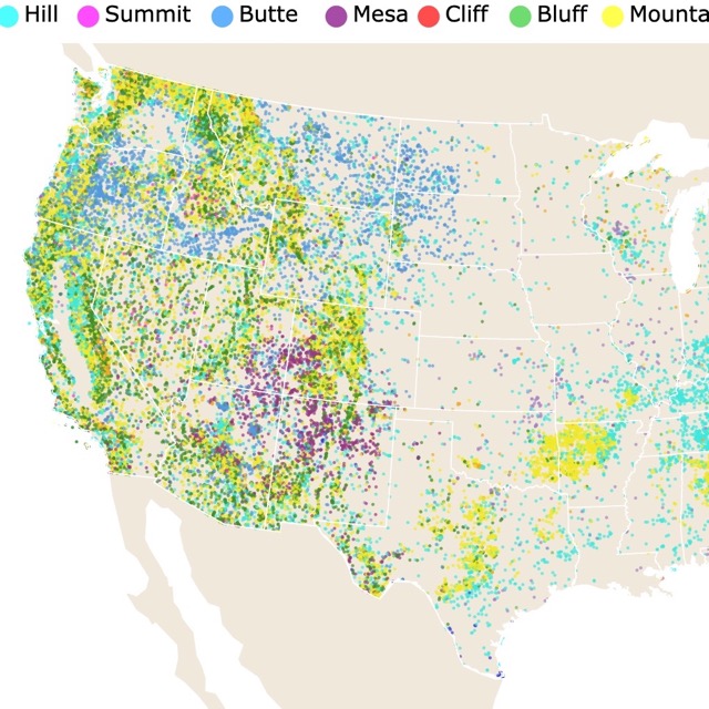
Map of Summits and Hills
De Soto National Forest
De Soto National Forest or De Soto Ranger District is represented by all the large green areas in southern Mississippi.
De Soto is often distinguished by the gently rolling terrain, southern pine ridges, and flowing streams.
The forest has a variety of ecosystems including dry sandy longleaf pine/scrub oak ridges, flooded tupelo/bald cypress swamps, hardwood forests of Ragland Hills, and the vast pitcher plant savanna at Buttercup Flats.
De Soto National Forest has two wilderness areas: the Leaf and Black Creek.
De Soto is home to Mississippi's only scenic river, Black Creek. Black Creek is famous for its white sandbars and serene flowing waters. The river also allows visitors the opportunity to observe birds and otters in their natural habitat.
The Black Creek and Tuxachanie trails offer more than 60 miles of paths to explore. The forest has several other routes, including ATV trails, the Big Foot horse trail, and the Bethel bike trail.
The park offers other recreational opportunities throughout the year, including hiking, biking, camping, canoeing, ATV rides, horseback riding, hunting, kayaking, and fishing; De Soto.
Holly Springs National Forest
Holly Springs National Forest or Holly Springs Ranger District is the green area in northern Mississippi.
Holly Springs has invaluable sparkling lakes, green upland hardwoods, unique bottomlands, and pine forests.
What is unique about this district is that the National Forest Service is working towards restoring native communities and eliminating invasive species.
The park consists of two units: Holly Springs in the north and Yalobusha in the south. With over 155-thousand acres, there is plenty to explore.
The Chewalla campground is a perfect way to spend a few days exploring Holly Springs. Hiking, water activities, and much more fun are ready to be had; Holly Springs.
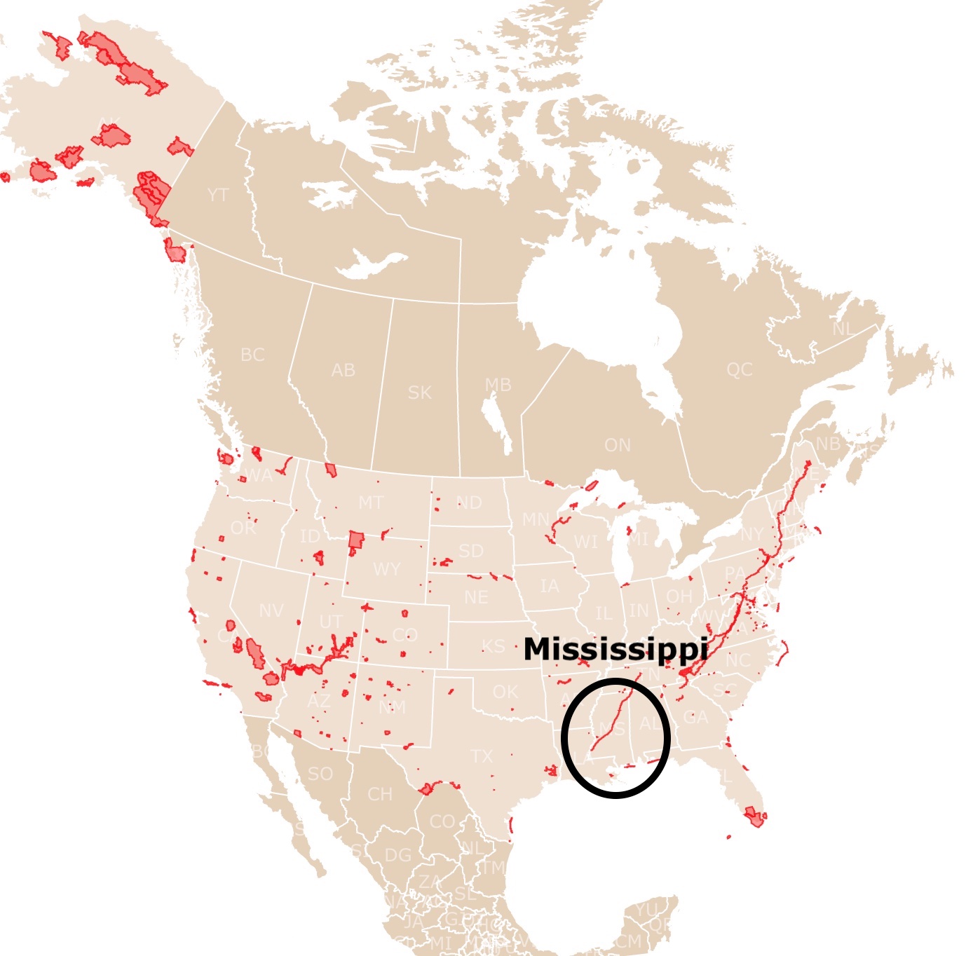
Mississippi has beautiful shores. To learn more about them, visit this map of North America's Marine Ecoregions
J.P. Coleman State Park
J.P. Coleman State Park is the lime area in the northeastern corner of Mississippi.
J.P. Coleman sits peacefully on a rocky bluff overlooking the Tennessee River.
This state park offers numerous water sports, including sailing, swimming, water skiing, and fishing. Anglers love catching the Smallmouth bass out of Pickwick Lake.
There is plenty of untamed wilderness to be explored along the banks of the Tennessee River. Visitors can camp out in an RV, a tent, or a cabin.
Play a game of mini-golf before taking the kids on a picnic and a swim at the pool; JP Coleman.
If you want a thorough description of Mississippi parks, Amazon has List of Mississippi state parks: Mississippi state park checklist. This book has descriptions of the parks, inventory checklists, and the ability to create your own exploration.
Paul B Johnson State Park
Paul B Johnson State Park is the lime polygon south of Hattiesburg.
Paul B Johnson is located in the heart of the state's pine belt region. The deep forests of majestic longleaf and loblolly pines, delicate dogwoods, and ancient oaks provide a picturesque setting for any outdoor activity.
The park is only a 20-minute drive from the University of Southern Mississippi; enjoy a game before heading to the park for a weekend away. Southern Miss to the Top!
There is an assortment of recreational activities visitors can enjoy at Paul B. Johnson, including playgrounds, splash pads, disc golf, swimming, nature trails, and a wealth of water activities. Stop in the visitor center for some educational material, and don't forget about the game room.
Camp Shelby, the Armed Forces Museum, is only 5 miles north of Paul B. Johnson State Park.
When camping at this park, pets are allowed in designated areas. However, animals are not permitted in or around villas, cabins, motels, or state buildings; Paul B Johnson.
World Map of Oil and Gas Fields
Le Fleur Bluff State Park
Le Fleur Bluff State Park is an urban park, the lime green polygon in Jackson, MS.
Visitors to Le Fleur Bluff State Park can enjoy fishing, camping, nature trails, and picnic areas.
This 305-acre park includes a nine-hole golf course and a driving range.
Leave the park to explore the town of Jackson, and you'll discover various museums, events, activities, unlimited shopping, and all sorts of dining.
There are 28 developed campsites and 10 shaded primitive tent sites at the park for visitors. The picnic pavilions make a great place to enjoy lunch in the shade. Disc golf and playgrounds are also available at Le Fleur's; Le Fleur Bluff.
Lake Lowndes State Park
Lake Lowndes State Park is a small lime area on the border with Alabama.
Lake Lowndes Park is located on a 150-acre lake and provides endless outdoor recreational activities, including camping, fishing, football, tennis, softball, disc golf, and other organized sports.
Camp at one of the 50 developed sites or choose from a scenic wooded tent camping space, vacation cabins, and cottages. Laundry facilities are available at the park, making an extended stay even more manageable.
Lake Lowndes has picnic pavilions, a playground, hiking trails, a boat launcher, and an opportunity for water skiing; Lake Lowndes.
World Geographic Range of the Raccoon Family
Delta National Forest
Delta National Forest or Delta Ranger District is the green and purple area northwest of Jackson, MS.
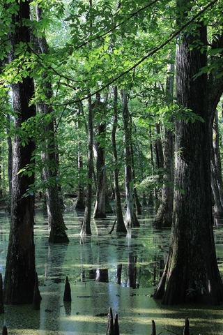
The forest lies within the floodplain of the Mississippi River, and it's one of the few hardwood forests left in the Mississippi Delta.
This National Forest comprises over 60,000 acres of associated wetlands and bottomland hardwoods. 10,000 acres of the forested wetland habitat are mainly for waterfowl spending winter there.
The park maintains a recreation program with over 55 campsites, 2 recreation areas, and more than 45 miles of ATV and multi-use trails. 19 trails are multi-use, while one is for hiking.
Biking, hiking, camping, ATV and off-road vehicle riding, fun in the water, and more are available at the Delta National Forest; Delta.
Mississippi is rich in culture and history. There is so much to do in and around every National and State park, so plan your trip well.
List of Mississippi's Parks and Natural Areas
| National Seashore | |
|---|---|
| Gulf Islands National Seashore | |
| National Military Park | |
| Vicksburg National Military Park | |
| National Historic Site | |
| Brices Cross Roads National Battlefield | Shiloh National Battlefield |
| State Parks | |
| Buccaneer State Park | Leroy Percy State Park |
| Carver Point State Park | Nanih Waya State Park |
| Clarkco State Park | Natchez State Park |
| Cossar State Park | Paul B Johnson State Park |
| Golden Memorial State Park | Percy Quin State Park |
| Gulf Marine State Park | Roosevelt State Park |
| Holmes County State Park | Shepard State Park |
| Hugh White State Park | Tishomingo State Park |
| J. P. Coleman State Park | Tombigbee State Park |
| John W Kyle State Park | Wall Doxey State Park |
| Lake Lincoln State Park | Winterville State Park |
| Lake Lowndes State Park | |
| State Wildlife Areas | |
| Okatibbee Wildlife Area | Leaf River Wildlife Mgt. Area |
| Tippah County State Fishing Lake | Little Biloxi Wildlife Mgt. Area |
| State Wildlife Management Areas | Malmaison Wildlife Mgt. Area |
| Chickasawhay Wildlife Mgt. Area | Pascagoula River Wildlife Mgt. Area |
| Choctaw Wildlife Mgt. Area | Red Creek Wildlife Mgt. Area |
| Copiah County Wildlife Mgt. Area | |
| National Forests | |
| Bienville National Forest | Holly Springs National Forest |
| DeSoto National Forest | Homochitto National Forest |
| Delta National Forest | Tombigbee National Forest |
| Delta Experimental Forest | |
| National Wildlife Refuges | |
| Bogue Chitto National Wildlife Refuge | Morgan Brake National Wildlife Refuge |
| Hillside National Wildlife Refuge | Noxubee National Wildlife Refuge |
| Horn Island National Wildlife Refuge | Panther Swamp National Wildlife Refuge |
| Mathews Brake National Wildlife Refuge | Yazoo National Wildlife Refuge |
| Mississippi Sandhill Crane National Wildlife Refuge | |
| Army Corps of Engineers | |
| Arkabutla Lake | Okatibbee Lake |
| Grenada Lake | Enid Lake |
| Sardis Lake | Tennessee-Tombigbee Waterway |
Follow Me
Resources for Mississippi's Protected Areas Map
The shapefiles with Mississippi's state boundary lines, major rivers, and cities were downloaded from Natural Earth Data.
The Parks and Public Lands shapefiles for Mississippi were downloaded from USGS.
This map will be updated with new data! To receive updates on this and more nature maps join my email list!!!!!!!
Made by Luz K. Molina with D3.js.