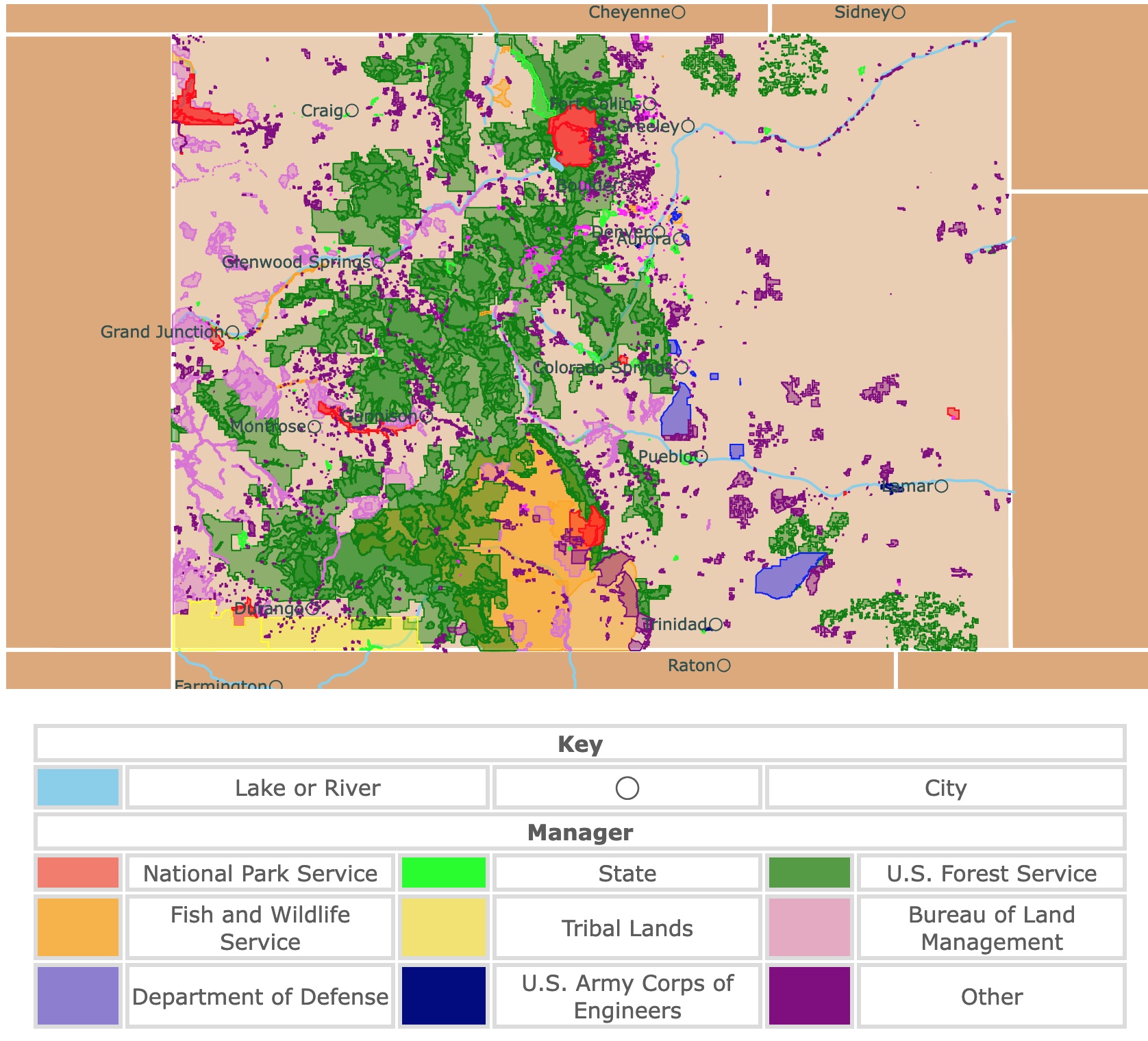
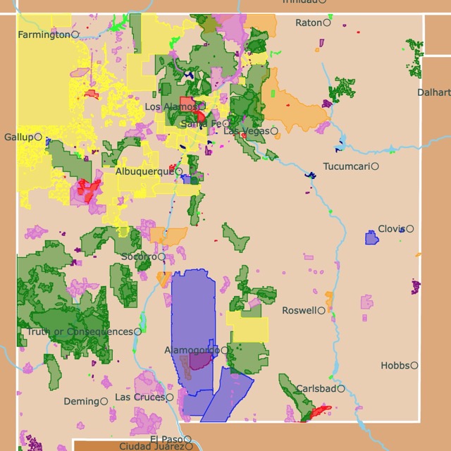
Map of Colorado's Parks and Protected Areas
This interactive map shows the Locations, Names, Areas, and Details of National Parks, State Parks, National Forests, Tribal, and other Public Lands of Colorado. It also shows major cities and rivers for context. For more detail, zoom in. For more information, hover over the map, or scroll down.
| Key | |||||
|---|---|---|---|---|---|
| Lake or River | ◯ | City | |||
| Manager | |||||
| National Park Service | State | U.S. Forest Service | |||
| Fish and Wildlife Service | Tribal Lands | Bureau of Land Management | |||
| Department of Defense | U.S. Army Corps of Engineers | Other | |||
Colorado State Geography
Colorado's southwest corner intersects with New Mexico, Arizona, and Utah. This intersection is called the "Four Corners"; it's the only place in the United States where you can stand in four states simultaneously.
The Rocky Mountains span most of the western part of Colorado. The Rocky Mountain range stretches from New Mexico into Canada. However, Colorado is home to the range's tallest peak, Mount Elbert, which is 14,400 feet (4,401 meters) above sea level.
Travel to the east of Colorado, and you'll find the Great Plains. The Great Plains are a massive grassland covering more than a million square miles of North America's interior. The plains are used to grow wheat corn and raise cattle.
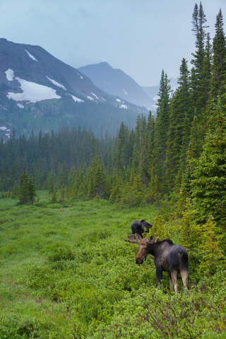
The mountains of Colorado are home to Rocky Mountain bighorn sheep, black bears, beavers, mountain lions, mountain goats, golden eagles, great horned owls, and the endangered boreal toad.
While on the plains, you can find mammals like bison and prairie dogs. You'll also see reptiles such as the rattlesnake. Birds like the burrowing owls and the lark bunting call the plains home. Amphibians such as the tiger salamander reside there as well.
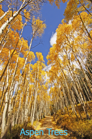
Dozens of trees are native to the state of Colorado; many of them are conifers, including the ponderosa pine. It's been said that the bark of the ponderosa pine smells slightly of butterscotch or vanilla. If you're in the area during September and October, you might get a glimpse of the aspen tree changing color.
One look around the beautiful landscape of Colorado shows off the beautiful plant life that exists, including the Columbine, which is the state flower. Serviceberries, giant goldenrod, and wild roses are just a few of the plants in Colorado.
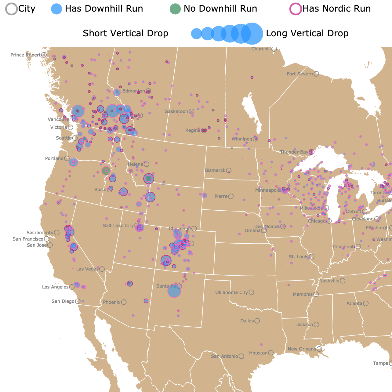
Colorado has some of the Best Ski areas in the country. To find where they are, check this map of Ski Resorts in North America
Colorado's Climate
The combination of high elevation, midlatitude, and continental interior geography creates a cool, dry, and invigorating climate. Colorado's average annual temperature is about 43.5 degrees Fahrenheit (6.39 degrees Celsius). The average amount of rainfall in Colorado is about 17 inches.
The climate varies profoundly depending on the area. For instance, the temperatures might be much cooler in the mountain ranges than down in the valleys or prairies. There is a 4 to 5-degree difference every 1,000 feet (304.8 meters) of elevation, meaning the higher you go, the more the temperature will decrease.
In Colorado, you will find snow-capped mountains, beautiful prairies, and even deserts. That being said, the climate and wildlife can vary from one region to the next. Mesa Verde is one of Colorado's national parks located in the Four Corners area, and it is desert land.
Severe weather varies greatly, from extreme cold to extreme heat. Blizzards, high winds, seasonal flooding, flash floods, forest fires, droughts, and tornadoes are all potential severe weather.
Although the state of Colorado is semiarid, the most damaging events are flash floods and droughts. The regions of Colorado most prone to flash floods are located along the base of the lower foothills, east of the mountains. The Fort Collins flood of 1997 is only one example of severe flooding, Colorado Encyclopedia.
Colorado's National Park Service and Wilderness Areas
Rocky Mountain National Park
The Rocky Mountain national park was established in 1915, and it covers over 400 square miles of incredible mountain environments.
This national park is one of the most visited parks in the United States. It is represented as a red polygon on the map.
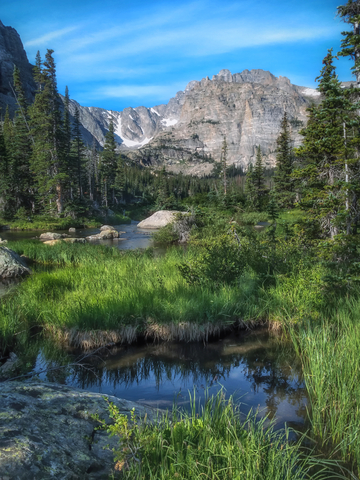
The Rocky Mountain is one of the highest national parks, with elevations from 7,860 feet (2,395 meters) to 14,259 feet (4,346 meters). When you're that high up, you'll feel like you're on top of the world.
Within the Rocky Mountain National Park, you'll discover 77 mountain peaks that are over 12,000 feet (3,657 meters) high, as well as the Continental Divide, National Geographic
One of the reasons the park is so popular is that it's one of the country's top wildlife watching sites. Rocky Mountain National Park is home to over 60 species of mammals, including elk and moose. You can also find over 280 bird species.
The Rocky Mountain National Park has an extensive museum collection ranging from household items that were a part of historic homes, photos, watercolor paintings, and oil paintings.
Stop into the museum to see what life was like back then. You'll find cultural items, works of art, geological specimens, and biological specimens.
While the Rocky Mountain National Park doesn't have a lodge on-site, there are several excellent options to choose from. You could always camp out if you're into that sort of thing. The Grand Lake Lodge is a magnificent cabin resort located just outside the park's west entrance.
You could always book a space at the tiny house resort or a haunted hotel. Needless to say, you'll have plenty of options to choose from whether you're camping or looking for a cabin. However, you'll want to book your spot in advance since the Rocky Mountain National Park is so famous visitors come all year long.
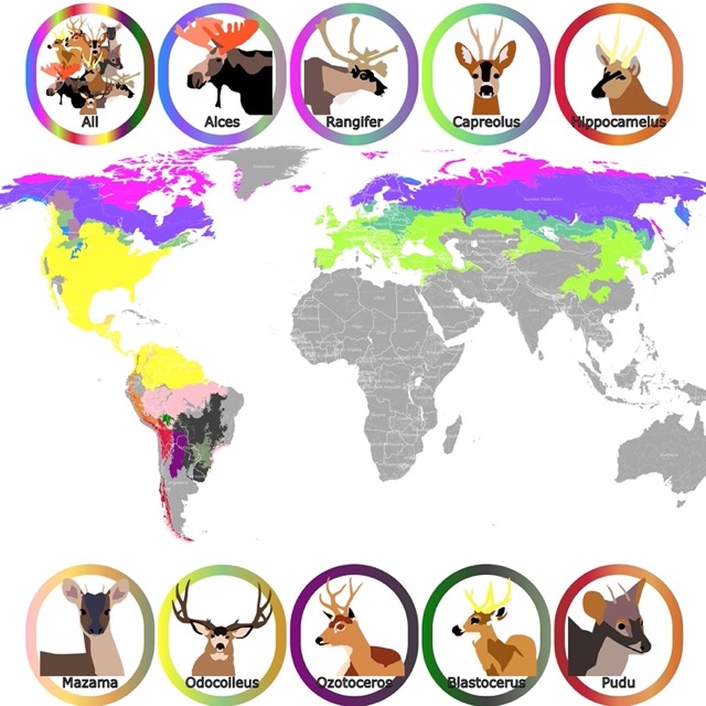
Want to find deer or moose? Check this map of New World Deer!
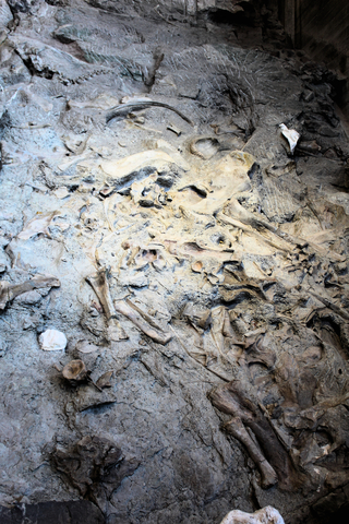
Dinosaur National Monument
Dinosaur National Monument is located in the northwestern corner of Colorado and is depicted in red.
This national monument has many places to explore. Whether you're into hiking, archeology, geology, camping, or dinosaurs, there's something here to do.
The park also has petroglyphs (images carved into the rock) and pictographs (patterns painted on the rock). The petroglyph sites are traces of the life that once was, Dinosaur.
There are miles of trails to hike through the rugged landscape, with incredible scenery around every bend.
There are six campsites with over 120 sites to pick from. Three of the campgrounds are in Utah, while the other three are in Colorado.
You can experience the park's natural beauty and remote canyons by water if you're into river rafting. You can choose to raft the Yampa or Green rivers.
The dinosaur quarry draws a lot of attention to the park. However, the quarry is on the side of the monument located in Utah.
The layer of rock enclosing the fossils is a sandstone and a conglomerate bed of alluvial (materials deposited from rivers), Alluvium. The river systems carried the ancient animals and dinosaurs, which eventually entombed their remains, leaving us with the fossils we see today.
The quarry exhibit wall allows you to view 1,500 dinosaur bones. If you want to take a hike, you may be able to find some bones yourself. It's a real adventure for children and adults too.
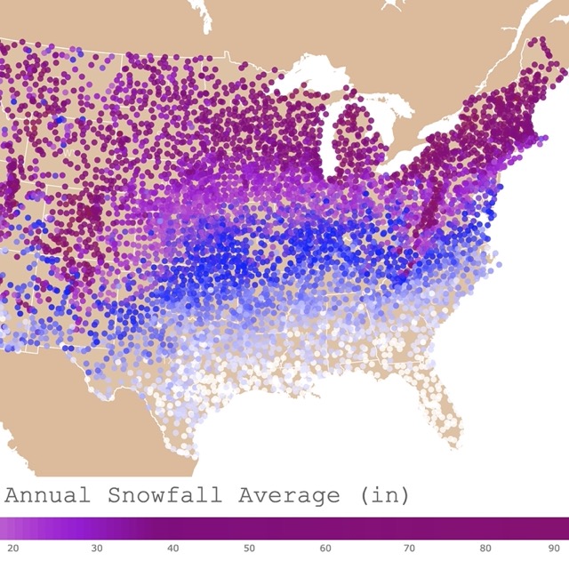
Map of Snowfall in the USA
Great Sand Dunes National Park and Preserve
The Great Sand Dunes National Park and Preserve is the red polygon located in the southern middle section of Colorado.
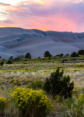
Great Sand Dunes National Park never closes; it's open 24/7. Here you can experience the tallest dunes in North America.
The dunes may be the centerpiece, but that isn't all the park has to offer. There is a diverse landscape of wetlands, grasslands, alpine lakes, forests, and tundra to explore.
Something unique about this national park is that they offer a limited number of sand wheelchairs for those with limited mobility, Great Sand Dunes.
Many people have heard of snowboarding, but at the Great Sand Dunes National Park and Preserve, you can experience sandboarding and sand sledding Sand Boarding.
Inside the park, it is also possible to experience water sports. The Medano Creek offers a popular seasonal creek for swimming and floating.
Bird lovers might enjoy a glimpse of the Sandhill Crane migration during the spring and fall. Hiking, camping, horseback riding, swimming, fishing, and the scenery make the trip worthwhile.
Want to find places to explore in nearby New Mexico? Check this map of New Mexico's Parks
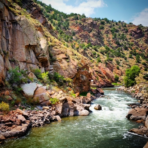
Black Canyon of the Gunnison Wilderness
The Black Canyon of the Gunnison Wilderness is the curved red belt on the map located east of Montrose.
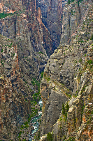
The Black Canyon is the deepest narrow canyon in the United States.
Two billion years ago, the coarse-grained, granite-like metamorphic rock formed the core of this area. The Black Canyon is 53 miles (85.29 kilometers) long and was incredibly slowly worn away by the Gunnison River.
In some places, the Gunnison River throbs wildly over 2,000 feet (609.6 meters) below, while at The Narrows, the canyon's only 1,100 feet (335.28 meters) wide at the rim and as little as 40 feet (12.19 meters) wide at the base.
Black Canyon of Gunnison Wilderness may not seem like a place for beginner hikers, climbers, or fishers. However, you can still enjoy the scenic route by vehicle along the rims and by the river.
The North and South rims of the canyon offer trails for all levels, but the inner canyon consists of challenging hiking, rock climbing, and kayaking.
Camping is permitted at the bottom of the canyon but nowhere else. You can enjoy night sky viewing all year long, and the canyon offers an interesting vertical view for wildlife watchers.
The Black Canyon is surrounded by a dryland forest full of pinon and juniper trees.
Colorado State Parks
State Forest
State Forest is represented in a lime green band west of Fort Collins.
The rugged Colorado State Forest State Park offers over 70,000 acres of beautiful forest, alpine lakes, jagged peaks, an abundance of wildlife, and miles of trails.
The park stretches along the west side of Medicine Bow Mountains and into the north end of the Never Summer Mountain Range, Never Summer Wilderness.
The State Forest State Park offers something for everyone all year long. With such an abundance of diversity, visitors can experience an array of outdoor recreational activities.
Some of the activities include camping, four-wheeling, horseback riding, hiking, snowshoeing, snowboarding, snowmobiling, fishing, hunting, bird watching, telemarking, geocaching, and wilderness watching.
North Park is considered to be the moose viewing capital of Colorado. Over 600 moose can be observed all year long. Needless to say, moose is the park's claim to fame.
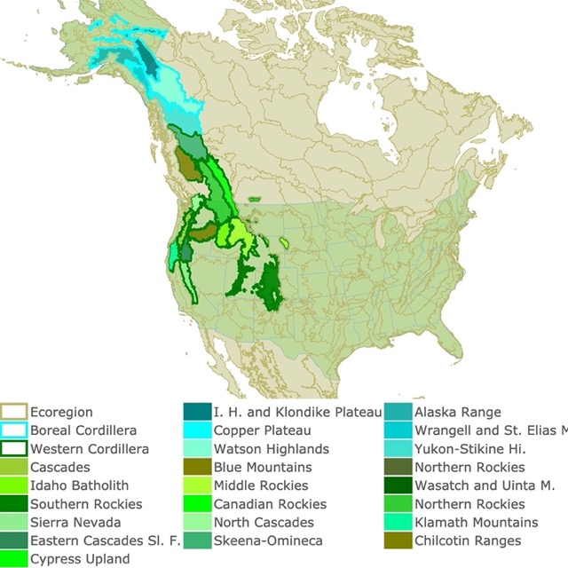
The Rockies play a crucial role in Colorado's landscape. To learn more, check this map of the Northwestern Mountains
Mueller State Park
Mueller State Park is represented as a lime green polygon west of Colorado Springs.
Mueller is an extremely popular wildlife area for wildlife watchers. The site is home to abundant wildlife, including hawks, mule deer, elk, and black bears.
Mueller State Park offers over 5,000 acres of spring-fed meadows, several ponds dotting the landscape, forested ridges, and massive rocks of Pikes Peak Granite.
Mueller Park supports a variety of plant life, from wildflowers and native grasses to fir, spruce, and aspen trees. Aside from the larger animals mentioned, an abundance of small mammals and birds call the park home.
This beautiful state park has year-round recreational opportunities such as camping, trails, fishing, picnicking, and nature studies. The activities include snowshoeing, sledding, and even cross country skiing during the winter months. Every season offers photographers the chance to get incredible photos.
Mueller Park welcomes your pets inside the campgrounds as long as they're leashed. You'll find beautiful picnic sites and paved roads where your furry friends are welcome as well. However, the hiking trails and backcountry are off-limits to animals.
There is so much to experience in Colorado's parks! You can find something for everyone except maybe a Wi-Fi signal; however, they might offer that at the campgrounds and lodges. Check out some of these items you might find helpful while you're out exploring.
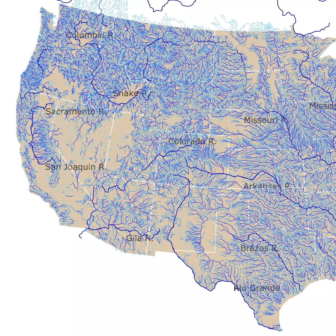
There are lots of rivers to explore in the U.S. For a detailed map, visit this map of U.S. Rivers
Colorado's Protected Areas
Arkansas Headwaters
The Arkansas Headwaters Recreation Area is represented by a tiny green speck between Colorado Springs and Pueblo.
Arkansas Headwaters Recreation Area (AHRA) is recognized as one of the nation's most popular kayaking and whitewater rafting locations in the United States.
The Arkansas River is one of the most commercially rafted rivers in the U.S. It's noted for the world-class fishery that provides people with an excellent opportunity for anglers to catch brown and rainbow trout.
Arkansas Headwaters offers camping, hiking, picnicking, mountain biking, rock climbing, and wildlife watching.
You can even go gold panning along the river's shores. Experience the broad ballers and towering mountain peaks within the upper Arkansas River valley.
Affiliate Disclosure
Databayou.com is a participant in the Amazon Services LLC Associates Program, an affiliate advertising program designed to provide a means for sites to earn advertising fees by advertising and linking to Amazon.com. Databayou.com also participates in affiliate programs with Clickbank, CJ, and other sites.
If you plan on visiting one of these Colorado parks, I suggest you get some of these items found on Amazon.
- Slip Face Sandboards' Jump Sandboard: You can bring your own board instead of renting one for those of you who want to go to the Sand Dunes.
- Mega Fossil Dig Kit Excavate 15 Real Fossils Including Dinosaur Bones and Shark Teeth. Great Gift for Girls and Boys.
- Intex Challenger Kayak: One Person Inflatable Kayak, Set with Aluminum Oars, and High Output Air Pump; for adventures in Colorado Rivers.
FOLLOW ME
Resources for Colorado's Protected Areas Map
The shapefiles with Colorado's state boundary lines, lakes, major rivers, and cities were downloaded from Natural Earth Data.
The Parks and Public Lands shapefiles for Colorado were downloaded from USGS.
This map will be updated with new data! To receive updates on this and more nature maps join my email list!!!!!!!
Made by Luz K. Molina with D3.js.