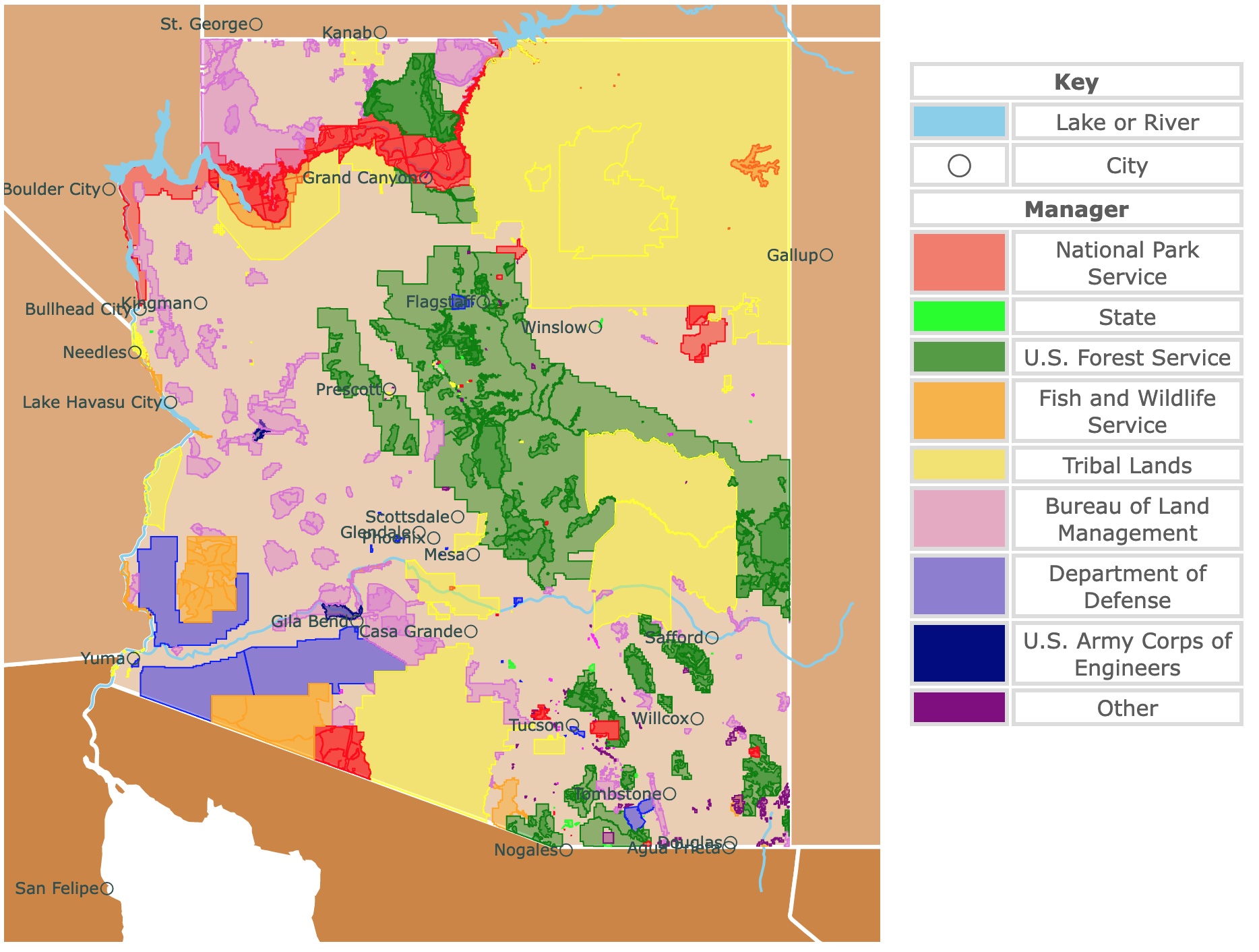
Map of Arizona's Protected Areas
This interactive map shows the Locations, Names, Areas, and Details of National Parks, State Parks, National Forests, Tribal, and other Public Lands of Arizona. It also shows major cities and rivers for context. For more detail, zoom in. For more information, hover over the map, or scroll down.
| Key | |
|---|---|
| Lake or River | |
| ◯ | City |
| Manager | |
| National Park Service | |
| State | |
| U.S. Forest Service | |
| Fish and Wildlife Service | |
| Tribal Lands | |
| Bureau of Land Management | |
| Department of Defense | |
| U.S. Army Corps of Engineers | |
| Other | |
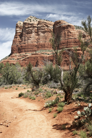
Arizona's Geography
Arizona is famous for its vast desert landscapes, towering rock formations, and commonly unbearable heat. Its reddish sand and dirt cover miles and miles of land that still remains uninhabited by people. Arizona State.
Arizona borders to the west with the states of California and Nevada. To the North with Utah, and to the west with New Mexico. To the south and southwest it shares a border with Mexico's state of Sonora and Baja California.
Arizona is the hottest and the sunniest state in the USA. Arizona is also known as one of the 4 four corner states with Utah, Colorado, and New Mexico!
Plateaus and large sandstone mountains are hubs for tourism and exploration in Arizona. From Sedona, Arizona, you are within just a few miles of several well-known examples, like Snoopy Rock.
Common images of Arizona usually include the wide-open spaces and lots of turquoises. Indigenous people often used these colorful stones to decorate their clothes or homes. Mining is actually still one of the major industries in Arizona.
Five percent of the population identifies with a Native American Tribe. The largest include the Navajo Nation, The Hopi, and Apache, but there are other reservations in the state as well.
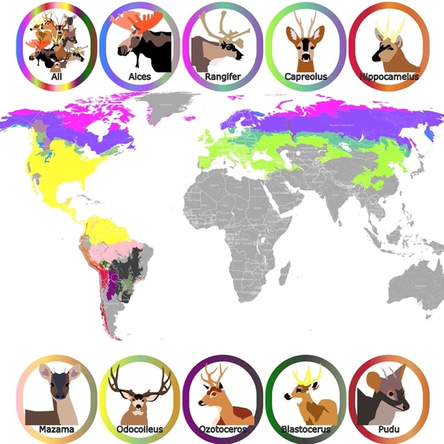
Map of Deer Geographic range worldwide.
Arizona Climate
If you’re planning a trip to Arizona, expect to sweat. The state consistently reaches temperatures above 100 degrees Fahrenheit (37.8 Celsius).
In the capital, Phoenix, temperatures rarely drop below freezing, and the state doesn’t get much precipitation.
Surprisingly, most of the rain comes in the summer and it usually causes flash flooding. As a visitor, you have to keep an eye on rain.
It is hard to believe, but Arizona also receives snow due to higher elevations. Humphreys Peak is the highest point in Kachina Peaks Wilderness at 12,633 feet (3,850m).
The desert makes up most of Arizona, but that’s not a bad thing. Images of the Arizona desert will prove how romantically breathtaking the views can be, but the sunset on a cool, desert night will prove it.
Arizona Wildlife
If you plan a trip to Arizona you should definately
The Arizona desert’s wildlife consists of many desert-dwelling species that would be expected, like prairie dogs, coyotes, and rattlesnakes. However, there are some less common desert animals in Arizona, as well. The most famous is the jaguar, which is native to Southern Arizona and facing extinction, due to habitat loss. AZ Governor.
Common plants in the state include Saguaro, Desert Lily, Elephant Tree, Desert Holly, Ponderosa Pine, Ocotillo, Skyrocket, Alligator Juniper, Teddy Bear Cholla, and California Fan Palm. Arizona Plants
While the state is known for its deserts, that isn’t all that Arizona has to offer. In the Northern regions of the state is where find the mountains and mountainous forests, with many different species of plants and animals.
Snow falls onto the mountains and stays all year round, just a few hours from the desert.
Arizon Highlights!
A hike in Southern Arizona might have you on the lookout for snakes and scorpions, but a hike in Northern Arizona should have your focus on more than just the ground!
While many species will leave people alone, there are mountain lions and bears living around the area. That said, mountain lions are also common in the desert part of the state. Flagstaff.
Thousands of families travel to Arizona every year, just so that they can see the wonders that exist in one of America’s fiercest climates.
Rock formations and colorful dirt walls that tower thousands of feet overhead are very common in the state.
These grand sandy structures of the desert continue to marvel visitors but aren’t the only massive geological structures in Arizona. Mountains and waterfalls and underwater estuaries breathe life into the Arizona landscapes.
All in all, if you’re thinking about taking a trip to Arizona, you’d be much happier seeing both North and South Arizona. Oh, and pack some sunscreen and shorts!
For a printed book, packed with information about Arizona, Amazon has Arizona (Blastoff!). This book highlights Arizona's history, landscape, a famous Arizonan, a favorite sports team, and much more!
Arizona’s National Park Service Areas
Arizona has 3 National Parks and 12 National Monuments. This state has a lot for visitors to see.
If the first park that comes to your mind is Grand Canyon, we have a page dedicated exclusively to this park! If you are interested in discovering other Arizona Parks, then keep reading.
For information on all the sites diplayed on the map, Amazon has Arizona Bucket List Adventure Guide: Explore 100 Offbeat Destinations You Must Visit! This book includes details from nature’s wonders views like the Camelback Mountain, to the Labirynth Slot Canyon, and the amazing Wupatki National Monument.
If you like canyons and rock formations, you will like this map of Zion National Park
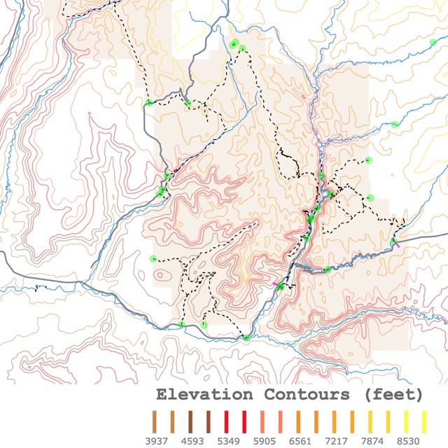
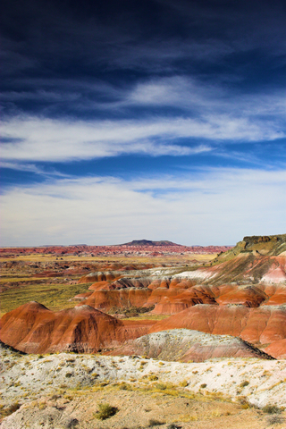
Petrified Forest National Park
Petrified Forest National Park is represented as a small, red polygon in eastern Arizona. This park is an ancient oasis and even has the remnants of an ancient village!
When you first arrive, you should sit back and cruise the main road to see what the place has to offer. Find a few good overlooks and take it all in.
Once you’ve somewhat got a lay of the land, use a park map or just wing it and go hiking off the trail! The landscape’s texture is unique, due to its powdery makeup.
The surprising thing about this park is that it isn’t a forest. Well, not anymore. You see, about 225 million years ago, massive redwoods fell to the ground. As time passed and the earth shifted, the trees became fossilized in the ground.
Now that so much time has passed, the ground in the park consists of brilliant hues of red and even a few shades of blue! Petrified Forest
The most beautiful side of the park is far from the road on the northern side, which is called the Painted Desert. This is the best location to see the different hues of the landscape.
If you wish to stay in various hotels or go glamping not far from the park. For options and prices go to Expedia!
Organ Pipe Cactus Wilderness
Organ Pipe Cactus Wildernessis on Arizona’s border with Mexico, in the Sonoran Desert. It is depicted in red. The area is just a two-hour drive from Tucson, Arizona, at 125 miles (201.2km).
The organ pipe cactus wilderness area is a UNESCO biosphere reserve. The biosphere reserves are a way of keeping at least one of every biome on earth from being majorly affected by human activity. Wilderness
Apart from its cultural significance, the wilderness area is impressive just to look at. The cacti and tumbleweeds are reminiscent of an old western movie. The area has camping and hiking that you can enjoy day or night. Organ Pipe
This park is isolated. You will probably need to fly to Tucson and rent a car to reach this park. Expedia has different options for you. For more information visit this link!
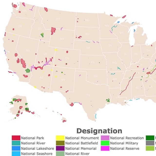
Map of U.S. National Parks
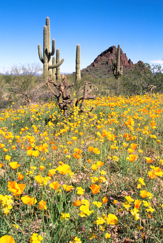
Saguaro National Park
Saguaro is the red polygon in the southern-middle section of Arizona, just west of Tucson. When you thought of Arizona, this is the place you pictured.
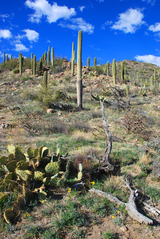
The sunsets fill the sky with the same reds and oranges that cover the ground. Rising out from the rocky desert floor, are the gorgeous giant saguaro cacti. These tenacious beasts have become an icon of the American West.
The cacti provide fruit to Native Americans and make the perfect Instagram background for modern ones. They are some of the most recognizable plants and certainly the most recognizable cactus. Saguaro
The area is not recommended for the casual nature enjoyer, due to the intense sunlight and heat. The campsites require hiking with all your required supplies. There is also no running water or food available.
For the experienced explorer, though, it shouldn’t outweigh the immeasurable beauty of the Saguaro National Park. If you’re interested in visiting the park, or any park, then make sure to check the park’s website for any updates on closures or announcements.
Due to its location next to Tucson, the hotel options are endless. For incredible suites and amenities go to Hotels.com.
Black Canyon of the Gunnison Wilderness
Black Canyon of the Gunnison Wilderness is not for the faint-hearted. A sheer and unforgiving trench that drops, in some places, a whopping 2,400 feet (721.5 km).
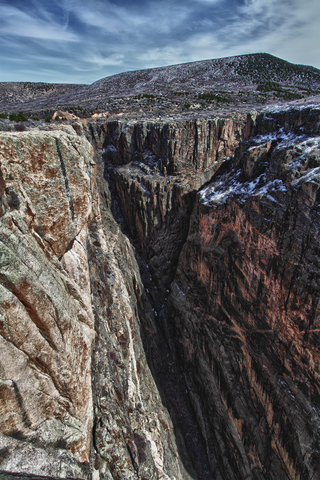
This canyon is one that you might imagine a spaceship from Star Wars to fly through. The walls are so close together, you are even likely to see a climber on the other side! Wilderness
Use caution, if you’re thinking of climbing this monstrous canyon. Always contact a ranger, another expert, or the National Park Service’s page on inner canyon use to seek out proper registration requirements. For example, you must obtain a Wilderness Use Permit before hiking. Don’t worry… they’re free.
If you’re not into seeking such a major thrill, you can still explore the ridge from above. The massive walls draw your eyes to the horizon before disappearing past your vision.
If you think you see someone climbing, it’s best to leave them be. When you’re at the Black Canyon, you may just be looking at a cougar or even a mountain goat! Black Canyon
The desert is a great place to see meteorite craters. To learn more, visit this map of Meteorite Landings
Sunset Crater National Monument
Sunset Crater National Monument is the small red triangle on the map, which is just northeast of Flagstaff. It’s only about a 19-mile (30.6 km) drive, which should take around half an hour.
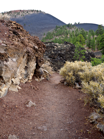
Even though the Sunset Crater is an ancient volcano, it’s responsible for the most recent eruption in Arizona. According to the National Parks Service, the volcano shot lava into the sky at distances that could have reached 850 feet (260 m)!
The Natives were forced to evacuate and start their lives over because of the tragedy. Their homes were covered and destroyed inside the flowing lava. At the time of the eruption, it’s estimated that ash was visible across most of the northern half of the state. Sunset Crater
The lava flows you will see there now is different than you may expect. The magma has become rock over time, showing where the lava went and how much of it there was.
Just like with the other parks and monuments, guides and tours are offered in the area. If you prefer to go by yourself, though, make sure to let someone know where you’ll be, in case you get lost!
Chiricahua National Monument
Chiricahua National Monument is the red area that you can find in the southeast corner of Arizona state. This is, of course, a lesser-known park than some of its neighbors, but that doesn’t mean it isn’t just as amazing.
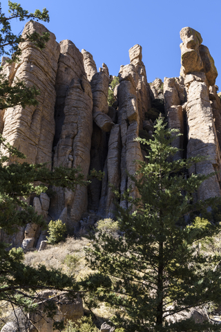
The park was formed by a volcano that erupted about 27 million years ago. The destruction caused by the volcano led to strange rock formations and fossilized lava flows, which are now in the park.
The once-barren land is not struggling to find fauna and flora anymore. There are forests and deserts, alike, in this park. If you wanted to see each biome that Arizona has to offer, then this is the place for you.
These forests provide a home to many different animals than the deserts. While you’re likely to run into a snake or another creepy-crawly in the desert, you could run into a bear in the forests! Chiricahua
What’s really unique about the Chiricahua National Monument is the standing stone structures that are scattered around the area. These upright stones are volcanic rock as well, but their peculiar shape can be quite jarring to the unprepared explorer.
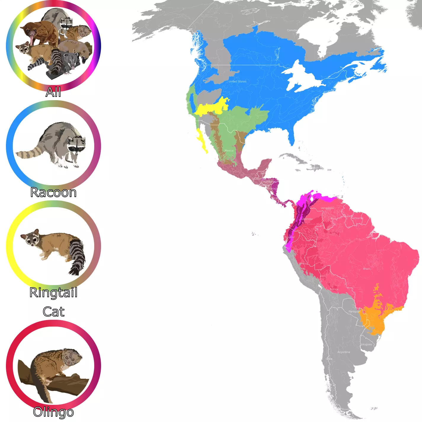
If you want to learn more about the raccoon and ring-tailed cats living in Arizona, check this map of the Raccoon Family Geographic Range
Arizona Tribal Lands
Monument Valley
Monument Valley is situated in the Navajo Nation on Arizona’s northern border with Utah. On the map, you can find it depicted in yellow.
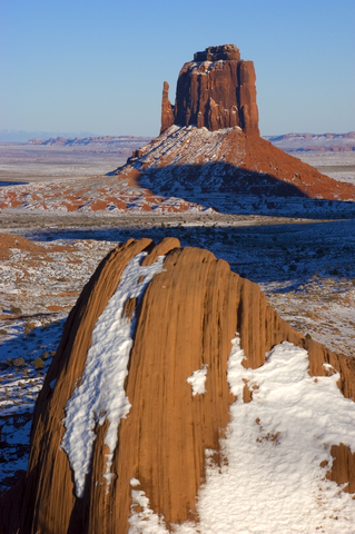
The valley shows off sandstone wonders that tower at heights of 400 to 1,000 feet (121 to 304m) from the desert floor. This is an overwhelming landscape with pinnacles of rock surrounded by buttes and mesas.
The Monument Valley offers souvenirs, snacks, and many events/activities. One of the most interesting is guided and narrated by Navajo tour operators, the tour of Merrick Butte and Mitten Buttes, which explores the landmarks while you ride along in their off-road Jeep.
The visitor center has a restaurant with Navajo food and American meals, for the less daring. What’s important to remember, though, is who the land belongs to and show respect to the Navajo and their culture.
One common activity for the adults to enjoy is buying art, crafts, clothes, etc. from the local Navajos. You’ll see roadside booths along the roads in Navajo Nation, usually offering great deals on local, handmade jewelry and other fun products. Monument Valley
Canyon de Chelly National Monument
This National Monument is also inside Navajo Nation. It looks like a red rotated W on the map.
This is smaller than the Grand Canyon but definitely worth your time!
The monument has only one public trail which takes approximately 2 hours to complete. Restrictions are due to hazardous conditions in the canyon.
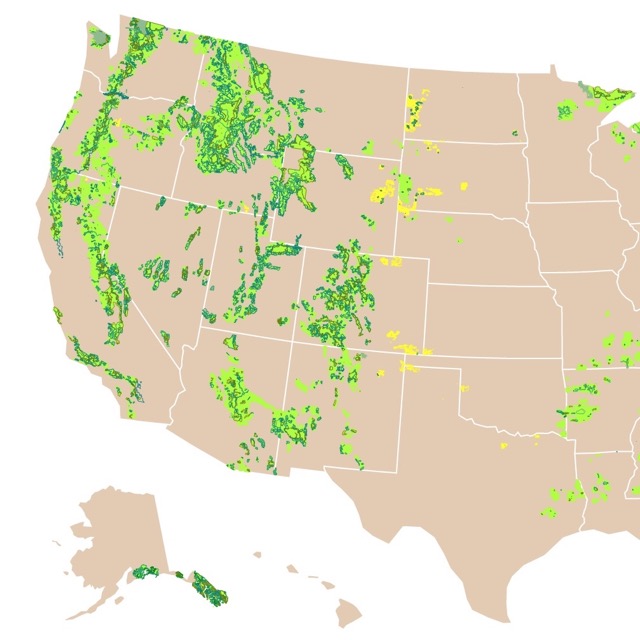
Map of National Forests
Arizona's Protected Areas
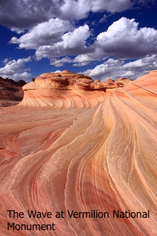
Vermilion Cliffs National Monument
This monument is located north of the state next to the border with Utah and is represented in pink.
This area is so remote that it was chosen to reintroduce the California Condor.
Accessing the famous wave uses a lottery, as this marvel requires a hike through a rugged landscape prone to flash floods.
Follow Me
Resources for Arizona's Protected Areas Map
The shapefiles with Arizona's state boundary lines, major rivers, and cities were downloaded from Natural Earth Data.
The Parks and Public Lands shapefiles for Arizona were downloaded from USGS.
This map will be updated with new data! To receive updates on this and more nature maps join my email list!!!!!!!
Made by Luz K. Molina with D3.js.