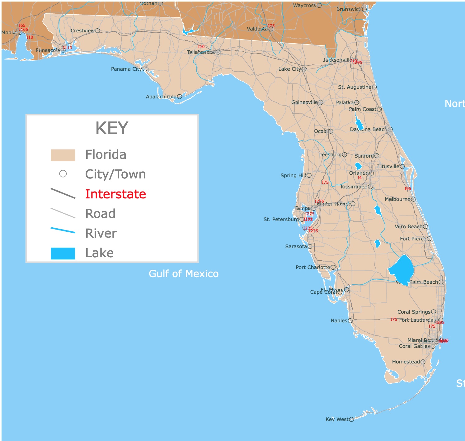
Map of Florida
This is an interactive map of rivers, lakes, cities, and roads of Florida. For names of Rivers, Lakes, Interstates, and Roads, hover over the map. For more detail, zoom in, or scroll down.
Florida's Geography
The Sunshine State is a peninsula that is mainly surrounded by water. To the east, it borders the Atlantic Ocean and the Gulf of Mexico to the south.
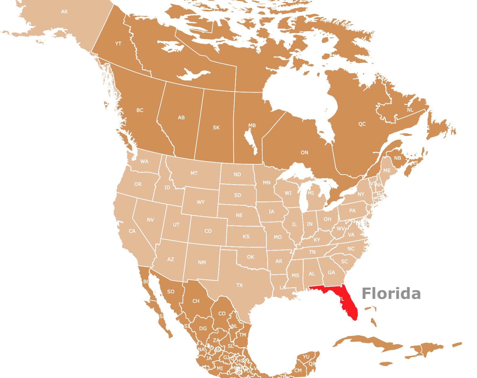
To the north, it shares borders with Georgia and to the west with Alabama.
The peninsula has an area of 170,304 km² (65,755 sq mi), and over one-fifth of the state is water.
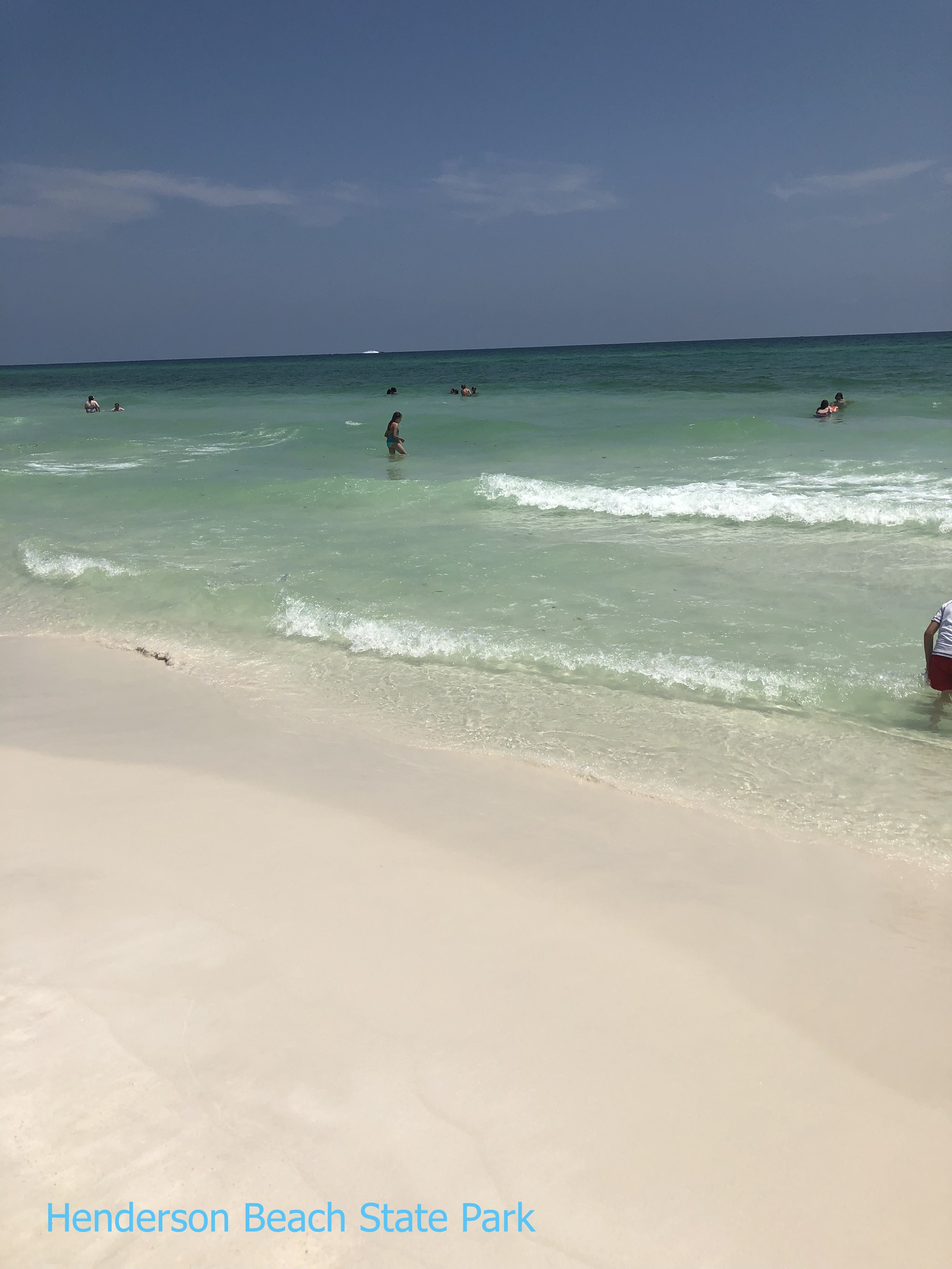
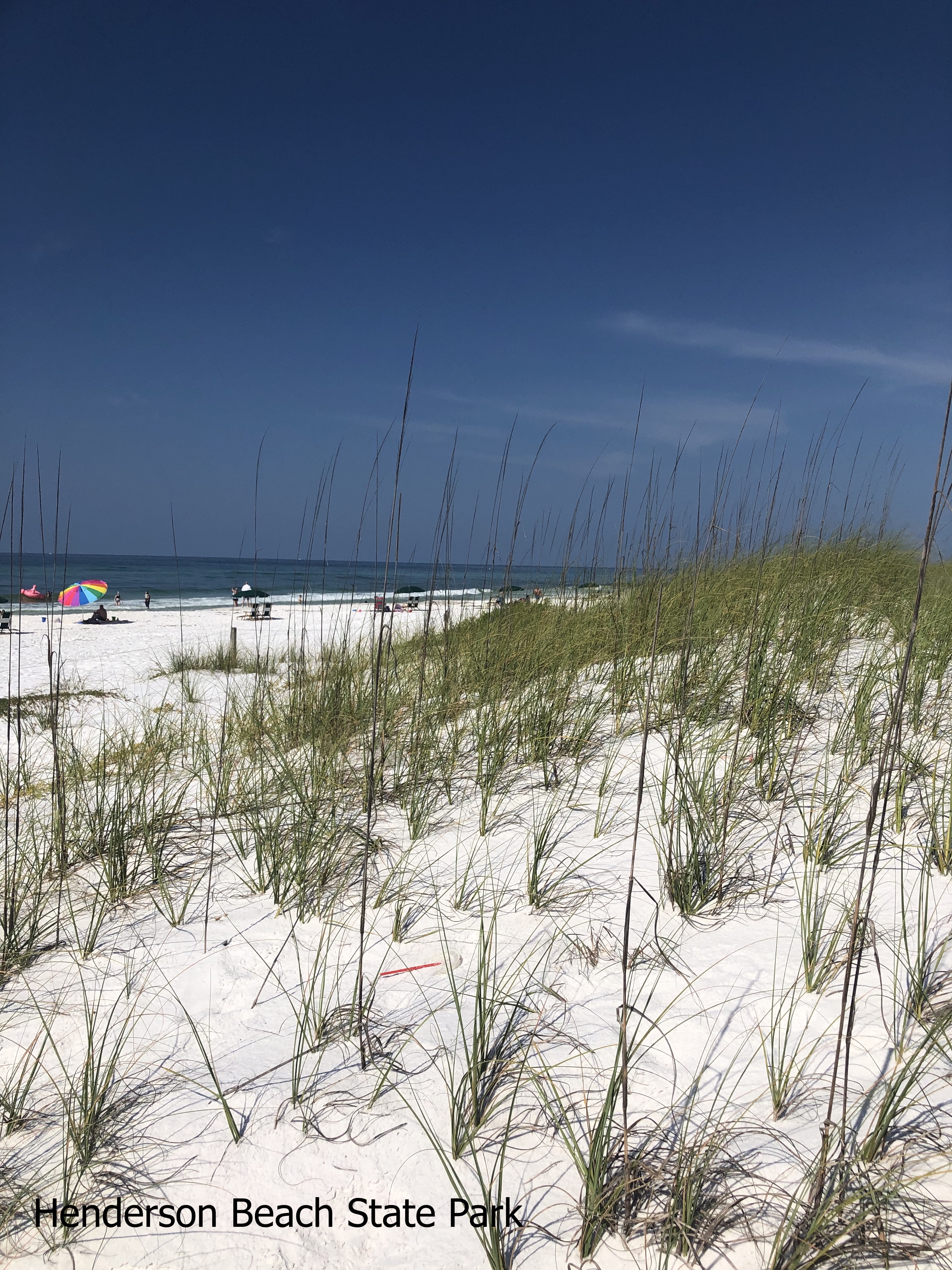
Florida has the longest coastline in the conterminous United States. Its coastline is 1,350 miles (2,170 km) long. More than two-thirds of the coastline is made of sandy beaches.
The beaches are quite important, as they are the heart of the local tourism industry. If you want to learn more about Florida's coastline, go to Florida's Beaches.
Florida has over 4,500 islands. The second highest number after Alaska.
Florida has the lowest average topography. The highest point is Britton Hill at 345 feet (105m).
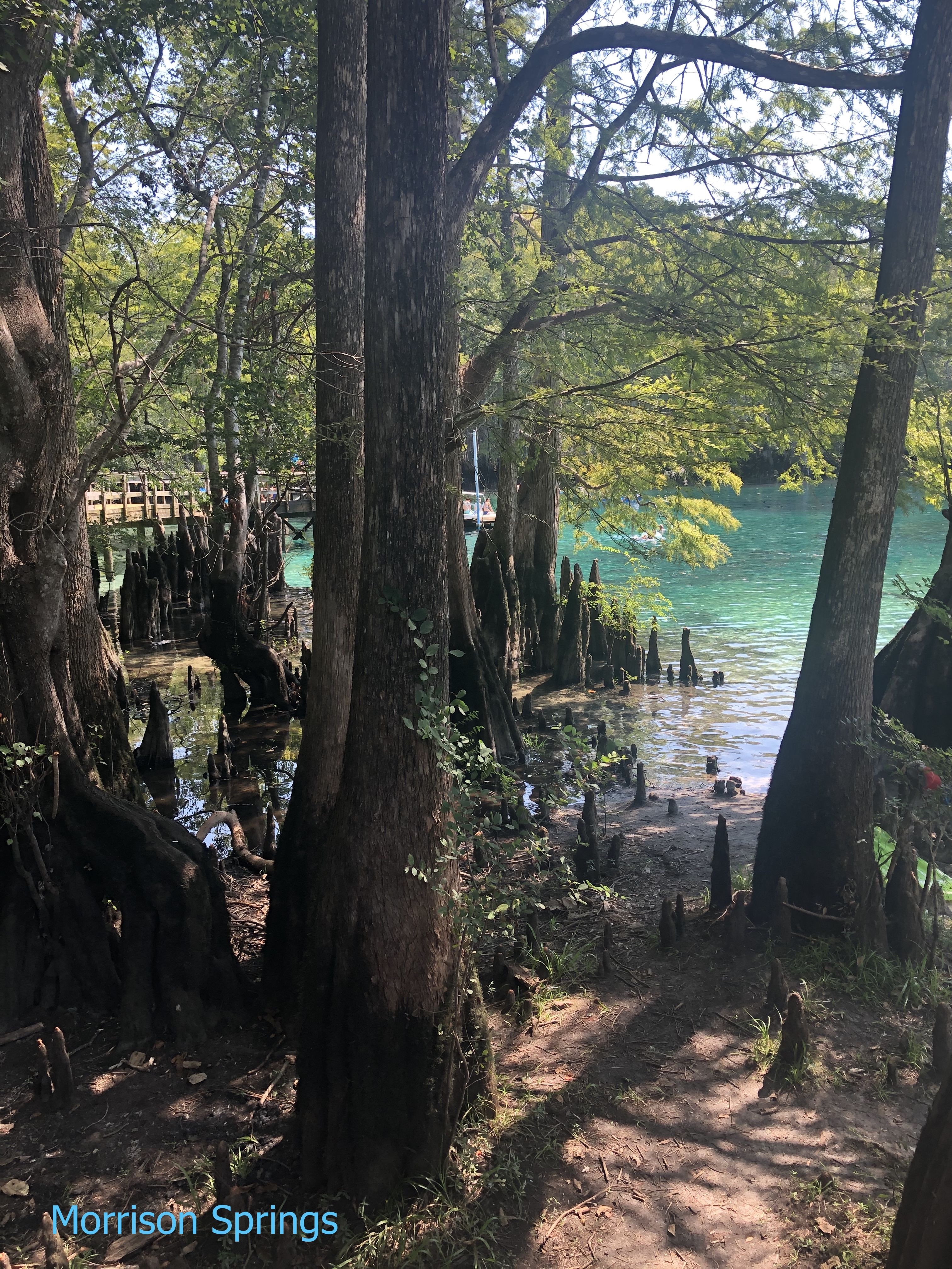
Florida is also home to a large number of lakes. The largest is Lake Okeechobee, also known as Florida's Inland Sea. Many of these lakes are fed by the many beautiful springs scattered throughout the state.
Florida's springs and sinkholes were created by the dissolution of limestone. This is a common rock formation found throughout the state.
The limestone is topped with sandy soils. These, in turn, are covered with pine trees adapted to this type of sandy ground.
If you want a laminated map of Florida, Amazon has Florida State Wall Map Poster. This is a large print with major gergraphical features and counties!
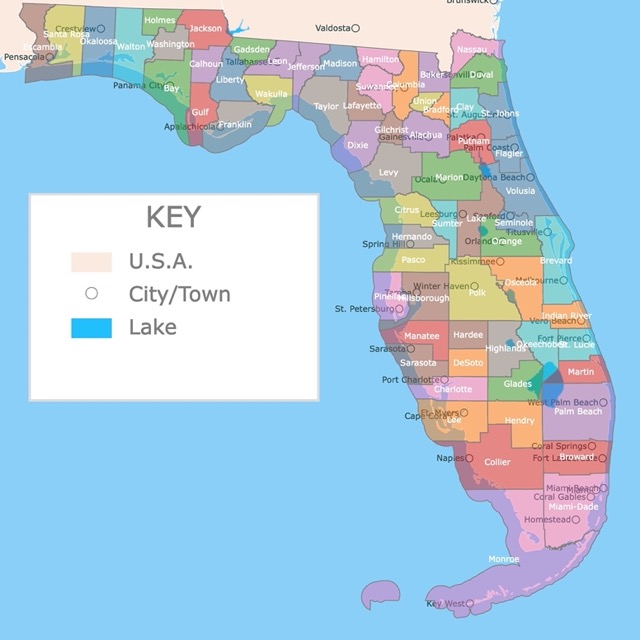
Florida Counties Map
Florida's Beginnings
Spanish explorer Juan Ponce de Leon was the first European in Florida. It named the territory "Pascua Florida" or "Easter of Flowers" in 1513.
In the early 1800s, the settlers in the state of Georgia began to complain to the U.S. government about the incursion of Indigenous groups.
The Seminole Wars began when American militias attacked and seized Spanish and Seminole lands in 1812.
The Spanish lost and ceded Florida to the United States!
If you like history and are interested in learning more about Florida, Amazon has The Great Book of Florida: The Crazy History of Florida with Amazing Random Facts & Trivia (A Trivia Nerds Guide to the History of the United States). This books narrates about its history, treasures, Disney World, and more.
Florida's Cities
In 1565 the Spanish founded the city of St. Augustine. This is the oldest European settlement in the USA.
Pensacola is Florida's second oldest city. It was founded by Spanish conquistadors in 1698. Pensacola was also the capital of the state.
Today, Pensacola is a tourist hotspot for its beaches and nightlife.
Florida's capital since 1824 is Tallahassee.
In the early 1820s, legislators transferred government business from St. Augustine to Pensacola for alternating sessions.
Tallahassee became the capital because it was halfway between these 2 cities.
Jacksonville is the largest city in Florida, with a population of 937,690, followed by Miami, with 440,807 residents. Source: Florida Demographics.
The third largest city is Tampa. This city is known for Busch Gardens, the Florida Aquarium, and the gorgeous Tampa Riverwalk.
Orlando is the Theme Park Capital of the World. Its main parks include Disney World, Universal Orlando, and Legoland.
Unsure of what you want to see first in Florida? Expedia can help you decide:
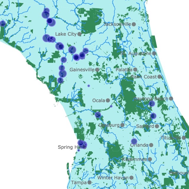
Florida's Cave Diving Sites
Florida's Roads
Florida's roads are an integral part of the state's transportation infrastructure, catering to millions of residents, tourists, and businesses daily.
One notable characteristic of Florida's road system is its sheer size. The state has the third-largest road network in the United States, encompassing approximately 267,000 miles of public roads. Source: Federal Highway Administration.
Florida's major interstates, such as I-4, I-75, I-95, and I-10, serve as vital transportation arteries, connecting the state to the rest of the country.
These interstates facilitate the movement to Florida's popular destinations, including Miami, Orlando, Tampa, and the Florida Keys.
Florida's roads also cater to the state's unique geographical features. The peninsula is surrounded by water, leading to numerous bridges, causeways, and toll roads that provide access to coastal areas and barrier islands.
Given Florida's warm climate, many roads are designed to accommodate outdoor recreational activities.
The state has an extensive network of scenic highways that showcase Florida's natural beauty, including the Overseas Highway (US 1), which stretches from Miami to Key West, offering stunning views of the Atlantic Ocean and the Florida Keys.
The Tamiami Trail (US 41) cuts through the Everglades, providing access to one of the most unique ecosystems in the world.
FOLLOW ME

Resources for Florida Map
The shapefiles for cities and roads came from Natural Earth.
This information will also improve with your suggestions. To receive updates on this and more nature maps, join my email list!!!!!!!
Made by Luz K. Molina with D3.js.