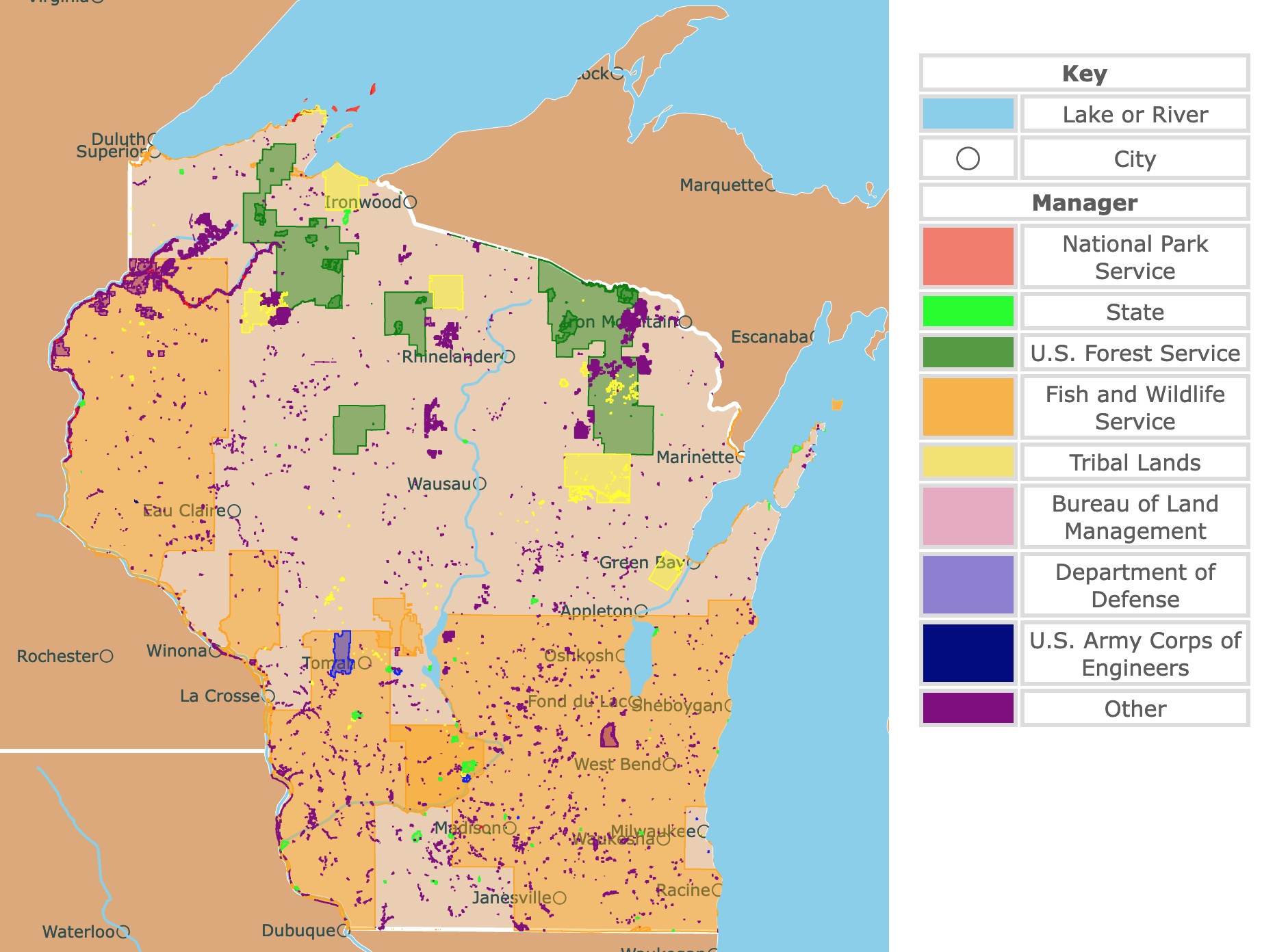
Map of Wisconsin's Parks and Protected Areas
This interactive map shows the Locations, Names, Areas, and Details of National Parks, State Parks, National Forests, Tribal, and other Public Lands of Wisconsin. It also shows major cities and rivers for context. For more detail, zoom in. For more information, hover over the map, or scroll down.
| Key | |
|---|---|
| Lake or River | |
| ◯ | City |
| Manager | |
| National Park Service | |
| State | |
| U.S. Forest Service | |
| Fish and Wildlife Service | |
| Tribal Lands | |
| Bureau of Land Management | |
| Department of Defense | |
| U.S. Army Corps of Engineers | |
| Other | |
Wisconsin's Geography
Wisonsin or the "Badger State" shares borders with Michigan and Lake Superior to the North, Lake Michigan to the east, Illinois to the south, Iowa and Minnesota to the west.
Wisconsin is made up of six regions.
- The Northern Highland, where the state's highest point, Timms Hill (1,951 feet - 595 meters), is located.
- The Lake Superior Lowland is a narrow plain where the surface of the Northern Highland drops suddenly.
- The Western Upland is located in the southwest corner of Wisconsin, and it's etched into valleys and ridges by streams cutting into the sandstone and limestone.
- The Driftless Area is where the glaciers bypassed the western and southwestern areas of the state along the Mississippi River.
- The Eastern Ridges were formed by three broad, parallel limestone ridges that run north to south and are separated by wide and shallow lowlands.
- The Lowlands Region is where the state's lowest elevation lies. It's along the shoreline of Lake Michigan, around 580 feet (180 meters) above sea level. Here are some of the world's best farmland.
A few of the distinct geographic formations in Wisconsin include the rocky Door Peninsula between Green Bay and Lake Michigan.
The Apostle Islands are located in Lake Superior, the wide gorges of the lower Wisconsin and Mississippi rivers, and ancient mountain remnants like the Baraboo Range, Gogebic Range, and Rib Mountain.
Even though it is called the land of 10,000 lakes, it has over 15,000 lakes thanks to the glaciers that covered the state more than 12,000 years ago, source National Geographic.
Want to find places to explore in nearby Minnesota? Check this map of Minnesota Parks
Wisconsin shares borders with Minnesota and Iowa to the west, Illinois to the south, and Michigan to the northeast.
Wisconsin also shares borders with Lake Superior to the North and Lake Michigan to the east.
Wisconsin's Climate
Wisconsin experiences long, cold winters and relatively short summers. The average temperatures in January range from around 10°F (-12°C) in the northern part of the state, to lows in the 20s°F (around -6°C) in the southeastern region.
July temperatures average about 82°F (27.9°C).
The state's annual rainfall averages around 30 inches (740 mm), most of it happening between May and October.
The snowfall varies from around 30 inches in south Wisconsin to about 50 - 60 (1,279 - 1,500 mm) inches in the north.
The best time to visit Wisconsin is between the middle of May to the end of September, Champion Traveler
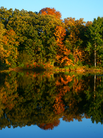
Wisconsin's Plants and Animals
Forests covered more than four-fifths of Wisconsin at one time, with the remainder covered in wetlands and prairies.
Most of the woods were cleared away, but about two-fifths of the state is again forested with natural regrowth and reforestation.
Some of the hardwood trees include birch, maple, elm, aspen, ash, oak, and basswood.
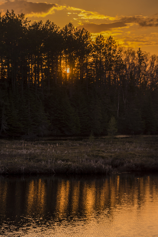
Evergreen trees in the state include hemlock, balsam fir, white cedar, tamarack, black spruce, white, red, and jack pine.
Foxes, white-tailed deer, skunks, cottontail rabbits, squirrels, chipmunks, gophers, and woodchucks call Wisconsin home.
Black bears, wolves, porcupines, otters, beavers, snowshoe hares, eagles, and coyotes mainly live in northern Wisconsin.
Gray wolves were reintroduced in the state but have been listed as endangered animals.
Pheasants reside in southern farming areas. Waterfowl are abundant, including Canadian migratory geese that fly in by the thousands to visit the refuges twice a year.
Numerous fish swim in Wisconsin's waters, including panfish, various species of trout, walleye, bass, muskellunge, sturgeon, and northern pike.
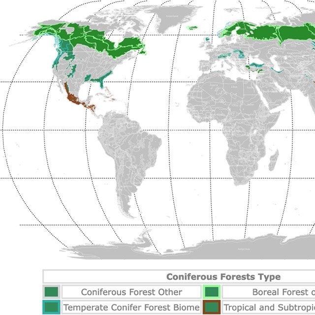
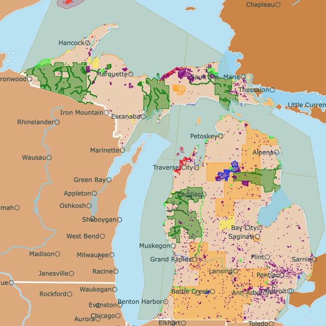
Northern Wisconsin has large areas covered with conifers. To learn more, visit this map!
Top Parks and Forests of Wisconsin
St. Croix National Riverway
St. Croix National Riverway is the long red and purple strip in northwest Wisconsin.
The St. Croix and Namekagon rivers make the St. Croix National Scenic Riverway. Offers visitors over 200 miles of freshwater that rushes through the scenic, forested terrain.
You can paddle the river with your own equipment or rent some with the local outfitters. The detailed river maps show campsites, landings, rapids, and other facilities along the route.
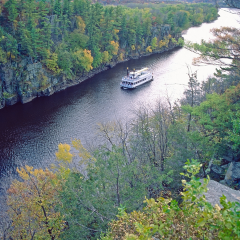
The park is sought after by kayakers and paddlers alike.
Visitors can hike, camp, fish, hunt, enjoy the water, and visit historic towns around the area.
The park has over 150 campsites, including primitive shoreline sites and modern sites with electricity and water. Keep in mind that this park is located in Wisconsin and Minnesota.
St. Croix National Scenic Riverway has seven maintained hiking trails along the St.
Croix and Namekagon Rivers. While the trails are open year-round, they're not maintained during the winter months, so hike at your own risk. The hiking trailers range in distance and difficulty levels.
The Ice Age Scenic Trail stretches over 1,000 miles of land. Ancient remnants can be found on and around this trail.
The Ice Age Interpretive Center is located inside the Wisconsin Interstate State Park. Visitors can check out exhibits and learn about the Ice Age. Source: St. Croix.
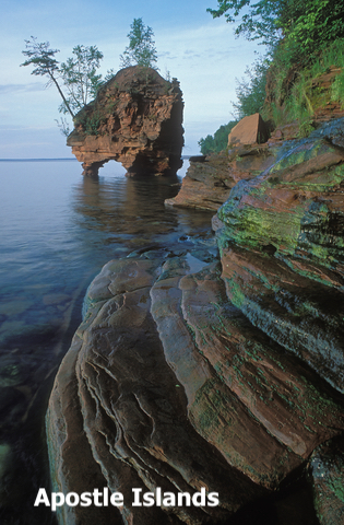
Apostle Islands National Lakeshore and Gaylord Nelson Wilderness
These Islands are the islands situated on Lake Superior, represented in red.
If you're looking for somewhere remote to relax, the Apostle Islands is the place for you. You'll need a boat to get to the islands, but that's part of the adventure, isn't it?
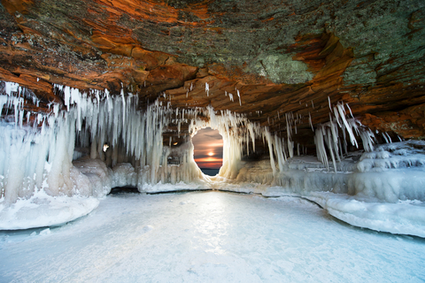
Gaylord Nelson Wilderness was added to the Apostle Islands National Lakeshore in 2004. The addition was created to help preserve and maintain the wilderness and wildlife in the area.
Fishing is prevalent in the Apostle Islands. Anglers have the opportunity to reel in various fish, including Coho salmon, lake trout, brown trout, and rainbow trout.
Lake Superior is known for its frigid temperatures, sudden storms, fog, and rough seas.
There are various guided activities at this park to choose from. Some tours are on land and trails, while others are on the water. Of course, there are self-guided tours as well.
Camping, kayaking, canoeing, sailing, hunting, scuba diving, and hiking are a few outdoor activities for visitors.
However, the Mainland Ice Caves are one of the most popular features at the park. This winter activity is on many "bucket lists", and for a good reason; it's incredible; it looks as if you've entered a magical winter wonderland, Ice caves.

Wisconsin has many lakes. To learn about them, check this map of conifer forests
Willow River State Park
Willow River State Park is the lime green park northwest of Madison.
Willow River State Park features stunning views of the Willow River Gorge and Willow Falls.
Visitors enjoy miles of scenic hiking trails, prairie remnants, lakeside picnicking, camping, and the nature center. All of these activities are within 2,800 acres of beautiful countryside.
Little Falls Lake provides visitors with the opportunity to canoe, kayak, swim, and fish. The swimming beach is perfect for summer fun.
While kayaking is permitted, kayakers should consider the changing river conditions and underwater debris.
Willow River's campground is located on the southern shores of Little Falls Lake. The park offers a 300 campground with 70 tent, trailer, and RV sites with showers and flush toilets. Visitors can also choose from the 200 and 100 campgrounds, each with its own camping accommodations.
The park offers a bit of winter recreation for outdoor enthusiasts that don't mind the cold and snow. Two miles of hard-packed trails are located on the north side of the river.
Visitors can enjoy snowshoeing, hiking, and dog sledding. This area is pet-friendly. On the south side of the river, trails are available for cross-country skiing and skating, Willow River.
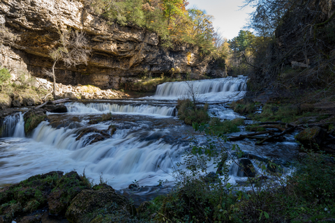
Copper Falls State Park
Copper Falls State Park is the lime green area in northern Wisconsin, west of Ironwood.
Copper Falls is considered one of the state's most scenic parks. It may be hard to believe, but one of the park's features is the ancient lava flows. Deep gorges and incredible waterfalls add to the park's beauty.
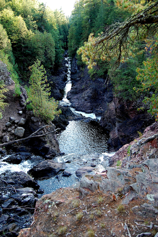
Because of its origin, resulting in different rock types with various colors and hardness, the falls and the gorge make this site one of the most beautiful parks in Wisconsin.
Make sure you visit the scenic overlook with a view of the 80 foot (24m)deep gorge.
Visitors come from all around to camp, hike, bike, picnic, and the swimming opportunities at Loon Lake.
Doughboy's Nature Trail is a 1.7-mile trail along the Bad River, and it's said to be one of the best areas to hike in the entire state.
The state park has two campgrounds with forested and shaded sites. These sites are well-separated from the public use areas, providing campers with a sense of privacy.
The park has six plowed sites for camping during the winter, but they're available only by reservation. All six winter sites have electric hook-ups with a public toilet.
The park has one group tent camping area for 40 people. It offers its own parking area, a water fountain, a vault toilet building, several picnic tables, a fire ring, and a grill (charcoal).
If you love the great outdoors but prefer sleeping indoors, the rustic, accessible cabin may be an option. The cabin can accommodate as many as four people.
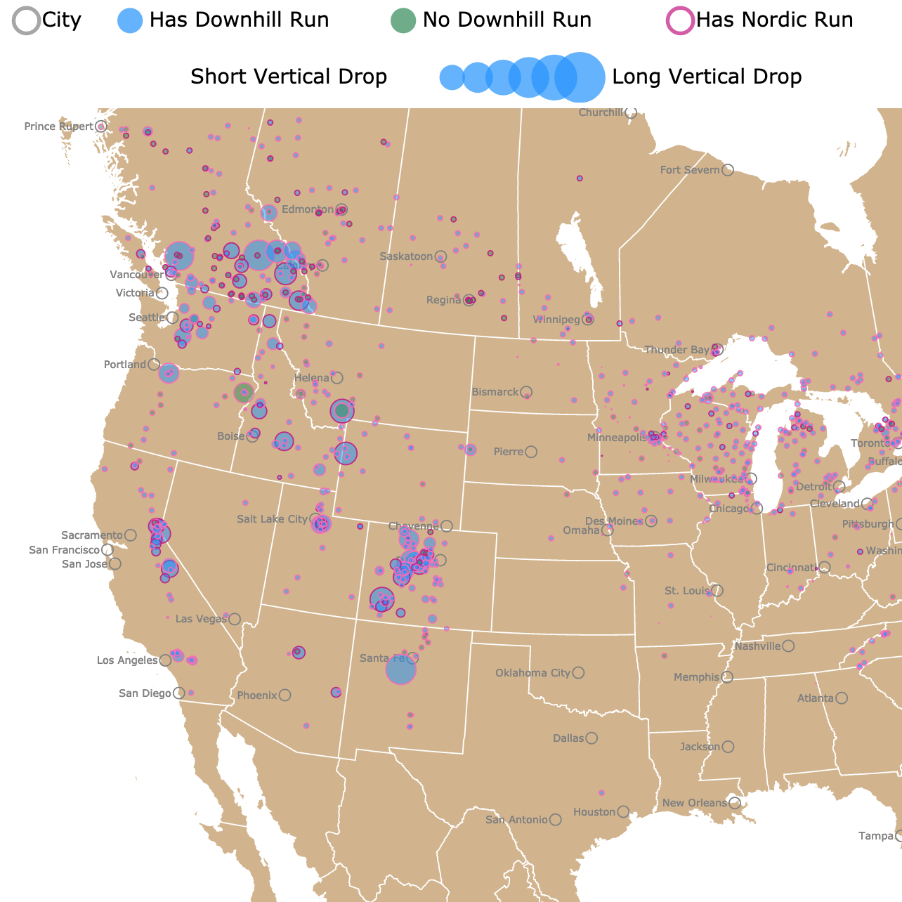
Wisconsin has places to ski and go snowshoeing. For more locations in North America, click on this map
Rocky Arbor State Park
Rocky Arbor is the small lime green area southeast of Tomah, only 1.5-miles away from the Wisconsin Dells.
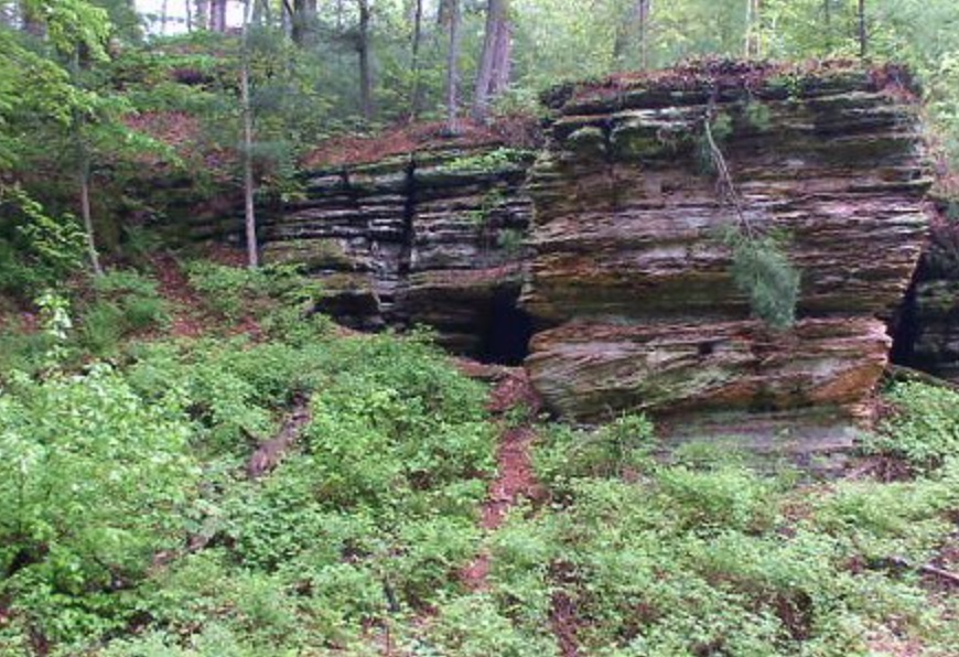
The park has beautiful pine trees, sandstone bluffs, and incredible rock formations to explore.
Rocky Arbor offers visitors privacy from other bustling vacation areas. The park has wooded campsites, hiking trails, a picnic area, and a playground. The picnic area and playground are near the park's entrance and down the hill from the campground.
Hunting and trapping are allowed to persons with the proper permits and licenses at this park. There are strict guidelines and rules, so make sure you read over them before heading out, Hunt Wisconsin.
Rocky Arbor State Park is open year-round and welcomes visitors all winter long. Outdoor enthusiasts can enjoy snowshoeing, hiking winter trails, and spotting wildlife, Rocky Arbor.
Amnicon Falls State Park
Amnicon Falls State Park is a lime green area in northwestern Wisconsin.
This park features four lovely waterfalls and rapids along the Amnicon River.

The lower falls are quite attractive thanks to the beautiful sandstone canyon and the surrounding red and white pines. The lower falls are also the setting for the charming Horton Bridge.
Bring your camera and head to the covered foot-bridge or the two miles of trails to capture some fantastic memories.
Park visitors can enjoy camping, picnicking, walking through the forest, and much more. Come learn about the Douglas Fault, a geological formation responsible for creating the Amnicon Falls, Amicon.
Want to find places to explore in nearby Michigan? Check this map of Michigan Parks
Kettle Moraine State Forest
Kettle Moraine is the lime green area west of Milwaukee.
Kettle Moraine State Forest covers over 22,000 acres of beautiful forested glacial hills, prairies, and kettle lakes (Kettle lakes are depressions formed by melted glaciers).
The southern unit of the state forest is interlaced with over 100 miles of trails, including hiking, mountain biking, nature, and horseback riding trails.
Park visitors paddle, boat, swim, fish, hunt, and indulge in winter sports. Three family campgrounds are available, as well as a horse camp, two group camps, and remote backpacking shelters along the Ice Age Trail.
The Ice Age Trail is a landscape carved by retreating glaciers over 12,000 years ago. This trail is an excellent example of the features left behind by glaciers!
The largest unit in the park offers visitors year-round recreational opportunities. Visitors can go for a swim at the beaches, ride challenging bike trails, ski the slopes, and enjoy a hike on the Ice Age Trails.
The Ice Age Visitor Center is open year-round as well, so stop in and check it out.
There are over 300 campsites, including family and group sites, Kettle Moraine.
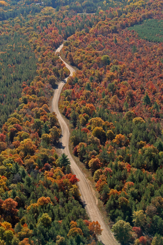
Chequamegon-Nicolet National Forests
These forests are the separate green units in northern Wisconsin. They comprise over 1.5 million acres of land in Wisconsin's north woods.
The land is managed by the Forest Service for various uses, including forestry, wildlife habitats, special forest gatherings, fisheries, wilderness, natural areas, and outdoor recreation.
The Chequamegon portion of the forest alone covers around 858,400 acres in Bayfield, Ashland, Price, Sawyer, Vilas, and Taylor counties.
While the Nicolet side covers close to 661,400 acres of forest in Florence, Oconto, Oneida, Vilas, and Langlade counties.
This forest has wetland, uplands, rivers, meadows, pine savannas, and glacial lakes.
Its native trees include beech, basswood, birch, maple, aspen, oak, fir, spruce, and tamarack. There are also alder thickets and cedar swamps.
Park visitors enjoy the solitude and peace there. The park is open year-round and offers numerous outdoor recreational activities besides viewing wildlife.
These activities include hiking, camping, canoeing, hunting, fishing, snowshoeing, and cross-country skiing; Forest Service.
Affiliate Disclosure
Databayou.com is a participant in the Amazon Services LLC Associates Program, an affiliate advertising program designed to provide a means for sites to earn advertising fees by advertising and linking to Amazon.com. Databayou.com also participates in affiliate programs with Clickbank, CJ, and other sites.
If you plan on visiting one of these parks or hiking around the lakes, I suggest you get some of these items found on Amazon.
- Snowshoes: These comfortable light snowshoes, with a heel lift, padded binding, and trekking poles, are perfect for hiking snowy Wisconsin trails and hills.
- Kingswell Telescopic fishing rod: Collapsible, made of graphite, and portable kid. Ideal for travelers that like to go fishing.
- Backpacking stove: This Jetboil cooking system is light and great for camping.
Resources for Wisconsin's Protected Areas Map
The shapefiles with wisconsin's state boundary lines, major rivers, and cities were downloaded from Natural Earth Data.
The Parks and Public Lands shapefiles for Wisconsin were downloaded from USGS.
This map will be updated with new data! To receive updates on this and more nature maps, join my email list!!!!!!!
Made by Luz K. Molina with D3.js.