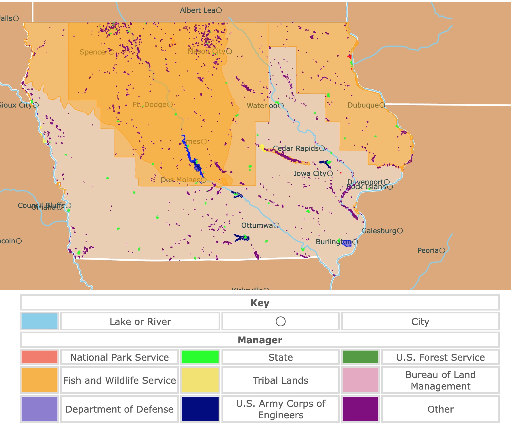
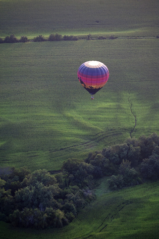
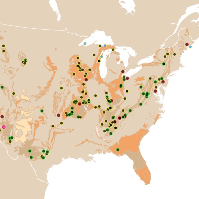
Map of Iowa's Parks and Protected Areas
This interactive map shows the Locations, Names, Areas, and Details of National Parks, State Parks, National Forests, Tribal, and other Public Lands of Iowa. It also shows major cities and rivers for context. For more detail, zoom in. For more information, hover over the map, or scroll down.
| Key | |||||
|---|---|---|---|---|---|
| Lake or River | ◯ | City | |||
| Manager | |||||
| National Park Service | State | U.S. Forest Service | |||
| Fish and Wildlife Service | Tribal Lands | Bureau of Land Management | |||
| Department of Defense | U.S. Army Corps of Engineers | Other | |||
Geography of Iowa
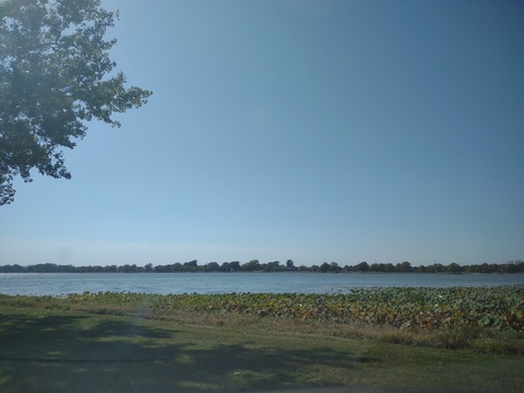
Iowa seems to form a bridge between the grasslands of the high prairie plains to the west and the lush forests of the east.
The gently rolling landscape rises slowly, extending westward from the Mississippi River, forming the entire eastern border.
With the Mississippi River along the eastern border and the Missouri River and its tributary, the Big Sioux forming the western border, Iowa is the only state in the U.S. that has two parallel rivers that define its boundaries.
Iowa is bound by six states; to the north is Minnesota. To the east, you'll find Illinois and Wisconsin, and to the south is Missouri. South Dakota and Nebraska are west of Iowa.
More than nine-tenths of Iowa's land is for agriculture, making it one of the leading states in agricultural production. The rich soil, ample precipitation, and gently rolling hills make the state incredibly suitable for mechanized agriculture.
A majority of Iowa's landscape consists of flat plains or gently rolling hills. Iowa's elevation typically increases from east-southeast to west-northwest.
The state's lowest point is located within the city of Keokuk, where the Des Moines River enters the Mississippi at only 480 feet (146 meters) above sea level.
The highest area, Hawkeye Point, is located in northwest Iowa and is 1,677 feet (511 meters) in elevation.
Iowa's rich soil and terrain are the result of the continental ice sheets that covered the area during the Pleistocene Epoch.
The ice sheet covered a small region in the southeast and eastern Iowa, diverting the Mississippi and creating a valley along the western front, which can still be seen.
Iowa's Climate
Iowa has a full, four-season climate. Winters are cold, with the temperatures in January averaging around 14°F (-10°C) in the northwestern portion of the state. In the southeast, the winter temperatures average somewhere in the low 20s (-6°C).
Snowfall in Iowa is light compared to the average amount of the bordering states to the north and east. While snow cover seldom remains throughout the winter season, heavy snowfalls have happened in late autumn and early spring.
Summer months in Iowa are warm and humid. July temperatures average somewhere in the mid-80s (30°C), but they rarely reach 100℉ (38°C).
Precipitation in Iowa is seasonal, with most rainfall taking place during the summer.
The average yearly rainfall ranges from less than 26 inches (660 mm) in the northwest portion of the state to over 38 inches (965mm) in the southeast.
Iowa has experienced severe flooding due to the rapid snowmelt and heavy summer rain. Some of the most severe floodings in the state were in 1993 and again in 2008. DesMoines Register
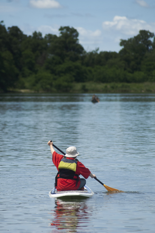
The Rathbun Dam on the Chariton River is one of several dams built to protect the area from flooding. Still, they also serve as important locations for recreation, like boating.
Want to find places to explore in nearby Illinois? Check this map of Illinois Parks
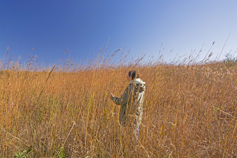
Iowa's Wildlife
Sadly, a most of Iowa's native prairie and wetland vegetation has been wiped out by agriculture.
The woodlands full of hickory, ash, and elm trees thrive along the rivers and in the hillier areas of the state. Around 5% of Iowa is forested, and red cedars can be found throughout the state.
Deer, squirrels, chipmunk, opossum, and raccoons are prevalent. The river otter was reintroduced to the state along with the wild turkey after being virtually extinct in the region in the 1960s.
The ring-necked pheasant was imported to Iowa in the early 1990s and is considered an important game bird. Other beautiful bird species in the state include the goldfinch, bunting, bluejay, cardinal, oriole, and bluebirds.
The bald eagle is the most noted avian resurgence in Iowa. They can be found throughout the state during the winter, especially close to open water. Taking a glance into the water, you'll find pike, trout, bass, and carp in the streams and lakes.
Iowa's Parks and Protected Areas
Northern Tallgrass Prairie National Wildlife Refuge
The refuge was established to preserve over 70,000 acres of native buffer and prairie lands in 1999.
The Northern Tallgrass Prairie National Wildlife Refuge is the large orange area in nonwestern Iowa. It is widespread within the historic northern tallgrass prairie region of western Minnesota and northwestern Iowa.
The wetland and northern tallgrass prairie habitats in the refuge are important habitats for many migratory birds, including songbirds, waterfowl, shorebirds, raptors, upland game birds, marsh, and wading birds. There are around 243 species of birds that regularly utilize the area.
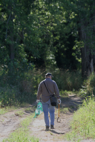
Wildlife watching is a massive deal at the refuge. It's an excellent place to learn about the surrounding nature, enjoy a hike, and get some great photographs.

Bats are common dwellers in Caves. To learn where they live, check this map of Bats!
Maquoketa Caves State Park
Maquoketa Caves State Park is a small state park northeast of Cedar Rapids.
Maquoketa Caves State Park has more caves than any state park, and it's one of Iowa's most beautiful outdoor attractions.
You'll find enormous bluffs towering throughout the park, the forests are brimming with natural beauty, and the six-mile trail system winds through geological formations.
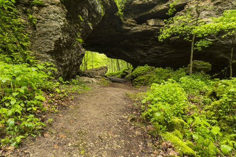
Maquoketa is one of the state's earliest state parks and has been a popular destination for hikers and picnickers since the late 1800s.
The park is full of adventure! The six-mile trail system links the caves and scenic overlooks, with the trails providing access to the caves, as well as other park facilities.
The Natural Bridge, a massive stone arch that stands 50 feet above Raccoon Creek, is definitely a highlight of the park, Iowa DNR.
You can explore the Dancehall Cave and many others, including Hernando's Hideaway, Wye Cave, and Shinbone Cave.
There are around 13 caves; some of them are explorable by walking while others are better left for experienced spelunkers.
During the summer, naturalists conduct something called a WNA or White Nose Syndrome Awareness Program to teach visitors about bats and the widespread illness that affects them.
You can learn about the geology of cave formations and the history of the park at the interpretive center.
Camp out amongst the pine trees at the upgraded campground or choose a primitive, hike-in site. Reservations can be made online for dates between March through November, but the campground is closed from December to February.
Effigy Mounds National Monument
This National Monument is situated in northeast Iowa and depicted in red on the map.
Many people consider the Effigy Mounds sacred, including the monument's 20 culturally associated Indigenous tribes.
Over 200 Native American mounds are located at the park with incredible, picturesque views of the Upper Mississippi Valley.
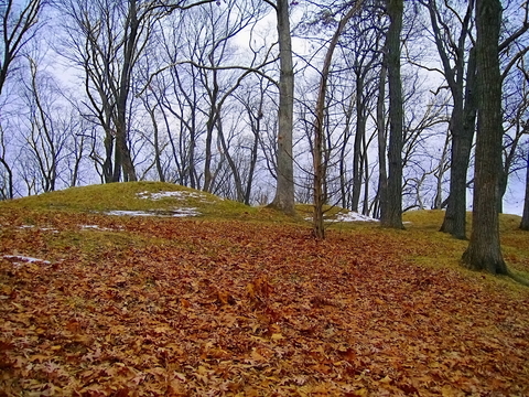
The construction of effigy mounds was a regional cultural phenomenon. The mounds of earth were made into the shapes of bears, birds, bison, turtles, panthers, and deer.
Effigy Mound Builders also built conical-shaped mounds for burial purposes and linear or long rectangular-shaped mounds for ceremonial use.
The animal-shaped mounds are still the symbol of the Effigy Mounds Culture. Along the Mississippi River in northeast Iowa and across the river in southwest Wisconsin, the bear and bird are two major animal mound shapes that prevail.
When visiting the Effigy Mound National Monument, start at the visitor center and pick up a brochure containing more info and a map of the incredible hiking trails. Temporary exhibits and a formal museum exhibit displaying ancient artifacts can be explored.
Touring the Effigy Monument involves short walks along the accessible trails, or you can take extended walks along the steep hiking trails. With the sacred nature of this site as an Indian burial and ceremonial ground, vehicle tours are not available.
Ranger talks and guided tours are available during the summer. You can check the site's calendar page for a list of the programs and times before you head out, Effigy Monument.
You will also find special events and programs to attend as well. The park offers a winter film festival, bird walks, and moonlight hikes.
The Effigy Mounds National Monument is an incredible place to learn about the history and culture of the natives who once inhabited the area.
Interested in caves? Visit this map of U.S. caves
Devonian Fossil Gorge
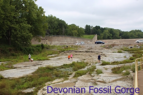
This site is north of Iowa City and is part of Coralville Lake. It is managed by the U.S. Army Corps of Engineers and depicted in blue.
In 1993 heavy rain flooded the spillway. Fifteen feet of bottom sediment was eroded and washed away. This erosion exposed the Middle Devonian Cedar Valley Group limestones below.
The area is rich with fossils dating 375 million years and is visited by thousands of visitors each year! U.S. Corps of Engineers.
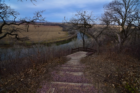
Pikes Peak State Park
Pikes Peak is also in northeastern Iowa, located on a national scenic byway. It is the lime green area south of Effigy Mounds.
Pikes Peak is known for the majestic views of the Mississippi River, and it's one of Iowa's premier nature destinations.
The park features 11 miles of trails full of scenic valleys and bluffs. Take the half-mile trail to the Bridal Veil Falls or hike to Point Ann, which overlooks the nearby town of McGregor.
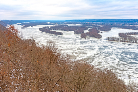
Visitors love seeing where the Mississippi and Wisconsin Rivers meet from atop the 500-foot bluff. It's truly a hiker's delight. If you're looking for some picturesque, breathtaking views, visit Pikes Peak.
Take the half-mile boardwalk to Bridal Veil Falls and explore Bear Mound, an effigy built by the Indigenous people during the Woodland era.
If you're looking for a more adventurous trail, you can hike the four-mile trail to Point Ann. Keep your eyes peeled because fossil remains can be found along the trails, including gastropods, cephalopods, and brachiopods.
FYI, mountain bikes are permitted on the tail from Homestead Park to the McGregor parking lot, Woodland period.
There are several campsites available at Pikes Peak. You'll find electric and non-electric sites, modern showers, restroom facilities, and a dump station. While some sites are available on a first-come, first-serve basis, others require reservations.
You'll find a rustic stone picnic shelter, as well as two beautiful gazebos in the main picnic and overlook area. Shelters can be reserved, and there is a playground near the stone shelter offering fun activities for the kids.
The Effigy Mounds National Monument is only seven miles north of the park, and you can get a glimpse of over 200 mounds.
Stone State Park
Stone State Park is a unique urban wildlife sanctuary located on the edge of Sioux City and the heart of Loess Hills.
The CCC or Civilian Conservation Corps built many of the structures in the park back in the 1930s, including the Calumet shelter, a rustic stone lodge, and the entrance portals.
Visitors can explore the natural history of the park while hiking along the many miles of trails.
Visitors can bike or hike over 15 miles of trails. One specific trail, the Carolyn Benne Natural Trail, details the natural history of the area during an interpretive walk through the park.
Mountain bikers have six miles of challenging dirt trails to ride throughout the park, and equestrians are offered six miles of the multi-use trails, Natural Atlas.
Cross country skiing and snowmobiling are extremely popular activities during the winter.
Camp out at one of the three camping cabins or at the park's campground. The cabins contain heat and air conditioning, but they don't offer sanitary facilities. The cabins are close to the campground.
One-fourth of the sites are available on a first-come, first-serve basis, while there are advance reservations for the remaining sites.
Interested in Fossils? Visit this Map of Fossils in North America
Lake Manawa State Park
Lake Manawa State Park is a popular outdoor recreation facility in the Omaha/Council Bluffs metropolitan area.
The park offers over 1,500 acres of land with a beautiful natural lake.
Lake Manawa was formed during the flood of 1881 due to a portion of the river channel being cut off by the Missouri River. Over the years, Oxbow Lace became a massive outdoor recreation center.
The state park offers ample opportunity for a hike, walk, or bike ride on seven miles of paved trails. The trails connect to the trail system running throughout Council Bluffs, including the Wabash Trace Trail and the Bob Kerrey Pedestrian Bridge, Wabash Trace.
If you're looking for something a bit more rough and rugged, there are eight miles of unpaved trails suitable for mountain biking on either side of the Missouri River.
Lake Manawa is a prime location for boating. Different size boats may be operated on the lake.
Modern boat ramps are located on the west, south, and north sides of the lake. Paddleboats and canoes are available for rent at the beach.
If you're into angler fishing, this is a great spot; crappies, bluegill, and catfish are waiting for you throughout the year. The population of bass and walleye is abundant.
Lake Manawa offers many locations for the perfect picnic. Five open picnic shelters are available, and one offers a kitchenette. While some sites are open, there are a few that require a reservation.
The Lake hosts a Winter-Fest, Ice Fishing Derby in January. July brings about the Fireworks over the Lake, and in August, you'll find the Black Squirrel Triathlon.
Take a short drive and visit the NCAA College World Series in June. The Western Trails Historical Center and Durham Museum aren't too far away either Race Omaha.
Walnut Woods State Park
Walnut Woods State Park is the lime green area next to Des Moines. The park is a quiet area for those looking for outdoor adventures close to the state's capital.
Walnut Woods is home to the largest stand of black walnut trees in Iowa.
You don't have to travel very far to reach the Purple Martin Water Resource Area, launch your canoe, or observe the purple martins that live nearby. These incredible birds dwell near the lake, Des Moines Outdoors.
There are over two miles of trails to hike through the wooded bottomland along the Raccoon River.
A popular winter activity is cross-country skiing through the park.
Shaded campsites are available at Walnut Woods. All of the sites have electric features, and 8 sites offer water, sewer, and electric hookups.
There are no showers at the campgrounds, but there are modern restrooms and a dump station.
Birdwatching is another popular activity at the park, especially during the summer months.
Fishing and canoeing can be done at the Raccoon River. Fish from the riverbank or launch a boat.
Keep in mind that the water level constantly changes since the park's elevation isn't much higher than the normal water level of the river.

Want to find places to explore in nearby Illinois? Check this map of Illinois Parks
Waubonsie State Park
This state park is depicted in lime green and found in the southwestern corner of Iowa.
The Waubonsie State Park provides one of the rarest vistas of Iowa's unique Loess Hills. The park is also a site along with the Lewis and Clark Historical Trail.

Explore the natural beauty and a good time around the campfire. Book a secluded cabin for privacy!
The extensive trail system fits the needs of many visitors.
Sunset Ridge Nature Trail highlights the heart of the park, taking visitors through long stretches of pristine hardwood trees that open into native prairie ridges and offer stunning views of the Missouri River Valley.
Take a trip around the lake, go fishing, go swimming, or enjoy nature surrounding the area.
Boats are limited to electric motors only, but there are some good fish to be caught. Hit a picnic area or shelter for a quiet lunch. Overlook Shelter is an open picnic shelter visitors can reserve up to a year in advance.
Affiliate Disclosure
Databayou.com is a participant in the Amazon Services LLC Associates Program, an affiliate advertising program designed to provide a means for sites to earn advertising fees by advertising and linking to Amazon.com. Databayou.com also participates in affiliate programs with Clickbank, CJ, and other sites.
If you plan on visiting one of these parks or preserves, I suggest you get some of these items found on Amazon.
- Fishing Lure Box: Includes lures, 302 fishing Baits, 8 Inch Fishing Pliers, and more.
- Binoculars: Ideal for birdwatching in Iowa.
- Collapsible Lantern: This solar inflatable lantern is ideal for camping or for power emergencies. It can be charged through solar panels or USB.
FOLLOW ME
Resources for Iowa's Protected Areas Map
The shapefiles with Iowa's state boundary lines, lakes, major rivers, and cities were downloaded from Natural Earth Data.
The Parks and Public Lands shapefiles for Iowa were downloaded from USGS.
This map will be updated with new data! To receive updates on this and more nature maps join my email list!!!!!!!
Made by Luz K. Molina with D3.js.