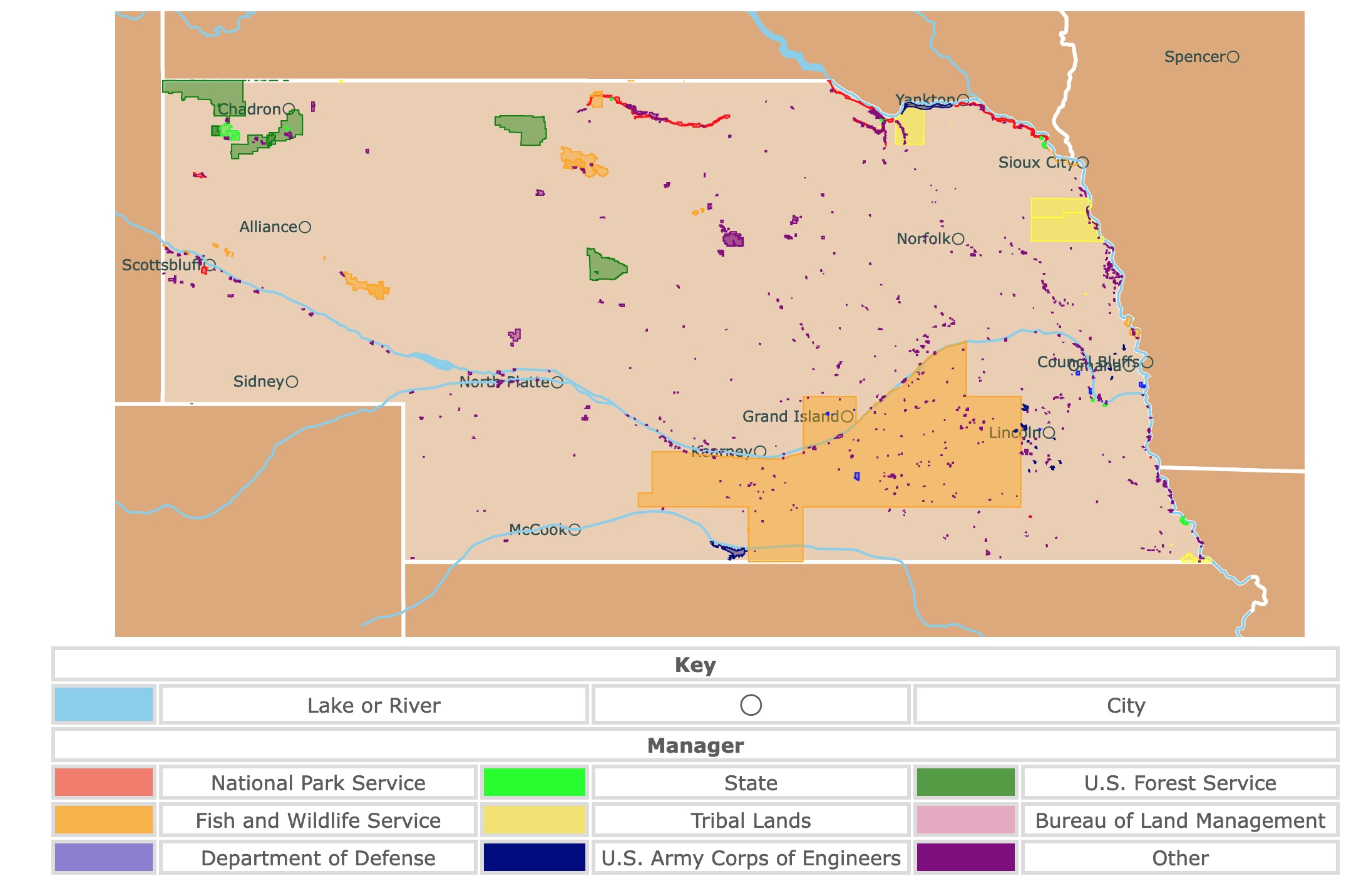
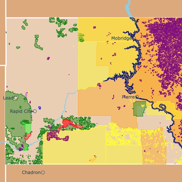
Map of Nebraska's Parks and Protected Areas
This interactive map shows the Locations, Names, Areas, and Details of National Parks, State Parks, National Forests, Tribal, and other Public Lands of Nebraska. It also shows major cities and rivers for context. For more detail, zoom in. For more information, hover over the map, or scroll down.
| Key | |||||
|---|---|---|---|---|---|
| Lake or River | ◯ | City | |||
| Manager | |||||
| National Park Service | State | U.S. Forest Service | |||
| Fish and Wildlife Service | Tribal Lands | Bureau of Land Management | |||
| Department of Defense | U.S. Army Corps of Engineers | Other | |||
Nebraska's Geography
Nebraska is bordered by South Dakota to the north, Kansas to the south, Missouri and Iowa to the east, Colorado and Wyoming to the west. The state can be divided into two major regions: the Great Plains and the Dissected Till Plains.
The Dissected Till Plains cover the entire eastern side of Nebraska. At the end of the last Ice Age, the glaciers melted leaving behind till.
Till is a mixture of gravel, sand, and boulders. Currently, Nebraska has deposits of loess and low hills. Loess is windblown sediment.
The Great Plains region spreads across the rest of Nebraska. This area is flat with some valleys, canyons, wetlands, and lakes.
The Great Plains area also includes the state's highest peak, Panorama Point at 5,429 feet (1.65 km) in elevation.
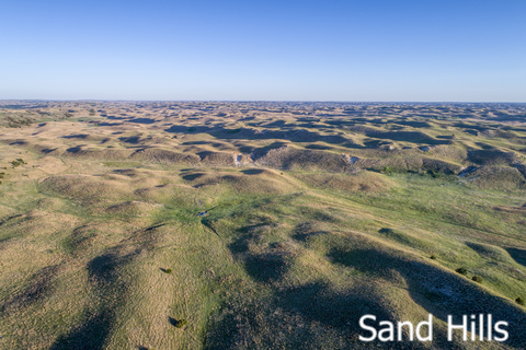
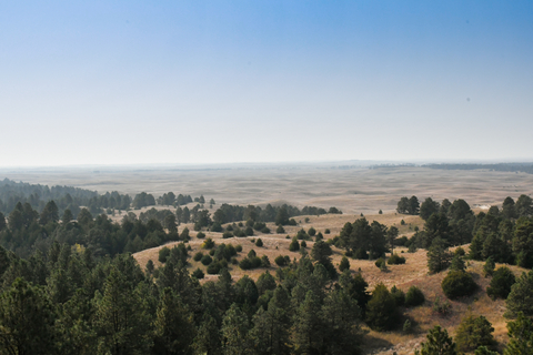
Central Nebraska also has the largest spread of mounds in North America. They're called the Sand Hills; these sand dunes cover about 20,000 square miles.
Nebraska's northwest has the Badlands. Here the wind has eroded the sandstone into mushroom-like features. National Geographic.
Want to find places to explore in nearby Kansas? Check this map of Kansas Parks
Nebraska's Climate
Nebraska experiences a typical Midwestern climate, meaning there are big extremes between the four seasons; hot summers, and cold winters.
The western region of the state is drier than the eastern side, which is more humid. However, the temperatures are relatively consistent throughout the whole state.
Summers are hot and humid in Nebraska, with frequent thunderstorms. The highs between June and August average about 80°F (26.66°C), but with the humidity it feels hotter.
Nebraska lies within Tornado Alley, with an average of 45 tornadoes yearly.
Winter is harsh with cold, snow, and daytime highs barely above 30°F (-1.11°C). Nighttime temperatures often drop below freezing. Ice storms and blizzards are common.
That being said, the best time of year to visit Nebraska is early summer and autumn.
Nebraska's Wildlife
Bison were nearly wiped out in the 1800s; however, some can still be spotted roaming around today. Fort Niobrara Wildlife Refuge in north-central Nebraska is home to some bison.
Some of the other native mammals in the state include pronghorns (the second fastest land mammal), coyotes, antelopes, prairie dogs, and jackrabbits, Pronghorns.
Over 400 species of birds fly through Nebraska's sky, including sandhill cranes, bald eagles, violet-green swallows, and western meadowlarks.
Bullsnakes and snapping turtles are common reptiles in the state, while the shy and slender glass lizard is rarely seen.
American bullfrogs, Great Plains toads, and western tiger salamanders are a few of the incredible amphibians in Nebraska.
Nebraska's state tree, the eastern cottonwood, is commonly found near bodies of water. Black walnut, slippery elm, red oak, boxelder maple, and ponderosa pines are other widespread trees.
Many wildflowers such as the star cucumber, pink primrose, wild blue flax, chicory, and leopard lily bloom beautifully throughout the state.
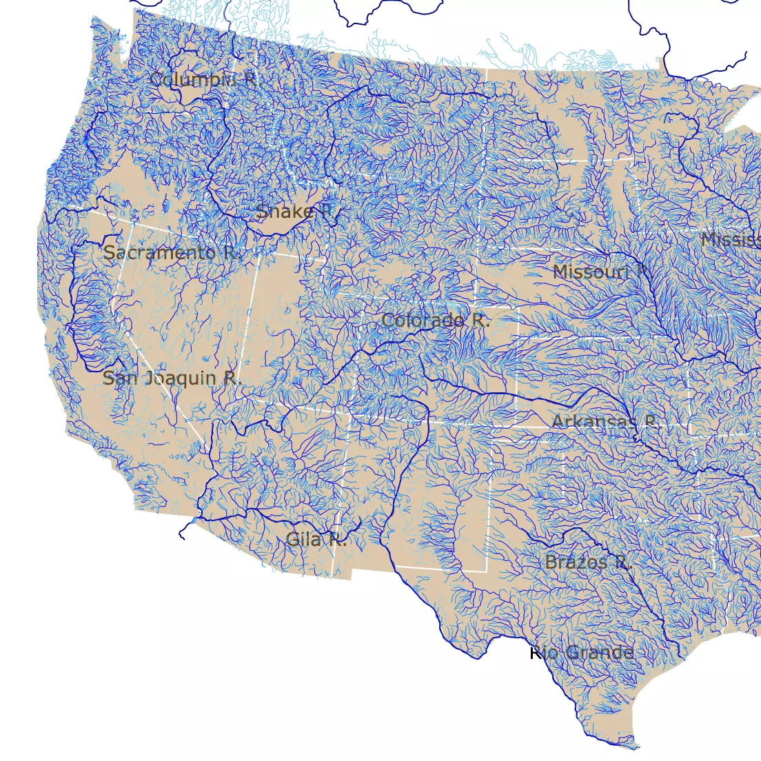
Looking for more rivers and streams? Visit this map of U.S. Rivers
Nebraska's Best Parks
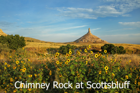
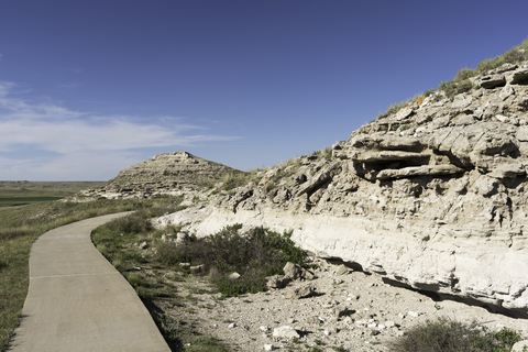
Scotts Bluff National Monument
Scotts Bluff National Monument is located in western Nebraska. It is represented in red, next to the city of Scottsbluff.
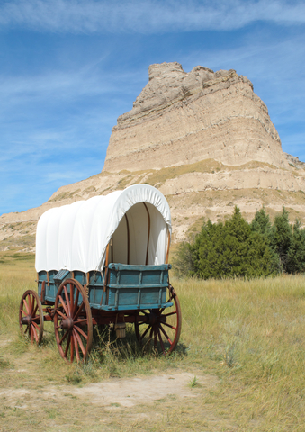
Scotts Bluff is an incredible 800 feet (243.8 meters) above the North Platte River. It served as a benchmark for the Indigenous people and emigrants on the Oregon, Mormon, and California Trails.
The most recognized landmark is Chimney Rock. Today the landmark looks like it did when the first settlers saw it in the mid 1800s.
With 3,000 acres to explore, there is much to discover in the area surrounding the bluff.
The many layers of Scott's Bluff were created by ancient seas, sand dunes, streams, and volcanic ash eruptions. At one point in time, wind and water were the driving forces that deposited the fine silt and ash.
The bluff has geologic strata from 33 to 22 millions of years ago. Today, the same forces that created it are wearing down the bluff.
Scotts Bluff played a huge role in navigation in the early days. Today, it's a site people visit to explore and enjoy recreational activities.
While there isn't any camping available at the monument, the site is full of activity during the day. Hiking, the visitors center, and driving Scotts Bluff Summit Road are a few of the main points people enjoy, Scotts Bluff.
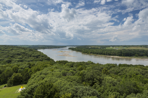
Missouri National Recreational River
The Missouri National Recreational River is the red belt on the border with South Dakota.
Made by two free flowing stretches of the Missouri River make up this National Park. Outdoor enthusiasts, history buffs, and geology fans find much appreciation in this area.
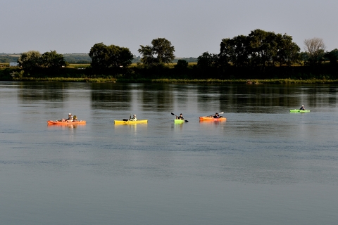
Some of the popular outdoor activities are: boating, birding, camping, hiking, biking, scenic drives, canoeing, kayaking, hunting, trapping, and fishing. Hunting and trapping require proper updated permits.
Hunting and trapping is permitted in Bow Creek and Goat Island Recreation Areas.
The park has a mobile ranger station, as well as a Ranger Program where visitors can learn about the area, its history, wildlife, geology, and so much more.
Primitive camping is available at Bow Creek, Goat Island, and Green Island. It is essential that you leave no trace, so make sure everything you pack in, you pack out. There are no fees required for camping.
Bird watchers love the opportunity they get to see all of the local species, as well as some of the migrating birds. There are a few rare species to keep an eye out for, so don't forget your binoculars! Missouri Rec.
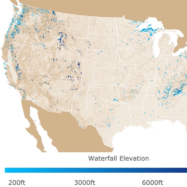
There are more Waterfalls to explore in the U.S. Formore information, click on this map
Agate Fossil Beds National Monument
Agate Fossil Beds National Monument is located in northwestern Nebraska and depicted in red.
During the early 1900s, paleontologists excavated and found the Age of Mammals as they found complete skeletons of extinct Miocene mammals in the hills of Nebraska.
Meanwhile, an understanding between the rancher James Cook and Chief Red Cloud of the Lakota tribe began. These events helped preserve the Agate Fossil Beds.
There are different fossil types that can be found at the Agate Fossil Beds Monument. These include hoofprints and layers of fossilized bones, from Dinohyus (a giant pig-like mammal), Menoceras (short rhinoceros), and Stenomylus (small gazelle-camels).
The Agate area experienced a major drought during the Early Miocene. Researchers believe that many exhausted animals collapsed and died once they finally reached water. As the muddy waters dried up, the fossil beds were formed.
There are not just fossils to look at, but agates located above the bone beds!
Besides paleontology and geology sites, the park offers two hiking trails, one is only a mile long and the other is a little over 2 miles long, Agate Fossil Beds.
Smith Falls State Park
Smith Falls State Park is situated in north central Nebraska, it is the lime green speck surrounded by the red Niobrara National Scenic River.
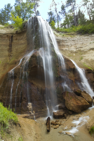
Smith Falls State Park is refuge to the state of Nebraska's highest waterfall with 63 feet (19m) height.
Smith Falls is named after Frederic Smith, the man who filed the first patent on the land encompassing the falls. While the land is home to the stunning falls, it's also an area of biological significance.
Hiking is limited to the trails to prevent erosion and protect rare plants. The park has a rare hybrid Aspen, spruce, and paper bark birch trees. These plants are remnants from when glacers melted after the Ice Age. Furthermore, the park is a rare mix of ecosystems! NPS.
This location is a popular stop for visitors that enjoy camping, kayaking, fishing, and canoeing. Above all this park is popular with tubers.
Camping season is from May 1st to September 30th, but the park is open for day use throughout the rest of the year.
The campground is located along the north side of the river and offers basic primitive tent camping. Campers have access to picnic tables, restrooms, showers, and a group shelter that can be reserved, source: http://outdoornebraska.gov/smithfalls/.
To find more fossils in North America, visit this map
Platte River State Park
The Platte River State Park is the lime green area south of Omaha.
The old-fashioned, cabins that housed campers in the past, today provide warm accommodations. For a more luxurious stay visitors can stay at gorgeous glamping cabins that offer nature-immersive experience.
The scenic creek, waterfall, spray park, quaint hiking trails, bike trails, and two observation towers are a few of the popular things that attract visitors.
From the top of the observation towers, you can get a spectacular view of the Platte River Basin, so don't forget your camera.
It's a beautiful park with a lots activities especially for families, source: http://outdoornebraska.gov/platteriver/.
Nebraska National Forest
The Nebraska National Forest surrounds the Pine Ridge National Recreation Area in northwest Nebraska
The Nebraska National Forest is shared between Nebraska and South Dakota. The park actually comprises two National Forests and three National Grasslands. It's truly an unusual combination of prairie grasslands and forests.
This national forest began in 1902 as an experiment. The experiment led to what is now the largest man-made forest in the United States.
Soldier Creek Wilderness is located within the Nebraska National Forest. Visitors will find a well-developed trail system of 15 miles in and across from the Soldier Creek Wilderness. It allows hikers and horseback riders to enjoy a variety of loop trail options, Recreation.
Each of the National Forests and Grasslands offers numerous outdoor recreation activities including; hiking, fishing, camping, mountain biking, off-roading, horseback riding, wildlife watching, and backpacking.
With seven different campgrounds to choose from, you're bound to find one most suitable for you and your needs. The Natick Horse Camp is perfect for equestrian friends, but each site offers some of its own beauty and serenity, Forest Service.
Want to find places to explore in nearby South Dakota? Check this map of South Dakota Parks
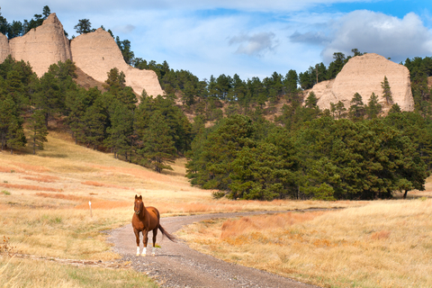
Fort Robinson State Park
North of Nebraska National Forest in lime green is Fort Robinson State Park. The park encompasses 22,000 acres of Pine Ridge landscape.
The park has buffalo and longhorn herds. It is also a magnet for family reunions!
The area was used as a fort back in the Old West days. Original buildings still stand today.
The park offers historic lodging, camping, museums, rodeo, golf, swimming, fishing, and hiking. One of its main attractions is horse-drawn tours, stagecoach rides, and horseback riding! Source: http://outdoornebraska.gov/fortrobinson/
Pine Ridge National Recreation Area
Pine Ridge National Recreation Area is situated in the northwest corner of the state. It is depicted in green as it is managed by the U.S. Forest Service.
Pine Ridge consists primarily of ponderosa pine forests and rocky bluffs, formed by river erosion.
The Pine Ridge Recreation Area is over 6-thousand acres of land established in 1986. Its purpose was to provide recreational opportunities in a primitive and semi-primitive ponderosa pine environment.
Some of the typical activities visitors enjoy are nature walks, biking, hiking, hunting (with proper permits), horseback riding, and cross-country skiing.
There are no developed sites or facilities in the area. That being said, it's essential to carry your own water when hiking or walking trails because the water supplies are hardly available.
There are two main trailheads that provide access to the park. Roberts Tract Camping Area/Trailhead provides access to the Pine Ridge Trail which leads into the National Recreation Area, the second trail is East Ash Trailhead.
This area is home to bobcats, elk, white-tiled deer, mule deer, coyotes, hawks, eagles, and wild turkeys, Pine Ridge.
If you're planning on visiting Nebraska, you should stop in and check out some of these incredible parks!
Affiliate Disclosure
Databayou.com is a participant in the Amazon Services LLC Associates Program, an affiliate advertising program designed to provide a means for sites to earn advertising fees by advertising and linking to Amazon.com. Databayou.com also participates in affiliate programs with Clickbank, CJ, and other sites.
If you plan on visiting one of these parks or hiking around Nebraska, I suggest you get some of these items found on Amazon.
- Geology Hammer Kit: Comes with Digging Chisels Set for Rock Hounding, Gold Mining & Prospecting Equipment Tool with Shovel Musette Bag, Compass, Whistle, and Wooden Chisel.
- Digital Canon Camera: To capture sites and moments you wish to keep.
- High definition Binoculars: Perfect to observe wildlife, and stars. It comes with a phone adapter and is waterproof.
FOLLOW ME
Resources for Nebraska's Protected Areas Map
The shapefiles with Nebraska's state boundary lines, lakes, major rivers, and cities were downloaded from Natural Earth Data.
The Parks and Public Lands shapefiles for Nebraska were downloaded from USGS.
This map will be updated with new data! To receive updates on this and more nature maps join my email list!!!!!!!
Made by Luz K. Molina with D3.js.