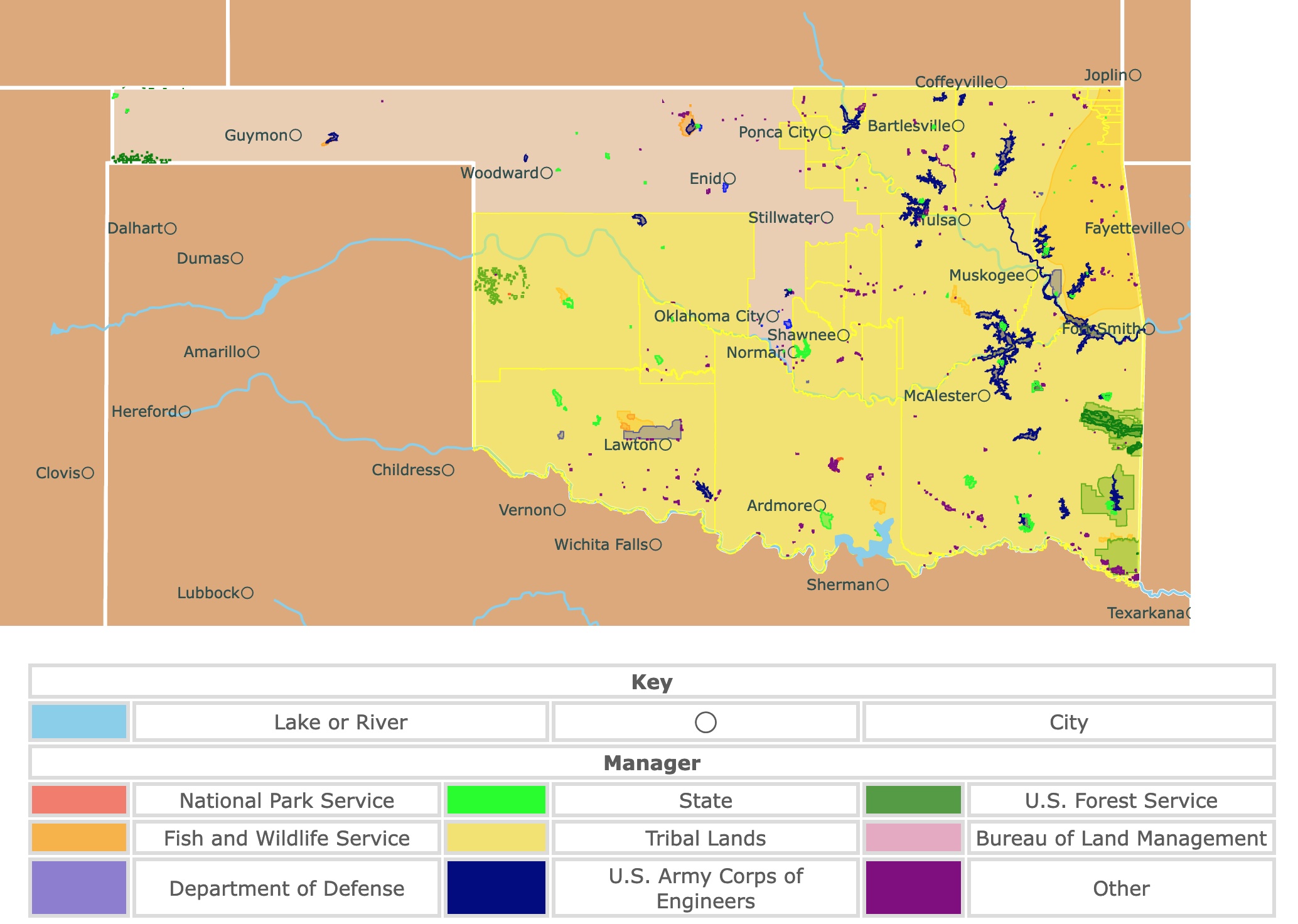
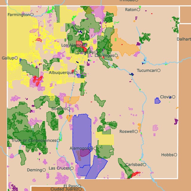
Map of Oklahoma's Parks and Protected Areas
This interactive map shows the Locations, Names, Areas, and Details of National Parks, State Parks, National Forests, Tribal, and other Public Lands of Oklahoma. It also shows major cities and rivers for context. For more detail, zoom in. For more information, hover over the map, or scroll down.
| Key | |||||
|---|---|---|---|---|---|
| Lake or River | ◯ | City | |||
| Manager | |||||
| National Park Service | State | U.S. Forest Service | |||
| Fish and Wildlife Service | Tribal Lands | Bureau of Land Management | |||
| Department of Defense | U.S. Army Corps of Engineers | Other | |||
Oklahoma's Geography
Oklahoma is considered a transition zone ranging from a drier region to a wetter and forested region. Oklahoma is a Great Plains state with diverse topography, including mountains, rivers, lakes, prairies, forests, mesas, and canyons.
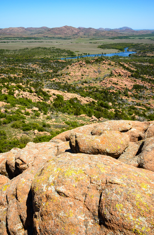
While the Great Plains cover most of the state, there are actually various landforms within Oklahoma's borders. The state is home to several small mountain ranges, including the Kiamichi Mountains. Some points of the Kiamichi Mountains reach elevations of 2,500 feet (762 meters) above sea level, OK History.
The Ouachita Mountains are also located in southeastern Oklahoma but are shared with neighboring Arkansas. This portion of the state is referred to as Choctaw and Kiamichi Country.
The name "Choctaw Country" honors the Choctaw Nation, a federally recognized Native American tribe. The Choctaw Nation has its headquarters located in Durant, Oklahoma. Ouachita National Forest is the state's only National Forest.
Black Mesa in northwest Cimarron County is the state's highest point, reaching 4,973 feet (1,516 meters). Oklahoma's lowest point is located on the Little River in McCurtain County. This is 289 feet (88 meters) above sea level.
The Ozark Mountains are a prominent physical feature in northeast Oklahoma, called Green Country. The forests in Green Country are full of deciduous and evergreen trees. This portion of the state also consists of rolling hills and lakes.
A majority of the lakes in Oklahoma are reservoirs. The state has more than 200 reservoirs, which is more than any other state in the U.S.
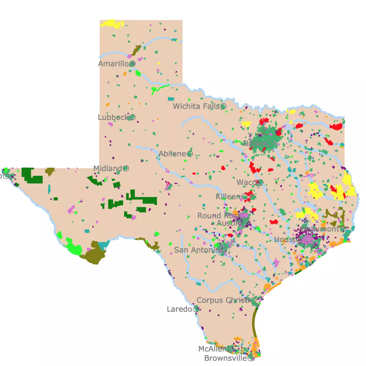
Want to find places to explore in nearby Texas? Check this map of Texas Parks
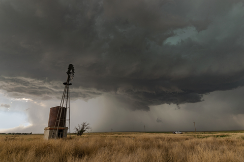
Oklahoma's Climate
The summers in Oklahoma City, Oklahoma, are hot and muggy. While the winters are extremely cold, windy, and snowy. Meanwhile, the skies are partly cloudy year-round.
The average temperatures range from 30°F (-1.11°C) to 94°C (34.44°C). The temperatures rarely drop lower than 17°F (-8.33°C) or above 102°C (38.88°C).
According to the beach/pool score, the best time to visit Oklahoma for warmer weather activities is mid-June to early September, Weatherspark.
Oklahoma's Plants and Animals
Believe it or not, there are two places in Oklahoma to find the American alligator; McCurtain and Choctaw counties.
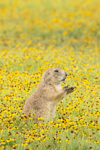
The state is also home to deer, antelope, rabbits, elk, wolves, coyotes, foxes, American bison, and prairie dogs.
Some of the native fish species include catfish, bass, and perch.
Every bird commonly found between the Rockies and the Mississippi River can be seen in Oklahoma, especially in the eastern part of the state.
Lizards, horned toads, rattlesnakes, water moccasins, and many varieties of nonpoisonous snakes are native to Oklahoma.
Oklahoma has over 130 species of native trees. Eastern forests support hickory, oak, sweetgum, and pine blends with elm, cottonwood, blackjack, hackberry, and post oaks. In the arid zones, sage, mesquite, and cacti are the dominant plants.
Interested in Prairies and where they are? Visit this map of World Grasslands
Oklahoma Parks and Protected Lands
Finding this array of parks and wilderness areas in Oklahoma is an absolute surprise.
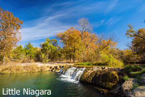
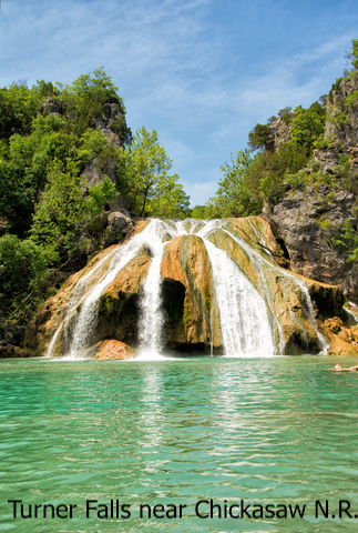
Chickasaw National Recreation Area
The State Fish and Wildlife (SFW) manages the Chickasaw National Recreation Area. It is depicted in purple and is located in Chickasaw tribal lands, south of Oklahoma City.
Initially, the park was created to protect the crystal clear water of the springs, and Chickasaw Recreation Area was once a National Park. Nevertheless, the Chickasaw and Choctaw tribes didn't want to see the land turn into a spa where nature would be disrupted and the sacred sites ruined, NPR.
One could state that visitors get two parks in one, the Platt National Park Historic District and Lake of the Arbuckles.
Within the wooded areas the park has stone outcroppings, travertine formations, limestone, and the Little Niagara Falls.
Chickasaw National Recreation Area is located in the Central Migratory Flyway and offers incredible bird watching opportunities throughout the year.
Around Lake of the Arbuckles, there are hunting specific areas for hunters with permits. They're allowed to hunt during the state's regulated seasons.
Boating, biking, camping, hiking, fishing, hunting, swimming, water skiing, picnicking, bird watching, and wildlife viewing are several activities visitors can enjoy at Chickasaw.
Hiking is allowed year-round; however, summer is too hot and humid, so spring and fall are better alternatives. Meanwhile, from March to October, the park blooms with wildflowers.
Water-based activities like boating, fishing, and canoeing are popular during the summer months, but the availability is year-round.
Chickasaw Recreation Area has over 400 campsites; however, there aren't any cabins or other lodging facilities inside the park; Chickasaw.
Beavers Bend State Park
Beavers Bend State Park is in the southeast corner of the state and is depicted in lime green. It is surrounded by Choctaw tribal lands.
Beavers Bend State Park is positioned in the mountainous region of Oklahoma, along the shore of the Mountain Fork River and Bow Lake.
The scenery in Beavers Bend is beautiful, and there are plenty of activities for visitors to enjoy. This is one of Oklahoma's most popular parks. The crystal clear water, timbered forests, and rugged terrain are picturesque.
Visitors enjoy hiking, fishing, biking, boating, floating the river, nature center activities, horseback riding, and more!
The trout streams are stocked all year, and there are two catch-and-release trophy areas for anglers. Mountain Fork River flows from the base of Broken Bow Lake through the sprawling park below.
Nestled mindfully among the trees and alongside the river, visitors will find rustic and modern cabins, tent campsites, RV sites, and two group camps. The park spans 3,482 acres, and throughout there are over 40 cabins with kitchenettes.
Leashed pets are welcome at the park, and there are one and two-bedroom cabins that permit pets for a nightly fee, Travel OK.
Interested in Prairies and where they are? Visit this map of World Grasslands
Glass Mountains State Park
The Gloss Mountains, sometimes called the Glass Mountains, are located in the northern section of the state of Oklahoma. It is the lime green park west of Enid.
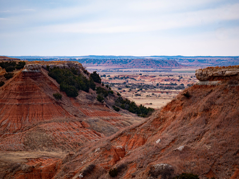
Glass Mountain is considered one of the state's treasures. The high Selenite content mimics a shiny glass exterior, which earned the park its name, OK History.
There may not be any campsites or lodging available at the park. However, visitors still make their way to enjoy the hikes on Cathedral Mountain. The scenery is something out of a Thomas Kinkade painting.
The park facilities include pavilions, restrooms, picnic areas, grills, and a water supply.
The trail leads to the top of Cathedral Mountain and across the mesa. At the top, you'll find an excellent view of Lone Peak Mountain and the valley floor.
Head over to Gloss Mountain Outfitters after a nice hike. At the outfitters, visitors can camp at a tent site or pull up in a RV, Gloss Mountains.
Natural Falls State Park
Natural Falls State Park is depicted in lime green and is located west of Tulsa, Oklahoma, in the Ozark Highlands region. It is inside Cherokee Tribal Lands close to the border with Arkansas.
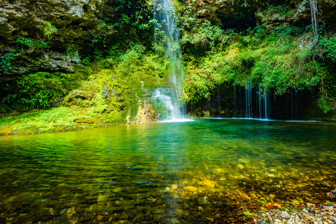
The park features an incredible 77-foot waterfall that drops through the rock wall, creating a hidden gem at the bottom of a slender, V-shaped valley.
An observation platform allows hikers to get an overview of the falls. Another observation deck offers seating and is located at the foot of the falls. Both locations allow visitors to admire the beautiful scenery.
The moist environment promotes the growth of liverworts, mosses, ferns, white oak, and dogwood.
Numerous visitors recognize the location from the movie "Where The Red Fern Grows" from 1974. The falls were also used as an encampment for Confederate and Union troops during the civil war.
Natural Falls State Park has yurts, campsites, RV sites, hiking trails, picnic shelters, volleyball, basketball, and playgrounds, Natural Falls.
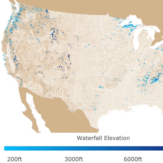
There are a few waterfalls in Oklahoma. Interested in more? Visit this page of waterfalls in the U.S.
Wichita Mountains Wilderness
Wichita Mountain Wilderness is the orange polygon next to Lawton.
Wild American buffalo once roamed these lands in uncountable numbers. Today, there is a small herd, but it's growing. People visit this park to see these massive creatures that were once near extinction.
Not only will you find American buffalo, but there is a herd of around 285 free-ranging Texas longhorn cattle. The Texas longhorn is rare in the area. The open range means these beauties are free to wander through the camp, so be prepared because they're not tame.
The sounds of the Oklahoma night ring with howls and yips of coyotes and hoots of owls. Friendly raccoons and other animal residents might show up and check you out while you camp. The site has over 50 mammals, 240 birds,64 reptile and amphibian species, plus 36 fish species.
The Charon's Garden Wilderness maintains two designated trails that total around 3.5 miles. This area features enormous granite boulders scattered around, perfect for a physical challenge.
Within the park, you'll find Cache Creek Falls. These waterfalls are a series of cascading water traveling over the face of the textured rock.
According to many visitors, the hike is definitely worth it. The Narrows Trail is believed to be one of the most accessible trails to the site, the Wichita Mountains.
Little Sahara State Park
Little Sahara State Park is located in north Oklahoma. It is the lime green polygon between Woodward and Enid.
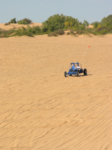
Little Sahara State Park is a perfect example of the diverse terrain in Oklahoma. The park contains 1,600 acres of sand dunes that range from 25 to 75 feet (7.62 to 22.86 meters) tall. The dunes were formed over time from terrace deposits.
According to OK History, some of the sand creating the dunes blows over from floodplain deposits. These deposits were formed from the river flowing through the area today.
The mini-desert atmosphere makes you feel like you're in a distant exotic desert, hence the name "Little Sahara."
The park offers RV sites with water and electricity. There are also tent sites, picnic areas, and showers available. All campsites must be reserved online, and concessions are only available in the park seasonally.
Dune buggy and ATV riding across the sand dunes are one of the park's main attractions. You can bring your own ATV or rent one from an off-site, private vendor.
It's only a few dollars for drivers and passengers to get out on the sand. Passengers under the age of 10 go free.
Little Sahara State Park offers annual family passes for those that frequent the park, source: Little Sahara.
Want to find places to explore in nearby New Mexico? Check this map of New Mexico Parks
Rita Blanca National Grassland
Rita Blanca National Grassland is in the southwestern section of the state on the border with Texas, represented by several green specks.
These grassland covers 230,000 acres in New Mexico, Texas, and Oklahoma.
Rita Blanca Grassland is a rolling grass prairie that reaches from one end of the horizon to the other. This area provides a healthy and endless supply of grass for cattle.
The park has two picnic areas. While camping is permitted on the land, there are no developed campgrounds. Unlike many state parks, there are no maintained hiking trails or fishing opportunities. Honestly, the land is meant to sustain the wildlife that calls the area home.
The Grassland is protected land and for good reasons. Its history dates back to the late 1800s. A drought brought many struggles to the area. The government stepped in to restore and maintain the land and wildlife for future generations, Forest Service.
While Rita Blanca National Grassland isn't full of recreational opportunities outdoor enthusiasts long for, it's a special place.
Wildlife is roaming-free, fat, and happy. The endless sea of grasses blowing in the breeze and the sheer beauty has visitors pouring into the lone prairie.
Affiliate Disclosure
Databayou.com is a participant in the Amazon Services LLC Associates Program, an affiliate advertising program designed to provide a means for sites to earn advertising fees by advertising and linking to Amazon.com. Databayou.com also participates in affiliate programs with Clickbank, CJ, and other sites.
If you plan on visiting one of these parks or hiking up the Wichita Mountains, I suggest you get some of these items found on Amazon.
- Camping Hammock: This is incredibly convenient when the ground is wet; it is portable, lightweight, single or double, comfortable, and can be used for just relaxing.
- Camping chair: From Coleman is essential for camping and sitting by the fire. It is also light, portable, and has its own small can cooler.
- Picnic Blanket: Perfect for short trips to the prairie or the beach. It is easy to clean and portable.
FOLLOW ME
Resources for Oklahoma's Protected Areas Map
The shapefiles with Oklahoma's state boundary lines, lakes, major rivers, and cities were downloaded from Natural Earth Data.
The Parks and Public Lands shapefiles for Oklahoma were downloaded from USGS.
This map will be updated with new data! To receive updates on this and more nature maps, join my email list!!!!!!!
Made by Luz K. Molina with D3.js.