Pangea and Continental Drift Interactive Map
This interactive map shows Pangea. As you click the purple buttons, you can see how the continents shift forming Laurasia and Gondwana. Then the continents as we know them today. Each button shows Millions of Years Ago (Ma). Hover to get the name of each continent today. For more information, scroll down.
Continental Drift
Continental Drift was a theory that proposed the Earth's continents had moved over geologic time relative to each other.
The idea of continental drift has been incorporated into the science of plate tectonics.
Various scientists and geographers noticed that the shapes of continents on opposite sides of the Atlantic Ocean seemed to fit.
These observers included Abraham Ortelius in the 1500s, Theodor Christoph Liliehtal in the 1700s, Alexander von Humboldt, Antonio Snider-Pellegrini, Charles Lyell, and Alfred Russel Wallace in the 1880s, among others.
This theory began as a hypothesis stating that the continents were moving slowly, changing their positions and creating the geographic features we see today.
The theory of continental drift was first proposed by Alfred Wegener in the early 20th century. It has since been supported by scientific evidence from geology, paleontology, and other fields.
The theory of continental drift suggests that the continents were once connected in a single supercontinent called Pangaea, which began to break apart around 200 million years ago.
Over millions of years, the continents moved away from each other, creating the familiar shapes of the continents that we see today.
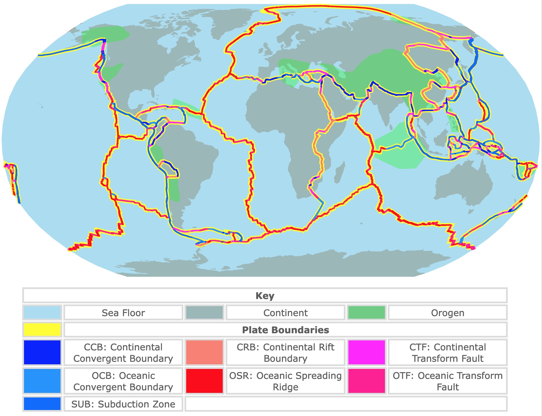
The mechanism behind continental drift is plate tectonics, which is the theory that the Earth's outer layer, or lithosphere, is divided into several large plates that move and interact with each other.
The movement of these plates can cause earthquakes, volcanic eruptions, and the formation of mountain ranges.
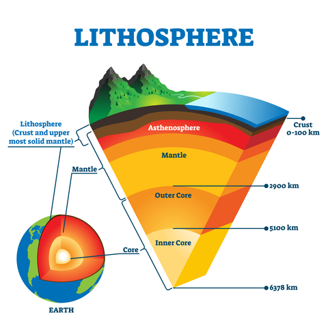
The movement of the plates is driven by the flow of material in the Earth's mantle, which is the layer beneath the lithosphere. As material in the mantle rises and cools, it creates convection currents that drag the plates along.
The movement of the plates can be slow, on the order of a few centimeters per year. Still, over millions of years, it can significantly change the Earth's surface.
Intrigued by Evolution of continents? Amazon has The Next Supercontinent: Solving the Puzzle of a Future Pangea. In this engaging work, geophysicist Ross Mitchell invites readers to remote lands for evidence of past supercontinents, delves into the phenomena that will birth the next.
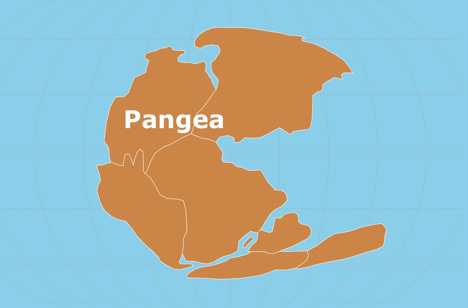
Pangea the Supercontinent
Pangea (sometimes spelled "Pangaea") was a supercontinent that existed about 335 million years ago during the late Paleozoic and early Mesozoic eras.
It was a vast landmass that contained all of Earth's continents, including Africa, Antarctica, Australia, South America, North America, Europe, and Asia, which were joined together.
Pangaea was surrounded by a giant ocean called Panthalassa, and the movement of the tectonic plates eventually caused it to break apart into the continents we know today.
The first person to propose the idea of Pangaea was Alfred Wegener, a German meteorologist and geophysicist.
In 1912, he published a book called "The Origin of Continents and Oceans". He suggested that the continents had once been joined together in a single supercontinent that he called "Pangaea."
He based this idea on the observation that the coastlines of Africa and South America appeared to fit together like puzzle pieces. He also noted similarities in the geology and fossils of these two continents, and others.
Wegener's hypothesis lacked a geological mechanism to explain how the continents could drift across the Earth's surface, as he proposed.
Although Wegener's theory was met with skepticism at the time, it eventually became widely accepted after the discovery of plate tectonics in the 1960s. It provided a mechanism for how the continents could have moved over time.
Today, the theory of continental drift and the existence of Pangaea are widely accepted by geologists and other scientists. Source: Berkley.
If you want to read this theory, right from the source, Amazon has >The Origin of Continents and Oceans by Alfred Wegener. This is an amazing book. Alfred Wegener explaining his theory in detail!
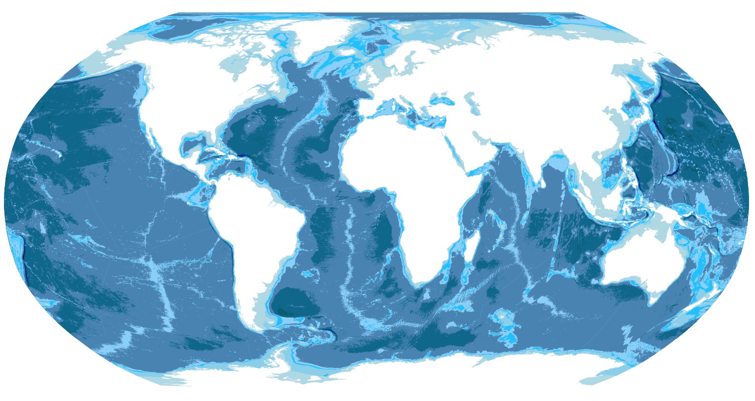
Map of Tropical Forests Worldwide
Laurasia and Gondwana
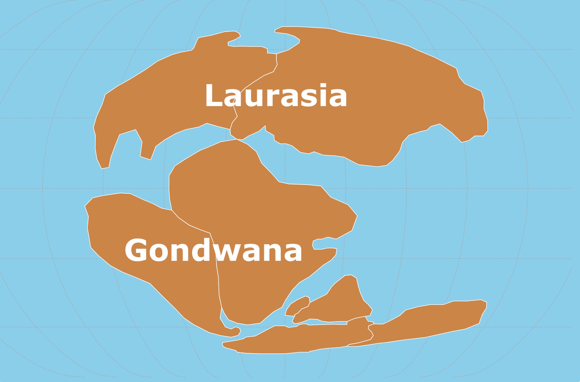
Pangaea began to break up 195 million years ago in the early Jurassic period when the Central Atlantic Ocean opened. The supercontinent fractured primarily along previous sutures.
Gondwana (what is now Africa, South America, Antarctica, India, and Australia) first split from Laurasia (Eurasia and North America).
Then about 150 million years ago, Gondwana broke up. India peeled off from Antarctica, and Africa and South America rifted.
Around 60 million years ago, North America split off from Eurasia. Source: Live Science.
For an indepth look at this supercontinent Amazon has The Road to Gondwana: In search of the lost supercontinent.
Evidence of Plate Tectonics
There are different clues that scientists have observed throughout the world that support continental drift.
Continents Fit
The first one was already mentioned. Africa and South America seem to fit. This is not just evident in the shape of their shores.
The Amazon and the Congo Rivers were also connected! Both rivers were a river system over Gondwana that flowed to the Pacific Ocean.
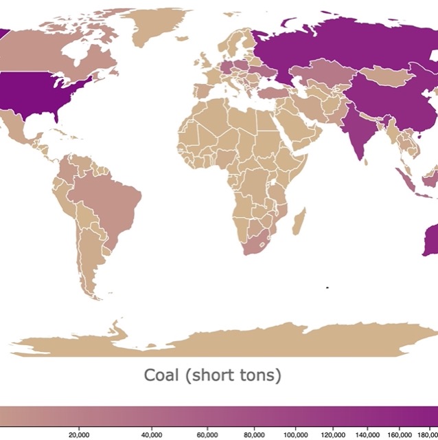
Map of Coal Origin and Deposits in the USA
Fossil Evidence
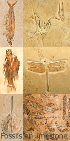
The distribution of fossils across the continents supports the theory of plate tectonics.
Similar fossils have been found on opposite sides of the Atlantic Ocean, suggesting that the continents were once joined and later separated.
For example, the Mesosaurus was a freshwater reptile that lived about 270 million years ago. Its fossils have been found in South America and Africa but nowhere else.
Similarly, the Glossopteris is a plant that lived about 250 million years ago. Its fossils have been found in Africa, South America, Australia, India, and Antarctica.
The distribution of these fossils supports the theory that these continents were once part of a larger landmass called Gondwana, which later split apart. Source: Let's talk Science.
Paleomagnetism Evidense
When rocks form, they contain magnetic minerals that align with the Earth's magnetic field.
By studying the alignment of these minerals, scientists can determine the position of the continents at the time the rocks were formed.
Paleomagnetic studies have confirmed that the continents have moved over time.
Earthquakes and Volcanoes as Evidence
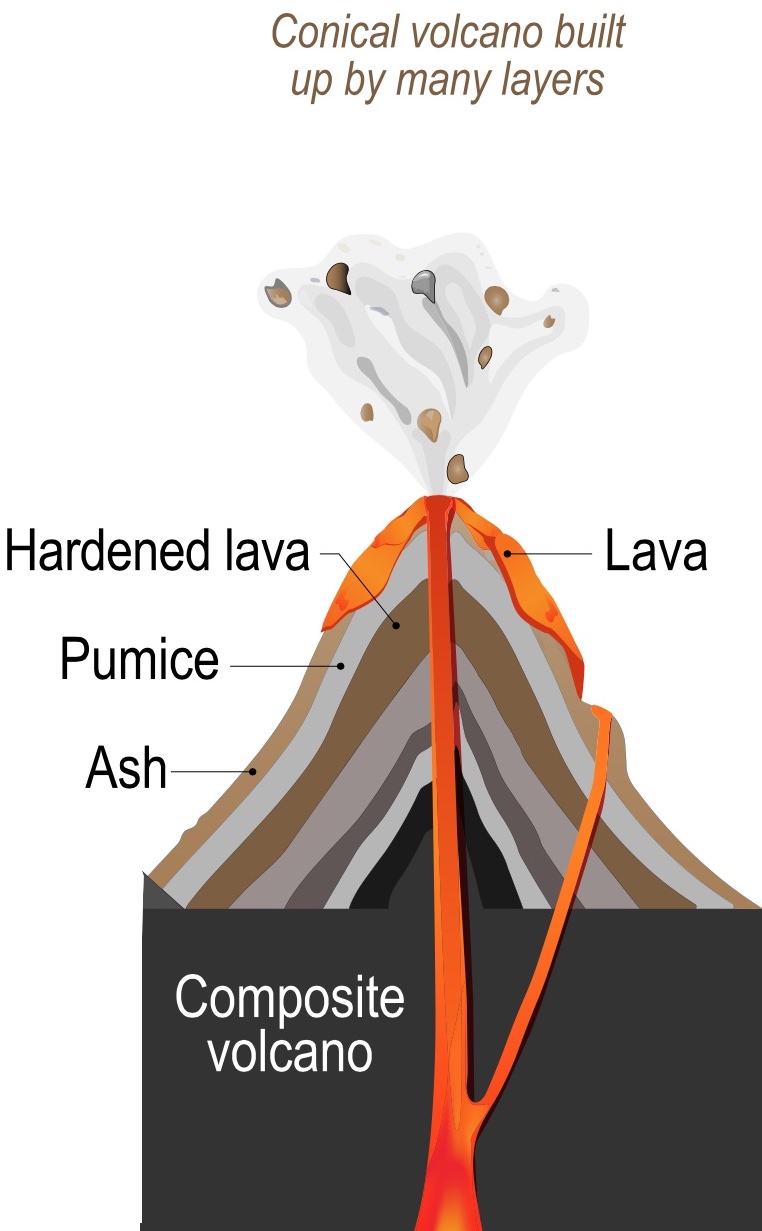
The boundaries between tectonic plates are often characterized by frequent earthquakes and volcanic activity.
This is because the movement of the plates can cause stress and pressure to build up, which is then released in the form of earthquakes and volcanic eruptions.
If you find the geology and maps fascinating, you might be interested in taking a course in GIS. Coursera has a course about Geographic Information Systems. For more information CLICK HERE!
GPS Measurements as Evidence
By using GPS technology, scientists can measure the movement of tectonic plates with high precision.
These measurements have confirmed that tectonic plates are moving and have provided new insights into the dynamics of plate tectonics.
Mid-Ocean Ridges as Evidence
Mid-ocean ridges are underwater mountain ranges that run through the center of the world's oceans.
These ridges are created by the upwelling of magma from the Earth's mantle, which solidifies to form a new oceanic crust.
The position of these ridges supports the theory of plate tectonics, as they mark the boundaries between tectonic plates.
Biological Evidence
The Wallace and Weber line is an imaginary divider used to mark the difference between species found in Australia from those in Papua New Guinea and Southeast Asia.
Once continental drift and plate tectonics started to pull these lands apart, the large amount of water that separated them drove evolution in different directions for the species present.
The distance made them unique to either continent after a long period of time had passed.
This continued reproductive isolation made the once closely related species disparate and distinguishable. Now they are close again, but their organisms are completely different. Source: ThoughtCo.
If you are interested in ecosystems and life as we know it and how changes led to where we are now, Amazon Continental Drift: The Evolution of Our World from the Origins of Life to the Far Future Explore how the continents have drifted, from the Devonian Era to the Jurassic Period, to form the world as we know it!
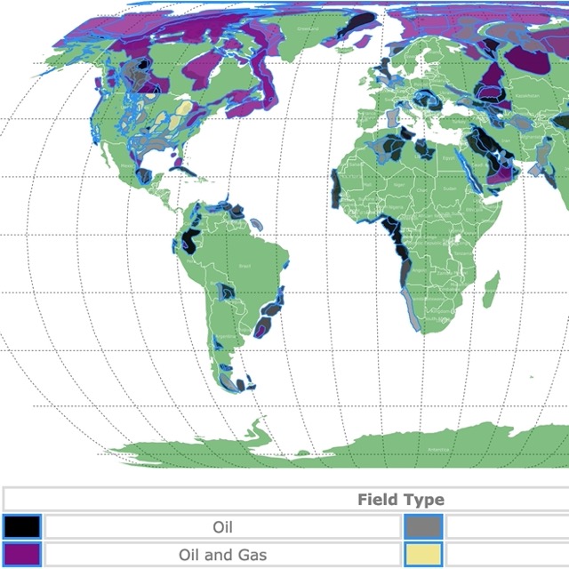
Map of Oil and Gas Fields in the USA
Distribution of Mountain Ranges
When the Pangea supercontinent was still united, the Appalachian Mountains bordered the Atlas Mountains in Africa. Both continued into New Foundland in Canada, then the British Isles, Greenland, and the Caledonian Mountains in Norway.
Climatic Markers
The movement of landmasses and mountain ranges changes the surrounding climate.
These leave behind fossilized remains, sedimentary rocks, glacial deposits, and coral reefs as a testimony of a landmass's past climate.
These past climatic markers may not correspond to the continent's current location or latitude.
World Map of Coal Deposits and Reserves
A New Supercontinent
The movement of the continents does not stop. The break up of Pangea is the latest of a long series of supercontinents on Earth.
These drifting continents came together repeatedly in a cycle that lasted approximately 500 million years. At the moment, we are halfway through the present cycle.
In another 250 million years, a new supercontinent will form.
Before Pangaea, about 1000 million years ago, another supercontinent occupied equatorial regions and has been called Rodinia.
It is the continent on which early complex life first evolved! Source: Geological Society.
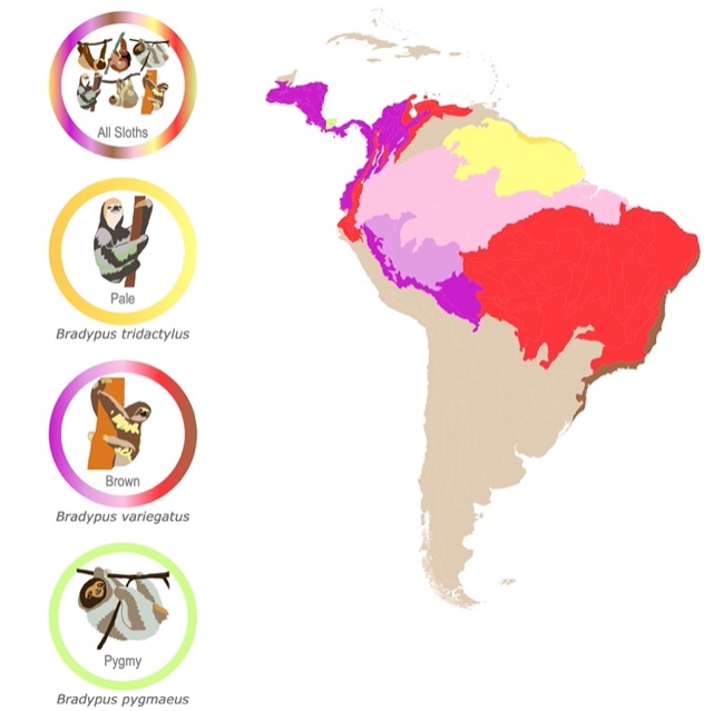
Interested in Animal Habitats? Check Sloth Habitat Map. You will find there is more than one species throughout South America!
Follow Me
Did you like this map? To receive updates on this and more nature maps, join my email list!!!!!!!
Made by Luz K. Molina with D3.js.