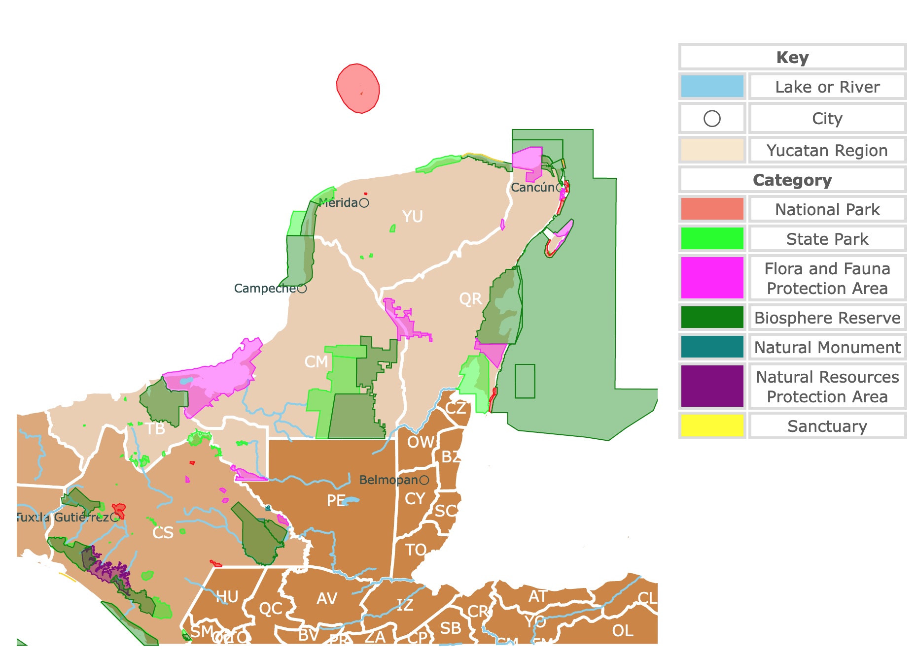
Interactive Map of Mexico's Yucatan Region Parks
This interactive map shows the Locations, Names, and Details of the National Parks of Mexico's Yucatan Region. It also shows major cities and rivers for context. For more detail, zoom in. For more information, hover over the map, or scroll down.
| Key | |
|---|---|
| Lake or River | |
| ◯ | City |
| Yucatan Region | |
| Category | |
| National Park | |
| State Park | |
| Flora and Fauna Protection Area | |
| Biosphere Reserve | |
| Natural Monument | |
| Natural Resources Protection Area | |
| Sanctuary | |
Geography of the Yucatan Peninsula
The Yucatan peninsula is surrounded by the Gulf of America to the north and west and the Caribbean Sea to the east.
The peninsula encompasses around 76,300 square miles (197,600 square km). It includes the Mexican states of Quintana Roo, Yucatan, and Campeche and large parts of Guatemala and Belize in the south.
Yucatan's northern and western coast is sandy, low, and semi-barren. The eastern coast comprises bluffs indented with bays and bordered by several islands. The largest and most developed are the Isla Mujeres and Cozumel.
Due to upwelling on its northern shores, cool, nutrient-rich waters from the bottom raise close to the surface. This results in excellent grounds for fishing along the coast.
The Yucatan peninsula is almost entirely made of coral and porous limestone rocks. The peninsula is covered with a layer of thin, dry soil created through the slow weathering of coral rocks.
Millions of years ago, the meteorite that banished the dinosaurs fell near what we know today as the Yucatan Peninsula. The large crater it left is not visible in plain sight, but the changes it left on the landscape affected the water flow underground.
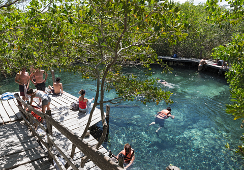
The water flow perforated the natural limestone and created natural sinkholes, caverns, and beautiful cenotes.
Because of the porous limestone, there are no major rivers in the entire peninsula. Therefore, cenotes have been the source of fresh water in Yucatan.
Henequen, cotton, coffee, tobacco, sugarcane, and corn are cultivated throughout the Yucatan. In several parts of the peninsula, oil has been discovered. There's a gas field at Xicalango and a few offshore fields near the Bay of Campeche.
The archaeological sites, including Uxmal and Chichen Itza (designated UNESCO World Heritage Sites), and the development of a transportation network have made tourism one of the major economic activities of the area.
A highway network, Cancun, and other major tourist centers have been linked to Mexico City.
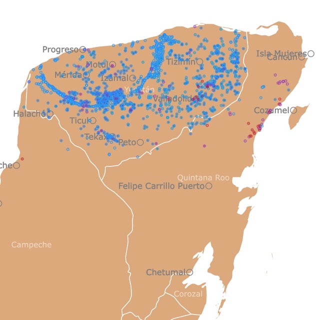
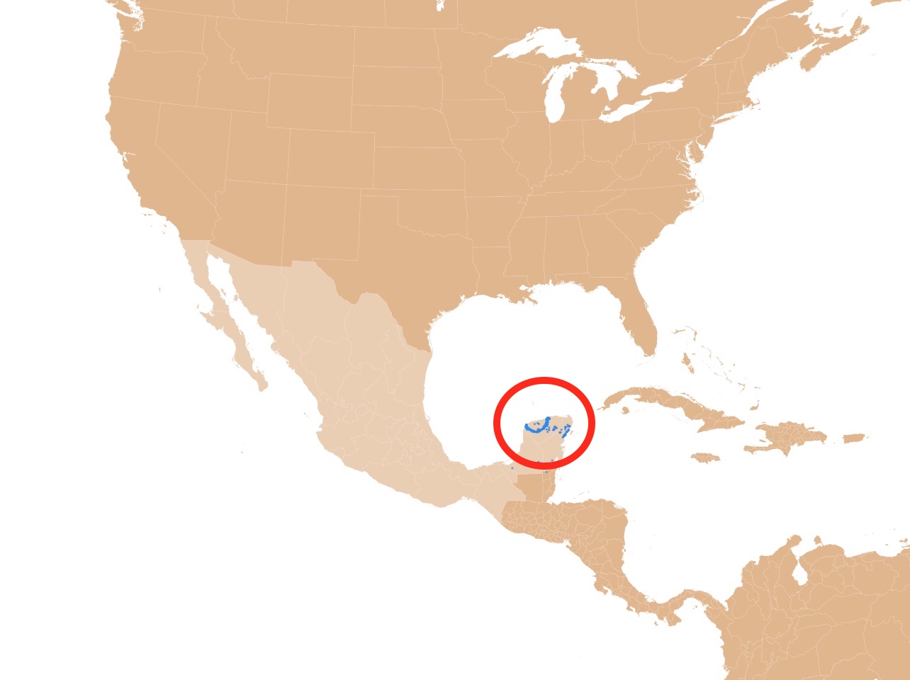
Map of Cenotes in Yucatan
Yucatan's Climate
Northern Yucatan experiences a hot and dry climate. The absence of high mountain ridges intercepting the moisture-bearing clouds results in limited rainfall.
Toward the south, moisture increases, ranging from 18 inches (460 mm) to 80 inches (2,000 mm) annually.
Daily high temperatures in Yucatan range from the mid-70s to 100℉ (24 to 38℃); however, the ocean winds modify the heat throughout a more significant part of the year.
Yucatan's dry season lasts from December to May, with the hottest months being May and June. A majority of the peninsula gets adequate rainfall throughout the year. Before you make reservations, remember Hurricane Season in Yucatan is from June to November.
Regions toward western Campeche and Belize have sufficient rainfall that allows the forests containing vanilla, logwood, mahogany, sapodilla, and dyewoods to thrive.
The best time to visit is from December to February, when the temperatures are slightly lower, and there's less rain.
Yucatan's Wildlife
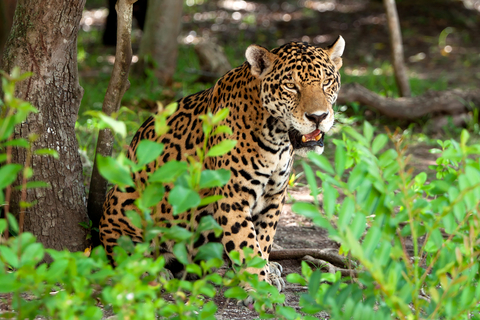
Deer, wild boar, monkeys, jaguars, snakes, and iguanas are among the common animals in Yucatan. Turkey, quail, and parrots can be seen flying around the peninsula.
Various crocodile and sea turtle species call the area home.
Keep an eye out; you might see storks and pink flamingos on the shores. Marine life is abundant in coastal waters.
A walk around Yucatan displays various tropical fruits and exotic flowering trees. There are numerous Mayan medicinal plants, including edible medicinal plants. Honestly, an abundance of edible food is growing throughout the entire peninsula.
Map of Parks and Reserves in Baja California
Best Parks in Yucatan
Arrecifes de Cozumel National Park
Cozumel is the island west of Yucatan Peninsula. Arrecifes de Cozumel National Park is the red stripe surrounding it.
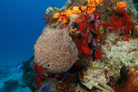
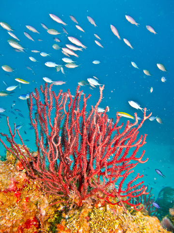
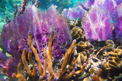
Arrecifes de Cozumel National Park is the second-largest coral reef on the planet! It's also known as the "Great Mayan Reef" or "The Great Western Atlantic Reef Belt."
The biodiversity of marine flora and fauna is immense. There are over 105 types of coral and 262 species of fish. Some of these organisms include starfish, splendid toadfish, hedgehogs, hawksbill, and loggerheads.
If you want to see giant manta rays, you should visit from December to March for an unforgettable experience.
The outdoor recreational opportunities are abundant and exciting. Sightseeing, wildlife observation, scuba diving, snorkeling, swimming, dolphin watching, and various activities and tours.
Eco-tours include swimming with manatees in Dolphin Discovery's Cozumel Park and snorkeling with the stingrays. Visitors can feed and pet the stingrays, explore the reef habitats, and meet nurse sharks.
A popular tour in Cozumel is the Mayan Villiage Jeep Tour. It's a single-day tour that gives visitors insights into the native people of the land, the Mayans. The tours vary in price and length of time.
Some sites may be closed from time to time, thanks to conservation efforts. Source: This is cozumel.com.
Isla Contoy National Park
The small red rectangle north of Cancun. To see it, you must zoom in on the map above.
Suppose you are looking for an enchanting day trip during your visit to the Mexican Caribbean. In that case, Isla Contoy National Park should be on top of the list.
This is where the Caribbean Sea meets the Gulf of America. This is also where the Mesoamerican reef begins.
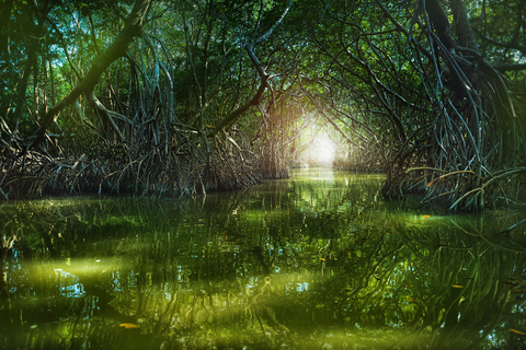
Besides coral reefs and white sand beaches, the island is dominated by mangrove forests and tropical forests.
The island is home to more than 150 bird species and four types of endangered sea turtles. The only full-time inhabitants on the heavily protected island are the animals and a handful of scientists.
The island has strict regulations that protect the habitat, so it's essential that you learn about the logistical aspects when planning your trip. There is no way to reach the island on your own, so you'll have to schedule with the boat tour company.
Since the island is such a unique and vital place for wildlife, there is a limit on how many visitors are welcome in one day, 200 guests a day. A boat picks guests up from their hotel, transports them to the island, and returns to pick them up at the end of the day.
There is no camping allowed, nor can anyone smoke on the island. The island is a sacred and protected place; all visitors should be respectful. It's a wildlife lover's paradise! Isla Contoy.
Cancun is the best location to begin your discovery journey in Yucatan. For excellent hotels and dates, visit Expedia.

North America's Marine Ecoregions Map
Ria Lagartos Biosphere Reserve
The green stripe on the northern coast of Yucatan is Ria Lagartos Biosphere Reserve.
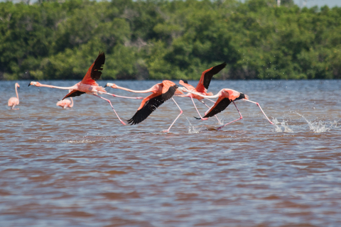
Ria Lagartos Biosphere Reserve features a variety of small estuaries, mangroves, marshes, coastal lagoons, and a savanna.
The Reserve is home to a variety of species. A substantial number of them are rare, vulnerable, and endangered.
Ria Lagartos encompasses vital wetlands recognized by the Ramsar Convention. The savanna ecosystem contains titular vegetation, reed beds, and grasslands, the primary nesting site for marshland and sea birds.
The Reserve's marshes are the ONLY nesting site for the Caribbean pink flamingo. They are an important nesting site for various turtle species, including the critically endangered Hawksbill sea turtle and the green sea turtle.
Bird watchers and nature lovers appreciate the Biosphere's diversity and the opportunity to view incredible species in their natural habitat.
If you're interested in visiting Ria Lagartos Biosphere Reserve, you should check out the incredible tours offered. Source: UNESCO.
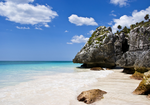
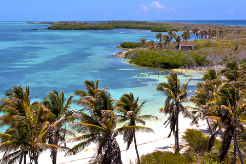
Tulum National Park
Tulum is a thin red stripe southwest of Cozumel. You need to zoom in on the map above to see it.
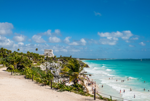
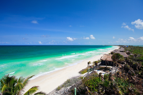
Tulum National Park is a famous archaeological site in Mexico. The fortified Mayan city made of stone is perched on a cliff 40 feet (12 meters) above the beautiful white Caribbean sand and blue waters.
However, the view is only one of the things to see and do at the ruins.
Tulum is the only fortified Mayan town by the coast. It's believed that it served as a military stronghold. The structures are a large part of the park's history and culture. The park is a historical, cultural, and archeological gem well preserved; Tulum.
There are more stunning Maya ruins and beaches throughout the peninsula. To learn more about them, Amazon has the Moon Yucatan Peninsula Travel Guide. It includes strategic advice for road trips, hidden spots, and authentic experiences.
Map of Tropical Forests Worldwide
Sian Ka'an Biosphere Reserve
Sian Ka'an Biosphere Reserve is the green area on eastern Yucatan.
Sian Ka'an Biosphere Reserve's intends to protect the local area and the fragile ecosystems of Sian Ka'an, a World Heritage Site. The park's business model is based on sustainable tourism, minimizing the environmental impact of the tours.
This tropical paradise is a nature lover's dream, with thousands of species of flora and fauna to explore. The biosphere is one of the largest protected areas in the Mexican Caribbean, and it's only 2 hours south of Cancun, near the small town of Tulum.
The park is home to jaguar, tapir, and manatee and has a system of underground rivers and cenotes.
Sian Ka'an is where visitors can join tailor-made and personalized nature tours, with private tours available upon request.
Tours are limited to six people per trip. Still, with special requests for families or group excursions, the group can be up to 12 people per tour. Sian Ka'an.
Yucatan is more than incredible beaches, rich history, and outstanding nature reserves. It has a wealth of flavors waiting to be discovered. Amazon has a unique cookbook if you are interested in its foods, Yucatán: Recipes from a Culinary Expedition. A hardcover book for those interested in learning recipes from the peninsula.
Arrecifes de Xcalak
Arrecifes de Xcalak is the red coastal strip on the southeastern tip of Quintana Roo.
Xcalak Reef National Park was established in 2003 to protect the coastal ecosystem and Xcalak's growing tourist economy.
The park encompasses nearly 44,479 acres (18,000 hectares) from the Belize border to the far north of town. It includes the reef and everything down to 328 feet (100 meters).
The main coral reef is only 100-200 yards (90-180 meters) from the shore, and the water is less than 5 feet (1.5 meters) deep nearly the entire way out.
Many snorkelers prefer the coral heads, which are even closer to the shore. Near the beach, there's less swell than on the main reef. Besides, the park's shallow waters keep boat traffic at a minimum.
Anglers who fancy fly fishing will be presented with the opportunity for world-class fly fishing. Source: Moon.com
Map of Mangrove Forests Worldwide
Arrecife Alacranes (Scorpion Reef)
Arrecife Alacranes is the red circular area north of Yucatan. It surrounds a small group of islands just off the coast.
The area is designated as a National Park and Biosphere Reserve. It contains one of the most extensive reefs in the southern Gulf of America.
Alacranes is a group of small atolls and Coraline islands. The reef is about 17 miles (27 km) long and around 13 miles (21 km) wide.
Given its location, it has been notorious for sinking ships and is a well-known site of shipwrecks.
A special permit is needed to visit Alacranes; The Yucatan Times.
Ria Celestun Biosphere Reserve
The green area in northeastern Yucatan is Ria Celestrun Biosphere Reserve.
The freshwater from underground aquifers flows to the Ria. Its mangroves, dunes, and low rainforests are home to various organisms, especially birds. In fact, the area is a resting place for many migrating species.
In Ria Celestun, visitors can view colonies of wintering pink flamingos, swim at Celestun Beach, enjoy a boat ride through the mangrove forest, and discover various native species.
The tour begins with visitors being picked up from their hotel in Merida. From there, the journey starts to the Biosphere, where you can explore the wildlife refuge.
The reserve is a bird lover's paradise with over 300 species of native and migratory birds, including the flamingos that spend the winter there.
Reptiles, mammals, and various plants can be seen and learned about.
The best time to observe the flamingos is between April and October when around 40,000 flamingos return to their winter homes to feed and nest. Source: Ria Celestun.
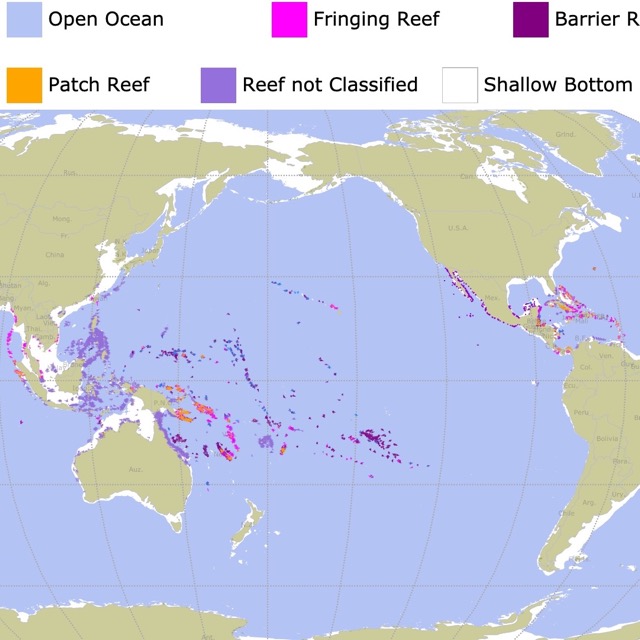
Map of Coral Reefs Worldwide
Bahia de Chetumal, Santuario del Manati
The lime area in eastern Quintanar Roo, north of Belize is Bahia de Chetumal.
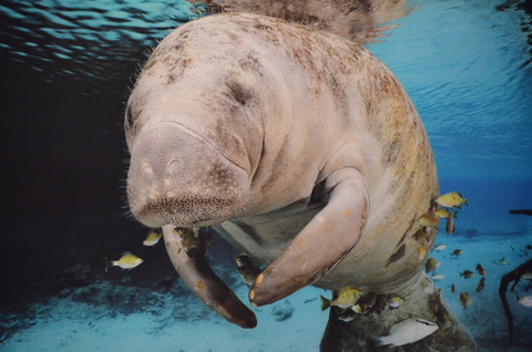
The government of Quintana Roo created the Santuario del Manati (manatee sanctuary), a National Protected Area, in 1996. The creation of the sanctuary was to promote the conservation of endangered species.
The sanctuary encompasses 695,516 acres (281,320 hectares), including the Hondo River, the Guerrero Lagoon, and Chetumal Bay.
Bahia de Chetumal is home to around 90 manatees that share their habitat with other threatened animals, including jaguars, crocodiles, and river turtles.
The main activity is wildlife and nature observation. The reserve is a beautiful place to relax and enjoy your surroundings. Make sure to bring your camera along because you never know what you might witness, Chetumal.
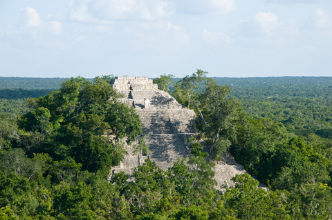
Dzibilchaltún
Dzibilchaltún is the red speck in northeastern Yucatan.
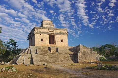
The Dzibilchaltun Ruins are located near the colonial city of Merida. It was once a large settlement, still occupied when the Spanish arrived in the 1500s.
Many archaeologists estimate there may have been around 200,000 inhabitants with over 8,000 buildings.
Artifacts found at Dzibilchaltun date back to around 700 - 800 A.D. Some incredible highlights within the Ruins are a large plaza, the Temple of the Dolls, Sacbe trails, and the Open Chapel, an unusual and interesting amphitheater-shaped structure.
Dzibilchaltun is a modern Mayan name meaning “writing on flat stones,” and while it doesn't contain massive pyramids like Uxmal or Chichen Itza, it has its own unique features; Dzibilchaltún.
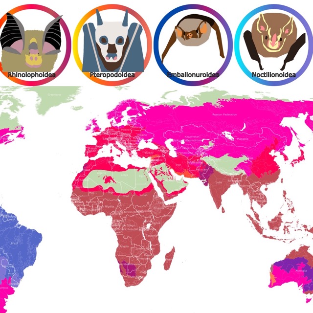
Map of Bats Geographic Range
Calakmul Biosphere Reserve
The Calakmul Biosphere is the green area in the State of Campeche, at the center of the Yucatan Peninsula.
The Reserve features the remains of the Mayan city Calakmul, found deep in the forest of the Tierras Bajas.
The city played a vital role in the region's history for more than 12 centuries. Calakmul can be characterized by the well-preserved structures that vividly depict life in the ancient Maya Capital.
The land falls within the Mesoamerica biodiversity hotspot, the third-largest worldwide, and encompasses all subtropical and tropical ecosystems; Calakmul.
Laguna de Terminos
The fuchsia area west of the Yucatan peninsula is the Laguna de Terminos.
According to Intechopen, the Laguna de Terminos System is the largest lagoon or estuary in the Gulf of America.
Laguna de Terminos contains a network of ponds, swamps, and estuaries that form a unique and essential habitat for various plants and animals.
Visitors will find white, black, and red mangroves that are vital nesting grounds for multiple species of migratory birds and marine turtles.
FOLLOW ME
Resources for California's Protected Areas Map
The shapefiles with Mexico's Yucatan Region state boundary lines, major rivers, lakes, and cities were downloaded from Natural Earth Data.
The shapefiles with Mexico's National Parks and State Parks were downloaded from CONABIO.
This map will be updated with new data! To receive updates on this and more nature maps, join my email list!!!!!!!
Made by Luz K. Molina with D3.js.