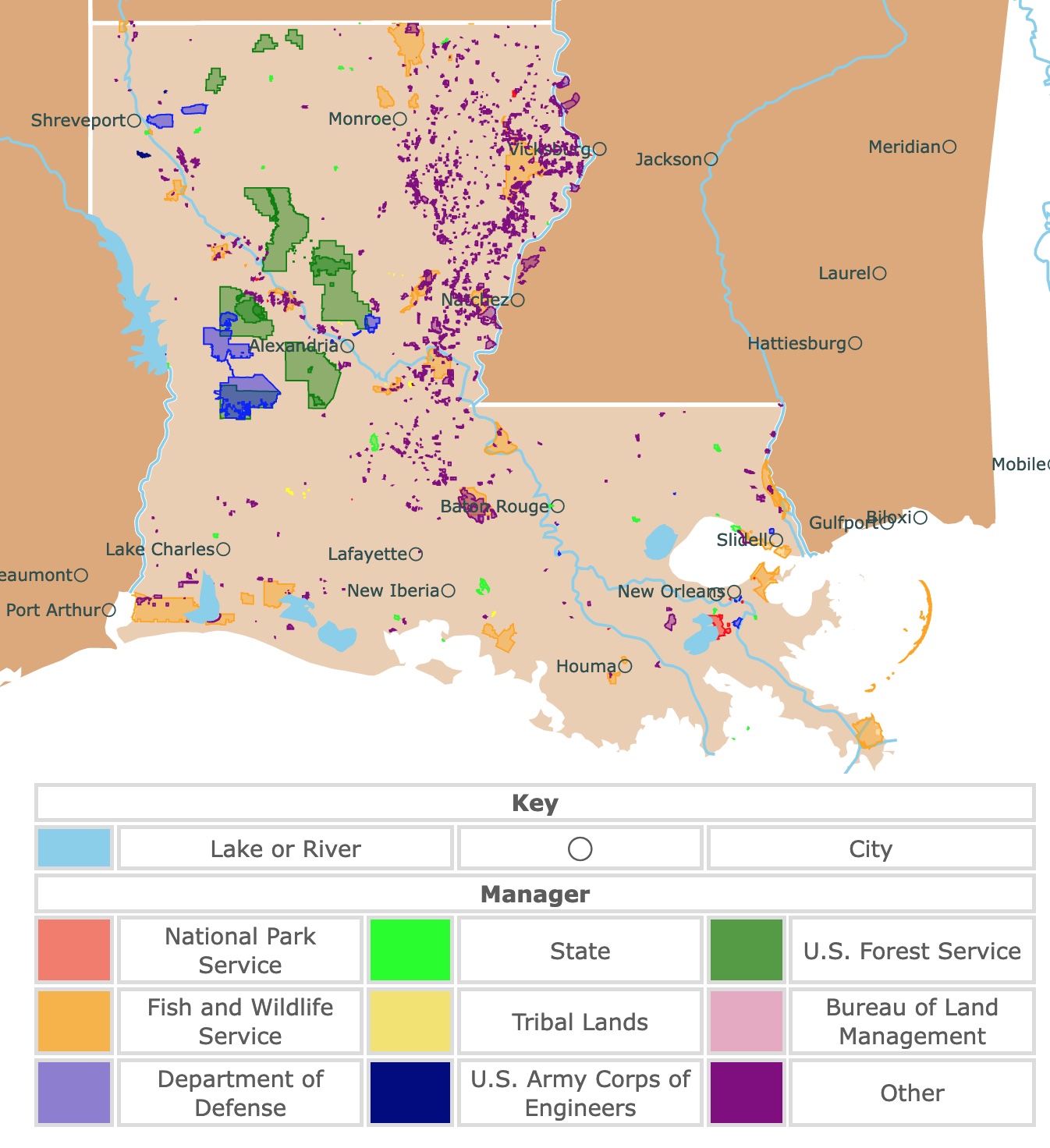
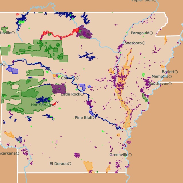
Map of Louisiana's Parks and Protected Areas
This interactive map shows the Locations, Names, Areas, and Details of National Parks, State Parks, National Forests, Tribal, and other Public Lands of Louisiana. It also shows major cities and rivers for context. For more detail, zoom in. For more information, hover over the map, or scroll down.
| Key | |||||
|---|---|---|---|---|---|
| Lake or River | ◯ | City | |||
| Manager | |||||
| National Park Service | State | U.S. Forest Service | |||
| Fish and Wildlife Service | Tribal Lands | Bureau of Land Management | |||
| Department of Defense | U.S. Army Corps of Engineers | Other | |||
Louisiana's Geography
Louisiana is well-known for Mardi Gras, Cajun culture, and seafood. The multicultural state was influenced by the 18th-century enslavement of African people and colonization of the Spanish and French.
Louisiana is situated in the southeastern portion of the U.S. The state is south of Arkansas, between Mississippi and Texas.
The topography of Louisiana consists mainly of relatively flat lowlands along the coastal plain of the Gulf of Mexico and the alluvial plain of the Mississippi River, USGS.
The highest point in Louisiana is Mount Driskill at 535 feet (163 meters) above sea level, while the lowest point is in New Orleans at -5 feet (-1.5 meters).
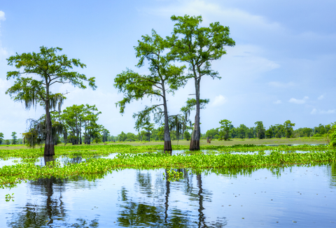
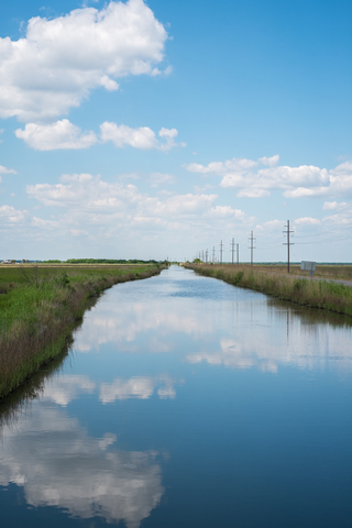
The state's main waterway is the Mississippi River. The state's coast has many slow-moving bayous, extensive lagoons, and oxbow lakes.
Louisiana's landforms include regional uplifts, wetlands, faulted river valleys, and salt domes.
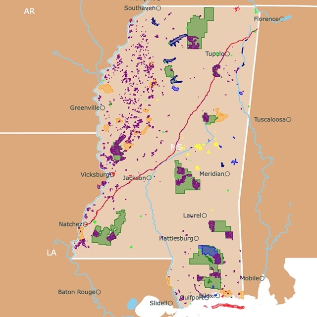
Want to find places to explore in nearby Mississippi? Check this map of Mississippi Parks
Louisiana's Climate
The climate in Louisiana is considered humid subtropical, and the state's coast is incredibly rainy. The result is many biodiverse marshes.
Inland areas are drier, dominated by low rolling hills and low prairies.
Louisiana's average temperatures vary depending on the location, with northern regions of the state being colder in the winter and hotter in the summer than areas closer to the Gulf of Mexico.
January highs average about 39°F (3.88°C), with lows around 24°F (-4.44°C). July temperatures range from 69 to 87°F (20.55 to 30.55°C).
Due to its location, Louisiana may have hurricanes. The hurricane season is between June and November.
Louisiana's Wildlife
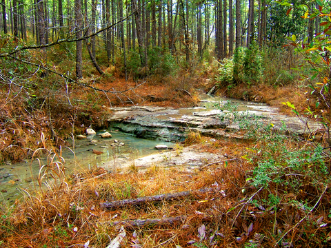
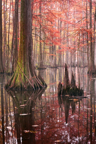
There are three distinct types of vegetation in Louisiana: Forests where you'll find pine trees, cypresses, various hardwoods, dry grasslands, and prairies; and the marshlands close to the coast.
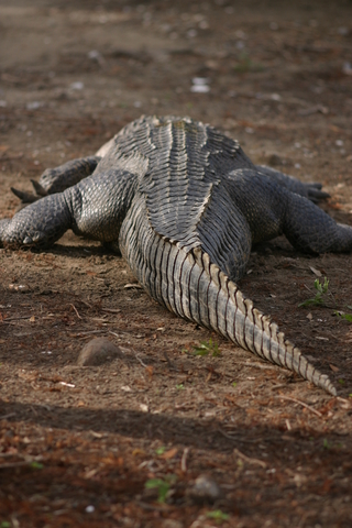
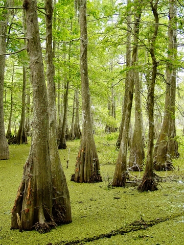
Louisiana swamps have always seemed intriguing to travelers and locals alike. The murky waters are home to numerous animals, including alligators, turtles, rodents, fish, snakes, beavers, and muskrats.
The land and forests are home to many common mammals, including bobcats, squirrels, raccoons, foxes, and wolves. Head down to the swamps, marshes, and oceans. You'll find the southern leopard frogs, gopher tortoises, crayfish, and the Louisiana pine snake.
Look to the sky, and you might find shorebirds, brown pelicans, great horned owls, great blue herons, countless species of songbirds, etc.
Lizards and reptiles are abundant throughout the state. If you plan on visiting, keep your eye out for coral snakes and tarantula hawk wasps. They're venomous.
Some of Louisiana's rare and endangered species include the long-tailed weasel, West India Manatee, and the gopher tortoise.
The Louisiana Farm Bureau has a thorough list of native plants that grow throughout the state, Farm Bureau.
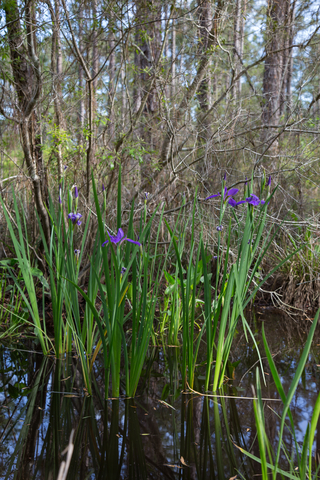
Spicebush, swamp azaleas, and luna hibiscus are only a few of the beautiful and colorful plants. Numerous species of wildflowers can be found growing in and around the forests and the prairies.
Louisiana is full of culture and rich history. The National Historic parks, outdoor recreation opportunities, incredible wildlife, and scenic landscapes are merely half of the reasons to plan your trip to LA.

If you want to learn more about the Gulf of Mexico, visit North America's Marine Ecoregions Map
Louisiana's Best Parks, Forests, and Preserves
Jean Lafitte National Historical Park and Preserve
Jean Lafitte National Historical Park and Preserve comprises 6 different units colored in red, south of New Orleans.
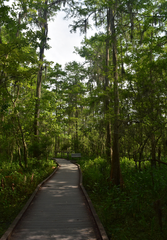
Each of Jean Lafitte's sites reflects traditions and memories of past generations. The park allows visitors to experience the ever-changing waterways and landscape.
The Barataria Preserve is perfect for nature and wildlife lovers. The preserve has hardwood forests, marshes, fishing, hunting, bayous, and wildlife viewing.
The visitor center offers exhibits and films explaining environmental changes and the wetland's habitat. Daily ranger programs are available daily, and the environmental education center provides programs available by reservation.
The trails are incredible for hiking ranging in distance and skill level. Take a stroll down the historic carriageway and take in the excellent architecture and history of the French Quarter.
History lovers may want to visit the Chalmette Battlefield, the site of the 1815 Battle of New Orleans. Explore an 1830s house, a reconstructed American rampart, a Chalmette monument standing 100-feet tall, and outdoor exhibits for self-guided tours., Battlefields.
The Acadian Cultural Center allows visitors to learn and explore the Acadian culture. Acadians (originally from Acadia in Canada) are the people that became Louisiana's Cajuns. The center offers ranger-led talks, permanent and special exhibits, and more about their history and culture.
Prairie Acadian Cultural Center brings Cajun culture to life through music, dancing, local musicians, cooking, and crafts demonstrations.
Lastly, the Wetland Acadian Cultural Center brings visitors on a boat trip around the bayou. Enjoy music and an incredible art exhibit.
While food and sleep accommodations aren't available at Jean Lafitte, there are plenty of options around the park and preserve, Jean Lafitte.
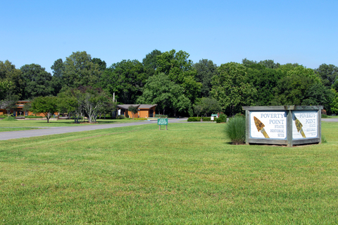
Poverty Point National Monument
Poverty Point National Monument is the small red square west of Monroe in northern Louisiana.
Many years ago, somewhere between 1650 and 700 BC, a unique site covering over 400 acres was created, leaving us with the most extraordinary archeological sites.
Men and women built this site with nearly 2 million cubic yards of soil. The result is an impressive 72 ft tall (21m) mound in the shape of concentric circles.
The State of Louisiana has an interpretive museum and special events, hosts programs, and provides guided tours of the area.
Visitors can tour the museum, view artifacts, and hear presentations. The archeological laboratory is an excellent place to learn about the monument.
The monument also has a picnic area and hiking trails perfect for outdoor adventures, Poverty Point.
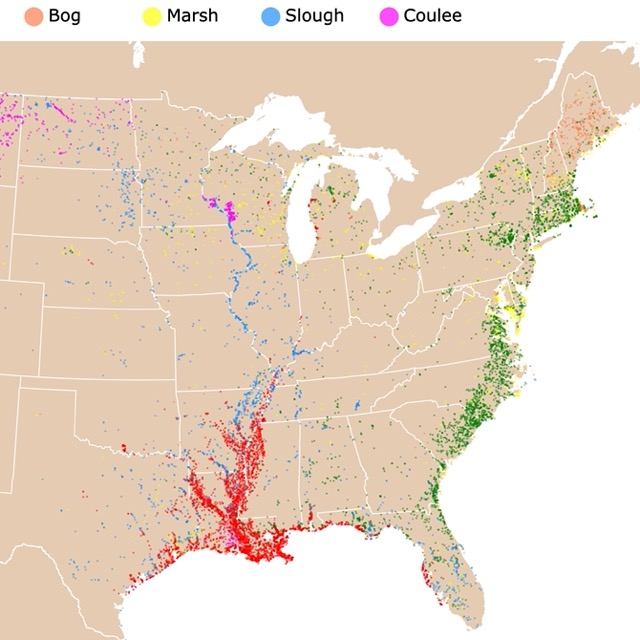
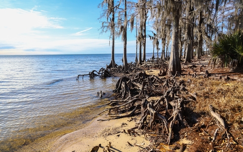
Louisiana has lots of Bayous. To learn where visit this map
Kisatchie National Forest
Kisatchie National Forest has 604,000 acres divided into the green units shown in central Louisiana.
The districts are Calcasieu, Caney, Catahoula, Kisatchie, and Winn. Each district has plenty of outdoor and recreational activities.
The forest is mainly Longleaf Pinewoods on rugged terrain, with elevations from 80 to 400ft (24 to 121m).
The views from the hiking trails include Kisatchie Bayou, buttes, messas, and sandstone outcrops.
Fishing and hunting in the Kisatchie National Forest offer some of the state's most incredible landscapes.
Numerous multi-use trails are marked throughout the forest. The trails stretch across rolling hills with scenic locations scattered throughout the landscape. Trail distances vary from a mile to close to 30 miles.
The tributaries and streams may not contain drinkable water, but they're fantastic places to cool off and relax.
Each of the five sites contains campgrounds and day-use areas. Visitors enjoy an afternoon of horseback riding with horse camps available at most locations.
The forest has canoeing, kayaking, swimming, motorbiking, hiking, mountain biking, and bird watching, Kisatchie.
The Sherburne Complex
The Sherburne Complex is west of Baton Rouge and composed of the Sherburne Wildlife Management Area and the Atchafalaya National Wildlife Refuge in orange and purple.
The Sherburne Complex is a joint land management venture of the Louisiana Department of Wildlife and Fisheries, the U.S. Army Corp of Engineers, and the U.S. Fish and Wildlife Service.
The Complex is located in the Morganza Floodway system of the Atchafalaya Basin. The Complex stretches north of Old Highway 190 and only a short distance to the south of I-10.
Sherburne WMA (Wildlife Management Area) is a playground for outdoor enthusiasts who enjoy fishing, hunting, hiking, trapping, and bird watching.
The Complex features incredible nature trails, ATV trails, and a boat launch accessing the Little Alabama and Big Alabama bayous.
The shooting range complex consists of archery, handgun, rifle, and skeet shooting year-round.
Camping is permitted in two designated areas. The access to habitat, wildlife populations, and public use has improved due to the management and development of the park's land.
WMA offers hands-on activities for adults and children on Step Outside Day. There are also classes in fishing, rock climbing, archery, and more provided by WMA management. Cajun-style cooking and bayou boat tours are also offered, Sherburne.
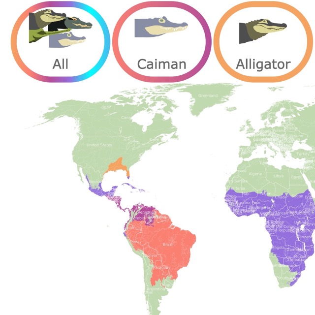
Alligators are not rare in Louisiana waters. To find more about them, visit this map!
Sabine National Wildlife Refuge
Sabine National Wildlife Refuge is the orange polygon south of Lake Charles, Louisiana. The refuge occupies the marshland between Sabine and Calcasieu lakes, nestled in southwest Louisiana.
The diverse habitat includes freshwater impoundments, levees, ponds, lakes, bayous, canals, and wooded ridges. Sabine is home to some of the state's most extensive wetland management endeavors.
Sabine National Wildlife Refuge provides a habitat for migratory waterfowl and various bird species populating the area. The refuge is managed to enhance coastal marshes for all wildlife and fish.
Some of the species in the Sabine include geese, alligators, raptors, wading birds, blue crabs, shrimp, ducks, shorebirds, muskrats, and nutria.
Environmental education, wildlife observation, hunting, fishing, photography, and interpretation are some of the recreation available at Sabine.
Chicot State Park
Chicot State Park is the lime polygon north of Lafayette, Louisiana.
With over 6,000 acres of rolling hills and Lake Chicot's clear, cool waters are naturally inviting.
Anglers come for freshwater prizes like crappie, largemouth bass, red-ear sunfish, and bluegill. They may also use the boathouse, three boat launches, and boat rental facilities for a superior experience.
The trail encompasses Lake Chicot and has several primitive camping sites along the way. Hikers and backpackers can experience both the bottomland hardwood forest and the lake.
Much of the trail is excellent for mountain biking and bicycling.
To learn more about Chicot and its vegetation, make sure you visit the Louisiana State Arboretum located inside the Park. It has trails to admire beeches, magnolias, maples, sycamores, and more! Chicot State Park.
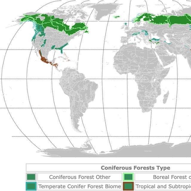
Want to find more pinewoods? Visit this map of Coniferous Forests
Fontainebleau State Park
Fountainebleau State Park is the lime polygon east of Slidell.
The park was a sugar plantation across Lake Ponchatrain, not far from New Orleans.
The park comprises 2,800 acres with sandy beaches inviting swimmers and sunbathers alike.
The old railroad tracks have been converted into the Tammany Trace as part of the Rails to Trails program. Tammany Trace is excellent for hiking, cycling, and in-line skating.
Fontainebleau State Park's nature trail makes an incredible nature walk. The interpretive signs throughout the path help wildlife enthusiasts identify the local shrubs and trees.
Visitors can find more than 400 spieces of birds and other animals that live in and around the park.
Fontainebleau is bordered on three sides by water; Bayou Cane, Bayou Castine, and Lake Pontchartrain. This diverse ecosystem provides unlimited habitats for birds.
After a day full of exciting activities, visitors can choose the rustic charm of the campgrounds or a scenic lakefront cabin; Fontainebleau.
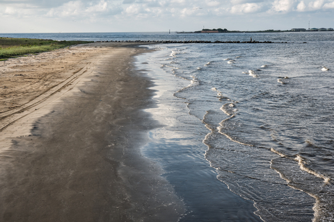
Grand Isle State Park
Grand Isle State Park is the tiny lime green specks on the Gulf of Mexico.
The beach ridge of Grand Isle was created by the wave action of the Gulf. It serves as a breakwater between the inland channels connecting to the Mississippi River and the Gulf.
The site is excellent for salt-water fishing. In July, the Tarpon Rodeo attracts thousands of anglers to these waters.
Surf anglers have an opportunity to catch speckled trout throughout the year, while Redfish is reeled in during fall and winter.
The Gulf's waters are warm, inviting most of the year, making Grand Isle an ideal location for swimmers.
Bird enthusiasts are thrilled by the number and variety of bird species surrounded by the beautiful lagoons and the seashore.
Visitors love visiting this spot for crabbing, fishing, bird watching, sunbathing, boating, and some old-fashioned rest and relaxation, Grand Isle.
Want to find places to explore in nearby Arkansas? Check this map of Arkansas Parks
Bogue Chitto State Park
The small lime green speck northeast of Slidell is Bogue Chitto State Park.
With over 1,700 acres, has diverse habitats, as it is one of the most dynamic and scenic river systems in Louisiana.
To impress visitors, Bogue Chitto has small streams, hardwood forests, cypress-tupelo swamps, rolling landscapes, and upland forests.
Fricke's Cave is basically a gorge of delicate sandstone spires formed by water erosion. The boardwalks in the cave were built so visitors could get a better view without the risk of damaging the fragile formations.
The water bodies are great for swimming and kayaking, while miles of trails are perfect for hiking, mountain biking, and horseback riding.
Visitors can choose tent campsites, RV sites, and cabins overlooking the bluffs. Large groups are welcomed at the group camp and conference room.
Affiliate Disclosure
Databayou.com is a participant in the Amazon Services LLC Associates Program, an affiliate advertising program designed to provide a means for sites to earn advertising fees by advertising and linking to Amazon.com. Databayou.com also participates in affiliate programs with Clickbank, CJ, and other sites.
If you plan on visiting one of these parks or hiking around its forests, I suggest you get some of these items found on Amazon.
- Camping Lantern and Ceiling Fan: Indispensable for camping in hot Louisiana parks or as part of your emergency kit.
- Coleman Camping Stove: This propane stove has two burners, temperature control, and shields to protect it from the wind. For those special picnic days or camping adventures.
- Binoculars: With so many waterways, Louisiana is a birdwatcher's paradise. These waterproof, easy-to-align binoculars, make birdwatching a delight.
FOLLOW ME
Resources for Louisiana's Protected Areas Map
The shapefiles with Louisiana's state boundary lines, lakes, major rivers, and cities were downloaded from Natural Earth Data.
The Parks and Public Lands shapefiles for Louisiana were downloaded from USGS.
This map will be updated with new data! To receive updates on this and more nature maps, join my email list!!!!!!!
Made by Luz K. Molina with D3.js.