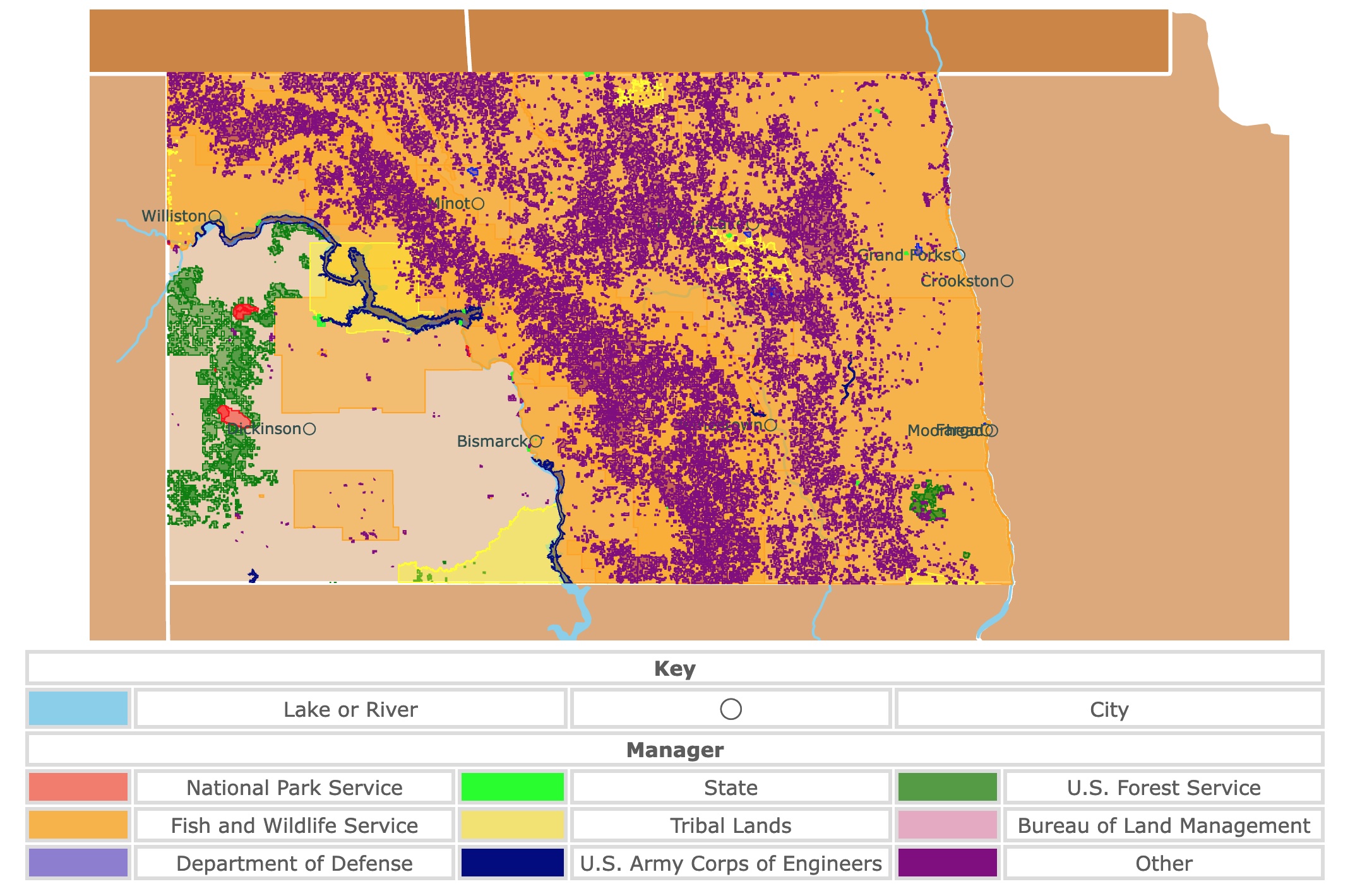
Map of North Dakota's Parks and Protected Areas
This interactive map shows the Locations, Names, Areas, and Details of National Parks, State Parks, National Forests, Tribal, and other Public Lands of North Dakota. It also shows major cities and rivers for context. For more detail, zoom in. For more information, hover over the map, or scroll down.
| Key | |||||
|---|---|---|---|---|---|
| Lake or River | ◯ | City | |||
| Manager | |||||
| National Park Service | State | U.S. Forest Service | |||
| Fish and Wildlife Service | Tribal Lands | Bureau of Land Management | |||
| Department of Defense | U.S. Army Corps of Engineers | Other | |||
North Dakota's Geography
Canada borders North Dakota in the north, South Dakota in the south, Minnesota in the east, and Montana in the west. The elevation in the state rises from the east to the west as the beautiful Rocky Mountains appear.
The Red River Valley is a flat area that was at the bottom of a lake in the past. The valley follows the Red River, which forms the border of North Dakota and Minnesota.
The soil in the area is rich in minerals, making it one of the world's most fertile lands, which explains why there are so many farms in the state.
The Drift Prairie region is speckled with hills, lakes, valleys, and wetlands to the west.
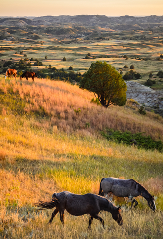
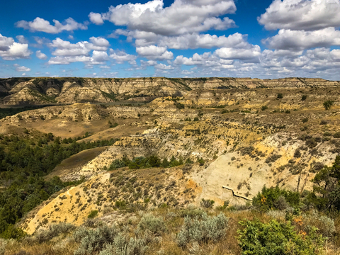
West of the Prairie, you'll find the Missouri Plateau, North Dakota's highest region. This area includes the Badlands. The Badlands are a harsh stone valley where wind and water have carved domes, buttes, and pyramids.
White Butte is the state's peak in the Badlands, measuring 3,506ft (1.06 km) in elevation. The area might have the highest point, but remember, it was once underwater, so fossils of ancient sea creatures can be found all over.
Want to find places to explore in nearby South Dakota? Check this map of South Dakota Parks
North Dakota's Plants and Animals
The open fields in North Dakota make the perfect spaces for bison, moose", bighorn sheep, and pronghorns. Eastern spotted skunks, muskrats, and arctic shrew call it home too.
If you look to the trees and sky, you'll find bald eagles, prairie falcons, woodpeckers, and American kestrels.
Tiger salamanders, softshell turtles, and green snakes are some of the amphibians and reptiles in North Dakota.
The forests are landscaped with elm, ash, pines, and willows. Colorful flowers like oxeye daisies, Queen Anne's lace, white violets, and black-eyed Susans highlight the fields, National Geographic.
North Dakota's Climate
Summer in North Dakota tends to be warm to hot, with average temperatures ranging between 77°F (25°C) to 87°F (30.6°C). The peak heat of summer hits in July. In some areas of the state, there might be a few days of temperatures in the high 90-degree range.
North Dakota winters are cold. Widespread snow cover and highly variable temperatures should be expected. On average, there are between 40 to 70 days during the winter when the temperatures fall below 0°F (-17.8°C).
The dry and cold air masses in the winter and warm air in the summer cause large daily fluctuations in temps. Autumn and spring are typically mild, with the chance of extreme conditions caused by high winds and frontal air passages.
Because of the rough weather, visiting North Dakota is best from May (late spring) to October. Summer is typically the height of the tourist season. If you're looking for discounted accommodation and fewer crowds, stick to autumn and spring.
If by chance, you are in the Grand Forks area during early September, and you are a fan of potatoes and football, it may be worth checking out the Potato Bowl. Every year there's a week-long event where people gather, watch football, and enjoy potatoes.
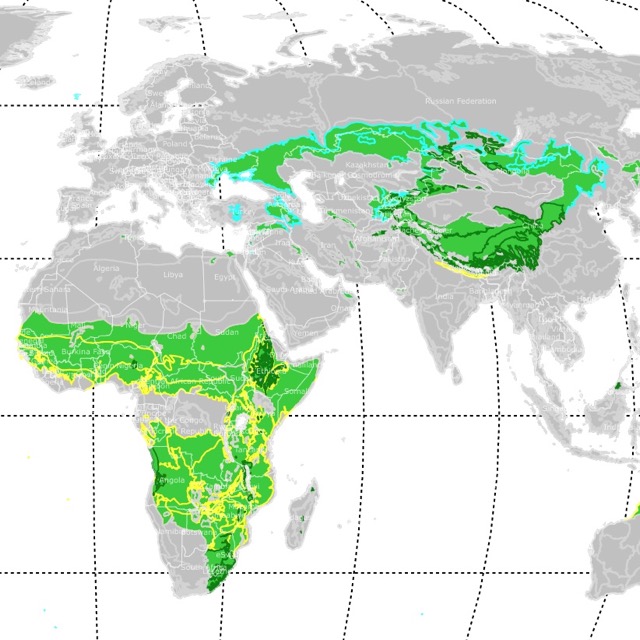
Interested in Prairies and where they are? Visit this map of World Grasslands
Great Parks in North Dakota
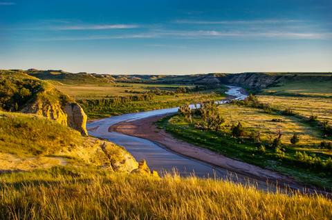
Theodore Roosevelt National Park and Wilderness
Theodore Roosevelt National Park and Wilderness are the 2 big red units in the western part of the state and a small red unit in between. The park is where the rugged Badlands meet the Great Plains.
Billions of years ago, when the Rocky Mountains emerged from the ground, material washed off the range. This material landed in what is today the park and formed a plain.
Millenia of rain and wind carved the badlands into the broken and colorful beauty we see today. Theodore Roosevelt actually had a cattle ranch in the area during the late 1800s.
The Wilderness area preserves the incredible geology of the badlands, mixed-grass prairie, a petrified forest, and an array of wildlife species.
Most of the "South Unit" west of the river and most of the "North Unit" is a Congressionally designated wilderness area. It provides refuge elk, mule deer, whitetail deer, bison, and pronghorn.
With 95 miles of trails, visitors are faced with ample opportunity for solitude in nature. Most visitors stay on the park's roads and within the established campgrounds.
When the snowmelt fills the surrounding rivers during spring, visitors can expect to find people paddling and kayaking.
Outdoor enthusiasts have plenty of opportunities for enjoying outdoor activities such as horseback riding, camping, hiking, wildlife observations, cross-country skiing, bicycling, fishing, and swimming.
The park offers two campgrounds, Cottonwood Camp and Juniper Camp. The Roundup Group Horsecamp is the only camping facility where horses are allowed.
The Dakota Nights Astronomy Festival is an event worth mentioning for all of the stargazers out there, and plan to visit the park, Theodore Roosevelt.
Knife River Indian Villages National Historic Site
The Knife River National Historic Site is a small red area northeast of Bismarck.
When the snowmelt fills the surrounding rivers during spring, visitors can expect to find people paddling and kayaking.
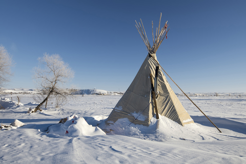
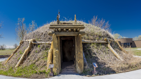
The site was of great importance for indigenous people for farming and game. Later, it became a center for the trade of fur.
Outdoors, there is a full-scale Earthlodge, village sites, the Hidatsa garden, and a Village Trail.
Hiking the North Forest loop through the bottomland forest and native prairies is an option if you have more time to visit. The Missouri overlook loop leads to an incredible view of the Missouri River.
Bird lovers may stop at the visitor center, grab a copy of the birding checklist, and enjoy the sights.
The Two Rivers Trail is a 6.2 mile (10 km) trek that follows Knife River south to the end of the park.
Fishing in the Knife and Missouri Rivers leads to northern pike, catfish, trout, and walleye.
Unfortunately, there is no lodging, camping, or food vendors in the park. However, a covered picnic pavilion is an excellent spot to enjoy lunch.
While camping isn't allowed at the historic site, camping is available on Harmon Avenue in Stanton City Park near the Knife River Indian Village. Fifteen miles from the historic site, visitors can find restaurants and a hotel in Hazen, North Dakota, Knife River.
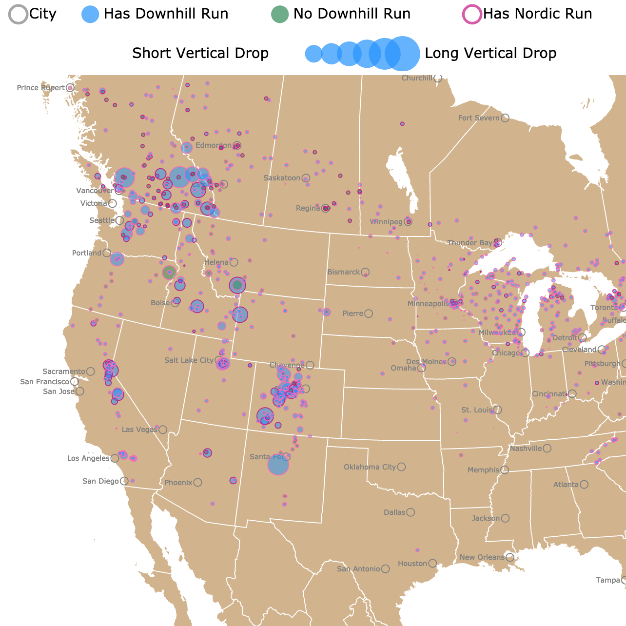
There are lots of winter activities in ND, but if you want to find the best places to ski, check this map of Ski Resorts in North America
Lewis and Clark State Park
The state's Lewis and Clark State Park is located in west North Dakota on the shores of Lake Sakakawea.
It features miles of stunning shoreline with incredible views of rolling hills and buttes. The park also features large areas of mixed-grass prairie.
The modern boating facilities, which include slip rentals and a marina with boat ramps, are popular with locals and visitors. If you enjoy a beautiful day on the water fishing, pack your gear because you'll have ample opportunity to catch sauger, walleye, and northern pike.
The park offers two cabins for lodging. The cabins have been appropriately named Lewis and Clark.
The Clark cabin is the only one in the park that's handicap accessible. The cabins are located in the Bluebird Loop Campground along the edge of Lake Sakakawea.
Visitors of the Lewis and Clark State Park appreciate the swimming area, and a day-use beach can be found along the east shore near the cabins. Canoes, snowshoes, kayaks, and stand-up paddleboards are a few items available to rent.
The park has different hiking trails, ranging in distance and skill level. The Prairie Nature Trail is for hiking only, while the other two allow mountain bikes and snowshoeing.
The Lewis and Clark Interpretive Center is an excellent place to check out and learn a bit about the area's history, source: Lewis and Clark.
Little Missouri State Park
Little Missouri State Park is located in west North Dakota on the shores of Lake Sakakawea. The Little Missouri State Park fits the description of a quiet little oasis in North Dakota.
Little Missouri has more than 45 miles of trails, allowing visitors to explore the Badlands. The views of the waterways rolling through the rough and rugged landscape are absolutely breathtaking.
Little Missouri State Park is only open seasonally, so you can only visit from May to October.
The park is one of those peaceful gems that provide the chance to explore North Dakota's backcountry and truly unplug.
There are corrals and a round pen for your four-legged friends. Remember that the trail conditions can vary, so it's best to check in with park staff before heading out.
The park's 28 modern campsites offer electricity. Three primitive sites, and there are about four group shelter campsites up for grabs as well, source: Little Missouri.
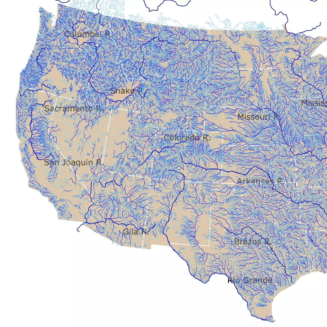
Rivers are an essential part of North Dakota's landscape. To see more, click on this map of U.S. Rivers
Lake Metigoshe State Park
Lake Metigoshe State Park is enclosed by the Turtle Mountains and is depicted in lime-green on the map. It is situated in north-central North Dakota, on the border with Canada.
This is North Dakota's most popular park as it has activities for all seasons.
In the summer, visitors can visit the small lakes within the park, perfect for canoeing, kayaking, and enjoying the serenity of nature.
Lake Metigoshe State Park offers over 12 miles of hiking and mountain biking trails in any season, but especially spring and fall. There is also a 3 mile, self-guided interpretive hiking trail where visitors can learn more about the area.
While some parks are closed during the rough winters in North Dakota, Lake Metigoshe is open for visitors to enjoy winter festivities. Sledding, snowshoeing, cross-country skiing, ice fishing, and riding fat tire snow bikes are among the most exciting things to do.
Wildlife watching is extremely popular. The wetlands and woodlands of the park are habitats for a wide variety of plants and animals rare in other parts of the state.
The Outdoor Learning Center is located in the park. It offers hands-on programs related to nature, history, and recreation, source: Lake Metigoshe.
Grahams Island State Park
Grahams Island State Park is situated in northwest North Dakota, west of Grand Forks, along the shores of Devils Lake.
This park is a hidden gem that's heavily wooded, surrounded by miles of beautiful shoreline.
Grahams Island is a hub for sports fishing. The park is home to numerous regional and national fishing tournaments held throughout the year. A bait shop, fish cleaning station, and a four-lane boat ramp are available for anglers to use.
Visitors come from all around to spend a day on the lake, hike trails, swim at the beach, hang out at the visitors center, and do numerous other outdoor activities.
This park also has numerous opportunities to enjoy winter sports! Source: Grahams.
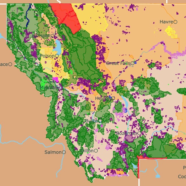
Want to find places to explore in nearby Montana? Check this map of Montana Parks
Fort Ransom State Park
This state park is represented in lime green. It is located in the southeastern corner of the state, along the lush and heavily wooded Sheyenne River Valley.
If you love hiking, you should know a short segment of the North Country National Scenic Trail runs inside the park.
Canoeing, fishing, and birdwatching are only a few popular outdoor activities in the park.
Horseback riding, skiing, and camping are other options for a fun visit.
There's a farmstead inside the park where the annual Sodbuster Days celebration occurs. It includes turn of the century farm and homemaking demonstrations and old-time music, source Fort Ramsom.
Affiliate Disclosure
Databayou.com is a participant in the Amazon Services LLC Associates Program, an affiliate advertising program designed to provide a means for sites to earn advertising fees by advertising and linking to Amazon.com. Databayou.com also participates in affiliate programs with Clickbank, CJ, and other sites.
If you plan to visit one of these parks or hike through the North Dakota prairies, I suggest you get some of these items found on Amazon.
- Sawtooth Snowshoes: These adjustable snowshoes are lightweight, have a quick release, are durable, and are optimal for snow flotation.
- Solar Charger: Primitive camping is great, but sometimes you might want the comforts of home with you. This small solar charger is portable, waterproof, and has 5V USB ports, plus a flashlight.
- Personal LifeStraw Water Filter: This straw is a lifesaver in an emergency while hiking or camping. It removes bacteria and parasites from water through microfiltration.
FOLLOW ME
Resources for North Dakota's Protected Areas Map
The shapefiles with North Dakota's state boundary lines, lakes, major rivers, and cities were downloaded from Natural Earth Data.
The Parks and Public Lands shapefiles for North Dakota were downloaded from USGS.
This map will be updated with new data! To receive updates on this and more nature maps, join my email list!!!!!!!
Made by Luz K. Molina with D3.js.