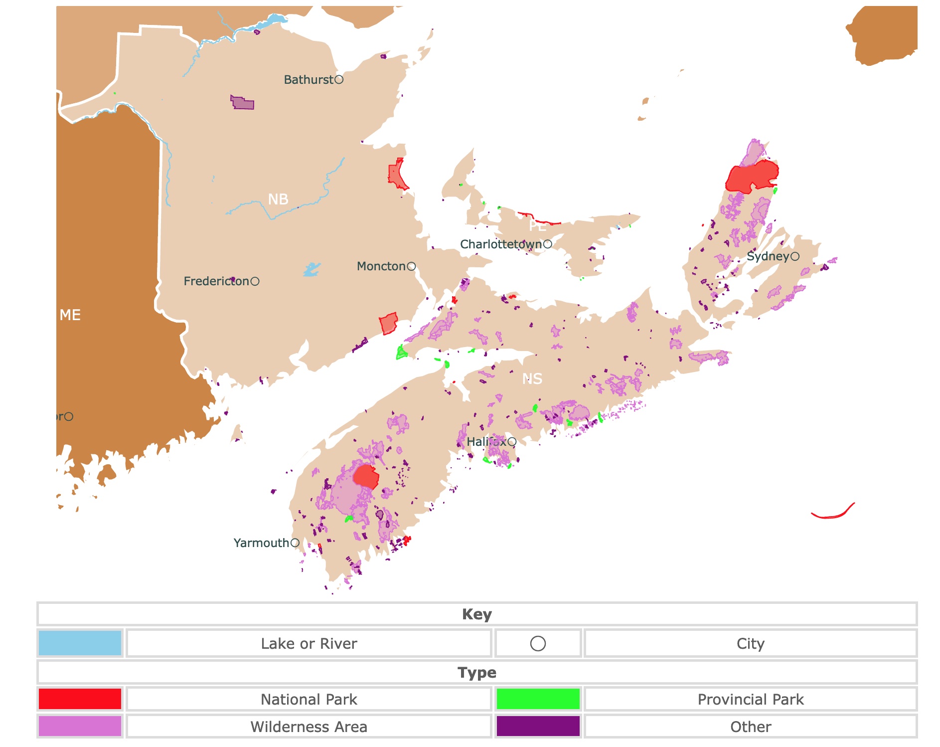
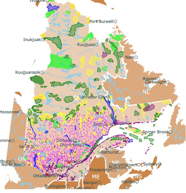
Map of Nova Scotia, New Brunswick, and Prince Edward Island's National Parks and Provincial Parks
This interactive map shows the Locations, Names, Areas, and Details of National Parks, Provincial Parks, and Natural Areas of Nova Scotia, New Brunswick, and Prince Edward Island. It also shows major cities and rivers for context. For more detail, zoom in. For more information, hover over the map, or scroll down.
| Key | ||||
|---|---|---|---|---|
| Lake or River | ◯ | City | ||
| Type | ||||
| National Park | Provincial Park | |||
| Wilderness Area | Other | |||
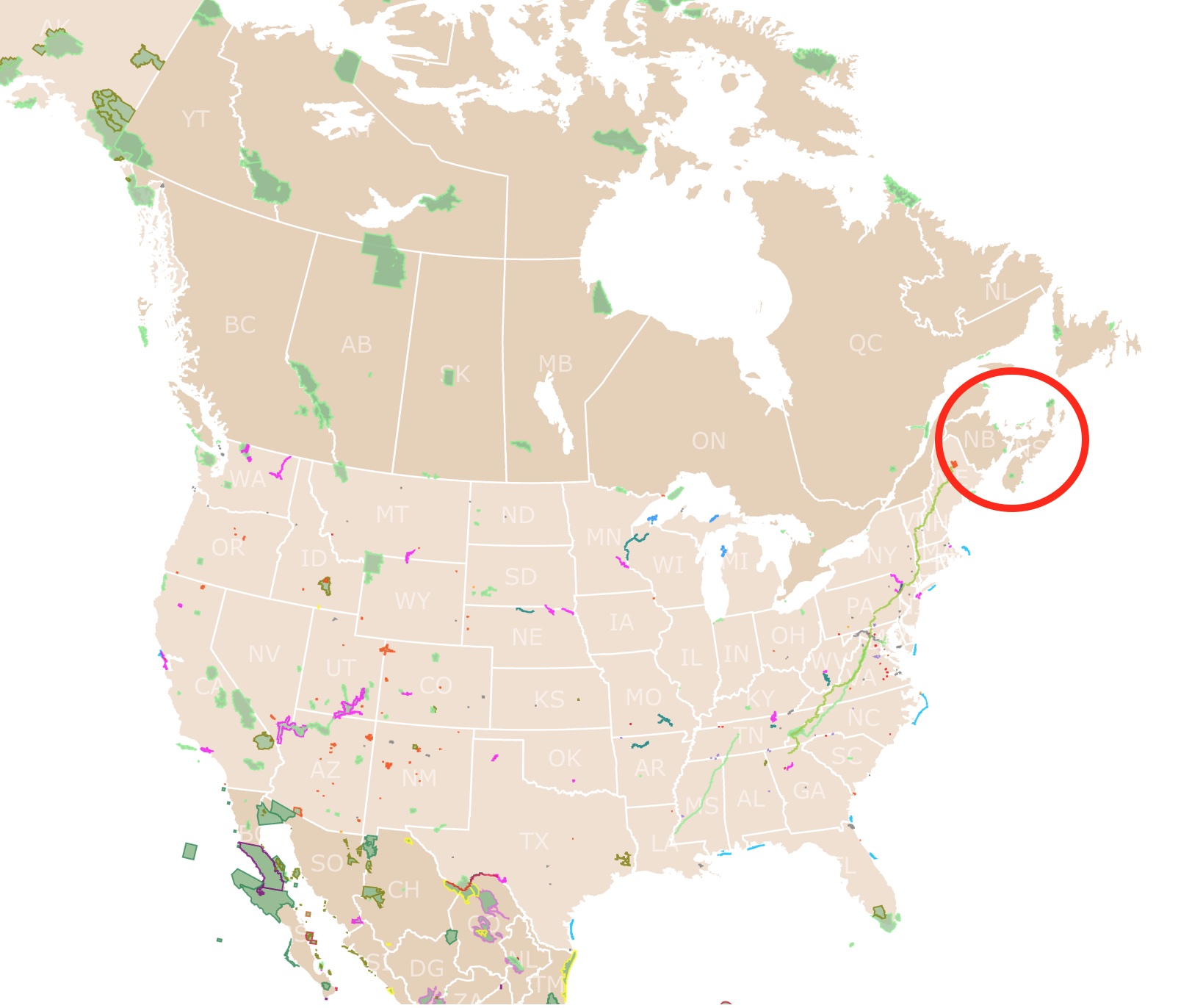
Geography of Nova Scotia, New Brunswick, and Prince Edward Island
Nova Scotia is one of the four original Canadian provinces alongside Ontario, Quebec, and New Brunswick.
Nova Scotia is one of the Canadian Maritime Provinces, alongside Prince Edward Island and New Brunswick. Past and present are closely tied to marine life, fishing, transatlantic shipping, and shipbuilding.
Nova Scotia, New Brunswick, Prince Edward Island, and New Foundland are in the Appalachian Region of Canada.
Nova Scotia is surrounded by the Atlantic Ocean to the south and shares a border with Maine to the east.
The province of Nova Scotia includes the peninsula with the same name, Cape Breton Island, and several small adjacent islands.
Cabot Straits and Northumberland separate Nova Scotia respectively from Prince Edward Island to the north and the island of New Foundland to the northeast.
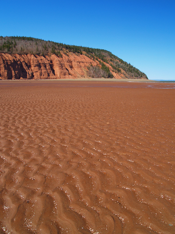
The upland region of Nova Scotia reaches a maximum elevation of over 1,700 feet (530 meters) above sea level in the Cape Breton Highlands. The lowlands lie along the Minas Basin and the Bay of Fundy.
This province withstands the highest tides in the world. This tides created housands of acres of marshland that thanks to the use dykes were later turned to agricultural use.
Over 3,000 lakes and hundreds of streams and short rivers can be found throughout Nova Scotia. Bras d'Or is one of the most well-known lakes on Cape Breton Island. This lake is saline, thanks to channels that connect it to the Atlantic Ocean.
Close to nine-tenths of the landmass in Nova Scotia isn't suitable for agriculture. A large part of Cape Breton Island is mountainous, forested terrain made of acidic and metamorphic rock.
New Brunswick is mainly dominated by mountains that are part of the Appalachian Range.
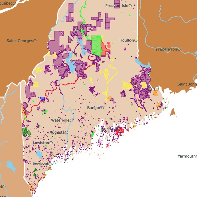
Want to find places to explore in nearby Maine? Check this map of Maine Parks
Appalachian Region Climate
This region experiences a modified continental climate, greatly influenced by the proximity of the sea. Atlantic coastal regions have the warmest winter and coolest summer temperatures.
In January, the average daily temperature in Halifax (the capital of Nova Scotia) is around 24℉ (-4.5℃). July averages about 66℉ (19℃).
Winters experienced in inland areas are typically colder, with some of the most frigid temperatures in the highlands, while summers are slightly warmer.
The amount of precipitation, including rain and snow, varies depending on the location. Annual amounts range from 49 inches (1,250 mm) along the Northumberland Strait to over 63 inches (1,600 mm) across the Cape Breton Highlands plateau.
The best time to visit Nova Scotia, New Brunswick, and Prince Edward Island is between May and October.
Summer provides the best weather; however, those who wish to avoid crowds should visit at the beginning or end of the summer season.
Appalachian Region Wildlife
Most of this region is occupied by forests. A quarter of the woodlands are held as public land.
Softwood trees are the numerous, with spruce, hemlock, pine, and balsam species. Birch trees are also quite common.
Deer, moose, star-nosed mole, snowshoe hare, beaver, red squirrel, and woodchuck are the mammals native to the area.
Birdwatchers might spot pheasants, ducks, and partridges among various bird species.
Marine animals include humpback whales, harbor, and gray seals.

New Brunswick has a beautiful coast. To learn more about it, visit this map of North America's Marine Ecoregions
Outstanding Parks in New Brunswick
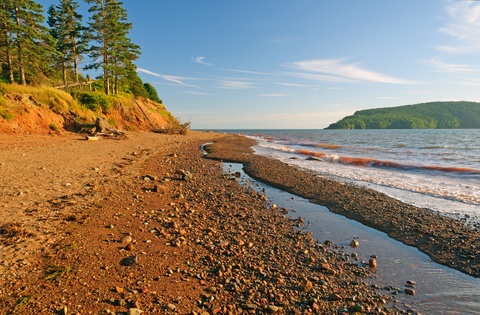
Kouchibouguac National Park
Kouchibouguac is located on the Acadian Coast. It is the red area on the eastern shores of New Brunswick.
Rich forests lead to colorful salt marshes and beautiful beaches. Furthermore, the park has gleaming sand dunes offshore for visitors to relish.
This Dark Sky Preserve becomes a stellar wonder at night. Additionally, during cold months, the park turns into a winter wonderland.
The park is not just rich in natural beauty but rich with Mi'gmaq and Acadian cultures.
The park has miles of sandy beaches, especially when the tides are out! Visitors love spending days at the beach in the summer months.
Believe it or not, its waters are warm. The sand dunes keep the waters calm for young and old. They are perfect for swimming, kayaking, and canoeing.
Visitors can explore and discover a saltwater lagoon. Paddle a canoe through the precious and protected ocean waters to an awe-inspiring grey seal colony.
The park also protects the Piping Plover, and the American Eel, among different plants and animals of the area.
Between May and September, visitors with a softshell permit can catch up to 100 clams per day.
An interpretive wigwam invites visitors to learn about the centuries-old Mi'gmaq culture and history.
If you prefer a more active stay, there are over 37 miles (60Km) of biking paths. They cross wildflower fields, peat bogs, woodlands, and saltwater lagoons. The tracks are open during winter for visitors that wish to pedal over snow on fat bikes.
If you are wondering what a fat bike looks like or if you would like one. You can check Amazon's Hiland bikes with fat tires". This bike is made of carbon steel and short chainstays for climbing. It provides 7-speed gears and a dual mechanical disc to ensure immediate stop. These children's bikes are suitable for the snow, the beach, and other road types.
If you wish to spend the night, Kouchibougac was voted one of the best campgrounds with beaches in Canada; Kouchibouguac.
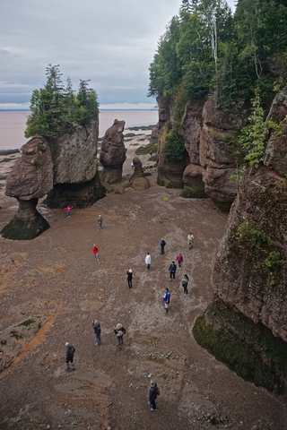
Fundy National Park
Fundy National Park is located on the Bay of Fundy, close to the village of Alma. It is the red area on the southern shores of New Brunswick.
Fundy Park showcases a rough and rugged coastline that rises up to the Canadian Highlands and over 25 waterfalls.
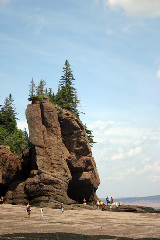
Fundy's claim to fame is that they experience the world's largest tides. Grab a kayak and paddle through the surging seas for a rush during high tide. The waters will rise about 39 feet (12m), depending on the location.
For a more relaxed time, explore the mudflats left exposed during the low tides; you'll never know what you might find. There are sea snails, limpets, rock crabs, and barnacles!
Fundy National Park is the only park in Canada with covered bridges. These bridges are not just rare but give the park a touch of past nostalgia.
Different areas of the park may have different climates. The coast is usually covered by fog, so be mindful and always have a sweater at hand.
Fundy has an extensive trail system with views of the coast, wildlife, estuaries, valleys, and Acadian forest. Besides the waterfalls, there are also pools and moss-covered paths. If you are lucky, you might even see some salmon!
Fundy has five campgrounds plus deluxe accommodations including comfortable yurts and oTENTTik tents for overnight guests.
Annual festivals offer visitors an authentic taste of Atlantic Canada's culture and music; Fundy.
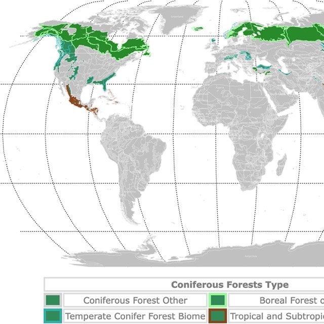
Nova Scotia has beautiful Conifer forests. Visit this map to learn more about them!
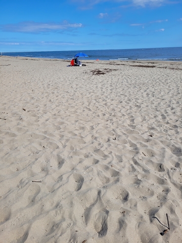
Prince Edward Island
Prince Edward Island National Park
The National Park stretches along the north shore of Prince Edward Island and is depicted in red.
Prince Edward National Park is renowned for its coastal environments like Acadian forest, saltwater marshes, sand dunes, beautiful beaches, and red cliffs.
The park is divided into 3 sections:
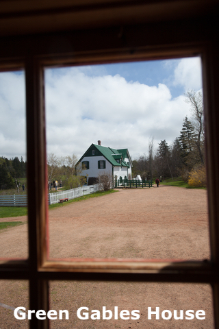
- The western part is Cavendish Beach. Here you will find a house where Lucy Maude was inspired to write Anne of Green Gables. This is also where you will discover incredible rock formations and Mackenzie's Brook sea arch.
- The middle section or Brackley-Dalvay is where visitors find the beautiful Covehead lighthouse. This area is surrounded by sand dunes and the beach.
- The eastern section or Greenwich is the floating dock after a trail with forests and dunes.
Bike along a seashore path, enjoy a picnic by the lighthouse, and try to spot herons as they wade across the coastal bays.
The woodlands offer attractive opportunities for hiking, biking, and camping. The ponds are excellent for wildlife watching; visitors might spot a red fox, warblers, and waterfowl. There are several beaches to explore at Prince Edward Island, so bring your sandcastle and sand sculpting gear!
Spend a night or a few camping in the park. A massive playground is perfect for kids of all ages; Prince Edward.
Stunning Parks in Nova Scotia
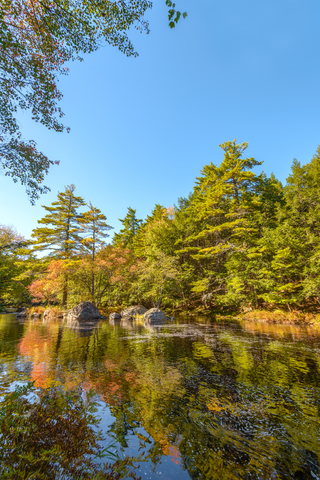
Kejimkujik National Park and National Historic Site
Kejimkujik is the only inland national park in Atlantic Canada. It is the red area in southwestern Nova Scotia on the map.
The park has two units or sites to traverse.
The park allows visitors to reconnect with nature and see old-growth forests while in Kejumkujik's historic site. Learn about the tales of the Mi'kmaq, carved in stone and shared through legends and stories.
Visitors can appreciate the Petroglyphs and the ancient canoe routes when exploring this site.
In the forest, travelers can see red maple, pine trees, hemlocks, red foxes, deer, and turtles.
This is also a Dark Sky location; therefore very little artificial light is allowed.
The second seaside unit is the National Park. It has beaches, pristine waters, bogs, oaks, maples, lagoons, wildflowers, harbor seas, piping plovers, and yellowthroats (birds).
Travelers can enjoy all sorts of outdoor recreation, including hiking, paddling canoes and kayaks, connecting with nature, and learning about the history and culture of the native people.
Staying at the park is not a problem. There are rustic cabins and all sorts of campsites available; Kejimkujik.
The Appalachian region is greatly influenced by the ocean. To learn more about the Atlantic Ocean, visit this map!
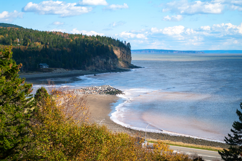
Cape Breton Highlands National Park
Cape Breton is the red area along the eastern border of Nova Scotia, New Brunswick, and Prince Edward Island on the map.
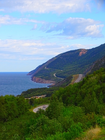
Cape Breton Highlands National Park is a beautiful place where the mountains meet the ocean. It is an ancient plateau where rivers carved canyons, and lush forests turn into colored cliffs.
The maritime climate and rugged landscape of Cape Breton Highlands provide a unique blend of Acadian, Boreal, and Taiga habitats, animals, and plants. The park is home to several dozen species of rare and threatened animals and plants.
The park has 26 extensive trails with ranges from easy to difficult. Cabot Trail is a world-famous highway that traverses the park with spectacular views throughout the way.
Animals in and around the park include moose, bald eagles, pilot, and minke whales.
Aside from the natural beauty, outdoor recreation opportunities include swimming (saltwater and freshwater), cycling, fishing, hiking, and camping. Make sure to stop in at one of the visitor centers to learn more about the park and its features; Cape Breton.
Cape Chignecto Provincial Park
Cape Chignecto is the lime area in Nova Scotia, south of Moncton.
The park features cliffs that reach 600 feet (180 meters) above the Bay of Fundy. This wilderness park offers 18 miles (29 km) of untouched shores, sheltered coves, unique plants, deep valleys, and old-growth forests.
Over 37 miles (60 km) of wilderness trails offer excellent hiking and biking opportunities.
The park has remote walk-in campsites and cabins, providing visitors the possibility of spending nights at the park.
Water lovers should bring their kayak or rent one for a day out at sea. Exploring the cliffs from the water is just unforgettable; Cape Chignecto.
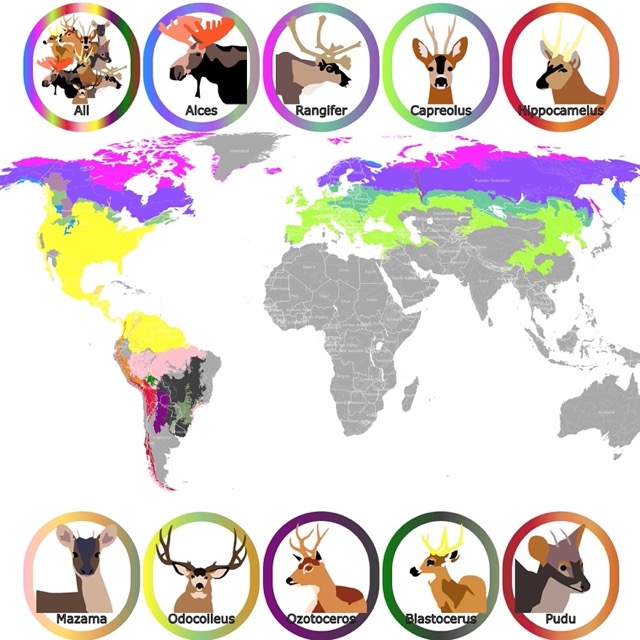
Moose are not rare in this region. To learn more, visit this map of moose
Blomidon Provincial Park
The lime area in Nova Scotia, northwest of Halifax, is Blomidon Provincial Park.
Blomidon Provincial Park stands over the shores of the Minas Basin and is recognized for its incredible views. Blomidon comprises 1,875 acres of land, including spectacular cliffs.
The park features different habitats, stunning natural features, rich wildlife, and some of the world's highest tides.
Blomidon Provincial Park provides ample outdoor recreational activities, including camping, hiking, photography, and beachcombing. Visitors can enjoy a picnic at the top or foot of Cape Blomidon.
The trails are moderate to challenging. They cross dense forests and have views of the cliffs, waterfalls, and the beach (if the tides are low). The main trail is Joudrey Trail and follows the cliffs with lots of look-offs along the way. Blomidon.
Visitors must remain mindful of the tide times, as they could potentially be stranded until the high tide recedes. They change twice daily!
Five Islands Provincial Park
Five Islands is the lime speck in Nova Scotia, northwest of Halifax.
The name comes from the Five Islands you see in the Bay of Fundy's Minas Basin.
Five Islands Provincial Park is a prime outdoor destination in Nova Scotia. The park is only 15 miles (24 km) east of Parrsboro and displays cliffs that reach 300 feet (90 meters), overlooking the highest tides in the world.
The scenery provides an incredible setting for camping. There is plenty of opportunity for hiking, rock collecting, beachcombing, and digging for clams.
You can walk to one of the islands but once again, note the time of the tides before heading out onto the mud flats since the tides at Fundy Bay rise very quickly.
If you're looking for the best views of the islands and basin, it's said that Red Head Trail offers four incredible views.
In terms of outdoor recreation, visitors can enjoy hiking, camping, water sports, skiing, snowshoeing, and cross-country skiing. Economy Mountain features 3.2 miles (5.2 km) of track trails that are marked and mapped.
While the park doesn't offer any facilities or services during the winter, the park is open for winter recreational activities.
In winter, the park's road is typically plowed up to the parking lot near the beginning of Economy Mountain Trai.
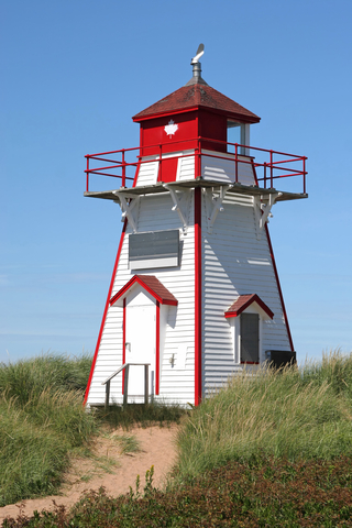
Not far from the park is a lighthouse that is over 100 years old. It has been moved several times due to the eroding forces on the coastline but definitely worth checking out; Five Islands.
Sable Island National Park Reserve
The long red island southeast of Nova Scotia is Sable Island Reserve.
This wild and windswept island of sands is located far out in the North Atlantic.
Sable Islands is well-known for its iconic crescent shape that emerges from the sea. The island is isolated and remote, making it one of Canada's furthest offshore islands.
Bring your camera, and you might be able to capture some of the infamous Sable Island wild horses that roam free. It's also home to the world's largest breeding colony of grey seals.
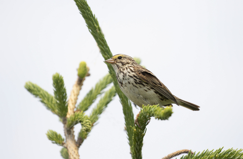
The island is home to various wildlife, including the ipswich sparrow. A bird endemic to this island. If that isn't enough, there are outdoor recreational activities to enjoy; Sable Island.
Want to find places to explore in nearby Québec Province? Check this map of Québec Province Parks
Lake Charlotte Provincial Park
The lime area in Nova Scotia, northeast of Halifax.
Lake Charlotte Provincial Park is a 1,900-acre reserve offering visitors backcountry hiking and camping, boat launches, and even winter recreation.
Lake Charlotte is one of the deepest lakes in Nova Scotia, 160 feet (48 meters). The swimming area is supervised by lifeguards.
The Memory Lane Heritage Village Museum is a popular place to explore at Lake Charlotte. Memory Lane Heritage Village allows visitors to stroll back to the 1940s.
The living museum is incredible and worth going to. Memory Lane hosts numerous events throughout the year, so make sure to check them out; Outside.
Resources for Nova Scotia, New Brunswick, and Prince Edward Island's Protected Areas Map
The shapefiles with Nova Scotia, New Brunswick, and Prince Edward Island's state boundary lines and cities were downloaded from Natural Earth Data.
The National Parks of Canada shapefiles were downloaded from Open Canada.
The shapefile with Nova Scotia's Provincial Parks' was downloaded from Nova Scotia Protected Areas.
The shapefile with Prince Edward Island's Parks was downloaded from Prince Edward Island Government.
The shapefile with New Brunswick Provincial Parks' was downloaded from the Canadian Council of Geomatics at http://www.snb.ca/geonb1/e/dc/catalogue-E.asp.
The shapefile with rivers and lakes from Canada was downloaded from Open Canada.
This map will be updated with new data! To receive updates on this and more nature maps, join my email list!!!!!!!
Made by Luz K. Molina with D3.js.