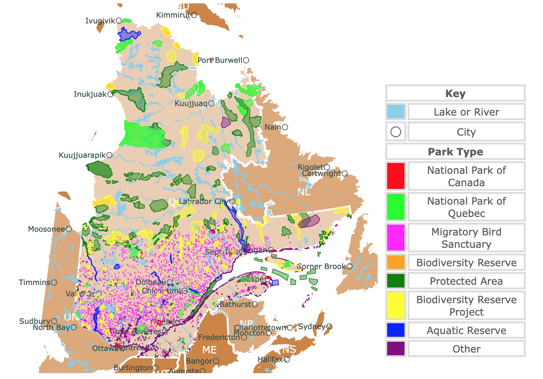
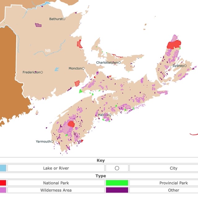
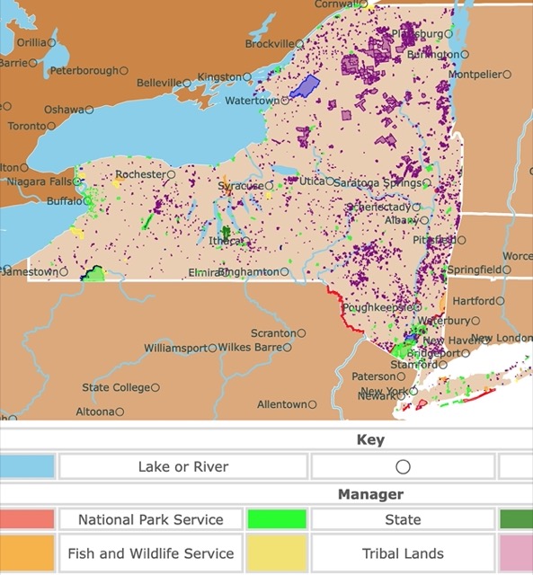
Map of Quebec's Parks and Protected Areas
This interactive map shows the Locations, Names, and Details of National Parks, Provincial Parks, Ecological Reserves, and Protected Areas of Quebec, Canada. It also shows major cities and rivers for context. For more detail, zoom in. For more information, hover over the map, or scroll down.
| Key | |
|---|---|
| Lake or River | |
| ◯ | City |
| Park Type | |
| National Park of Canada | |
| National Park of Quebec | |
| Migratory Bird Sanctuary | |
| Biodiversity Reserve | |
| Protected Area | |
| Biodiversity Reserve Project | |
| Aquatic Reserve | |
| Other | |
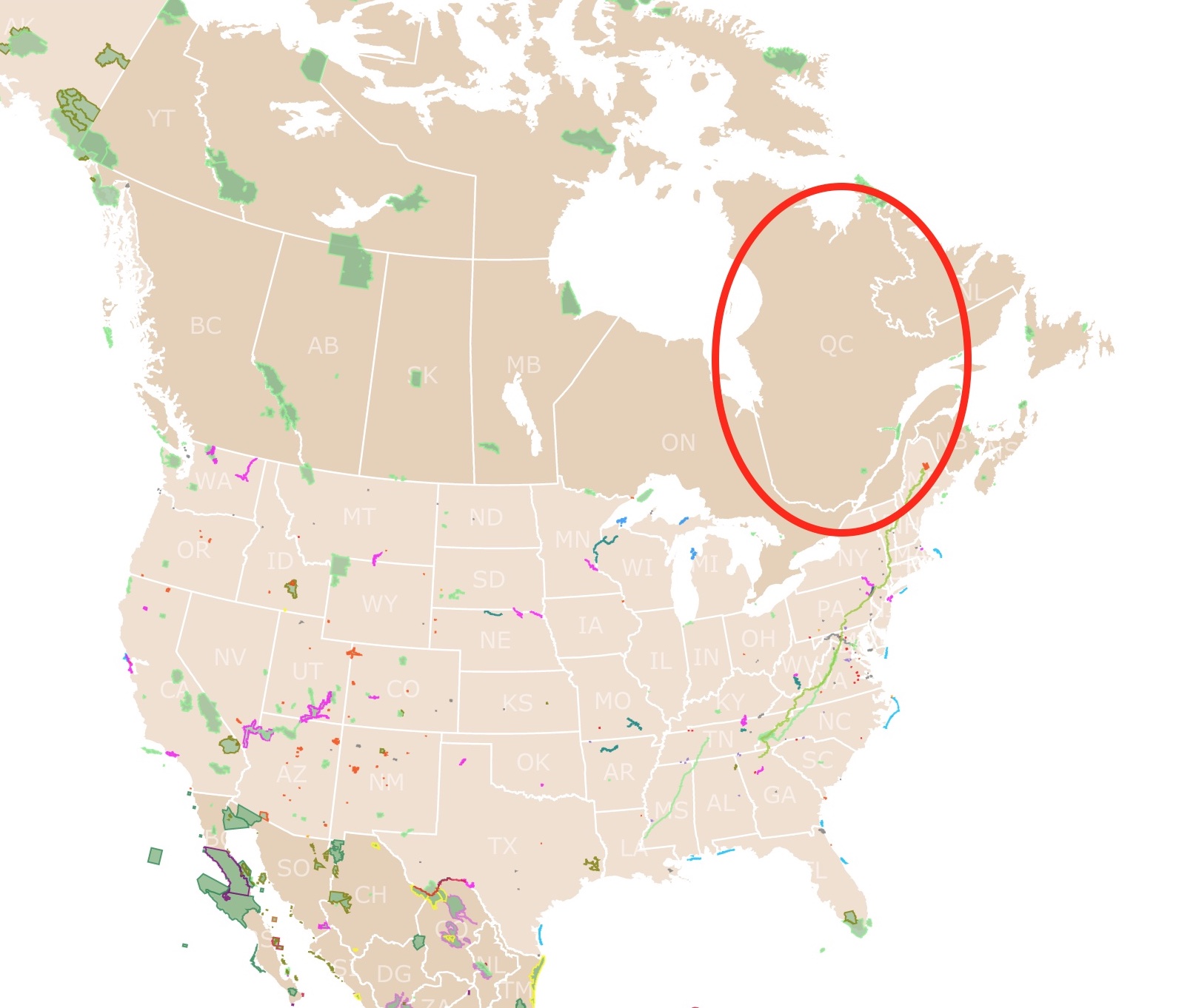
Geography of Quebec Province
Quebec is the largest of 10 Canadian provinces. Quebec City, the capital of Quebec, is the oldest city in Canada. Quebec was named such and derived from an Algonquian word "where the river narrows."
The St. Lawrence River and pastoral Orleans Island are true gems in the area, and they definitely draw in a crowd.
Montreal is the province's major metropolis, encompassing Montreal Island and Jesus Island to the north, with several communities along the south shore of the St. Lawrence River.
To the north, Quebec is bordered by Hudson Strait and Ungava Bay. The province of Newfoundland and Labrador lies to the east; along the southeast border lies the Gulf of St. Lawrence, New Brunswick, and Maine. The southern boundary of Quebec meets the U.S. states of Vermont, New Hampshire, and New York.
Quebec's territory is made up of extensions of three of Canada's major physiographic regions: the Appalachian Uplands, St. Lawrence Lowlands, and the Laurentian Shield (also called the Canadian Shield.) Every region consists of unique human and natural resources.
- The St. Lawrence Lowlands plain is on both sides of the St. Lawrence River, which drains the Great Lakes. This region was covered by glaciers 18,000 years ago, during the last glaciation. This is the base of Quebec's agricultural and industrial sectors.
- Quebec's Appalachian Uplands region stretches from the Gaspé Peninsula to the border of the United States. These are eroded mountains of 4,000ft (1,200m). The land is covered by forested hills, high plains, and arable plateaus.
- The Laurentian Shield or Canadian Shield covers over four-fifths of Quebec. It is among the oldest mountain ranges globally. It is characterized by Boreal Forests to the south and the frozen Tundra to the north.
The Torngat Mountains in the Laurentian Shield reac 5,420 feet (1,652 meters), making it the province's highest mountain peak.
The landscape of Quebec is beautiful, with thousands of rivers. The Saguenay, Ottawa, Saint-Maurice, and the Manicouagan Rivers are important tributaries. Source: The Canadian Encyclopedia.
Quebec's Craters
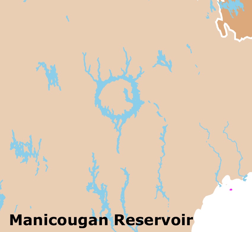
There is something unique about Quebec. Meteorites have left their mark on this province, and, incredibly, these marks are still visible today.
One is Pingualuit which is described below. The other is the Manicougan Reservoir, southeast of Labrador City.
If you zoom on the map above, you will see that the 750mi2 (1,943Km2) reservoir has a circular shape, evidence of the crater left 214 million years ago.
Parc national des Grands-Jardins also contains the remnants of a meteorite strike. It is found by the summit of Mont du Lac des Cygnes.
If you wish to learn more about Quebec's attributes, Amazon has Québec: A Photographic Road Trip Through Canada's Beautiful Province. This extraordinary visual tour leads you through five regions of Québec, from cosmopolitan cities to picturesque countryside to rugged wilderness.
Check this map of parks in New Brunswick, Nova Scotia, and Prince Edward Island
Quebec's Climate
The climate in Quebec can often be characterized by extremes of both hot and cold. Sometimes the weather can be severe.
The province is highly affected by major continental air masses that sweep down from the northwest.
Northwestern regions experience cool summers caused by the air masses encountering the cold Labrador Current. Hot, humid air moves upward from the Gulf of Mexico, producing heat waves in the summer.
January temperatures range from -11℉ (-24℃) to 52℉ (11℃). However, temperatures vary depending on proximity. July experiences average temperatures of about 68℉ (20℃).
Temperatures in Quebec can change as much as 30℉ in less than 24 hours.
Snow stays on the ground between 12 to 13 weeks on the Montreal Plain and for as long as 23 weeks north of the St. Lawrence River.
Quebec's Wildlife
Moose, deer, coyotes, hundreds of bird species, and over 100 freshwater fish species call Quebec home.
This area is home to foxes, Arctic hares, and polar bears.
The St. Lawrence estuary is home to sea mammals, including the white beluga whale. The skies are crossed by Canadian geese and snow geese fleeing for warmer weather.
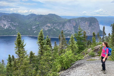
The Arctic Tundra is treeless yet covered in mosses, lichen, and peat bogs. Iris versicolor is the floral emblem of Quebec. You can find it in half of Quebec's territory.

Quebec has a beautiful coast. To learn more about it, visit this map of North America's Marine Ecoregions
Best Parks in Quebec Province
Quebec has 4 National Parks of Canada and 27 National Parks of Quebec. Nevertheless, there are many more natural areas for visitors to enjoy. Here is a summary of the best.
For detailed information on these and other parks Amazon has Insight Guides Explore Quebec (Travel Guide with Free eBook) (Insight Explore Guides). Discover the best of Québec with this unique travel guide, packed full of insider information and stunning images.
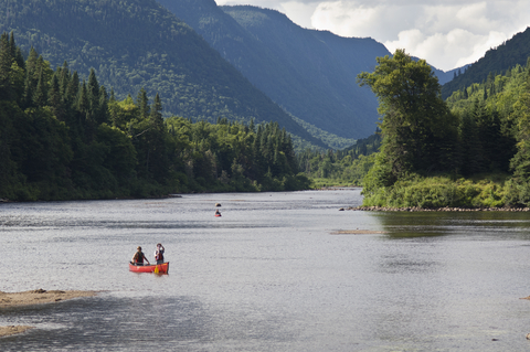
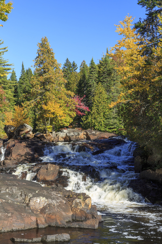
La Maurice National Park/Park National du Canada de la Mauricie
The red area west of Quebec city and only a two-hour drive from Quebec City and Montreal.
The Laurentian Mountains and stunning lakes dotting the valleys are the pride of this heartland.
Along with the lush forests comprised of conifers and hardwoods, the park features over 150 lakes varying in size.
The pools at the foot of waterfalls are inviting and make for a relaxing swim.
Les Cascade Trail is excellent for hiking; it has a sandy beach, an incredible waterfall, and a picnic area.
Waber Falls is an ideal place for hiking and canoeing. Caribou Lake is situated in a backcountry location, making it more private and remote.
There are other lakes worth the hike. They are calm and perfect for canoeing and for a swim.
If you've never heard the cry of the common loon, be prepared to listen to the hauntingly beautiful sound, it sounds almost like a wolf or coyote. There are also barred owls and great horned owls for wildlife enthusiasts to find, La Maurice.
Not sure if you want to land in Quebec or Montreal? Expedia has flights and hotels where you can find the perfect destination to reach la Maurice. For prices and locations click here!
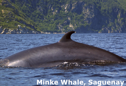
Saguenay-St. Lawrence Marine Park/ Park National du Fjord du Saguenay
Saguenay-St. Lawrence Marine Park is the lime strip northeast of the city of Quebec, next to the town of Chicoutimi.
Saguenay-St. Lawrence Marine Park is a prime location for whale watching worldwide. Blue whales aren't the only animals you might see. The beluga whale, minke whale, fin whale, harbor porpoises, and harbor seal spend all year in the St. Lawrence Estuary.
There are about 12 species of marine mammals that visit the park. The whales come to this area to feed between May and October.
It is possible to see these beautiful animals from land, but if you prefer to see them up close, you can see them while you are on a Kayak. Bring your boat and kayak for some fun on the water.
Amazon has inflatable kayaks for such adventures. Advanced Elements has an ultralight inflatable kayak. It has an aluminum frame, weighs 17lbs, and is easy to set up, unfold, and inflate. It also has 3 layers of material to resist puncture.
Nevertheless, due to the changing winds and tides, it is adviseable to do it with a certified guide. It is also possible to see them on cruises and boats.
The most daring can dive St. Lawrence River and discover a colorful underwater world.
Popular park activities include wildlife observation, photography, hiking, and sightseeing.
Saguenay-St. Lawrence Marine Park offers various programs and tours for visitors. The Marine Environment Discovery Center, Pointe-Noire Interpretation and Observation Center, and Cap de Bon-Dèsir Interpretation and Observation Center are excellent opportunities to learn about the land, environment, and animals; Marine Park.
Hotels.com Canada, has different stays near the Marine Park. For amenities and dates, visit this link!
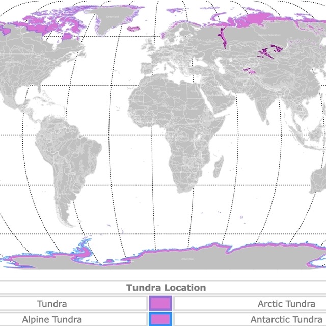
World Map of Tundra
Mingan Archipelago National Park
Mingan Archipelago National Park is the red area on the coast by the city of Mingan.
The Mingan Archipelago National Park encompasses nearly a thousand islands and islets along 93 miles running east to west.
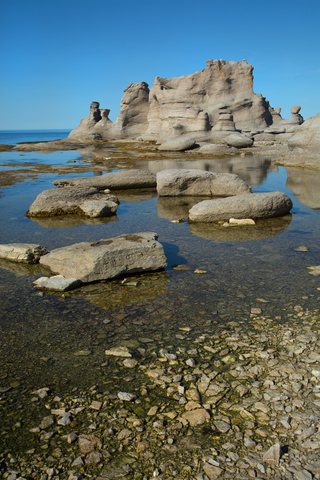
The park's main attraction is the large limestone outcroppings that date over 450 million years. Such an abundance of monoliths isn't found in other places in Canada.
A surprising diversity of animal and plant species call the islands home. During the spring, visitors can see various marine bird species, including razorbills, terns, puffins, guillemots, eider, and kittiwakes. They come to the island to nest and feed.
Mingan Archipelago is only accessible by boat, so visitors will need their own boat, kayak, or the services of registered marine transportation companies.
Many transportation companies only operate from the middle of June to early September. It's been said that the best time to visit the Archipelago is from June to early September, partly for the limitation of travel options.
Each island has something special, a lighthouse, rocky beaches, kayaking, or boreal forests, Mingan.
In remote locations like this, it is better to land at a nearby airport and rent a car with Expedia. For availability and brands, visit this link!
Anticosti National Park/ Parc National d'Anticosti
The lime area on Anticosti Island, in the Gulf of St. Lawrence, west of Corner Brook, is Anticosti National Park.
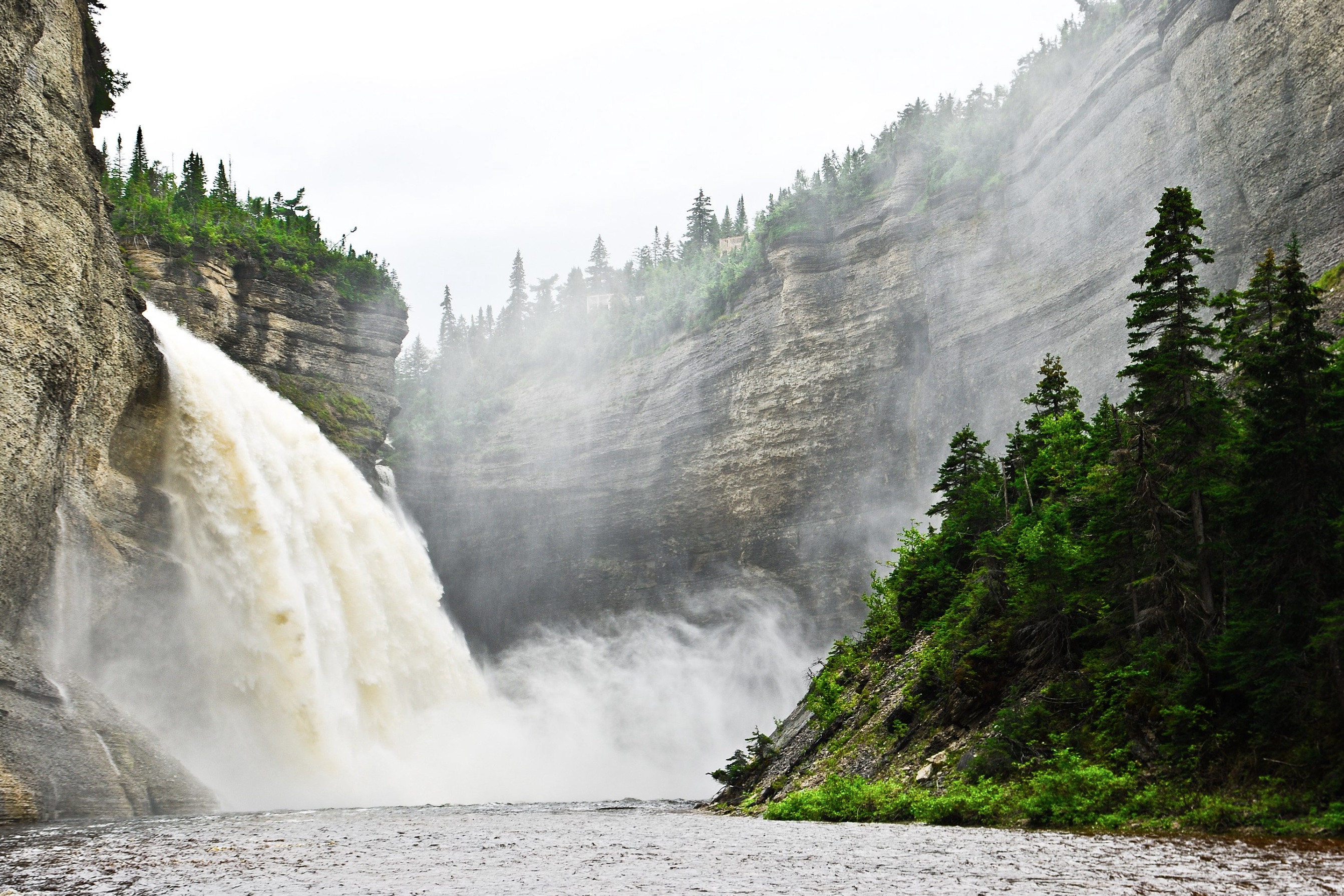
Graced with beautiful white cliffs against the ocean's waters, incredible canyons, prominent waterfalls, boreal forests, and hidden caves, Anticosti is a place waiting to be discovered.
The Vauréal Canyon and Waterfall are popular natural attractions at the park. The Vauréal River drops 249 feet (76 meters) before flowing through a 300-foot (90 meters) deep gorge.
Tour Bay or Bay de la Tour is on the island's north side, providing breathtaking seascapes, massive cliffs, and excellent bird-watching opportunities.
Potato Cave is one of the longest caves in Quebec, measuring 2,051 feet (625 meters.)
Visitors can partake in outdoor recreational activities like hiking, horseback riding, guided tours, and sea kayaking.
More than 100,000 white-tailed deer attract hunters, and salmon attract fishers. Over 200 bird species, whales, seals, and foxes attract wildlife lovers.
The park features around 77 miles (125Km) of trails ranging in difficulty. There are two visitor centers with restaurants, gasoline, and equipment rentals.
Spend a night or more at the campgrounds or rent a cabin. There is also an inn available. Picnic areas provide shade and a beautiful setting for lunch or an early evening meal; Anticosti.
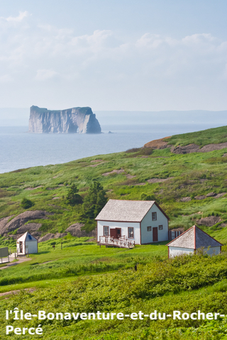
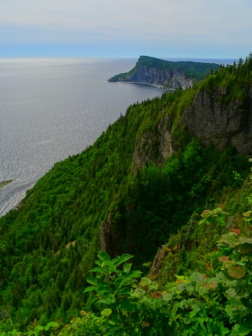
Île-Bonaventure-et-du-Rocher-Percé National Park
l'Île-Bonaventure-et-du-Rocher-Percé is the lime speck on the east coast of Quebec, south of Gaspé.
Gaspé Peninsula's tip is Perce Rock which is Quebec's tourism emblem. Both were beautifully sculpted and eroded by the sea.
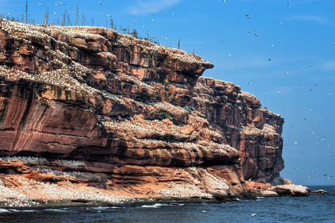
Perce's Rock is a monolith of 1,545 feet (471m) and is home to razorbills, cormorants, and black-legged kittiwakes.
Hiking, wildlife observation, underwater exploration, and cruises are popular park activities.
Nature loves genuinely appreciate the diverse flora and fauna including, but not limited to, the colony of Northern Gannets.
The cruises provide a closer look at the island, the wildlife, and the incredible scenery. Bonaventure Island has over 200,000 birds calling the place home, including 110,000 northern garnets; Bonaventure.
With so many opportunities to get a glimpse of birds and the stars, don't hesitate to take these binoculars found on Amazon. Celestron SkyMaster is a large aperture astronomy binocular for long distances. It comes with its own carrying case, so you can take it with you as you explore the park.
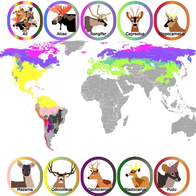
Moose are not rare in this region. To learn more, visit this map of moose
Forillon National Park /Park National du Canada de Forillon
The purple area on the east coast next to Gaspé.
Forillon National Park is the northern end of the Appalachian mountains. The mountains meet the sea, producing forests, salt marshes, sand dunes, and incredible cliffs.
Visitors can go snorkeling to explore underwater animal and plant life. Keep your eyes to the horizon, and you might see whales, seals, and seabirds. There are moose, beavers, and black bears roaming the land.
Predator bird species are quite common. Bird watchers come to see the rough-legged hawk, osprey, great horned owl, peregrine falcon, and bald eagles in action.
Hiking, sea kayaking, boat cruises, fishing, and loads of outdoor fun happen at Forillon National Park.
In winter, the park is not in operation but is open for visitors to go cross-country skiing, snowshoeing, and fat biking; Forillon.
Pingualuit National Park
The lime area in northern Quebec Province, southeast of Ivugivic.
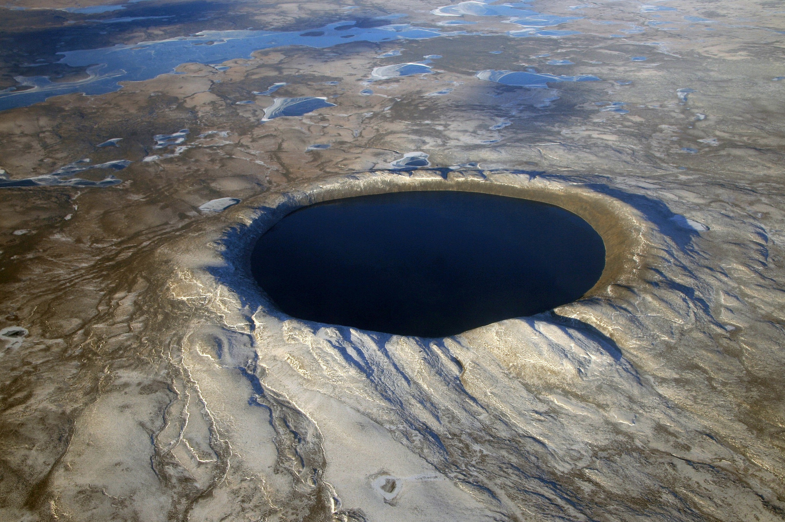
Pingualuit National Park is home to the well-known and legendary crystal eye. The crystal eye has a diameter of 2.11miles (3.4Km), is about 876m (267m) deep, and is a 1.4 million-year-old crater left by a meteorite.
Within the crater, the crystal blue waters in the circular lake are so transparent that you might not believe it's real. NASA Earth Observatory explains how the crew on a U.S. Army Air Force plane spotted the crater in 1943. Still, the location was so remote that it wasn't explored or investigated until the 1950s.
Deep in the heart of the tundra, Inuit guides bring visitors on a tour where they can discover lunar-like landscapes that seemingly unfold into the vast Arctic Sky.
If you plan on visiting any of the parks in the tundra region of Quebec, consider investing in a durable pair of tundra boots found on Amazon. These Salomon Tundra Boots keep your feet working, are waterproof, and offer traction in snow and ice.
Map of North America's Ski Resorts
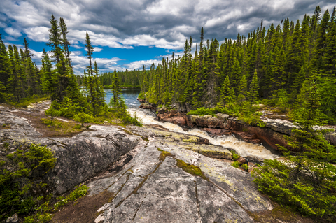
Parc National de la Jacques-Cartier
Parc National de la Jacques-Cartier is the lime area northeast of Quebec city and is only a 30-minute ride.
Here, the landscape comprises a mountainous plateau cut by a magnificent and deep glacial valley.
The main channel is 1,804feet (550m) deep. The top of the plateau is dominated by coniferous forests, and the bottom is dominated by deciduous forests.
Jaques Cartier River is calm in some areas making it a pleasant swim. Other areas are pretty turbulent.
It would be challenging to get bored at this park because there's so much to do. Canoeing, kayaking, fishing, paddle boarding, geocaching, hiking, fat bike riding, and much more. Fortunately, there are places where equipment can be rented, including the infamous Fatbike.
In winter, visitors are encouraged to explore the park on foot, snowshoes, Nordic skis, or off-trail skis; Jacques-Cartier.
Grands-Jardins National Park
Grands-Jardins National Park is the lime area northeast of Quebec city.
Major high points located within park, include Mont René-Richard, Mont du Lac des Cygnes, Mont Jean-Palardy, and Mont du Lac à Moïse.
Because of the altitude range, the park has taiga to alpine ecosystems. Visitors will find birch, aspen, larches, and jack pines.
The Arctic vegetation growing at such an altitude is almost unbelievable unless you see it with your own eyes. The forest floors are carpeted by ground lichen. In fact, there are over 200 species of lichen.
The park is filled with coyotes, lynx, mink, red foxes, porcupines, beavers, hares, muskrats, white-tailed deer, moose, and caribou.
Grands-Jardins was well-known for its exceptional fishing opportunities. The park is still a significant spot for anglers.
Hiking, biking, camping, and people looking for an awesome location for a vacation come to Grands-Jardins.
The park is one of the main zones that make up the Charlevoix Biosphere Reserve; Grands-Jardins.
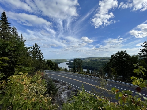
Hautes-Gorges-de-la-Rivière-Malbaie National Park
The lime area southeast of Chicoutimi is Hautes-Gorges.
This beautiful park was named for the series of valleys that cut deep into a range of towering mountains.
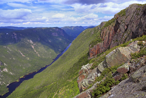
Hautes-Gorges-de-la-Rivière-Malbaie contain some the highest rock faces east of the Rockies. The park displays glacial valleys, white waters, and waterfalls.
The steep slopes, exceptional natural surroundings, and the unusual course of the river make the site an exceptional vacation spot. Hautes-Gorges park is another core zones of the Charlevoix Biosphere Reserve.
Canoeing, kayaking, fishing, biking, and winter activities, are waiting for visitors to come; Hautes Gorges.
Want to find places to explore in nearby New York? Check this map of New York Parks
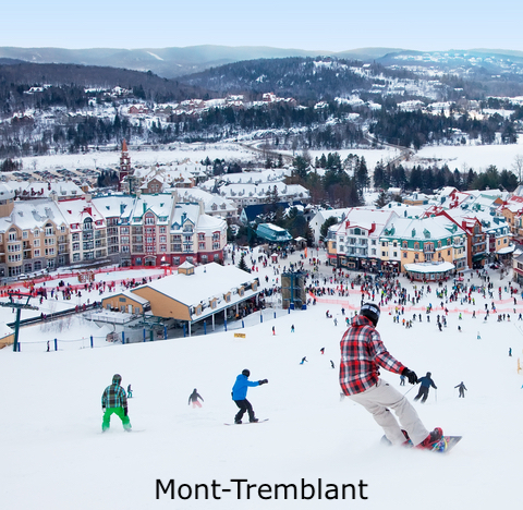
Mont-Tremblant National Park
The lime area north of Montreal is Mont-Tremblant Park.
Mont-Tremblant National Park celebrated its 125th anniversary back in 2020, meaning the park was created in 1895. It's the first park created in Quebec and the third in Canada.
This park features six incredible rivers and around 400 streams, waterfalls, and lakes, making it a canoer and kayaker's heaven.
Mont Tremblant National Park is home to sugar maples and about 40 mammals, including wolves, moose, and white-tailed deer.
The Via Ferrata du Diable is an intermediate activity between hiking and climbing. The park is open year-round and has a ski resort, meaning winter activities like snowshoeing, skiing, and ice fishing are possible.
For packages with flights, meals, and hotels included, visit this link of Expedia!
Parc National d'Oka
Park National d'Oka is the lime area located just west of Montreal.
This list of best parks in Quebec would not be complete without mentioning Oka park. This is a destination for swimmers, bikers, bird watchers, and hikers.
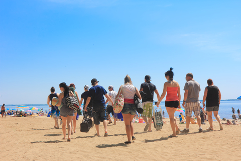
Visitors' main reason for coming is the 3.1mile (5Km) beach. But there are also creameries, volleyball courts, restaurants, bathrooms, and lifeguards.
Visitors can reach the park on a bike and spend the night at a campsite.
The beach can be crowded, but if you prefer a quiet location, you can walk east and find a more peaceful shore; Oka.
FOLLOW ME
Resources for Quebec's Protected Areas Map
The shapefiles with Quebec's state boundary lines and cities were downloaded from Natural Earth Data.
The national Parks of Canada shapefile was downloaded from Open Canada.
The shapefile with Quebec National Parks and other Protected Areas was downloaded from Aires Protegees au Quebec.
The shapefile with rivers and lakes from Canada was downloaded from Open Canada.
This map will be updated with new data! To receive updates on this and more nature maps, join my email list!!!!!!!
Made by Luz K. Molina with D3.js.