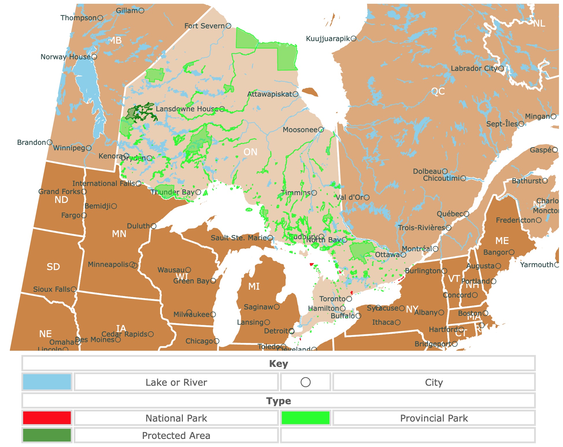
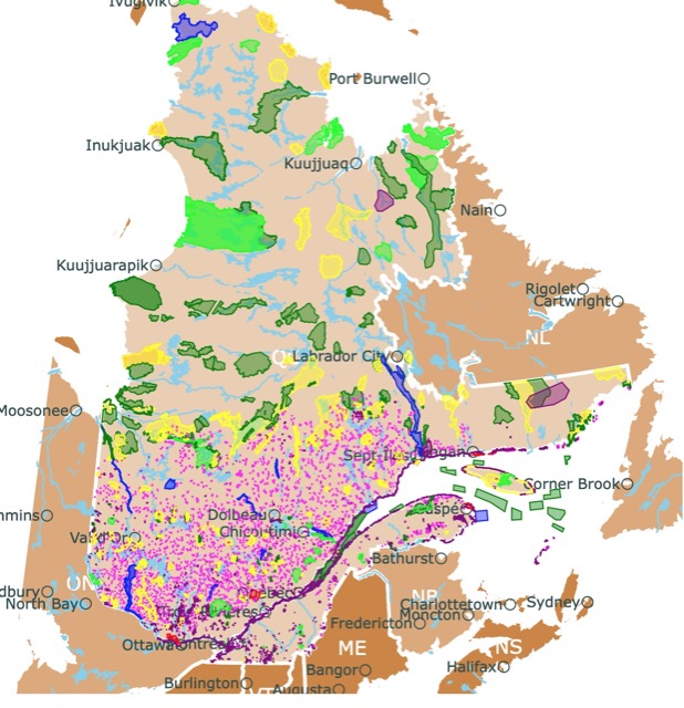
Map of Ontario's Parks and Protected Areas
This interactive map shows the Locations, Names, and Details of National Parks, Provincial Parks, Ecological Reserves, and Protected Areas of Ontario, Canada. It also shows major cities and rivers for context. For more detail, zoom in. For more information, hover over the map, or scroll down.
| Key | ||||
|---|---|---|---|---|
| Lake or River | ◯ | City | ||
| Type | ||||
| National Park | Provincial Park | |||
| Protected Area | ||||
Ontario's Geography
Ontario is "The Loyalist Province" or "The Province of Opportunity", depending on what you wish to highlight; it is also the second-largest province of Canada after Quebec.
Ontario holds more than half the quality farmland in Canada, and its capital is Toronto.
Boasting approximately 250,000 lakes, Ontario is estimated to have 20% of the world's freshwater.
Ontario borders the province of Quebec to the east, New York to the southeast, and the St. Lawrence River-Great Lakes chain to the south. Across Lake Eerie, are Pennsylvania and Ohio. Across Lake Huron is Michigan.
To the southwest, it shares borders with Minnesota and to the west with the province of Manitoba. To the north it shares borders with Hudson Bay and James Bay.
Ontario has two major drainage basins; to the south is the Great Lakes and to the north is Hudson Bay.
This Canadian province comprises two regions of widely different characteristics; Northern and Southern Ontario.
Northern Ontario
Northern Ontario lies north of a line from the confluence of the Ottawa and Mattawa rivers.
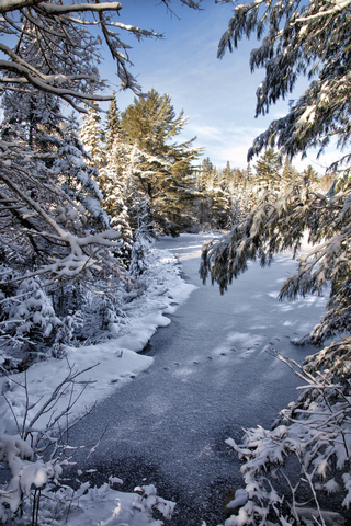
The region spans 350,000 square miles (900,000 square km). Most of the area is part of the ancient Canadian Shield, marked by a profusion of rivers, lakes, muskeg (bogs), rocky terrain, and boreal forests.
Northern Ontario is a low plateau, which is typically no more than 1,500 feet (460 meters) above sea level. However, it contains the highest point in the province, Ishpatina Ridge, rising to 2,274 feet (693 meters).
The area's rich mineral deposits, massive forest reserves, and the hydroelectric power potential of the rivers make the region a significant source of the area's contemporary wealth.
Southern Ontario
The Southern Ontario region covers about 15 percent of the province's area. The highest point in the region is in the Blue Mountains of Georgian Bay, just over 1,770 feet (540 meters) in elevation. The lowest place is only 150 feet (45 meters) above sea level on the Ottawa River.
It is pretty similar to states like Michigan and New York and is dominated by deciduous forests.
Map of Arctic Permafrost
Ontario's Climate
Northern Ontario's climate varies from Southern Ontario, which is frost-free over 100 days a year, to the harsh climate of the Hudson Bay area, where the frost-free period might be as short as 40 days.
The mean temperature in January on Lake Superior is 5℉ (-15℃), and July averages 64℉ (18℃). The annual precipitation averages about 28 inches (700 mm), and the yearly snowfall is typically less than 85 inches (2,160 mm).
Southern Ontario's climate is typically favorable to agriculture. However, considerable local variations do exist.
The eastern portion, which is farther away from the moderating influence of the lakes, tends to be more humid and cooler than the southern and southwestern regions.
Ottawa gets under 35 inches (900 mm) of rain annually and over 85 inches (2,160 mm) of snow. January sees average temperatures of about 25℉ (-4℃), and July reaches about 72℉ (22℃) in the southern region.
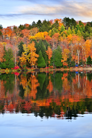
Ontario's Wildlife
Northern Ontario's vegetation is that of the boreal forest, including black and white spruce, tamarack, white birch, poplar, balsam, and jack pine trees.
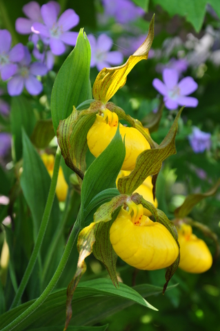
Along the south, there is a surprising variety of orchids and wildflowers.
Along the Hudson Bay, there is a band of tundra.
Large mammals call Ontario home, including caribou, deer, moose, polar bears, black bears, and wolves.
Porcupines, muskrats, rabbits, otters, foxes, beaver, and skunks are some of the small mammals in the area.
Ducks, grouse, hawks, geese, owls, and finches are among the many birds in Ontario. The Common Loon is the provincial bird.
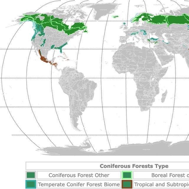
Map of World Conifers and Boreal Forests
Top-Rated Parks and Preserves in Ontario
Ontario has 5 National Parks and manages over 300 provincial parks.
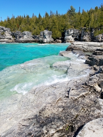
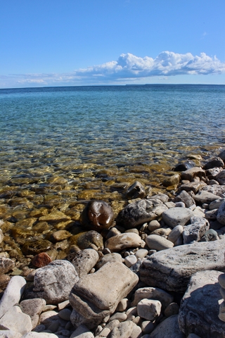
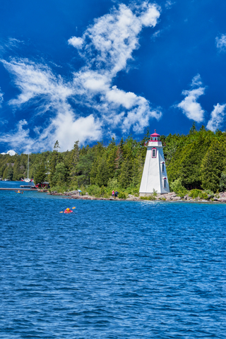
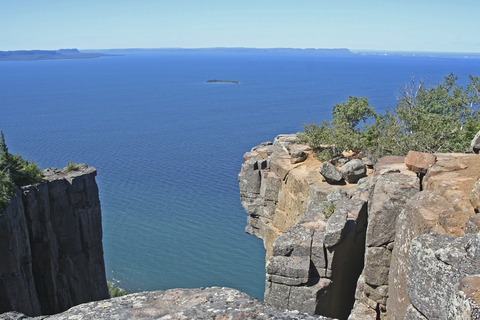
Bruce Peninsula National Park
Bruce Peninsula National Park is the red speck northeast of Toronto. Between Lake Huron and Georgian Bay. You need to zoom in on the map to see the different units in a small area. It might also highlight the Georgian Bay National Park.
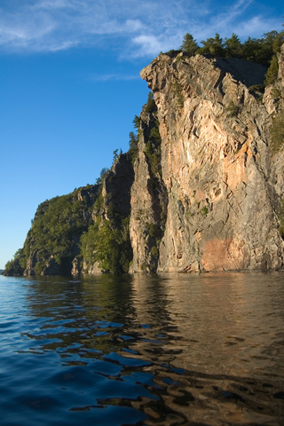
Bruce Peninsula National Park is where towering cliffs rise from the deep blue waters of Georgia Bay. Old cedar trees thrive on top of the cliff's edge, beautiful coves hide in the limestone, and diverse wetlands entertain visitors.
There are also wave-created grottoes, flat rocks, and cobble beaches.
The other side of the peninsula has the warmer waters of Lake Huron, gentle shorelines, and sandy beaches.
Botanists flock to the area as over 40 different orchid species, ferns, and wildflowers are found around the park. Just make sure you don't touch the flowers, as they are fragile and protected.
Large tracts of forest are home to black bears roaming freely, rare reptiles seeking refuge in the rocky areas, and different wetland habitats.
Bruce Peninsula is also a UNESCO World Biosphere Reserve, where visitors enjoy hiking, climbing, camping, playing in the sand, swimming, fishing, canoeing, or riding the ferry! Bruce Peninsula.
On really calm days, you can take your own kayak for a unique perspective of the peninsula! Amazon has Advanced Elements, an ultralight inflatable kayak. It comes with an aluminum frame, weighs 17lbs, and is easy to set up, unfold, and inflate. It also has 3 layers of material to resist puncture.
The park is on the Niagara Escarpment. This is a long escarpment that runs east-west through Canada and the United States in the Great Lakes region.
It is named for the cliff over which the Niagara River plunges at Niagara Falls. The Escarpment has the oldest forest ecosystem and trees in eastern North America. The Canadian portion crosses Ontario from Lake Ontario (near Niagara Falls) to the tip of Bruce Peninsula, on Georgian Bay.
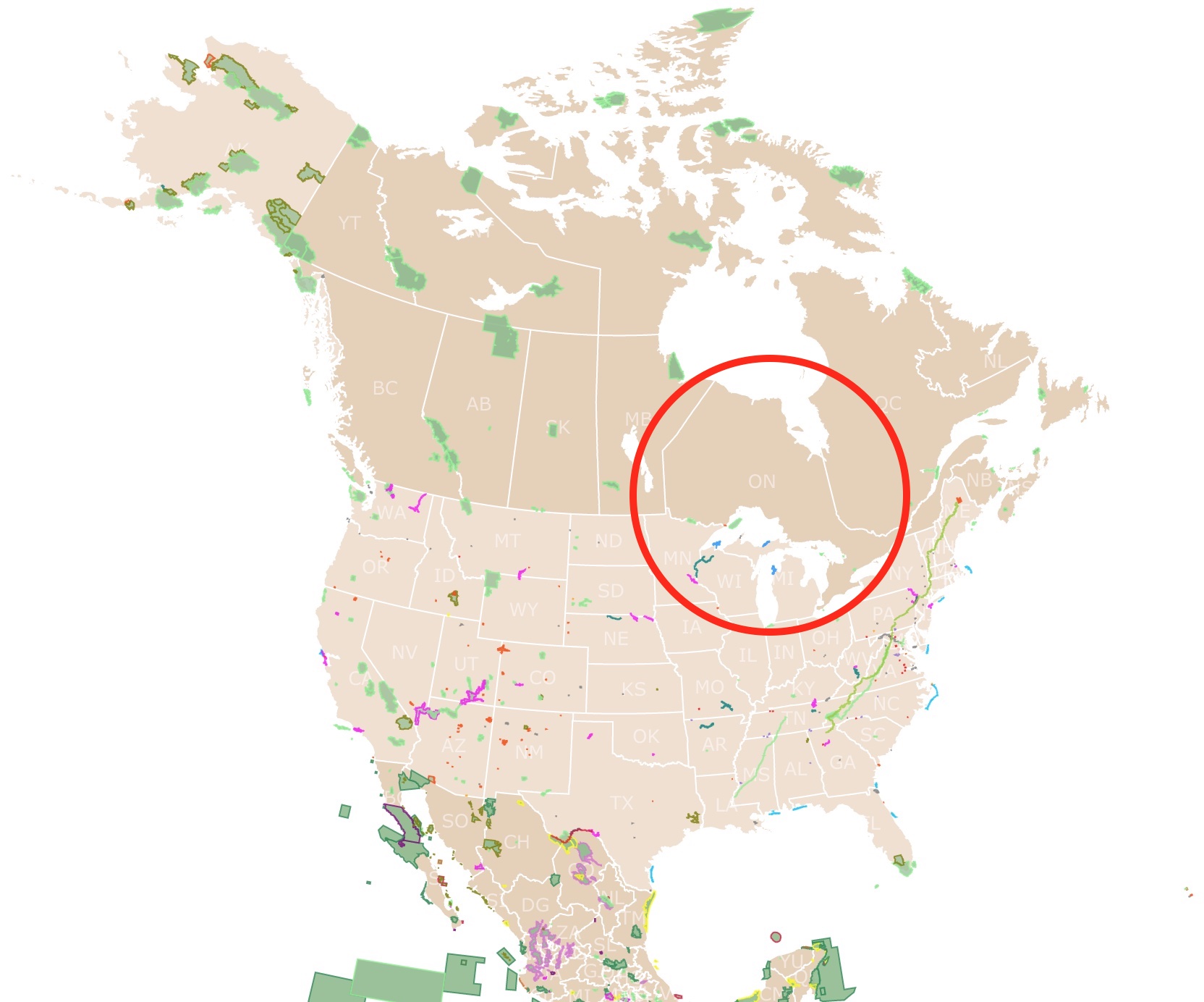
Want to find places to explore in nearby Quebec? Check this map
Fathom Five National Marine Park
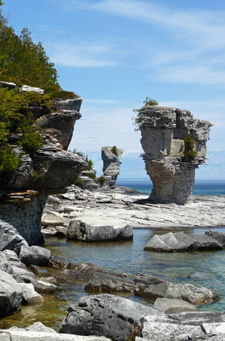
At the western tip of Bruce Peninsula, you will find the Fathom Five National Marine Park depicted in red. You need to zoom in on the map to see it!
Within the marine park you will reach the famous Flowerpot Island. The island is well known for the rock pillars that look like flowerpots.
The freshwater ecosystem comprises ancient rock formations, excellent dive sites on 22 shipwrecks, cliff-edged forests, and various rare orchids.
Visitors enjoy hiking, camping, swimming, diving, and checking the sites on a glass-bottom boat.
The small town of Tobermory is the departure point for the ferry to explore the park.
Fathom Five is considered the diving capital of Canada.
Cabot Head Provincial Park
Cabot Head is the eastern tip of Bruce Peninsula.
It's a geologically significant area with several exciting landforms. It is called a fine example of Karst Pavement. The rocks in such a pavement become weathered natural solvents like slightly acid water.
The terrain in this region is highly varied, with scree slopes, cliffs, ponds, swamps, marshes, shorelines, and wet and dry rock pavements.
The area has varied terrain, with cliffs, rock pavements, swamps, and ponds.
Cabot Head Provincial Park doesn't have any visitor facilities. This park is a part of the Niagra Escarpment Biosphere Reserve. Camping is NOT permitted at Cabot Head.

Map of North America's Marine Ecoregions
Georgian Bay Islands National Park
Georgian Bay Islands are the red specks northeast of Toronto, on Georgian Bay.
The "Thirty Thousand Islands" are the world's largest freshwater archipelago. In reality, the park covers 63 islands scattered along the bay. The largest island is Beausoleil Island.
This nature preserve is situated where white pines and granite shores transform into dense deciduous woodlands. The only way to access it is by boat.
The park has coyotes, foxes, beavers, porcupines, raccoons, wolves, lynx, moose, and white-tailed deer. There are also rattlesnakes and migratory birds.
Head out for a hike or ride along the wooded trails. The secluded campsites and waterfront cabins make overnight stays comfortable. Visitors can hike to viewpoints atop the emerald shoreline.
The scenic shores are definitely picturesque. The meandering bike paths are stunning, while hikers can explore secluded lakeside vistas.
Christian Beach offers romantic rustic cabins. Cedar Springs offers waterfront cabins. Visitors don't have to spend the night, although they'll want to; there is a plethora of adventure to be had during day trips at Georgian Bay Islands.
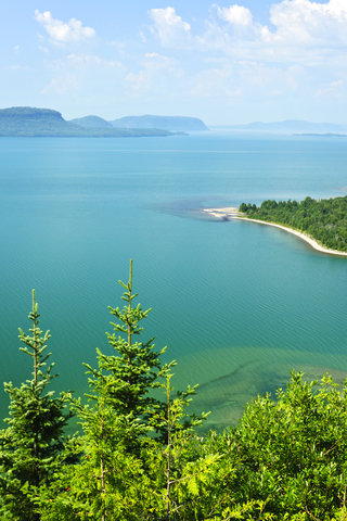
Sleeping Giant Provincial Park
Sleeping Giant Provincial Park is the lime speck east of Thunder Bay on Lake Superior.
Sleeping Giant Provincial Park has over 60K acres of protected land that offers incredible views of Lake Superior and the surrounding area.
The name comes from the resemblance of the park's outline to a sleeping giant. The Sleeping Giant was formed from volcanic rock. It is among the highest points in Ontario and has steep cliffs of 951ft (290m).
The park features over 62 miles (100 km) of rugged trails with spectacular geological features, including Tree Harbour and Sea Lion.
The Sleeping Giant trail is quite strenuous but worth your time. For a difficult hike like this, you can find comfortable hiking boots on Amazon. Columbia Ridge Plus is a waterproof hiking boot. The boot gives superior cushioning and is durable, with a grip for traction on a wide variety of terrain.
Wildlife lovers can catch glimpses of various animals like deer, fox, wolf, lynx, and over 200 birds living in this boreal forest.
Full-service cabins can be rented year-round. The exhibits at the Visitor Center allow visitors to explore the cultural and natural history of the Sibley Peninsula, and it includes a model of the Silver Islet Mine, Sleeping Giant.
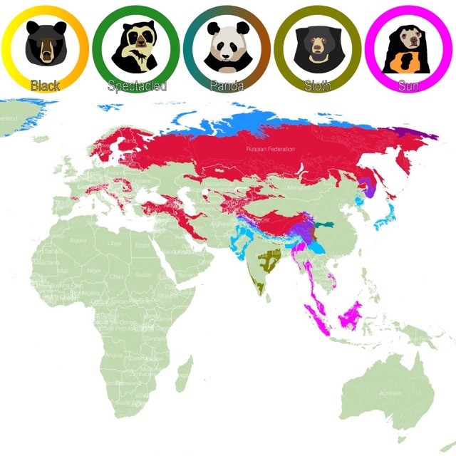
Map of Bears Habitat
Algonquin Provincial Park
This Algonquin Provincial Park is the lime area northwest of Ottawa. This is the oldest provincial park in Canada; it was established in 1893.
Algonquin Provincial Park offers a vast area comprising maple hills, thousands of lakes, and rocky ridges. 2,947 square miles (7,635 square km) of forests, lakes, rivers, and bogs make the park what it is.
The park is in the transitional zone between Northern Ontario and Southern Ontario, offering the best of both worlds with mixed forest types and incredible diversity.
Most of the park can only be explored on foot or paddling on a kayak.
Visitors can expect a wealth of outdoor recreation, including hiking and biking trails, fishing, photography, wildlife viewing, birdwatching, and seasonal activities.
The park has as many visitors in winter as in the summer. Winter activities include skiing, snowshoeing, and skating. Camping is done in cozy yurts.
Aside from this provincial park, there is a second Algonquin that features eight campgrounds. Visitors can hike one of the 14 interpretive trails and participate in the park's extensive educational Discovery Program.
The Visitor Center, Logging Museum, and Art Center are excellent places to explore; Algonquin.
Killarney Provincial Park
Killarney is the lime area in southern Ontario, southwest of Sudbury. It occupies an area of 400 square miles (1036 Km2).
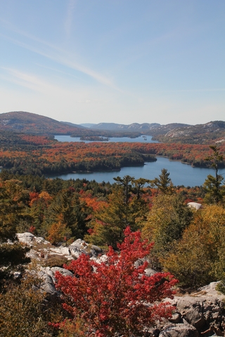
This wilderness park features the La Cloche Mountains' white quartzite ridges and Georgian Bay's pink granite. These mesmerizing rocks are mixed with pine hills and over 50 deep blue lakes.
Visitors can enjoy extensive backcountry canoeing and sea kayaking. The hiking opportunities are exceptional and include the 49 miles (80 km) looped La Cloche-Silhouette Trail.
La Cloche-Silhouette Trail is also available for winter activities like snowshoeing and skiing.
George Lake Campgrounds offers access to the beaches, several trails, and canoeing opportunities.
If you want to spend a few nights, you can camp out or rent a Yurt any time of the year. Some say this is one of the best parks to camp in Ontario because of its serenity and natural views.
The Historic Village of Killarney was founded as a fur trading post on Georgian Bay, and it's only 6 miles (10 km) from the park, Killarney.
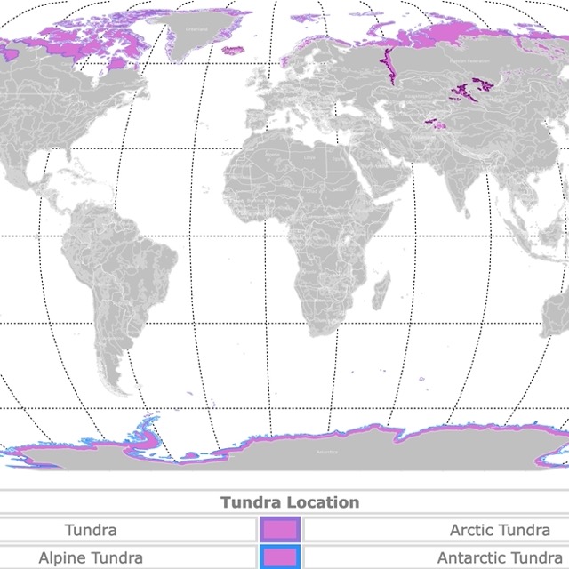
Map of World Tundra
Point Pelee National Park of Canada
Point Pelee is the red speck southeast of Detroit, on the shores of Lake Erie. The park is the southernmost point of the Canadian mainland.
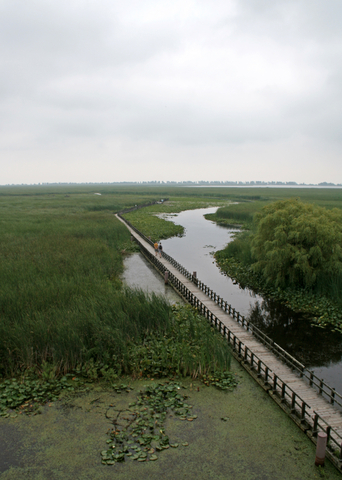
The park is basically made of sediment transported by currents. Most of the park is covered by marsh and dotted by ponds. The park is a Ramsar site, therefore a protected wetland.
Every spring, birdwatchers have the opportunity to welcome flocks of migratory birds. There are over 350 species found at the park.
When autumn arrives, stunning waves of Monarch butterflies can be witnessed crossing the park.
Besides watching wildlife, visitors enjoy canoeing, kayaking, swimming, going to the beach, hiking, and biking.
During the winter months, hike some trails in solitude and glimpse the incredible natural ice formations. Summer welcomes beachgoers to the sandy beaches and cool waters; Point Pelee.
Bon Echo Provincial Park
Bon Echo Provincial Park is the lime speck southwest of Ottawa.
The park has several lakes, and one of the deepest in Ontario features Mazinaw Rock.
Mazinaw Rock is 328-foot (100m) high and features more than 260 Indigenous pictographs. These are the largest of their kind and are found on the cliffs.
Hiking trails range from 0.6 miles (1 km) to 10 miles (17 km) in length.
The Interpretive Boat Tours on Mazinaw Lake are incredible. Visitors can also take a boat tour to Mazinaw Rock for a closer and personal look.
Visitors have several camping options, including RV, backcountry, and roofed accommodations for overnight guests. Interior canoe-in and hike-in campsites are available; Bon Echo.
Map of Glaciers Worldwide
Rouge National Urban Park
This Urban Park is the red speck north of Toronto.
Rogue National Urban Park is a beautiful blend of rich cultural, natural, and agricultural landscapes.
At Rogue, you'll find some of the last remaining working farms throughout the Greater Toronto Area, one of the region's most extensive marshes, a beautiful beach at Lake Ontario, and Toronto's only campground.
The hiking opportunities are incredible. History and cultural fans will enjoy learning about human history that dates bake more than 10,000 years, including some of Canada's oldest 'known' Indigenous sites.
Canoeing, camping, fishing, hiking, kayaking, swimming, kayaking, and biking are only a few recreational opportunities to enjoy at Rogue National.
Thousand Islands National Park
This park is the red specks south of Ottawa, close to the shores of Lake Ontario.
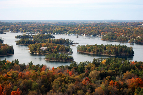
Navigate or paddle between the park’s 20 islands between Kingston and Brockville. Thousand Islands National Park has a charming granite island and beautiful bays worth exploring.
Spend the day on the river swimming, fishing, and boating. Call it a night with a waterfront oTENTik rental.
Wildlife lovers can discover rare species of turtles and a plethora of birds alongside excellent hiking trails.
If there is anything to do outdoors, you'll find it at this park, from canoeing and swimming to scuba diving and camping. Let's not forget the playground for the little ones; Thousand Islands.
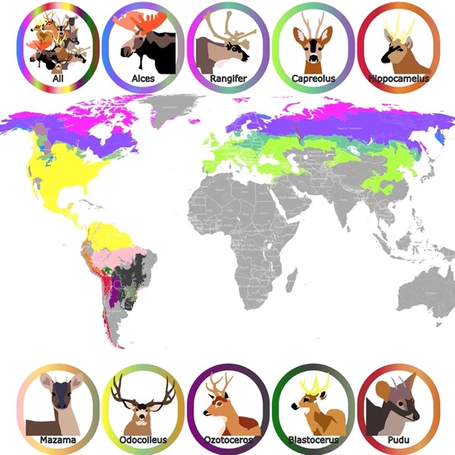
Map of Moose and Caribou
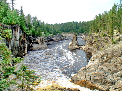
Quetico Provincial Park
Quetico is the lime area in southwestern Ontario. Situated west of Thunder Bay.
Quetico is a wilderness class park known for its imposing rock cliffs, incredible waterfalls, lush forests, lakes, and rivers.
This wilderness park is excellent for backcountry canoeing, with more than 2,000 lakes. The park adjoins the Boundary Waters Canoe Area Wilderness of the Superior National Forest in Minnesota.
The park is recognized as an International Dark Sky Park and is one of eight Wilderness Class Parks.
Dawson Trail Campground is perfect for family camping, contains facilities for all sorts of camping equipment, and features 21 miles (35 km) of hiking trails.
Year-round rustic cabin rentals are available year-round, and the groomed winter trails are perfect for cross-country skiing; Quetico.
Kakabeka Falls Provincial Park
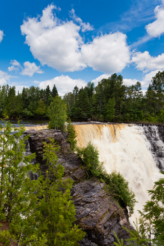
Kakabeka Falls is the lime speck in southwestern Ontario, just west of Thunder Bay.
Kakabeka Falls is the second-highest waterfall in Ontario, reaching 131 feet (40 meters) high. Visitors come to experience the falls every season.
A boardwalk wraps around the top of the falls providing an incredible view of the falls and the gorge.
The Kaministiquia River is responsible for carving and cutting into the rocks, revealing 1.6 million-year-old fossils at the base of the falls.
Hiking and cross-country skiing are some of the activities visitors like to enjoy at the park, Kakabeka.
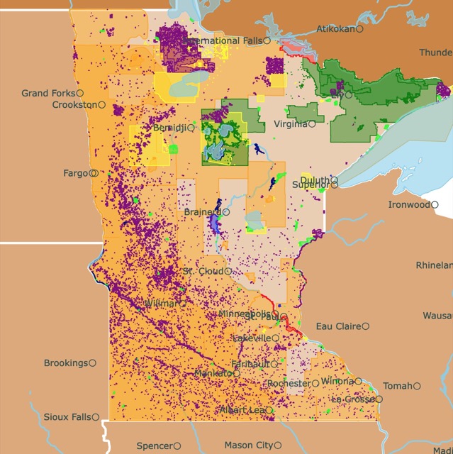
Map of Minnesota Parks
Missinaibi Provincial Park
The long lime strip west of Timmins.
The Missinaibi is one of several Canadian Heritage Rivers designated for its significant Indigenous, trading, and logging cultural heritage.
It's also been designated for its incredible ecological and natural geological heritage and outdoor recreation.
Missinaibi Provincial Park encompasses large lakes, scenic waterfalls, and incredible whitewater.
There are various camping experiences, including Barclay Bay Campground on Missinaibi Lake, interior canoe and boat sites on the lake, and backcountry canoe sites for miles along the Missinaibi River.
Polar Bear Provincial Park
Polar Bear Provincial Park is the large lime area in northern Ontario. This is Ontario's largest provincial park.
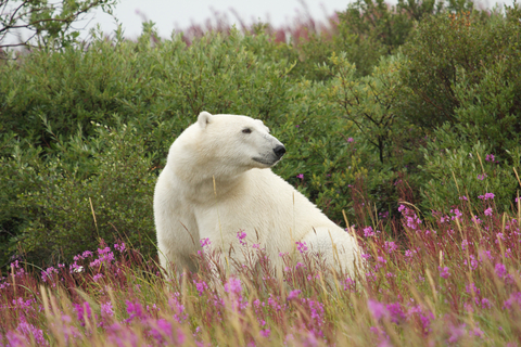
Polar Bear is only accessible by plane. Visitors require special permits to land and visit the park.
This park features untouched tundra, and Arctic conditions prevail in the park.
The park has incredible wildlife, including walruses, belugas, white whales, and seals. Land animals include moose, caribou, marten, beaver, fox, goose, black bear, and polar bear.
The terrain is mainly flat, with a few ridges. The top layers are covered with lichen, moss, or bogs, while the bottom layers contain permafrost.
South of the tundra, visitors may see spruce, tamarack, and willow; Polar Bear
FOLLOW ME
Resources for Ontario's Protected Areas Map
The shapefiles with Ontario's state boundary lines and cities were downloaded from Natural Earth Data.
The national Parks of Canada shapefile was downloaded from Open Canada.
The shapefile of Ontario's Provincial Parks was downloaded from Ontario Data Catalogue.
The shapefile with rivers and lakes from Canada was downloaded from Open Canada.
This map will be updated with new data! To receive updates on this and more nature maps, join my email list!!!!!!!
Made by Luz K. Molina with D3.js.