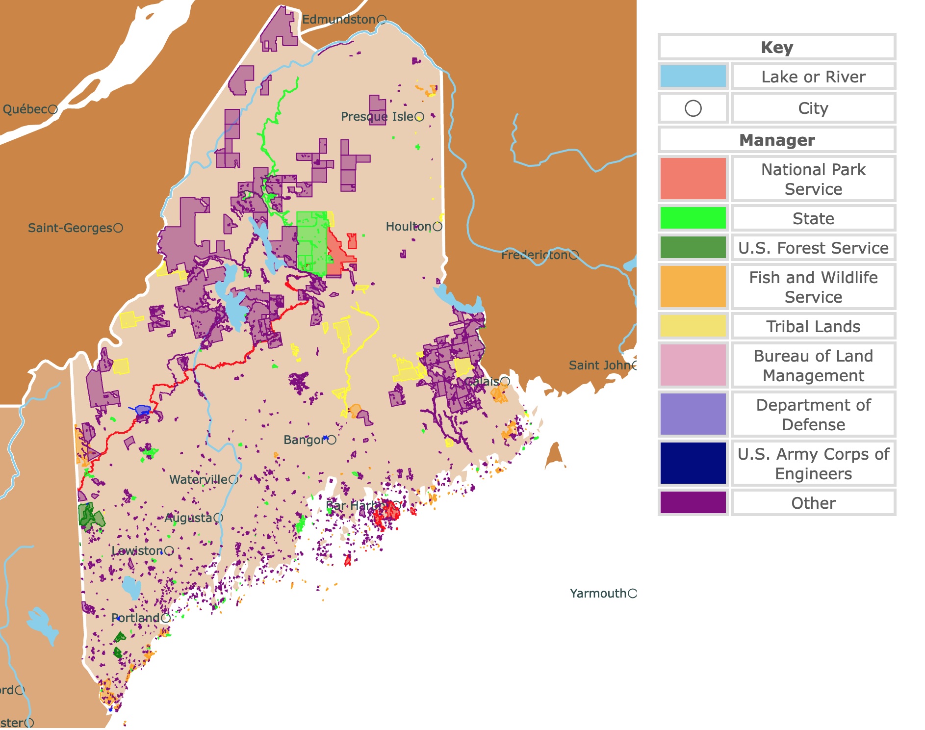
Map of Maine's Protected Areas
This interactive map shows the Locations, Names, Areas, and Details of National Parks, State Parks, National Forests, Tribal, and other Public Lands of Maine. It also shows major cities and rivers for context. For more detail, zoom in. For more information, hover over the map, or scroll down.
| Key | |
|---|---|
| Lake or River | |
| ◯ | City |
| Manager | |
| National Park Service | |
| State | |
| U.S. Forest Service | |
| Fish and Wildlife Service | |
| Tribal Lands | |
| Bureau of Land Management | |
| Department of Defense | |
| U.S. Army Corps of Engineers | |
| Other | |
Maine's Geography
Maine is the northernmost state of the contiguous United States and also the biggest state in New England. It borders Canada's New Brunswick to the east and Quebec Province to the west. It also borders New Hampshire to the southwest and the Atlantic Ocean to the southeast.
The state is divided into three geographic regions: the Coastal Lowlands, White Mountains, and Eastern New England Uplands.
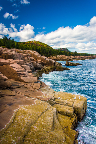
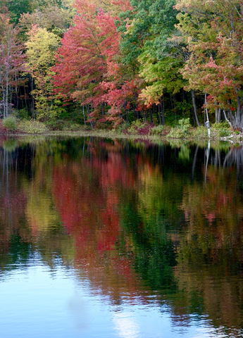
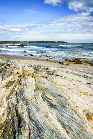
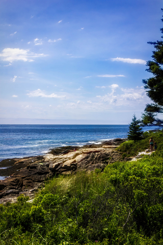
- The Coastal Lowlands: The Lowlands begin at the Atlantic coastline, stretching between 10 to 40 miles inland. The area is comprised of sandy beaches, inlets, bays, salt marshes, and thousands of coastal islands. Mount Desert Island is the largest of the coastal islands. The islands used to be mountains, but during the last Ice Age, the sea level rose and turned them into islands. One set of the islands in northern Maine is home to Acadia National Park.
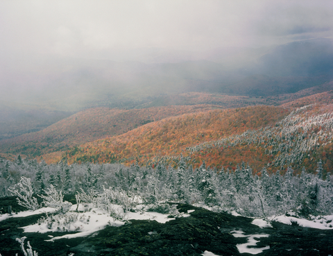
- The White Mountains: This region is located in northwestern Maine and is home to Mount Katahdin, the state's highest point at 5,268 feet (1,606 meters). The White Mountains region is home to Baxter State Park, where Mount Katahdin stands.
- The Eastern New England Uplands: Maine's Uplands lie northwest of the Lowlands. This region is known for having rich and fertile soil, streams, lakes, and it's home to the Longfellow Mountains; NatGeo.
According to the U.S. Geological Survey, while the highest point in Main is Mount Katahdin, the lowest point is by the Atlantic Ocean.
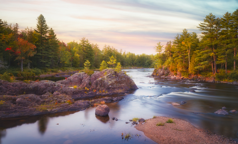
Some of the major bodies of water in Maine include. Moosehead Lake, Richardson Lake, St. John River, Androscoggin River, Penobscot River, and Kennebec River.
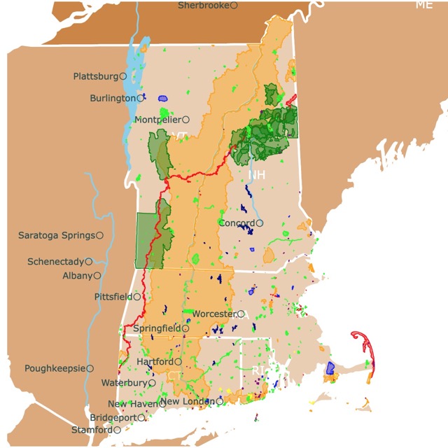
Want to find places to explore in the New Hampshire? Check this map of New England Parks
Maine's Climate
Maine experiences a humid continental climate. Generally, summers are warm and moist, and winters are cold and snowy. Coastal areas have a more moderate climate since they are so close to the Atlantic Ocean.
According to NOAA National Centers For Environmental Information, winter temperatures in Maine average 25 ℉ (-3.88 ℃) in the far south to less than 15 ℉ (-9.44 ℃) in the northern regions and interior parts of the state.
Summer temperatures range from 60 ℉ (15.55 ℃) in the north to 70 ℉ (21.11 ℃) in the south, NCICS.
Maine is typically safe from tornadoes, hurricanes, and tropical storms due to its location north, close to the Atlantic Ocean.
Maine's Wildlife
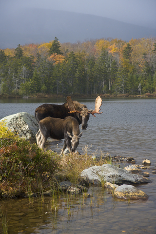
The Moose is Maine's state animal. Black bears, bobcats, Canada lynx, and white-tailed deer are a few other mammals thriving throughout the state.
Osprey, bald and golden eagles, great gray owls, and roseate terns are a handful of birds flying around the Pine Tree State.
Bullfrogs, eastern painted turtles, and eastern red-backed salamanders are some of the amphibians in the area.
Northern redbelly snakes, eastern garter snakes, and smooth green snakes slither throughout Maine. There are also various lizards including the common Basilisk and several gecko species.
Maine is home to about 17.7 million acres of forest. This makes it the most forested state by percentage of the total land covered. This means approximately 89.5% of the state is forested, State Rankings.
Growing thick in the broadleaf forests and throughout the entire state are black oaks, black walnuts, sugar maples, American elms, and white pine trees.
Mountain wood sorrel, Queen Anne's lace, Canada violet, and calypso orchid are some of the wildflowers blooming across Maine.

If you want to learn more about the Atlantic Coast, visit North America's Marine Ecoregions Map
Best Parks in Maine
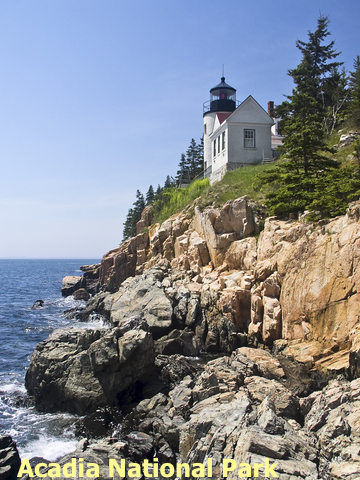
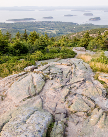
Acadia National Park
Acadia National Park is the red area on Maine's coast.
According to Main Biz, Acadia National Park sees more than 3.5 million visitors every year!
Birdwatching, stargazing, 158 miles of hiking trails, 45 miles of historic carriage roads for biking, tide-pooling, boating, swimming, rock climbing, and historic sites are popular outdoor recreational activities visitors can enjoy.
Most of Acadia's 47,000 acres are located on Mount Desert Island. In contrast, some areas in the Schoodic Peninsula and others on Isle au Haut.
The park is quite attractive for visitors thanks to its fall foliage in autumn, skiing opportunities in winter, fishing in spring, and hikes or water sports in the summer.
Acadia National Park attractions include:
- Cadillac Mountain: Beautiful mountain located in Mount Desert. Besides the landscape and views, visitors love hiking its trails.
- Thunder Hole: is an incredible stone inlet that creates loud, thunder-like sounds produced by the waves crashing on the stones.
- Sand Beach: The rocky coastline has some gaps with sandy beaches. Although the water is still cold in the summer, visitors enjoy playing and hiking in the sand.
- Great Long Pond: This 113 ft (34m) deep pond is popular with tourists for canoeing and fishing.
- Schoodic Peninsula: This side of the park is less used but offers fantastic views of Mount Desert and the coast.
- Isle au Haut: This island is only accessible by mail boat. It has rustic campsites and hiking trails, Visit Maine.
Acadia has five campgrounds, including the Wildwood Stables Campground for visitors with stock animals. The park has six picnic areas, five of them are on Mount Desert Island, and one is on Schoodic Peninsula.
Jordan Pond House Restaurant is a seasonal restaurant in the park that serves lunch, tea, and dinner from mid-May through late October.
Katahdin Woods and Waters National Monument
Katahdin Woods and Waters is the red area in central Maine.
Katahdin Woods and Waters offers incredible views of Mount Katahdin. Visitors can explore the park's rivers, streams, flora, fauna, woods, geology, and even Maine's night sky.
This is a new monument created in 2016. Its roads are dirt, and its bathrooms are vault toilets. Nevertheless, there are vast areas of old-growth woodlands and infinite opportunities for boating and fishing.
Hiking, hunting, camping, biking trails, kayaking, skiing, snowshoeing, and snowmobile riding are a few popular outdoor activities. The park has 18 campsites, and 4 three-sided lean-tos, and 2 huts.
There are various things to get into in and around Katahdin Woods and Waters. The Millinocket Historical Society and Pattern Lumberman's Museum are history fans' favorites. You can even book a sightseeing tour via plane flying over the woods to see the park from a new perspective, KaWW.
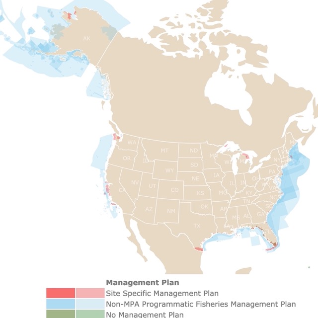
Maine has a long coastline and many marine ecosystems to protect. To learn more, check this map!
Caribou-Speckled Mountain Wilderness
Caribou-Speckled Mountain Wilderness is the green area in western Maine.
Caribou-Speckled Mountain Wilderness comprises 14,000 acres of land. There are 25 miles of maintained hiking trails for visitors to explore. There are trails for all hiking difficulty levels, from lower hardwood slopes to exposed rocky peaks.
Speckled Mountain is the highest peak in the park at 2,906 feet (885.7 meters). Mount Caribou is the second-highest at 2,840 feet (865 meters). This is the largest state park in Maine.
White pine, the official state tree of Maine, grows at lower elevations, while spruce and fir dominate the forest on higher slopes. Areas of hardwoods are visible from afar with their different colors, giving the site its name of Speckled Mountain.
Day hikes, scenic drives, mountain biking, and camping are some of the most common recreational opportunities at Caribous-Speckled Mountain Wilderness.
Baxter State Park
Baxter State Park is the lime area in central Maine.
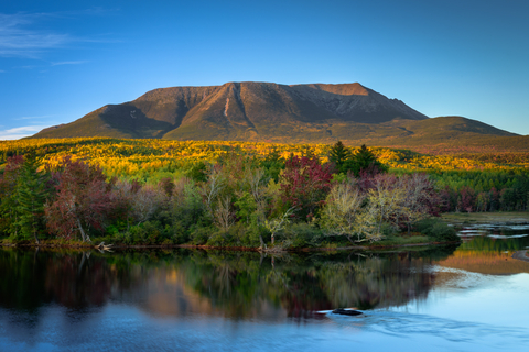
The park consists of more than 209-thousand acres of land. The setting is picturesque with ponds, streams, lakes, more than 40 peaks, and ridges with patches of forest and treelines as the backdrop.
There are over 215 miles of trails for hiking that go through lowlands, granite routes, brooks, and streams. Mountaineering and climbing are also possible, especially in glacial cirques found in the park.
The park is popular for cross-country skiing, ice climbing, and snowshoeing during winter. Snowmobiling is permitted on Tote Road.
Wildlife is first and people second in this park. Baxter is home to moose, white-tailed deer, lynx, and black bears.
The park is also home to boreal bird species and 857 types of plants.
There are 10 primitive campgrounds and various backcountry sites. Kayaks and canoes can be rented at pondside campgrounds and backcountry campsites with trail access, Friends of Baxter.

Maine is covered with Broadleaf Deciduous Forests. To learn more, visit this map
Two Lights State Park
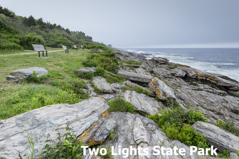
Two Lights State Park is the lime speck south of Portland.
Two Lights is a small state park encompassing 41 acres in Cape Elizabeth, Maine. The views of the Atlantic Ocean and Casco Bay are incredible. Besides the ocean views, the rocky shores are mesmerizing!
Two Lights was named after the twin lighthouses near the end of Two Lights Road.
Picnic tables on the hills looking out to the ocean invites guests to an incredible view over lunch; Two Lights.
Sebago Lake State Park
Sebago Lake State Park is a light blue lake in southwestern Maine, located in Casco and Naples.
The park is open year-round, offering visitors opportunities to engage in outdoor recreational activities.
Sebago offers 1,400 acres of sandy beaches, extensive woodlands, ponds, bogs, a river, and a diverse habitat for many plants and animals.
The hiking trails are easy to moderate and provide ample opportunity to see wildlife. Boating, camping, fishing, snowshoeing, cross-country skiing, and picnics can all be enjoyed at the park.
There are 5.5 miles of groomed snowshoe and cross-country skiing trails open on the Casco side, and six miles of ungroomed trails in the Naples portion of the park.
The park also offers thousands of miles of maintained snowmobile trails that connect to other parks, states, and even Canada! Maine Department of Agriculture, Conservation, and Forestry.
Crescent Beach State Park
Crescent Beach State Park is the lime speck south of Portland.
Crescent Beach gets its name from the mile-long, crescent-shaped beach perfect for fun in the sun. The relatively warm water and mild surf make boating and swimming a breeze.
Many consider this to be one of Maine's finest beaches. Picnic tables and grills are available for a beautiful cookout. Suppose you forgot to bring something to eat; the snack bar can solve that problem.
The beautiful coast views and the walking trail are worth a thousand words. Saltwater coves, sandy beaches, forested areas, and rock ledges provide the setting for recreation and beachgoers. Fishing, watersports, and boating can turn a simple weekend into an adventure.
During the off-season, the park is closed to vehicles, but those on foot can enjoy the peace and tranquility of the beaches and quiet trails. In the winter season, park visitors trade in swim gear for cross-country skis and snowshoes; Maine.gov.
Rangeley Lake State Park
Rangeley Lake State Park is the lime area northwest of Waterville.
Rangeley State Park is located in the western mountains, one of the most beautiful spots in Maine.
The park sits on 869 acres of remote land on Rangeley Lake, a 10-square-mile (16.09 square meter) lake. Rangeley Lake offers landlocked salmon and trout fishing for anglers. Some anglers voluntarily catch and release the fish so they can continue breeding.
Aside from fishing, swimming, and water sports, park visitors enjoy hiking, camping, wildlife observation, picnics, and incredible pictures. The campground only has 50 campsites, and some of them have access to water; Rangley.
Maine has ample opportunities for skiing. For more locations, visit this map of ski resorts in North America
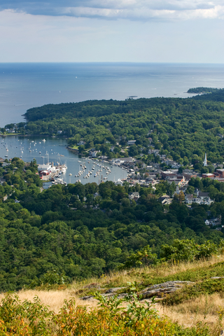
Camden Hills State Park
Camden Hills State Park is a large lime area on Maine's coast. It is located just a few minutes north of Camden, Maine.
The park offers trail activities and camping all year. A rustic shelter is available for winter camping by reservation.
The panoramic view of Penobscot Bay and Camden Harbor is incredible. Did we mention that the best view is from the top of Mount Battie?
Camden Hills has 20 trails ranging from 0.3 miles to 2.5 miles in length, ranging from easy to moderate. There are several trails for biking that will be marked with a bicycle icon; Maine Department of Agriculture, Conservation, and Forestry.
Reid State Park
Reid State Park is a lime speck east of Portland.
Thousands of visitors explore the park's long and wide sandy beaches. Reid State Park is Maine's first state-owned Saltwater Beach!
The beaches in this region are nesting areas for rare and endangered piping plovers and least terns. The shores also provide a place to rest and feed numerous other shorebirds.
What's rarer than beaches along Maine's coast? Sand dunes! By the way, you can take a geological tour of Maine's beaches to learn more about the land in the area; what it is now, and what it once was; Reid.
Grafton Notch State Park
Grafton Notch State Park is a lime area west of Waterville.
Grafton Notch State Park is a prime recreational destination located in Maine's Mahoosuc Mountain Range. The land in this region is rugged, making it excellent for backcountry hikers.
Grafton offers 12 of the most challenging trails along the Appalachian Trails. Hikers will find an incredible view once they traverse the steep summit trails and reach their destination. Just a hint, it's Old Speck.
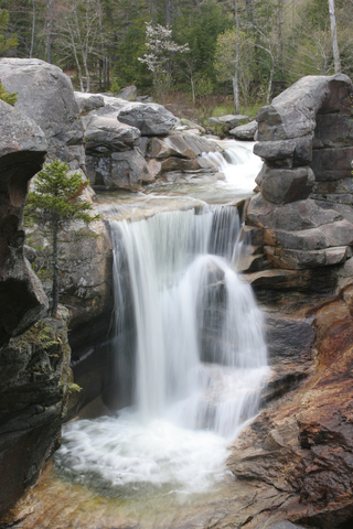
There are excellent short walks leading to magical waterfalls and gorges for those seeking less rugged paths.
To enjoy this park, you don't even have to get out of your car. The Grafton Notch Scenic Byway bisects the park, allowing you to travel the park with pull-offs pointing out interesting facts, Grafton.
Affiliate Disclosure
Databayou.com is a participant in the Amazon Services LLC Associates Program, an affiliate advertising program designed to provide a means for sites to earn advertising fees by advertising and linking to Amazon.com. Databayou.com also participates in affiliate programs with Clickbank, CJ, and other sites.
If you plan to visit one of these wooded parks or hike up Maine's mountains, I suggest you get some of these items found on Amazon.
- Snowshoes: Ideal for walking comfortably through Maine's snowy trails. They have padded ratchet binding, heel lift, toe box, adjustable pivot bar, and durable back strap. They come with a set of trekking poles, a Carrying Bag, and are available in different colors.
- Padded Camping Charis: Perfect for cold and temperate parks. This round chair has a cup holder and a carry on bag.
- Sleeping Bag: Made for cold and windy nights. Portable, light, and fits two.
Resources for Maine's Protected Areas Map
The shapefiles with Maine's state boundary lines, major rivers, and cities were downloaded from Natural Earth Data.
The Parks and Public Lands shapefiles for Maine were downloaded from USGS.
This map will be updated with new data! To receive updates on this and more nature maps, join my email list!!!!!!!
Made by Luz K. Molina with D3.js.