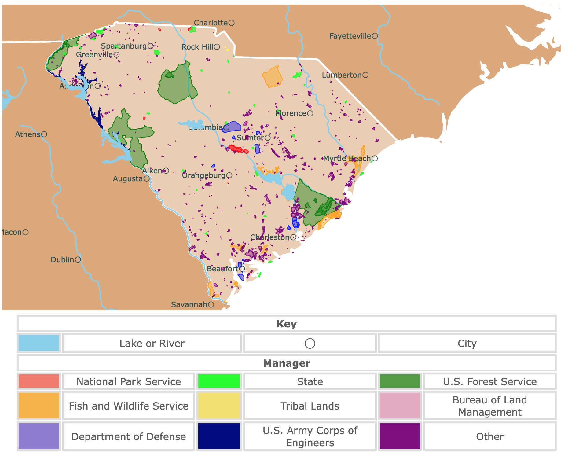
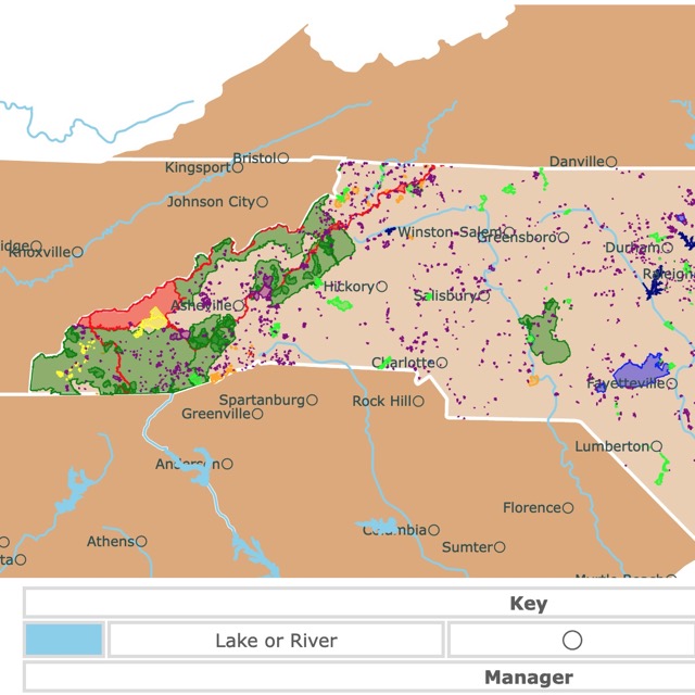
Map of South Carolina's Parks and Protected Areas
This interactive map shows the Locations, Names, Areas, and Details of National Parks, State Parks, National Forests, Tribal, and other Public Lands of South Carolina. It also shows major cities and rivers for context. For more detail, zoom in. For more information, hover over the map, or scroll down.
| Key | |||||
|---|---|---|---|---|---|
| Lake or River | ◯ | City | |||
| Manager | |||||
| National Park Service | State | U.S. Forest Service | |||
| Fish and Wildlife Service | Tribal Lands | Bureau of Land Management | |||
| Department of Defense | U.S. Army Corps of Engineers | Other | |||
South Carolina's Geography
South Carolina is bordered by North Carolina to the north. The Atlantic Ocean is to the east and Georgia lies to the west and south.
South Carolina can be divided into six landform regions.
Interested in South Carolina facts? Amazon has South Carolina (State Profiles). This book is has engaging text and beautiful photographs combined to show off the states history, culture, industry, and more.

- Blue Ridge Mountains: This area comprises 2% of the state's landmass, making it the smallest landform region. However, the state's highest point, Sassafras Mountain - 3,554 feet (1,083 meters), is nestled in this area. The Blue Ridge Mountain is a part of the Appalachian Mountain Range. In this region, there are many hardwood forests, waterfalls, streams, and several rivers that flow out to the coast.
- Piedmont Region: This area is also known as the Upstate. It's the largest landform region in South Carolina. Piedmont is located at the foothills of the mountains, and it includes rolling hills, valleys, waterfalls, and swift-flowing rivers. Monadnocks (isolated bedrock hills) are situated in Piedmont, including Table Rock.
- Sandhills: What we know as the Sandhills was once the coastline of North America millions of years ago. The fall line is between the Piedmont and Sandhills regions, where river waterfalls from higher land to lower land. This causes the rushing water and rapids. Columbia, South Carolina's capital, is in the Sandhills Region; Sandhills.
- Inner Coastal Plain: A dividing line remains where the ocean once was millions of years ago. These regions comprise partly rolling hills and swamps, where Congaree National Park is located. The Inner Coastal plain is the center of cotton production and wheat and soy crops.
- The Outer Plain: is broken up by streams and rivers, including Pedee, Edisto, and Santee Rivers. Swamps cover most of the land in the Outer Plain Region, but some have been drained for farmland use.
- Coastal Zone: The Coastal Zone bordered the Atlantic Ocean. It is comprised of marshlands, sand dunes, and barrier islands. Palmetto trees, deltas, and beaches can be found in this region. Port of Charleston is located in the Coastal Zone, and it's one of the busiest ports along the eastern coast of the U.S.
South Carolina's Wildlife
With such diverse landforms and regions, it's no surprise that South Carolina is home to various plants and animals. Wild pigs, gray foxes, river otters, and bobcats are a handful of the mammals in the state.
The Carolina chickadee and Carolina wren are two bird species named after the Carolinas.
Reptiles like the American alligator, gopher tortoises, and corn snakes live in the state. The eastern narrow-mouth toad and pine barrens tree frog are only two of the various amphibians around the state.
The palmetto tree may be one of South Carolina's best-known. Still, the loblolly pines, southern magnolias, and live oaks are also incredibly beautiful and common.
Local wildflowers blossom and bloom throughout the year, including the Carolina wild petunia, Carolina desert-thorn, Carolina phlox, Carolina geranium, Carolina silverbell, and all of the countless flowers not associated with "Carolina" in their names; NatGeo.
South Carolina's Climate
South Carolina has a humid and subtropical climate with long, hot summers and short, relatively mild a winters. It's the eighth hottest state in the U.S., with the average annual temperature around 62.4 ℉ (16.88 ℃).
According to U.S. News Travel, the best times to visit South Carolina for outdoor recreation are from March to May or September to November, when the temperatures are mild. However, lodging rates may be high, and bustling crowds should be expected as that's peak tourist season; Charleston.
To learn more about South Carolina and plan your trip, Amazon has Exploring South Carolina State Parks. This is more than a publication of South Carolina state parks. It is the perfect guide for exploring what the parks have to offer in detail.
Want to find places to explore in nearby Georgia? Check this map of Georgia Parks
Best Parks in South Carolina
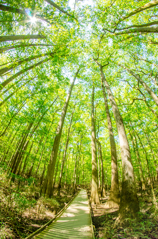
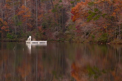
Congaree National Park
Congaree National Park is the red band on the border with Tennessee. The park has more than 6,000 acres available for visitors.
Whether you're heading to Congaree for a short stroll along the boardwalk or plan on spending the day, this park offers a variety of ways to enjoy outdoor recreation at its best. Congaree National Park is home to one of the tallest and oldest forests east of the Mississippi River.
Congaree's floodplain forest is home to one of the highest canopies in the world. The park is known for its massive hardwoods and towering cypress trees. It's a sanctuary for all wildlife (plants and animals), a peaceful wilderness setting for visitors, and a research site for scientists.
It is not just the forests Congaree is famous for. The park is the habitat of the Synchronous Fireflies. These rare species are known for synchronizing their flashing light patterns. This incredible event occurs for a couple of weeks between May and June!
Because this is such a popular and uncommon event with a fragile species, viewing is limited to lottery winners. The tickets are available once a year on Recreation.gov.
The incredible natural features draw in a crowd. Still, the park's landscape holds a rich cultural heritage, from the prehistoric natives that once inhabited the land to the Revolutionary War patriots and escaped slaves.
Today, Congaree visitors enjoy boating, fishing, hiking, and camping. If you plan on camping at Congaree National Park, reservations are required, so make sure you get that set up in advance.
There aren't any RV sites available, but you'll find tent and hammock sites at the campground. Haul in your own canoe or kayak for an adventure down Cedar Creek. While the park doesn't have any rental gear, there are various outfitters in Columbia, S.C., that will be more than happy to assist you; Congaree.
For a close and comfortable stay near Congaree National Park, Expedia has the perfect hote for you. For ammenities and dates click here!
Francis Marion and Sumter National Forests
Francis Marion and Sumter National Forests comprise all the green areas on the map. They encompass more than 600,000 acres of diverse landscape.
The forest has four ranger districts named Andrew Pickens, Enoree, the Long Cane, and the Francis Marion District. All of these areas offer various recreational activities in multiple settings.
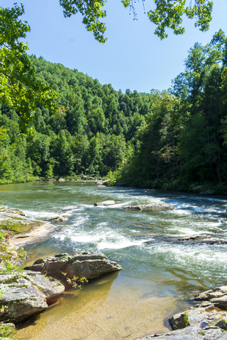
The forest is characterized by many rivers and major habitat types: mountains, piedmont, and coastal plain. It is also exceptional because it is the best site for birdwatching in South Carolina.
The Forks Area Trail System on Long Cane is excellent for mountain bike riding. The Wild and Scenic Chattooga River in the Andrew Pickens district is perfect for paddling and fishing.
Bring your horse and saddle to explore the horse trails in any district. ATVs and dirt bikes are welcome on the four OHV trails. Fishing and hunting are also popular.
The Buck Hall boat launch on the Francis Marion is a significant part of the Intracoastal Waterways, waiting to be explored.
Nine rifle ranges, hiking trails, picnic areas, and campgrounds are available throughout these parks. Wherever you choose to roam, there will be something worth your time; Forest Service.
Visitors can stay in a beautiful retreat near the forest. VRBO has cabins and homes for you to choose. More information here!
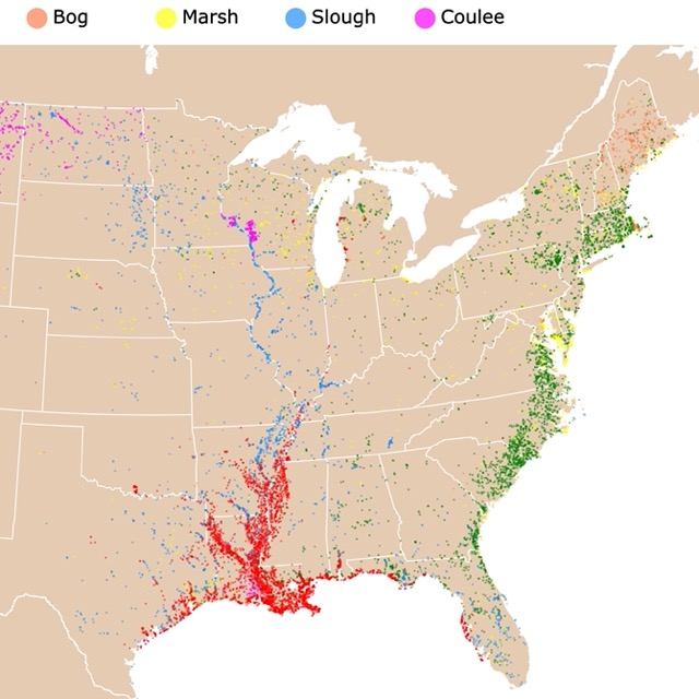
South Carolina has lots of marshes and swamps. To learn more, visit this map!
Carolina Sandhills National Wildlife Refuge
Carolina Sandhills National Wildlife Refuge is the orange polygon north of Sumter.
The Carolina Sandhills Refuge was established in 1939 to provide habitats for migratory birds, enhance natural resource conservation, and provide wildlife-oriented recreational opportunities for all to enjoy.
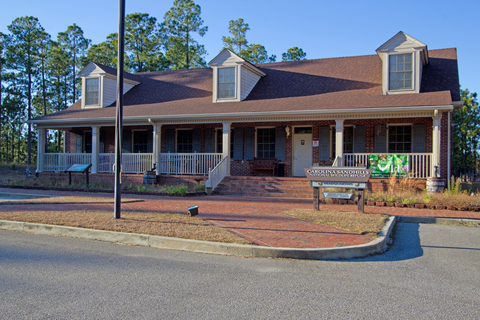
Much of the land was eroded and in poor shape, but thanks to conservation efforts, it has been restored.
The Sandhills Refuge is located in the Sandhills Physiographic Region of South Carolina. Along with the longleaf pine/wiregrass ecosystem, there are rolling sandhills, streamside pocosins (evergreen shrub wetlands with sandy peat soils), open fields, water ponds, and hardwood ridges.
The habitat shelters over 190 bird species, 42 mammals, 41 reptiles, and 25 amphibians. Botany fans will find over a thousand species of plants, including a rare pitcher plant species, the white-wicky, and Well's pixie-moss.
Bird and wildlife observation opportunities aren't all the park has to offer. Visitors can hike various trails, go backpacking, hunting, fishing, swimming, boating, and camping;Sandhills.
Table Rock State Park
Table Rock State Park is the lime area on the northwestern side of South Carolina, located at the edge of the Blue Ridge Mountains.
The park has incredible views of the open rock mountain that gives the park its name and serves as a backdrop for the 3-thousand-acre park.
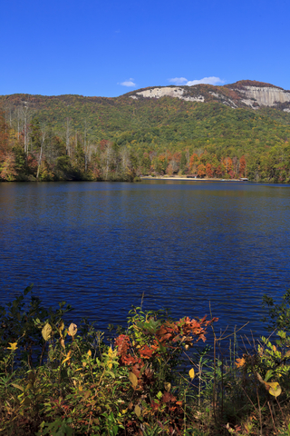
A Table Rock visitors enjoy the campgrounds, cabins, and an old-fashioned swimming hole on one of the two lakes at the park. The hiking trails at the park serve as an access point for the famous 76-mile Foothills Trail.
Hikers in South Carolina can use the foothills Trail to travel between several of South Carolina's State Parks. Hikers can journey past the waterfalls and mountain streams, all the way to the tops of Pinnacle and Table Rock Mountains.
While Table Rock State Park is well-known to many outdoor enthusiasts for its natural features, the park also has a place in history. Many of the cabins and other structures at Table Rock were built by the Civilian Conservation Corps (CCC), which still stands strong today. The buildings are on the National Register of Historic Places.
Visitors can enjoy a wealth of outdoor activities at Table Rock, including hiking, biking, boating, fishing, and geocaching. Opportunities are endless; Table Rock.
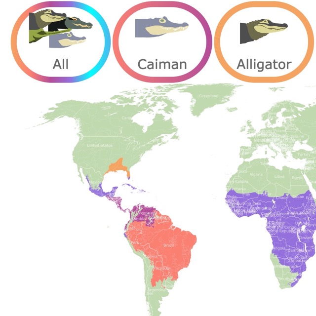
You can find alligators in South Carolina's swamps. To find more, check this map!
Jones Gap State Park
Jones Gap State Park is a lime green area north of Greenville.
The deep mountain cove at Jones Gap State Park is memorable, to say the least. There are pristine mountain woodlands, trails, the Middle Saluda River, and cascading waterfalls.
The park's trails and 13-thousand acres of precious mountain woodlands join the park with Caesars Head in what is known to many as the Mountain Bridge Wilderness Area.
The Mountain Bridge Wilderness Area has 11,000 acres of pristine and untouched woodlands in the state.
Jones Gap State Park trails make it easy for hikers to traverse between Jones Gap and Caesars Head. A portion of the tracks connects to the Palmetto Trail and the Foothills Trail.
The Middle Saluda River, the state's first designated river, runs through Jones Gap, offering some excellent trout fishing opportunities.
The living lab for the park's hands-on ecology learning center is an ideal place for both the young and old.
Fishing, bird watching, boating, canoeing, kayaking, and geocaching are only a handful of outdoor recreational activities for visitors to enjoy. While the park offers camping, there is no water or electricity to any sites, so you'll be backcountry camping; Jones Gap.
Caesars Head State Park
Caesars Head is next to Jones Gap in northeastern South Carolina.
The granite gneiss outcropping sitting atop the Blue Ridge Escarpment gives Caesars Head State Park its name. (Gneiss is a metamorphic rock with alternating layers composed of different minerals.)
Every autumn, the overlook on the top of the rocky peak of the Blue Ridge Escarpment, visitors can be a part of the Hawk Watch Program, with an incredible view extending into North Carolina and Georgia. During the program, participants count migrating hawks.
Visitors of Caesars Head are impressed by the incredible trails and opportunity for outdoor activity. The Raven Cliff Falls trail leads to a marvelous scenic overlook of the 420-foot (128m) cliff falls. A 6.6-mile round trip hike to a suspension bridge crossing the creek above the falls is exhilarating.
Fishing, picnics, hiking, and geocaching are some of the park visitor's favorites. Camping is also allowed on designated campsites Caesars.
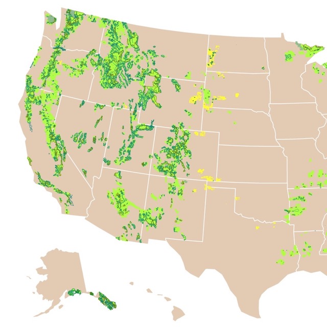
South Carolina has beautiful forests. To learn about the forest service and U.S. Forests, check this map!
Paris Mountain State Park
Paris Mountain State Park is just north of Greenville.
Paris Mountain is a mountain that stands alone, otherwise known as a monadnock. The small peak rises above the land surrounding downtown Greenville six miles to the south.
Paris Mountain Park preserves the heritage and natural beauty of the area. This park, like many others, was built by the Civilian Conservation Corps during the Great Depression. What was once a stone and timber bathhouse has been renovated and serves as the Park Center with a classroom, historical exhibits, and a gift shop.
The park is a popular spot for swimming, fishing, and paddling. The park offers 39 paved campsites with individual water and electricity hookups. The campsites include restrooms and showers; Paris S.P.
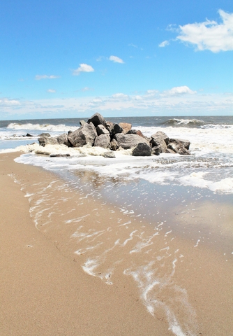
Huntington Beach State Park
Huntington Beach State Park is located southeast of Myrtle Beach on the Atlantic Coast.
Surf fishing, bird watching, and the abundant beauty of nature are what you'll find at Huntington Beach State Park. The Grand Strand Beach is an incredible place to spend a few days or a week.
The Atalaya Castle is an incredible landmark with its dramatic, Moorish-style look. Many weddings have been booked in the area because of the setting, and the castle, of course.
Art lovers deeply appreciate the Atalaya Arts and Crafts Festival held every September.
Nature fans love the park's wide variety of programs, including the opportunity to see endangered plant and animal species up close, including the loggerhead turtle. Huntington Beach's freshwater lake is an excellent place to see alligators and minks.
The park has standard and rustic campsites for visitors to stay overnight, Huntington Beach
Want to find places to explore in nearby Georgia? Check this map of North Carolina Parks
Hunting Island State Park
Hunting Island State Park is east of Beaufort on the Atlantic coast.
Hunting Island is one of the most popular state parks in South Carolina. Over a million people visit the park every year.
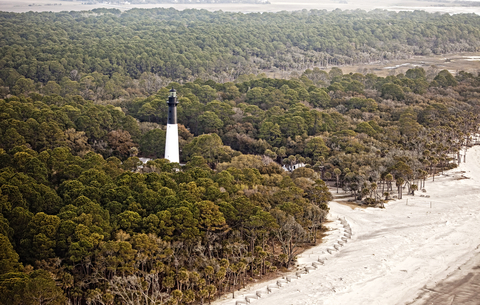
Hunting Island has five miles of pristine beaches, thousands of acres of maritime forests, marsh forests, a saltwater lagoon, and an ocean inlet. These features are only a portion of what the park offers to visitors.
The historic Hunting Island lighthouse is a major attraction. The lighthouse was built in 1859 but was destroyed during the Civil War, so it was rebuilt in 1875.
One of the most unique features of this lighthouse is that it was constructed using interchangeable cast-iron sections. Therefore, it could be dismantled if it ever had to be moved.
The park's campground has 100 campsites with electric and water hookups, a shower, restrooms, beach walkways, and a playground. The outdoor recreation opportunity is incredible, and the setting makes it even better; Hunting Island.
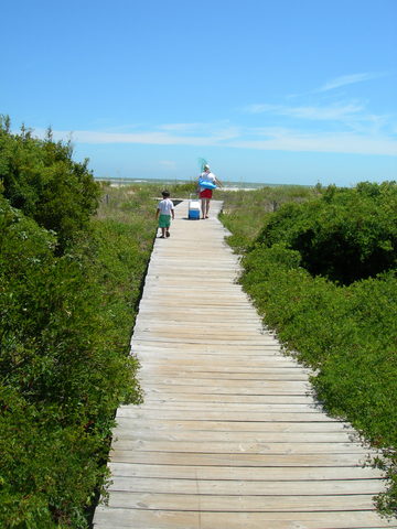
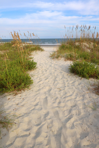
Edisto Beach State Park
Edisto Beach State Park is situated south of Beaufort on the coast, on Edisto Island.
Edisto Beach is one of four oceanfront state parks in South Carolina. It is loaded with seashells for visitors to collect.
The park features trails for both biking and hiking.
The environmental education center has exhibits highlighting the natural history of the island and the surrounding ACE Basin.
For those who want to spend a couple of days at Edisto Beach, there are furnished cabins nestled in the woods and campgrounds along the oceanfront. It's an incredible view! Edisto.
FOLLOW ME
Resources for South Carolina's Protected Areas Map
The shapefiles with South Carolina's state boundary lines, lakes, major rivers, and cities were downloaded from Natural Earth Data.
The Parks and Public Lands shapefiles for South Carolina were downloaded from USGS.
This map will be updated with new data! To receive updates on this and more nature maps, join my email list!!!!!!!
Made by Luz K. Molina with D3.js.