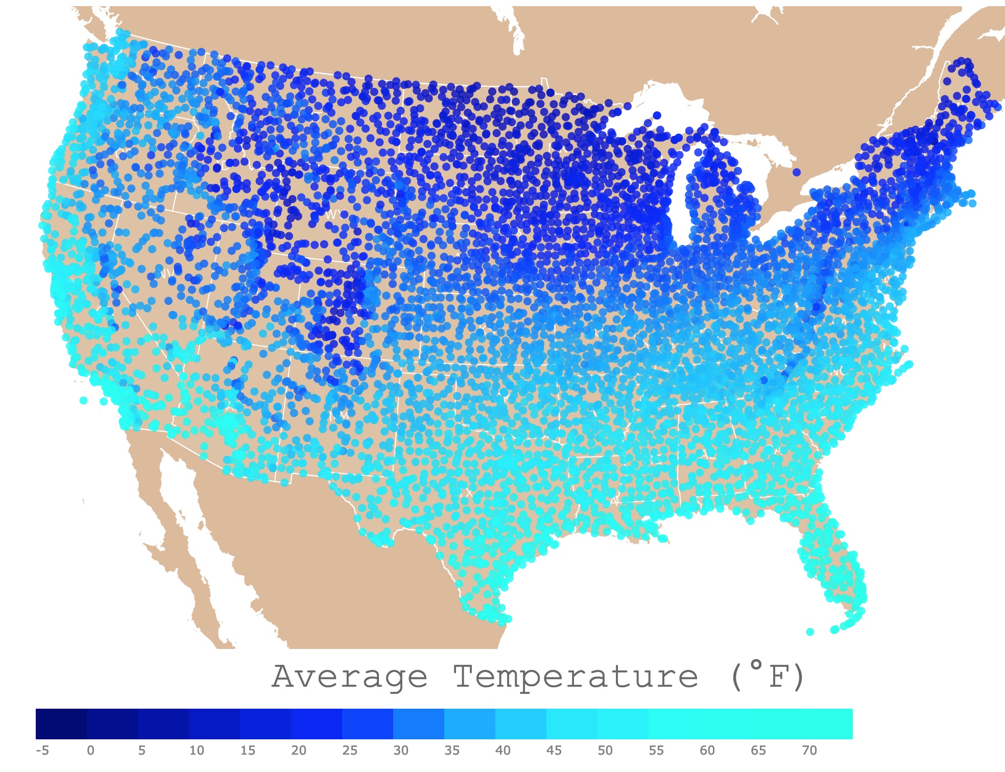
Winter Average Temperature Map
This interactive map displays the Long-term averages of winter average temperatures in the United States. For stations, winter temperature, and elevation, hover over the map. Zoom out to see Alaska, Puerto Rico, and Hawaii. Zoom in to see all stations in detail.
Average Temperature (°F)
Winter
Winter is the coldest season of the year in temperate and polar climates. This is caused by the Earth's tilt of the axis. It occurs when a hemisphere is oriented away from the sun.
The effects of winter in the northern hemisphere is variable. It depends on elevation, marine winds, and precipitation.
For example, areas in the middle of the country, like the central plains, have lower winter temperatures than areas in similar latitudes like San Francisco.
If you love checking the weather and cannot get enough of weather maps, Amazon has the AcuRite Iris (5-in-1) Indoor/Outdoor Wireless Weather Station. This station is for Indoor and Outdoor Temperatures. Humidity, Wind Speed and Direction, and Rainfall with Digital Display!
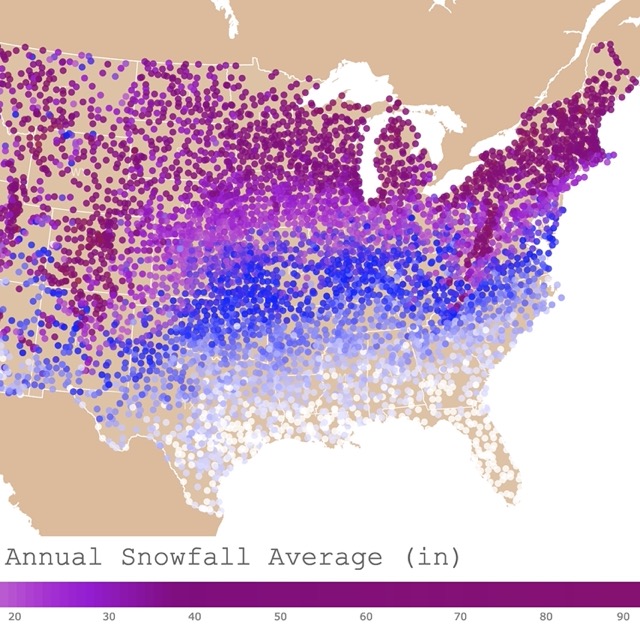
Interactive map of Annual Average Snowfall in the U.S.A.
Winter in the U.S.A
Winter conditions in the U.S.A. can vary significantly based on geographic location.
The country experiences diverse climates, ranging from the frigid temperatures of Alaska to the milder winters along the southern coasts.
Northern States and Alaska
These regions endure harsh winters with freezing temperatures, heavy snowfall, and icy conditions.
In places like Minnesota, Wisconsin, and the Dakotas, temperatures can plummet well below freezing, often reaching sub-zero levels.
Snowstorms and blizzards are common, creating challenges for transportation and daily activities.
Alaska experiences extreme cold, with temperatures dipping far below zero, accompanied by heavy snowfall in many areas.
Northeast
States like New York, Pennsylvania, and New England face cold winters with significant snowfall.
Cities like Boston and Buffalo often see heavy snowstorms, causing disruptions to travel and daily routines.
The Great Lakes region, including cities like Chicago and Cleveland, also experiences chilly temperatures and lake-effect snow.

Midwest
States such as Illinois, Ohio, Michigan, and Missouri endure cold winters with varying amounts of snowfall.
Temperatures can drop significantly, affecting daily life and necessitating snow removal and winterization measures.
Pacific Northwest
Areas like Washington and Oregon witness milder winter conditions compared to the northern and eastern parts of the country.
Rain is more common than snow in many coastal areas, though inland regions and higher elevations can experience snowfall.
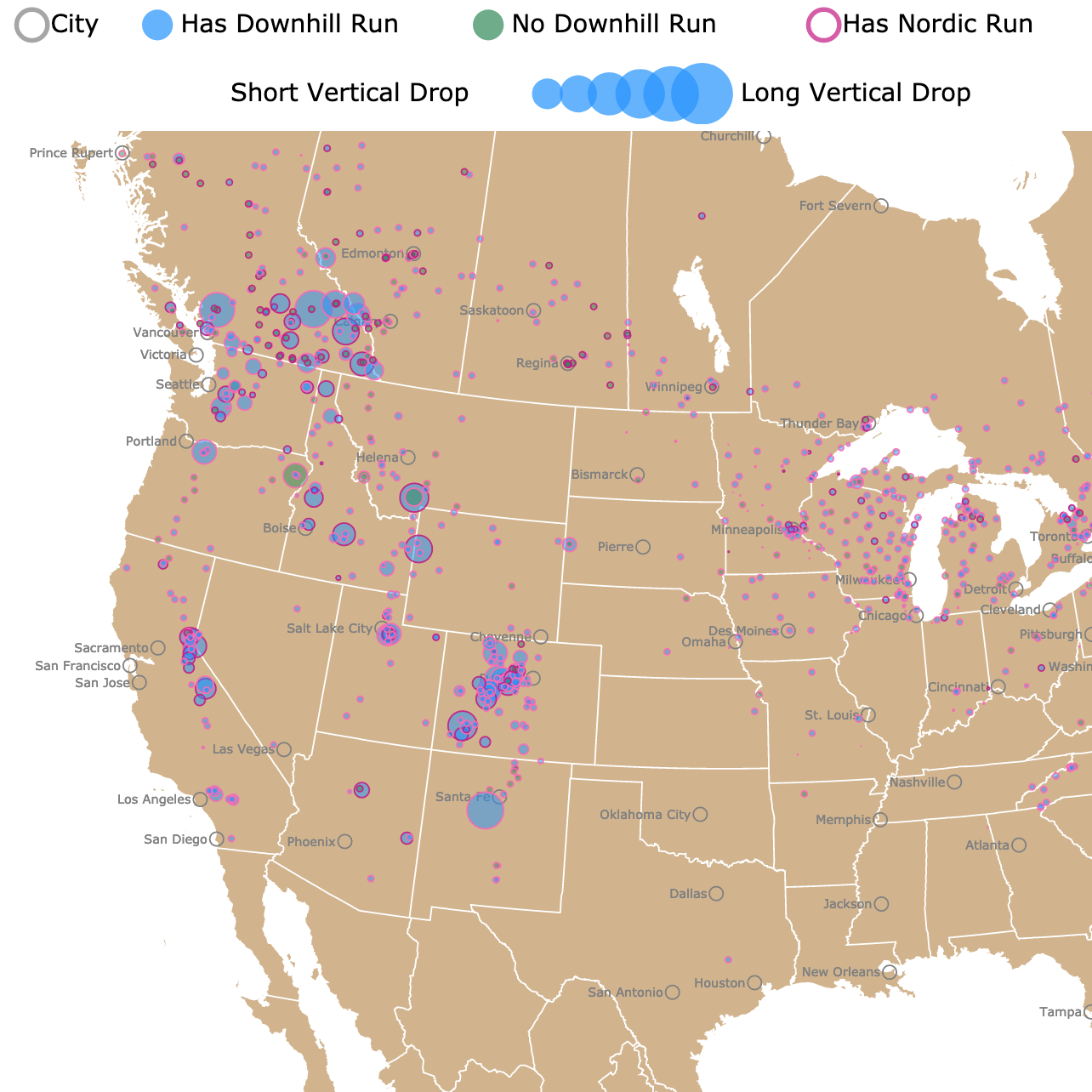
Interactive map of Ski Resorts in the U.S. and Canada
Southern States
States along the southern coast, such as Florida, Texas, and California, typically have mild winters compared to the rest of the country.

While they might not experience extreme cold or heavy snow, some regions can still have cooler temperatures and occasional frost or light snow in more northern areas.
In response to these varying conditions, different regions employ specific strategies to deal with winter weather. Northern states have well-established snow removal protocols, use salt and sand on roads, and often have winter tires or chains on vehicles.
Conversely, areas less accustomed to severe winter weather might experience more disruptions when faced with even moderate snow or ice.
Winter activities like skiing, snowboarding, ice skating, and festivals centered around the season are popular across the country, providing opportunities for outdoor recreation and celebration despite the cold.
Coldest Average Temperatures
As expected, the coldest average winter temperatures are found in Alaska:
- Prot Alcan: -82°F
- TOK: -77°F
- Wiseman: -71°F
- Battles: -70°F
- Fairbanks: -59°F
Climate science and meteorology require different skills and the analysis of big data. Coursera offers a specialization in Deep Learning that you can use in various fields of science and technology. For more information, go to THIS LINK!
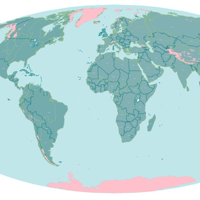
Interactive map of Glaciers worldwide
The coldest average winter temperatures in the Conterminous United States are:
- Hallock, Minnesota: 47°F
- Embarrass, Minnesota: 58°F
- Edmore, North Dakota: 62°F
- Langdon, North Dakota: 66°F
- Roseau, Minnesota: 69°F
Warmest Winter Average Temperatures
- Pago Pago, American Samoa 82.5°F
- Yap Island, Federated States of Micronesia: 82.3°F
- Kwajalein, Marshall Islands: 81.9°F
The warmest average winter temperatures in the Conterminous United States are:
- Marathon, Florida: 71°F
- Key West, Florida: 70.9°F
- Fort Lauderdale, Florida: 70.3°F
- Isla Morada, Florida: 70.2 °F
- Conch Key, Florida: 70.2 °F
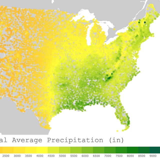
Interactive map of Annual Average Precipitation in the U.S.A.
Temperature Normals
"Climate normals are typically defined as 30-year averages of meteorological conditions, such as air temperature, precipitation, etc.
They are arguably the most fundamental attributes of the climate of a given locale. In fact, the terms normal and climatology are often used interchangeably." Source: NOAA.
These temperature normals displayed are from over 7,500 stations throughout the U.S.A.
The "mean temperature" is defined as the average of Maximum Temperature and Minimum Temperature for the day.
Follow Me
Resources for U.S. Winter Average Temperature Map
The temperature averages were downloaded from Anthony Arguez, Imke Durre, Scott Applequist, Mike Squires, Russell Vose, Xungang Yin, and Rocky Bilotta (2010). NOAA's U.S. Climate Normals (1981-2010). [Temperature-Inventory]. NOAA National Centers for Environmental Information. DOI:10.7289/V5PN93JP [November 2023].
The Shapefiles for this map were downloaded from Natural Earth.
Made by Luz K. Molina with D3.js.
This map will be updated with improved and recent information! To receive updates on this and more nature maps, join my email list!!!!!!!