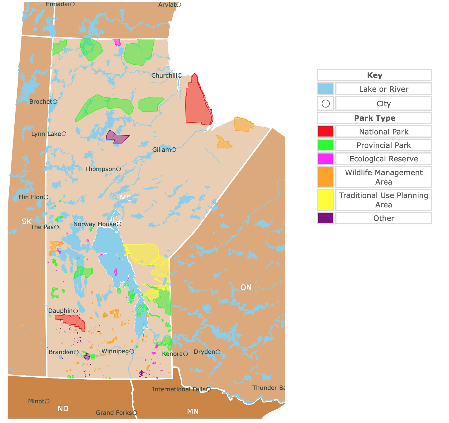
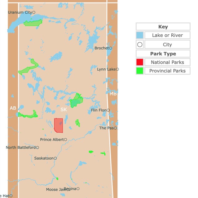
Map of Manitoba's Parks and Natural Areas
This interactive map shows the Locations, Names, Areas, and Details of National Parks, Provincial Parks, and Natural Areas of Manitoba. It also shows major cities and rivers for context. For more detail, zoom in. For more information, hover over the map, or scroll down.
| Key | |
|---|---|
| Lake or River | |
| ◯ | City |
| Park Type | |
| National Park | |
| Provincial Park | |
| Ecological Reserve | |
| Wildlife Management Area | |
| Traditional Use Planning Area | |
| Other | |
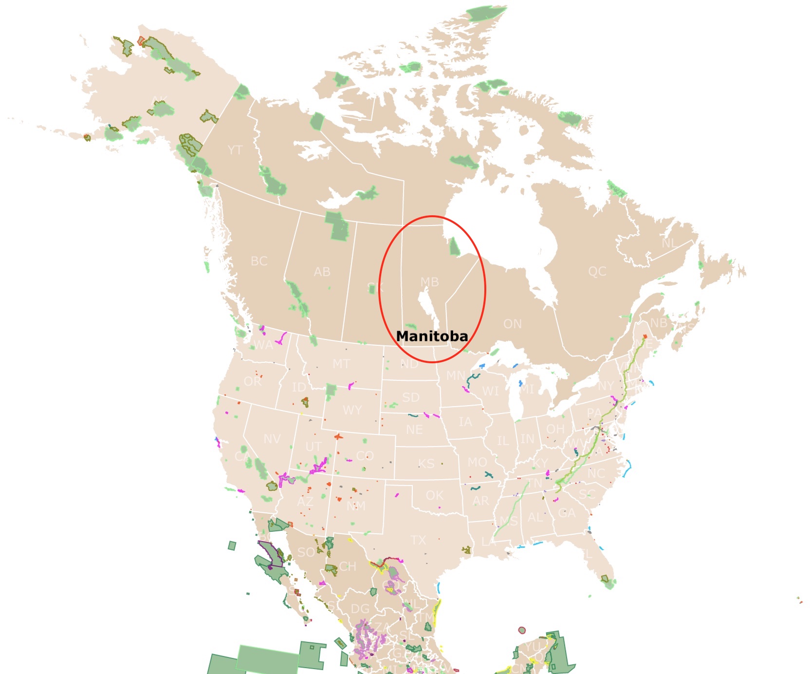
Geography of Manitoba
Manitoba is situated in the middle of Canada. Winnipeg, its capital is in the countrie's geographic center, is its largest city and has been named one of the coldest cities in the world.
‘Manitoba comes from a Cree word meaning “the narrows of the Great Spirit,” which is in reference to Lake Manitoba, as it narrows at its center.
Manitoba is bordered north by the Nunavut Territory and the Hudson Bay. To the east lies Ontario. The southern border of Manitoba is met by Minnesota and North Dakota. To the west lies Saskatchewan.
Manitoba is one of the Prairie Provinces and contains over 100,000 lakes, including Lake Winnipeg. Lake Winnipeg is one of Canada's largest freshwater lakes.
The far southern portion of Manitoba is part of the Saskatchewan plane, with rich prairie land and rolling pastures. To the north lies the Manitoba Lowland, a basin that once held the glacial Lake Agassiz, which left behind Lake Winnipeg, Lake Manitoba, and Lake Winnipegosis.
Much of Lake Winnipeg is a natural floodplain, but modern flood-control measures have mitigated the issue.
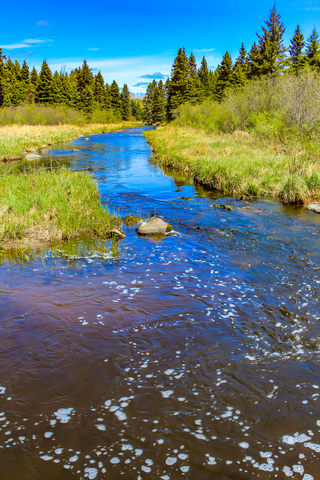
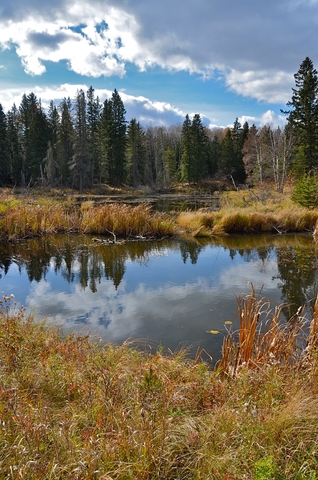
Over two-fifths of Manitoba's land is forested. The area comprises upland plateaus, limestone outcrops, forests, wooded river ballers, and swamps.
North and east of the lowland are the geologically ancient, Laurentian or Canadian Shield, an area of forests, rocks, and rivers. The Shield covers around three-fifths of the province, and it is drained by the Churchill and Nelson rivers into the beautiful Hudson Bay.
The Hudson Bay Lowland stretches roughly 100 miles (160 km) inland as a flat plain of tundra and bog-like muskeg. The region of Western Upland is along the Saskatchewan border.
The Manitoba Escarpment is formed by the Duck, Riding, and Porcupine mountains. The highest point is in Baldy Mountains at 2,727 feet (831 meters).
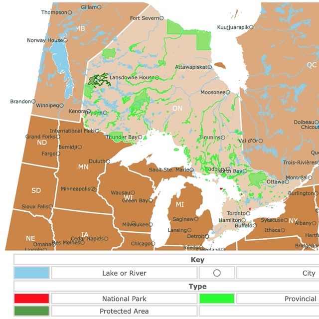
Want to find places to explore in nearby Ontario? Check this map of Ontario Parks
Manitoba's Climate
Manitoba experiences a moderately dry climate with rather sharp seasonal temperature changes.
Average daily temperatures range from 9°F (13°C) in January to 80°F (27°C) in July. The average lows vary from -9°F (-23°C) in January and 57°F(14°C) in July.
Winter temperatures can drop to about -40°F (-40°C) occasionally in any part of Manitoba, and summer temperatures may peak at 100°F (38°C) in the southern regions of the province.
The annual precipitation in Manitoba varies from about 14 inches (360 mm) in the north to 22 inches (560 mm) in the southeast.
Snow generally covers the ground from November to April in southern Manitoba and even longer in the north.
Manitoba's Wildlife
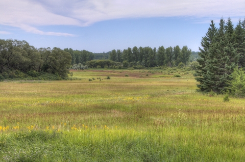
The southern region of Manitoba was once covered by open grasslands. Manitoba's southern plains are relatively treeless, other than the river valleys where aspen, willows, poplar, and oak are common.
The province comprises over 148,000 square miles (383,000 square km) of a forest. It includes open parklands of Manitoba maple, ash, oak, and elm in the south, transforming into a mix of a coniferous and broad-leaved forest.
Jack pine, black spruce, white birch, tamarack, and aspen are common trees in the north. While Hudson Bay is home to willow and spruce trees, sedges, moss, and lichens.
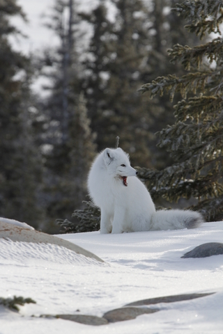
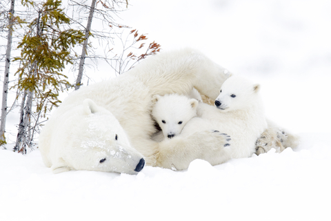
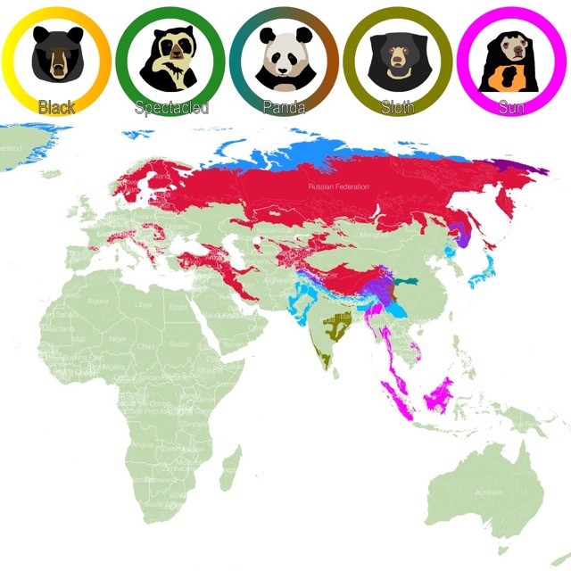
In the more southerly region of Manitoba, various mammals, including caribou, moose, martens, wolves, otters, Arctic foxes, cougars, black bears, elk, beavers, weasels, red foxes, and coyotes can be found. Polar bears can often be spotted roaming along the Hudson Bay.
Manitoba is home to prairie chickens, grouse, and other game birds in the uplands. Millions of ducks and geese breed in Manitoba's ponds and sloughs.
Bass, sauger pike, whitefish, trout, and pickerel are some of the fish, and beluga whales call the Hudson bay home.
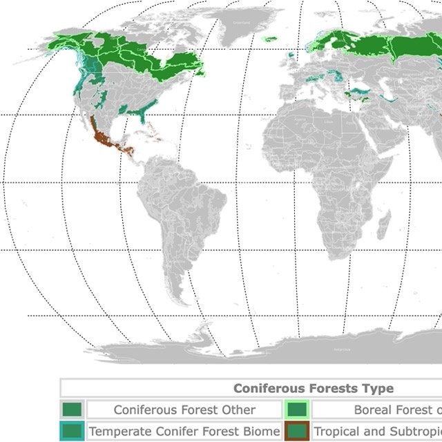
Map of Conifers and Boreal Forests
Stunning Parks in Manitoba
Before you decide which park you want to visit, remember in Manitoba open fires are prohibited from April 1 to November 15 annually. Except under a burning permit or in enclosed approved firepits such as grated campfire pits in provincial campsites.
Wapusk National Park
Wapusk National Park is the large red area in northeastern Manitoba, within the range of Western Hudson Bay.
Wapusk National Park is a broad wilderness area in the remote subarctic. The 4,430 square miles (11,475 square km) park is located at the transition between the arctic tundra and boreal forest.
The park protects one of the world's largest polar bear maternity den areas. The park has about 1,000 bears roaming the land.
The park features aerial tours where visitors can fly in by helicopter for an incredible experience and view. During the fall, Cape Churchill is the place to view polar bears in their natural element.
Canoeing, stargazing, wildlife viewing, photography, and several programs and tours are available at the park.
A canoe excursion along the Owl River is available for the entire month of June, and its a popular activity. According to the Government of Canada, the Owl River canoe excursion traverses 104 miles (168 km), the entire breadth of Wapusk National Park, lasting four to seven days.
Riding Mountain National Park
Riding Mountain National Park is the red area in southwestern Manitoba.
The park is located in Treaty 2 Territory, where park officials work together with Anishinabe, First Treaties 2, 4, and 1. The Indigenous contributions are honored and highly recognized by the province of Canada.
Riding Mountain National Park is home to grasslands, forests, lilies, orchids, lakes, and wetlands brimming with life.
Visitors need to be cautious of bears, wolves, and bison!
Riding Mountain offers a lengthy list of recreational opportunities. Camping opportunities are abundant and include backcountry camping and oTENTik options.
The park features over 250 miles (400 km) of beautiful hiking trails. Visitors can enjoy a short walk or a day-hike around Moon Lake or Grey Owls cabin.
Swimming, tennis, kite surfing, horseback riding, geocaching, mountain biking, cycling, kayaking, and canoeing are a few favorites at Riding Mountain.
Expedia has packages to visit this unforgettable park. For details and prices visit this link!
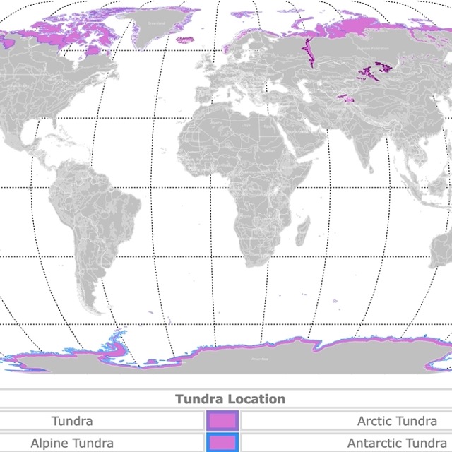
Map of Tundra Worldwide
Whiteshell Provincial Park
Whiteshell is the lime area northeast of Winnipeg.
Imagine transparent lakes, flowing rivers, sandy beaches, and fragrant scents of pines.
Whiteshell is home to a meteorite lake where scuba divers and swimmers enjoy cool waters, and little ones spend a day playing around.
Visitors can indulge in a peaceful round of golf, hike one of its many trails, or admire one of the 200 lakes. Anglers can toss out a line and try to reel in northern pike, walleye, bass, lake trout, and rainbow trout.
The park is open year-round, and visitors who want to spend the night at the park can select from different options. A private campsite by the river, a beach campsite with a playground, a group campsite, a family resort, or a rustic cabin.
Whether you are interested in watching wildlife and identifying flowers, swimming, camping, or tanning on the beach, Whiteshell might be the place for you; Whiteshelll.
For ticket prices to and from Winnipeg, check Expedia. Expedia also has packages, cars, and hotels you can find in Manitoba.
Spruce Woods Provincial Park
This park is the lime speck west of Winnipeg.
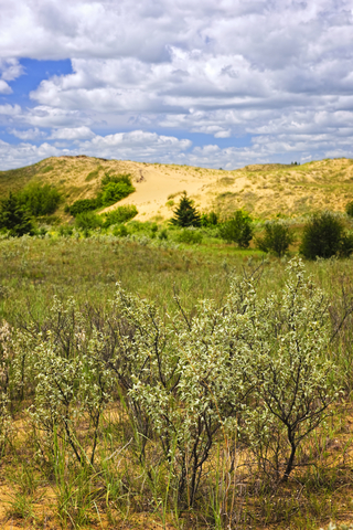
Spruce Woods Provincial Park is a natural wonder. There are sand dunes, rare animals like the hognose snake, and unique plants like the pincushion cactus. Yes, there are cacti in the heart of Canada.
The park is also a place of contrast, as visitors also find the Devils Punch Bowl, a blue-green oasis of spruce trees, and a spring-fed pond.
After a long hike, spend the rest of the day cooling off in the riverbank forests, wander through the fields of sweet mixed-grass prairie, or capture photographs from the Steels Ferry Overlook.
The Kiche Manitou campground offers visitors a range of activities, sites, and services. Group camping is available as well.
For the wild and free wilderness fans, the park features five backcountry sites and the Jackfish Lake Cabin, all along the Epinette Creek trail system.
Horseback riders are welcome to overnight at the Equestrian campground, Spruce Woods.
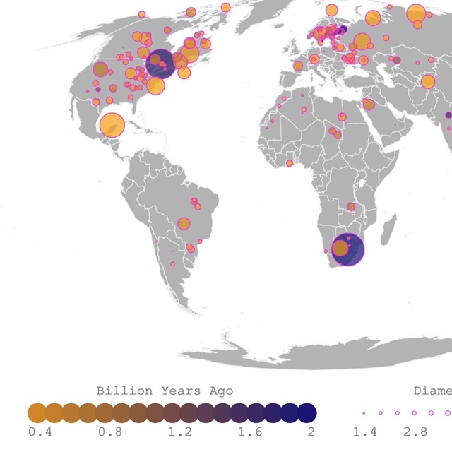
World Map of Meteorite Landings
Grand Beach Provincial Park
Grand Beach is a lime speck north of Winnipeg on the shores of Lake Winnipeg.
Grand Beach Provincial Park features 39-foot (12 meters) high dunes and miles of warm sandy beaches with gentle waves from the prairie along Lake Winnipeg, Canada's sixth-largest lake.
The endless views of the water, grass-topped dunes, and powdery white sand make this park one of the top beaches in North America.
Swimming, sunbathing, fishing, sailing, windsurfing, board sailing, canoeing, and boating are popular activities at this park.
The Grand Beach campground offers both basic and electrically serviced sited. Adjacent to the park, visitors will find cottage rentals; Grand Beach.
There is no reason to settle for swimming by the lake when you can take your own paddle board. Amazon has the Stand Up Paddle Board. It is ultra-light and inflatable. It comes with a paddle, a leash, a hand pump, and a backpack. It is perfect for beginners, as it has superior stability and maneuverability.
Little Limestone Lake Provincial Park
Little Limestone Lake Provincial Park is the small lime area southwest of Norway House.
Little Limestone Lake is considered one of the world's largest marl lakes. It is about 9.3 miles(15Km) long. According to Canadian Geographic, marl lakes change color with temperature changes.
The bedrock of limestone beneath the lake releases calcium carbonate into the water in the form of crystals (marl). The marl turns the lake into a cyan hue. When it cools, the calcite dissolves, and the lake is transparent again.
There are no docks, but motorboats, canoes, and kayaks are allowed.
Visitors who wish to overnight at the park have to rough it, as the only camping available is basic tent camping.
camping. The summer months bring the most beautiful colors to Little Limestone Lake. They provide beautiful blue hues that make you feel like you're on a Caribbean Island, Little Limestone.
For remote sites like this, Amazon has Explorer K2 Inflatable Kayak. This is a 2-person kayak with aluminum oars and directional stability. It comes with a pump and removable seats. Perfect for a lake like Little Limestone.
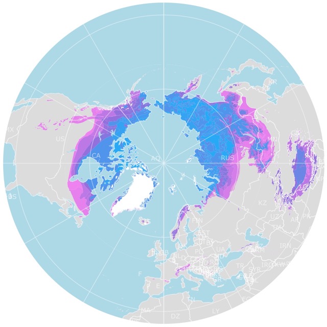
Map of Arctic Permafrost
Hecla Provincial Park
The park is a series of islands between the east and western shores of Lake Winnipeg. They are depicted in lime on the map above.
With names such as Drumming Point and Black Island, the park gives us a bit of insight into the ways of the Anishinabe (Ojibwe) medicine men.
The park has a rocky coastline, a dense forest, scenic beaches, and wildlife worth your time.
Visitors can enjoy a day on the sandy beaches and stroll along the limestone-cobbled shores. You can hear the beautiful sound of the waves from Gull Harbours 18-hole golf course. Explore the Hecla lighthouse, and enjoy the stunning view from the top.
Hecla Island is a prime location for outdoor activity in what many consider a year-round natural playground. Visitors definitely enjoy many hiking and cross-country ski trails.
The park features individual and group campsites, family vacation cabins, a year-round bed and breakfast, luxury resort accommodations, and motel units.
Clearwater Lake Provincial Park
The lime speck in western Manitoba, west of Norway House.
Clearwater Lake gets its name from the crystal clear waters allowing us to see the bottom, at 36 feet (11 meters) deep. Anglers love the fishing opportunity to catch northern pike, lake trout, and whitefish.
Visitors can explore and enjoy the white beaches and conifer forests. Spend a few nights at one of the campsites; Campers Cove offers basic and electrically serviced sites. You can also choose from walk-in tent sites of Pioneer Bay and lodges that are available year-round; Hecla.
Duck Mountain Provincial Park
Duck Mountain Provincial Park is the lime area northwest of Dauphin.
Duck Mountain is a secluded park with rolling hills, boreal forests, beautiful wetlands, and valley meadows.
The park is dotted with lakes left from a glacial past and currently fed by springs.
Accommodations range from wilderness camping and electrical campsites to two Camp-Easy yurts, a lodge with modern cabins, and townhouses available for rent. In-park accommodations are available year-round at Duck Mountain.
Wildlife includes waterfowl, black bears, moose, lynx, white-tailed deer, wolves, and coyotes.
The family-friendly park features a wide range of recreational opportunities, including fishing, biking the Trans Canada Trail, self-guided trails, interpretive trails, hiking, fishing, swimming, and more; Duck Mountain.
Map of Bears Geographic Range
Birds Hill Provincial Park
Birds Hill Provincial Park is the lime speck northeast of Winnipeg.
Birds Hill Provincial Park is a place where visitors can explore hills, ridges formed by glaciers, oak and aspen forests, native wildflowers, rare orchids, waterfowl, deer, and songbirds.
Take a hike, go biking or cycling, or horseback ride on equestrian trails.
Bird Hills is open year-round, setting the stage for numerous recreational activities and sports events.
The park is home to the Winnipeg Folk Festival, which takes place every July. That's not the only event at the park; visitors will also find cycling races, horse shows, and polo tournaments.
Small and large groups can enjoy a beautiful picnic.
The park features basic and fully serviced campsites. The full-service grounds can be found along South Drive, near the lake, and it includes a full range of support services; Birds Hill.
Nopiming Provincial Park
The small lime area northeast of Winnipeg on the border with Ontario is Nomping Provincial Park.
In the Anishinabe language, Nopiming translates to "Entrance to the wilderness".
The park's entrance road leads to miles of Canadian Shield country scattered with hundreds of beautiful crystal clear lakes, bordered with granite rock, and sheltered by black spruce, birch, and poplar stands.
Bring your canoe and traverse the waterways that have carried the travelers and Aboriginal people for thousands of years.
Visitors can explore the land to discover equipment remains and abandoned shafts from the 1930s during Manitoba's gold rush. The old trapper's cabin is a beautiful piece of history to be explored; Nopiming.
Want to find places to explore in nearby Saskatchewan ? Check this map of Saskatchewan Parks
Beaudry Provincial Park
The lime speck is just west of Winnipeg.
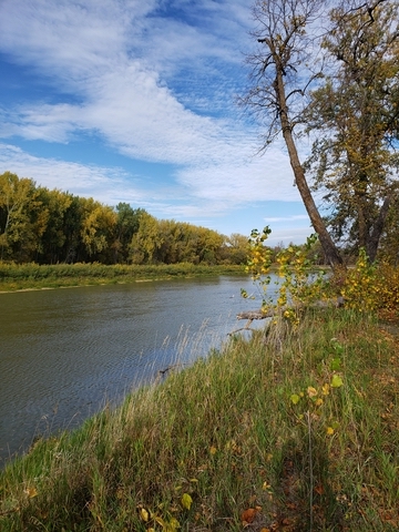
Beaudry Provincial Park welcomes you to the river bottom forest year-round. The woods are home to some of the region's largest cottonwood, maple, and basswood trees.
Hikers can choose from trails like the Wild Grape or Elm Trail that twist along the southern bank of the Assiniboine River. On both sides of the well-marked path, you'll find lush green fern carpets and wild grape vines that rise 40 feet (12 meters) into the treetops.
Nature and wildlife lovers have opportunities to glimpse white-tailed deer, raccoons, beaver, fox, owls, and muskrat, to name a few.
Bring your canoe and paddle the Assiniboine leisurely. Outdoor recreational opportunities are abundant.
Resources for Manitoba's Protected Areas Map
The shapefiles with Manitoba's state boundary lines and cities were downloaded from Natural Earth Data.
The National Parks of Canada shapefile was downloaded from Open Canada.
The shapefile with Manitoba Parks and Natural Areas was downloaded from Manitoba Land Initiative.
The shapefile with rivers and lakes from Canada was downloaded from Open Canada.
This map will be updated with new data! To receive updates on this and more nature maps, join my email list!!!!!!!
Made by Luz K. Molina with D3.js.