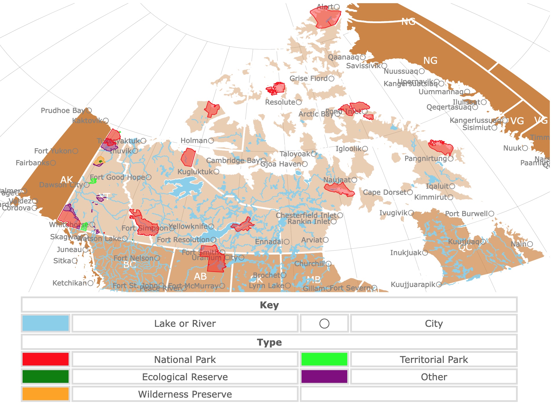
Map of Northern Canada's Parks and Territorial Parks
This interactive map shows the Locations, Names, and Details of National Parks, Territorial Parks, Protected Areas of Yukon, the Northwest Territories, and Nunavut. It also shows major cities and rivers for context. For more detail, zoom in. For more information, hover over the map, or scroll down.
| Key | ||||
|---|---|---|---|---|
| Lake or River | ◯ | City | ||
| Type | ||||
| National Park | Territorial Park | |||
| Ecological Reserve | Other | |||
| Wilderness Preserve | ||||
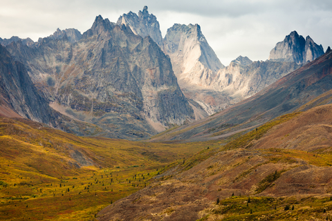
Northern Canada's Geography
This map depicts the parks in Northern Canada. It includes Yukon, Northwestern Territories, and Nunavut.
Yukon
Yukon is in the northwest corner of Canada. It borders Alaska to the west, the Arctic Sea to the north, the Northwest Territories to the east, and British Columbia to the south.
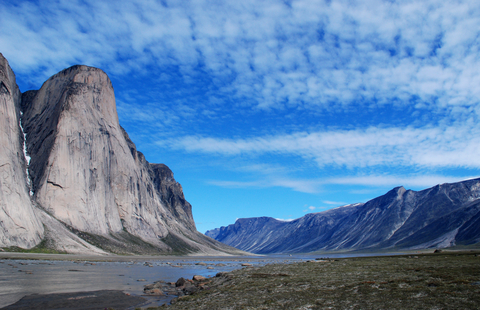
Most of the Yukon is dominated by the Cordillera region, characterized by mountains. Mount Logan is Canada's highest peak, with 19,550 feet (5,959 m).
Here also lie the largest non-polar ice fields in North America.
Northwest Territories
The Northwest Territories are surrounded by Yukon to the west, the Arctic Sea to the North, Nunavut to the east, and Saskatchewan, Alberta, and British Columbia to the south.
This territory has the Arctic Archipelago to the north, the Cordillera to the west, Interior Plains in the center, and the Canadian Shield to the east.
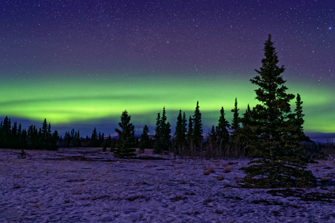
The Northern Lights or Aurora Borealis are visible in the Northwest Territories 240 nights per year. Yellowknife is right below the Aurora Oval; the best place in the world to witness the phenomenon.
The Arctic Archipelago has a severe climate and permafrost. The Interior Plains is fairly flat. The Canadian Shield is an undulating rocky surface with low elevations.
Nunavut
Nunavut is Canada’s largest province/territory with a total area of 2,093,190 Km2. (almost 1 million square miles). Now that’s huge!
Nunavut is surrounded by the Arctic Sea to the north, Hudson Bay to the east, Manitoba to the south, and the Northwest Territories to the west.
Nunavut is comprised mainly of the Arctic Archipelago and the Canadian Shield.
The Arctic Archipelago is a polar desert as the climate is dry and cold.
The Canadian Shield is at least 1 billion years old. It has a thin layer of soil and is covered by lakes and rivers. Nunavut contains 21% of Canada's freshwater.
Want to find places to explore in nearby Quebec? Check this map of Quebec Parks
Northern Canada Climate
Yukon experiences cold winters and hot summers.
Nunavut experinces long cold winters and cool summers. The northern archipelago receives 100 to 200 mm (3.93in to 7.87in) of precipitation yearly.
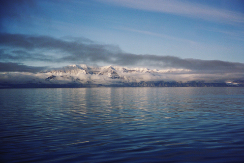
The average annual temperature on Baffin Island may be as low as -4°F (-20°C) in the north and 21°F (-6°C) in the south. Source: The Canadian Encyclopedia.
Northern Canada Wildlife
To the west, the cordillera is mainly covered with Boreal Forest. The Arctic Archipelago has very poor soil, and the vegetation is mainly Tundra. The ground is soggy and covered with marshes and lakes in summer.
Nunavut has dwarf shubs, grasses, mosses, and lichens. There are also a few flowering plants.
Marine animals include beluga whales, Polar Bears, seals, and walruses.
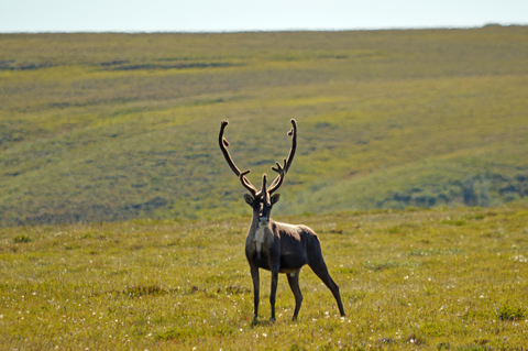
Terrestrial animals include Caribou, Black Bears, arctic foxes, beavers, wolves, bison coyotes, ravens, and porcupines.
Best Parks in the Yukon Territory
Kluane National Park
The large red area in Yukon Territory's southwestern corner is Kluane National Park.
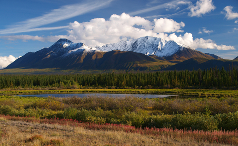
Kluane is located high in the mountains of southwest Yukon and is a land of maximums. Kluane National Park is home to 17 of the 20 tallest mountains in Canada, including the highest peak in Canada, Mount Logan.
The park is also home to the largest non-polar ice fields in the world and the most genetically diverse grizzly population in North America.
Here, visitors find mountain goats, dall sheep, caribou, black bears, and wolves.
As you pass by massive glaciers, rafting along the remote Alsek River is awe-inspiring. Hardcore hikers and backpackers appreciate the multi-day hikes while exploring the high mountain passes.
For visitors in search of a more accessible adventure, Kathleen Lake is an excellent area for hiking, and it's just off the highway.
The park's visitor center should be the first place you stop, as it lays out all recreational options, including flightseeing; Kluane.
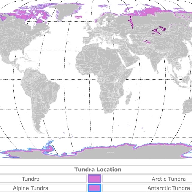
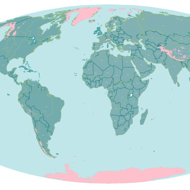
Map of World Tundra
Ivvavik National Park
Ivvavik National Park is represented in red on the map. It is in the northwestern Yukon Territory, above the Arctic Circle. The only way to reach this park is by plane.
Ivvavik is the first national park to be created in Canada due to an Indigenous land claim agreement in 1984, known as the Inuvialuit Final Agreement.
The park protects a portion of the porcupine caribou herd's calving grounds (birthing grounds).
Visitors can raft through mountain valleys and slot canyons on an expedition along the Firth River, taking them from Ivvavik's interior to the Arctic Ocean.
Flying into Ivvavik Base Camp makes an excellent multi-day Arctic adventure, including hiking, fishing, and catered meals.
Wildlife watching, hiking, backcountry camping, and wilderness photography are popular activities at the park. While adventuring the park, keep your eyes peeled for one of the infamous Red Chairs in Ivvavik.
Fly fishers and cast-rod anglers can catch up on some fishing. The two main sports fish species at Ivvavik are the Arctic grayling and the Dolly Varden char.
Because this is a remote park, visitors have to be self-sufficient and self-reliant; The Planted.
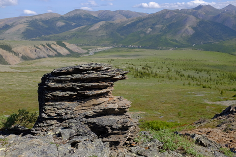
Tombstone Territorial Park
The lime area in western Yukon Territory is Tombstone Territorial Park.
The park has beautiful arctic tundra and impressive wildlife. The landscape has varied niches that resulted in diverse flora and fauna for this latitude.
There are also rocky peaks, permafrost landforms, and First Nations Culture to learn from.
There is something to do for people of all abilities, ages, and interests. It's a prime location for hiking, wildlife viewing, car camping, backcountry camping, and various winter recreation.
Tombstone Interpretive Center is open from mid-May through mid-September. The facilities include a gift shop and wheelchair-accessible toilets. Outdoor information boars contain information about the trail conditions, wildlife sightings, and bear safety. Sign up for an interpretive guided hike or a campfire program.
Tombstone Mountain is the only campground that's road-accessible in the park. The campsites are available on a first-come, first-served basis, with self-registration onsite.
The Tombstone Interpretive Center is the best place to start at Tombstone Territorial Park. Due to its location, the park has no cellphone service Tombstone.
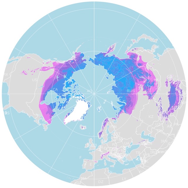
Map of Arctic Permafrost
Best Parks in Canada's Northwest Territories
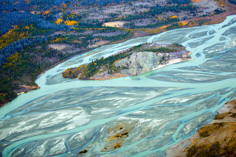
Nahanni National Park
Nahanni National Park is the large red area in the southwest of the Northwest Territories.
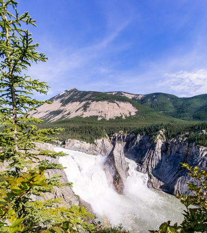
The park encompasses 11,583 square miles (30,000 square kilometers) and is a designated UNESCO world heritage site.
Nahanni National Park is a paradise for those who favor remote wilderness adventures. Nahanni has a unique landscape found nowhere else.
Paddlers can explore the heart of the reserve on water, while mountaineers explore by land.
There are several places that visitors cannot miss:
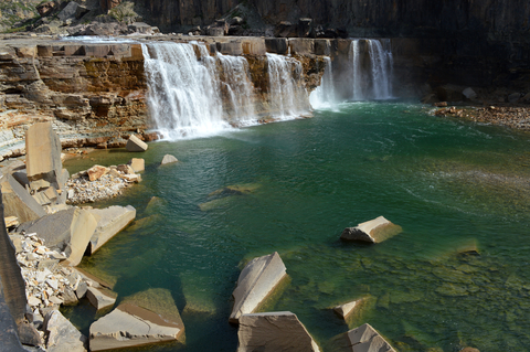
- Virginia Falls: These falls are 314 feet (96m) high and divided by a spire resulting in a breathtaking exhibit of water's power.
- Cirque of the Unclimable's: are impressive granite spires that look like giant daggers. This is an alpinist dream!
- Ram Plateau: is a grassy mesa over the incredible scenery of plateaus, river gorges of 5,905 feet (1,800 m), and hoodoos.
- Nahanni River: This wild river is the most scenic path in the country. It has canyons, hot springs, rapids, mountains, waterfalls, and wildlife.
- Lakes: The lakes are serene and perfect for fishing.
The Dehcho First Nations welcome outdoor enthusiasts to this land. Visitors can learn about the cultural history, cultural ways, and history.
Visitors can tour the park, finding interpreters conveying the Dene culture to those wishing to learn.
Canoeing, camping, hiking, wildlife observation, mountain climbing, fishing, and paddling are a handful of popular park activities.
Dene guides lead interpretive walks through the community to share their knowledge about the culture, history, and traditional life during the Nahanni Butte Community Experience.
For those not afraid of heights and willing to sightsee from the air, the park offers the Nahanni Day Flight Experience.
While there are no formal established trails in Nahanni Park, heavy use and travel has paved the way for some of the park's most popular trails; Nahanni.
So much beauty in such a remote place deserves a memorable picture. Amazon has the Canon EOS Rebel Camera for this task. With a 24.1 Megapixel CMOS (APS-C) and sensor with is 100–6400 (H: 12800), it is perfect for keeping this unforgettable scenery. It also has an optical viewfinder with approximately 95% viewing coverage.
Tuktut Nogait National Park
The red area in the northeast of the Northwest Territories is Tuktut Nogait National Park.
Tuktut Nogait is one of the most isolated parks in North America. Rescue services and facilities are limited, meaning visitors should be knowledgeable and experienced in survival and first aid.
Visiting Tuktut requires visitors to be self-reliant, self-sufficient, and completely capable of handling emergency situations that may arise.
There is a rescue team based in Inuvik. Still, the rescue operations depend on the weather conditions, as well as aircraft and staff ability. Again, visit at your own risk.
Those that want to see and experience the landscape and wildlife must be willing to travel 105 miles (170 km) north of the icy Arctic Circle. The park features three major river systems, rolling hills, waterfalls, barren-ground caribou, and steep canyons.
Let's not forget about some fierce predators that call the area home, including elusive wolverine, arctic wolves, and grizzly bears.
The park is named after the Bluenose West Caribou. It is born in the area when the migratory herd returns home to their calving grounds every spring.
The wildflowers that blanket the tundra are beautiful and best viewed during day hiking, backpacking, and paddling expeditions on the tributaries, Tuktut.
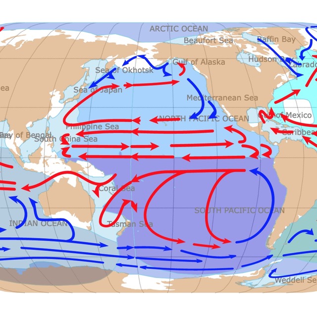
Map of World Ocean Currents
Thaidene Nene National Park
The red area in the eastern Northwest Territories is Thaidene Nene National Park.
Thaidene Nene (The Land of The Ancestors) is an Indigenous Protected Area in the Northwest Territories.
Thaidene Nene National Park is managed by the Indigenous governments with a cultural connection to the land: Lutsel K'e Dene First Nation, Deninu Kue First Nation, Northwest Territory Metis Nation, and Yellowknives Dene First Nation.
A place where the subarctic boreal forest and barrens meet at the shore of one of the world's largest freshwater lakes.
The area is culturally rich and has a spiritual significance, which is why the continued relationship between the Indigenous people and the land is so important.
The Land of Ancestors is a place where visitors can go sea kayaking and canoeing past moose and muskox travel by boat to the fabled Pike's Portage.
This is an angler's paradise for lake trout, whitefish, Inconnu, or Arctic grayling.
Visitors can choose to explore remote areas of the park or enjoy a fully catered experience with a licensed tour operator. Go for a flightseeing trip for a birds-eye view.
Enjoy some time berry picking before having lunch on the shore and pitching a tent for the night; Thaidene Nene
If you plan to go fishing in Thaidene Nene, you might as well take some fishing gear with you. Amazon has the Ghosthorn Fishing Rod and Reel Combo. This is a graphite telescoping fishing pole. It is collapsible and therefore portable with a travel kit and carrier bag. It is also lightweight and flexible, rust-proof.
Aulavik National Park
The red area is Banks Island, in the northern region of the Northwest Territories.
Aulavik means “place where people travel” in Inuvialuktun. The park protects 4,633 square miles (12,000 square km) of arctic lowlands.
This is a polar paradise of crystal clear rivers and various landscapes, including fertile river valleys, polar deserts, buttes, badlands, bold seacoasts, and rolling hills.
The Thomsen River is considered the northernmost navigatable river in the world, and it drains into the Arctic Ocean. Visitors enjoy kayaking, canoeing, and paddling down the river.
The park has no trees or hiking trails. Since the landscape is open, hikers can take any direction they want. Hikers find tundra muskox, wildflowers, and archeological sites as they hike.
It is estimated that half of the world's muskoxen live on Banks Island. 10,000 of them live in Aulavik National Park.
Aulavik Park is another incredibly isolated park with limited rescue services and facilities. Visitors must be self-reliant, self-sufficient, and able to handle emergencies that could arise.
The park is only accessible by air; Aulavik
Map of Glaciers Worldwide
Nunavut Territory
Ukkusiksalik National Park
Ukkusiksalik National Park is the red area in the eastern Nunavut Territory.
Ukkusiksalik National Park allows visitors the opportunity to view the pristine Barrenlands terrain with its abundance of Arctic wildlife. There are polar bears, grizzlies, Arctic wolves, caribou, lemmings, seals, and even beluga whales!
Travelers can hike along the Sila River, stop at the incredible reversing waterfall, and visit the remnants of the old Hudson's Bay Company trading post.
The Archives of Manitoba has an extensive fur trade post map of all of the HBC, Hudson's Bay Company.
It is possible to travel on foot and by boat. Travelers can spend the day snowmobiling into the park in early spring across the frozen sea ice.
The concentration of wildlife and numerous cultural sites make the park excellent for nature lovers and cultural anthropologists, Ukkusiksalik.
Auyuittuq National Park
On Baffin Island, the red area in the eastern Nunavut Territory is Auyuittuq National Park. This is Nunavut's most accessible and most popular National Park.
Granite peaks, towering fjords, and glistening glaciers overlook the beautiful tundra valleys of Auyuittuq. 85% of the landscape is rock and ice.
The twisting waterways in the park are teeming with narwhales and ringed seals.
Visitors can hike alongside the ice-cold, thundering streams among the wildflower-dotted meadows.
Akshayuk Pass is a natural corridor naturally carved through a landscape of towering rock. The Pass is a popular destination for experienced mountaineers and backcountry skiers.
Nature lovers can spot Arctic foxes, snow geese, and the human-shaped Inuksuit. Inuksuit are manmade stone landmarks built by Canada's Indigenous people.
Skiing, snowmobiling, and dogsledding are popular activities at the park; Auyuittuq.
For freezing temperatures, Amazon has the Wantdo Jacket. TThis is a mountain waterproof, windproof jacket. It comes with elastic fabric and premium insulation. It can be cleaned in a washing machine.

Map of North America's Marine Ecoregions
Sirmilik National Park
Sirmilik National Park is the red area in northern Nunavut Territory, on Baffin Island.
Sirmilik landscape boasts one of the most diverse and abundant wildlife populations in the Arctic.
Visitors like to go to Floe Edge areas. Floe Edge areas are where sea currents keep ice from reforming once it starts to break during spring. These sites are used by polar bears and arctic birds to feed. They are also sites where narwhals and beluga whales breathe.
Sirmilik National Park is a relatively easy-access Arctic. While ice fields can be traversed, mountains climbed, and the waterways traveled by paddle boats, the park welcomes day-hikers to explore the hoodoos and cultural sites too.
Adventurers can take a multi-day trip across the frozen seas for an unforgettable experience that only happens once in a lifetime; Sirmilik.
Qausuittuq National Park
The red area in northern Nunavut Territory is Qausuittuq National Park.
The word Qausuittuq means “place where the sun doesn't rise” in Inuktitut.
The rolling tundra is home to Peary Caribou, an endangered species.
It's an excellent area for whale watching, birdwatching, hiking, and ski tours. Make sure you bring excellent gear with you, a warm sleeping bag, and a tent; Qausuittuq.
FOLLOW ME
Resources for Canadian Territories' Protected Areas Map
The shapefiles with Canadian Territories' state boundary lines and cities were downloaded from Natural Earth Data.
The National Parks of Canada shapefile was downloaded from Open Canada.
The shapefile of Yukon Territory National Parks, Territorial Parks, and Protected Areas were obtained from Yukon Parks and Protected Areas.
The shapefile with rivers and lakes from Canada was downloaded from Open Canada.
This map will be updated with new data! To receive updates on this and more nature maps, join my email list!!!!!!!
Made by Luz K. Molina with D3.js.