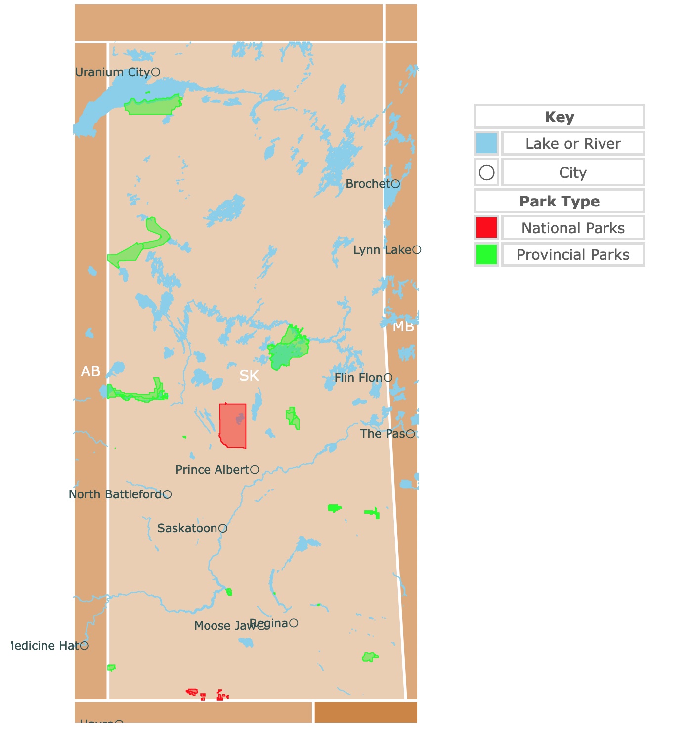
Map of Saskatchewan's Parks and Natural Areas
This interactive map shows the Locations, Names, Areas, and Details of National Parks, Provincial Parks, and Natural Areas of Saskatchewan. It also shows major cities and rivers for context. For more detail, zoom in. For more information, hover over the map, or scroll down.
| Key | |
|---|---|
| Lake or River | |
| ◯ | City |
| Park Type | |
| National Parks | |
| Provincial Parks | |
Geography of Saskatchewan
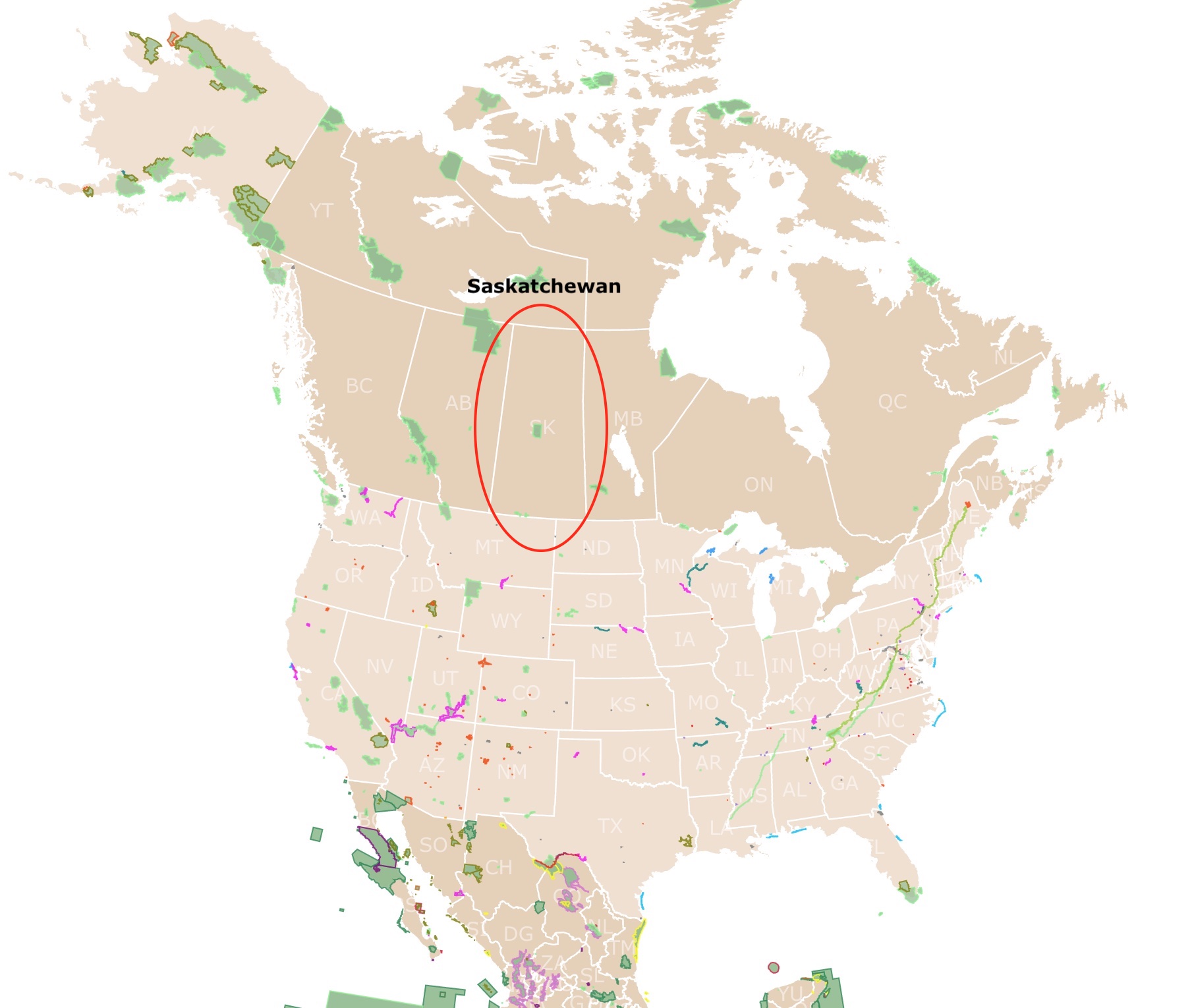
Saskatchewan, or Canada's Breadbasket, is a Prairie Province of Canada. This is Canada's only landlocked province and the only province with artificial boundaries (not being formed by natural features).
Saskatchewan shares borders with Montana and North Dakota to the south. With Manitoba to the east, the Northwest Territories to the north, and Alberta to the west.
The southern half of Saskatchewan is primarily an extension of the Great Plains of the United States, rarely rising 2,000 feet (610 meters) above sea level.
Saskatchewan’s most crucial land division lies between the northern province, part of the Canadian Shield, and the plains, covering the southern two-thirds of the province.
The lowest point in Saskatchewan is 699 feet (213 meters), located in the extreme northwest.
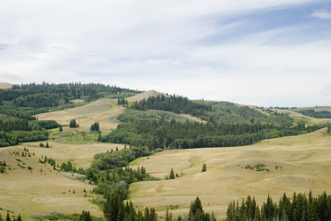
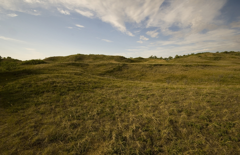
The highest elevations in this Canadian province are found in the Cypress Hills, 4,567 feet (1,392 meters) above sea level. Cypress Hills is located in the southern portion of Saskatchewan.
Saskatchewan’s landscape was greatly influenced by continental glaciation, which scoured and molded the northern shield producing a landscape of lakes, rivers, and rocky outcrops.
During glaciation, a few areas escaped ice cover. These were Cypress Hills and Grasslands National Park. These areas are called "nunataks".
These areas are characterized by their high elevation and today contain unique animal and plant life.
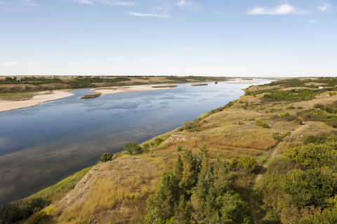
Many incredible river valleys were cut into the plains, including those of the North and South Saskatchewan rivers and the Qu’Appelle River. Many of Saskatchewan’s river valleys were cut and carved by the melt waters flowing from the melting ice sheets.
About an eighth of Saskatchewan is covered by water, including Lake Wollaston and large portions of Reindeer Lake and Lake Athabasca. The water flowing through the province’s river systems drains to the Arctic and Atlantic Oceans and the Gulf of Mexico.
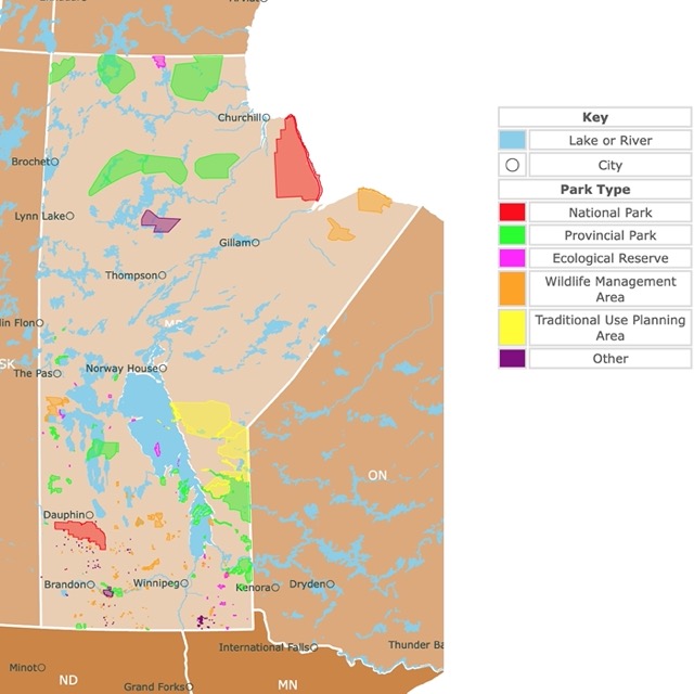
Want to find places to explore in nearby Manitoba? Check this map of Manitoba Parks
Saskatchewan’s Climate
The climate in Saskatchewan is variable, with cold winters and warm summers. Since the province is in the continent's interior, the amount of rainfall is low, averaging between 10 to 20 inches (250 to 510 mm) every year.
Most of the precipitation in the winter falls as snow.
The climate in Saskatchewan is a major limiting factor for agriculture. The temperature variations are extreme; January temperatures have dropped below the mid -60s ℉ (-53℃) in settled areas, and July has experienced temperatures over 100℉ (41℃) on occasion.
In January, the mean daily temperatures in arable regions range between -5 to 10℉ (-21 to -12℃). In July, temperatures reach between the mid-50s to mid-60s (13 to 18℃)
The best time to visit Saskatchewan is from April to May or September through November; this is the area’s shoulder season. Average daytime temperatures in May are around 60℉ (15℃).
Visitors that don’t like extreme climate conditions shouldn’t plan a trip to the area during the middle of summer or winter. However, more attractions are open during the summer in Saskatchewan, making it the busiest tourism season.
Saskatchewan’s Wildlife
Saskatchewan is marked by six recognizable bands of natural plant life from north to south.
The province's northeastern corner contains a subarctic woodland with widely spaced jack pine and black spruce standing tall next to the lichen-covered ground.
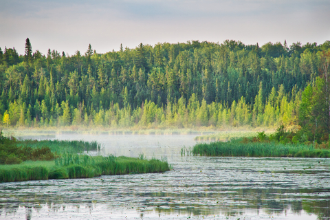
Southwest of the subarctic woodland is the northern boreal forest containing mostly jack pine and black spruce; however, it’s more densely packed. South of the shield is where you’ll find the southern boreal forest, home to conifers and stands of broad-leaved trees like trembling aspen.
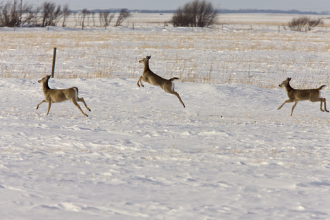
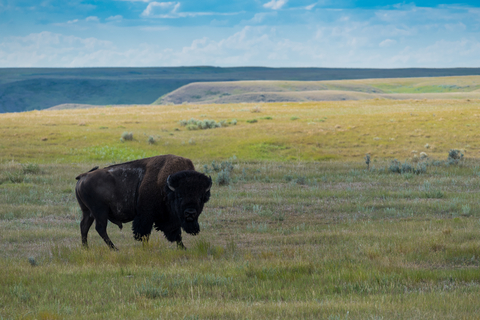
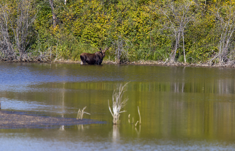
Grizzly bears, black-footed ferrets, and bison are a few native mammals in the area. Cougars are occasionally seen along the river valleys, while black bears and wolves frequent northern Saskatchewan. Antelope, moose, elk, and deer are regionally common.
Smaller mammals are abundant, including foxes, coyotes, rabbits, gophers, and lynx. Saskatchewan is situated on the main western flyway of songbirds, hawks, waterfowl, and owls, many of whom nest in the area.
Saskatchewan’s extensive water resources lead to numerous species of fish and water creatures.
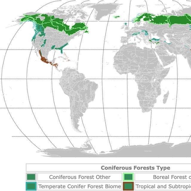
Saskatchewan has Boreal Forests. Visit this map to learn more about them!
Top National Parks in Saskatchewan
Prince Albert National Park
Prince Albert National Park is the large red area in central Saskatchewan.
Prince Albert National Park is a transitional landscape from aspen to a boreal forest with patches of Grassland. Furthermore, the park is dotted with lakes, ponds, bogs, and rolling hills, legacies from the last glaciation.
The park has free bison, over 150 species of birds, and lots of beaver.
The park offers outdoor recreation opportunities year-round. Springtime is excellent for hiking trails and welcoming the first migratory birds home for the season. Meanwhile, the lakes and beaches are inviting during the summer.
Horseback riding during the autumn provides colorful scenery. On the park's west side, you may catch a glimpse of plains buffalo.
Winter opens the gates for activities like cross-country skiing. If you listen closely, you might hear the howl of surrounding wolves.
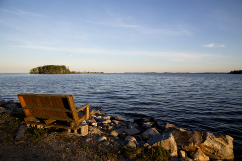
Waskesiu Lake is a resort town serving as a base location, offering visitors easy access to the beaches, swimming spots, and boating areas (motorized and non-motorized). They also have campsites, various activities, amenities, and a wide range of dining accommodations.
There are over 60 miles (100Km) of hiking trails and canoe routes thread throughout a string of beautiful backcountry lakes.
Campsites include the hallowed cabin from the turn-of-the-century conservationist and well-known author Grey Owl.
Anglers can fish any time of the year if they bring their ice fishing gear in the winter. Lake trout, walleye, and northern pike are a few of the prizes swimming in Saskatchewan’s waters; Prince Albert.
Grasslands National Park of Canada
Grasslands National Park is the red specks in southern Saskatchewan, all the way to the U.S. border with Montana.
This is the only park dedicated to preserving Prairie Grasslands in Canada. It protects shortgrass and dry-mixed grass.
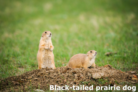
The park is home to black prairie dogs, burrowing owls, grizzly bears, pronghorns, coyotes, ferruginous hawks, elk, wolverines, prairie rattlesnakes, and more.
Grasslands National Park of Canada features a range of activities, from family-friendly interpretive walks to remote backcountry adventures for highly experienced hikers and backpackers.
The park welcomes the whole family for seasonal events, including fireside chats with park interpreters, a guided wagon ride, and lasso practice at the historic ranch.
Visitors can take time exploring the park, and they’ll find dinosaur bones, old tipi rings, and a prairie homestead (if you look to the distant horizon).
Camping accommodations range from convenient and comfortable to rugged backcountry style. Visitors can choose from tents, RVs, and equestrian campsites. Grasslands offer 4 oTENTiks units in the West Block of the Frenchman Valley Campground and 8 units in the East Block of Rock Creek Campground. Source:Mustdocanada.com.
Athabasca Sand Dunes Provincial Park
Athabasca Sand Dunes Provincial Park is the lime area in northwestern Saskatchewan.
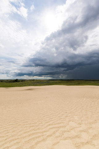
Athabasca Sand Dunes Provincial Park is home to the most northerly active sand dunes in the WORLD! The dunes are between the lake and the boreal forest.
According to Smithsonian Magazine, the Athabasca Sand Dunes are a geological oddity in Canada. The dunes span 62 miles (99 km) across, with individual sand dunes reaching heights of 100 feet (30 meters) and stretching for the length of a mile (km).
Most dunes occur in desert or arid areas. Here, it is a mix of water, trees, and dunes.
The dunes are believed to have formed when the ice sheet covering the area during the last glaciation retreated, leaving behind sediments in the glacial lake. When the lake receded, it left the sediments exposed.
The park is divided into three management zones to protect and preserve the fragile environment. Each zone has different guidelines governing visitor activities and camping.
Visitors can only reach Athabaska Sand Dunes Park by float plane or boat, and it’s recommended that only those that are highly experienced with above-average wilderness survival skills.
There are NO ONSITE SERVICES within Athabaska; park visitors must check in with a conservation officer before making a trip. Guided tours with licensed outfitters are available.
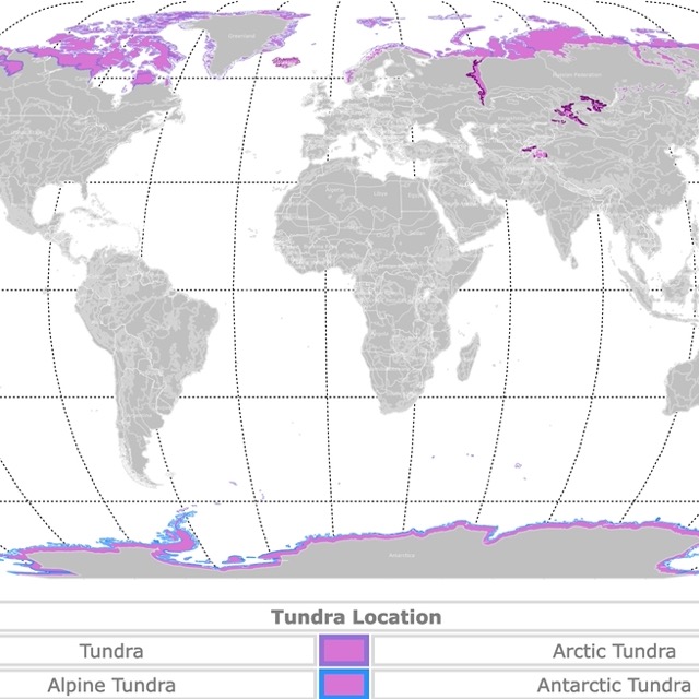
World Map of Tundra
Clearwater River Provincial Park
Clearwater River Provincial Park is the lime area in northwestern Saskatchewan.
Clearwater River is a prime and popular location for skilled canoeists. This provincial park encompasses most of the Clearwater River, featuring rapids ranging from Class II to Class IV and an incredible waterfall.
This wilderness is a pack-in, pack-out park, and it’s recommended that ONLY those highly experienced with backcountry camping and survival skills visit the park.
It’s suggested visitors camp in pairs or groups, but if you wish to camp alone in solitude, be sure to pack everything you’d need to sustain yourself for survival.
The park's main activities are birdwatching, wildlife observation, camping, fishing, and canoeing. Bring some sports equipment and outdoor games for a round or two in the wilderness; Clearwater.
Meadow Lake Provincial Park
The lime strip northwest of Prince Albert is Meadow Lake.
Meadow Lake Provincial Park features beautiful beaches and over 20 lakes, streams, and rivers. It’s one of Saskatchewan’s largest provincial parks.
Meadow Lake is an excellent location for fishing and water-based opportunities.
The Boreal Trail is excellent for backpacking, birding, and camping. However, it is generally considered a challenging route for skilled hikers and backpackers. The trail measures 151.6 miles out-and-back or round trip, near Saskatchewan and Pierceland.
The park features several alternate hiking trails, picnic areas, and twelve campgrounds with more than 800 campsites.
Boating, canoeing, swimming, fishing, and other outdoor recreational activities are common during camping trips; Meadow Lake.
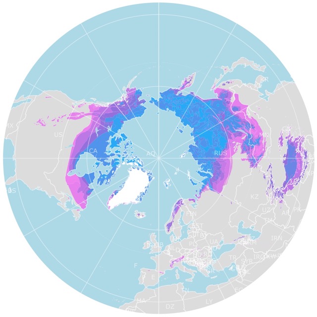
World Map of Arctic Permafrost
Lac La Ronge Provincial Park
Lac La Ronge Provincial Park is the large lime area northeast of Prince Albert and is one of Saskatchewan's largest parks.
Lac La Ronge Provincial Park is a nature lover’s paradise. It contains nearly 100 lakes and over 30 documented canoe routes. Many of those canoe paths follow old fur trade routes.
The park is dominated by Boreal Forest and rocky outcrops on the Canadian Shield.
Inside the park, Nistowiak Falls are the highest falls in Saskatchewan. The formation is located where the Lac La Ronge enters the Churchill River System.
The exceptional fishing opportunities are one reason visitors flock to the park.
The beautiful private campgrounds and various amenities include boat launches, cross-country ski trails, hiking trails, service centers, and the oldest standing building in the province, the Holy Trinity Anglican Church.
According to Government Canada, the Holy Trinity Anglican Church was constructed between 1854 and 1860 and is recognized under the Historic Sites and Monument Act; Lac La Ronge.
For parks with endless waterbodies, Amazon has the Explorer K2 Inflatable Kayak. This is a 2-person kayak with aluminum oars and directional stability. It comes with paddles, a pump, and removable seats. Perfect for Lak La Ronge.
Narrow Hills Provincial Park
Narrow Hills Provincial Park is the lime area east of Prince Albert National Park.
Narrow Hills is the perfect place for a wilderness getaway. Anglers can spend hours or days fishing walleye, perch, northern pike, and different trout species.
The park is full of narrow valleys with kettle and knob terrain and lush boreal forests.
Jade, Diamond, and Opal Lakes contain wilderness campsites for backcountry camping. The park also features two Camp-Easy sites, where all visitors have to do is show up, and their camping spot is set up for them.
The park is pet-friendly, and the outdoor recreational activities are endless; Narrow Hills.
Greenwater Lake Provincial Park
The Greenwater Lake Provincial Park is the lime area east of Saskatoon.
Greenwater Lake offers year-round outdoor recreation, including supreme fishing and water sporting opportunities. The park features a peaceful beach, campsites, in-park accommodations, and extensive trails.
There are designated trails for hiking, biking, snowmobiling, and cross-country skiing. Birdwatchers are provided the opportunity to see over 200 birds.
Overnight guests can choose tent campsites, cabin rentals, Camp-easy sites, and yurt rentals.
The visitor center provides excellent educational exhibits and materials. Bring your clubs and hit the 18-hole golf course before a swim.
Want to find places to explore in nearby Alberta? Check this map of Alberta Parks
Porcupine Hills Provincial Park
The lime area southwest of The Pas is Porcupine Hills Provincial Park.
Porcupine Hills is Saskatchewan’s newest addition to provincial parks.
Porcupine Hills comprises five existing provincial recreational sites, including Saginas Lake, Parr Hill Lake, Woody River, Pepaw Lake, and McBride Lake. The park’s primary focus is protecting and preserving the region’s natural landscapes and ensuring that cultural values are maintained.
The camping opportunities are excellent; there is also hunting, fishing, snowmobiling, and other winter activities.
The park features a beach, boat launch, firepits, non-electric camping sites, picnic areas and shelters, playgrounds, and tent camping sites; Porcupine Hills.
Moose Mountain Provincial Park
Moose Mountain Provincial Park is the lime area southeast of Regina.
Moose Mountain offers opportunities for year-round outdoor adventures. The area is ideal for hiking, camping, boating, swimming, snowshoeing, and snowmobiling. A golf course and tennis court are also featured at the park.
Moose Mountain’s Visitor Center is a must-see. The Artist’s Colony is an exciting place to explore. Take a trip back in time while visiting Cannington Manor.
Extensive trail systems wind throughout the park. The trails are for hiking, mountain biking, snowshoeing, cross-country skiing, and snowmobiling. Spend the night at a tens or electric site, and enjoy an incredible sunrise in the morning.
Cypress Hills Provincial Park
Cypress Hills Provincial Park is the lime area southwest of Regina.
Cypress Hills Park spans Saskatchewan's southwest corner and Alberta's southeast corner. On the park's south side, visitors will find the National Heritage Site of Fort Walsh.
Camp under the stars at one of the beautiful campsites. Hiking, biking, water, fishing, horseback riding, and summer and winter activities are available at Cypress Hills.
Several tours and programs are designed to teach guests about the area's culture, history, environment, indigenous peoples, and wildlife in the area; cypresshills.com.
Douglas Provincial Park
Douglas Provincial Park is the lime area northwest of Regina.
The park was created after the damming of the Qu'Appelle and South Saskatchewan Rivers.
Douglas Provincial Park is situated on the southeast end of Lake Diefenbaker. The park features a beautiful sandy shoreline, wooded campsites, and inland sand dunes accessible by hiking trails.
One of the trail systems is part of the TransCanada Trail, which will lead you to Danielson Provincial Park.
Douglas Park offers unique outdoor recreational opportunities for the whole family. Anglers can catch a few fish, and the interpretive hiking trails are fun to explore.
An 18-hole championship golf course is nearby. There are plenty of water activities to enjoy with all of the surrounding water. Build sandcastles, soak up the sun, and enjoy an evening picnic in Canada’s beautiful wilderness park; Douglas.
Resources for Saskatchewan's Protected Areas Map
The shapefiles with Saskatchewan's state boundary lines and cities were downloaded from Natural Earth Data.
The National Parks of Canada shapefile was downloaded from Open Canada.
The shapefile with Saskatchewan Parks was downloaded from Saskatchewan Government. Park classification was obtained from Saskatchewan Government.
The shapefile with rivers and lakes from Canada was downloaded from Open Canada.
This map will be updated with new data! To receive updates on this and more nature maps, join my email list!!!!!!!
Made by Luz K. Molina with D3.js.