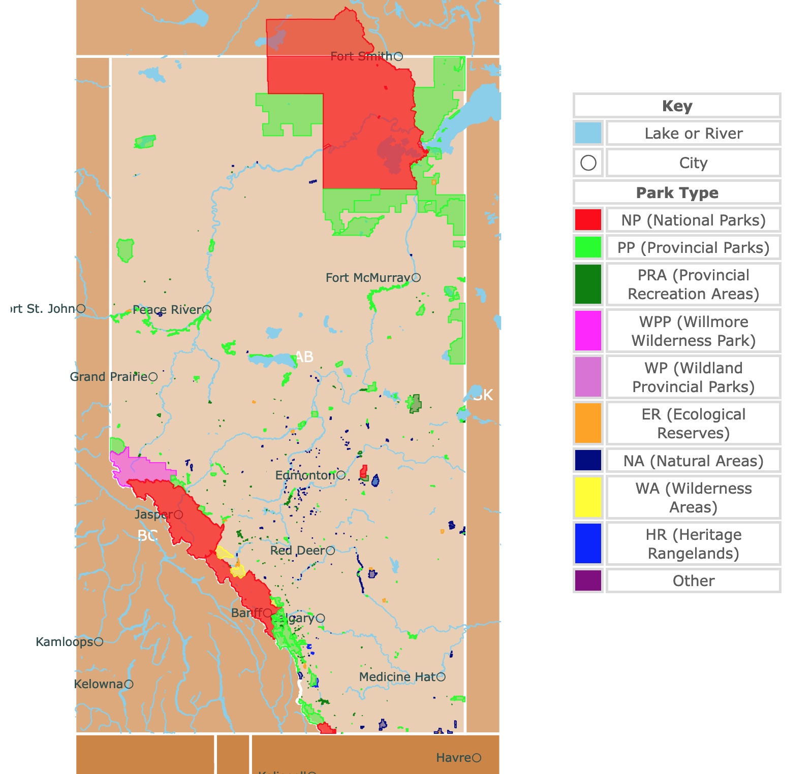
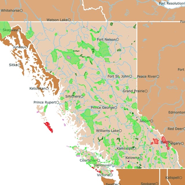
Map of Alberta's Parks and Natural Areas
This interactive map shows the Locations, Names, Areas, and Details of National Parks, Provincial Parks, and Natural Areas of Alberta. It also shows major cities and rivers for context. For more detail, zoom in. For more information, hover over the map, or scroll down.
| Key | |
|---|---|
| Lake or River | |
| ◯ | City |
| Park Type | |
| NP (National Parks) | |
| PP (Provincial Parks) | |
| PRA (Provincial Recreation Areas) | |
| WPP (Willmore Wilderness Park) | |
| WP (Wildland Provincial Parks) | |
| ER (Ecological Reserves) | |
| NA (Natural Areas) | |
| WA (Wilderness Areas) | |
| HR (Heritage Rangelands) | |
| Other | |
Geography of Alberta
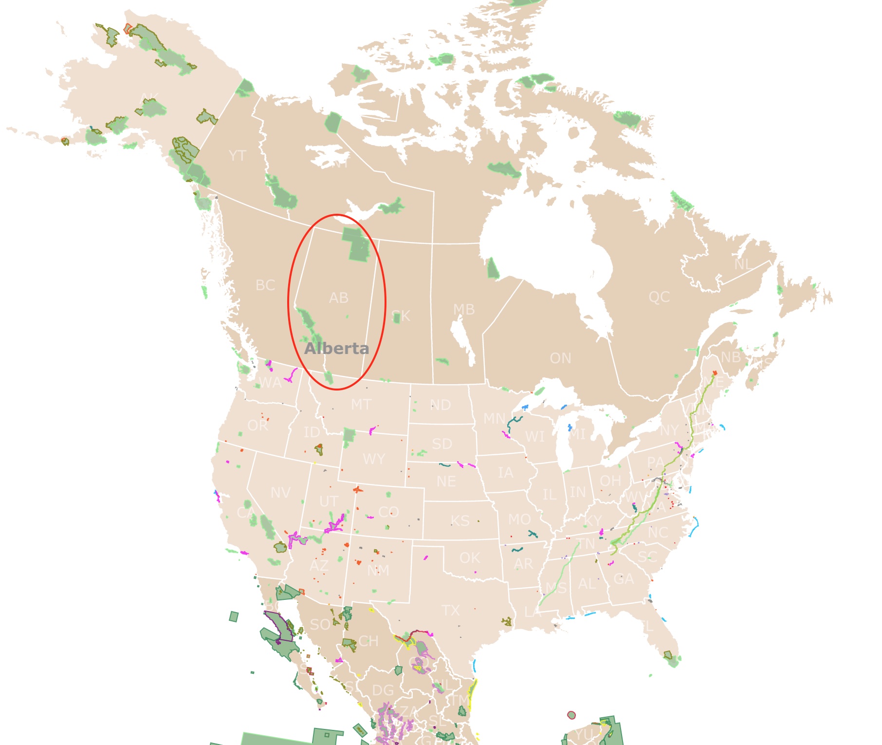
Alberta is one of three Canadian Prairie Provinces and occupies the continental interior of the western part of Canada. This province is also known as the "Energy Province" because it produces most of Canada's oil and natural gas.
Alberta borders British Columbia to the west, the Northwest Territories to the north, and Saskatchewan to the east. Alberta also has an international boundary with the U.S. state of Montana to the south.
The earliest explorations of the area were done by fur traders and followed by Alberta's settlement.
The natural northern routes have led to Alberta becoming a central point for developing the Canadian Arctic and subarctic regions.
The Rocky Mountains lie along the province's southwestern border. Mount Columbia, the highest point with 12,294 feet (3,747 meters), is found here.
Numerous peaks in the area exceed 11,000 feet (3,350 meters). The mountains to the east are flanked by a narrow foothill zone.
Beyond the mountainous region lie the interior plains that fall from over 3,000 feet (900 meters) in the southwest dropping below 1,000 feet (300 meters) in the northeast.
In the northeast, ancient Precambrian rocks outcrop the Canadain Shield.
Canada's Columbia Icefield is between British Columbia and Alberta in the Rocky Mountains. This is the source of two of Alberta's significant bodies of water; the Athabasca and North Saskatchewan Rivers.
The southern portion of this Canadian Province is dominated by the Saskatchewan River system. There are hundreds and thousands of creeks, springs, little rivers, and ponds dotting Alberta's landscape; Alberta Geography.
Want to find places to explore in nearby Saskatchewan? Check this map of Saskatchewan Parks
Alberta's Climate
Alberta experiences a continental climate, with more sunshine than other Canadian provinces. The winters are sunny, dry, and cold. However, the Chinook winds blow in the south.
Britannica explains that a Chinook is a warm, dry wind descending from the eastern slopes of the Rocky Mountains (primarily in winter).
The Chinook winds carrying the warm Pacific air can raise the temperatures by 40℉ (22℃) within an hour or less.
Alberta summers are warm and wetter than expected, except during drought. Summer brings occasional destructive hailstorms and tornadoes to the region.
The average mean and extreme temperatures recorded in Edmonton range between 6° and -59℉ (-14° and -51℃) in January; and between 60° to 95℉ (16° to 35℃) in July.
Around half of the precipitation in Alberta falls from June to August. Annual rainfall in Edmonton averages about 18 inches (460 mm), compared to 12 inches (300 mm) in the southeast, where it's dry.
The mountains receive yearly over 50 inches (1,270 mm) of rainfall.
Alberta's Wildlife
Wild grasses, including blue grama, dominate the prairie lands in southern Alberta.
However, tumbleweeds, sagebrush, and cacti are slightly more conspicuous. Few trees are growing naturally outside of the river valleys.
Alberta's transitional parklands contain aspen-covered bluffs. The foothills include mixed and coniferous forests.
The north is home to white spruce, aspen, lodgepole and jack pines, and balsam firs. Tamarack and black spruce grow on peat bogs.
Look to the fields for the wild roses, Alberta's provincial flower, widespread across the landscape.
Alberta's badlands are home to scorpions, rattlesnakes, and horned lizards, while pronghorn and meadowlarks attract attention on the prairies. The parkland areas support beavers, coyotes, elk, buffalo and white-tailed deer. While great horned owls rear their young in empty crow's nests.
Northern forests are home to numerous fur-bearing animals and big game, including caribou, moose, elk, and black bear. Gray jays fly overhead while loons can be heard singing songs on the lakes.
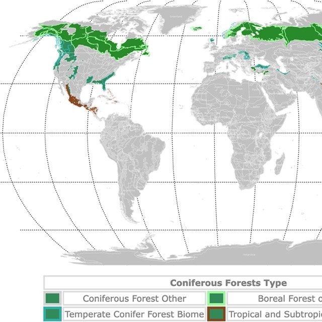
Alberta has Boreal Forests. Visit this map to learn more about them!
Incredible Parks in Alberta
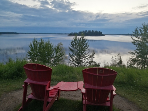
Among the many gorgeous parks Canada has to offer, there is Waterton Lakes National Park. This park is not just alluring but special. It is next to the border with the U.S.A.
Its mountains and valleys continue to the south into one of America's most beautiful parks. To read more about them go to Glacier National Park.
For details on all the amazing sites displayed on the map Amazon has 200 Nature Hot Spots in Alberta: The Best Parks, Conservation Areas and Wild Places. Each hot spot entry includes a detailed destination profile, color photographs and a sidebar of at-a-glance information featuring all the activities one can expect to enjoy.
Wood Buffalo National Park
The large red area in northern Alberta is Wood Buffalo National Park.
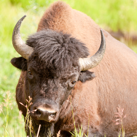
Wood Buffalo National Park is the largest National Park in Canada. It covers 17,300 square miles (4,4806 sq km); that's bigger than Denmark.
In 1922 the park was created to protect the last remaining buffalo herds in northern Canada. It now protects an incredible example of the Canadian Northern Boreal Plains.
Today, the park has black bears, wolves, moose, the largest population of wild bison, the only breeding habitat of the whooping crane, and the world's largest inland delta; UNESCO.
In a park of superlatives, the world's largest beaver dam stayed unnoticed for years!
The park's diverse landscape includes salt plains, boreal forest, and gypsum karst formations. There are underground streams, saline streams, and sinkholes!
Wood Buffalo National Park serves as a Dark Sky Preserve (DSP), making it an excellent place to view the night sky. Astronomy fans can watch meteors and witness the northern lights dancing through the atmosphere directly from the campsite.
Stroll through the boulder field and across Grosbeak Lake's unique salt landscape.
The park offers traditional outdoor recreation, including swimming, camping, biking, hiking, canoeing, boating, and animal watching.
Anglers will want to check out the five major rivers bordering the park; goldeye, walleye, northern pike, and perch are a few catches reeled in regularly; Wood Buffalo.
Wood Buffalo is in a remote location. If you wish to spend the night before camping, VRBO is your best. For available homes visit this link!
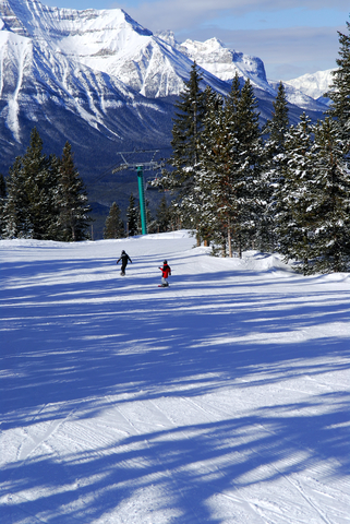
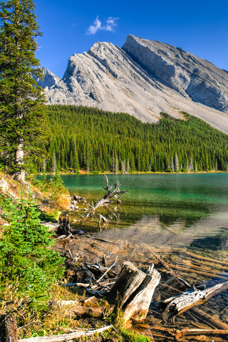
Banff National Park
The red strip in southwestern Alberta, 96 miles (155Km) west of Calgary, is Banff National Park.
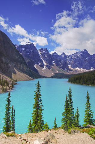
Banff National Park is the crown jewel of Canada's National Parks. It is also the oldest and most popular park in the country.
Why is Banff so special? The park is where cyan glacial lakes, snow-capped summits, peaceful lakeshores, and furious rapids create majestic mountain scenery.
More than three million visitors go to Banff for recreational activities, including hiking, biking, camping, flyfishing, kayaking, and skiing.
Bighorn sheep, bears, and hundreds of birds are at home in the park.
Head out to explore the incredible Rockies on foot or bike with the extensive network of trails to follow. Take a drive to spots where you can see the crystalline lakes and glaciers.
14 campgrounds allow guests to spend the night, days, or weeks.
The natural, historic sites are highly recommended for history buffs. The park also has hot springs and its own village!
Suppose you're a fan of cold weather activities. In that case, winter paves the way for snowmobiling, skiing, ice skating, ice climbing, winter sightseeing, and building snow creations! Banffnationalpark.com
Banff has incredible unlimited recreational opportunities and locations to stay. Hotels.com has rooms at resorts, lodges, chalets, and hotels for travelers to choose from. This is a sought-after park. You can book early here!
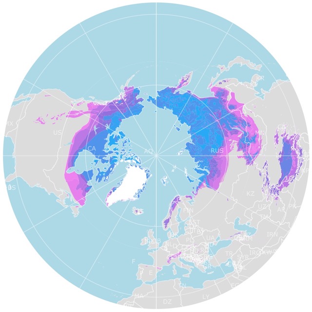
World Map of Arctic Permafrost
Jasper National Park
The red strip in southwestern Alberta is Jasper National Park.
Jasper stretches over 4,4247 square miles (11,000 sq km), is the most extensive park in Canada's Rocky Mountains, and is a part of UNESCO's Canadian World Heritage Sites.
The park has rugged mountains, valleys, glaciers, alpine meadows, and forests. Featuring five regions to explore. The park has an extensive trail network of over 600 miles (990Km), welcoming hikers, bikers, and explorers.
Winter activities include fat tire biking, ice skating, snowshoeing, and skiing.
Not sure where to start? Here are some activities and locations:
- Maligne Canyon is a spectacular canyon plunging to depths of 160 feet (48 meters).
- Maligne Lake is a scenic and serene water body to paddle.
- Visit Medicine Lake
- Old Fort Point Trail for a hike.
- Swim in Lake Edith and Lake Annette
- Ride the Jasper Skytram for the views
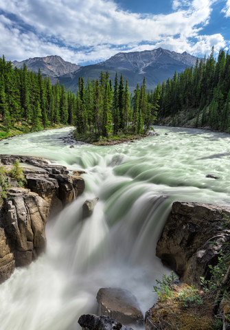
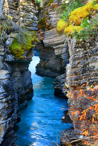
- Check Athabasca Falls
- Visit Angel Glacier
The park's wildlife includes moose, grizzly bears, elk, and other 70 mammal species. Furthermore, there is a wide variety of plants and insects. Just keep in mind these are wild animals and may be dangerous!
For a more laidback leisurely time, go for a scenic drive, or savor a scenic picnic; Jasper.
There are shuttles and a train to reach the park, but the most convenient way to see it is by car. If you come from afar, Expedia has cars available to rent. For brands, locations, and prices, check this link!
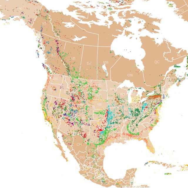
Map of North America's Fossils
Peter Lougheed Provincial Park
Peter Lougheed Provincial Park is the lime strip southwest of Calgary. It is situated in the Front Ranges of the Canadian Rockies,
Peter Lougheed invites you to experience towering mountains, pristine alpine lakes, glacial streams, and lush evergreen valleys.
Backpackers appreciate the wilderness hiking and camping opportunities. Some trails hikers seek are the Rawson Lake trail, Serrail Ridge, Chester Lake, Burstall Pass, and Elephant Rocks.
Anglers have rods and reels ready for bull trout and cutthroat fishing. Hundreds of trails are maintained for visitors to explore, including hiking, biking, and interpretive trails.
Peter Lougheed features six campgrounds, as well as two group sites. Basic outdoor recreation opportunities are available throughout the park; let your imagination lead the way; Peter Lougheed.
Writing-on-Stone Provincial Park
The lime specks close to the border with the U.S. are Writing-on-Stone Provincial Park.
Writing-on-Stone Provincial Park features an extensive collection of pictographs (rock paintings) and petroglyphs (rock carvings). Aisinai'pi Provincial Park or Writing-on-Stone Park contains depictions of the lives of the Indigenous people who used this space as a spiritual place for over 10,000 years.
The extensive glyphs combined with the nearby Hoodoo hikes provide an interesting and otherworldly spiritual experience.
The pictographs were carved on sedimentary rocks formed 85 million years ago. They were exposed when the ice melted after the last glaciation. The melt left behind coulees and hoodoos you see today.
Visitors are welcome to take free guided tours of the historic site, one of the largest concentrations of pictographs and petroglyphs in North America's prairies. Guides teach about the people who created this space and explain why it has been sacred for centuries.
Visitors can extend their trip to Writing-on-Stone by staying in one of the park's fully-outfitted tent cabins with comfortable beds. It's like a trip to the past with modern amenities; Writing on Stone.
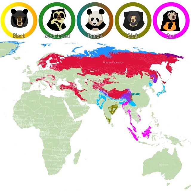
World Map of Bear Habitats
Dinosaur Provincial Park
Dinosaur Provincial Park is the lime area east of Calgary.
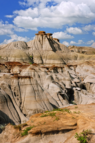
Over 130 complete dinosaur skeletons have been discovered and unearthed within Dinosaur Provincial Park. Over 50 species of dinosaurs have been found, leading to the park's designation as a UNESCO World Heritage Site.
While dinosaurs called this land home millions of years ago, now, it's a place of adventure to explore. Bring your family and begin the hunt for real dinosaur bones and fossils. It's a fun and educational experience.
The prairie trail invites visitors for a peaceful walk. The visitor center and museum are definitely a must before or after your trip through the park.
The little ones love the playground and educational activities; Dinosaur.
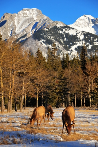
Elk Island National Park
Elk Island National Park is the red area on the map, 35 minutes east of Edmonton.
Elk Island is an important refuge for elk, bison, and over 250 bird species. Follow the buffalo's footprints along trails, learning how these incredible beings were brought back from near-extinction.
The park is a year-round wonderland to explore. Elk Island offers a Dark Sky Preserve that makes the entire Universe seemingly come into view.
Hike the trails and see if you can spot any buffalo prints. Get a behind-the-scenes tour at the buffalo handling facility, and learn how these incredible animals wound up here after being brought back from near extinction.
Visitors can canoe Astotin Lake, among other water activities including paddling, boating, sailboating, and kayaking. The beach provides an excellent place to spend sunny summer days.
Astotin Theater is the perfect place to spend the day with family.
The Island is an oasis of relaxation for day picnics and overnight camping trips; Elk Island.
Map of North America's Ski Resorts
Lesser Slave Lake Provincial Park
The park is the lime area next to Lesser Lake in the center of Alberta. Just a 2.5-hour drive from Edmonton
Lake activities are incredibly popular during the warm summer months. The Trans Canada Trail travels along the lakeshore, making it an excellent location for cross-country skiing during the winter.
Some visitors can be found building sandcastles, swimming, and picnicking on the warm sandy beach. While others are hiking up to Marten Mountain Viewpoint for the most amazing bird's-eye view of Lesser Slave Lake.
Avian lovers might be found at the Lesser Slave Lake Bird Observatory, where they can learn more about the local and migrating species.
The observatory offers this printable checklist; Lesser.
Kinbrook Island Park
Kinbrook Island Park is the lime speck northwest of Medicine Hat.
Kinbrook Island Park sits on the shore of Lake Newell. The lake provides relief to locals during hot summer days.
Trees create shady picnic spots while the water invites visitors for a swim. Bird watching opportunities are excellent at the wetlands near the campground.
The interpretive marsh trail will act as your guide.
Summer is also the time for kayaking, canoeing, fishing, swimming, power boating, and a couple of volleyball games.
Winter activities include ice skating, cross-country skiing, ice fishing, and nearby- off-site snowmobiling.
The park offers over 160 campsites suitable for tents, RVs, and backcountry camping (unserviced); Kinbrook.
Want to find places to explore in nearby British Columbia? Check this map of British Columbia Parks
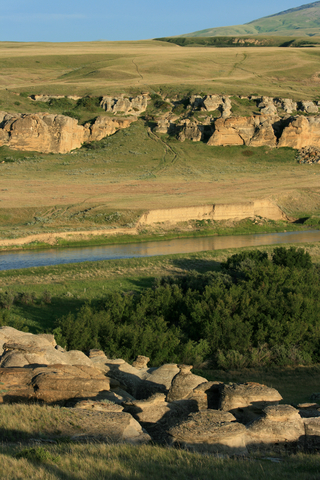
Dry Island Buffalo Jump Provincial Park
The lime speck southeast of Red Deer is Dry Island Buffalo Jump Provincial Park.
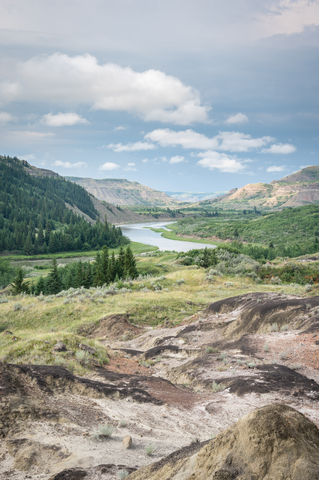
Dry Island Buffalo Jump Provincial Park is one of Alberta's park system's unknown beauties. The park offers incredibly breathtaking views of the Red Deer River Valley.
Dry Island Buffalo Jump is a prime location for nature and wildlife enthusiasts. The area is home to over 150 species of birds. Visitors can see everything from warblers to turkey vultures and everything in between.
The park's hand boat launch allows access to paddlers eager to experience the badlands from the water.
Informal trails wind through the native grasslands and coulees, inviting hikers out for an afternoon adventure. Travelers must be mindful of the sensitive plants growing along the paths.
Dry Island is a day-use-only park, but the park offers picnic sites with firepits. During wet weather, the access road to the park is closed due to slippery, dangerous road conditions, so be sure to check the weather before you head out; Dry Island.
Rock Lake - Solomon Creek Island
The violet area north of Jasper is Rock Lake - Solomon Creek Island.
Rock Lake - Solomon Creek Wildland Park is an excellent location for hiking, horseback riding, wildlife viewing, birdwatching, camping, and winter activities like cross-country skiing.
Visitors can expect to find basic campsites, picnic sites, and horse-holding facilities at Rock Lake.
Camping, geocaching, horseback riding, hiking, hunting, fishing, wildlife viewing, photography, and winter activities are popular at Rock Lake.
Resources for Alberta's Protected Areas Map
The shapefiles with Alberta's state boundary lines and cities were downloaded from Natural Earth Data.
The National Parks of Canada shapefile was downloaded from Open Canada.
The shapefile with Alberta Parks and Natural Areas was downloaded from Alberta Government. Park classification was obtained from Alberta Parks.
The shapefile with rivers and lakes from Canada was downloaded from Open Canada.
This map will be updated with new data! To receive updates on this and more nature maps, join my email list!!!!!!!
Made by Luz K. Molina with D3.js.