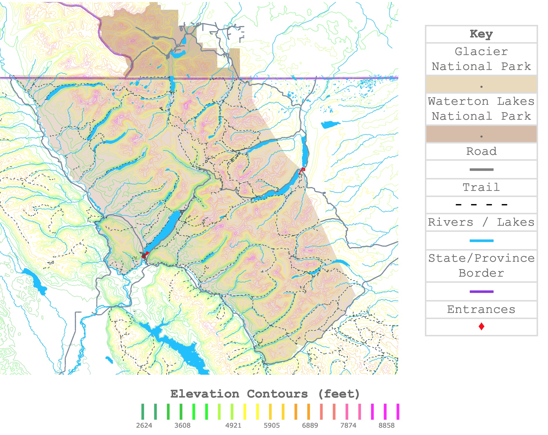
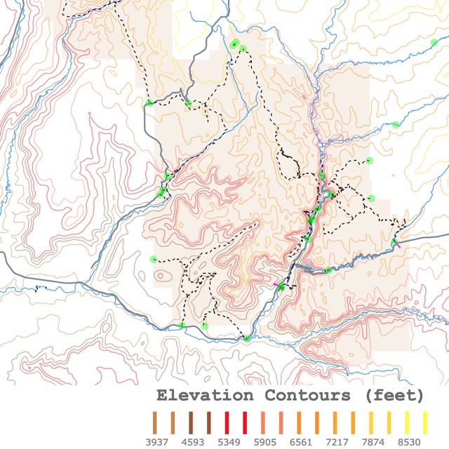
Glacier National Park Map
This interactive map shows the contour lines of Glacier National Park, Waterton Lakes National Park, and their surroundings. Different colors represent different elevations. The map also indicates rivers, roads, and trails in the parks. For more detail, zoom in. For names, hover over the map. For more information, scroll down.
| Key |
|---|
| Glacier National Park |
| . |
| Waterton Lakes National Park |
| . |
| Road |
| ━━━ |
| Trail |
| - - - - |
| Rivers / Lakes |
| ━━━ |
| State/Province Border |
| ━━━ |
| Entrances |
| ♦ |
Elevation Contours (feet)
Glacier and Waterton Lakes Peace Park
Glacier National Park is the Crown of the Continent, where mountain ranges carved by prehistoric ice rivers feature alpine meadows, deep forests, and waterfalls.
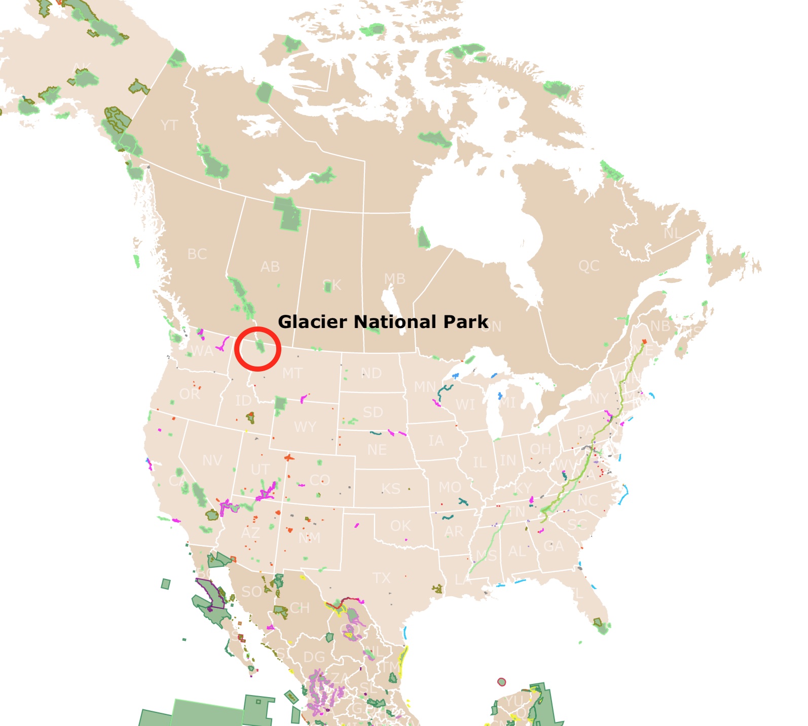
Glacier National Park is located in northwestern Montana.
It is bordered to the west and southwest by the Flathead River and the Flathead National Forest. To the southeast, it is surrounded by the Lewis and Clark National Forest, and to the east is bordered by the Blackfeet Indian Reservation.
To the north, the park is bordered by Canada's Alberta Province.
In 1910 President William Taft signed a bill to create Glacier National Park. This was the country's 10th national park.
Thanks to its location, in 1932, the world's first International Peace Park was established. The Peace Park combined the Glacier National Park in Montana and the Waterton Lakes National Park in Alberta, Canada.
63 years later, in 1995, UNESCO listed the two parks as a Joint World Heritage Site for the outstanding scenery and their diverse and plentiful wildlife and plant species.
For these reasons, the map displays both parks.
Interactive Map of Yellowstone National Park
Glacier National Park Geography
Glacier National Park is 1,583 sq miles (4099.95 sq km) of wilderness in Montana's Rocky Mountains. The glacier-carved peaks and valleys are a striking geographic feature.
Visitors flock to the Peace International Park to see alpine meadows, forests, waterfalls, glaciers, and over 200 lakes.
The park's elevation varies from 3,150 feet (960 m) at the junction of the Middle and North Forks of the Flathead River to a high of 10,466 feet (3,192 m) on Mt. Cleveland.
Glacier National Park Continental Divide
The Continental Divide separates North America's watersheds. In fact, the Divide separates the river drainages from the the Atlantic, the Pacific, and the Gulf of Mexico.
Creeks and streams in the southeast will end in the Mississippi River and eventually the Gulf of Mexico.
Waters from the northeast flow to Lake Winnipeg and eventually Hudson Bay.
Waters west of the Divide flow through the Flathead River, then to the Columbia River, and eventually to the Pacific Ocean.
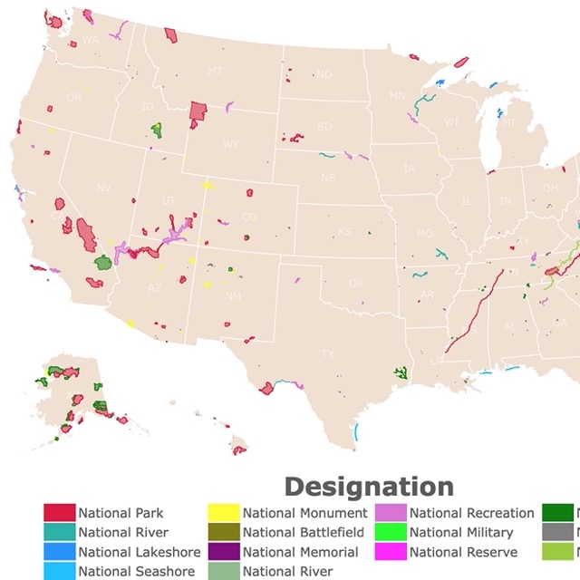
Want to find more National Parks to explore? Check this map of National Parks in the USA
Glacier National Park Geology
The area was formed by sedimentation and rock deposition. Then, there was the uplift of the mountains and, finally, glaciation that carved valleys.
Both parks have some of North America's oldest and best-preserved sedimentary rocks. These were deposited over 1600 million years ago in an ancient inland sea.
This inland sea left formations of carbonate rocks. It also left layers of Stromatolite Fossils. These are ancient microbial mats that can be seen in Grinnell Glacier.
While most of the park has a sedimentary origin, 750 million years ago, late in the Proterozoic, lava flowed into the ancient sea floor. This igneous material is seen as lava formations in the Granite Park area. It can also be seen as Purcell Sill on Mt. Siyeh and Mt. Cleveland in Glacier and Mt. Blakiston near Red Rock Canyon in Waterton.
The tectonic movements resulted in the collision of the North American Plates. They uplifted the crust, forming mountains and creating the Lewis Overthrust Fault.
This fault is visible from Marias Pass, just outside the park's southeast corner.
Finally, during the Pleistocene Ice Age, intense cooling resulted in the advance of ice sheets. These glaciers sculpted the mountains and formed the park's valleys.
There are no more glaciers in Waterton but a few dozen in Glacier National Park. Unfortunately, due to climate change, the size of the glaciers keep shrinking.
Glacier National Park Weather
Glacier National Park's weather changes constantly. In winter, most of the park is covered in several feet of snow.
Spring is quite cool and rainy. Spring is also the perfect time to see spectacular waterfalls flowing as the winter snow melts.
During summer, days can be warm, but nights are pretty cool. During fall, visitors may find snow in the park's lower elevations; Source: NPS.
Because of their topography and weather, Glacier National Park and Waterton Lakes Park are ideal sites for skiing, cross-country skiing, and snowshoeing.
There are many options to stay within a 10-mile radius of the park, relish its natural beauty, and enjoy the comfort of a holiday retreat. For options and locations, Expedia has top resorts in the area at reasonable prices for you.
Interactive Map of Zion National Park
Fun Things To Do in Glacier National Park
Remember, this is a popular park, and you may need to plan ahead. For example, the parking areas of popular destinations like Logan Pass and Avalanche Creek begin filling before sunrise and remain congested for most of the day.
Summer is a popular time to visit. Spring has wildflowers, fall has beautiful colors, and winter brings ski enthusiasts to the area.
There are over 700 miles (1,126 km) of hiking trails and the opportunities are endless. For more ideas, read below or check the map.
Drive The Going-To-the-Sun Road
Glacier National Park is crossed from east to west by the beautiful mountainous "Going-to-the-Sun Road". This is the most scenic drive in the park. It meanders and turns through the Continental Divide.
The road is over 50 miles long, and it takes about 2 hours to drive its length. It has plenty of spots for resting, parking, and enjoying the view. Unfortunately, it is so popular you are likely to deal with traffic jams.
The road is open from June to October. You can also use the shuttle during these months and decrease the traffic while decreasing your footprint in the park and eliminating the stress of driving.
Since 2023 the park has required a vehicle reservation due to high congestion. This reservation applies to Going-to-the-Sun Road, the North Fork, Two Medicine, and Many Glacier.
Interactive Map of Smoky Mountains National Park
Avalanche Lake
Halfway between the West Entrance and Saint Mary Entrance is Avalanche Lake Trail. You can reach this trail through Trail of the Cedars. You can find both trails if you zoom in the map.
The Trail of the Cedars begins and ends at the Going-to-the-Sun Road. This trail is a loop and has beautiful views. Hikers can walk in a forest of hemlocks and red cedars.
Once visitors reach the Avalanche Lake trail, they can enjoy Avalanche Creek. This is a narrow gorge with powerful glacial melted water. The creek is not just a beautiful sight, but the clear sounds of flowing water are a constant throughout most of the trail.
After several miles, visitors will reach the end of the Avalanche Lake trail, and will find Avalanche Lake.
This is a splendid lake at the base of Bearhat Mountain. Besides the mountains, cliffs, and waterfalls, the place is sought after for its solitude; Hiking Glacier.
St. Mary Lake
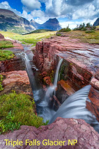
Just west of Saint Mary Entrance is Saint Mary Lake. The western side of Saint Mary Lake has several popular trails. These trails iclude Three Falls, where visitors will see several beautiful falls. These include Virginia Falls, St. Mary Falls, and Baring Falls.
This is a moderate hike, so the average hiker can complete it without major strain. It takes about 3 hours to finish the trek with photos and water/snack breaks.
The trail has an elevation change of about 800 feet. So be prepared for the slopes.
Interactive Map of Yosemite National Park
Grinnell Glacier
Northwest of St. Mary Lake is the Grinnell Glacier trail. This is a strenuous hike of 10 miles.
Visitors come here for the outstanding vistas, alpine meadows, and the park’s only easily accessible glacier!
This is a beautiful hike with stunning views of waterfalls and mountains.
Visitors may see mountain goats, moose, and bears.
Visitors can reach this trail on foot or partially by boat. To take the boat, visitors board in front of the Many Glacier Hotel on Swiftcurrent Lake.
Visitors can stay in Many Glacier hotel, inside the park. For dates and amenities, check Expedia!
McDonald Creek
Just north of McDonald Lake is Mac Donald Creek. This is a tranquil area of the park. This is an easy, flat hike that takes about 2 hours.
The perks of this trail are views of the creek.
Not far from McDonald Lake and the West Entrance, VRBO has several Vacation Rentals. Cozy cabins and guest houses with views of the park and Flathead River. For more information and prices, click here!

Interactive Map of Lakes and Ponds in the USA
Highline Trail
Highline Trail is west of Grinnell Glacier Trail. It begins in Logan Pass, just off Going-To-The-Sun Road.
This is a popular hike because of the incredible scenery. It also follows the Continental Divide. This section of the divide is also called the Garden Wall.
Panoramic views and peaks are the hikers' favorites.
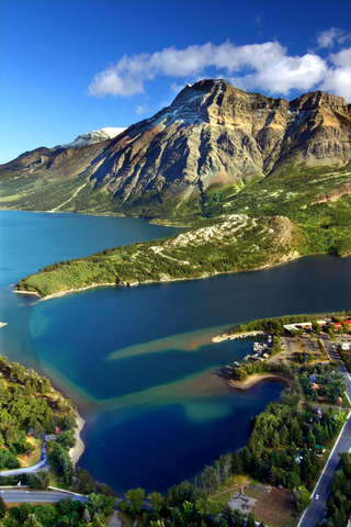
Waterton Lakes National Park
This park contains 505 km2 (195 sq mi) of rugged mountains and wilderness.
This park ranges in elevation from 4,232 ft (1,290m) to 9,547 ft (2,910m).
Waterton Lakes has similar attractions to Glacier National Park, including its scenery and geology.
Waterton Lakes National Park is where Alberta's peaceful prairies reach the rugged peaks of the Rocky Mountains. Colored pebbles create rainbow streams, and beautiful rocks support powerful waterfalls.
After the park was created in 1927, a ship was built to travel between Glacier and Waterton through the lake.
It is possible to hike between Waterton Lakes and Glacier NP. The most common option is to cross the border by driving outside both parks. But the most enjoyable one is to take the boat in Upper Waterton all the way to Glacier National Park.
Everyday activities include wildlife watching, hiking, skiing, cycling, golfing, stargazing, wildflower viewing, and horseback riding.
The hiking and biking trails range from leisure strolls to strenuous treks.
Crypt Lake Trail is one of the most renowned trails in the Canada Rockies.
A trip to the postcard-perfect community of Waterton features the historic and breathtaking Prince of Wales Hotel, plus various water activities.
The Prince of Wales Hotel is one of the park's jewels. It is a Grand Railway Hotel built in the 1920s to lure American tourists during the prohibition. Today it is a grand historic hotel with breathtaking views of the park and Waterton Lake.
You can spend the night in lodges nearby, inside the park. For dates and accomodation, visit Hotels.com.
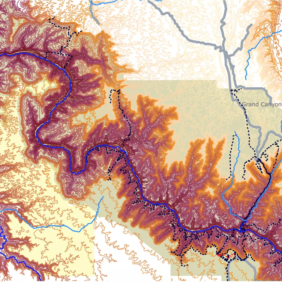
Interactive Map of the Grand Canyon National Park
FOLLOW ME
Resources to Make Glacier National Park Topography Map
The contour lines from Smoky Mountains National Park were downloaded from USGS.
Rivers and Lakes shapefiles from Montana were downloaded from Science Base Catalog.
Montana trails were downloaded from Koordinates.
Waterbodies of Alberta, Canada, were downloaded from Mapcruzin.
Roads from Alberta were downloaded from Alberta Government.
Montana Roads shapefiles were downloaded from Science Base-Catalog.
Park Boundaries for Glacier National Park and Waterton Lakes National Park were downloaded from USGS.
This map will be updated with new data! To receive updates on this and more nature maps, join my email list!!!!!!!
Made by Luz K. Molina with D3.js.