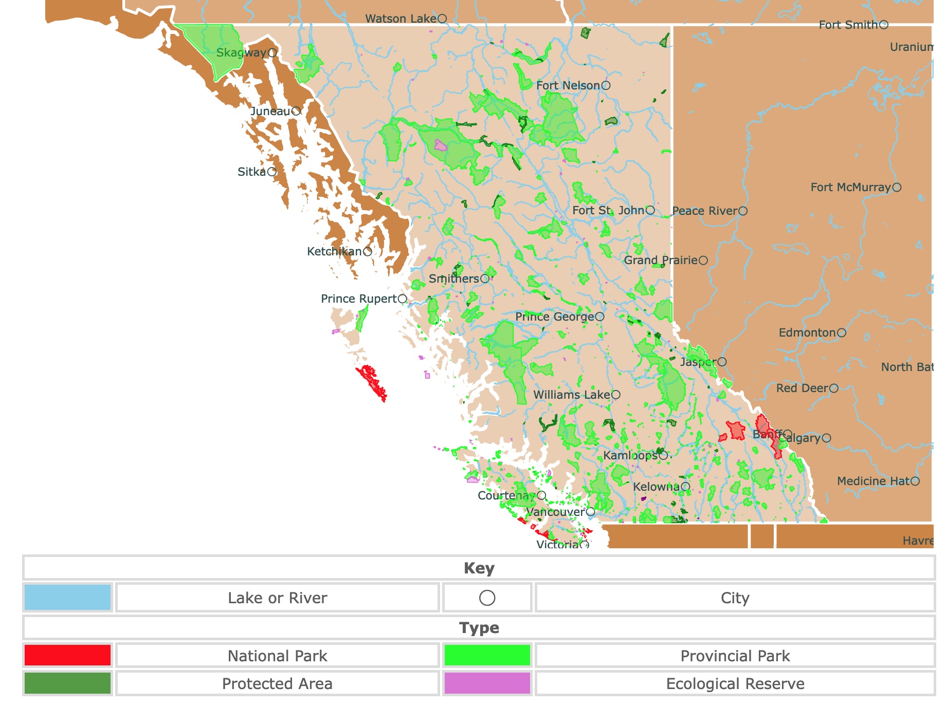
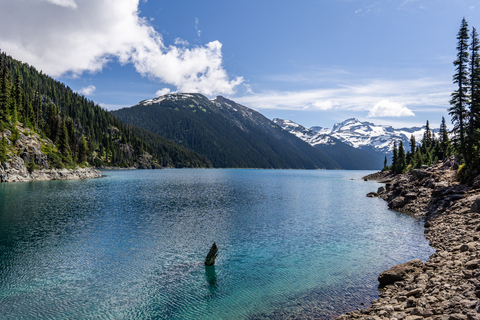
Map of British Columbia's Parks and Protected Areas
This interactive map shows the Locations, Names, and Details of National Parks, Provincial Parks, Ecological Reserves, and Protected Areas of British Columbia, Canada. It also shows major cities and rivers for context. For more detail, zoom in. For more information, hover over the map, or scroll down.
| Key | ||||
|---|---|---|---|---|
| Lake or River | ◯ | City | ||
| Type | ||||
| National Park | Provincial Park | |||
| Protected Area | Ecological Reserve | |||
British Columbia's Geography
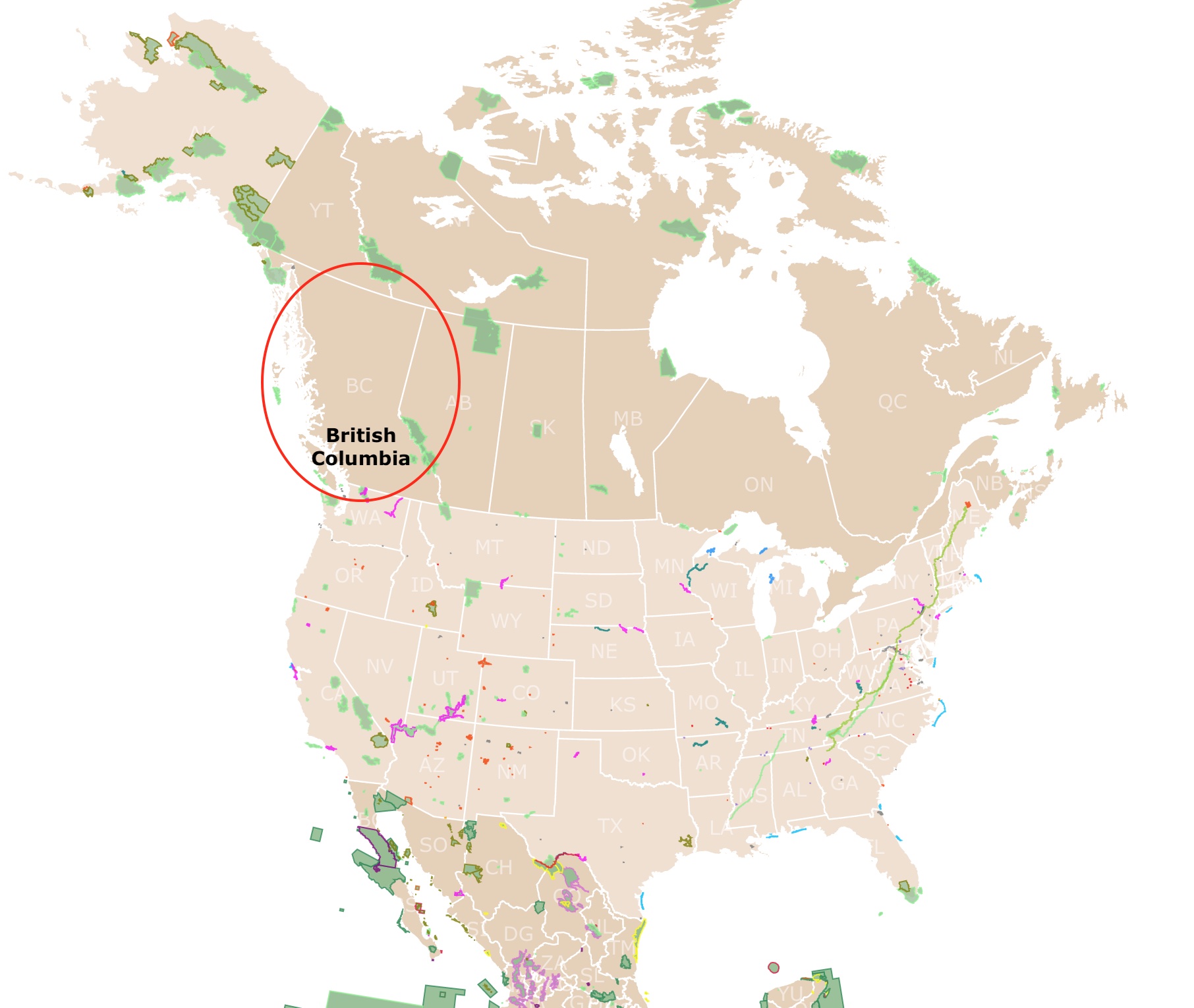
British Columbia is the westernmost of the 10 Canadian provinces. This is also known as The Pacific Province.
To its north lies Yukon and the Northwest Territories and to the east is Alberta's province.
The United States of Montana, Washington, and Idaho lie south of British Columbia. The Pacific Ocean and the southern panhandle region of Alaska are to the west.
British Columbia's vast territory lies almost entirely within the cordillera system or group of parallel mountain ranges stretching along the westernmost edge of the Americas from north of the Arctic Circle to Cape Horn.
The mountains divide the province into the Cordillera and Interior Plains.
Two major mountain ranges in British Columbia are the Coast Mountains (located in western B.C.) and Canada's portion of the Rocky Mountains, which lies in the eastern region. British Columbia's highest elevation is reached in the far northwest at Mount Fairweather – 15,300 feet (4,663 meters), located in the St. Elias Mountains, a range of the Coast Mountains.
Hundreds of islands surround the coast of British Columbia, the two largest being Vancouver Island and Haida Gwaii( formerly the Queen Charlotte Islands).
These islands offer a protected waterway along the coastline with narrow fjords around the bases of rugged mountains.
The largest of the limited coastal lowlands, known as the Fraser Delta, lies just beyond Vancouver to the south.
The interior contains broad plateaus cut by deep canyons and surrounded entirely by mountain ranges, including the Skeena, Hazelton, Omineca, and Cassiar mountains in the north and the Columbia Mountains in the southeast.
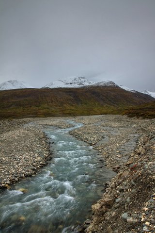
British Columbia contains three major river systems: the Fraser- which drains nearly all of the interior plateau; the Peace in the north; and the Columbia in the southeastern and southcentral regions. While the Liard system empties the northeastern region into the Arctic Ocean.
In southern British Columbia lies the only desert, or semi-arid region of Canada, called the Thompson-Okanogan Plateau. Close to this area is where half of Canada's wine is produced.
In contrast to its semi-arid region, Abbotsford in British Columbia is Canada's rainiest place.
For printed detailed information about BC's parks origin and history, Amazon has British Columbia's Magnificent Parks: The First 100 Years.
Want to find places to explore in nearby Alberta? Check this map of Alberta Parks
British Columbia's Climate
The Kuroshio Current warms the coast of British Columbia and the adjoining mountain ranges. Kuroshio is a strong oceanic current in the Pacific Ocean.
The Kuroshio causes British Columbia to experience a variety of climates. The southwestern corner of the province undergoes the most favorable environments due to its temperature, humidity, and variability.
Prevailing winds blowing in from the Pacific flow over the mountain ranges. This leads to ample temperature ranges and precipitation.
Along the coast, this variation isn't present. Summers along the coast are comfortable and cool. Winters aren't severe, with temperatures seldom dropping to 0℉ (-18℃). The Cariboo and Okanagan regions to the east experience wider variations; the summers are hot and winters much colder.
Still, farther east against the Rockies, similar temperatures are experienced; however, there are considerably heavier snowfalls. The northern interior and Peace River country have severe winters, with hot summers expected.
British Columbia's Wildlife
The coastal region's mild, wet climate produces massive trees. Some old-growth specimens tower over 200 feet (60 meters) high.
Red cedars, western hemlocks, Sitka spruce, and balsam firs dominate the land; however, the Douglas firs grow in slightly drier coastal areas. A third of the province contains barren Alpine tundra, glaciers, and snowfields.
Black bears, moose, and mule deer are some of the province's native large mammas. There is also a small population of grizzly bears.
Porcupines, beavers, marmots, red squirrels, and wolverines call the province home. Raccoons and skunks can be spotted in the south, while bighorn sheep roam the mountain ranges.
Elk are most abundant in the Kootenay region and on the western slopes of the Rockies. In north British Columbia, elk and caribou are not rare.
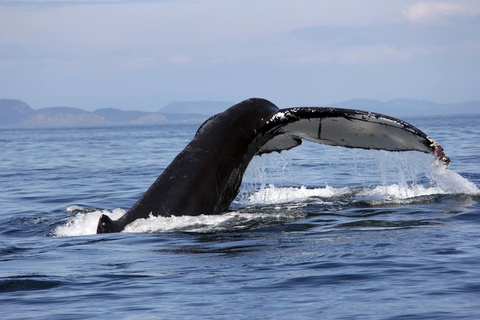
The province's coastal waters are home to humpback whales, several species of seals, sea lions, and dolphins. Salmon, trout, and halibut are the principal game fish in British Columbia.
The diversity of waterfowl, raptors, game birds, and shorebirds is immense. Skylarks, sparrows, starlings, and other songbirds can be heard singing songs throughout the land.
Some endangered species in the province include orca (killer whale), mountain beaver, northern spotted owl, and harbor seals.
Map of Glaciers Worldwide
Best National Parks in British Columbia
British Columbia is the province with the most National Parks. It is home to 7 of Canada's National Parks.
This province also has more than 400 provincial parks.
For a unique loook at BC's parks Amazon has 125 Nature Hot Spots in British Columbia: The Best Parks, Conservation Areas and Wild Places. This is a beautifully illustrated guidebook that explores this province's remarkable splendor and natural diversity.
Pacific Rim National Park
The red strip southwest of Vancouver is Pacific Rim National Park.
Pacific Rim National Park is rich in Nuu-chah-nulth culture dating back thousands of years. A First Nation Beach Keeper will gladly greet you as you step out of your kayak or boat. They'll share ancient legends around a campfire by the Guardians of the West Coast Trail.
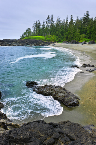
The park is a gateway to Vancouver Island's beautiful and rugged coast. The park has three regions:
- Long Beach: This is the northernmost part of the park. It is a beachfront with a coastal temperate rain forest.
- Broken Group Islands: This is an archipelago of more than 100 rugged small islands. They are popular kayak destinations.
- West Coast Trail: The area is named for the 47-mile (75Km) hiking path in a pristine temperate rain forest. This trail is not an easy one. Hikers climb over 100 ladders laden with heavy packs.
The Kwisitis Visitor Center is a beautiful building perched at the end of the beach. The deck is a prime location for whale watching. The exhibits are engaging and educational. Visitors can spend hours on end at the center.
The park features three campgrounds to choose from, allowing visitors an extended stay at the park.
Outdoor recreation includes swimming, boating, fishing, cycling, mountain biking, water sports, storm watching, and surfing; Pacific Rim.
Pacific Rim is a 5-hour drive from Vancouver through roads and a ferry. You can also take a one-hour flight from Vancouver. If you are not sure if you want to take a flight or rent a car, Expedia has different options for you. For fees and dates, click here!
Gwaii Haanas National Park Reserve
Gwaii Haanas National Park is on Haida Gwaii (formerly Queen Charlotte Island). It is the long red island west of British Columbia on the map.
Gwaii Haanas National Reserve is an untouched ecological paradise where the massive moss-draped cedar and Sitka spruce trees tower high above the ground.
This is also where the Haida people's ancient villages remain with fallen longhouses and carved poles.
Visitors can learn about the spirituality and culture of the First Nation people from the area. According to the Village of Masset, the Haida Gwaii First Nation's people have inhabited the islands for over 13,000 years.
The islands are also known for their incredible igneous rock formations visible around the main island.
Bald eagles and puffins can be seen soaring high in the sky, while bears can be spotted snacking on salmon along the coast. Coastal waters are brimming with humpbacks, dolphins, and sea lions.
Enjoy an early morning hike followed by a dip in the hot springs. Kayak the waters teeming with marine life, enjoy interpretive hiking trails, a day on the beach, and much more.
With so many coastal parks available for kayakers, it is only reasonable for outdoor enthusiasts to bring their own watercraft. Amazon has the Sea Eagle sport kayak. This is a two-person inflatable kayak. Light and easy to travel with, it comes with a pump and oars.
Map of Ski Resorts in North America
Gulf Islands National Park Reserve of Canada
Gulf Islands National Park are the red dots on the map, south of Vancouver.
Gulf Islands National Park Reserve of Canada is overflowing with life. The sheltered, islet-dotted waters are full of otters, orcas, seals, and pods of porpoises, making it an excellent location for wildlife observation.
The Mediterranean-like climate is perfect for kayaking, hiking, mountain biking, and cycling.
Birdwatchers appreciate the shores and lagoons that serve as a haven for thriving birds.
The park is crossed by 13 beautiful trails that lead to summits with vantage points, lighthouses, and relics of the First Nations who have existed in the area for thousands of years.
Urban centers are close by, making the Gulf Islands easily accessible. With 15 islands to explore, you could spend days or weeks at the park, Gulf Islands.
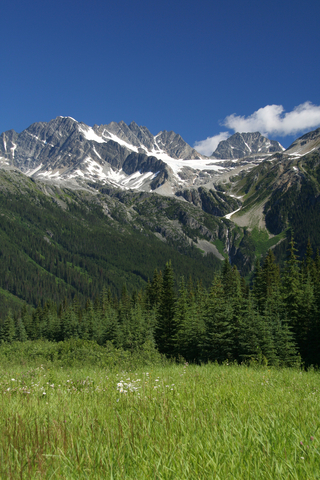
Yoho National Park
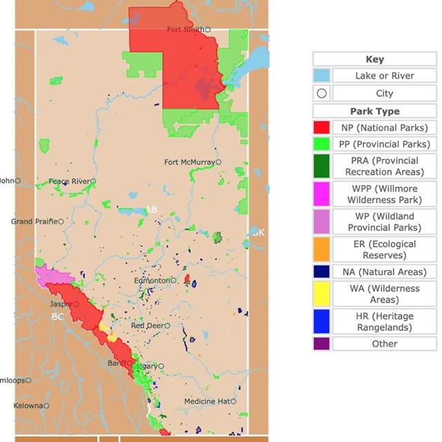
Yoho National Park is the red area on the eastern border of British Columbia. It lies on the western slopes of the Canadian Rocky Mountains. This park sits next to Banff National Park in Alberta.
Incredible waterfalls, soaring peaks, vertical rock walls, and about 30 peaks of more than 9,842ft (3,000m) draw in the crowd.
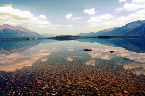
Hop in the car and enjoy a scenic drive to the vistas and the iconic Emerald Lake. Other attributes of the park include a natural bridge over a waterfall and rare orchids.
Yoho features exceptional hiking trails with sightseeing opportunities. Visitors can choose from four campgrounds or spend the entire day hiking. This is a place to unplug along the western slopes of the Great Divide (The Rockies).
Guided fossil hikes in the Burgess Shale are an exciting way for the family to learn about history and science. The park has half-billion-year-old fossil beds. These are some of the oldest and most complex fossils in the world.
If you've always wanted to go paragliding, this is a great place to do it.
The park has outdoor recreational opportunities, from hiking and biking to ice climbing and stopping at the famous red chair sites.
According to Parks Canada, there are two sets of red chairs at Yoho, with a total of 200 throughout the country; Yoho.
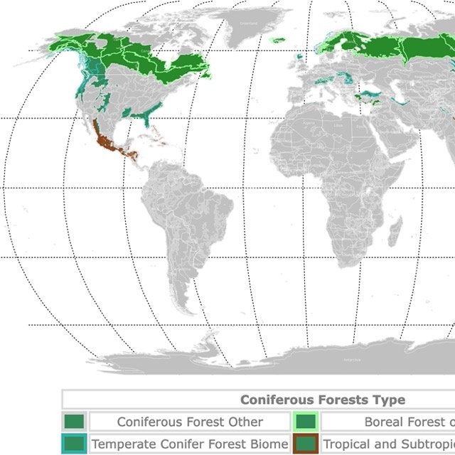
World Map of Boreal Forests and Conifers
Kootenay National Park
The red band on the eastern border of British Columbia is Kootenay National Park.
Kootenay Yoho, Jasper, and Banff are the 4 UNESCO World Heritage sites in the Canadian Rocky Mountains Parks.
Kootenay park is a place of fantastic contrast, from the icy mountain rivers to the incredible steamy hot springs. A 60-minute scenic drive allows visitors to explore and discover canyons, grasslands, and colored mineral pools.
The park has alpine tundra and stands of Douglas fir. Visitors can even find prickly pear cacti at low altitudes in the south. There are mountain goats, elk, bighorn sheep, and white-tail deer for wildlife seekers.
Visitors can explore the deep canyons and rushing waterfalls or spend a few days traversing more than 125mi (200 kilometers) of hiking and backcountry trails.
Radium Hot Springs provides a relaxing soak in Kootenay's naturally heated mineral waters.
Stop for a scenic picnic with friends or family. Choose between backcountry and front-country campgrounds. For those that want to camp without spending time on setting up, Kootenay Park offers oTENTik sites.
You can always find a relaxed stay in the many resorts and lodges in the area. For prices and amenities, visit Hotels.com!
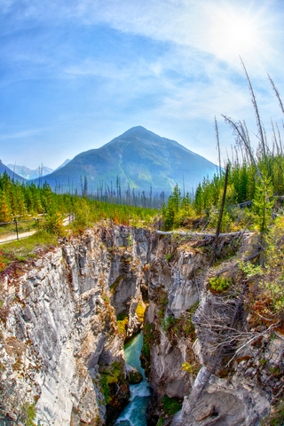
Glacier National Park of Canada
Glacier National Park is the red speck on the map, located in eastern British Columbia.
The incredible alpine scenery and deep valleys full of ancient forests of Glacier National Park are inviting.
This is an outdoor lover's paradise. Visitors can enjoy a peaceful walk through the moss-draped old-growth cedar trees or hike through the alpine meadows with lichen-covered boulders. The trails pioneered by Swiss mountain guides make for beautiful hikes.
The park is open year-round, but many trails may be closed due to snow. Snow season is from October to June!
Some highlights of the park include:
- Mount Sir Donald is popular with rock climbers.
- Illecillewaet is one of North America's most studied glaciers, thanks to its easy access by train and cars.
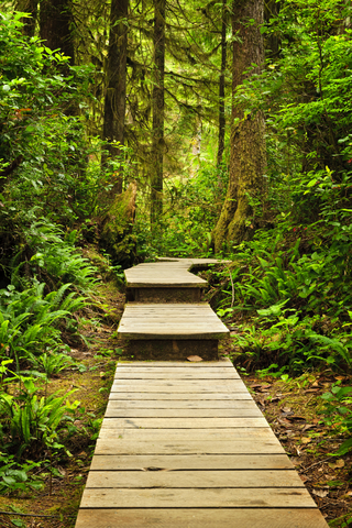
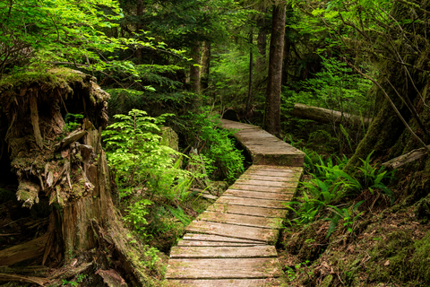
- Hemlock Grove is a wooden boardwalk that goes through a dense forest and is popular with visitors that want to view giant 500-year-old hemlock trees.
- Visitors can obtain a fishing license to catch fish in its lakes and streams.
- The park has various caves and caverns. They are home to the brown bat and Moonmilk bacteria. Nevertheless, cavers need to be experienced and get a permit to visit them.
Glacier National Park of Canada features the history of Rogers Pass, a final link in the railway that united Canada as a nation. Many people lost their lives due to the avalanches while constructing Rogers Pass.
After learning about the park's rich history, enjoy an evening by the fire beside the glacier-fed river. The park offers backcountry, front-country, and winter campsites. Visitors can also rent cabins and huts; Glacier.

Map of North America's Marine Ecoregions
Ts'ilʔos Provincial Park
The lime area southwest of Williams Lake is Ts'ilʔos Provincial Park.
Mountains, glaciers, crystal clear lakes, waterfalls, and beautiful meadows await you at Ts'yl-os Provincial Park.
Chilko Lake is one of Canada's largest natural, high-elevation freshwater lakes.
Anglers love the rainbow trout caught out of the lake. From August through October, the chinook/sockeye salmon run takes place, and it's the 3rd largest salmon run in the province.
Backcountry hiking is one of the park's main attractions, but the trails are recommended for experienced hikers only. The paths aren't maintained and lack facilities.
Beware of grizzly bears, and bring a can of bear spray. Visitors are welcome to bring their horses for a day of horseback riding.
This Canadian Provincial Park is definitely not easy to get to. The roads leading into the campgrounds are rough, and the drive from Williams Lake to either of the campgrounds can take four to six hours. If you're looking for remote wilderness recreation, you'll find it here.
The park features two small campgrounds, along with two lodges on Chilko Lake; Chilko Lake Resort and Ts'yl-os Park Lodge. Some campground amenities include picnic tables, water, fire pits, firewood, and pit toilets; Tilos.
Wells Gray Provincial Park
Wells Gray Provincial Park is the large lime area east of Williams Lake.
Wells Gray has thriving alpine meadows, volcanoes, waterfalls, mineral springs, and glaciers.
The park is a great place for birdwatching and wildlife viewing. There are hiking opportunities for every ability that range from a few minutes to several days to get lost while exploring.
Wells Gray Provincial Park has something for everyone. Boating, canoeing, kayaking, river-rafting, fishing, hiking, and horseback riding.
History lovers can learn about the area's early trappers, prospectors, and homesteaders.
The park is separated into eight different regions, including, Clearwater River, Clearwater/Azure Marine, Mahood Lake, Spahats Creek, Myrtle Lake, Trophy Mountain, and the Wells Gray Corridor; Ells Gray.
With so many trails for hiking, it is essential to take a good pair of hiking shoes. Amazon has Timberland's, Hiking Boot. These are comfortable waterproof boots made of leather with a rubber sole. Ideal for outdoor adventures!
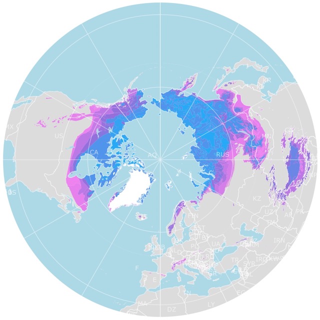
Map of Arctic Permafrost
Tatshenshini-Alsek Provincial Park
Tatshenshini-Alsek Provincial Park is the large lime area on the map. Situated in the northwest corner of the province.
The combined area of this provincial park, Glacier Bay, Wrangell St. Elias in Alaska, and Kluane National Park in Yukon, make the largest protected area in the world.
The great gap carved by Alsek and Tatshenshini Rivers through the coastal mountains allows cool, moist ocean air into the cold interior. Creating an incredible river system and maintaining unusual plant communities.
The diverse wilderness and rivers have attracted hikers, mountaineers, kayakers, and rafters.
Clayoquot Plateau Provincial Park
Clayoquot Plateau Provincial Park is the small lime area in the middle of Vancouver Island.
This park was created to protect undisturbed forests, rare plants, fragile karst formations, caves, sinkholes, and small lakes.
The park has no official trails, and reaching different features requires strenuous hikes; Clayoquot.
Joffre Lakes Provincial Park
Joffre Lakes is the lime speck southwest of Kamloops.
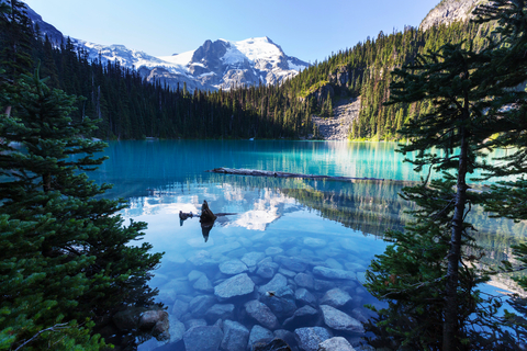
The park displays jagged peaks, icefields, rushing streams, and clear blue lakes.
The U-shaped valleys, lateral moraines, and glacial silts are extraordinary evidence of the park's glacial history.
The turquoise blue waters of the Lower, Middle, and Upper Joffre Lakes are a highlight of the park. All three of the lakes are located along the trail.
Outdoor recreation opportunities include camping, mountaineering, fishing, wildlife viewing, and hiking. Combined with beautiful nature, the adventure is awe-inspiring; Joffre.
Garibaldi Park
The lime area north of Vancouver is Garibaldi Park.
Garibaldi Park was named after the towering 8,786-foot (2,678 meters) peak, Mount Garibaldi.
The park is well-known for its beauty and incredible hiking opportunities, thanks to its location in the heart of the Coast Mountains.
The park's rich geological history, snow-capped mountains, iridescent waters, wildlife, diverse vegetation, and lovely vistas only add to the outdoor adventure.
The park's extensive hiking trails are close to 56 miles (90 km) and weave their way throughout the park.
The park features year-round recreational opportunities in the beautiful wilderness of British Columbia.
Want to find places to explore in nearby Yukon and Northwest Territories? Check this map of Yukon and Northwest Territories Parks
Carmanah Walbran Provincial Park
The small lime area in southern Vancouver Island.
The forested sanctuary of Carmanah Walbran Provincial Park is undoubtedly incredible. The park is designated for protecting diverse forest ecosystems, including the Sitka spruce ecosystem.
Carmanah Walbran provides unique opportunities for things like forest research and education in areas of wildlife, fisheries habitats, and biodiversity.
Hikers and wilderness lovers fondly appreciate outdoor recreation opportunities and wildlife.
Several trails provide visitors access to the park's many notable features, including some of the largest trees in the province.
Mount Robson Provincial Park
Mount Robson Provincial Park is among the oldest parks in British Columbia's system. It is the lime area on the eastern border of British Columbia, bordering Jasper National Park.
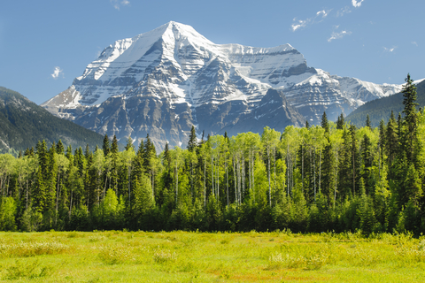
This is one of Canada's crown jewels and one of the finest views of the Canadian Rockies. Mount Robson stands 12,972 feet (3,954 meters) high close to the west entrance.
Visitors who walk through the western slope may find 3 different vegetation zones in one day hike.
The park has over 182 species of birds. At lower elevations, there are black bears, mule white-tailed deer, moose, and elk. At higher elevations, there are Grizzly bears, caribou, mountain goats, and mountain sheep.
Hiking, swimming, fishing, and a wealth of recreational activities are possible in this incredible park. The waterfalls, lakes, and hiking trails are the icing on the cake; Robson.
FOLLOW ME
Resources for British Columbia's Protected Areas Map
The shapefiles with British Columbia's state boundary lines and cities were downloaded from Natural Earth Data.
The National Parks of Canada shapefile was downloaded from Open Canada.
The shapefile of BC Parks, Ecological Reserves, and Protected Areas were obtained from British Columbia Data Catalogue.
The shapefile with rivers and lakes from Canada was downloaded from Open Canada.
This map will be updated with new data! To receive updates on this and more nature maps, join my email list!!!!!!!
Made by Luz K. Molina with D3.js.