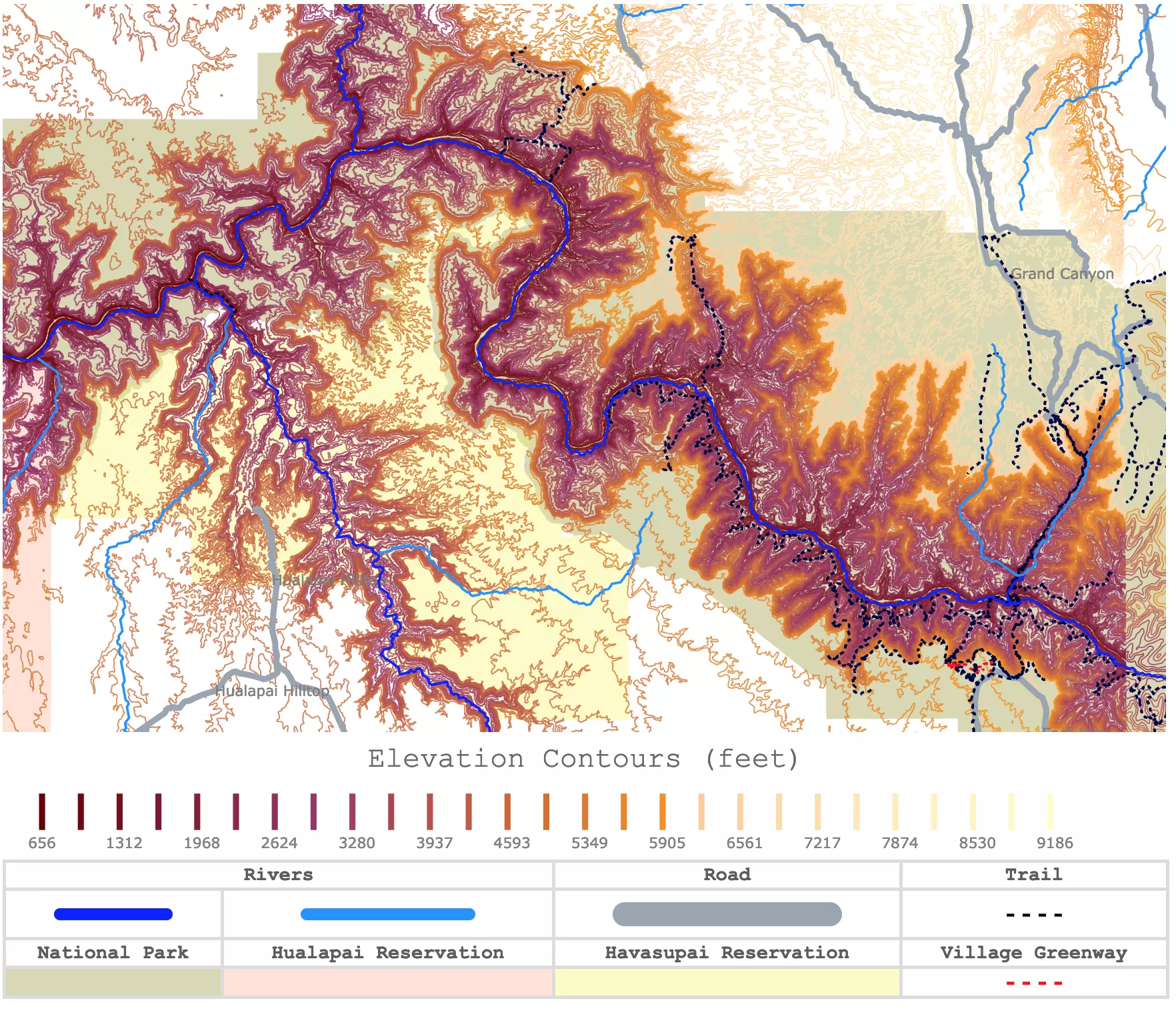
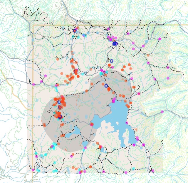
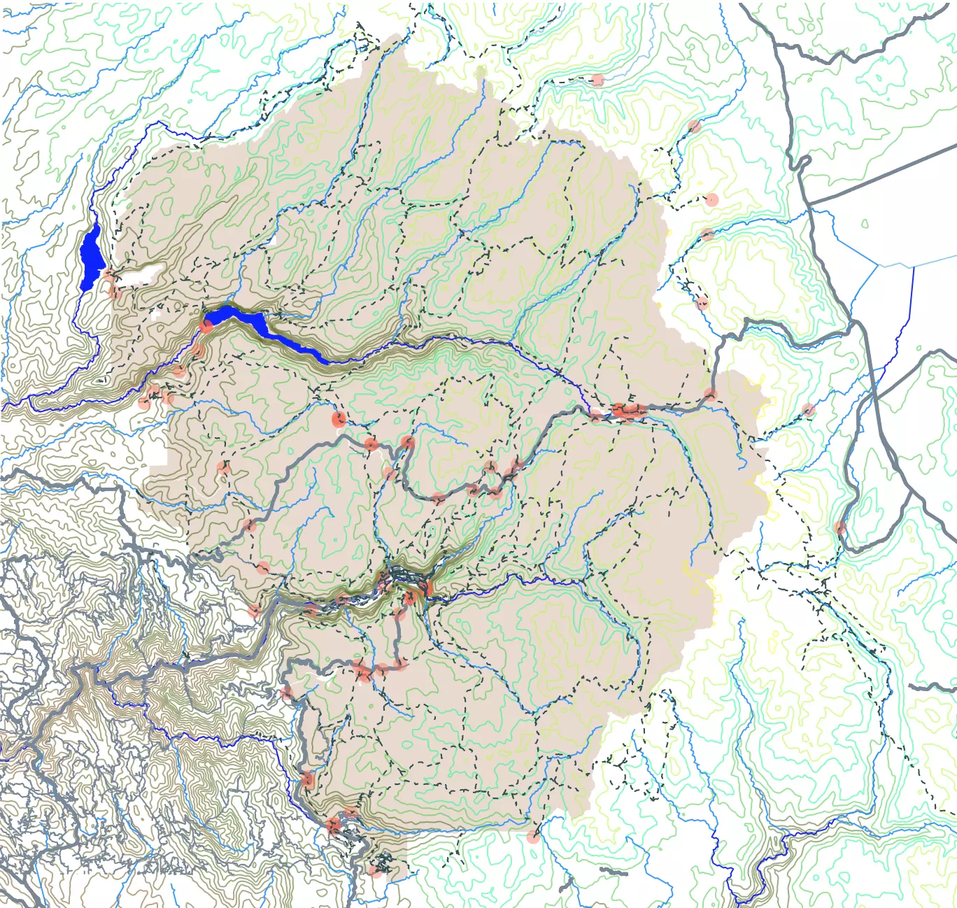
Interactive Grand Canyon Elevation Map
This interactive map shows the contour lines of the Grand Canyon. Dark colors represent lower elevations. The map also shows rivers, roads, and trails around the canyon. The only names displayed are for the roads. To see the whole National Park and zoom out. For more detail, zoom in. For names and elevations, hover over the map. For more information scroll down.
Elevation Contours (feet)
| Rivers | Road | Trail | |
|---|---|---|---|
| ━━━━━ | ━━━━━ | ━━━━━ | - - - - |
| National Park | Hualapai Reservation | Havasupai Reservation | Village Greenway |
| - - - - | |||
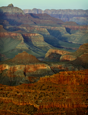
The Grand Canyon
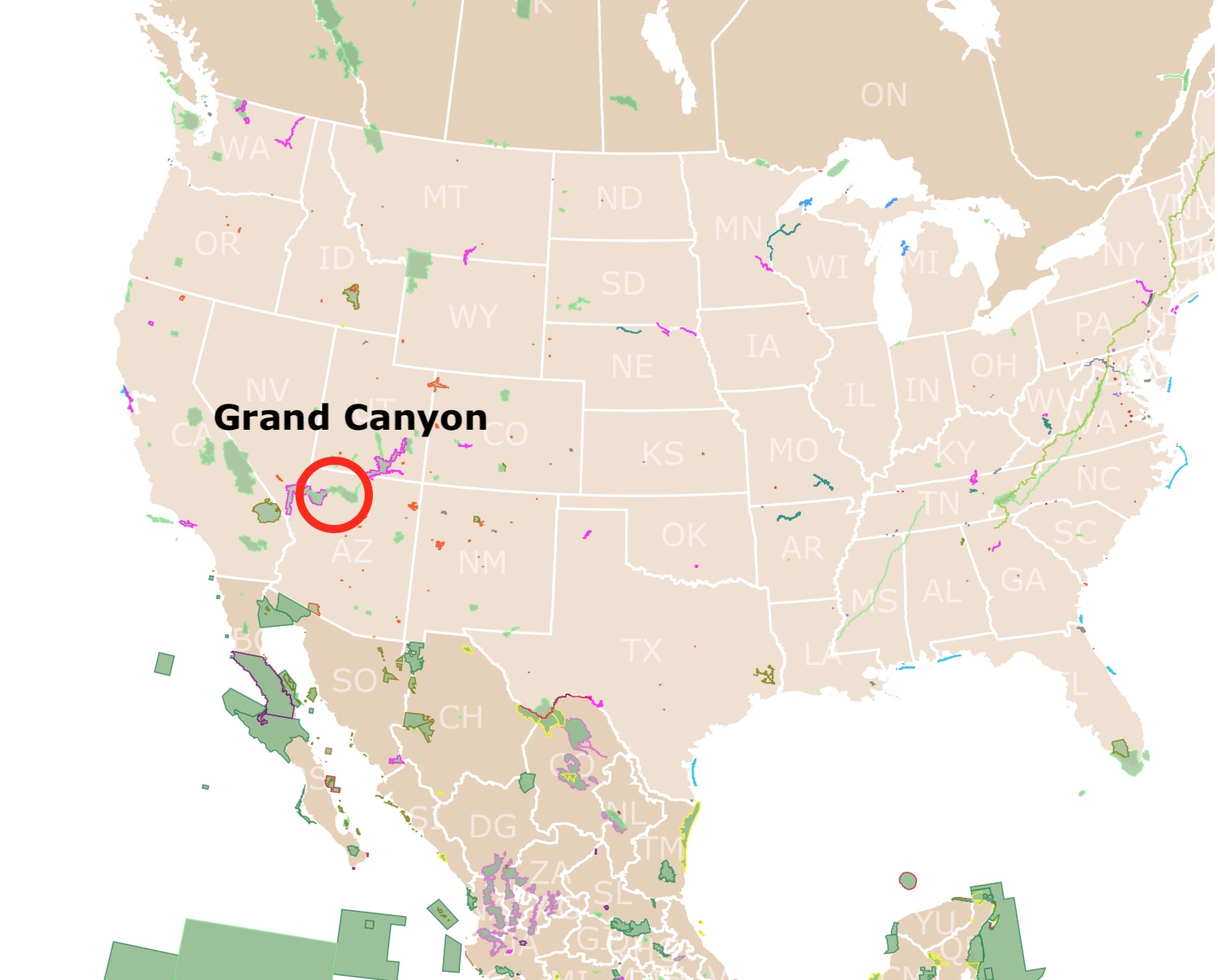
A World Heritage Site and one of the Seven Natural Wonders of the World, the Grand Canyon is located in the northwest corner of the state of Arizona.
Most of northern Arizona is part of the Colorado Plateau. The Colorado Plateau has the largest concentration of U.S. National Park Service (NPS) units in the country outside the Washington, DC, metropolitan area.
The Grand Canyon cuts through the Colorado Plateau.
The area is mainly arid. Most of the rain comes in the summer but in the form of flash floodings.
Many visitors are satisfied with viewing the Grand Canyon from the South Rim, but there is much more to experience and learn if toured in depth.
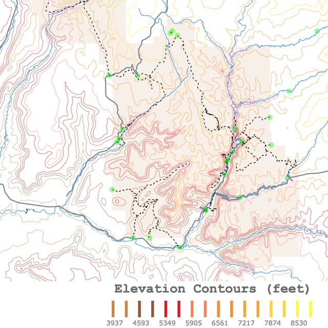
Map of Zion National Park
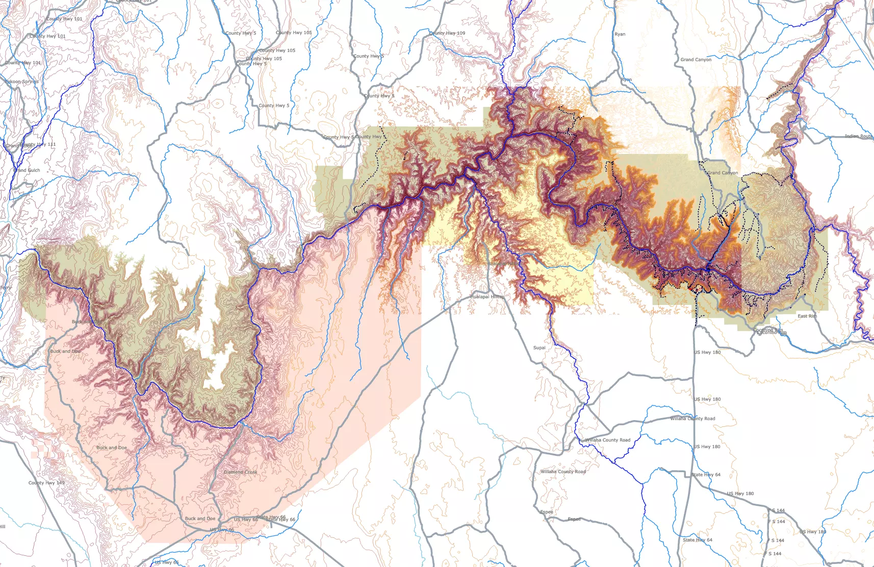
Topography Map of the Grand Canyon
The Grand Canyon National Park does not cover the whole canyon. It is managed by different entities. On the map above, different shades represent different managers. The Department of Interior manages most of the Grand Canyon as a National Park. The park is represented in olive green.
Part of the canyon is also managed by the Hualapai Tribe as a reservation. It is represented in pink on the map. Another section is managed by the Havasupai Tribe, also as a reservation, and it is represented in bright yellow.
The main area of the National Park is represented in more detail. The elevation contour lines in this area are every 1,640 feet (500m). As you zoom out, you will notice the contour lines in the rest of the map are every 3,280 feet (1,000m).
Facts About the Grand Canyon
- The Grand Canyon is, on average, 1 mile (5,249 feet or 1,600m) deep.
- The North Rim has the highest elevation, with an altitude of 7,545 feet (2,300m) above sea level. This is highlighted by the lighter yellow colors on the map contours.
- The Grand Canyon is 277 miles long and 18 miles (29Km) wide.
- The Grand Canyon is the 11th largest national park at 1,904 square miles (4931.337 Km2).
- The Colorado River drops 2,000 feet (609m) in its journey through the Grand Canyon.
- The Grand Canyon is so Grand that temperatures vary significantly within the canyon. As elevation increases, the temperature drops. For every 1,000 feet (300m) in elevation, the temperature decreases by 5.5°F (2.8°C).
- The canyon has over 1,000 caves, but few have been recorded or mapped.
- The canyon has large quantities of fossils of ancient marine animals.
- About 5.5 million visitors visit the canyon each year. The second most visited National Park after the Smoky Mountains. Source: DOI.
Grand Canyon Formation
The Grand Canyon was carved 6 million years ago. Erosion from the Colorado River created the Canyon.
Different processes helped in the formation of the Grand Canyon.
Around 2 billion years ago, igneous and metamorphic rocks were formed and deposited in the area.
The site was a shallow sea and even a dune at some point. This can be seen in the different rock layers around the canyon.
Geologic processes, including plate tectonics, caused the uplifting of the area. This resulted in the formation of the Colorado Plateau.
The formation of the canyon is because of the Colorado River. The movement of large amounts of water through the river channel, plus flooding events, resulted in the downcutting of the rocks.
The carving of the river is believed to have started about 6 million years ago.
Lastly, the erosion and weathering caused by rain, snow, and freezing weather made the different rock layers start to break. After millions of years of the erosive action of water, the distance between the rims grew wider.
These processes are still going on today, changing the landscape even more, a little bit at a time. Source: GC Geology.
The formation of the Grand Canyon still has many unknowns. There are millions of years of missing rock layers. For some undetermined reason, rock layers were not deposited and stacked like the rest of the geological record in some canyon areas. This gap is known as the 'Great Unconformity'. Science Alert.
Sides of the Grand Canyon
The Grand Canyon is so big that to visit it or describe it, it is better to subdivide it into 4 main areas:
- Southern Rim
- Northern Rim
- Inner Canyon
- Western Rim
Southern Rim
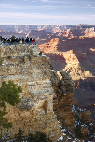
The Southern Rim is located on the southern side of the Colorado River. The area around the Village Trail is on the map above in red. This trail begins at the Grand Canyon Visitor Center.
Many visitors reach this Rim, by driving from Phoenix, AZ. The drive is 229 miles (368Km), and it takes about 3.5 hours.
The Southern Rim is the most visited section of the park. Furthermore, 90% of visitors to the park only reach this area of the Grand Canyon.
The South Rim is open all year.
The South Rim is a small city. It has the only K-12 school district inside a National Park.
Temperatures on the Southern Rim are from about 80+°F (26°C) to over 100°F (38°C) in the summer. Temperatures in the winter can range from a low of 20°F (-6.6°C) to a high of 43°F (6.1°C). Grand Canyon NP.
Hotels.com has a wide range of hotels for you to stay near the South Rim. These range from suites to glamping. More details here!
Interactive map of Yellowstone Park
Northern Rim
The Northern Rim is on the opposite side of the Colorado River.
The Northern Rim is on average 8,000 feet (2,438m) above sea level. This is about 1,300 feet (396m) higher than the Southern Rim. As mentioned before, this elevation is highlighted with bright yellow on the map.
The North Rim gets more snow than the South Rim due to its elevation.
This Rim is remote and has a short season, between May and October. During the winter months, the roads are closed due to snow. Nevertheless, hikers and cross country skiers are allowed to enter with a valid permit.
The North and South Rim are maybe 10 miles (16Km) apart. But to travel between the Southern Rim and the Northern Rim may take 5 hours, as the drive around the canyon is 215 miles (346Km).
Only 10% of the visitors to the National Park reach this side. Grand Canyon NP.
In a remote arid area like the Grand Canyon, it is essential to have adequate hydration. Amazon has the Hydration Backpack with 2L Water Bladder. It is BPA free, lightweight, and insulated. Perfect for hiking, skiing, cycling, climbing, and camping.
Inner Canyon
This is all the area below the rim or darker contour lines on the map. It is mainly frequented by hikers, backpackers, mule riders, and river runners.
It takes a fit hiker 5 hours to walk back and from the Colorado River 5 hours.
The inner canyon is arid, has no shade, and during the summer, it can reach temperatures of 100°F (>38°C).
Visitors can descend and take motorized and non-motorized whitewater rafting trips down the Colorado River.
The best rafting weather is in Spring and Fall, as that weather is likely to be mild.
Want to see flights and hotel prices? Check with Expedia below!
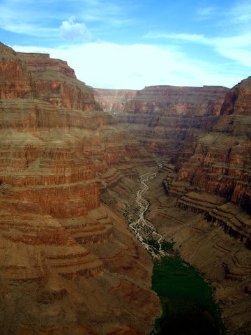
The Colorado River
The Colorado River begins atop the Rocky Mountains National Park in Colorado and flows to the Gulf of California. It carved its way through the Colorado Plateau on its descent, creating the Grand Canyon
Less than one-fifth of the Colorado River runs through the Grand Canyon. The river is 1,450 miles (2,333Km) long, and only 277 miles (445Km) go through the canyon.
The Colorado River has a maximum depth of 85 feet. The average temperature of the river through the canyon is 50 degrees. AZ Central.
Many creeks, springs, and tributaries connect with the Colorado River in the Grand Canyon. You can see some of them on the map above. These include Little Colorado, Kanab Creek, Havasu Creek (Havasu Canyon on the map), and Bright Angel Creek.
While exploring the canyon you will want to see every rock, layer, crack, and animal. For every detail Amazon has Bushnell Binoculars. These binoculars are waterproof and light. They have multicoating and nitrogen purging to prevent fogging. They are ideal for boating and wildlife watching.
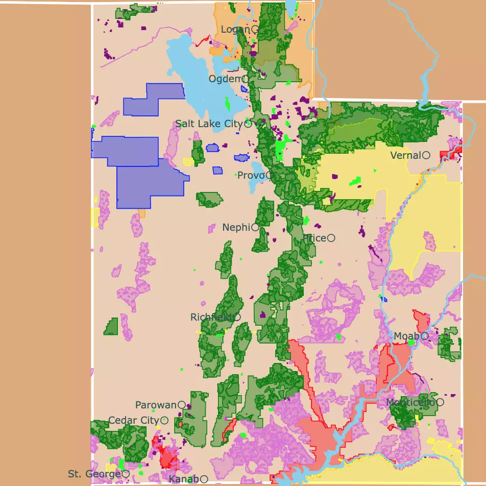
Want to find places to explore in nearby Utah? Check this map of Utah Parks
Havasupai Reservation
South of the Colorado River is the Havasupai Reservation. On the map, it is shaded yellow.
This is a remote community in the Havasu Canyon. The reservation has no roads. To access it, you must walk or fly.
To visit the area, you need a permit, as it is tribal land. Drugs, alcohol, and camping are not permitted.
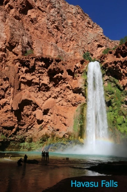
The main attraction of this side of the Canyon is the views of the Canyon and the Havasu Falls.
The water of the falls is fed by a spring and plunges 90 feet (27m) into a green-blue pool. Supai Village.
Western Rim
The Western Rim is located in the Hualapai Reservation, west of the Grand Canyon National Park.
The Hualapai Reservation is not part of the National Park. On this map, the Hualapai Reservation is represented in light pink. To view it completely, you must zoom out.
This area of the Grand Canyon is closer to Las Vegas in Nevada. The drive is 130 miles (209Km), and it takes about 2.5 hours.
The average elevation of the West Rim is 4,000 feet (1,219m).
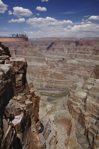
One of the major attractions on this side of the Western Rim, is the Skywalk. This is a 10-foot (3m) wide, horseshoe-shaped glass bridge.
It extends 70 feet (21m) out over the rim, which is 1,160 ft (350 m) over the Canyon floor below.
The Skywalk is found at the end of Buck and Doe Rd on the map above.
At the Hualapai Reservation, you can also immerse yourself in Native American culture, go ziplining, or just enjoy the views. Sky Walk.
You can stay near the Western Rim, glamping or at a ranch. For details and prices go to Hotels.com.
Yosemite National Park Map
Wildlife at the Grand Canyon
The Canyon boasts about 91 mammal species, 447 bird species, 58 reptile species, and 18 fish species (five of them native).
Botanists have counted 1,750 plant species growing in the park.
The Grand Canyon is so big and its topography so uneven that visitors can experience different ecosystems.
The most dangerous animal in the Grand Canyon is the rock squirrel. Several tourists are bitten by this squirrel every year when they try to feed it. Stay away from wildlife!
The Grand Canyon is home to the Pink Rattlesnake, a species endemic to the area. The pink color helps the snake blend into the surrounding rocks.
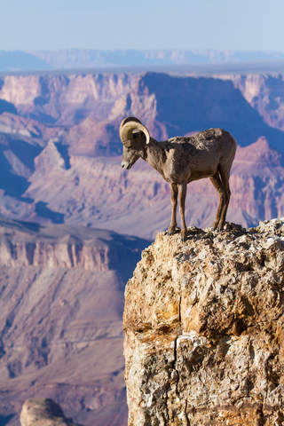
Other dwellers of the area include coyotes, ring-tailed cats, gray foxes, bighorn sheep, coyotes, mule deer, and birds.
The Grand Canyon was always a difficult habitat for fish. This was a result of heavy silt, frequent floods, and extreme temperatures due to the summer heat and winter cold. Only 8 fish species are found in the Canyon, 6 of these species are only found in the Grand Canyon; AZ Central.
FOLLOW ME
Sources to Make the Grand Canyon Topography Map
The detailed contour lines for the inner park were downloaded from USGS.
The contour lines from the rest of the canyon were also downloaded from USGS.
The Trail shapefiles were downloaded from NPS.
The Road shapefiles were downloaded from Data.gov.
The shapefiles for the park and tribal lands were downloaded from Science Base USGS.
The River Shapefiles were downloaded from National Weather Service.
This map will be updated with new data! To receive updates on this and more nature maps, join my email list!!!!!!!
Made by Luz K. Molina with D3.js.