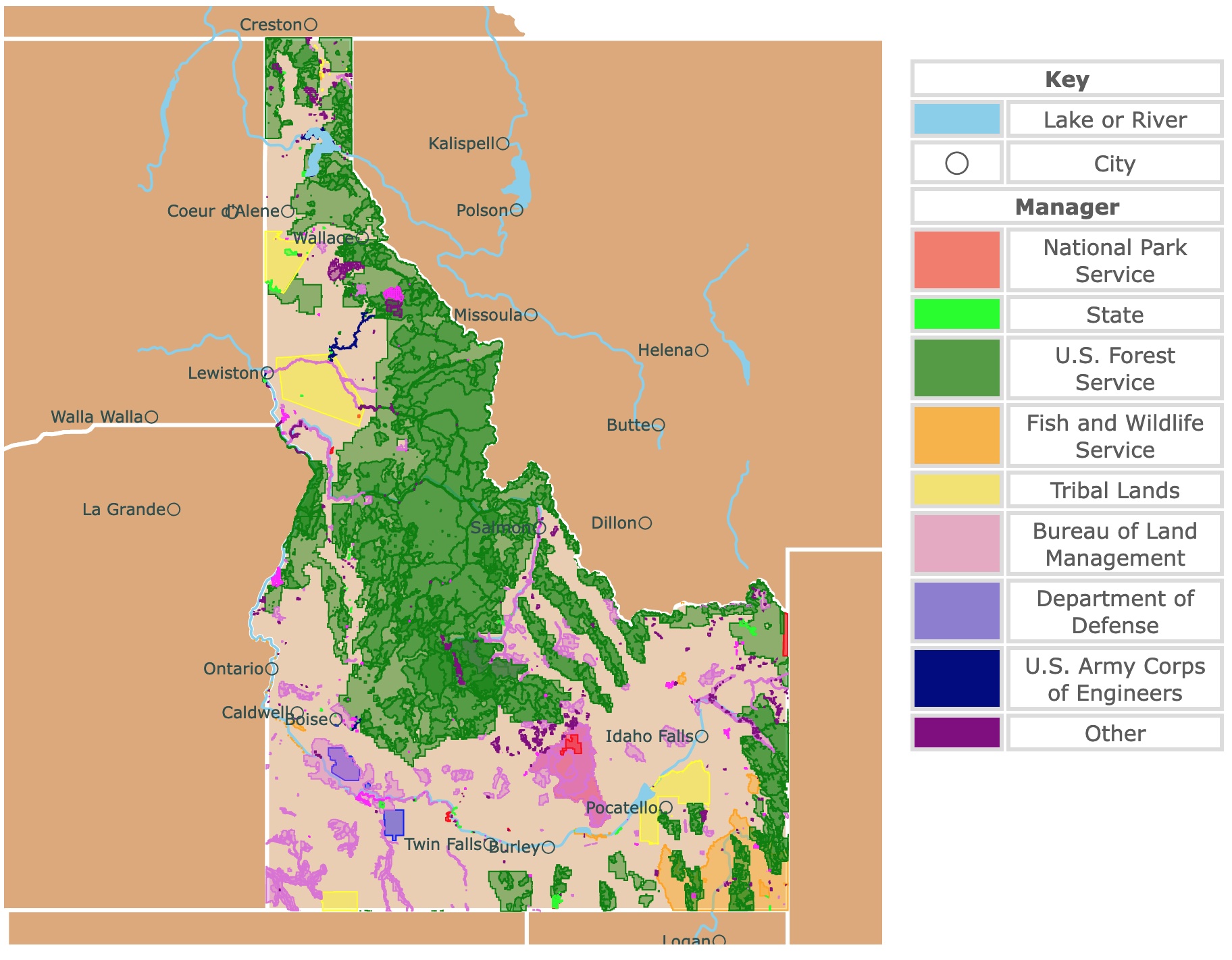
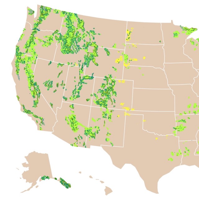
Map of Idaho's Parks and Protected Areas
This interactive map shows the Locations, Names, Areas, and Details of National Parks, State Parks, National Forests, Tribal, and other Public Lands of Idaho. It also shows major cities and rivers for context. For more detail, zoom in. For more information, hover over the map, or scroll down.
| Key | |
|---|---|
| Lake or River | |
| ◯ | City |
| Manager | |
| National Park Service | |
| State | |
| U.S. Forest Service | |
| Fish and Wildlife Service | |
| Tribal Lands | |
| Bureau of Land Management | |
| Department of Defense | |
| U.S. Army Corps of Engineers | |
| Other | |
Geography of Idaho
Idaho, or the "Gem State," is famous for its beautiful landscapes and diverse animal life. It got its nickname for its abundance of natural resources and scenic areas.
Idaho shares borders with Montana and Wyoming to the east. Utah and Nevada to the south.
To the west, it shares borders with Oregon and Washington State.
To the north, it shares borders with Canada's British Columbia Province.
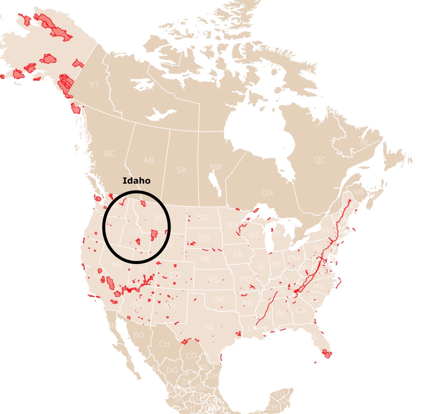
Map of National Parks of the U.S.A.
Idaho's Landscape
Idaho's landscape is rugged and dominated by the Northwestern Mountains.
This state has deep river-cut canyons and glacial trenches. That includes Hells Canyon, the deepest gorge in North America. It’s even deeper than the Grand Canyon!
Borah Peak is one of Idaho’s most important mountains. Not only is it a beautiful view and home to thousands of animal and plant species, but it is the last glacier in Idaho. Half of the ice of the mountain disappeared in the last 20 years.
A few million years ago, Idaho was violently forming from the molten lava that spewed from volcanoes. The lava became rock, which became the land that would one day become known as Idaho.
In 1980, Mount Saint Helens erupted. It’s technically in Washington State, but it still had a major effect on Idaho and its citizens.
Some parts of Idaho were covered in inches of ash, which is even worse than it sounds.
While the state's volcanic history (and future) can be frightening, it is also responsible for a beautiful and surprising phenomenon.
Idaho is one of the few places in America where you can find minerals, including diamonds! In fact, the world’s largest diamond was found in Idaho!
Idaho's Water Features
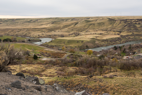
One prominent feature of the state is the Snake River. This is a major river of the Pacific Northwest region and a major tributary of the Columbia River.
The Snake River is the thirteenth longest river in the U.S. It lies between the Rocky Mountains and the Columbia Plateau. USGS.
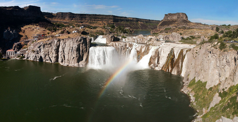
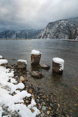
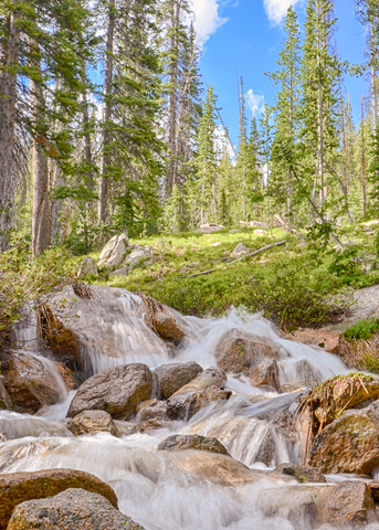
Located on the Snake River, next to Twin Falls, is Shoshone Falls. This waterfall used to be called the "Niagara of the West".
This impressive feature is 212 feet (65 m) in height and 900 feet (274 m) wide. Shoshone Falls.
Formed by the cataclysmic outburst flooding of Lake Bonneville, it is not just important because of its scenic beauty but because it marks the upper limit of fish migration.
This fish migration includes important species like salmon.
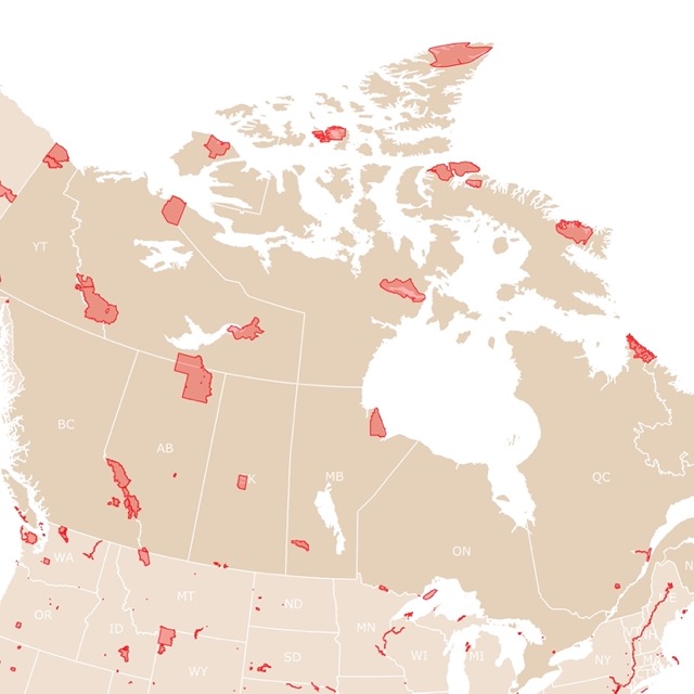
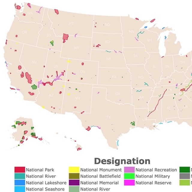
Map of National Parks of Canada
Idaho's Climate
Idaho’s climate is extremely diverse, from hot summer days of 70-80 degrees Fahrenheit (~25 degrees Celsius) to harsh winter nights that can drop to -50 degrees Fahrenheit (-45.5 degrees Celsius) Idaho Climate.
On a clear summer night, visitors can watch meteors soar among thousands of stars in the night sky. Idaho is also one of the few states where you can see the colorful neon light shows, called arouras!
The clear night skies are due to low precipitation. The southern part of Idaho is considered arid. Part of the state is classified as a cold desert.
Most of the Snake River watershed is arid and desertic. Receiving, on average less than 12 inches (300 mm) of precipitation per year.
Warm summer days are wisped away in the breeze of autumn. The forest floors are slowly covered in a collage of warm hues as the trees shed their leaves for the brutal winters.
The winter anywhere in Idaho is cold, but not many places are colder than Stanley, Idaho. Stanley, Idaho, gets below-freezing temperatures nearly 300 days of the year.
Winter gives way to spring, which breathes new life into the prairies and mountains of Idaho. As the thick blankets of snow melt away, flowers and greenery reintroduce the landscapes to the cool, bright colors of the state.
Each of these uniquely beautiful seasons can be experienced from inside the thousands of acres of protected land in Idaho.
Deep in the thick woods or from a barren mountaintop, you can see the natural beauty that Idaho’s pioneers fell in love with.
Idaho's Nature
Common wildlife found in Idaho includes Grizzly bears, Canada lynxes, Striped skunks, northern goshawk, fisher, cutthroat trout, mountain goats, northern flicker, salmon, and bighorn sheep.
Common plants include white fir, subalpine fir, verbena, ponderosa pine, and aspen; Idaho Species.
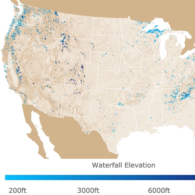
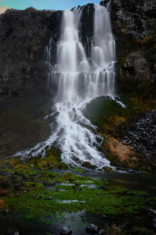
There are more waterfalls you can visit in Idaho. For more sites, check this map of U.S. Waterfalls
Idaho’s National Park Service Areas
Idaho has incredible natural parks. Its most renowned National Park is Yellowstone National Park.
For more parks to discover in Idaho, read below.
Craters of the Moon National Wilderness Area
Craters of the Moon National Wilderness Area is the youngest volcanic area in Idaho USGS.
Located 144.4 miles (232.4 km) from Pocatello, Idaho, it is a three-hour drive from the city. On the map, you can see the Craters of the Moon by looking at the small, red polygon northwest of Pocatello.
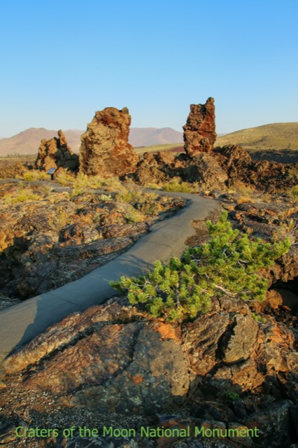
The Craters of the Moon is a unique vacation spot for nature lovers.
Whereas most of the state and national forests are covered in greenery or snow, depending on the month, Craters of the Moon is famous for its desolate wasteland covered in flowing lava.
Craters of the Moon is expected to erupt sometime in the next thousand years, but that doesn’t stop thousands of families from exploring the phenomenon that formed the Earth they live on.
Whether you go with all your family or by yourself, you shouldn’t have trouble finding an interesting trail/tour to go on.
This vacation spot is perfect for those who want to see an interesting, different side of nature. The rolling hills and plains are met by solid black, glasslike rocks to form a prehistorically awe-inspiring experience.
There are also lots of campsites and activities to visit and explore; National Park Service.
Before you go, check the updated status of the park’s main attractions. For example, during winter months, the caves can be completely off-limits, due to hazardous amounts of snowfall and risk of avalanches.
If you are ready to begin your trip, go to Expedia. For plane tickets, hotels, and rental cars, use Expedia!
Hagerman Fossil Beds National Monument
Hagerman Fossil Beds National Monument is one of the greatest vacation destinations for dinosaur lovers. The visitor’s center is only a 45-minute drive from Twin Falls, Idaho, or about 35 miles (56.3 km) away.
The Hagerman Fossil Beds are the burial place of many creatures, including extinct ones, like the saber-tooth tiger and the woolly mammoth and elephant’s American cousins, the mastodon.
The fossils are somewhere between 3-4 million years old!
The fossils are like pieces of a million-piece puzzle, each telling its piece of Earth's story and capturing a moment in time.
The preserved remains can be pieced together to create entire skeletons of dinosaurs and ice-age creatures.
During major extinction events, like the death of the dinosaurs and the end of the ice age, animals flock to the water. They gather in herds in an attempt to find food and survive the conditions that threaten them.
Over time, the water and mud become the animals’ graves and dry up. The dried mud preserves the animals’ remains, which is later uncovered by paleontologists, like the ones at Hagerman.
Expedia has different options for your stay near Hagerman. For hotels and cottages, click here!

Map of Lakes and Ponds in the USA
City of Rocks National Reserve
City of Rocks National Reserve is the lime green that you see near the Idaho-Utah border. It’s only 17.7 miles (28.5 km) from Oakley, Idaho, making it a great weekend getaway for locals and last-minute addition for tourists!
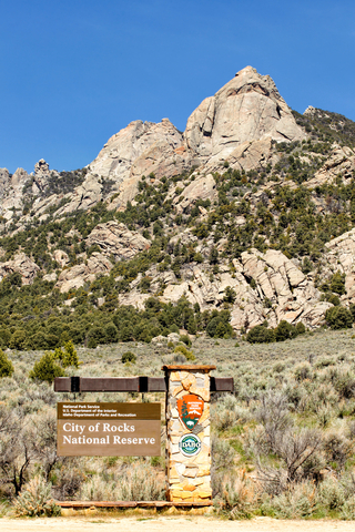
The “Silent City of Rocks” is named after the towering rock formations that resemble buildings/skyscrapers.
There are many activities to do at the City of Rocks, like rock climbing and mountain biking. If you would like to visit the City of Rocks, you can do so any time of year!
It also has a rich history. The City of Rocks is connected to Native American History and European Explorers’ history.
The Shoshone and Paiute are some of the tribes that have inhabited this area for years. In fact, you can still find their cave drawings in the park!
Many cool geological formations can be found on the trails of the City of Rocks. On a hike, you can find huge arches that formed in rock over thousands of years.
Some indentations on rocks are so large it looks like a cat scratched the side of a mountain.
If you are not interested in camping, you can stay in different cottages and retreats not far from the reserve. For prices and amenities, visit VRBO!
Idaho’s State Parks
Bruneau Dunes State Park
The Bruneau Dunes State Park is the tallest single-structured sand dune in North America, according to stateparks.com.
The dune peaks at 470 feet (143.3 m) above the lakes that surround it. On the map, it is the small, speck of light green, southeast of Boise.
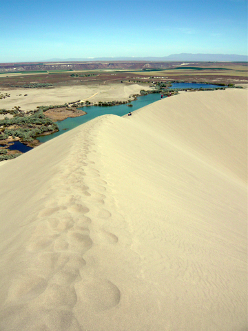
Around 15,000 years ago, the area flooded in what was known as the Bonneville Flood and started what is now the Bruneau Dunes.
Just over 60 miles (96.6 km) from Idaho’s capital, Boise, the drive is easy and only lasts about an hour.
There are many activities available at the Bruneau Dunes, like fishing, hiking, swimming, and boating.
One popular attraction is the Bruneau Dunes Observatory, where you can use a variety of high-quality telescopes to peer into the unknown above.
There are campsites, with and without electricity, as well as a few cabins that can be rented.
Since the Dunes are fairly far into the desert of Southern Idaho, the weather is perfect for camping. Shades and shelters make the warm weather into a paradise from March to mid-autumn.
If you wish to see the skies at your own convenience, Amazon has a telescope for you. The Hexeum Telescope has an 80mm aperture, it is portable, Multi-coated, with Tripod, Phone Adapter, Wireless Control, and Carrying Bag. Easy Set-Up.
Map of Ski Resorts in North America
Farragut State Park
Farragut State Park is located next to Lake Pend Oreille and is situated in the northern part of the state. This park has a rich history that will interest any World War II buffs and campgrounds teeming with activities.
During the Second World War, Farragut State Park was actually a training station for the U.S. Navy. In 1942, the station had over 50,000 people living in it, which secured it the title of the most populated city in Idaho.
The lake still, to this day, houses a submarine research center for the Navy.
No matter what time of year you visit, there is something to keep you there. From horseback riding and swimming to skiing and snowshoeing, you won’t get bored at Farragut State Park.
However, if you like to keep it simple, you can also try some of the trails in the park. All trails are open, but most aren’t groomed. So, watch your step!
Ponderosa State Park
Ponderosa State Park is one of those classic parks that capture the simplistic beauty of nature.
There may not be prehistoric remains or flowing lava, but there is an undeniable charm to the park.
Located 107 miles (172.2 km) from Boise, the park is a two-and-a-half-hour drive out of the city.
With loads of overnight-stay options, it’s the perfect place to disconnect from the hustle and bustle of the world; Ponderosa. It is the small, lime green speck, just west of Salmon, on the map.
Just like Farragut, Ponderosa State Park is a great destination in winter and summer.
Canoeing and kayaking are popular in the summer. Winter brings other attractions, like skiing and snowshoeing.
The views of the lakes and surrounding forests in Ponderosa State Park allow for you to see miles and miles of American land. Inside the forests are many different types of cabins for rent, as well as other camping options.
If you want to learn more about forests in the U.S., check this map of the U.S. Forest Service
Thousand Springs State Park
Located in southern Idaho, west of Twin Falls, Thousand Springs State Park is divided into 6 units depicted in lime green.
This park has waterfalls, springs, a beautiful 250-foot (76m) gorge, fishing, birdwatching and lots of wildlife to observe.
Because it is situated by the Snake River it offers different water activities for visitors to enjoy.
At Thousand Springs visitors can explore the Oregon Trail, hike, picnic, fish, view wildlife or even ride horses in the indoor arena.
There are also opportunities to watch bald eagles, or teach the kids to fish at Niagara Springs; Thousand Springs.
Idaho’s National Forests Worth Visiting
Sawtooth National Forest
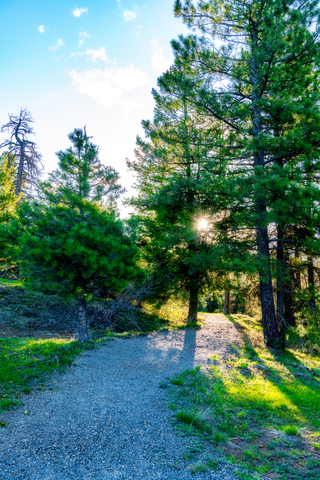
Sawtooth National Forest is the photogenic classic place that comes up when you think of Idaho.
Snow-capped mountains are surrounded by the dense forest, creating one of the most beautiful backdrops in the country.
Sawtooth is in Southern Idaho, near the Nevada border. On the map, it is the dark green area in the southwest.
The forest is about 217,000 acres of wilderness.
Colossal peaks and deep valleys are all part of the being that is Sawtooth.
Biodiversity is especially important to the forest, since the climate of one part could be completely different from another.
Sawtooth is a National Forest, which means that it’s free to camp anywhere in the forest (besides areas designated otherwise).
On top of the fun activities at Sawtooth, there are also educational tours and excursions to go on, which can be rewarding.
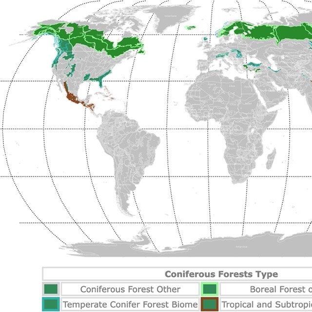
Map of Conifer Forests worldwide
List of Parks in Idaho
This list includes National Parks, National Forests, State Parks, and other Natural Areas in the State of Idaho.
| National Parks | |
|---|---|
| Yellowstone National Park | Craters of the Moon National Park |
| National Historic Site | |
| Minidoka National Historic Site | |
| National Historic Park | |
| Nez Perce National Historical Park | |
| National Monument | |
| Hagerman Fossil Beds National Monument | |
| National Recreation Trails | |
| Caribou Ridge National Recreation Trail | English Point National Recreation Trail |
| Chipmunk Rapids National Recreation Trail | Independence Creek National Recreation Trail |
| Coeur D ALene River National Recreation Trail | |
| National Recreation Area | |
| Sawtooth National Recreation Area Headquarters | |
| National Reserve | |
| City of Rocks National Reserve | |
| State Parks | |
| Bogus Basin State Park | Malad Gorge State Park |
| Bruneau Dunes State Park | Mary Minerva McCroskey Memorial State Park |
| Dworshak State Park | Massacre Rocks State Park |
| Eagle Island State Park | Mowry State Park |
| Farragut State Park | North Beach State Park |
| Harriman State Park | Old Mission State Park |
| Henrys Lake State Park | Ponderosa State Park |
| Heyburn State Park | Priest Lake State Park Indian Creek Unit |
| Horsethief Reservoir State Park | Round Lake State Park |
| Indian Rocks State Park | Three Island Crossing State Park |
| Lewis-Clark Canoe Camp State Park | Three Island State Park |
| Winchester State Park | |
| State Forest | |
| Priest Lake State Forest | |
| National Forests | |
| Boise National Forest | Saint Joe National Forest |
| Challis National Forest | Salmon National Forest |
| Clearwater National Forest | Sawtooth National Forest Trailhead |
| Coeur d'Alene National Forest | Targhee National Forest |
| Nez Perce National Forest | Payette National Forest |
| National Wildlife Refuges | |
| Bear Lake National Wildlife Refuge | Grays Lake National Wildlife Refuge |
| Camas National Wildlife Refuge | Kootenai National Wildlife Refuge |
| Deer Flat National Wildlife Refuge | Minidoka National Wildlife Refuge |
FOLLOW ME
Resources for Idaho's Protected Areas Map
The shapefiles with Idaho's state boundary lines, major rivers, and cities were downloaded from Natural Earth Data.
The Parks and Public Lands shapefiles for Idaho were downloaded from USGS.
This map will be updated with new data! To receive updates on this and more nature maps join my email list!!!!!!!
Made by Luz K. Molina with D3.js.